St Boniface Down: Isle Of Wight High Point

Significance: Highest peak on the Isle of Wight (Present Day County Top), Isle of Wight National Landscape High Point
Member of: Marilyn, Hardy
Parent Peak: n/a.
Nearest Higher Neighbour: Butser Hill
Historic County: Hampshire (of which Pilot Hill is the County Top)
Elevation: 241m
Date climbed: 6th July 2014
Coordinates: 50° 36' 13'' N, 1° 11' 51'' W
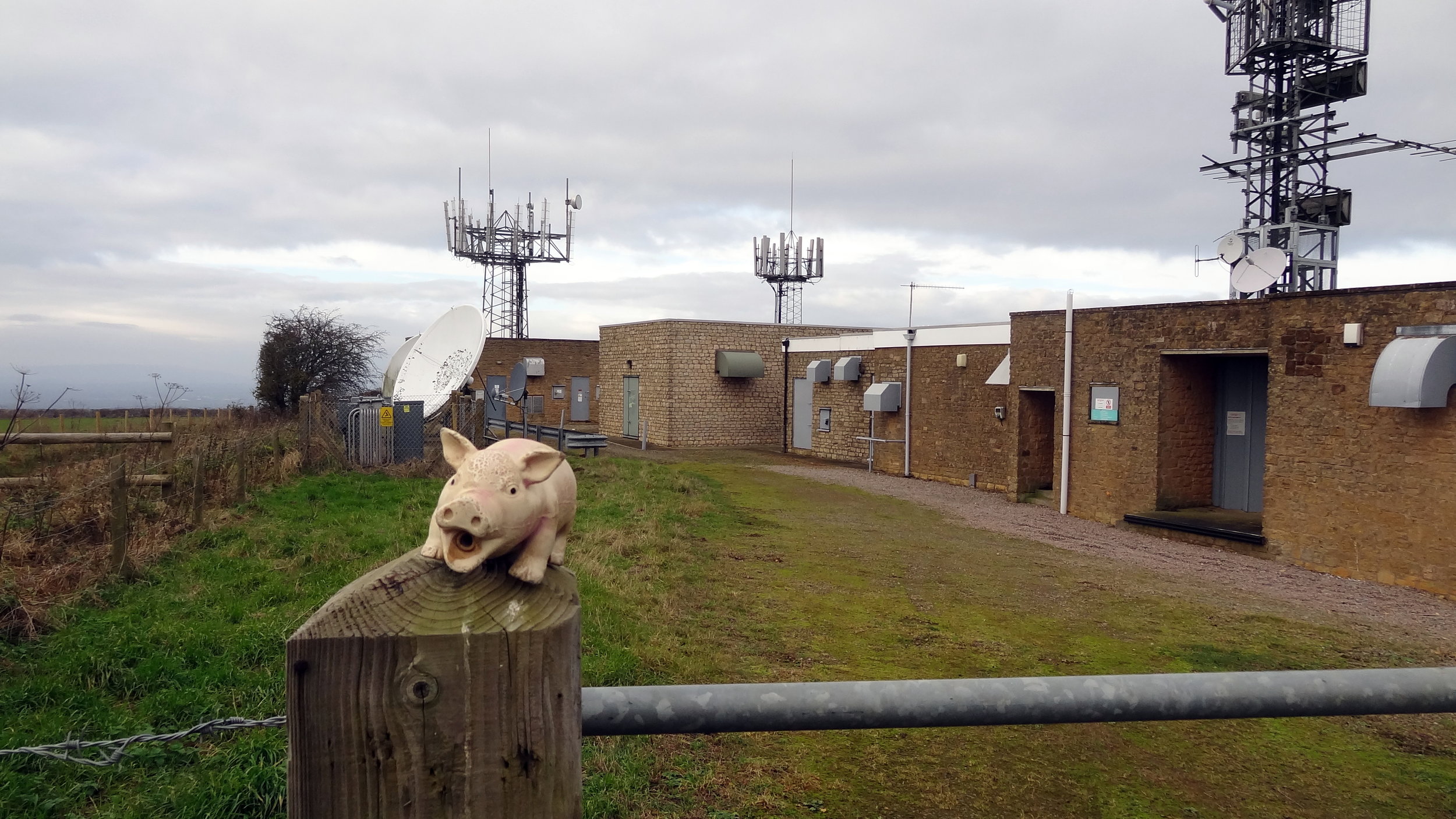
OS Trig Pillar: TP0352 - Wroxall Down
Map: OS Explorer OL29 Isle of Wight
Guidebook: Walking the County High Points of England (David Bathurst)
Links: Wikipedia (Isle of Wight), Wikipedia (St Boniface Down), Peakbagger, Hillbagging, National Trust

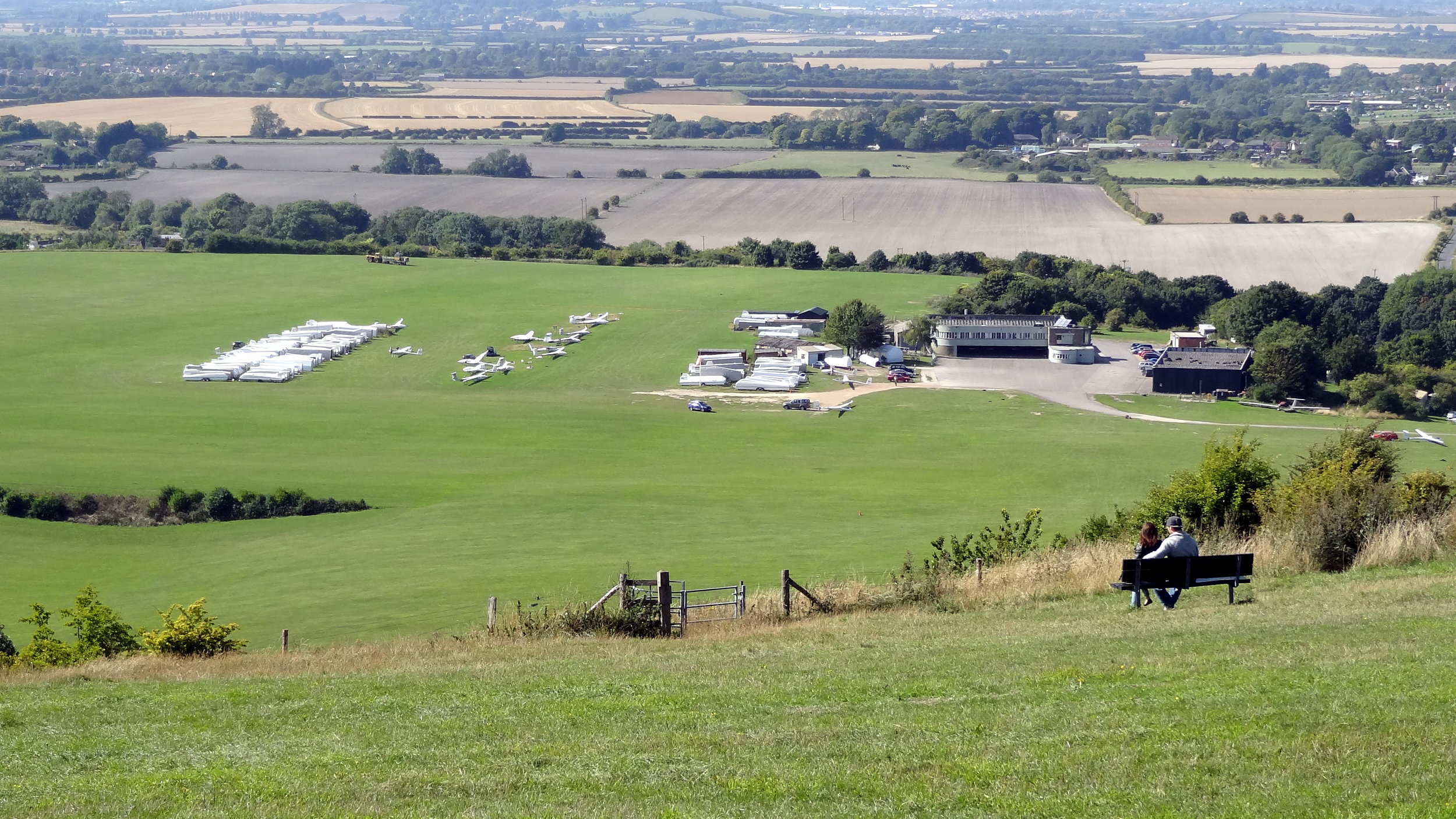
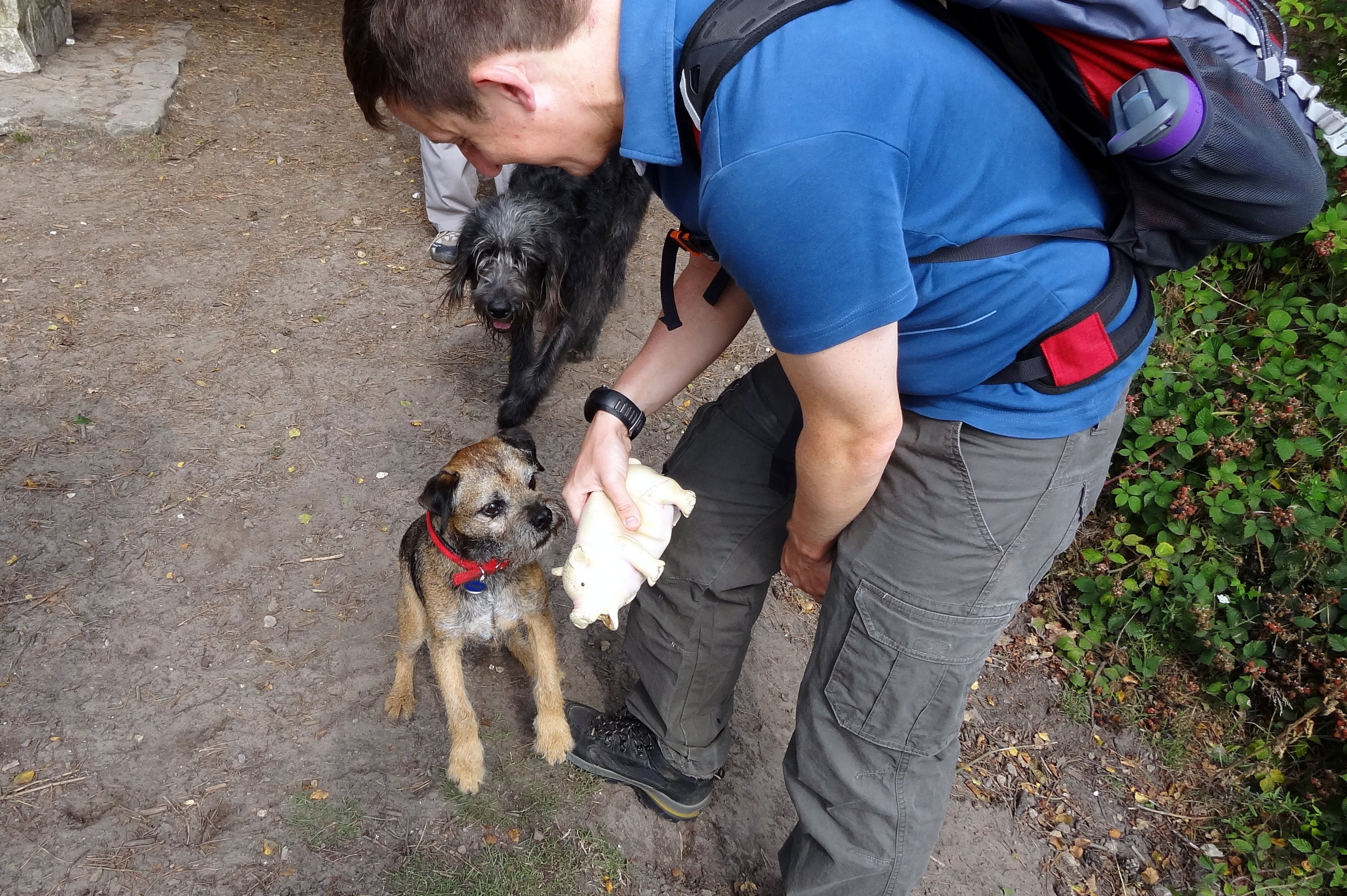
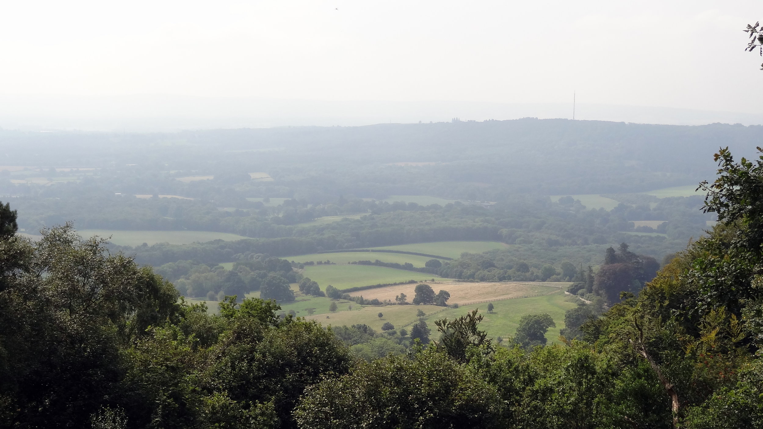
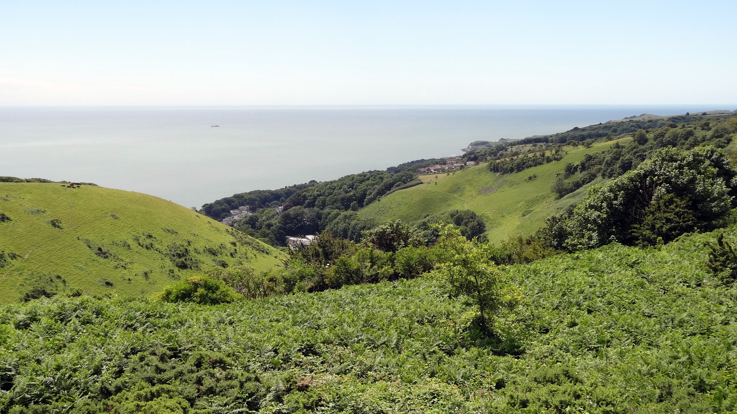
This was another drive-by County Top bagging for us. We were on a weekend trip for my mum's birthday and I convinced her that the diversion to the top of a hill to see a radar station was a good thing to do. As it turned out the views to the south coast of the island were fantastic that day.

Having seen David Bathurst's book since that trip, I've been inspired to go back one day and try a longer circular route to the top. I also completely missed bagging the Trig Pillar so I definitely have some unfinished business up there.


Black Mountain: Herefordshire County Top

Also Known As: Twyn Llech (Welsh)
Significance: Highest peak in Herefordshire (Historic CT).
Member of: Marilyn, Hewitt, Nuttall
Parent Peak: Waun Fach. NHN = Rhos Dirion
Elevation: 703m
Date climbed: April 20th 2014
Coordinates: 52°00′30″N 3°05′05″W
Route Start / End: Gospel Pass Car Park, Capel-y-ffin, Abergavenny, NP7 7NP
Route Distance: 8 km (5 miles)
Route Elevation Change: +/- 196m
Subsidiary tops on route: Hay Bluff (677m)
GPX File: get via Buy Me a Coffee
Other routes touched: Offa’s Dyke Path
OS Trig Pillar: TP5402 - Pen-Y-Beacon
Map: OS Explorer OL13 Brecon Beacons National Park
Guidebook: The UK's County Tops (Jonny Muir), Walking the County High Points of England (David Bathurst)
Links: Wikipedia (Herefordshire), Wikipedia (Black Mountain), Peakbagger, Hillbagging


If I had known that I’d be returning to the Ewyas valley many times in the future I probably wouldn’t have attempted this on on such a rainy day. As it happened we were on the last day of a long weekend in the Brecon Beacons and I was eager to bag this one.

Although Black Mountain is the high point of Herefordshire, an English County, much of the walk is in Wales. The obvious starting point is the car park at the top of Gospel Pass. From here there’s a well trodden path up the side of the valley to the Hay Bluff Trig Pillar. From the pillar, take the south-easterly path to join Offa’s Dyke. Continue for ~1.2k until you get to the high point. There’s nothing here except for a small group of stones. As visibility was very poor and it was raining a lot, we quickly retraced our steps back to the parking spot.

In the following years a good friend of ours would move to the valley and we have done a lot more walks near there. With better weather and more time I would plan a different walk that includes both Twmpa and Black Mountain.


Boring Field: Huntingdonshire County Top

The boring summit of Boring Hill


Significance: Highest peak in Huntingdonshire (Historic CT)
Member of: N/A
Parent Peak: Cleeve Hill. NHN = The Slipe
Elevation: 81m
Date climbed: December 13th 2013
Coordinates: 52° 19' 46'' N, 0° 27' 42'' W 
Route Start / End: Layby near water tower on B645 (NN9 6BG)
Route Distance: 2.5 km (1.6 miles)
Route Elevation Change: +/- 10m
Subsidiary tops on route: None
GPX File: get via Buy Me a Coffee
Other routes touched: None
Map: OS Explorer 225: Huntingdon and St.Ives, Grafham
Guidebook: The UK's County Tops (Jonny Muir)
Links: Wikipedia (Huntingdonshire), Wikipedia (Covington), Peakbagger, Hillbagging

Note: Boring field is now in the Ceremonial County of Cambridgeshire

Border post


Ebrington Hill: Warwickshire County Top

Significance: Highest peak in Warwickshire (Traditional CT)
Member of: N/A
Parent Peak: Cleve Hill. NHN = Bredon Hill
Elevation: 261m
Date climbed: 13th December 2013
Coordinates:  52°04′54″N 1°43′38″W 
Route Start / End: layby near radio transmitter at junction of Cotswold Link and country road between Park Lane and Nebsworth Lane
Route Distance: 0.1 km (0.1 miles)
Route Elevation Change: +/- 0m
Subsidiary tops on route: none
GPX File: get via Buy Me a Coffee
Other routes touched (walk): Cotswold Link
Other routes touched (cycle): none
Map:
OS Explorer Map (205) Stratford-upon-Avon and Evesham
Guidebook: The UK's County Tops (Jonny Muir), Walking the County High Points of England (David Bathurst)
Links: Wikipedia (Warwickshire), Wikipedia (Ebrington Hill), Peakbagger, Hillbagger


This County Top can be done as a very quick drive-by if, as I was, you’re short on time and on the way to somewhere else. There’s parking space for a couple of cars at the transmitter station. Don’t worry too much about whether you’ll find a parking space. You’ll soon find out when you get there why this isn’t one of England’s Top Ten tourist attractions.

There’s a Queen Elizabeth Diamond Jubilee boundary stone by the transmitter. From here, cross the road following the Cotswold Link and take a bearing using the coordinates above to reach the high point of Warwickshire. Retrace your steps to the car, get in and drive somewhere more interesting.

If you have the time a more interesting way to bag this would be as part of a long distance walk on the Cotswold Link.


Cleeve Hill: Gloucestershire County Top
Cotswold Way junction near the summit.

Cotswold Way junction near the summit.

Significance: Highest peak in Gloucestershire (Historic County Top), Cotswolds National Landscape High Point
Member of: Marilyn
Parent Peak: The Wrekin.
Nearest Higher Neighbour: Herefordshire Beacon
Elevation: 330m
Date climbed: 8th December 2013
Coordinates: 51.920°N 2.007°W
   
Route Start / End: Rising Sun Hotel, Rising Sun Lane, Cleeve Hill, Cheltenham, GL52 3PX
Route Distance: 12 km (7.5 miles)
Route Elevation Change: +/- 304m
Subsidiary tops on route: Cleeve Hill (317)
GPX File: get via Buy Me a Coffee
Other routes touched (walk): Cotswold Way, Winchcombe Way (West), Isbourne Way
Other routes touched (cycle): none
OS Trig Pillar: TP0007 - Cleeve Hill
Map: OS Explorer Map (179) Gloucester, Cheltenham and Stroud
Guidebook: The UK's County Tops (Jonny Muir), Walking the County High Points of England (David Bathurst)
Links: Wikipedia (Gloucestershire), Wikipedia (Cleeve Hill), Peakbagger, Hillbagging


OTHER HIGH POINT IN Gloucestershire


Great Wood: Suffolk County Top
DSC06145.JPG

Significance: Highest peak in Suffolk (Historic CT)
Member of: N/A
Parent Peak: Haddington Hill. NHN = Chrishall Common
Elevation:
 128m
Date climbed: 17th November 2013
Coordinates: 51°17′18″N 0°03′26″E   
Map: OS Explorer Map (211) Bury St.Edmunds and Stowmarket
Guidebook: The UK's County Tops (Jonny Muir), Walking the County High Points of England (David Bathurst)
Links: Wikipedia (Suffolk), Wikipedia (Great Wood), Peakbagger, Hillbagging

I bagged Great Wood, the high point of the Historic County of Suffolk, in 2013 as a part of series of quick high-point drive-bys. Nothing to see here so do it on the way to much more interesting destinations in the area.


Other High Point In Suffolk


Great Chishill and Chrishall Common: Cambridgeshire and Essex County Tops

The inspiring summit of Cambridgeshire


Great Chishill

Significance: Highest peak in Cambridgeshire (Historic CT)
Member of: N/A
Parent Peak: Haddington Hill. NHN = Chrishall Common
Elevation:
 146m
Coordinates: 52° 1' 39'' N, 0° 4' 45'' E
Links: Wikipedia (Cambridgeshire), Wikipedia (Great Chishill), Peakbagger, Hillbagging

Chrishall Common

Significance: Highest peak in Essex (Historic CT)
Member of: N/A
Parent Peak: Haddington Hill. NHN = Whitehill-Butterfield Green
Elevation:
 147m
Coordinates: 52° 0' 19'' N, 0° 6' 5'' E
Links: Wikipedia (Essex), Wikipedia (Chrishall Common), Peakbagger, Hillbagging

For both peaks:
Date climbed:
 17th November 2013
Route Start / End: Great Chishill Village Hall
Route Distance: 9.2 km (5.6 miles)
Route Elevation Change: +/- 78m
Subsidiary tops on route: None
GPX File: get via Buy Me a Coffee
Other routes touched: Harcamlow Way
Map: OS Explorer Map (209) Cambridge, Royston, Duxford & Linton
Guidebook: The UK's County Tops (Jonny Muir), Walking the County High Points of England (David Bathurst)


Other High Points In Cambridgeshire

  • Boring Field (81m) Huntingdonshire High Point (now part of Ceremonial County of Cambridgeshire)

  • Haddenham Village (39m) Former Administrative County of the Isle of Ely High Point

Other High Points In ESSEX

GREATER LONDON BOROUGH HIGH POINTS FORMERLY WITHIN Essex


Grand Union Half Marathon

When: November 10th 2013
Where: Cowley (Middlesex) to Watford (Hertfordshire), UK
Course: Point to point: Grand Union towpath from Cowley recreational ground, ending in Cassiobury Park
Other routes touched (walk): Grand Union Canal, London Loop, Colne Valley Trail, Hillingdon Trail
Other routes touched (cycle): NCN Route 6, 61
Finish time: 2:03

 
Betsom's Hill: Kent County Top

Significance: Highest peak in the Historic County of Kent, High point of the Lathe of Sutton-at-Hone
Member of: N/A
Parent Peak: Botley Hill.
Nearest Higher Neighbour = Botley Hill
Elevation:
 251m
Date “climbed”: 3rd November 2013
Coordinates:  51°17′18″N 0°03′26″E

Route Start / End: Parking / Bus stop on A233
Route Distance: 0.2 km (0.1 miles)
Route Elevation Change: +/- 2m
Subsidiary tops on route: None
GPX File: get via Buy Me a Coffee
Other routes touched: None
Map: OS Explorer Map (147) Sevenoaks and Tonbridge
Guidebook: The UK's County Tops (Jonny Muir), Walking the County High Points of England (David Bathurst)
Links: Wikipedia (Kent, Sutton-at-Hone, Betsom’s Hill), Peakbagger, Hillbagging


I bagged Betsom’s Hill, the high point of the Historic County of Kent, in 2013 as a part of series of quick high-point drive-bys. It’s just over the border with Greater London so it can bagged within a short walk with Westerham Heights, the high point of Greater London. Nothing to see at either high point so do it on the way to much more interesting destinations along the North Downs Ridge.


Red = Betsom’s Hill. Green = Westerham Heights. Actual summits not accessible

Red = Betsom’s Hill. Green = Westerham Heights.

A peak so boring we only took 1 photo

elevation_profile.jpg

OTHER HIGH POINT IN Kent

Greater London Borough High Points formerly within Kent


Cold Overton Park: Rutland County Top

Significance: Highest peak in Rutland (Historic CT)
Member of: N/A
Parent Peak: Cleeve Hill. NHN = Beacon Hill (Leicestershire)
Elevation: 197 m
Date climbed: October 14th 2014
Coordinates: 52°40′05″N 0°46′34″W 
Route Start / End: Layby near Cold Overton Road / Manor Lane junction
Route Distance: 1.4 km (0.9 miles)
Route Elevation Change: +/- 6m
Subsidiary tops on route: None
GPX File: get via Buy Me a Coffee
Other routes touched: None
OS Trig Pillar: TP7029 - Wood Close
Map: OS Explorer 234: Rutland Water
Guidebook: The UK's County Tops (Jonny Muir), Walking the County High Points of England (David Bathurst)
Links: Wikipedia (Rutland), Wikipedia (Cold Overton Park), Peakbagger, Hillbagging


Bardon Hill: Leicestershire County Top

Bardon Hill, Leicestershire County Top


Significance: Highest peak in Leicestershire (Historic CT)
Member of: Marilyn
Parent Peak: Thorpe Cloud. NHN = Thorpe Cloud
Elevation: 278m
Date climbed: October 14th 2014
Coordinates: 52° 42' 52'' N, 1° 19' 14'' W
Route Start / End: On-street parking at Vercor Close, Coalville, LE67 4QS
Route Distance: 4.3 km (2.7 miles)
Route Elevation Change: +/- 91m
Subsidiary tops on route: None
GPX File: get via Buy Me a Coffee
Other routes touched (walk): Ivanhoe Way
Other routes touched (cycle): none
OS Trig Pillar: TP1022 - Bardon Hill
Map: OS Explorer 245: The National Forest
Guidebook: The UK's County Tops (Jonny Muir), Walking the County High Points of England (David Bathurst)
Links: Wikipedia (Leicestershire), Wikipedia (Bardon Hill), Peakbagger, Hillbagging


OTHER HIGH POINTS IN Leicestershire


Dunstable Downs: Bedfordshire County Top
Hills near the Five Knolls Barrow Cemetery

Hills near the Five Knolls Barrow Cemetery


Significance: Highest peak in Bedfordshire (Traditional CT), Central Bedfordshire Unitary Authority High Point
Member of: N/A
Parent Peak: Haddington Hill. NHN = Pavis Wood
Elevation: 243m
Date climbed: 31st August 2013
Coordinates:  51° 51' 51'' N, 0° 32' 11'' W


Route Start / End: Chilterns Gateway Centre, Dunstable Road, Whipsnade, LU6 2GY
Route Distance: 5.2 km (3.2 miles)
Route Elevation Change: +/- 92m
Subsidiary tops on route: none
GPX File: get via Buy Me a Coffee
Other routes touched (walk): Chiltern Way, Icknield Way
Other routes touched (cycle): Icknield Way Trail
OS Trig Pillar: TP0379 - Dunstable Down
Map: OS Explorer Map (181) Chiltern Hills North
Guidebook: The UK's County Tops (Jonny Muir), Walking the County High Points of England (David Bathurst)
Links: Wikipedia (Bedfordshire), Wikipedia (Central Bedfordshire), Wikipedia (Dunstable Downs), Peakbagger, Hillbagging, National Trust


The County Top and Trig Point can be easily bagged on a drive-by or a 5 minute walk from the car-park. This would be a waste though as the walks and views from here are amazing. Take a picnic on a sunny day and watch the gliders taking off and landing below the hill.


elevation_profile - Dunstable Downs.jpg

Other High Points In Bedfordshire


Black Down: Sussex County Top
View from Black Down on a misty day

View from Black Down on a misty day


Significance: Highest peak in Sussex (Historic CT), Highest peak in West Sussex (Present Day CT), South Downs National Park High Point, Rape of Chichester High Point
Member of: Marilyn
Parent Peak: Leith Hill.
Nearest Higher Neighbour = Leith Hill
Elevation: 280m
Date climbed: 26th August 2013
Coordinates: 51°03′30″N 0°41′24″W 


Route Start / End: National Trust - Black Down Car Park, Tennyson's Lane, Haslemere, GU27 3BJ
Route Distance: 4 km (2.5 miles)
Route Elevation Change: +/- 57m
Subsidiary tops on route: None
GPX File: get via Buy Me a Coffee
Other routes touched (walk): Sussex Border Path, The Serpent Trail
Other routes touched (cycle): none
OS Trig Pillar: TP1443 - Blackdown
Map: OS Explorer OL33 Haslemere & Petersfield
Guidebook: The UK's County Tops (Jonny Muir), Walking the County High Points of England (David Bathurst)
Links: Wikipedia (Sussex), Wikipedia (West Sussex), Wikipedia (Black Down), Rape of Chicester, Peakbagger, Hillbagging, National Trust


OTHER HIGH POINTS IN Sussex


Milk Hill: Wiltshire County Top
The White Horse at Milk Hill

The White Horse at Milk Hill


Significance: Highest peak in Wiltshire (Historic CT)
Member of: Hardy
Parent Peak: Walbury Hill. NHN = Walbury Hill
Elevation: 295m
Date climbed: 18th May 2013
Coordinates: 51°22′40″N 1°51′07″W 
Route Start / End: Pewsey Downs Car Park, Marlborough, SN8 4JX
Route Distance: 5.8 km (3.6 miles)
Route Elevation Change: +/- 77m
Subsidiary tops on route: None
GPX File: get via Buy Me a Coffee
Other routes touched (walk): Mid Wilts Way, White Horse Trail, Great Stones Way
Other routes touched (cycle): NCN 45
Map: OS Explorer Map (157) Marlborough and Savernake Forest 
Guidebook: The UK's County Tops (Jonny Muir), Walking the County High Points of England (David Bathurst)
Links: Wikipedia (Wiltshire), Wikipedia (Milk Hill), Peakbagger, Hillbagging


OTHER HIGH POINT IN Wiltshire


The South West England County Tops

Dunkey Beacon, Somerset County Top


Having 6 County Tops in the bag, I was now ready for a longer multi-day trip to climb a few more remote ones. We went with a group of friends, some in it for the County Tops, others along for the ride. We headed down to Cornwall on a Friday afternoon for the start of the peaks of the South West. We started in Cornwall with the furthest away peak and worked our way back towards home.


Brown Willy

Significance: Highest peak in Cornwall (Historic County Top), Cornwall National Landscape High Point
Member of: Marilyn
Parent Peak: High Willhays.
Nearest Higher Neighbour: Cox Tor
Elevation: 420m
Date climbed: 20th April 2013
Coordinates: 50°35′20″N 4°36′08″W

Route Start / End: Rough Tor Car Park, Roughtor Road, Camelford, PL32 9QJ
Route Distance: 8 km (5 miles)
Route Elevation Change: +/- 400m
Subsidiary tops on route: Showery Tor (385m), Little Rough Tor (373m), Rough Tor (400m)
GPX File: get via Buy Me a Coffee
Other routes touched: N/A
OS Trig Pillar: TP1710 - Brown Willy
Map: OS Explorer 109: Bodmin Moor
Guidebook: The UK's County Tops (Jonny Muir), Walking the County High Points of England (David Bathurst)
Links: Wikipedia (Cornwall), Wikipedia (Brown Willy), Peakbagger, Hillbagging

Brown Willy is in a remote patch of Bodmin Moor, roughly in the centre of the county. By the time you’ve reached the car park you’re already at 260m elevation so the walk only adds another 160m. It’s a fairly quick out and back to bag the summit but worth a couple of diversions to Rough Tor, Little Rough Tor and Showery Tor in the way.


High Willhays

Significance: Highest peak in Devon (Historic County Top), Dartmoor National Park High Point
Member of: Marilyn, Hewitt, Nuttall
Parent Peak: Cross Fell.
Nearest Higher Neighbour: Garreg Las
Elevation:
 621m
Date climbed: 20th April 2013
Coordinates: 50°41′06″N 4°00′36″W

Route Start / End: Meldon Reservoir Car Park, Okehampton, EX20 4LU
Route Distance: 6.4 km (4 miles)
Route Elevation Change: +/- 395m
Subsidiary tops on route: Yes Tor (619m)
GPX File: get via Buy Me a Coffee
Other routes touched (walk): Mary Michael Pilgrims Way
OS Trig Pillar: TP7101 - Yes Tor
Map: OS Explorer OL28: Dartmoor
Guidebook: The UK's County Tops (Jonny Muir), Walking the County High Points of England (David Bathurst)
Links: Wikipedia (Devon), Wikipedia (High Willhays), Peakbagger, Hillbagging

High Willhays is the highlight of this collection of four peaks. It’s the highest and it’s a great circular walk. Note that the summit is on a Military firing range so check firing times before you leave to make sure that access is open.

From the Meldon Reservoir car park walk in a south easterly direction across the top of the reservoir dam wall. Take a right and follow the path on the southern edge of the reservoir and continue south on the path following the West Oke River. At ~5km from the car park you can take a path that climbs up the hill in a north-westerly direction to Fordlands Ledge. Here you'll join the Mary Michael Pilgrims Way. Continue up the hill until you reach the summit of High Willhays. From High Willhays continue north to Yes Tor.

From Yes Tor we took a bearing and followed a direct line in a north-westerly direction to meet the track at 50°41'51.3"N 4°01'39.2"W. This track takes you in a northerly direction, curving to the west and returns to the reservoir then back to the start.

elevation_profile (1).jpg

Dunkery Beacon

Significance: Highest peak in Somerset (Historic County Top), Exmoor National Park High Point
Member of: Marilyn
Parent Peak: High Willhays.
Nearest Higher Neighbour: Werfa
Elevation:
 519m
Date climbed: 21st April 2013
Coordinates: 51.16197°N 3.58736°W

Route Start / End: Dunkery Beacon Parking, Cutcombe, Minehead, TA24 7AT
Route Distance: 2.7 km (1.7 miles)
Route Elevation Change: +/- 120m
Subsidiary tops on route: none
GPX File: get via Buy Me a Coffee
Other routes touched (walk): Macmillan Way West
OS Trig Pillar: TP7321 - Dunkery
Map: OS Explorer OL9: Exmoor
Guidebook: The UK's County Tops (Jonny Muir), Walking the County High Points of England (David Bathurst)
Links: Wikipedia (Somerset), Wikipedia (Dunkery Beacon), Peakbagger, Hillbagging

Like Brown Willy, Dunkery Beacon is a quick out and back from a convenient car park. The Trig Pillar at the summit is long gone but it’s been replaced by a massive pile of stones and a plaque commemorating the handover of the hill to the National Trust.

From the car park it's only a 1.5km route to the summit. We made a small circle of it by taking the westerly path up and easterly down. The hill is also on the Macmillan Way so can be bagged on a longer trek


Lewesdon Hill

Significance: Highest peak in Dorset (Historic County Top), Dorset National Landscape High Point
Member of: Marilyn
Parent Peak: Staple Hill (Somerset)
Nearest Higher Neighbour: Staple Hill
Elevation:
 185m
Date climbed: 21st April 2013
Coordinates: 50°48′28″N 2°47′59″W 

Route Start / End: Parking spot on junction of B3162 and Coombe Lane
Route Distance: 2.2 km (1.4 miles)
Route Elevation Change: +/- 112m
Subsidiary tops on route: none
GPX File: get via Buy Me a Coffee
Other routes touched: none
Map: OS Explorer 116: Lyme Regis and Bridport
Guidebook: The UK's County Tops (Jonny Muir), Walking the County High Points of England (David Bathurst)
Links: Wikipedia (Dorset), Wikipedia (Lewesdon Hill), Peakbagger, Hillbagging, National Trust

We unintentionally saved the least interesting of the four peaks til last. Lewesdon Hill, the high point of Dorset is most easily done on a short out-and-back walk from parking spaces on the B3162 near Bucks Head Cottage. From here walk ~200m along Coombe Lane then take a footpath on the right. The summit is approximately 1km from where you parked. We didn't find anything of interest to mark the summit.

Slightly further to the north is the Wessex Ridgeway which gives you options to bag this hill as a part of a more interesting longer distance trek.


Other High Points In Cornwall

  • Telegraph Tower, Higher Newford (51m) Isles of Scilly Administrative County High Point: Peakbagger / Hillbagging

Other High Points In Devon

Other High Points In Dorset

Other High Points In Somerset