Walking The Chiltern Way
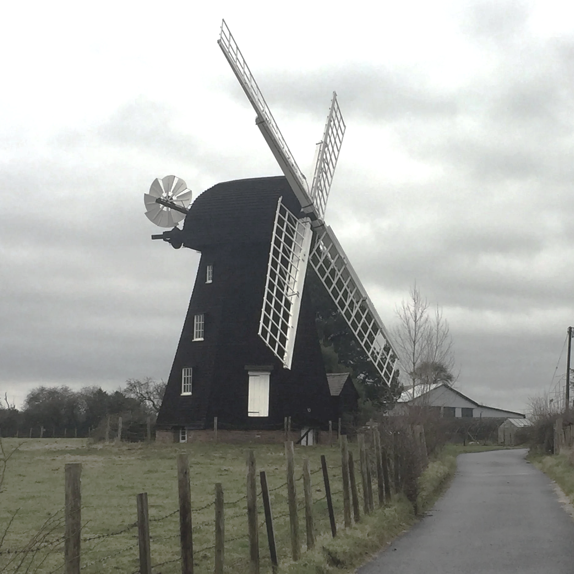
The Chiltern Way is a long distance path weaving through the heart of the beautiful Chiltern Hills. Created by the Chiltern Society as a Millennium project, this route is the perfect way to experience the very best of the Chilterns National Landscape (formerly Area of Outstanding Natural Beauty). The path is approximately 177 miles (285 km) long, depending on which extensions you take, and links together a wonderful variety of landscapes and charming villages across Buckinghamshire, Hertfordshire, Bedfordshire, and Oxfordshire.
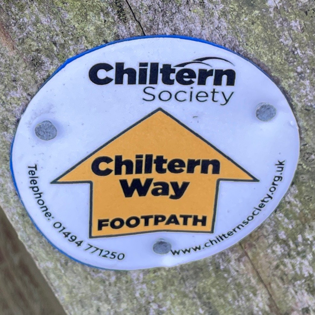
The Chiltern Way is a circular route, which means you can start and finish wherever you like, making it incredibly flexible for day trips or a multi-day challenge. It's well waymarked with yellow-on-white discs, and it also links up with other major trails like The Ridgeway and The Icknield Way.
My friend Brian and I have been doing a section per year on or around the Winter Solstice since 2019. Since we started both the Northern and Southern extensions have been incorporated into the main route making it an even longer route. Our plan is to complete the main route, including the Southern extension in 2029 followed by the Berkshire Loop and Northern Extension.
Listed below are the 11 sections of the Chiltern Way that we have either completed or plan to complete. Click on the link for the blog post for already completed sections.
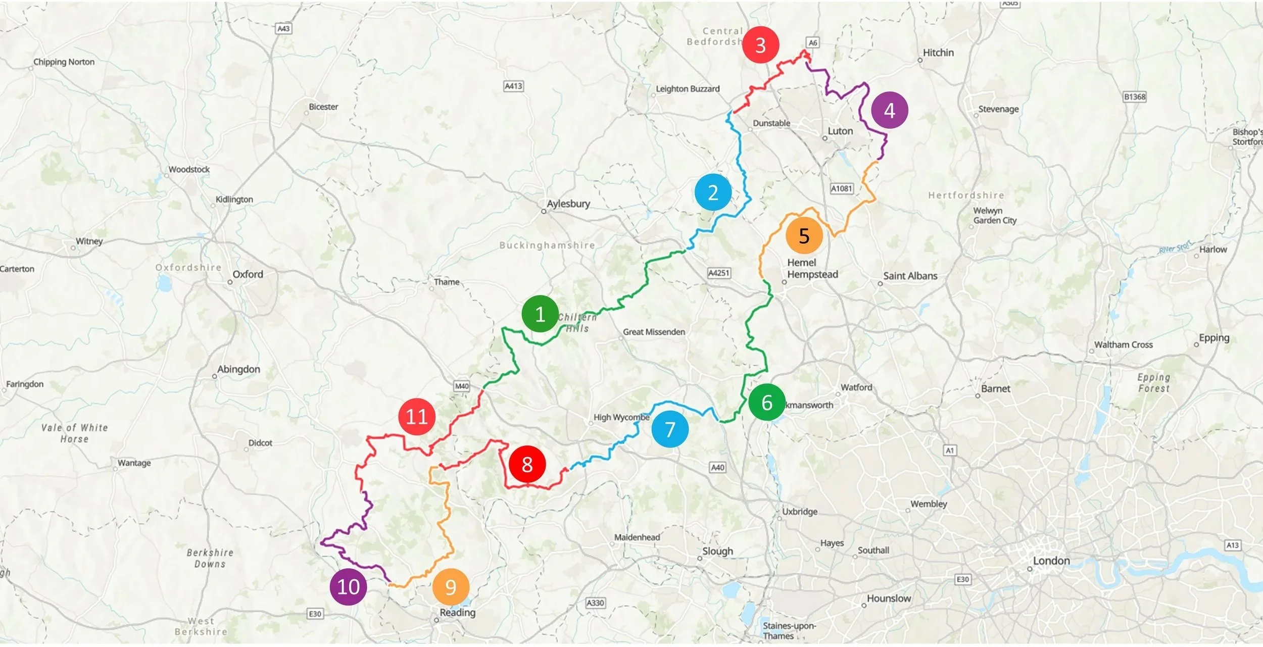
Numbers above correspond to each section. Route direction is clockwise.
Section 1: Stokenchurch to Cow Roast
Start: The Royal Oak Pub, Church St, Stokenchurch, High Wycombe, HP14 3TH
Finish: Cowroast Lock, 46 Wharf Ln, Tring HP23 5RE
Distance: 36.5 km (22.7 Miles)
Elevation change: +452m / -646m. Net -194m

Section 2: Cow Roast to Chalk Hill
Start: Cowroast Lock, 46 Wharf Ln, Tring HP23 5RE
Finish: White Lion Pub, Watling Street, Houghton Regis, Dunstable, LU6 1RS
Distance: 21.9 km (13.6 Miles)
Elevation change: +314m / -315m. Net -1m

Section 3: Chalk Hill to Streatley
Start: White Lion Pub Watling Street, Houghton Regis, Dunstable, LU6 1RS
Finish: The Chequers, 171 Sharpenhoe Road, Streatley, Luton, LU3 3PS
Distance: 16.4 km (10.2 Miles)
Elevation: +184m / -149m. Net +35m

Section 4: Streatley to Peter’s Green
Start: The Chequers pub, 171 Sharpenhoe Road, Streatley, Luton, LU3 3PS
Finish: The Bright Star Pub, Kimpton Road, Peter's Green, Luton, LU2 9QP
Distance: 20.8 km (12.9 Miles)
Elevation change: +223m / -227m. Net -4m

Section 5: Peter’s Green to Shrub Hill Common
Start: The Bright Star Pub, Kimpton Road, Peter's Green, Luton, LU2 9QP
Finish: Chaulden Adventure Playground, 106 Long Chaulden, Hemel Hempstead, HP1 2HX
Distance: 26.8 km (16.6 Miles)
Elevation change: +288m / -304m. Net -16m

Section 6: Shrub Hill Common to Chalfont St. Giles
Start: Chaulden Adventure Playground, 106 Long Chaulden, Hemel Hempstead, HP1 2HX
Finish: The Village Green, Chalfont Saint Giles, HP8 4QF
Distance: 22.7 km (14.1 Miles)
Elevation change: +250m / -303m. Net -53m

Section 7: Chalfont St. Giles to Marlow Bottom.
Start: The Village Green, Chalfont Saint Giles, HP8 4QF
Finish: Marlow Bottom Playing Field, Marlow, SL7 3PJ
Distance: 23.3 km (14.5 Miles)
Elevation change: +376m / -389m. Net -13m
Blog post coming in December 2025

Section 8: Marlow Bottom to Maidensgrove.
Start: Marlow Bottom Playing Field, Marlow, SL7 3PJ
Finish: Maidensgrove Common, Henley-on-Thames, RG9 6EX
Distance: 22.7 km (15.3 Miles)
Elevation change: +500m / -377m. Net +123m
Blog post coming in December 2026

Section 9: Maidensgrove to Mapledurham.
Start: Maidensgrove Common, Henley-on-Thames, RG9 6EX
Finish: St Margaret's Church. Mapledurham. Reading, RG4 7TP
Distance: 23 km (14.3 Miles)
Elevation change: +266m / -415m. Net -149m
Blog post coming in December 2027

Section 10: Mapledurham to Ipsden.
Start: St Margaret's Church. Mapledurham. Reading, RG4 7TP
Finish: King William IV pub, Ipsden, Wallingford, OX10 6AD
Distance: 22.8 km (14.1 Miles)
Elevation change: +439m / -359m. Net +80m
Blog post coming in December 2028
Section 11: Ipsden to Stokenchurch.
Start: King William IV pub, Ipsden, Wallingford, OX10 6AD
Finish: The Royal Oak Pub, Church St, Stokenchurch, High Wycombe, HP14 3TH
Distance: 28.1 km (17.8 Miles)
Elevation change: +567m / -460m. Net +107m
Blog post coming in December 2029

The Berkshire Loop
Start: Penn, Buckinghamshire
Finish: Harpsden Bottom, Oxfordshire
Distance: 46.9 km (29.1 Miles)
Elevation change: +568m / -634m. Net -66m
Blog post coming in December 2030

The Northern Extension
Start: Sharpenhoe Clappers, Hertfordshire
Finish: Peter's Green, Bedfordshire
Distance: 42.9 km (26.7 Miles)
Elevation change: +645m / -568m. Net +77m
Blog post coming in December 2031