Walking The Hillingdon Trail

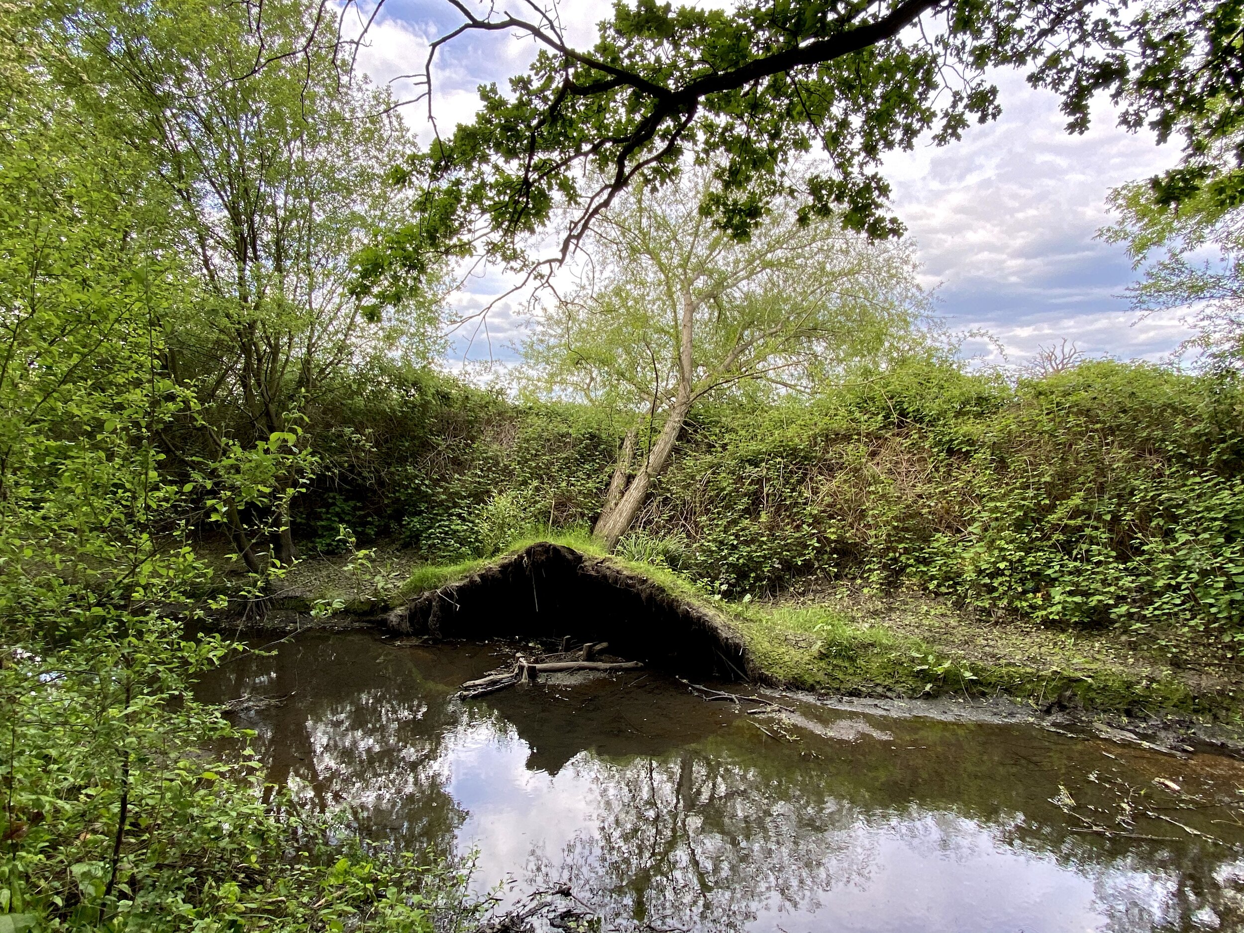
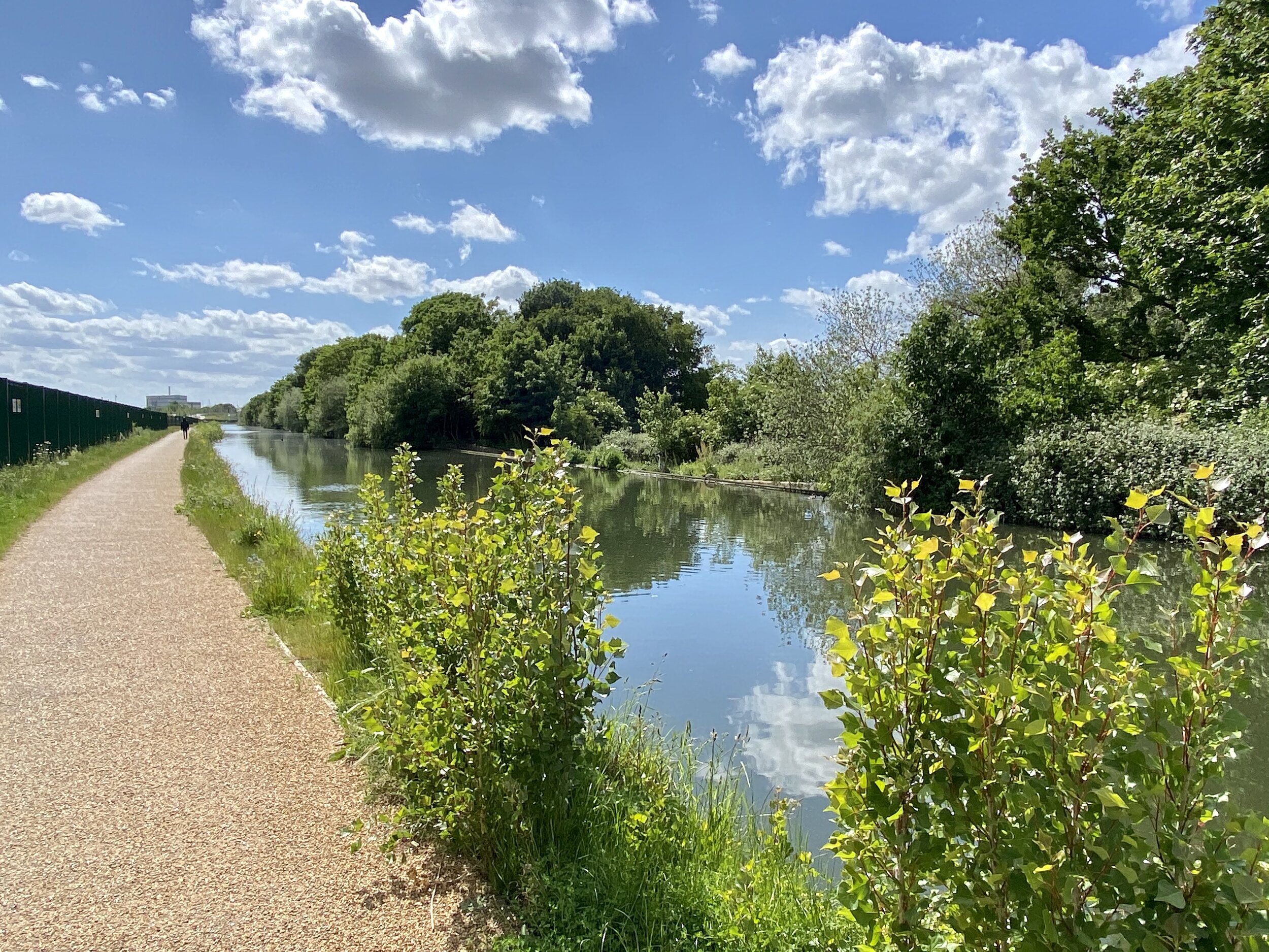
Yeading Brook near Northolt
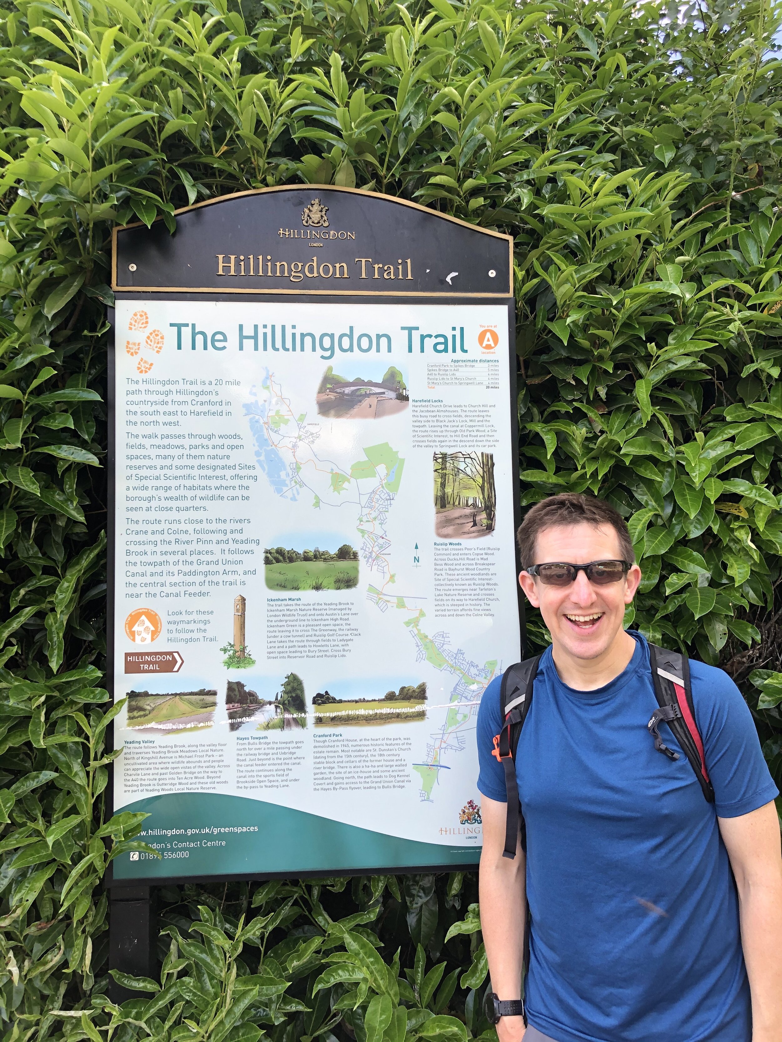
The Hillingdon Trail is a ~17 mile walking route from Springwell Lock near Maple Cross to Cranford Park near Heathrow Airport. It was another local route that I’d had on the back burner for later and decided to try out as the country was emerging from the Covid lockdown. Hillingdon is the closest London borough to us and I’d only ever visited busy parts of it so had never associated it with nice country walking. As it turned out it took us through some beautiful parts of the area that we’ll be returning to for other walks soon.
SECTION 1 - Springwell Lock To Ruislip Lido
Start: Parking spaces at Springwell Lane, Harefield, Uxbridge UB9 6PG
Finish: Car park at Ruislip Lido, Reservoir Road, Ruislip HA4 7TY
Distance: 10.2 km (6.4 miles)
Elevation change: +143m / -135m
GPX File: get via Buy Me a Coffee
Other routes touched (walk): Grand Union Canal Towpath, The London Loop, Colne Valley Trail
Other routes touched (cycle): NCN 6, 61
Other Pubs / Cafes on route: The Water's Edge, Reservoir Road, Ruislip HA4 7TY (end of route).
Map: OS Explorer Map (172) Chiltern Hills East
Links: Hillingdon, Harefield, ANZAC Memorial, Ruislip Lido
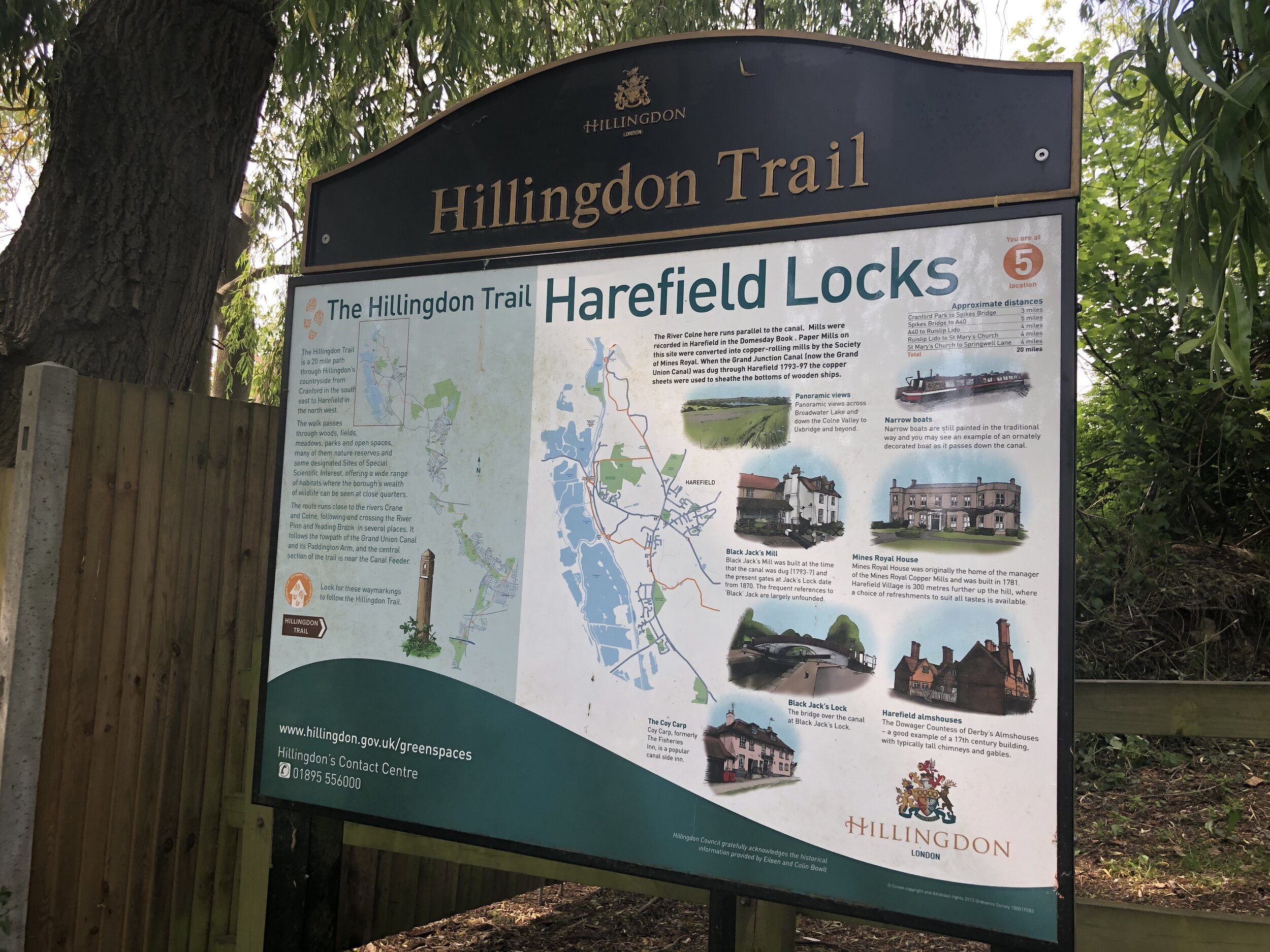
We had already passed the official start of the trail at Springwell Lock a few weeks ago on the Colne Valley Trail. This stretch of the Grand Union Canal has a lot of trails passing through it and is especially well sign-posted. As we had covered the first 2 km many times before, we decided to start this section a bit further south at Harefield Locks. This is the point where the trail diverts off from the Grand Union and Colne Valley Trail, heading south-east.
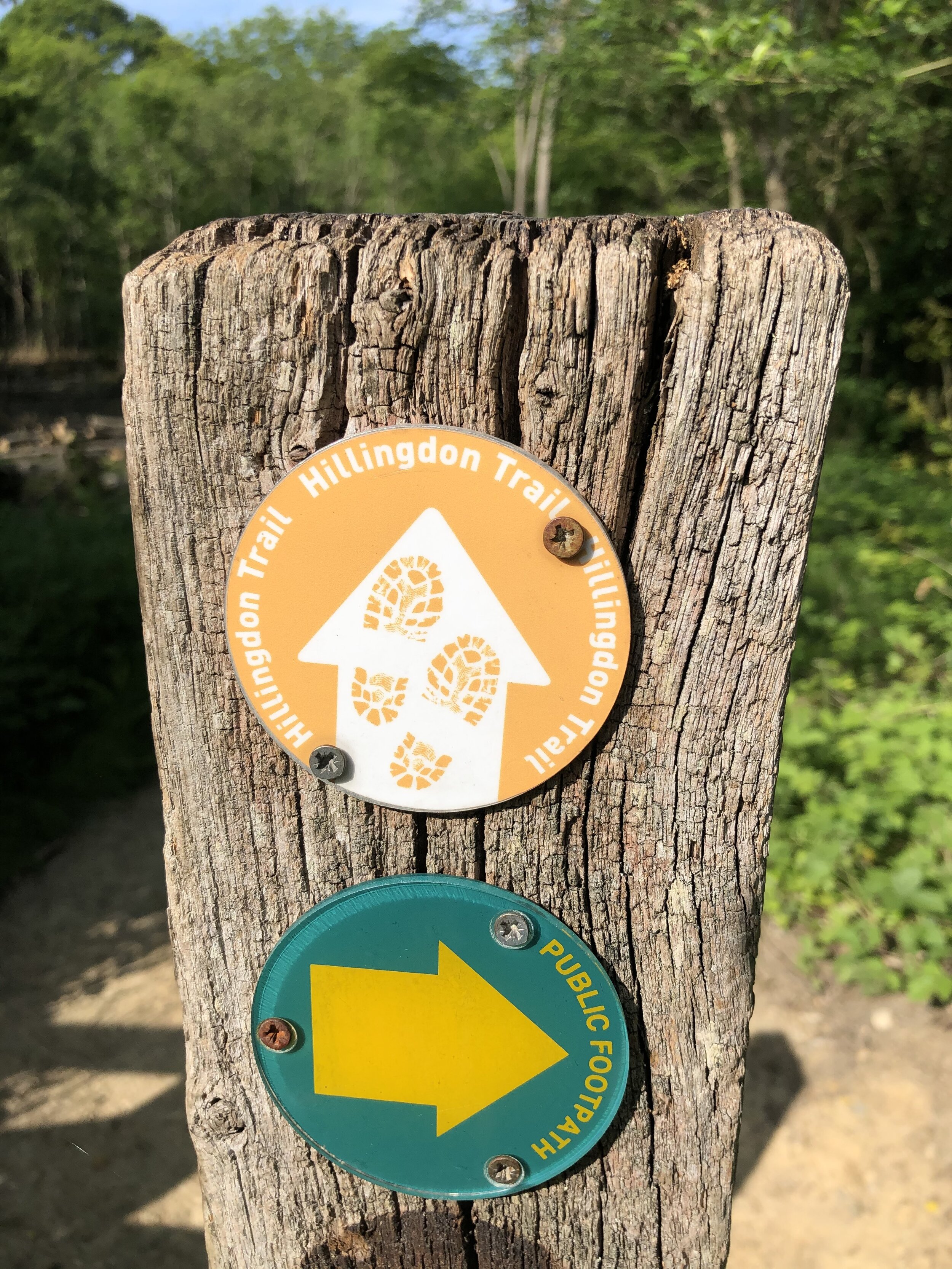
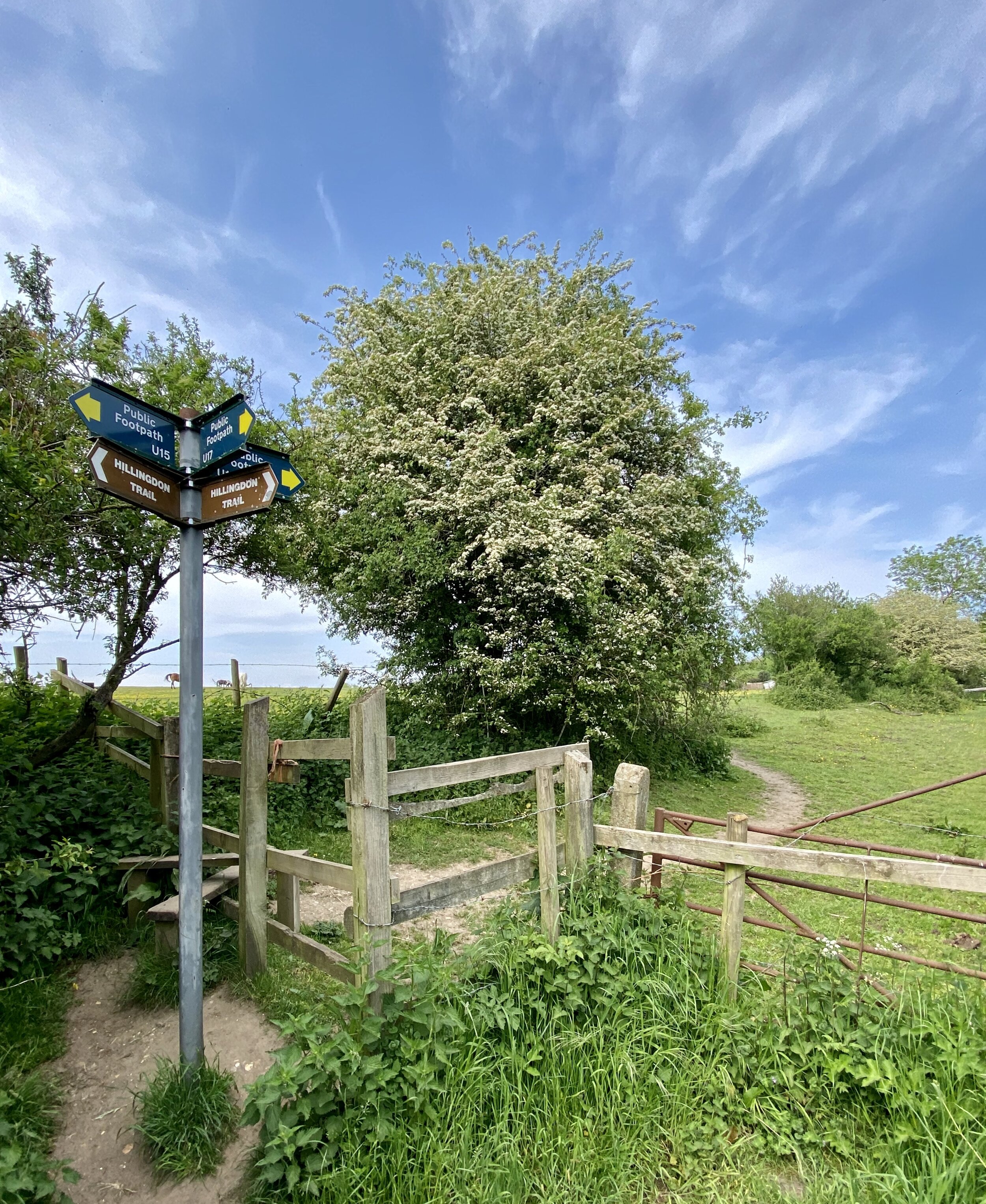
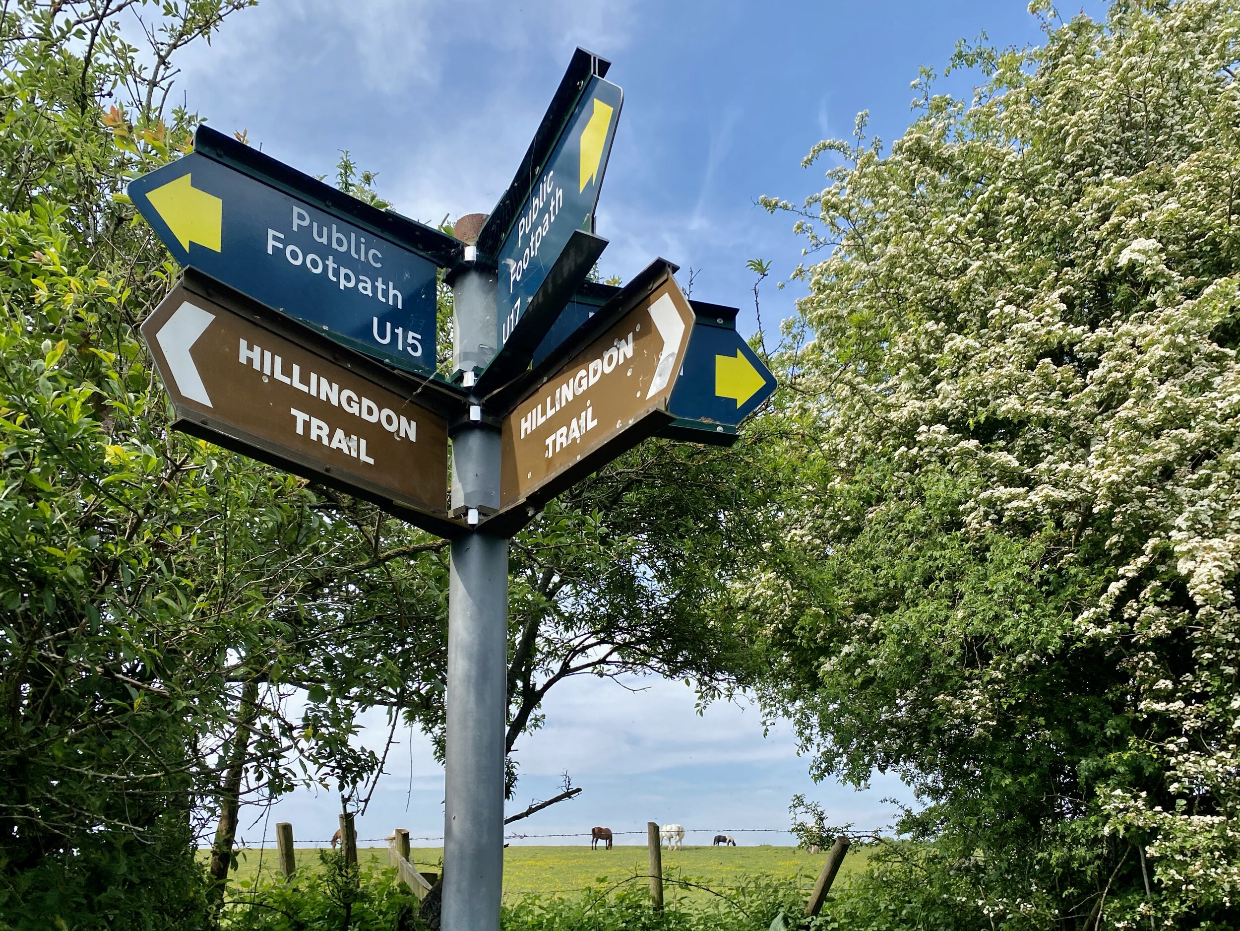
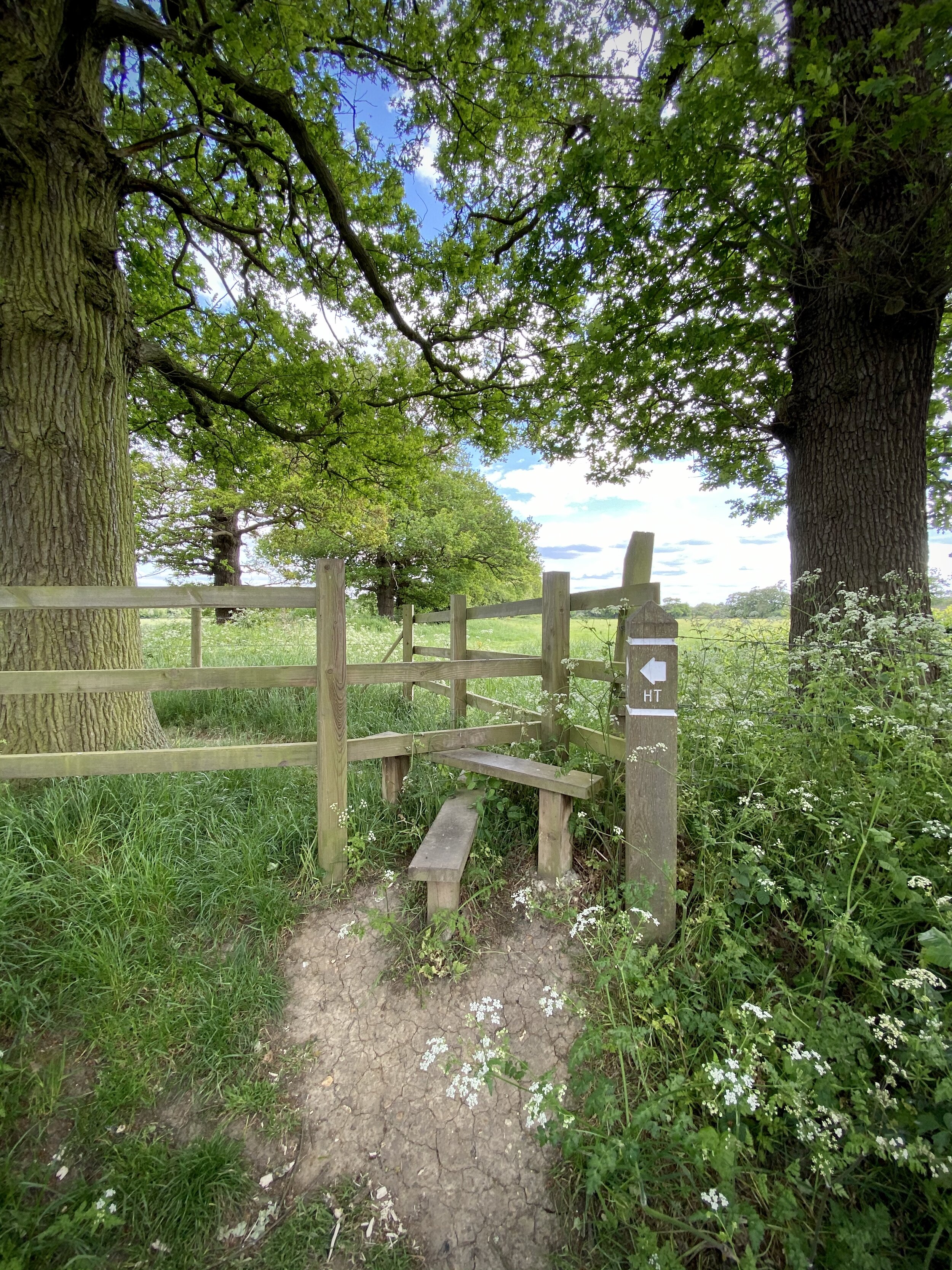
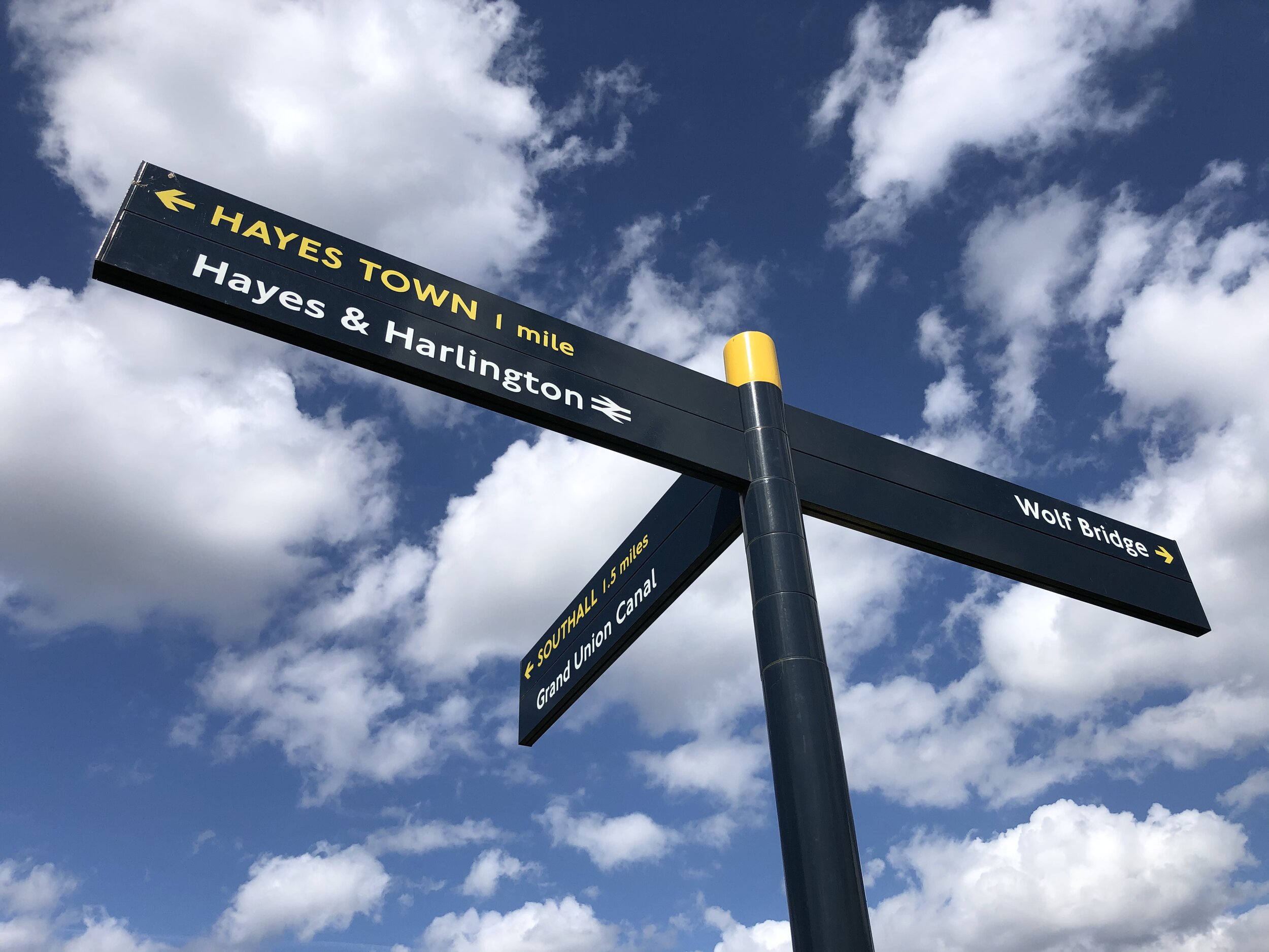
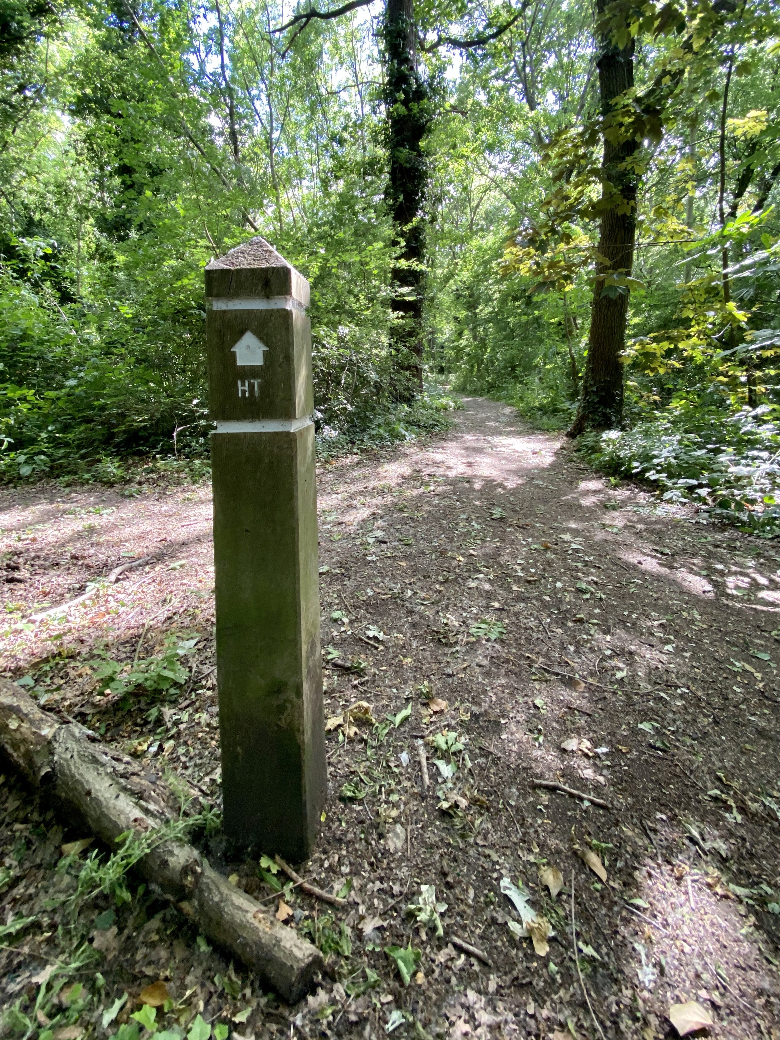
The whole trail is well sign-posted either with traditional metal arrow footpath signs or short wooden posts with HT marked on them. We were also following a GPS route but found that there were some inconsistencies. All of these were pretty minor and any diversions would come back together pretty quickly. I recommend not completely trusting the signs but take a GPS route or marked-up map too.
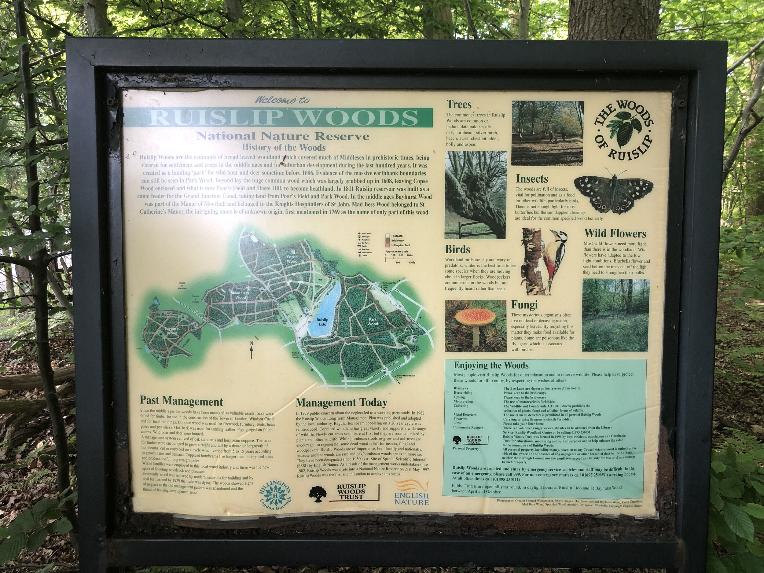
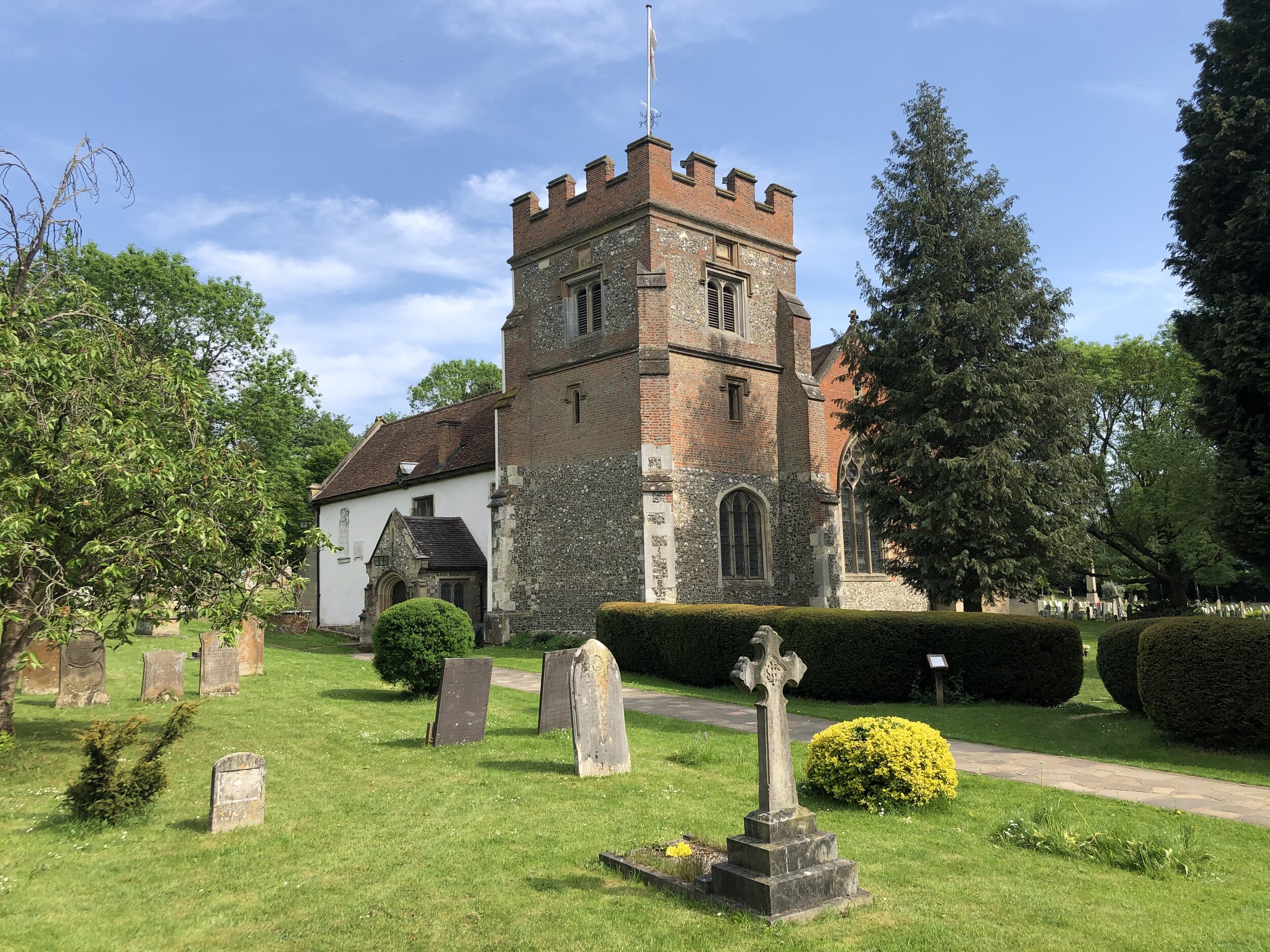
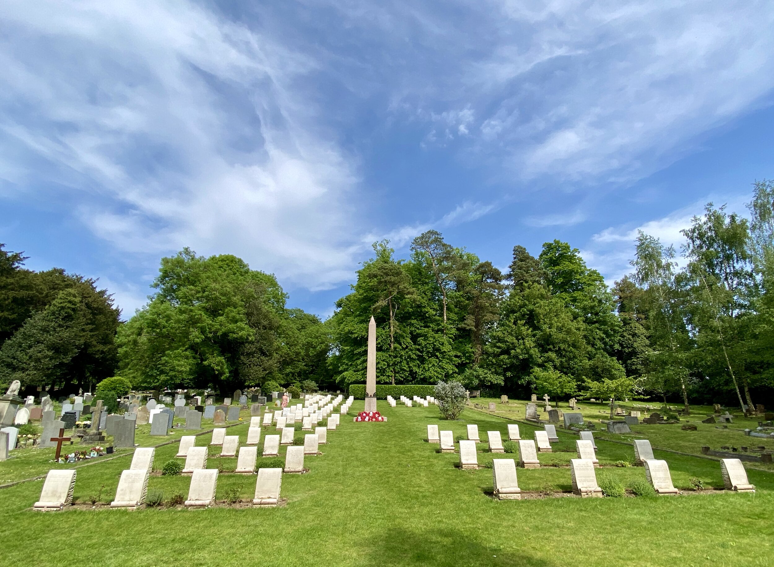
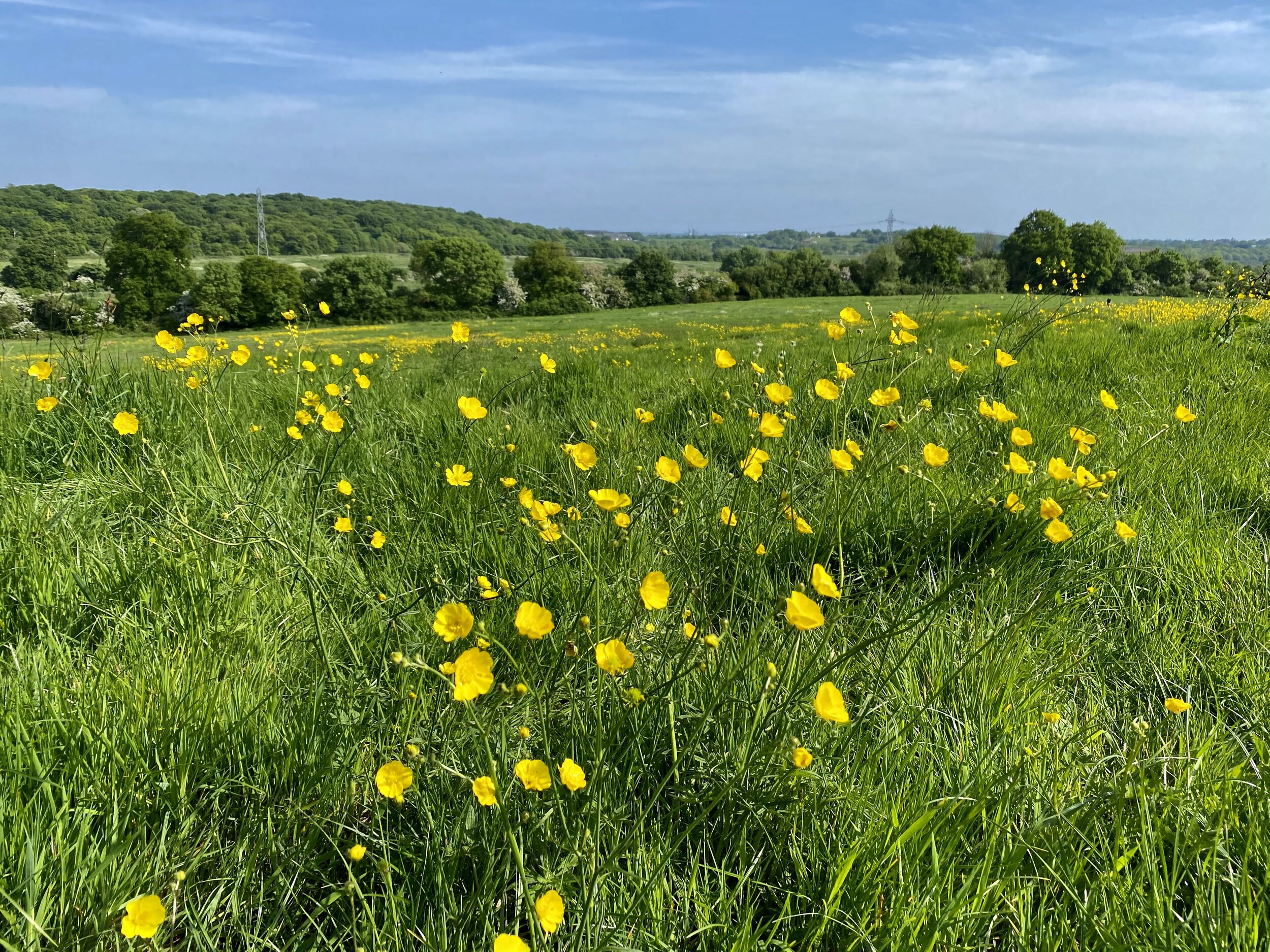
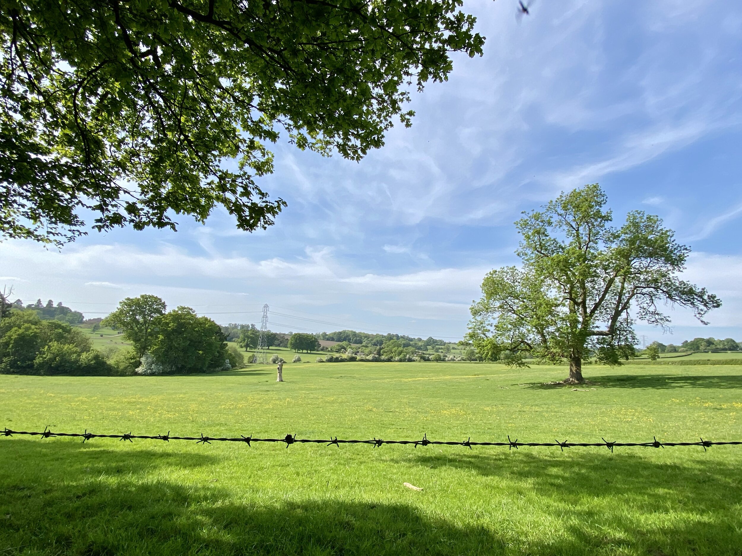
From the Grand Union the trail ascends through fields up to Harefield Village before heading back into undulating countryside. As you leave Church Hill Road in Harefield, take a moment to visit the ANZAC Memorial by St Mary’s Church. From here the rest of this section takes you through Bayslip Woods and Ruislip Woods, ending at Ruislip Lido.

SECTION 2 - Ruislip Lido To Yeading Brook Meadows
Start: Car park at Ruislip Lido, Reservoir Road, Ruislip HA4 7TY
Finish: On street parking near Yeading Brook Meadows, Hayes, Northolt, UB4 9JA
Distance: 9.8 km (6 miles)
Elevation change: +29m / -53m
GPX File: get via Buy Me a Coffee
Other routes touched (walk): Celandine Route, Willow Tree Wander, Dog Rose Ramble,
Other routes touched (cycle): N/A
Other Pubs / Cafes on route: Home Bar & Kitchen, 16 High Road, Ickenham, Uxbridge UB10 8LJ
Map: OS Explorer Map (172) Chiltern Hills East and OS Explorer Map (173) London North, The City, West End, Enfield, Ealing, Harrow & Watford
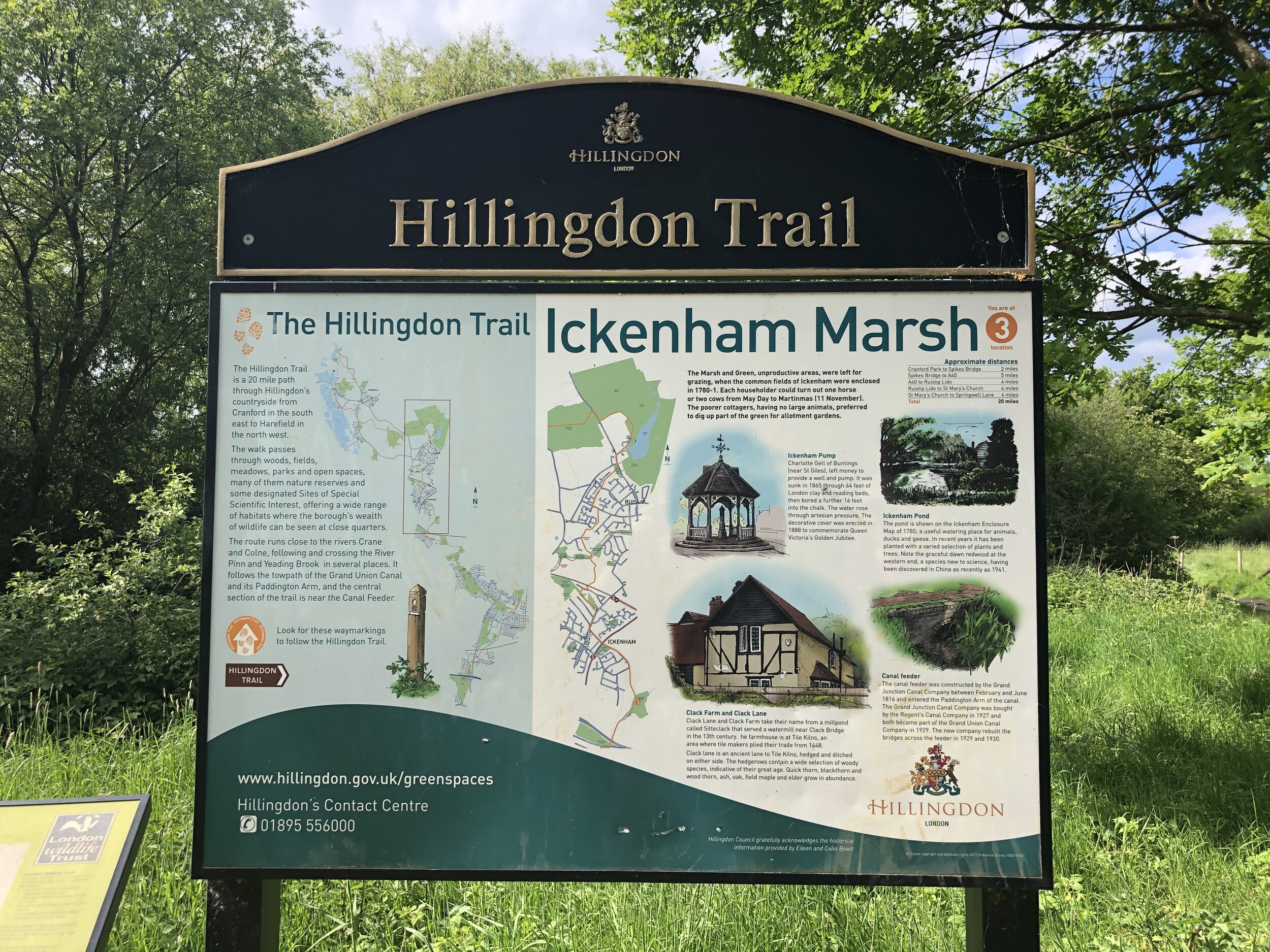
Links: Hillingdon, Ruislip Lido, River Pinn, Yeading Brook, RAF Northolt, Yeading, Yeading Brook Meadows
Following the mostly wooded Section 1, the trail now enters residential areas of Ruislip and Yeading. From Ruislip Lido, the trail heads roughly south through housing, re-joining the countryside near the River Pinn. Watch out for signs here as we took a wrong turn immediately after crossing the Pinn and started following the Celandine Route.
Once back on track we crossed what were once quiet meadows and have now become a building site for HS2. At the time of writing there is still a fenced off path through the site. Check before you attempt this section as the building will go on for years and may be diverted in future. Once through the building site you’ll cross under the existing GWR mainline and into West Ruislip. After some more housing you’ll cross over the Metropolitan underground line and back into the countryside.
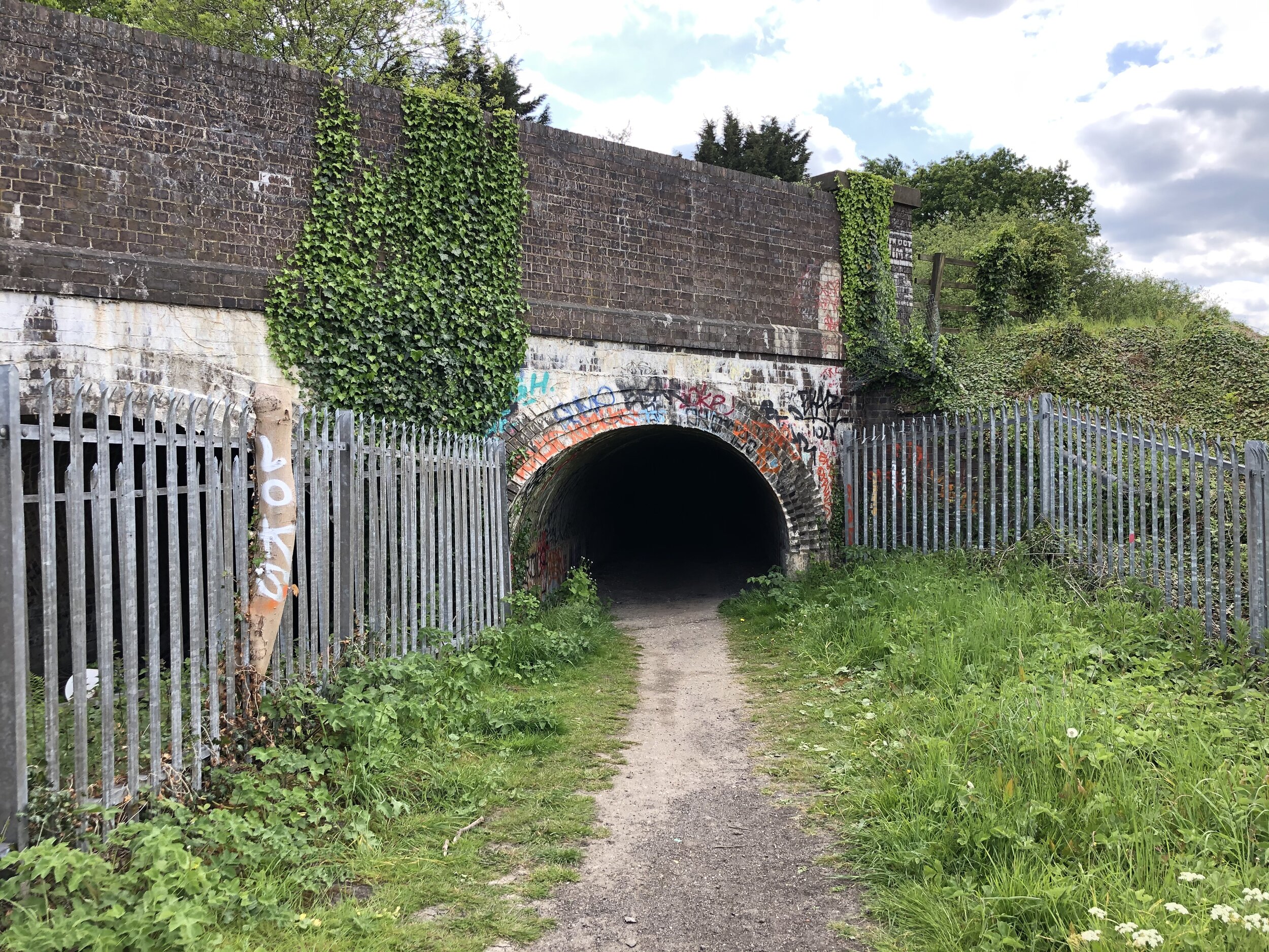
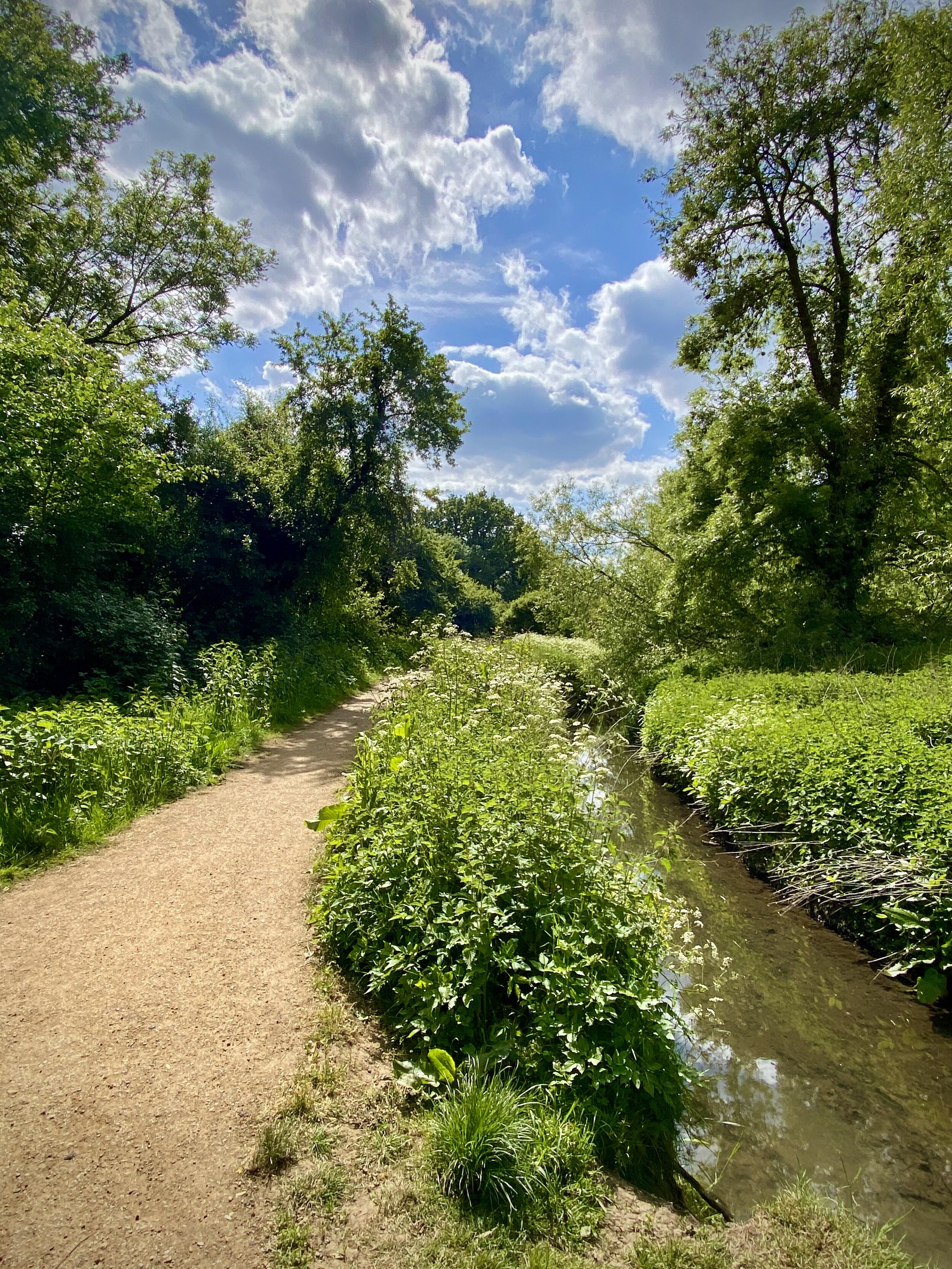
With West Ruislip behind you, the trail curves round to the western perimeter of RAF Northolt, continuing to follow the Yeading Brook. Unless any planes are taking off overhead you wouldn’t know that the airport is there. The growing rumble that you’ll hear is the A40 Western Avenue. A small tunnel takes you safely under the dual carriageway where the path follows a south-easterly direction. Continuing on you’ll pass through Gutterage Wood, then Ten Acre Wood. The path will change direction again and head due south continuing to follow the Yeading Brook.
This section finishes at the start of Yeading Brook Meadows as you cross Kingshill Avenue. There’s no car park here, but lots of free on-street parking on The Greenway that runs along the eastern border of the Meadow.
Points of Interest along or near to the Route
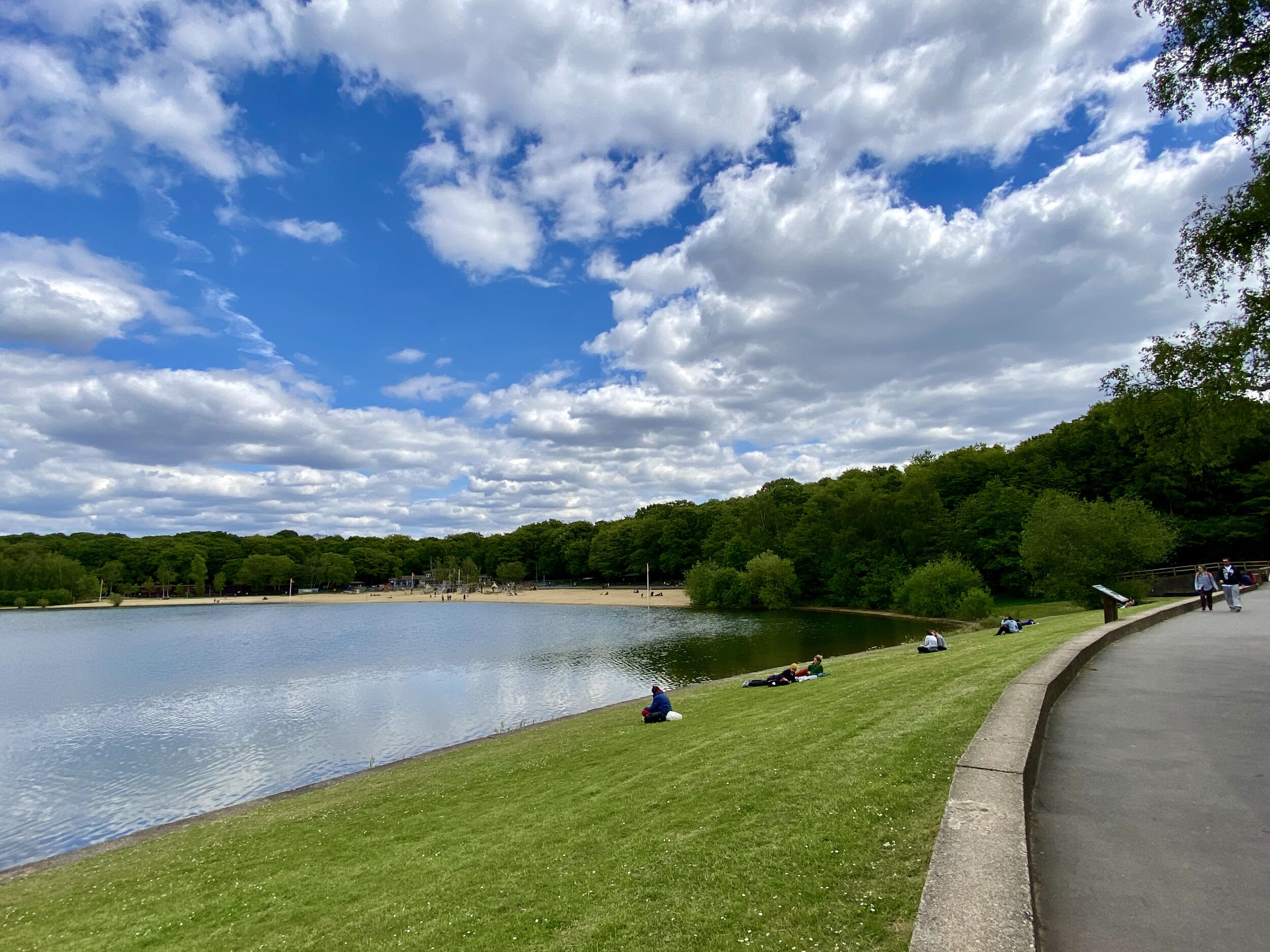
Ruislip Lido Set on the edge of Ruislip Woods, Ruislip Lido is a 60-acre reservoir surrounded by sandy beaches and a narrow-gauge railway. Originally constructed in 1811 as a feeder reservoir for the Grand Junction Canal, it never fully served its intended industrial purpose and was eventually developed into a popular lido in the 1930s. Today, it serves as a stunning nature reserve and a major highlight of the trail.
RAF Northolt As you walk the western perimeter of RAF Northolt, you are passing by an airfield steeped in history. Established in 1915, it is the Royal Air Force's oldest continuously operating station. It played a vital role during the Battle of Britain in World War II, housing fighter squadrons that defended London's skies. Today, it handles both military flights and private civil aviation.
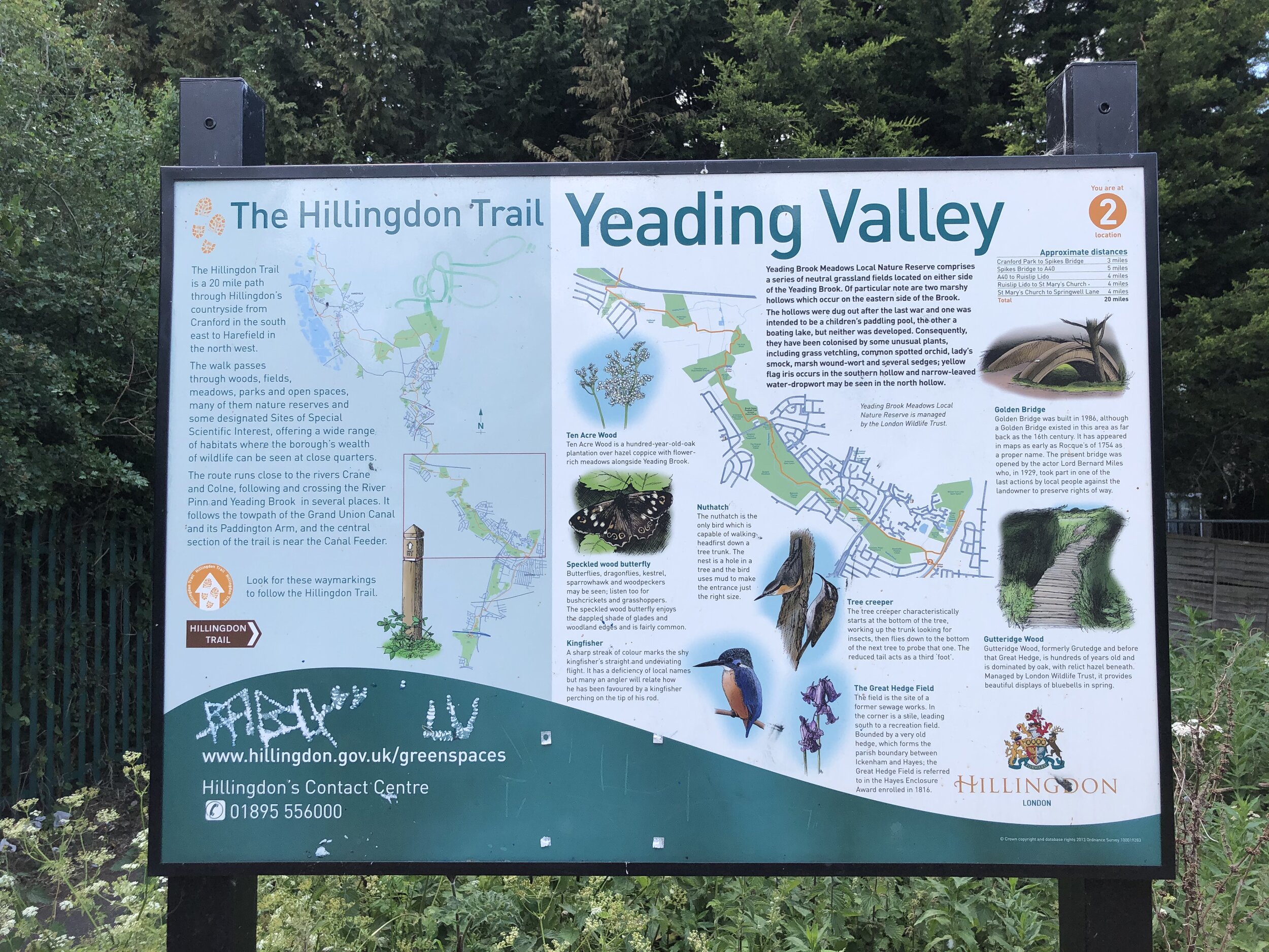
Yeading Brook Meadows Providing a vital green corridor through the suburban landscape of West London, Yeading Brook Meadows is a designated Local Nature Reserve. The floodplains here are a haven for wildlife, featuring a mix of marshland, tall herbs, and traditional wildflower meadows. It provides a peaceful sanctuary for walkers and supports a diverse range of local flora, butterflies, and bird species.
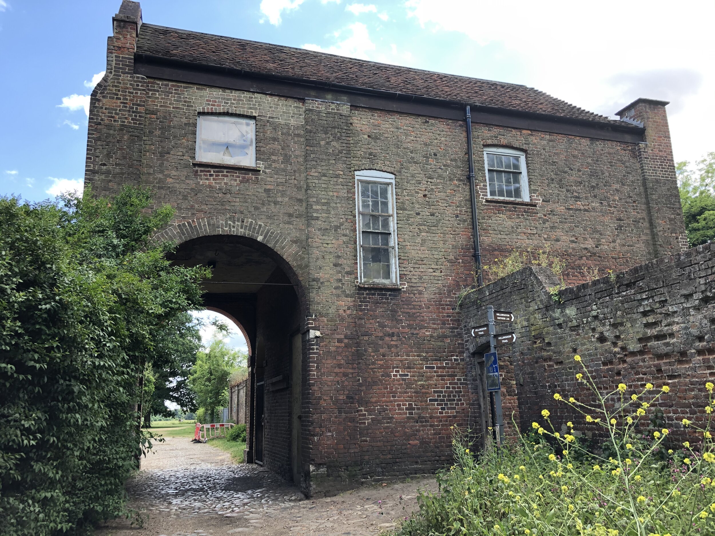
Cranford Park & St Dunstan's Church Approaching the end of the trail, Cranford Park offers 144 acres of historic parkland. It was once the grounds of Cranford House, which was demolished in 1945, though the surviving 18th-century stable block remains. Nestled within the park is the Grade II* listed St Dunstan's Church, which has medieval origins and houses the remarkable monuments of the Berkeley family, who owned the estate for over 300 years.

SECTION 3 - Yeading Brook Meadows To Cranford Park
Start: On street parking near Yeading Brook Meadows, Hayes, Northolt, UB4 9JA
Finish: Car Park at Cranford Park, London TW5 9RZ
Distance: 7.4 km (4.6 miles)
Elevation change: +29m / -31m
GPX File: get via Buy Me a Coffee
Other routes touched (walk): Grand Union Canal Paddington Branch Towpath, Grand Union Canal Towpath, The London Loop
Other routes touched (cycle): N/A
Other Pubs / Cafes on route: N/A
Map: OS Explorer Map (160) Windsor, Weybridge & Bracknell and
- OS Explorer Map (173) London North, The City, West End, Enfield, Ealing, Harrow & Watford
Links: Hillingdon, Yeading, Yeading Brook Meadows, Southall, River Crane, Cranford Park
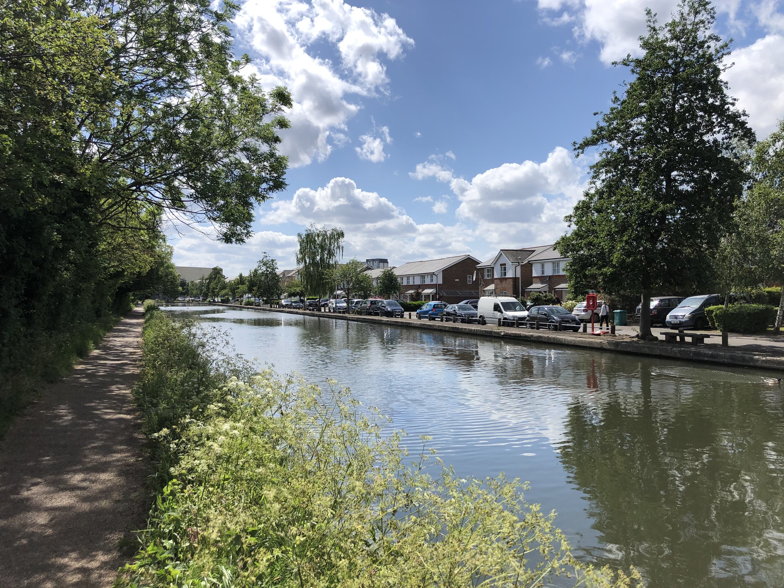
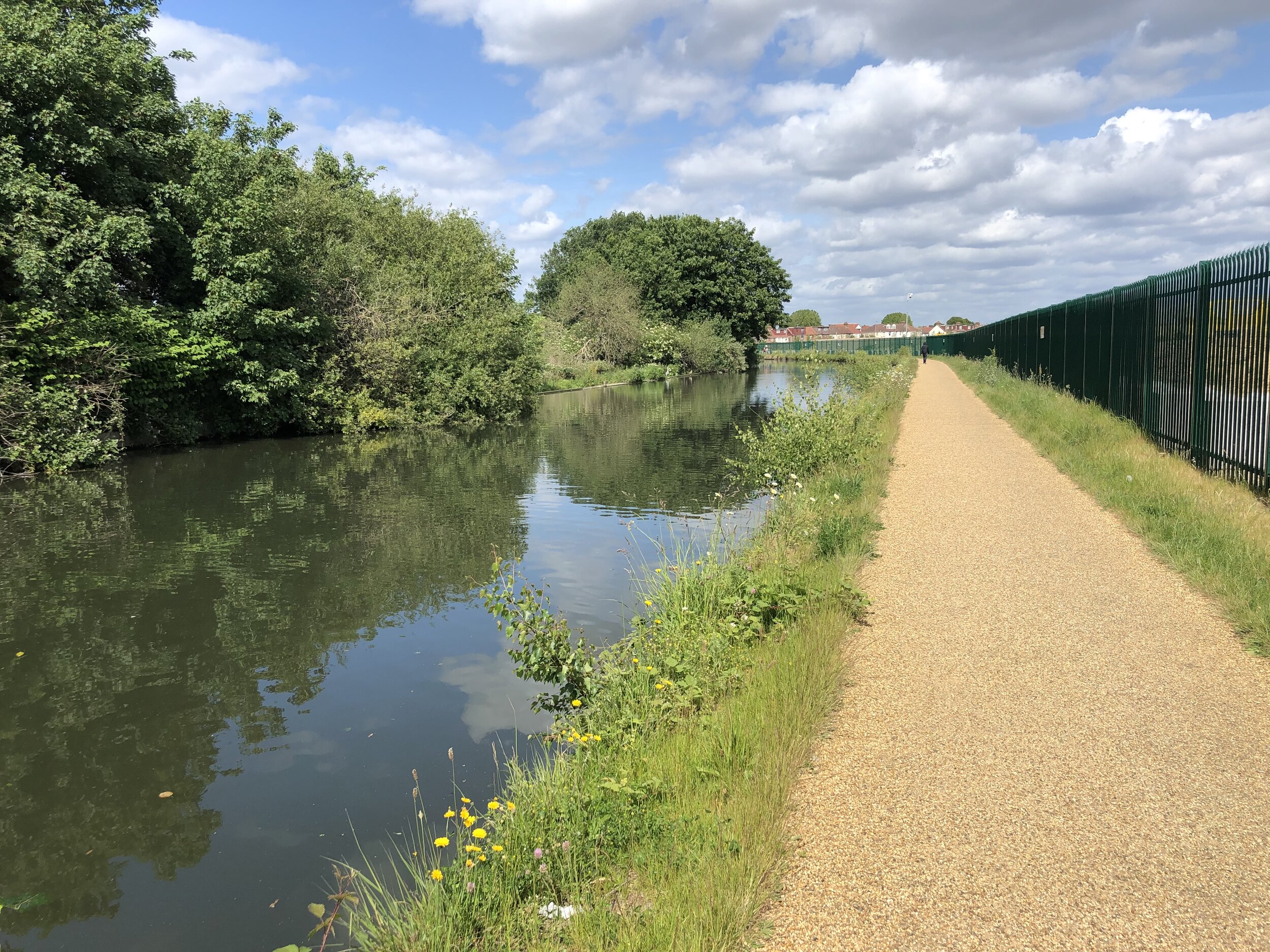
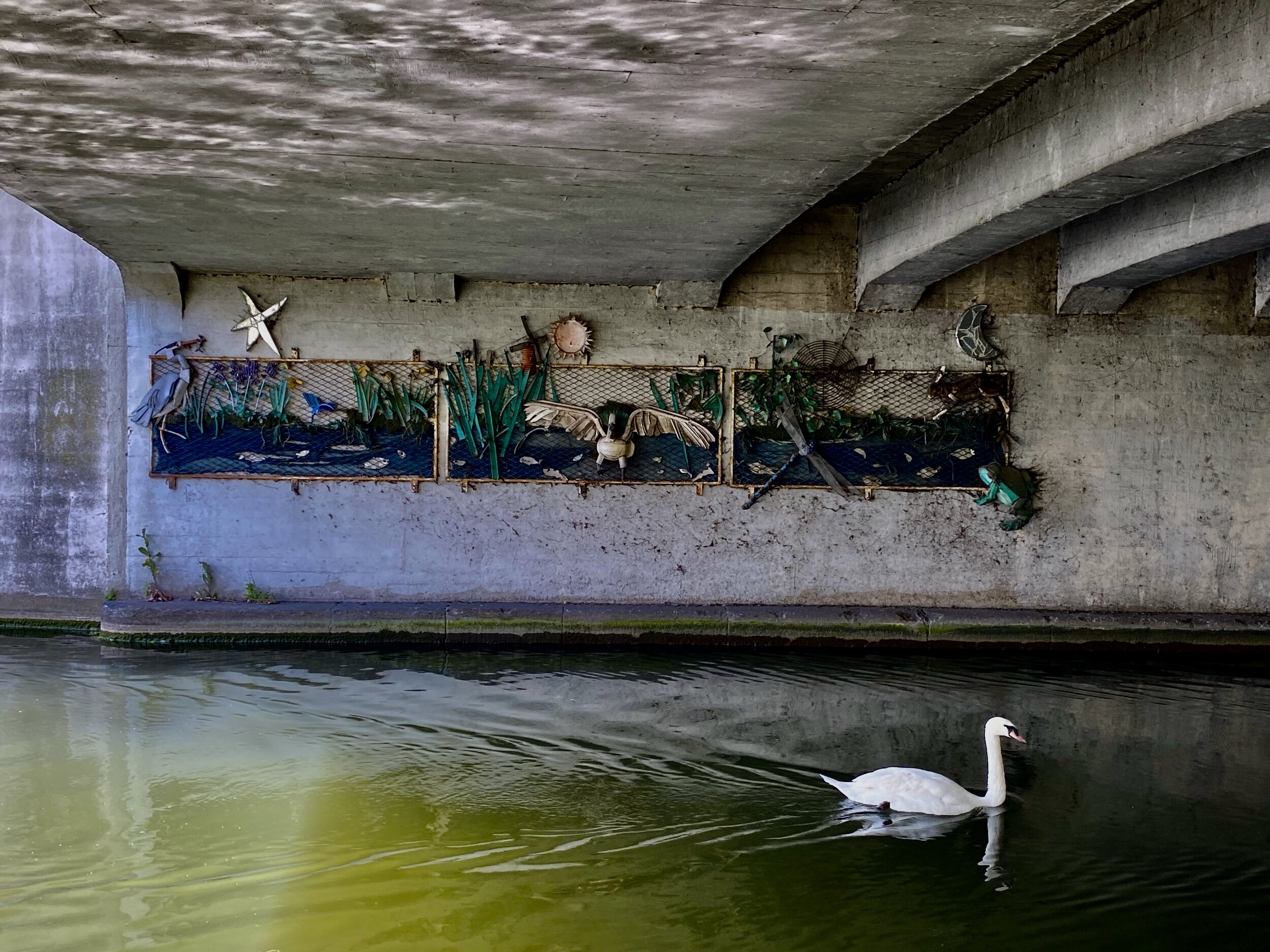
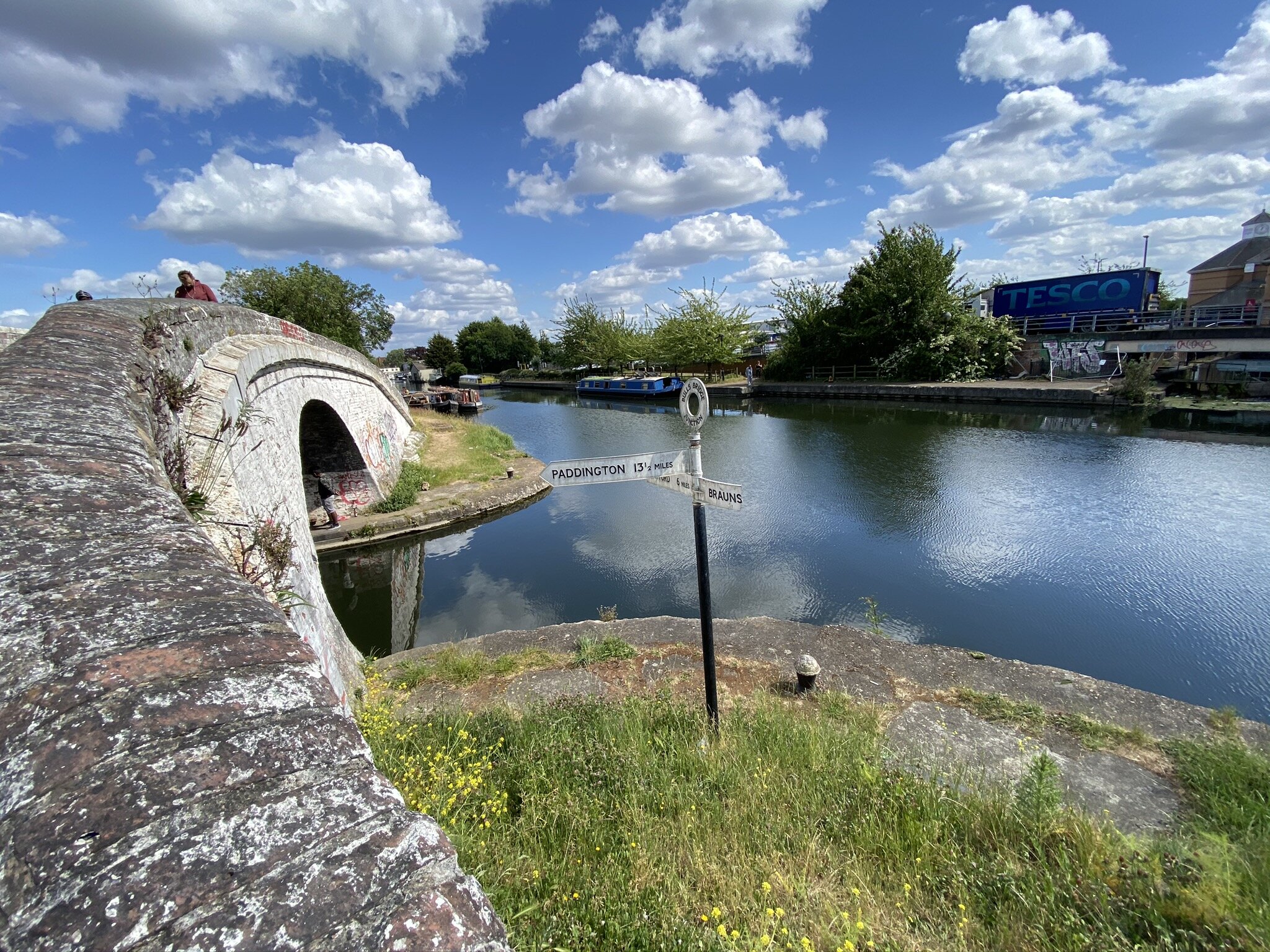
Picking up from where you left off at the end of Section 2, continue south-east through Yeading Brook Meadows. Cross over Yeading Lane and under the A312 into Brookside where you’ll join the Paddington Arm of the Grand Union Canal. Cross over the bridge and follow the towpath in a south-westerly direction. After ~3 km the canal meets the main channel of the Grand Union at Bulls Bridge. Take a right and follow the canal for approximately 300m until you get to the A312 Parkway overpass. Use the zig-zagging footway to climb up to road level and follow the footpath to the side of the road south over the bridge. By now you’ll be missing the quiet countryside of section 1 as you walk through the busiest, ugliest part of the trail.
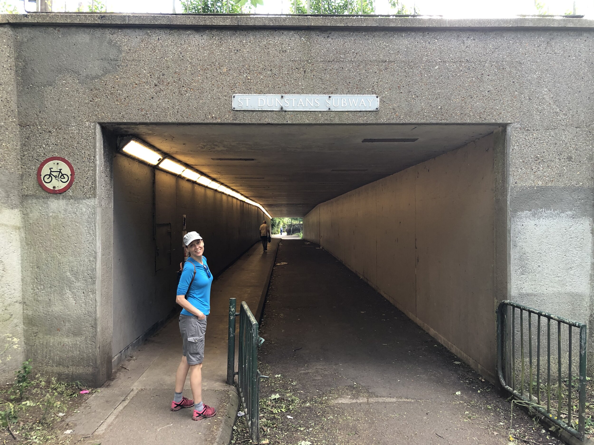
At the roundabout to the south of the overpass take a left onto North Hyde Road and a left onto Watersplash Lane. Here you’ll enter Cranford Park and the home stretch of the trail. You’ll now be following the River Crane which splits off from the Yeading Brook a bit further north at Minet Country Park. After ~500m cross under the M4 via St Dunstan’s Subway and into the main part of Cranford Park. You’ll pass by St Dunstan’s Church and the remains of Cranford Manor.
As we were using 2 cars to get to the start and end points of the trail, the car park next to St Dunstan’s Church was the obvious place to end our walk. If you’re using public transport, continue south through Cranford park to the A4 Bath Road where there are several options servicing the Heathrow area. This final section of the trail from the Grand Union canal also follows the London Loop which continues south towards Kingston.


Next sections of the London Loop:
Clockwise: South Oxhey to Hill End
Anti-clockwise: Cranford Park to Bushy Park