Botley Hill

Significance: Parent Peak of Betsom’s Hill (Kent County Top) and Westerham Heights (Greater London High Point), Highest Point of the North Downs
Member of: Marylins
Parent Peak: Leith Hill
Nearest Higher Neighbour: Leith Hill
Historic County: Surrey
Elevation: 270m
Date “climbed”: December 3rd 2023
Coordinates: 51° 16' 44'' N, 0° 0' 45'' W
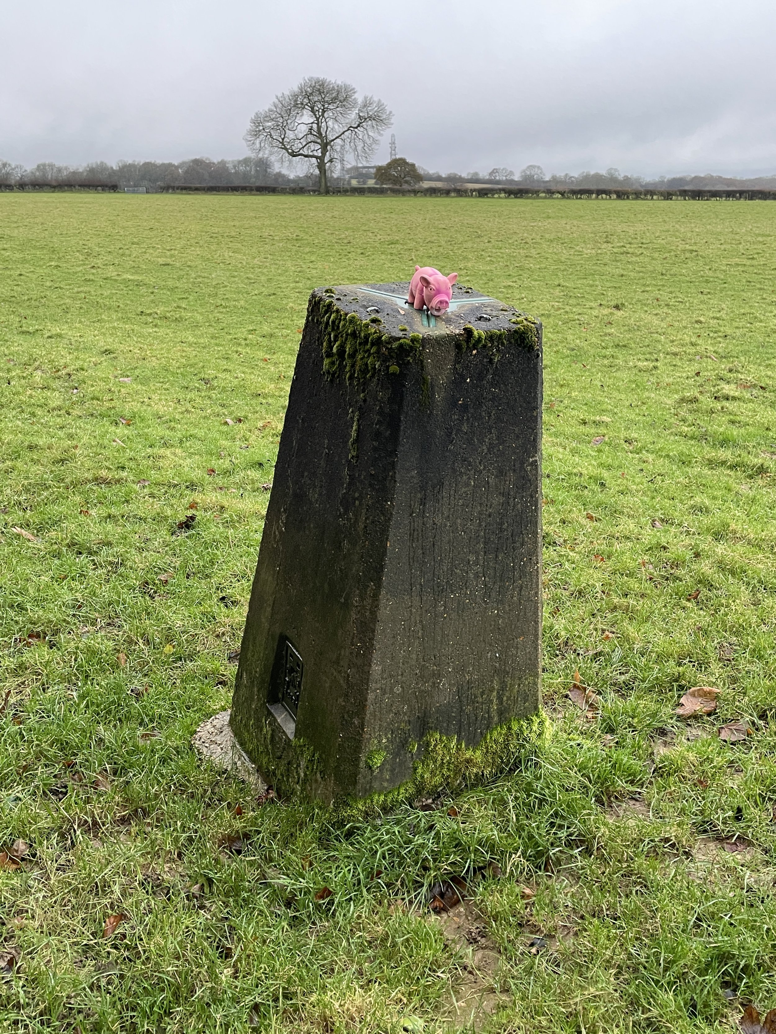
OS Trig Pillar: TP1536 - Botley Hill
Map: Sevenoaks & Tonbridge Map | Royal Tunbridge Wells & Westerham | Ordnance Survey | OS Explorer Map 147
Links:
- Wikipedia (Botley Hill, North Downs)
- Peakbagger (at Water Tower, at Trig Pillar)

I had only discovered Botley Hill recently when researching County Tops and routes in the area. It’s the high point of the North Downs, but doesn’t make it into any lists as the North Downs isn’t an AONB, National Park or similar. It’s taller than the nearby high points of Kent and Greater London, but is in Surrey so misses out to the 5m higher Leith Hill for the County Top. It’s a must-do though for high-point completists and more more interesting than both Betsom’s Hill and Westerham Heights, the high points of Kent and Greater London.
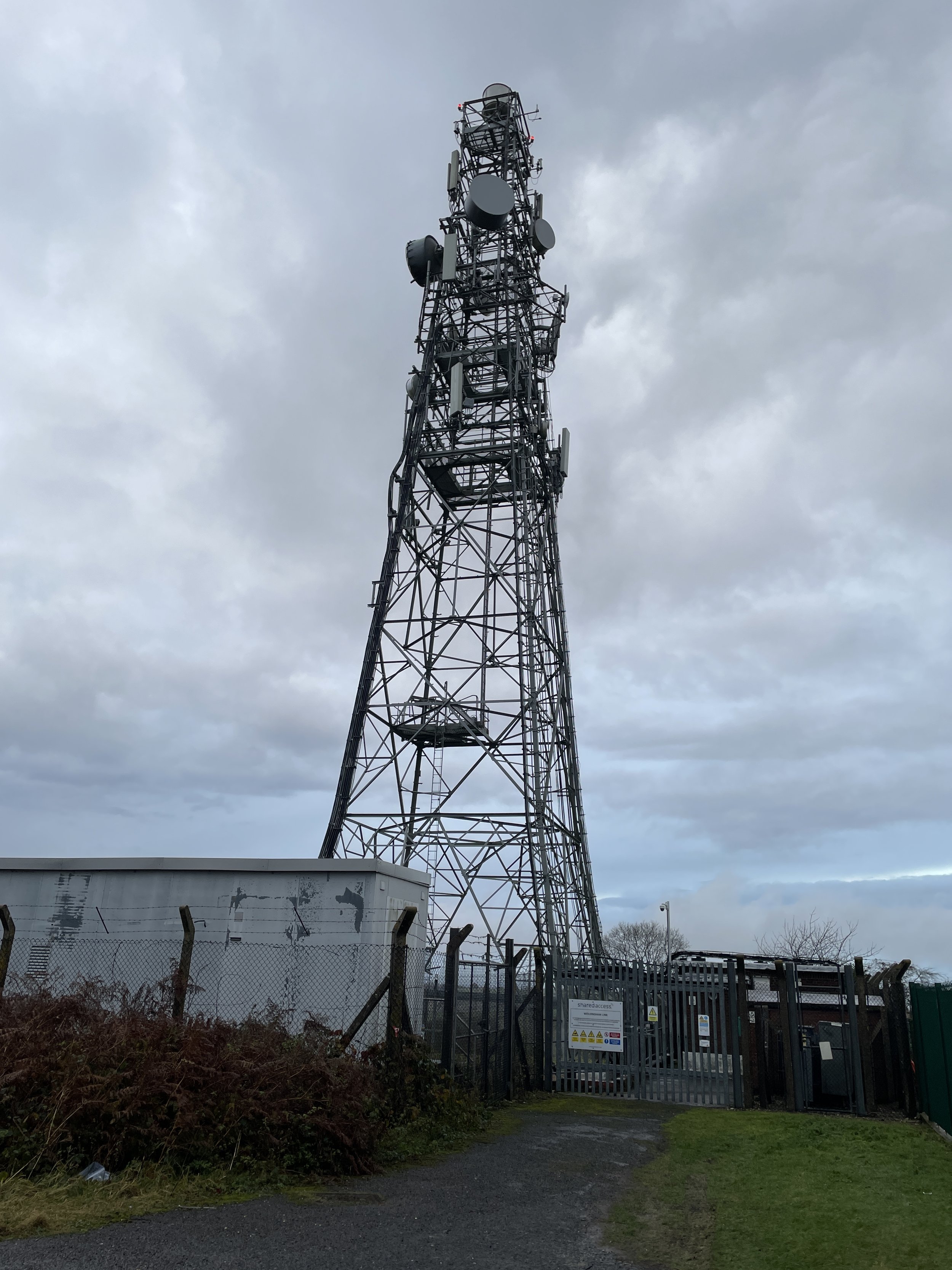
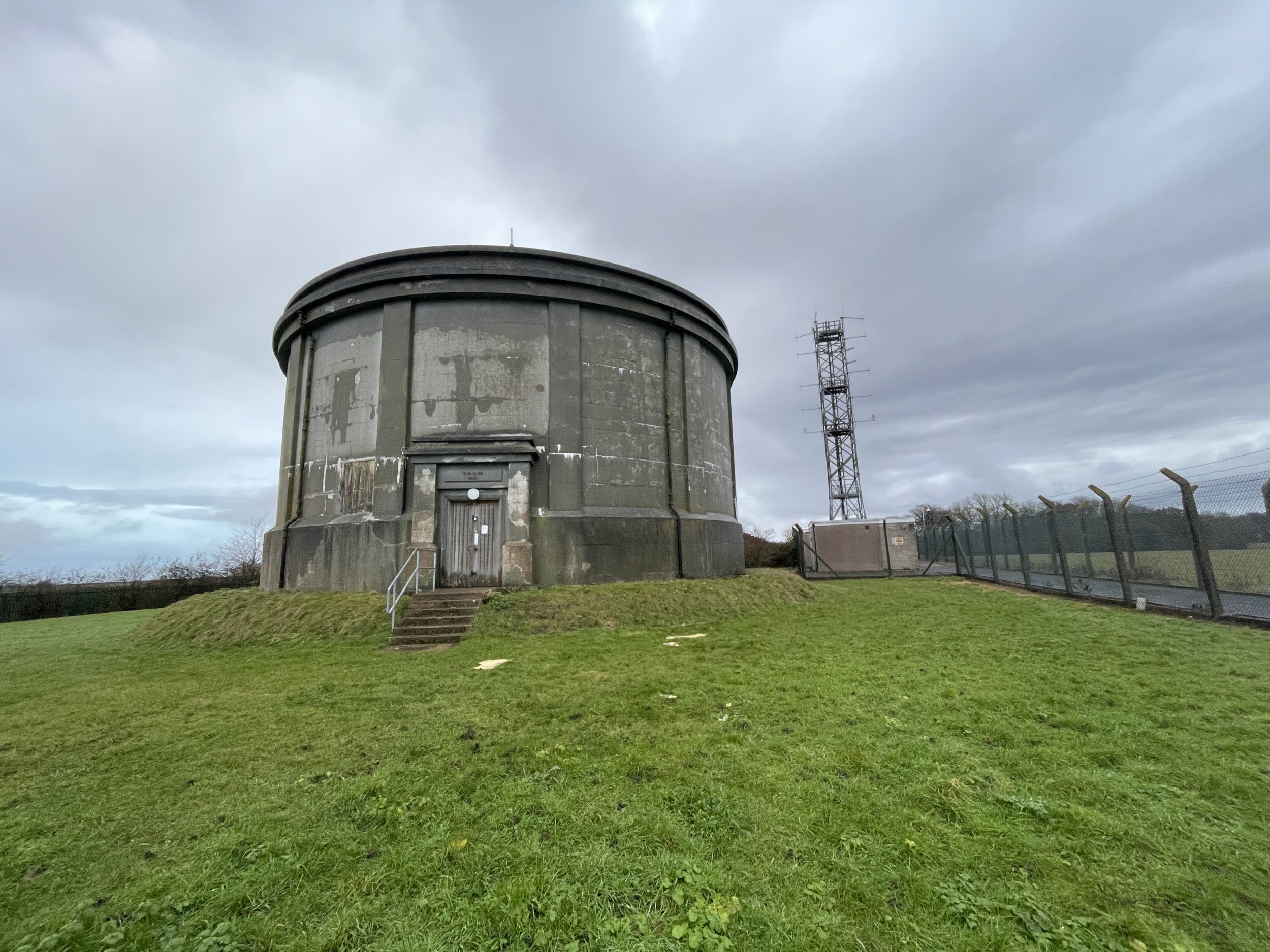
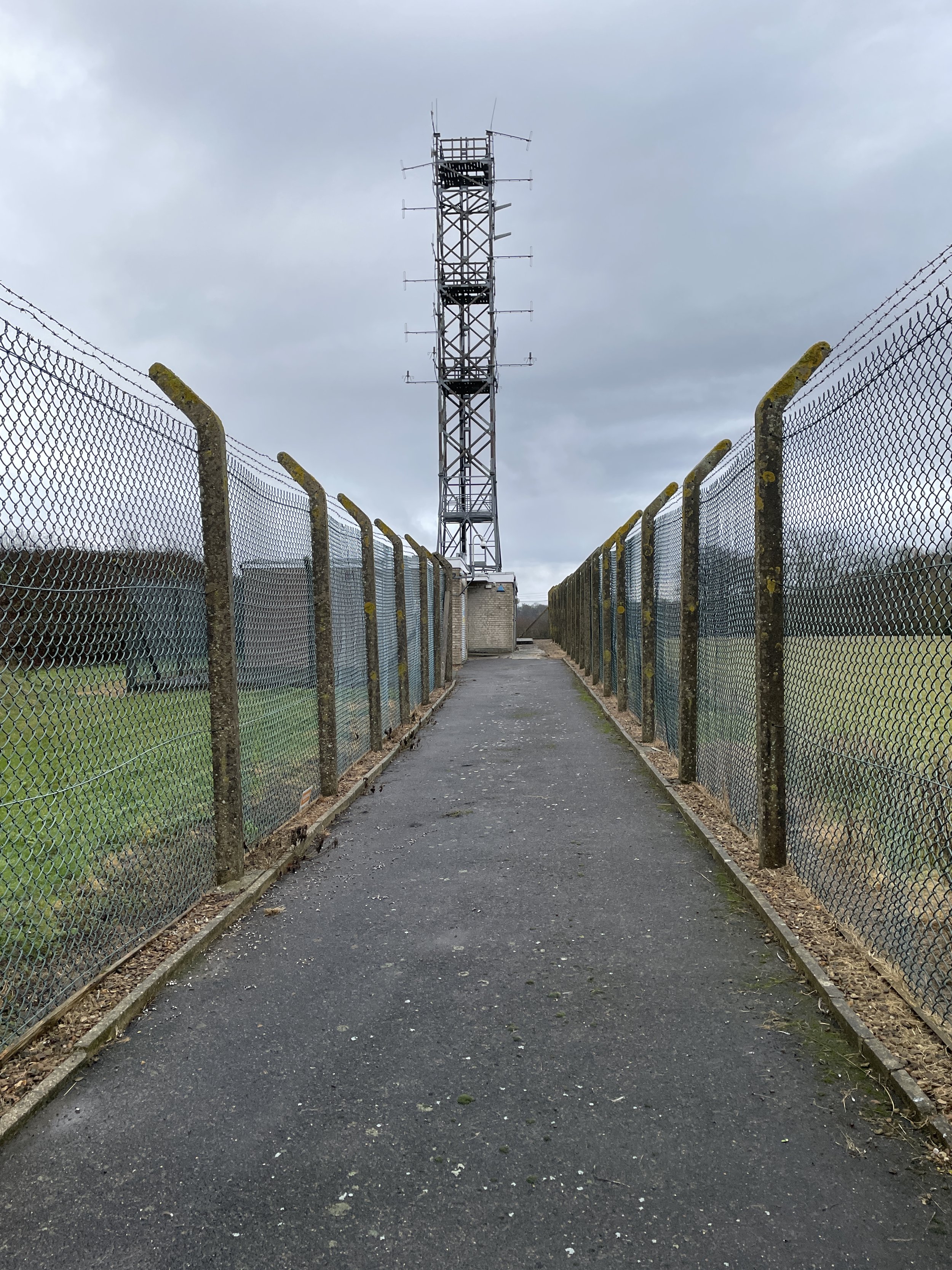
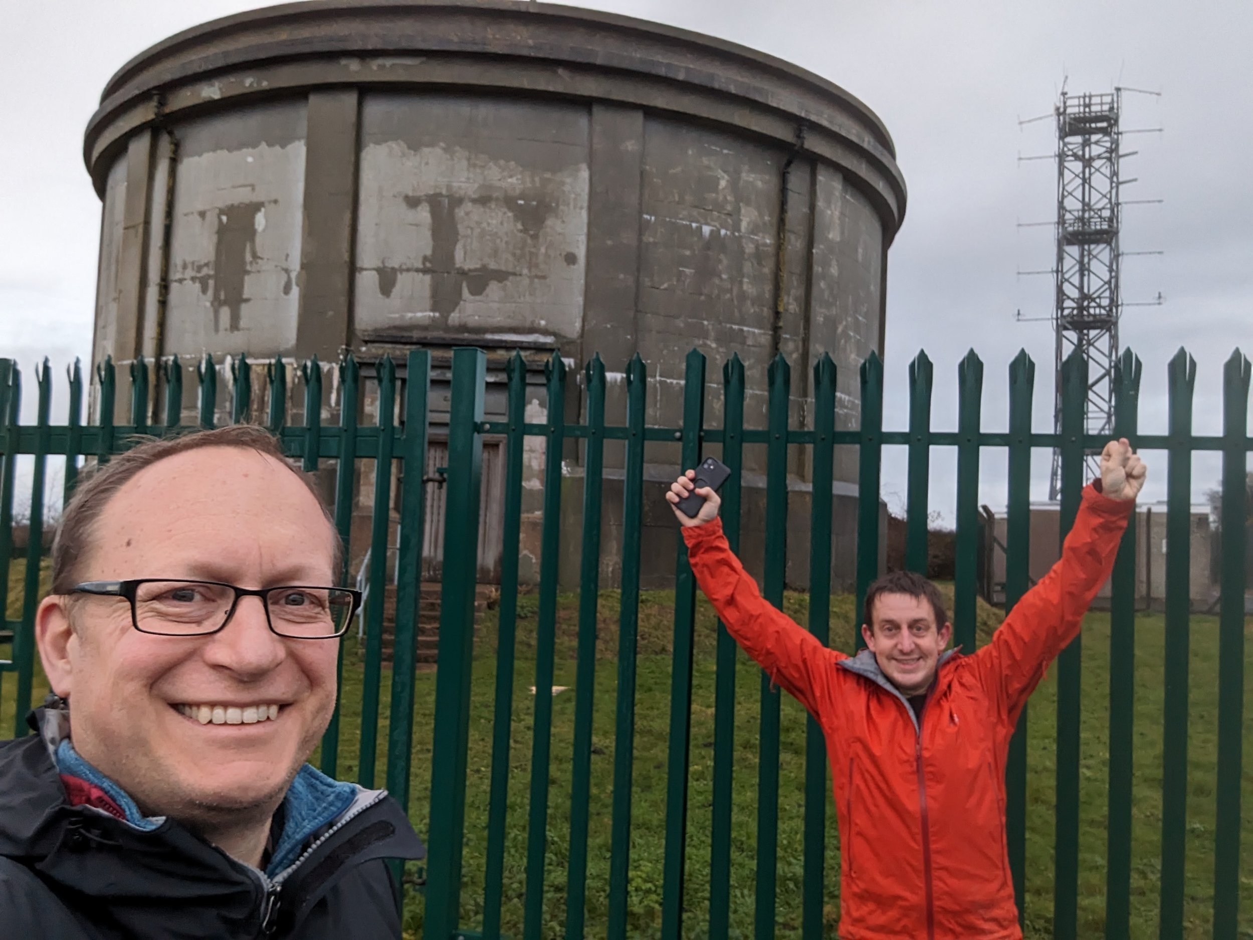
The Botley Hill summit is next to a water tower and transmitter and easily accessible by road. It’s also on the Vanguard Way, 1km north of its junction with the North Downs Way so can be bagged on a diversion from both. We bagged it on the same day as walking a section of the North Downs Way but drove to the Botley Hill summit after completing the walk.
The water tower summit isn’t the only significant point on the hill. There’s an OS Trig Pillar approximately 1 km to the east which was once considered to be the hill summit but is actually ~1m lower. We also visited this one as a drive-by after our North Downs Way walk.
Source: Legislation.gov.uk
For the absolute completists there’s also Botley Hill Northeast Slope. Peter Stone’s Peakbagger entry from March 2012 describes it as: “A 255 m slope feature inside a Reptile Zoo or behind adjacent Waylands House. Got as close as I could for a bona fide claim. However, perhaps a bit pointless and of historic interest only as this place is no longer the highpoint of Greater London since a boundary change ceded it to Surrey in 1993. Greater London's high point is now Westerham Heights, 245 m, a few km to the E and very close to Kent's top” .
The transfer between Bromley in Greater London and Surrey was actually on April 1st 1994, although the legislation had 1993 in the name. More information can be found in this article on legislation.gov.uk. The map to the right shows the southern tip of Bromley, previously the Greater London High Point, which moved to Surrey with this legislation.
The Botley Hill Family

Botley Hill is the Parent Peak to:
- Botley Hill Trig Pillar and Botley Hill Northeast Slope
- Betsom’s Hill, the County Top of Kent
- Toy's Hill, the High Point of the Kent Downs AONB
- Westerham Heights, the High Point of Greater London and the London Borough of Bromley
- All Greater London Borough High Points south of the Thames plus Heston The Vale (Hounslow)