London Road and Heath Mount: Southend High Points
The county of Essex has, at time of writing, 2 Unitary Authorities: Thurrock and Southend-on-Sea. With a rare quiet week at work and a need for a geek-adventure based day off, I headed east to bag them both. First up: Southend which has 2 alternative options for its high point. It’s hard to say which is the most interesting as neither offers a great view or a Trig Pillar. Both could be bagged on a single walk or cycle ride but I did both as drive-bys before heading on to Thurrock for a more interesting adventure.
London Road
Significance: Unitary Authority High Point for Southend-on-Sea
Member of: N/A
Parent Peak: Haddington Hill NHN: Sandpit Hill
Historic County: Essex (of which Chrishall Common is the County Top)
Elevation: 61m
Date “climbed”: November 24th 2023
Coordinates: 51° 32' 57'' N, 0° 37' 31'' E
Map: Southend-on-Sea & Basildon Map | Brentwood & Billericay | Ordnance Survey | OS Explorer Map 175
Links: Wikipedia (Southend-on-Sea), Peakbagger, Hillbagging
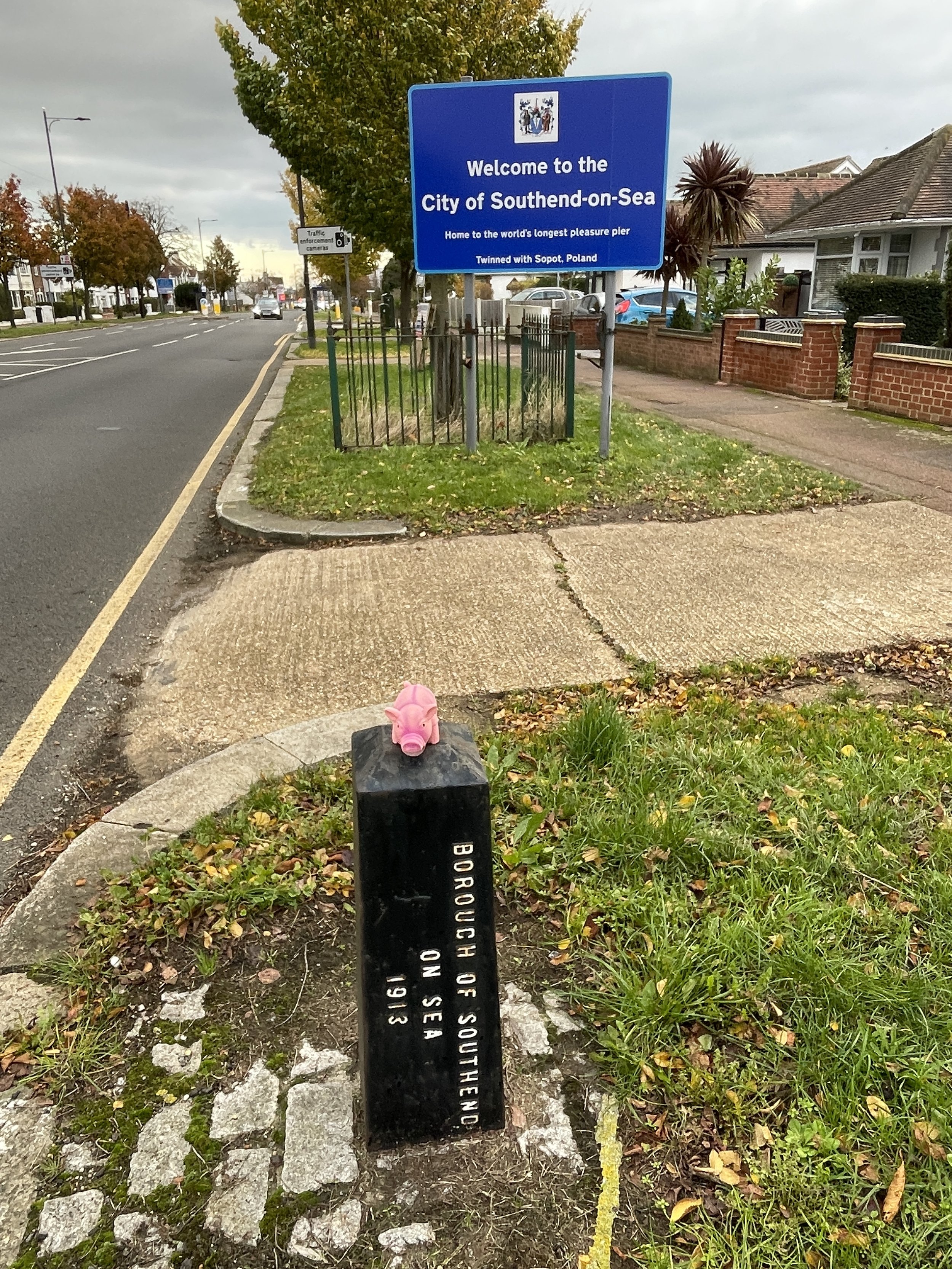
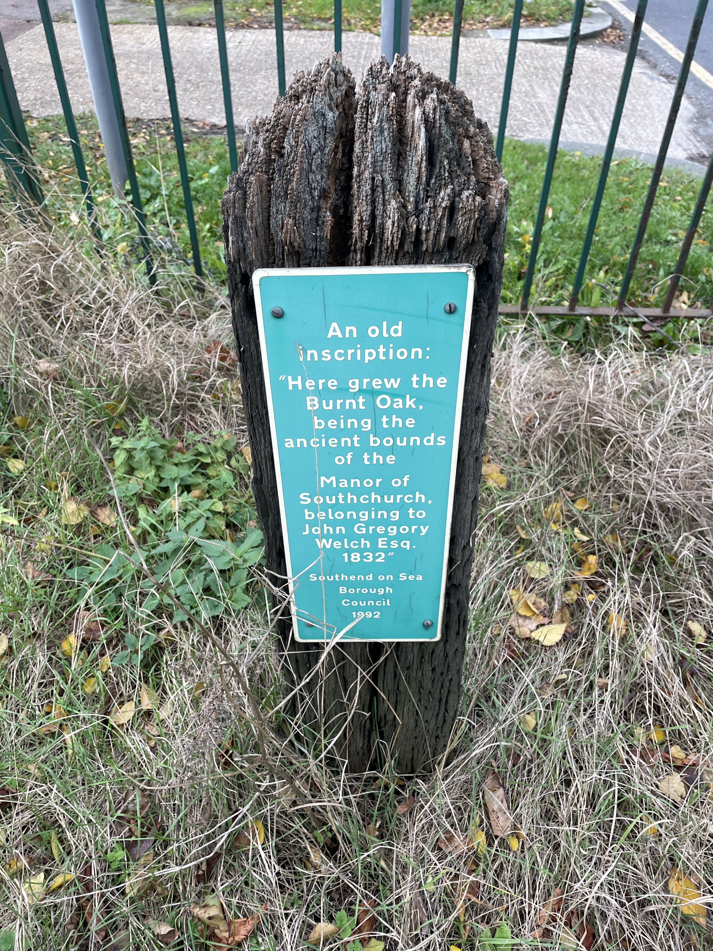
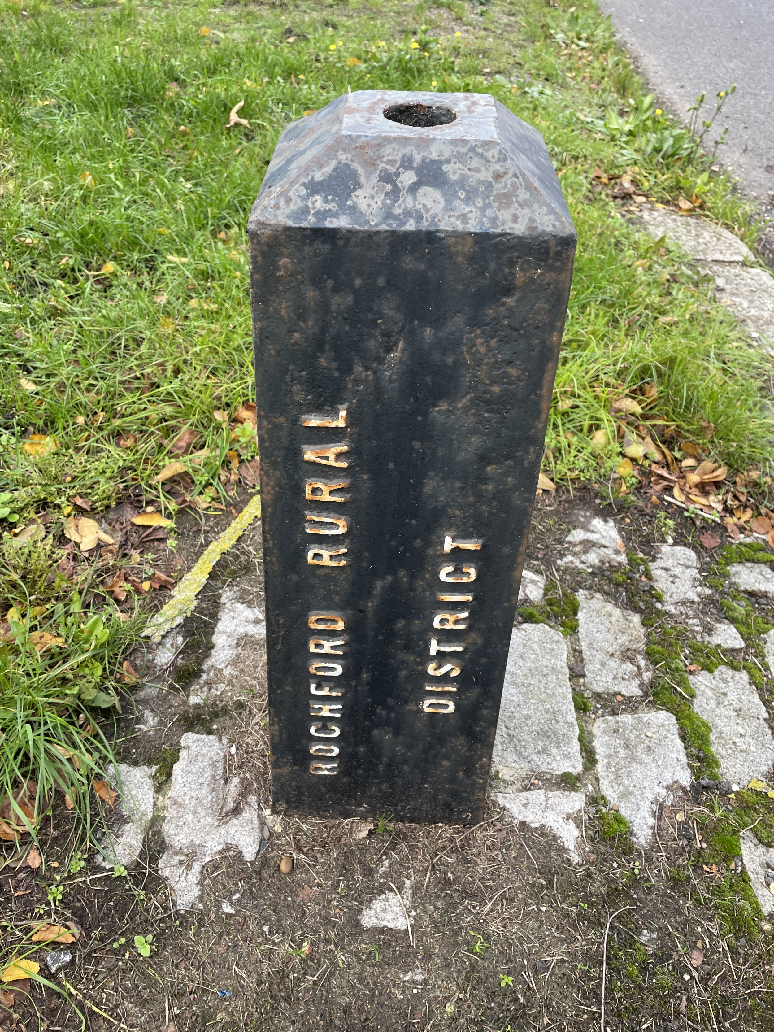
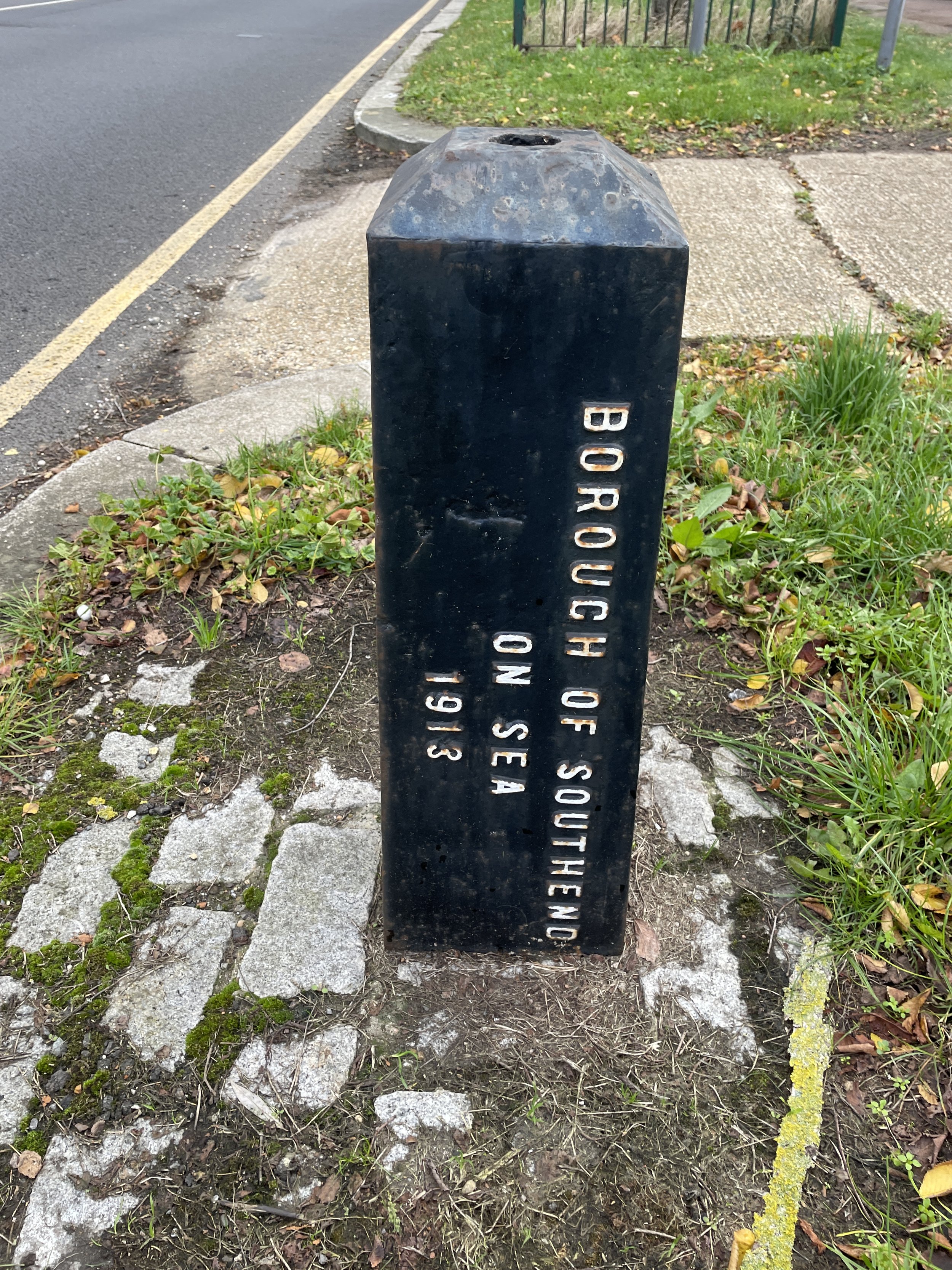
The first contender for the Southend High Point is right on the boundary with the Castle Point borough of Essex. The high point is by the “Welcome to the City of Southend-on-Sea” sign. Next to the sign you’ll also find a Rochford/Southend boundary stone and an old wooded post with an inscription that reads “Here grew the Burnt Oak, being the ancient bounds of the Manor of Southchurch, belonging to John Gregory Welch Esq. 1832”.

Heath Mount
Significance: Unitary Authority High Point for Southend-on-Sea
Member of: N/A
Parent Peak: Haddington Hill NHN: Thundersley Hill
Historic County: Essex (of which Chrishall Common is the County Top)
Elevation: 61m
Date “climbed”: November 24th 2023
Coordinates: 51° 33' 49'' N, 0° 38' 5'' E
Map: Southend-on-Sea & Basildon Map | Brentwood & Billericay | Ordnance Survey | OS Explorer Map 175
Links: Wikipedia (Southend-on-Sea), Peakbagger, Hillbagging
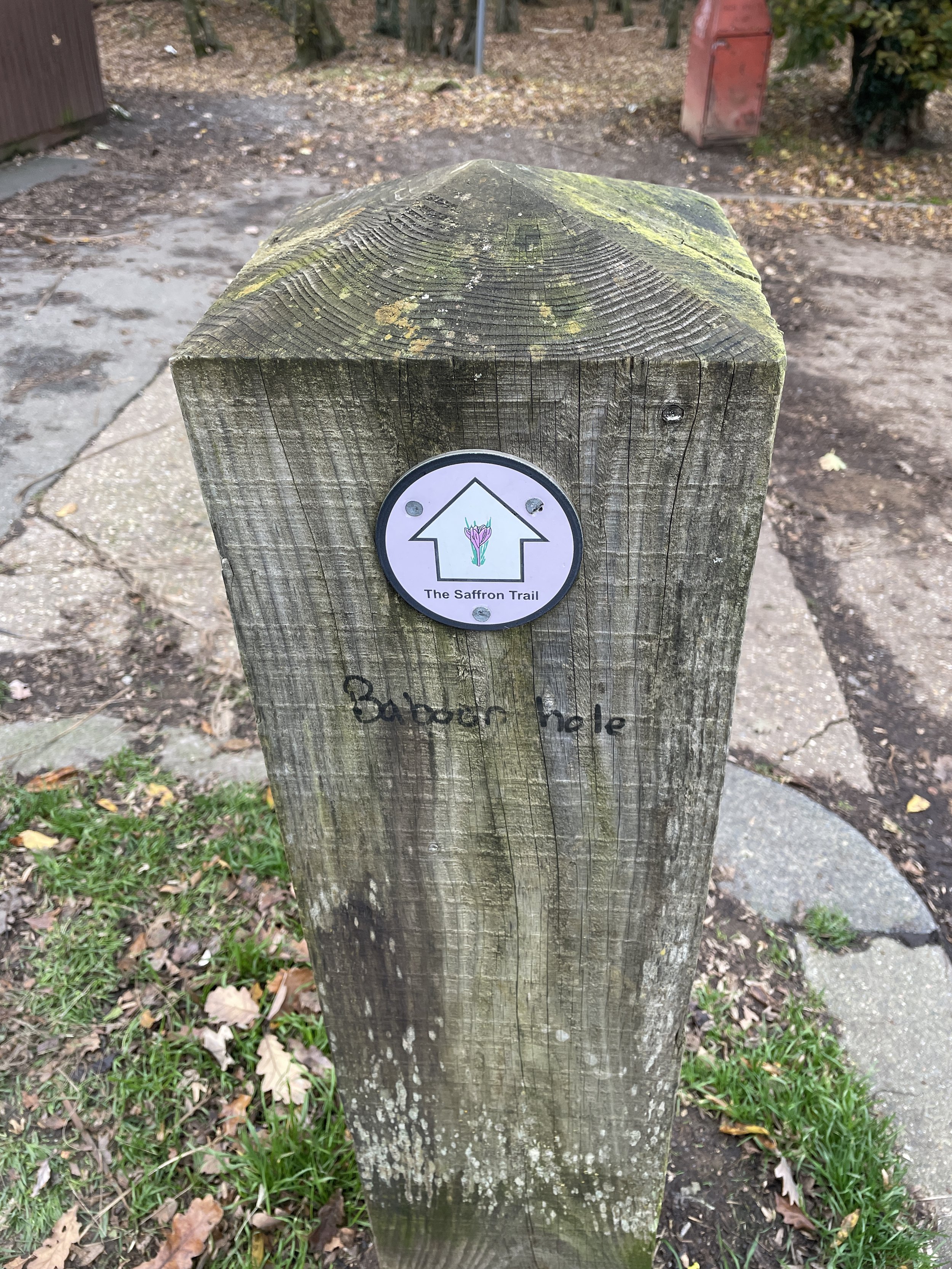
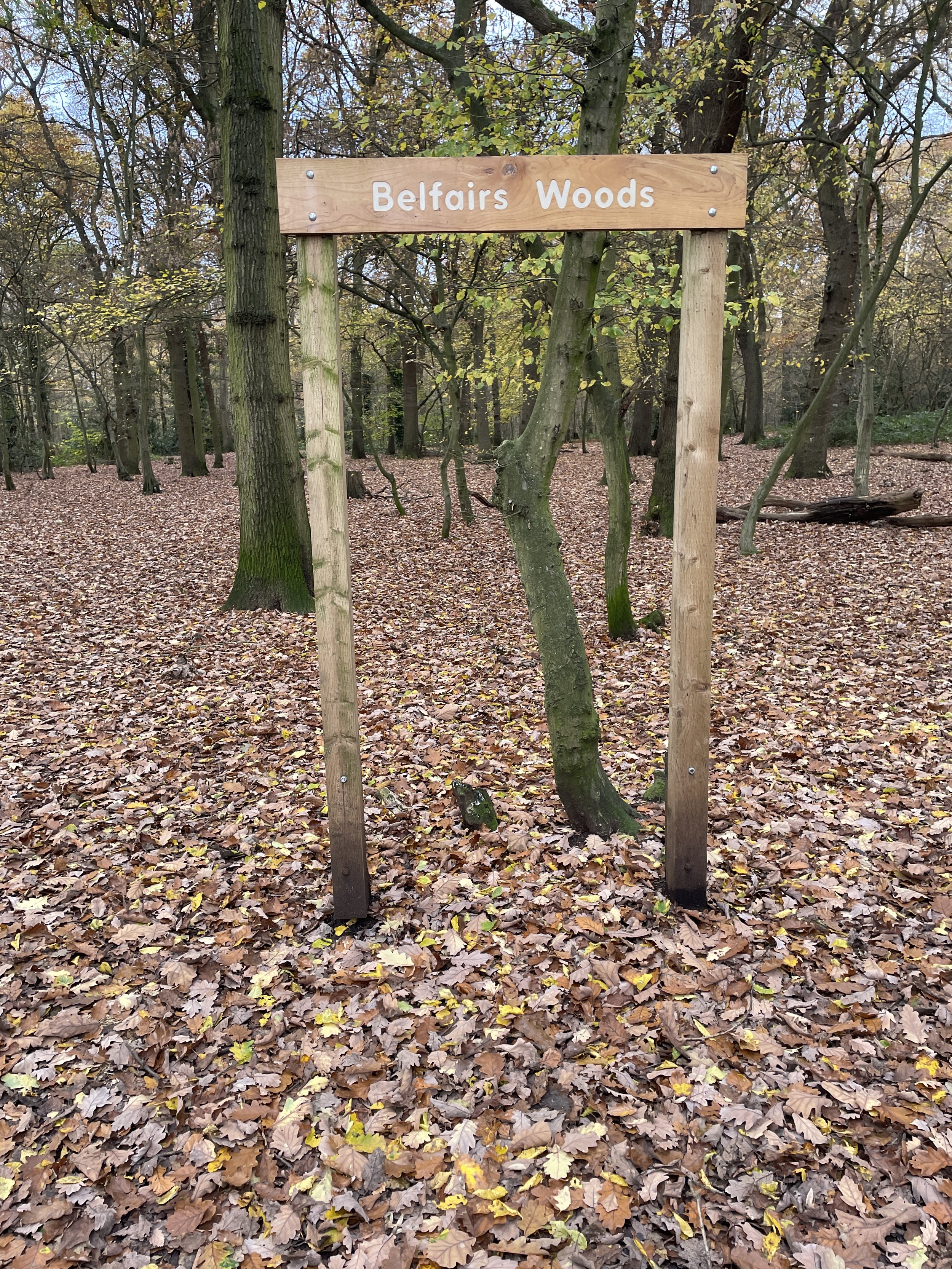
Heath Mount is a 5 to 10 minute, 2 mile drive from the London Road High Point. It’s at the entrance to Belfairs Woods off Woodside road where there’s free on-street parking. Nothing obvious to mark the spot. The spot is on the Southend Ring, a 24km trail circling the city.