Shooter’s Hill: Greenwich Borough High Point


Significance: Highest peak in London Borough of Greenwich
Member of: N/A
Parent Peak: Botley Hill. NHN = Sanderstead Plantation
Historic County: Kent (of which Betsom’s Hill is the County Top)
Elevation: 132m
Date “climbed”: 4th December 2021
Coordinates: 51° 28' 13'' N, 0° 4' 10'' E
Nearest Station: Welling or Falconwood (southeastern rail): 2.7 km
On route of: Green Chain Walk
Map: Greenwich & Gravesend Map | East End, Docklands, Bromley, Sidcup & Thurrock | Ordnance Survey | OS Explorer Map 162
Links: Wikipedia (Greenwich), Peakbagger
Like Langdon Shaw, this was another London High Point on the far side of London from where I live. I could easily have bagged it on the same trip but I decided to wait for Charlton, another south-east London parkrun, to visit it on the way.
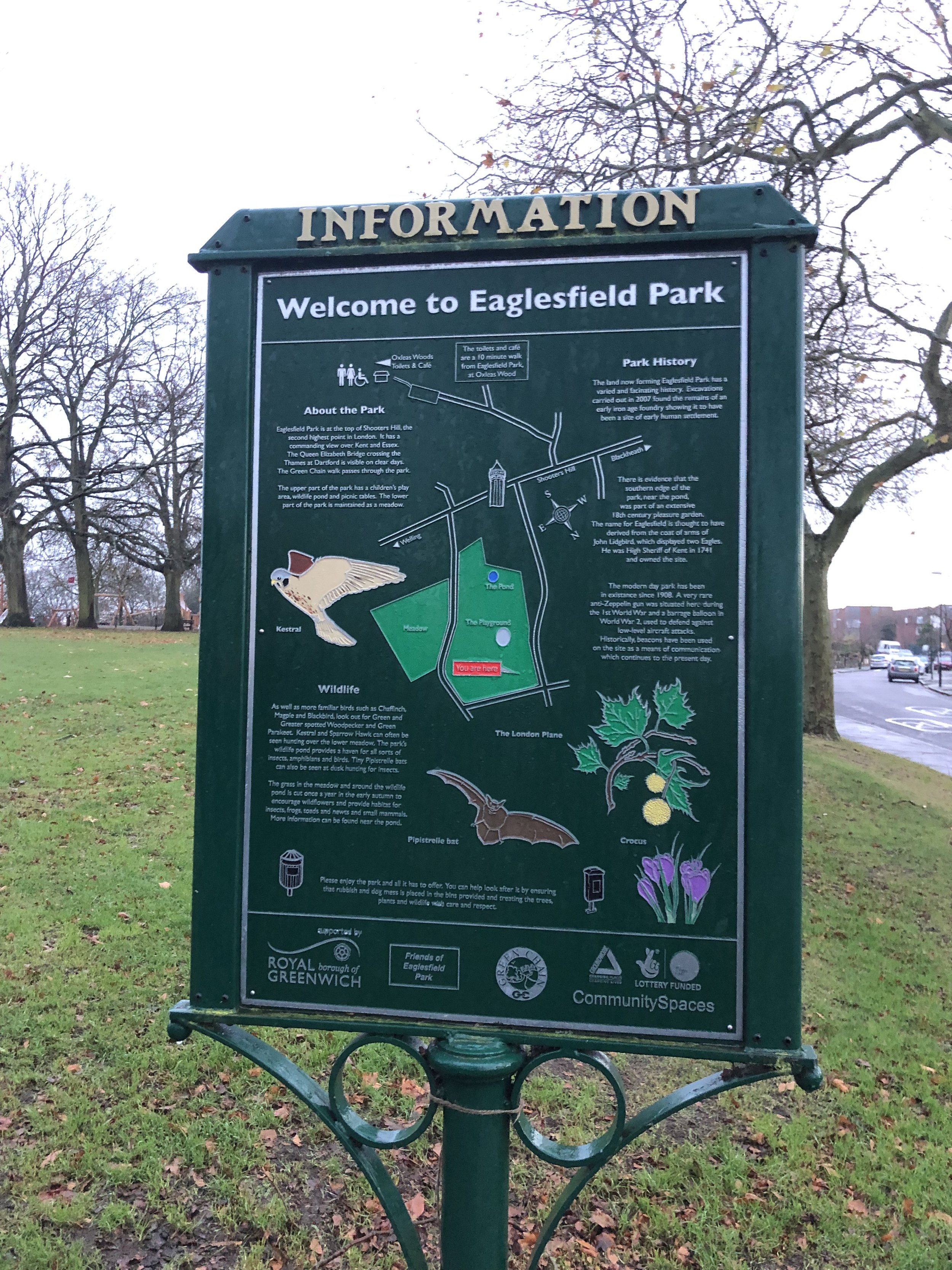
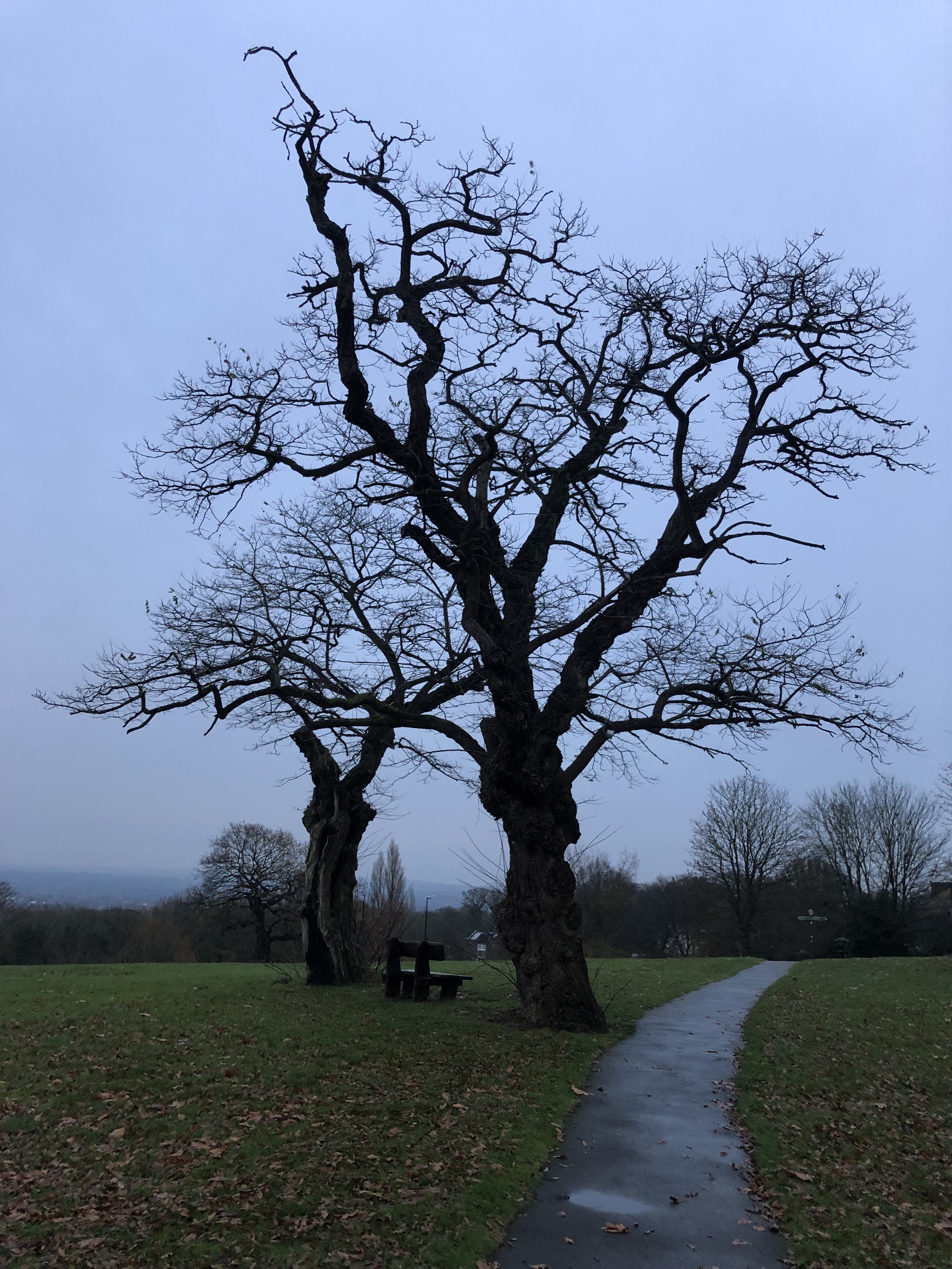
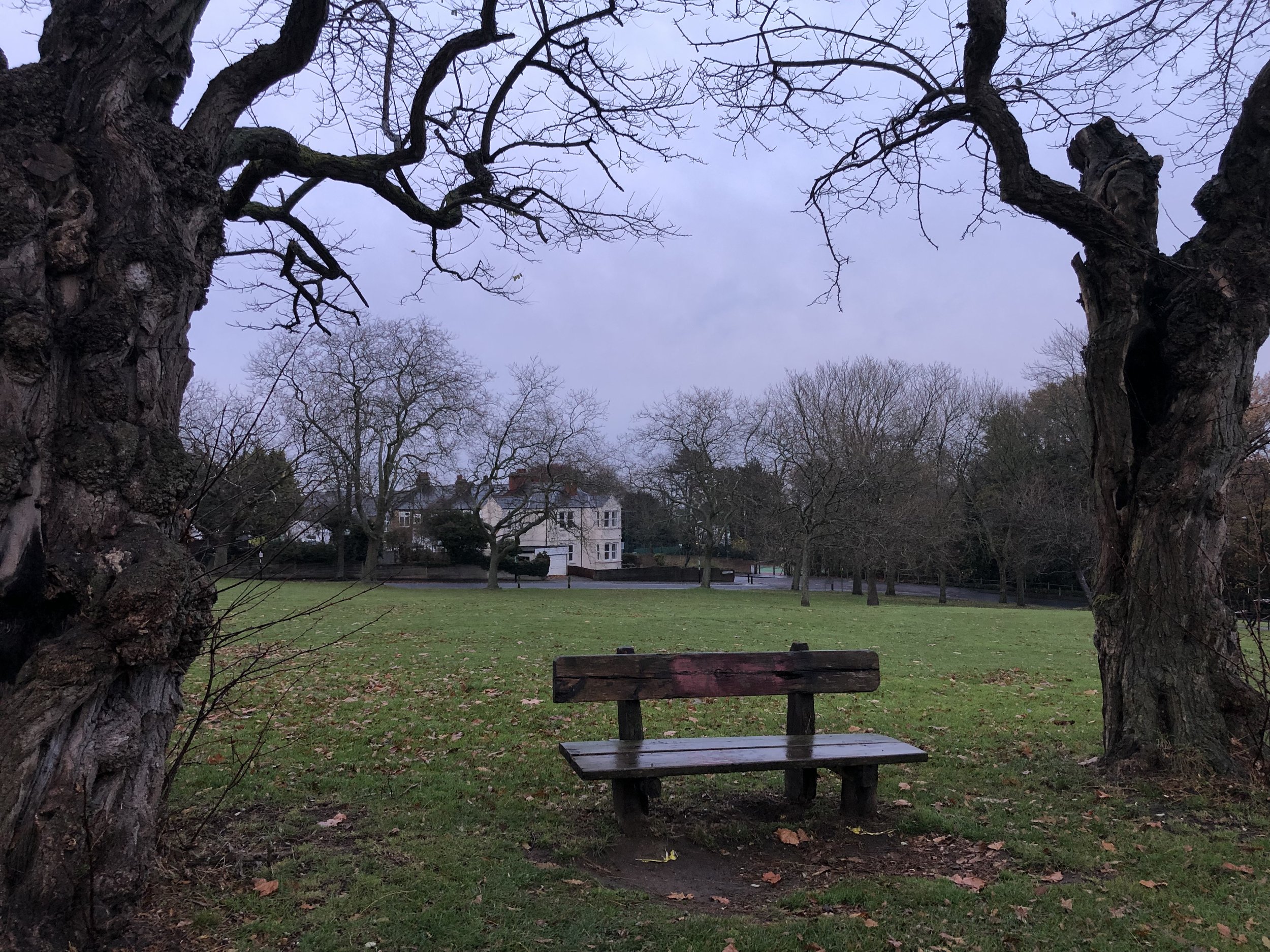
This is a more pleasing visit than many of the other London High Points as it at least feels like a summit. The high point is by the bench* between the two trees in the centre of the Eaglesfield Park. Although there’s no view to the centre of London, you get a great sight of the skyline from the top of nearby Occupation Lane. For the best view return at sunset.
The hill’s name probably harks back to medieval times, when its rich woodlands were a favoured site for archery practice. The hill has maintained its shooty links over the centuries. The former dockyards and munitions factories of Woolwich abut the area. Its most famous landmark, Severndroog Castle, is named after a military engagement off the coast of India. The main road was long the haunt of armed highwaymen. Anti-aircraft guns on its summit protected south east London during the second world war, and it would have served as a last line of defence for the capital if the Germans had attempted a land invasion. More recently, a bank of rapier missiles were stationed on the hill during the 2012 Olympics. Shooters Hill might just be the most appropriately named hill in London. Source: How London’s Hills Got Their Names).
* note that the bench has been removed since I was there. Thanks to Alistair for the tip