North London Seven Summits

City skyline from Hainhault Country Park on ascent to Cabin Hill
The North London Seven Summits sounds like it should be a recognized challenge. It’s not. It’s just a collection of the Greater London Borough High Points that I decided to visit by car on a grey November afternoon. Although none are particularly inspiring, there’s a few interesting places along the way.
There’s some obvious missing boroughs when you look at the map. Hillingdon, Harrow, Harringey and Waltham Forest are not in this collection as I had already completed them before. They’re also on more interesting routes like the London Loop, Capital Ring and Greenwich Meridian Trail. Click on the links on the borough names above for details on those.

Wakemans Hill Avenue

Significance: Highest peak in London Borough of Brent (alternative)
Member of: N/A
Parent Peak: Haddington Hill (Wendover Woods). NHN = Highwood Hill
Historic County: Middlesex (of which Bushey Heath is the County Top)
Elevation: 92m
Date “climbed”: 19th November 2021
Coordinates: 51° 35' 10'' N, 0° 15' 31'' W
Nearest Station: Kingsbury (Jubilee Line): 1.6 km
On route of: N/A. Capital Ring is 1.5 km to the south-west
Map: OS Explorer Map (173) London North, The City, West End, Enfield, Ealing, Harrow & Watford
Links: Wikipedia (Brent), Peakbagger, Hillbagging
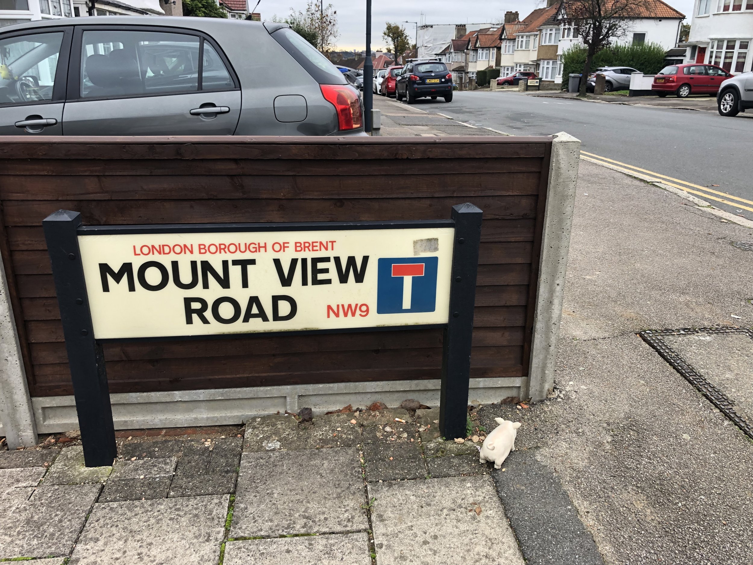
Having already visited Subury Hill, the other high point in Brent, I was keen bag the other. The coordinates took me to the corner of Wakemans Hill Avenue and Mount View. The Wikipedia article on the Kingsbury district of Brent says that the hill “peaks at an elevation of 302 feet (92 m) near the crossing of Buck Lane and Wakemans Hill Avenue”, but the road definitely seems to peak at Mount View Road. Other road signs like Summit Avenue, Sunny View and Hill View Gardens confirm that you’re on a high point. Not much to see here so I took a quick photo and moved on to Barnet.
Highwood Hill


Significance: Highest peak in London Borough of Barnet
Member of: N/A
Parent Peak: Haddington Hill (Wendover Woods). NHN = Bushey Heath Boundary
Historic County: Middlesex (of which Bushey Heath is the County Top)
Elevation: 146m
Date “climbed”: 19th November 2021
Coordinates: 51° 37' 58'' N, 0° 14' 26'' W
Nearest Station: Edgware (Northern Line): 4.2 km
On route of: Dollis Valley Greenwalk. London Loop is 0.2 km to the north
Map: OS Explorer Map (173) London North, The City, West End, Enfield, Ealing, Harrow & Watford
Links: Wikipedia (Barnet), Peakbagger, Hillbagging
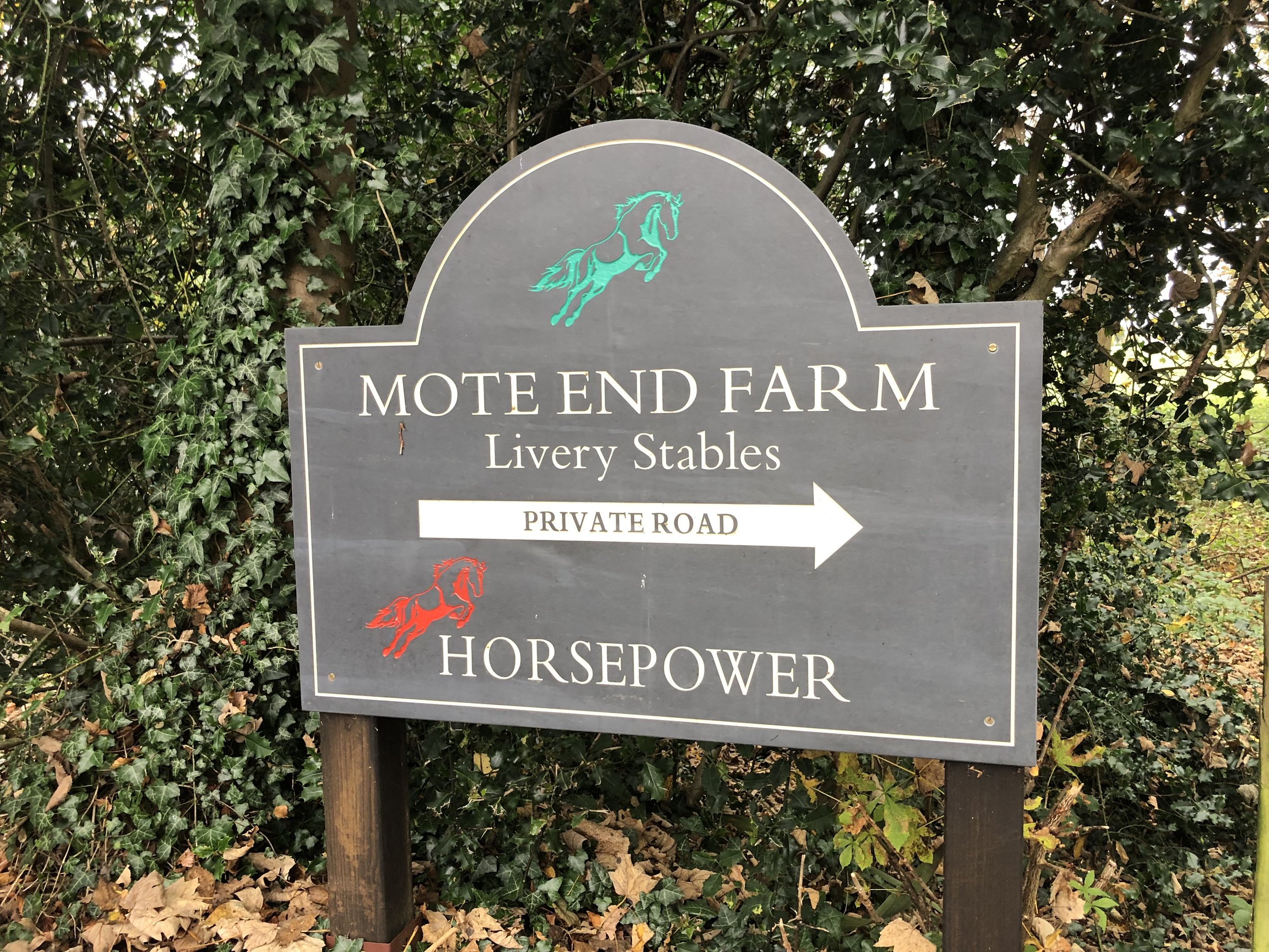
The high point of Barnet is in private property in Mote End Farm Livery Stables. Having read the reports of people being denied access to the summit, I decided to get as far as I could via public access. The closest accessible spot is the stile by the main gates to the farm at the end of the lane off Nan Clark’s Lane.
Although it’s possible to park on Nan Clark’s Lane, it’s narrow with few spots that won’t annoy the neighbours. I parked round the corner at Crown Close and walked the 600m to the gate following the Dollis Valley Greenwalk Link.
Look out for the blue plaque on the corner of Highwood Hill Road and Nan Clark’s Lane marking the “site of Hendon Park residence of William Wilberforce from 1826 to 1831”. See the blog by Adam Yamey for more on this.
Bournwell Hill-West Slope
Significance: Highest peak in London Borough of Enfield
Member of: N/A
Parent Peak: Haddington Hill (Wendover Woods) NHN = Bournwell Hill - West Slope
Historic County: Middlesex (of which Bushey Heath is the County Top)
Elevation: 119m
Date “climbed”: 19th November 2021
Coordinates: 51° 39' 50'' N, 0° 11' 7'' W
Nearest Station: Hadley Wood (Great Northern, Thameslink): 1 km
On route of: N/A. London Loop and Pymmes Brook Trail are 0.7 km to the south-west
Map: OS Explorer Map (173) London North, The City, West End, Enfield, Ealing, Harrow & Watford
Links: Wikipedia (Enfield), Wikipedia (Monken Hadley Common), Peakbagger, Hillbagging
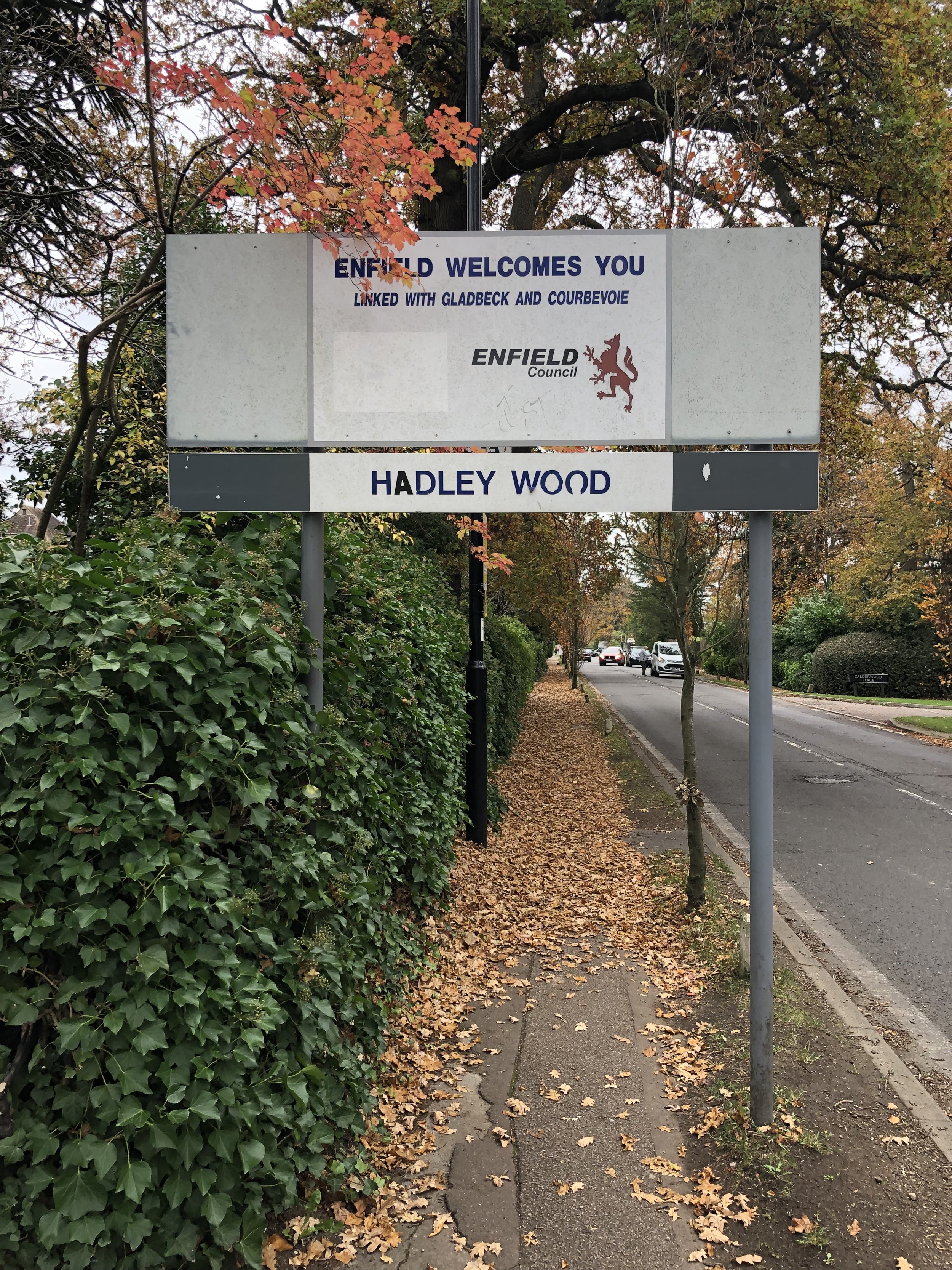
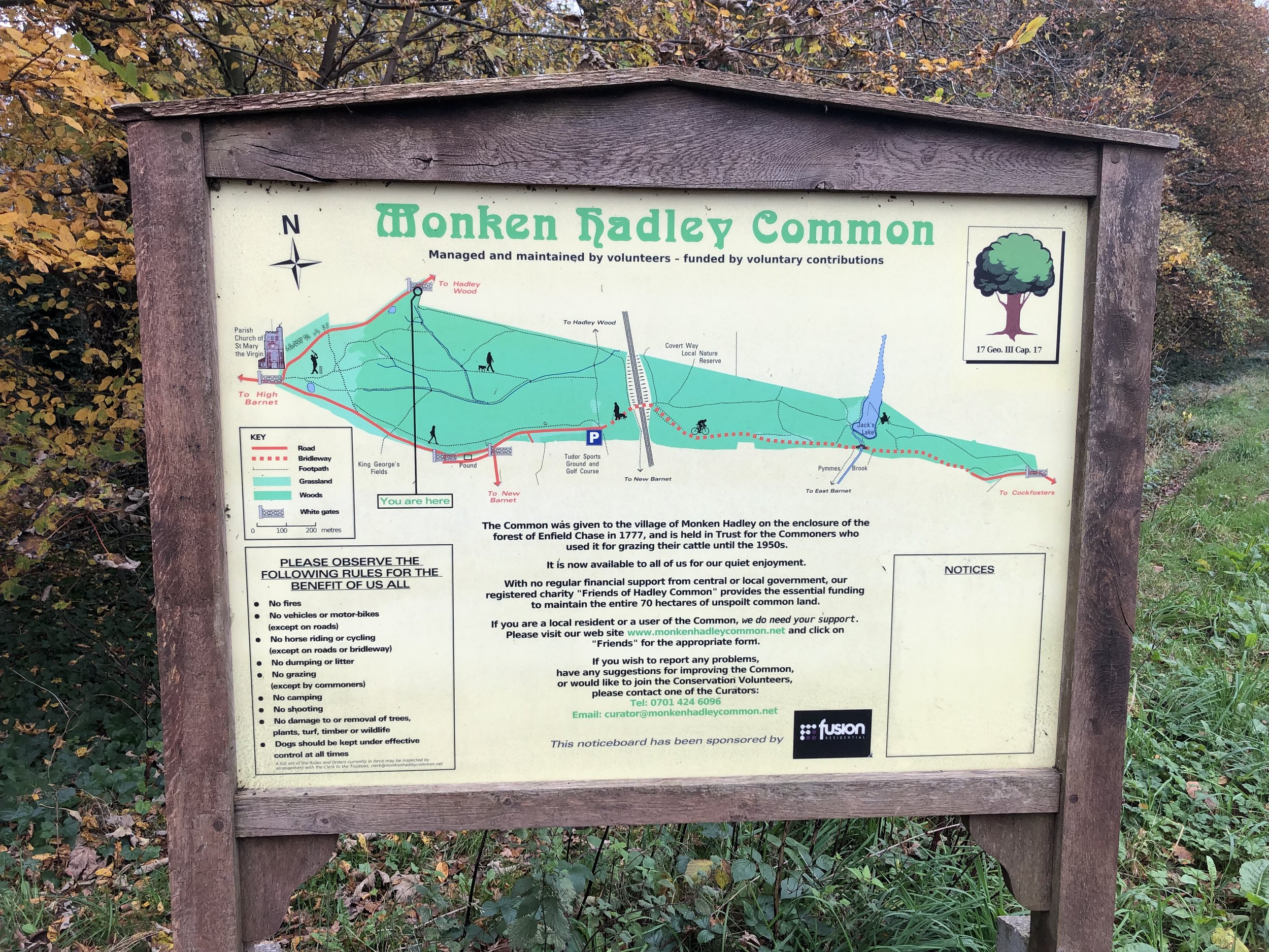
The high point of Enfield can be found at the white gates marking the entrance to Monken Hadley Common on Camlet Way. Look out for the “Enfield welcomes you” sign on the north side of Camlet Way. You can’t park on the roads around the Common so I stopped a the side of the road once the double yellow lines had run out further up Camlet Way. Hillbagging logs say that there’s a lamp-post with a “congratulatory and explanatory notice taped to lamp post by www.londons-peaks.com” although I didn’t see it on the day I was there. Looks like the website has gone too as I got an “account has expired” error when I tried to check it.
Wanstead Flats

Significance: Highest peak in London Borough of Newham
Member of: N/A
Parent Peak: Haddington Hill (Wendover Woods). NHN = Beckton Alps
Historic County: Essex (of which Chrishall Common is the County Top)
Elevation: 15m
Date “climbed”: 19th November 2021
Coordinates: 51° 33' 22'' N, 0° 1' 20'' E
Nearest Station: Wanstead Park (Overground): 0.6 km
On route of: N/A. Greenwich Meridian Trail is 0.3 km to the north-west
Map: Epping Forest & Lee Valley Map | Hertford & Harlow | Ordnance Survey | OS Explorer Map 174
Links: Wikipedia (Newham), Peakbagger, Hillbagging
I would have already bagged this one a few years ago if I had known that this high point is close to the start of Wanstead Flats parkrun. Not close enough to count though so I had to do a return trip.
Closest parking is at the Centre Road Car Park although you may find some on-street parking closer. The lowest high point of all Greater London Boroughs is by a group of trees at the edge of the common next to Sydney Road.
Note that Beckton Alp is often recognised as the high point of Newham. However, that’s an artificial hill rather than the natural high point on Wanstead Flats. Based on the description I think I’ll give it a miss unless I happen to be passing by it.
Cabin Hill
Significance: Highest peak in London Borough of Redbridge
Member of: N/A
Parent Peak: Haddington Hill (Wendover Woods). NHN = Havering Atte Bower Church
Historic County: Essex (of which Chrishall Common is the County Top)
Elevation: 90m
Date “climbed”: 19th November 2021
Coordinates: 51° 37' 25'' N, 0° 8' 10'' E
Nearest Station: Grange Hill (Central Line): 4.2 km
On route of: Three Forests Way. The London Loop is 0.1 km to the south-east
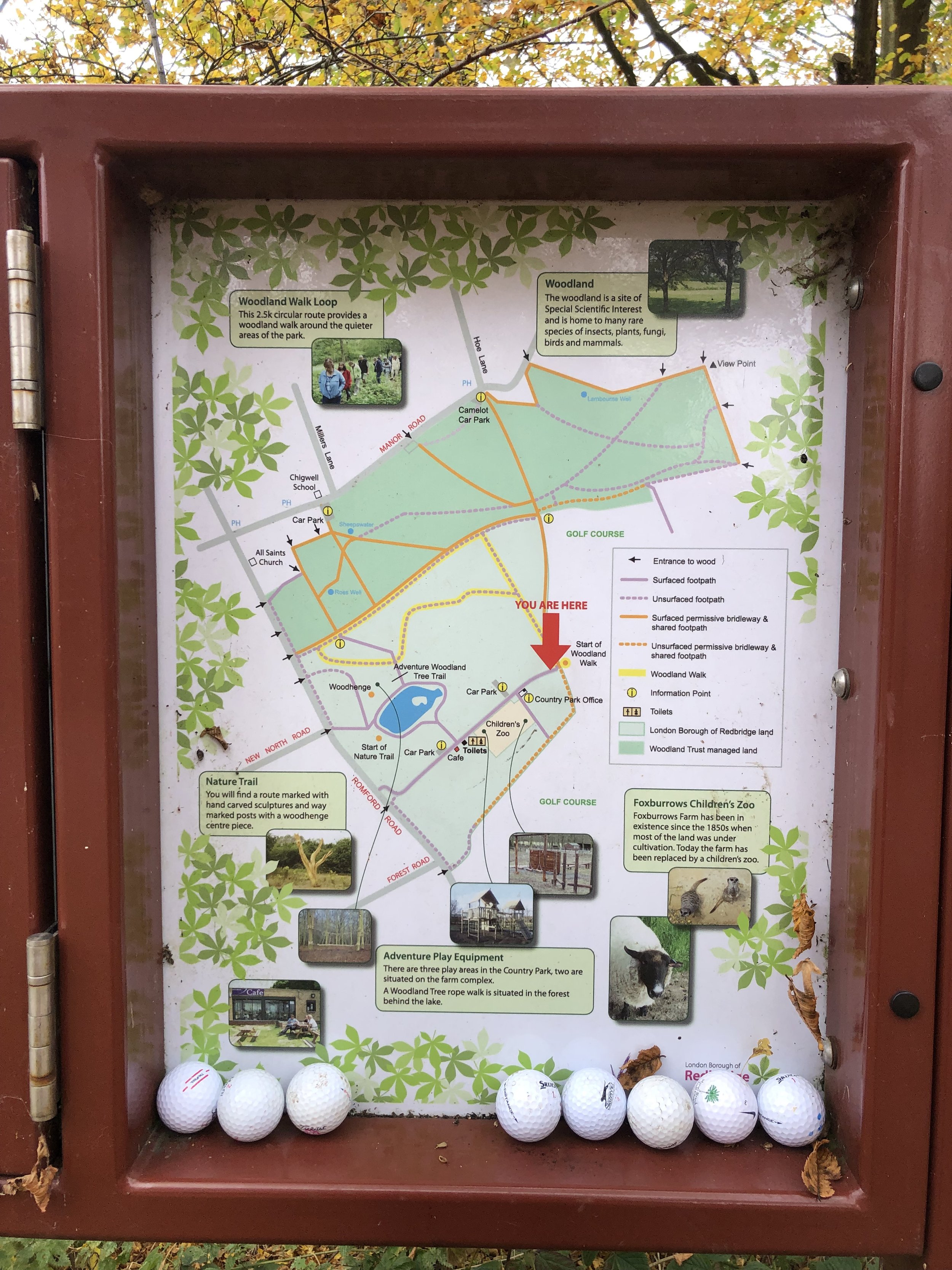
Walk Start & Finish: Hainault Forest Country Park Car Park, Fox Burrow Road, Chigwell, IG7 4QL
Walk Distance: 3.3 km (2.0 miles)
Walk Elevation change: +/- 64m
GPX File: get via Buy Me a Coffee
OS Trig Pillar: TP2802 - Dog Kennel Hill
Map: Epping Forest & Lee Valley Map | Hertford & Harlow | Ordnance Survey | OS Explorer Map 174
Links: Wikipedia (Redbridge), Peakbagger, Hillbagging
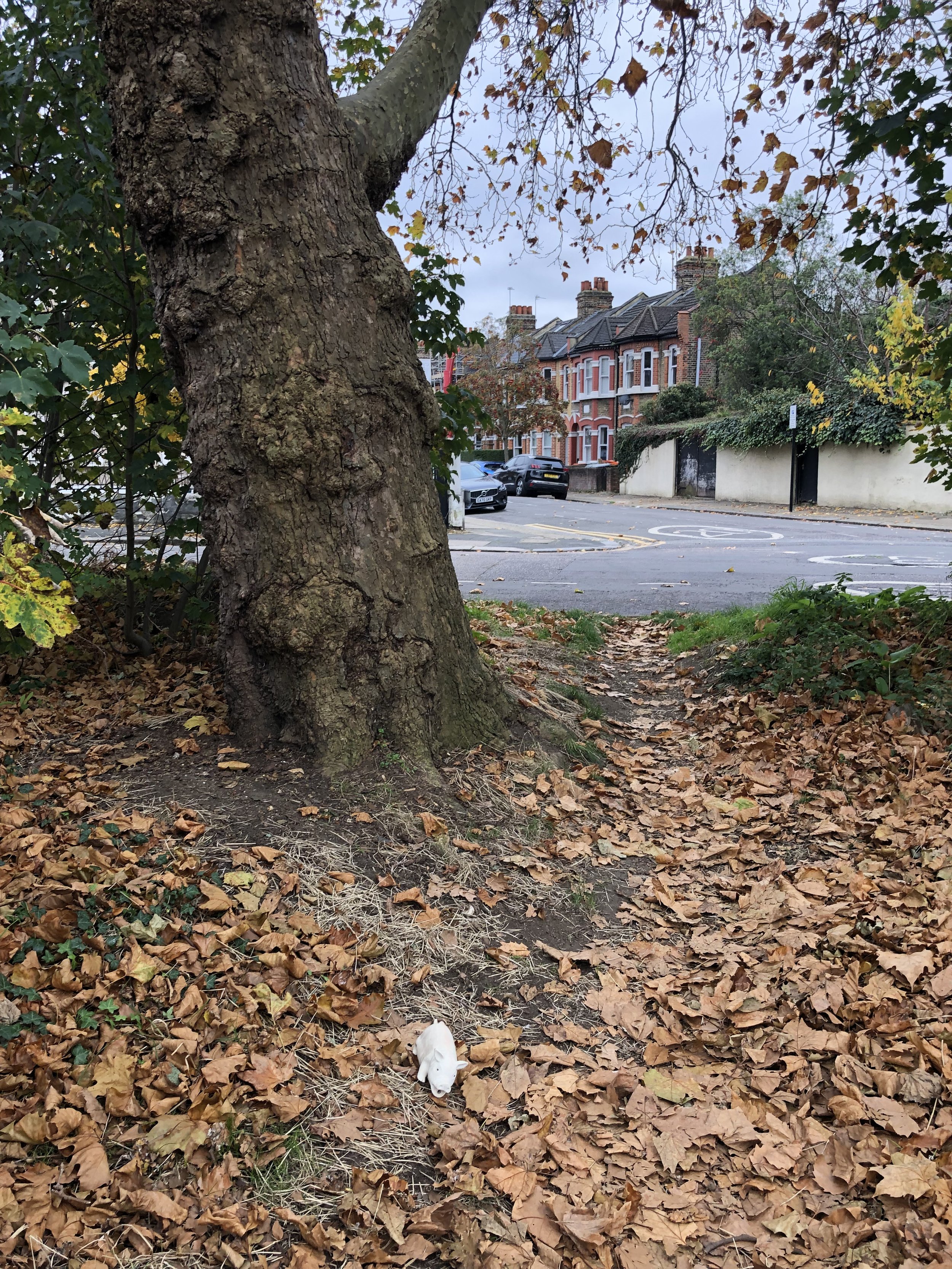
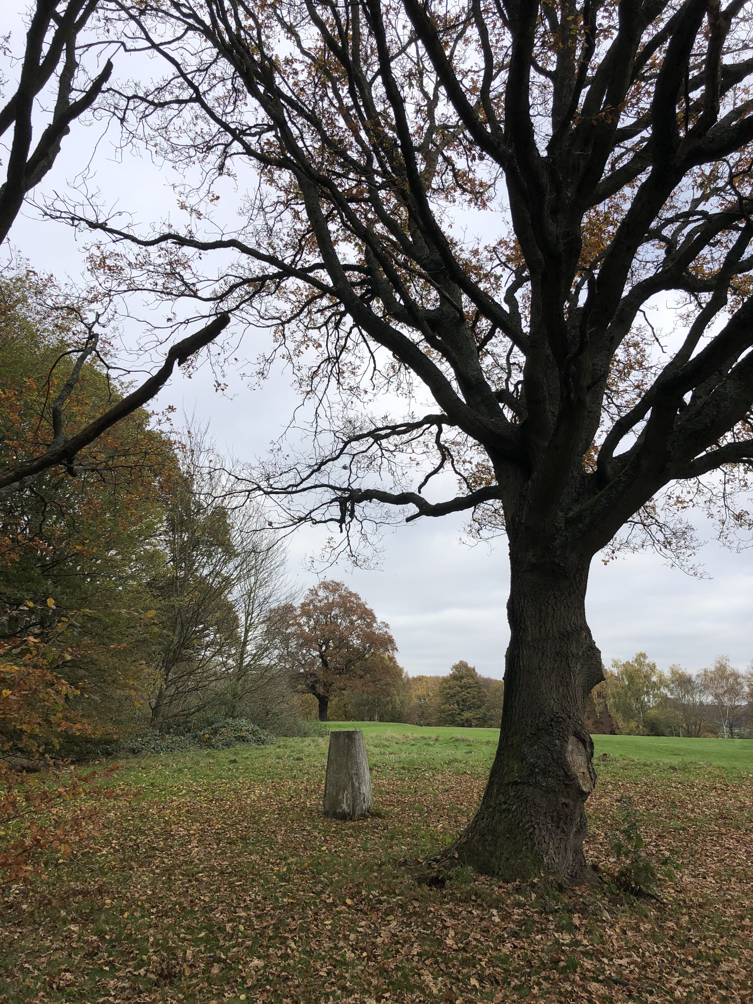
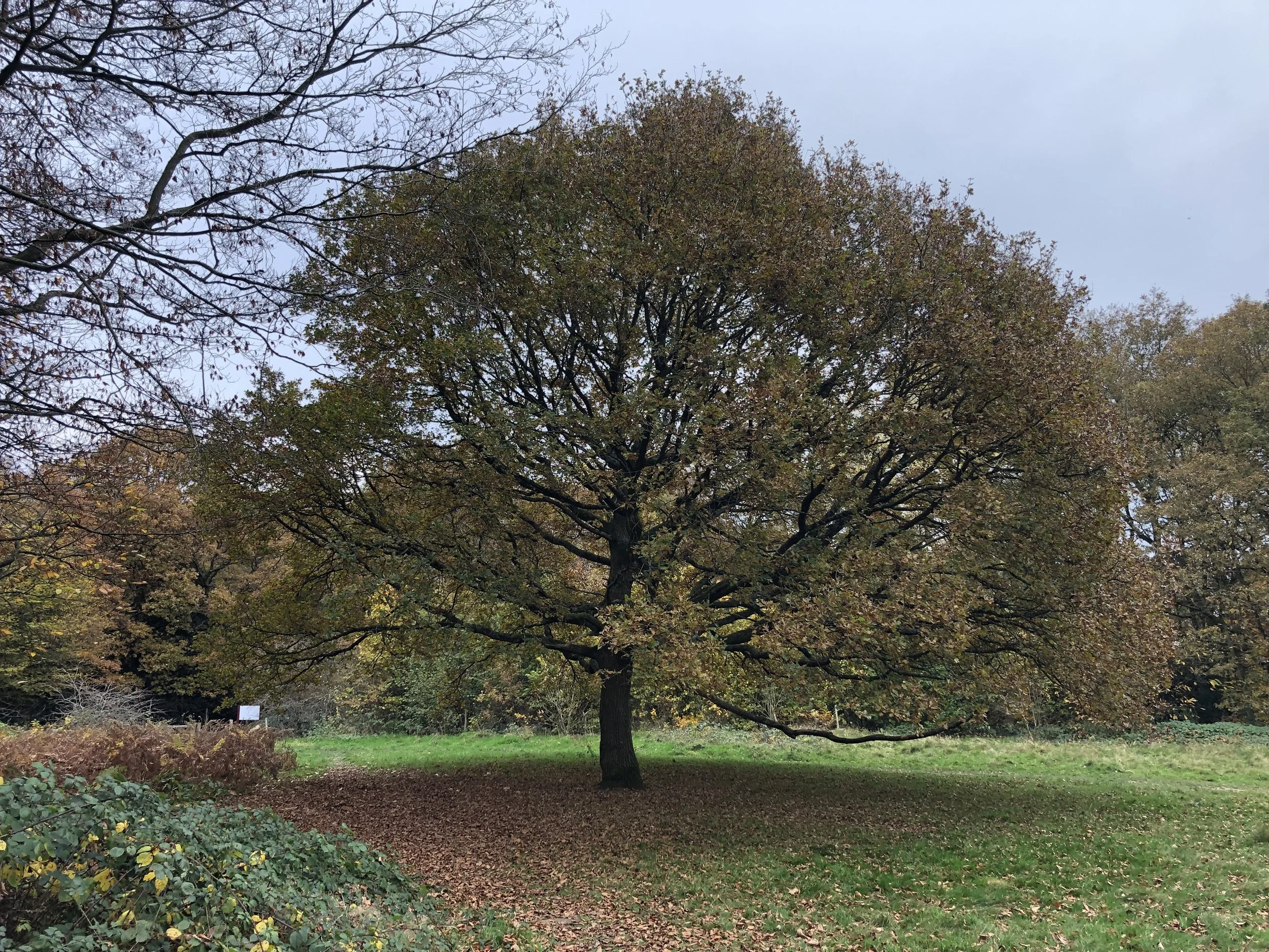
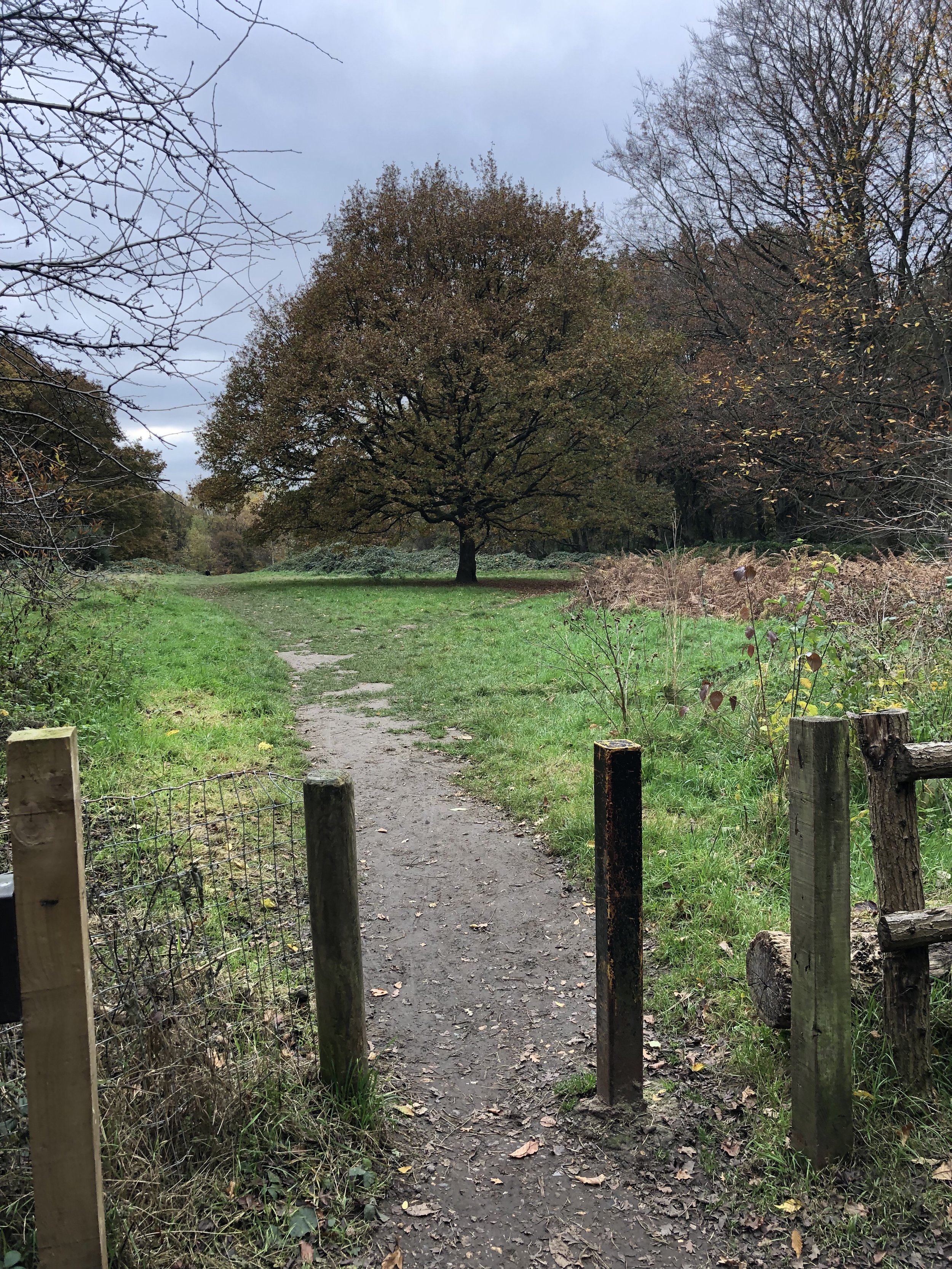
Cabin Hill is the outlier of this group as it includes a short but pleasant walk, not just a quick drive-by. From the Hainault Forest Country Park car park take the footpath that heads up the hill to the south-east behind the cafe. After 200m from the cafe take a left onto a footpath up through the woods, emerging at the golf course. Here you’ll meet the Dog Kennel Hill Trig Pillar. From the pillar return to the edge of the woods and follow the boundary path north until you meet the London Loop at the northern edge of the country park. The actual summit wasn’t obvious, so I visited several contenders: the clearing where the coordinates take you, the big tree, the gate to the park and a post in the woods. There’s not too much to see here but you’ll get some great views of the London skyline as you descent back to the car park.


Marks Gate

Significance: Highest peak in London Borough of Barking and Dagenham
Member of: N/A
Parent Peak: Haddington Hill (Wendover Woods). NHN = Cabin Hill
Historic County: Essex (of which Chrishall Common is the County Top)
Elevation: 43m
Date “climbed”: 19th November 2021
Coordinates: 51° 35' 16'' N, 0° 8' 29'' E
Nearest Station: Chadwell Health (TFL Rail, Greater Anglia): 4.3 km
On route of: N/A. The London Loop is 3.8 km to the north
Map: Epping Forest & Lee Valley Map | Hertford & Harlow | Ordnance Survey | OS Explorer Map 174
Links: Wikipedia (Barking and Dagenham), Peakbagger, Hillbagging
This wins the prize for the most uninspiring of the day’s uninspiring summits. The high point of Barking and Dagenham is on a sad mound between the A1112 and Kingston Hill Avenue. Nothing to see here, so park on Kingston Hill Avenue, bag the summit and move on quickly.
Atte Bower Farm

Significance: Highest peak in London Borough of Havering
Member of: N/A
Parent Peak: Haddington Hill (Wendover Woods). NHN = Langdon Hill- Southwest Slope
Historic County: Essex (of which Chrishall Common is the County Top)
Elevation: 105m
Date “climbed”: 19th November 2021
Coordinates: 51° 36' 59'' N, 0° 11' 18'' E
Nearest Station: Harold Wood (TFL Rail, Greater Anglia): 5 km
On route of: N/A. The London Loop is 0.4 km to the north
Map: Epping Forest & Lee Valley Map | Hertford & Harlow | Ordnance Survey | OS Explorer Map 174
Links: Wikipedia (Havering), Peakbagger, Hillbagging
Alternative = Havering Atte Bower Church
Parent Peak: Haddington Hill (Wendover Woods). NHN = Shooters Hill
Coordinates: 51° 36' 57'' N, 0° 10' 58'' E
Links: Peakbagger, Hillbagging
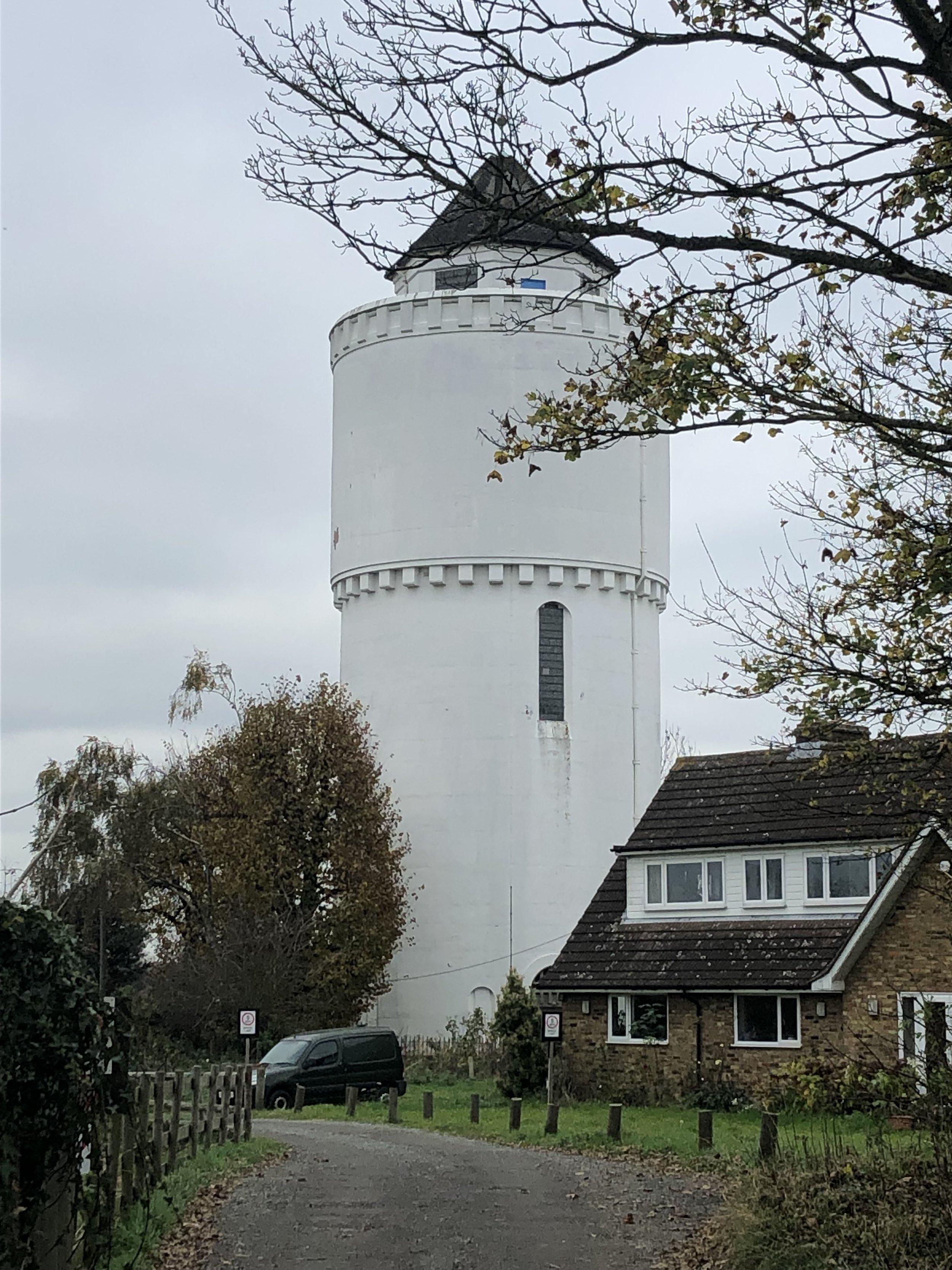
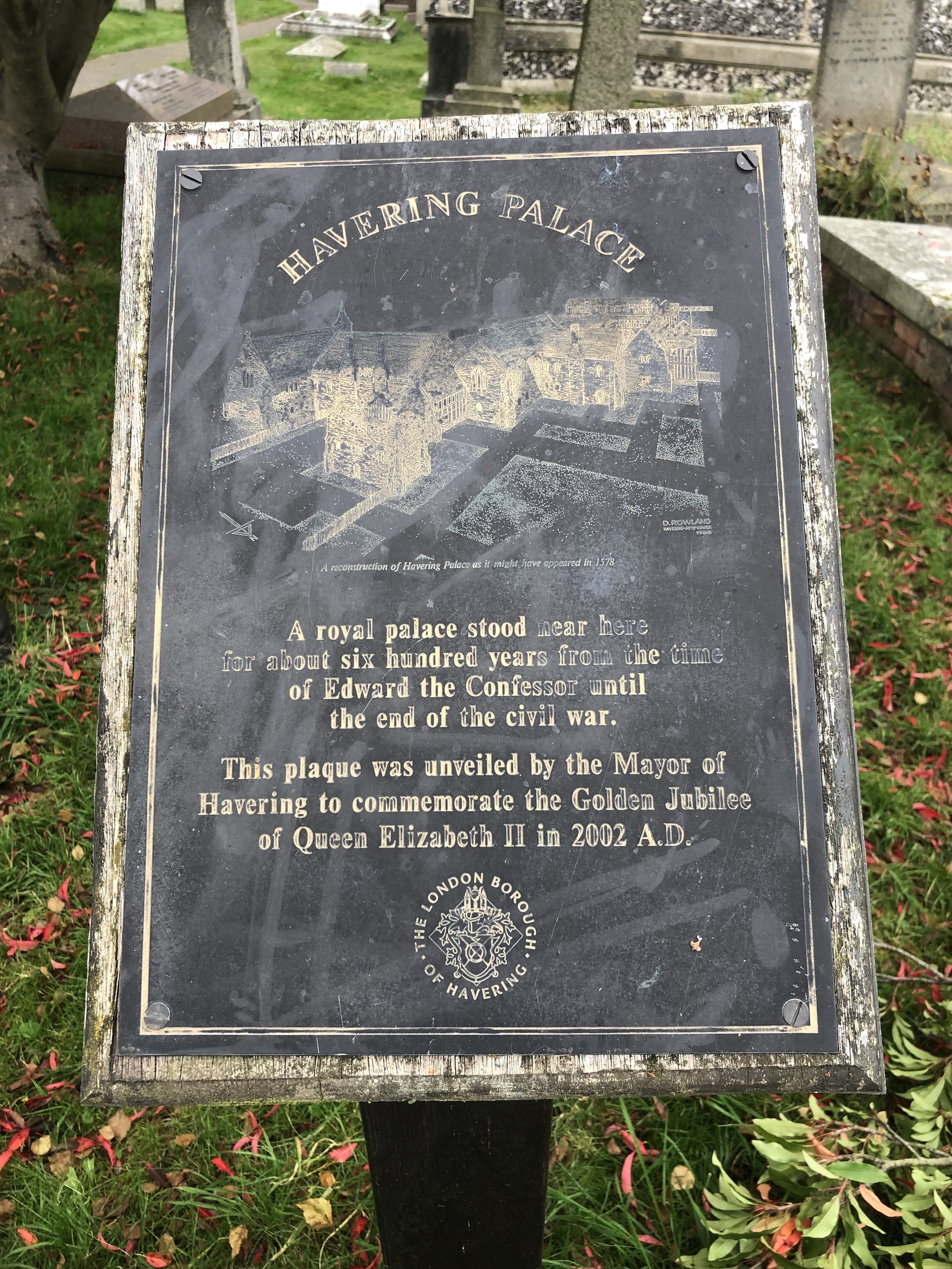
After the underwhelm of Marks Gate, the high point of Havering was at least in a more pleasant location. The official high point is in the grounds of Atte Bower Farm. I got as far as the entrance to the farm to take a photo of the water tower but didn’t enter the property. A better alternative is to visit the Church of St. John The Evangelist in Havering-Atte-Bower village. This was previously the twin high-point but, according to to Hillbagging, was de-twinned in October 2020.
Look out for the plaque at the eastern entrance to the church that refers to Havering Palace: “A royal palace once stood near here for about six hundred years from the time of Edward the Confessor until the end of the civil war.”