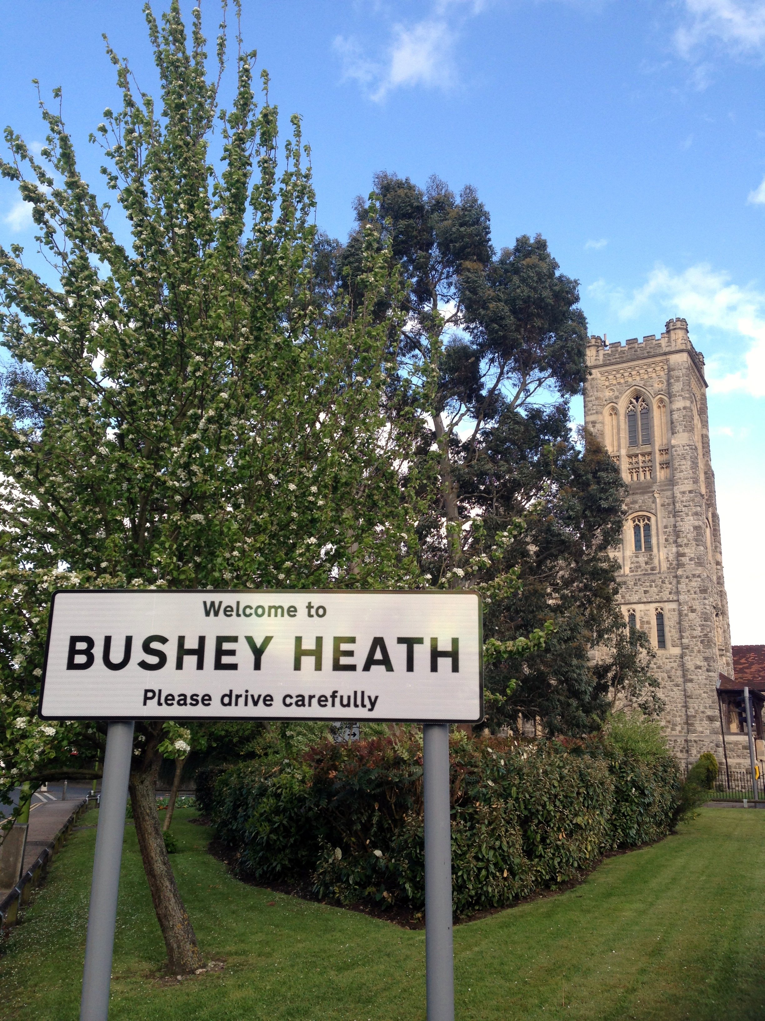
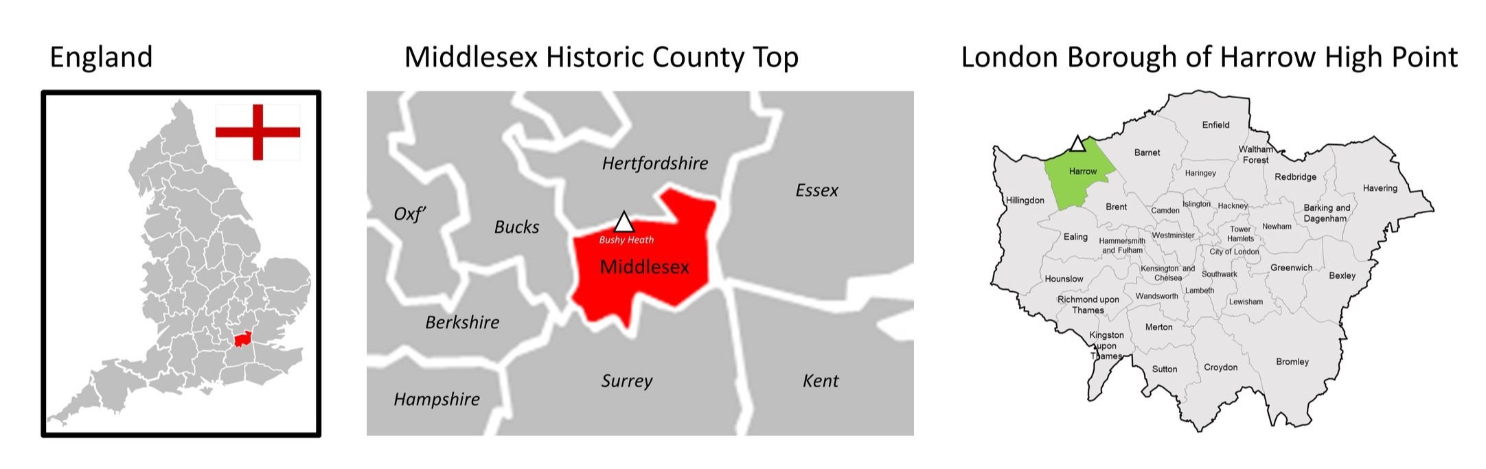
Bushey Heath: Middlesex County Top & London Borough of Harrow High Point
Significance: Highest "peak" in Middlesex (Traditional CT), High Point of London Borough of Harrow
Member of: London Borough High Points
Parent Peak: Haddington Hill. NHN = Pavis Wood
Elevation (Bushey Heath): 155m, (Bushey Heath-Boundary): 153m
Date “climbed”: 13th May 2013 and 21st January 2023
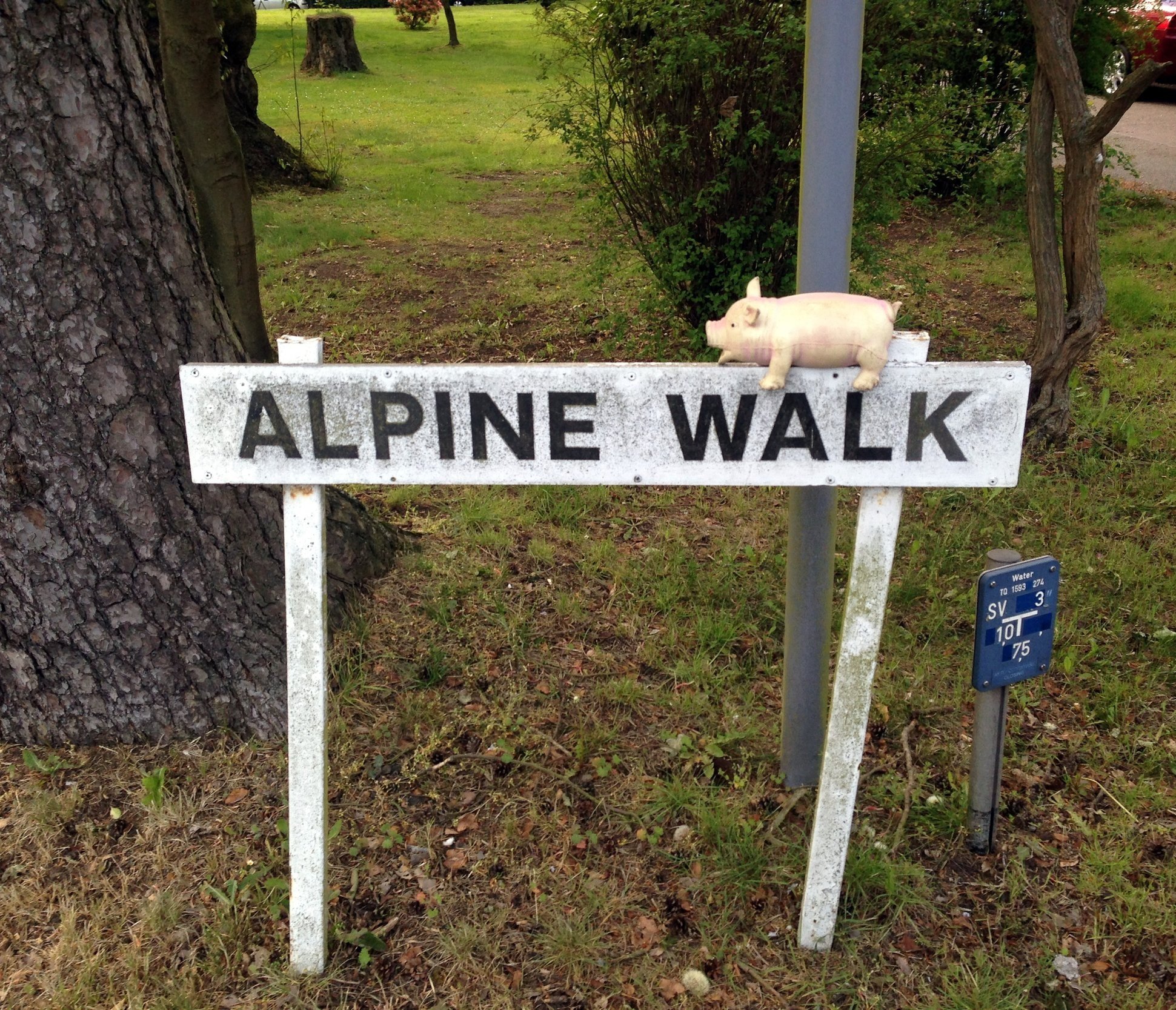
Coordinates (Bushey Heath): 51° 37' 56'' N, 0° 20' 18'' W
Coordinates (Bushey Heath-Boundary): 51° 37' 52'' N, 0° 20' 10'' W
Nearest Station: Bushey (Overground, West Midland Trains): 4 km
On route of: N/A. The London Loop is 0.7 km to the south-east
Map: OS Explorer 173 London North and OS Explorer 172 Chiltern Hills East
Guidebooks: The UK's County Tops, Jonny Muir, Walking the County High Points of England, David Bathurst
Links:
- Wikipedia: Middlesex, Harrow, Bushey
- Peakbagger: Bushey Heath, Bushey Heath Boundary
- Hillbagger: Bushey Heath, Bushey Heath Boundary
My first visit to the Bushey Heath high point was in May 2013 in the early days of my County Top adventures. Knowing that this would be a boring destination I made a more interesting trip of it by cycling there along the Ebury Way from Rickmansworth. I found the point noted in Jonny Muir’s book, took a photo and considered it “bagged”. Or so I thought …
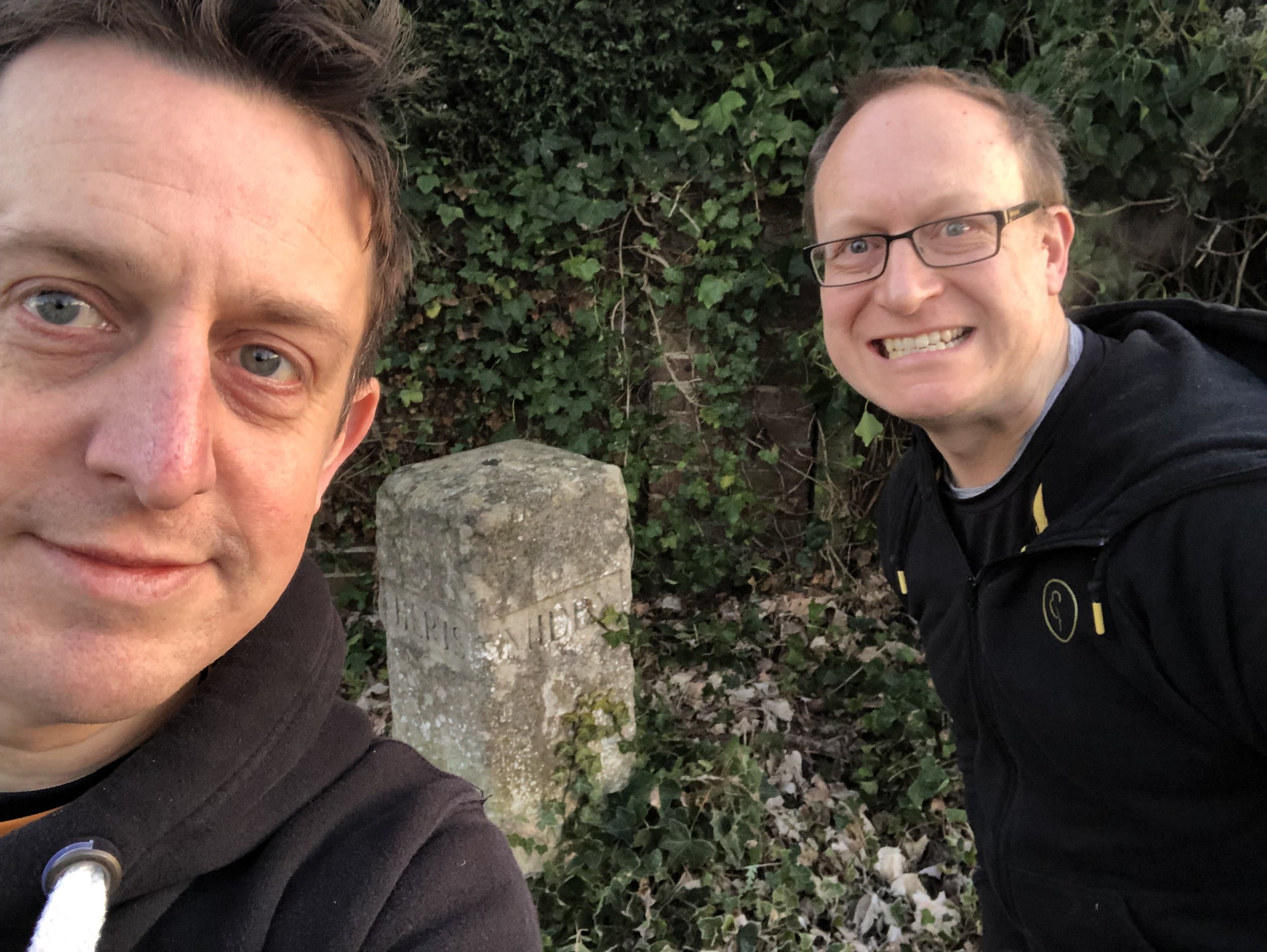
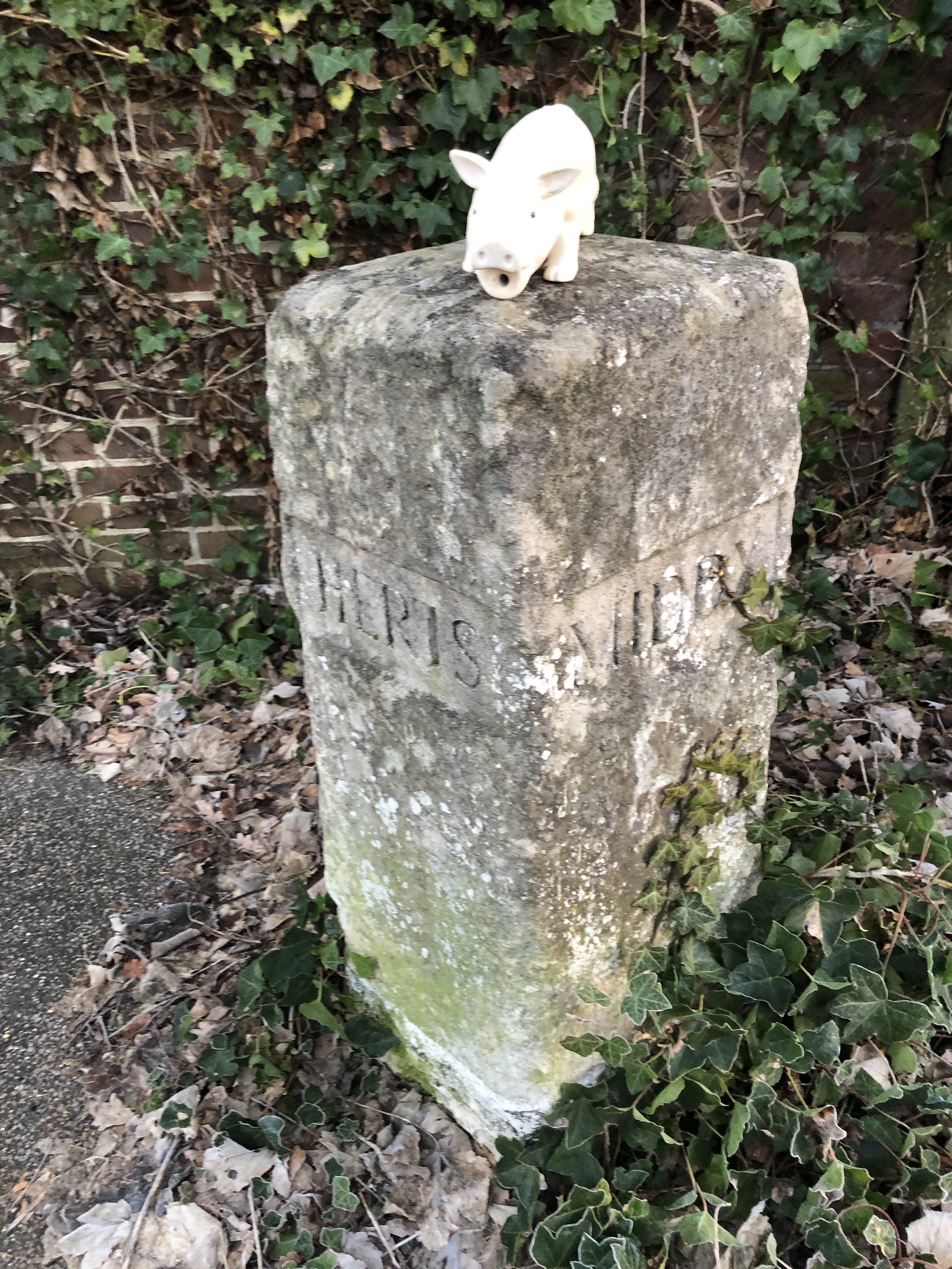
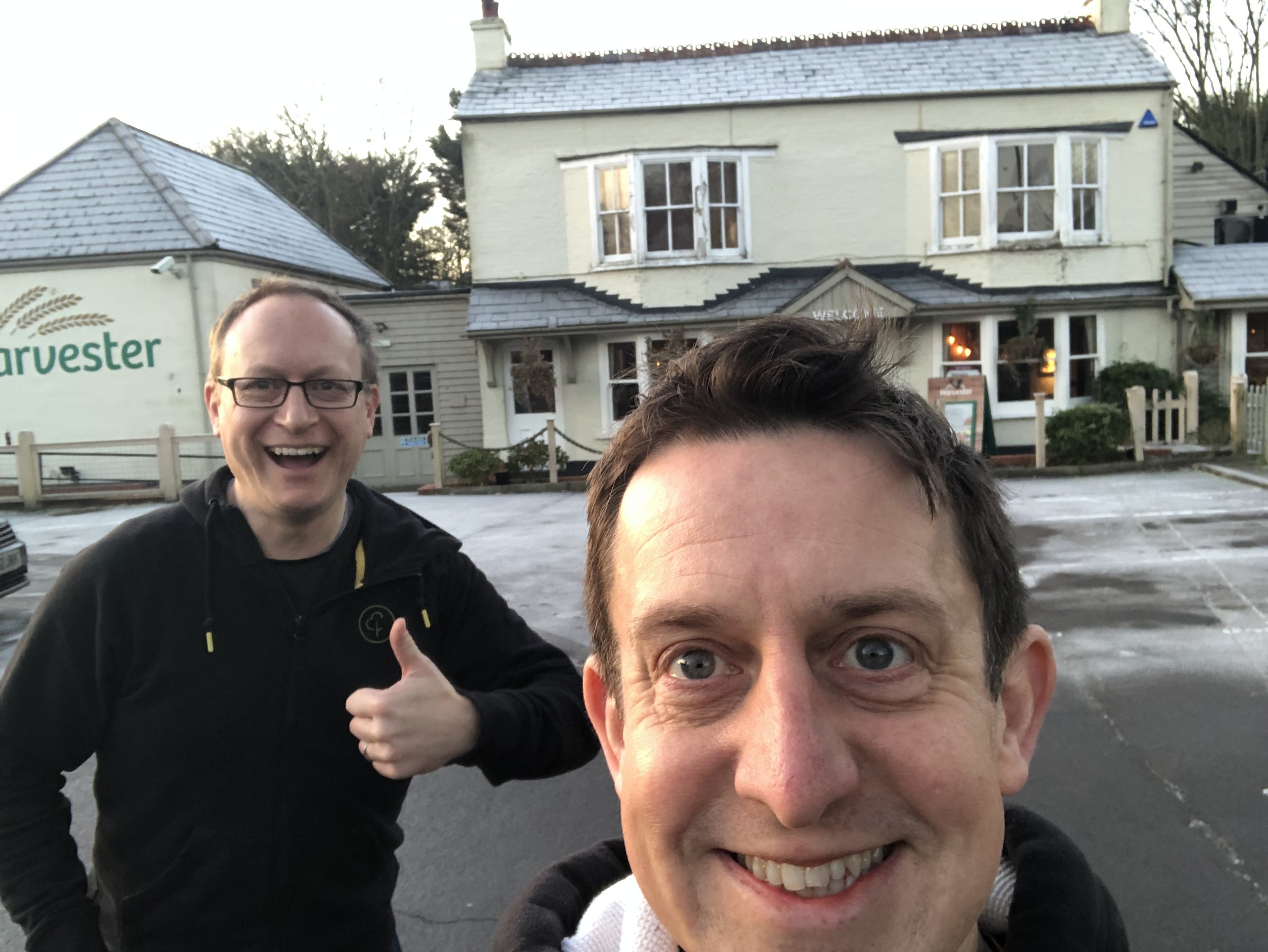
As it turned out, to fully tick the box of visiting the high point of both the Historic County of Middlesex and the London Borough of Harrow you need to also go a bit further to the north-west. The historic boundary of Hertfordshire and Middlesex is marked by a boundary stone on the A4140 opposite the Windmill Harvester. In 1965 this became the boundary of Hertfordshire and Harrow. In 1993 the Herts/Harrow boundary was moved to its current position running along Common Road / Magpie Hall Road.
So, nearly 10 years after my original visit to Bushey Heath, I returned to visit the old boundary stone to properly bag the high point.
Greater London Borough High Points formerly within Middlesex
Bushey Heath-Boundary (153m) Harrow Borough High Point
Highwood Hill (146m) Barnet Borough High Point
Hampstead Heath (134m) Camden Borough High Point
Potter Street Hill (134m) Hillingdon Borough High Point
Highgate (129m) Haringey Borough High Point
Bournwell Hill-West Slope (119m) Enfield Borough High Point
Highgate Hill (100m) Islington Borough High Point
Wakemans Hill Avenue (92m) Brent Borough High Point
Sudbury Hill (91m) Brent (alternative) Borough High Point
Horsenden Hill (85m) Ealing Borough High Point
Saint John's Wood Park (52m) City of Westminster Borough High Point
College Park (45m) Hammersmith and Fulham Borough High Point
Harrow Road (45m) Kensington and Chelsea Borough High Point
Seven Sisters Road (39m) Hackney Borough High Point
Heston The Vale (35m) Hounslow Borough High Point