Potter Street Hill: Hillingdon Borough High Point

Significance: Highest peak in London Borough of Hillingdon
Member of: N/A
Parent Peak: Haddington Hill. NHN = Bushey Heath
Historic County: Middlesex (of which Bushey Heath is the County Top)
Elevation: 134m
Date “climbed”: 5th June 2021
Coordinates: 51° 36' 47'' N, 0° 24' 15'' W
Nearest Station: Northwood (Metropolitan Line): 1.9 km
On route of: N/A. The London Loop is 0.6 km to the north-west
Coal Duty Post: 51
Map: OS Explorer Map (173) London North, The City, West End, Enfield, Ealing, Harrow & Watford
Links: Wikipedia (Hillingdon), Peakbagger, Hillbagging

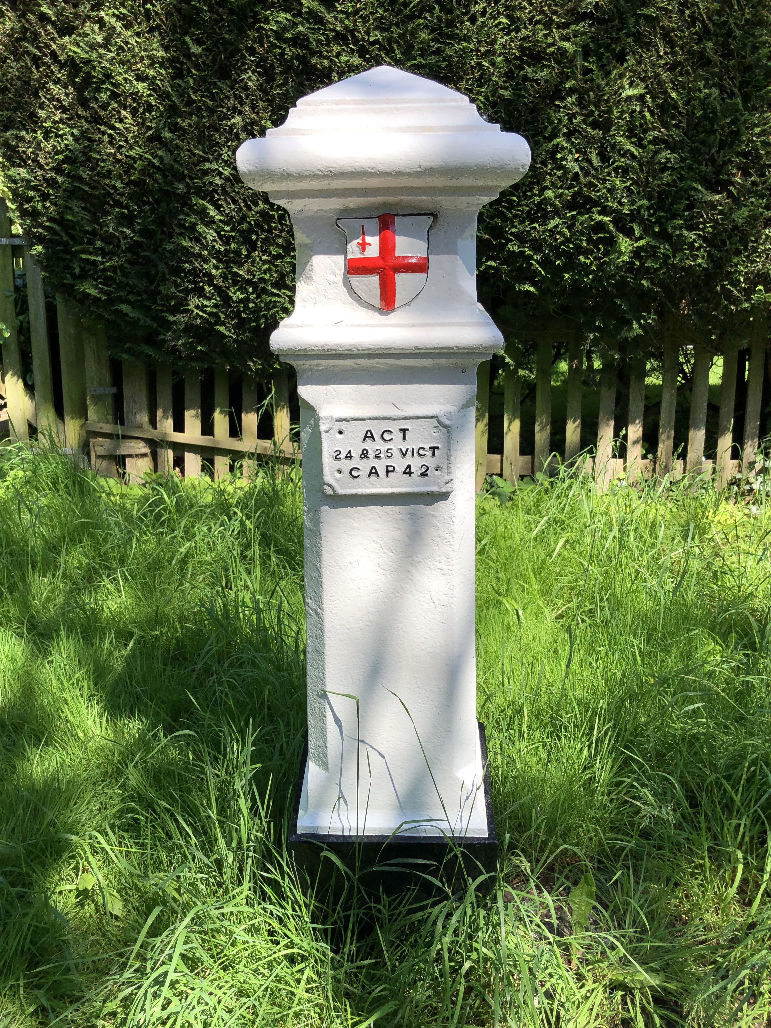
The high point of Hillingdon is marked by a well-maintained Coal Duty Post. It’s a 0.6 km diversion from the London Loop via Oxhey Woods. Alternatively it’s an east drive-by, accessible from either the south end of Woodside Walk or the North End of Potter Street Hill