Central London Five Summits

London skyline from Primrose Hill, near the high point of the City of Westminster.

Two weeks after completing the North London Seven Summits, I was back in the capital to tick off the central London peaks. As with the previous collection this was a pretty arbitrary grouping. It could have also included High Holborn, the high point of the City of London, but I had already bagged that one on an earlier trip.
The advantage of this group is that they can all be easily accessed by London Underground, or central London Overground stations. The disadvantage is that they’re all exceedingly dull summits. Even boroughs like Kensington and Chelsea that sound like they should be pleasant manage to have their high points in their most under-whelming corners.
Harrow Road
Significance: Highest peak in London Borough of Kensington and Chelsea
Member of: N/A
Parent Peak: Haddington Hill (Wendover Woods). NHN = Saint Johns Wood Park
Historic County: Middlesex (of which Bushey Heath is the County Top)
Elevation: 45m
Date “climbed”: 3rd December 2021
Coordinates: 51° 31' 49'' N, 0° 13' 43'' W
Nearest Station: Kensal Green (Overground and Bakerloo Line): 0.3 km
On route of: N/A. Grand Union Canal Towpath is 1.8 km to the south
Map: OS Explorer Map (173) London North, The City, West End, Enfield, Ealing, Harrow & Watford
Links: Wikipedia (Kensington and Chelsea), Peakbagger, Hillbagging
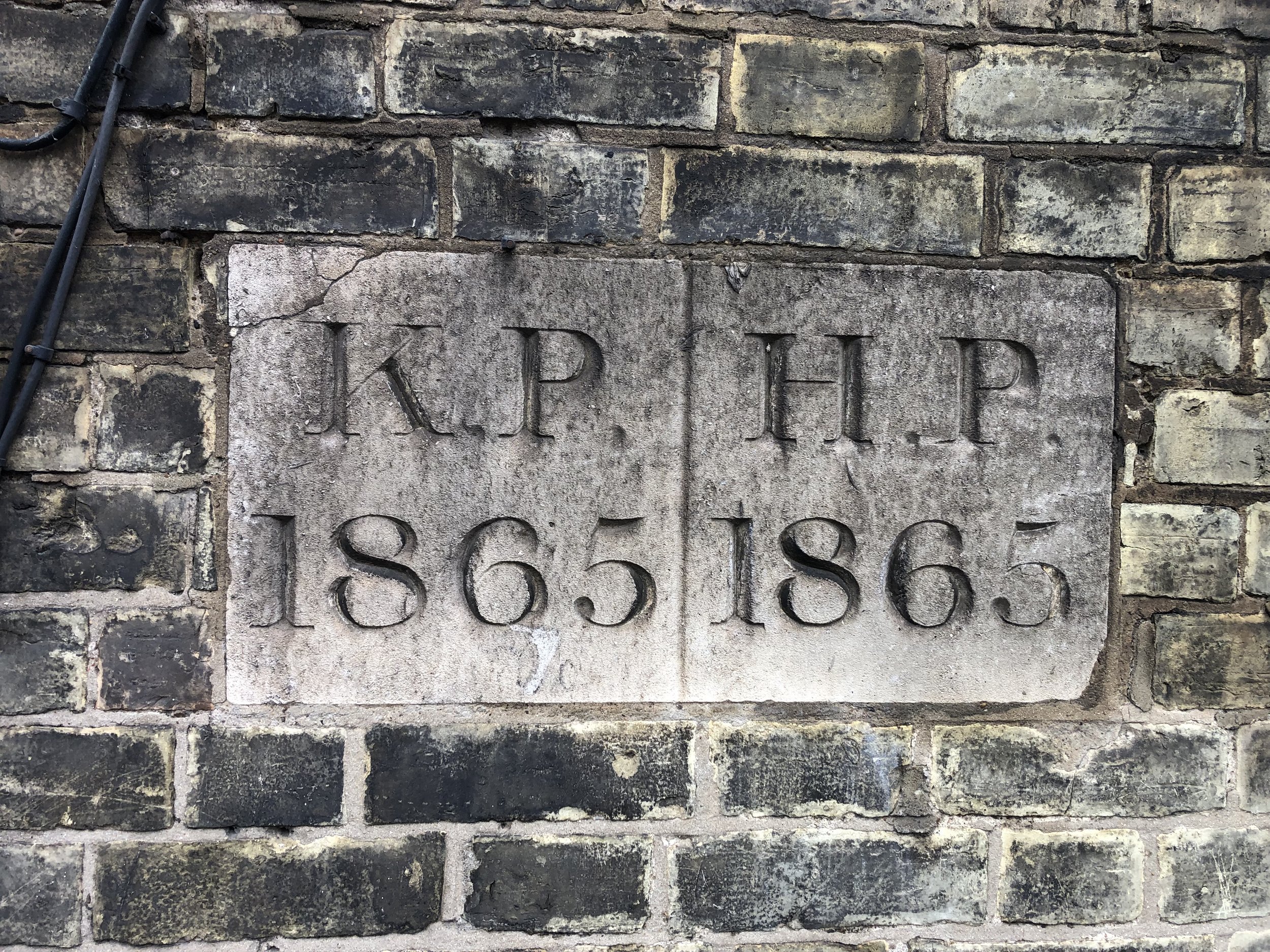
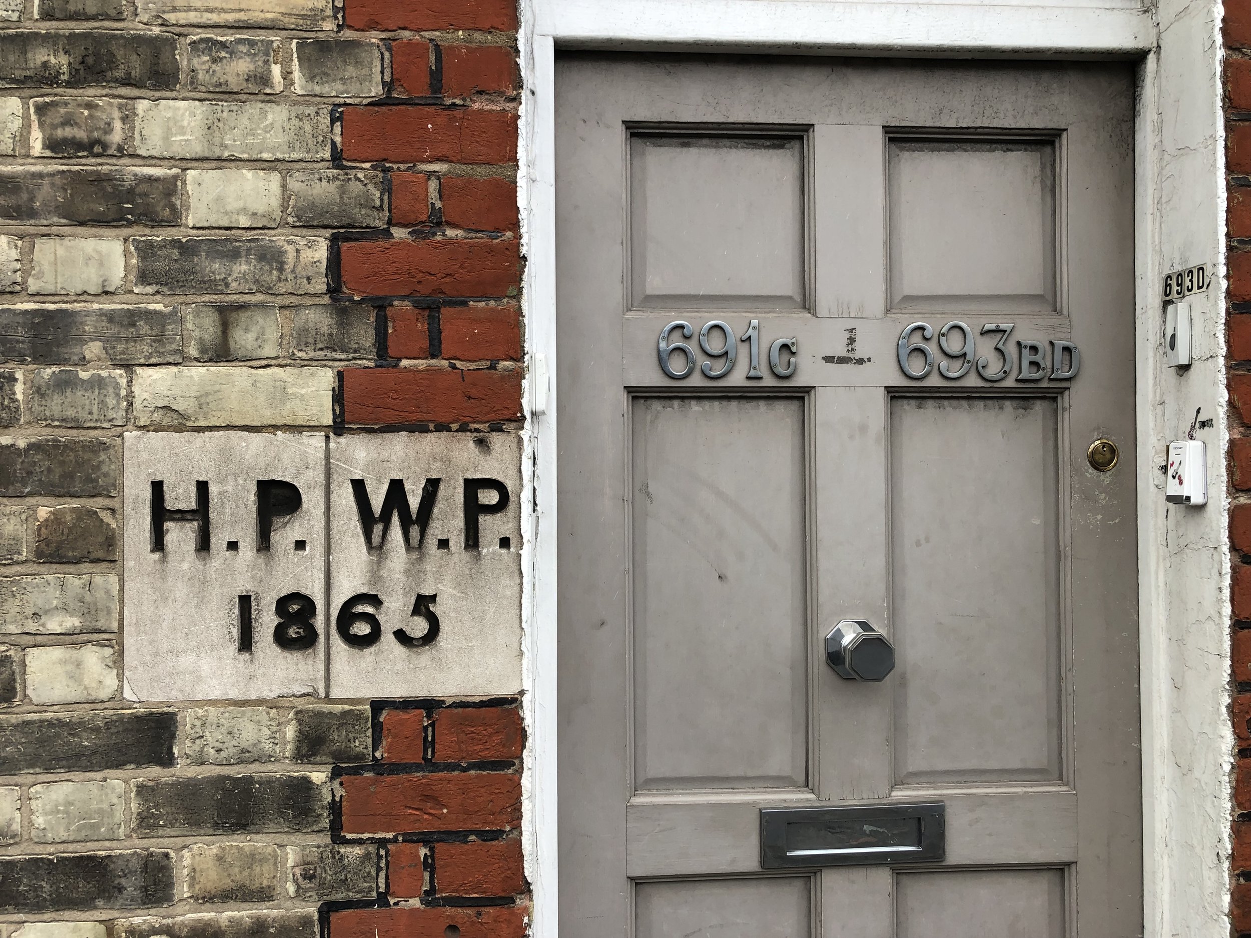
Harrow Road and College Park come as a pair as they are only a few minutes walk apart on Harrow Road. The high point of Kensington and Chelsea, called “Harrow Road”, can be easily identified by the engraved 1865 boundary markings on 691a and 691c.
College Park
Significance: Highest peak in London Borough of Hammersmith and Fulham
Member of: N/A
Parent Peak: Haddington Hill (Wendover Woods). NHN = Saint Johns Wood Park
Historic County: Middlesex (of which Bushey Heath is the County Top)
Elevation: 45m
Date “climbed”: 3rd December 2021
Coordinates: 51° 31' 51'' N, 0° 13' 51'' W
Nearest Station: Kensal Green (Overground and Bakerloo Line): 0.5 km
On route of: N/A. Grand Union Canal Towpath is 1.6 km to the south
Map: OS Explorer Map (173) London North, The City, West End, Enfield, Ealing, Harrow & Watford
Links: Wikipedia (Hammersmith and Fulham), Peakbagger, Hillbagging
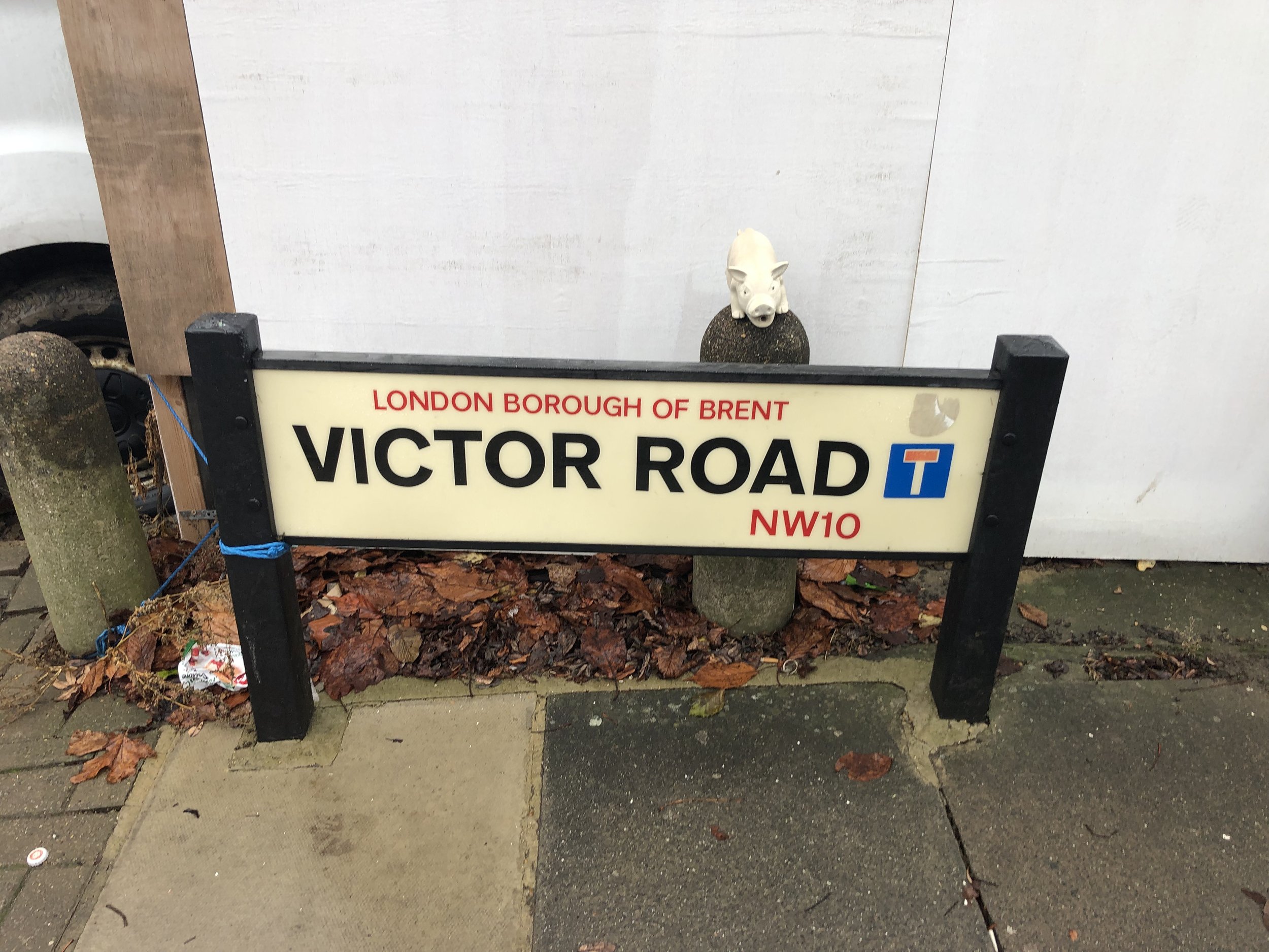
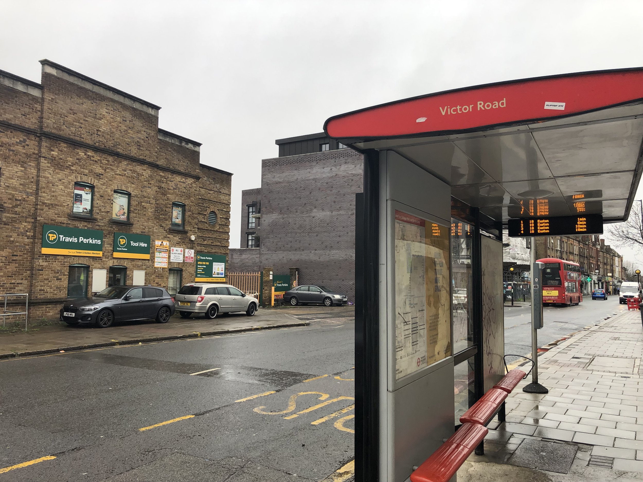
From the Harrow Road Kensington and Chelsea high point continue north-west along Harrow Road until you reach Travis Perkins opposite the bus stop at the end of Victor Road. Congratulations, you’re at the high point of Hammersmith and Fulham. After a well deserved celebration, return to Kensal Green Station to visit the next boring summit.
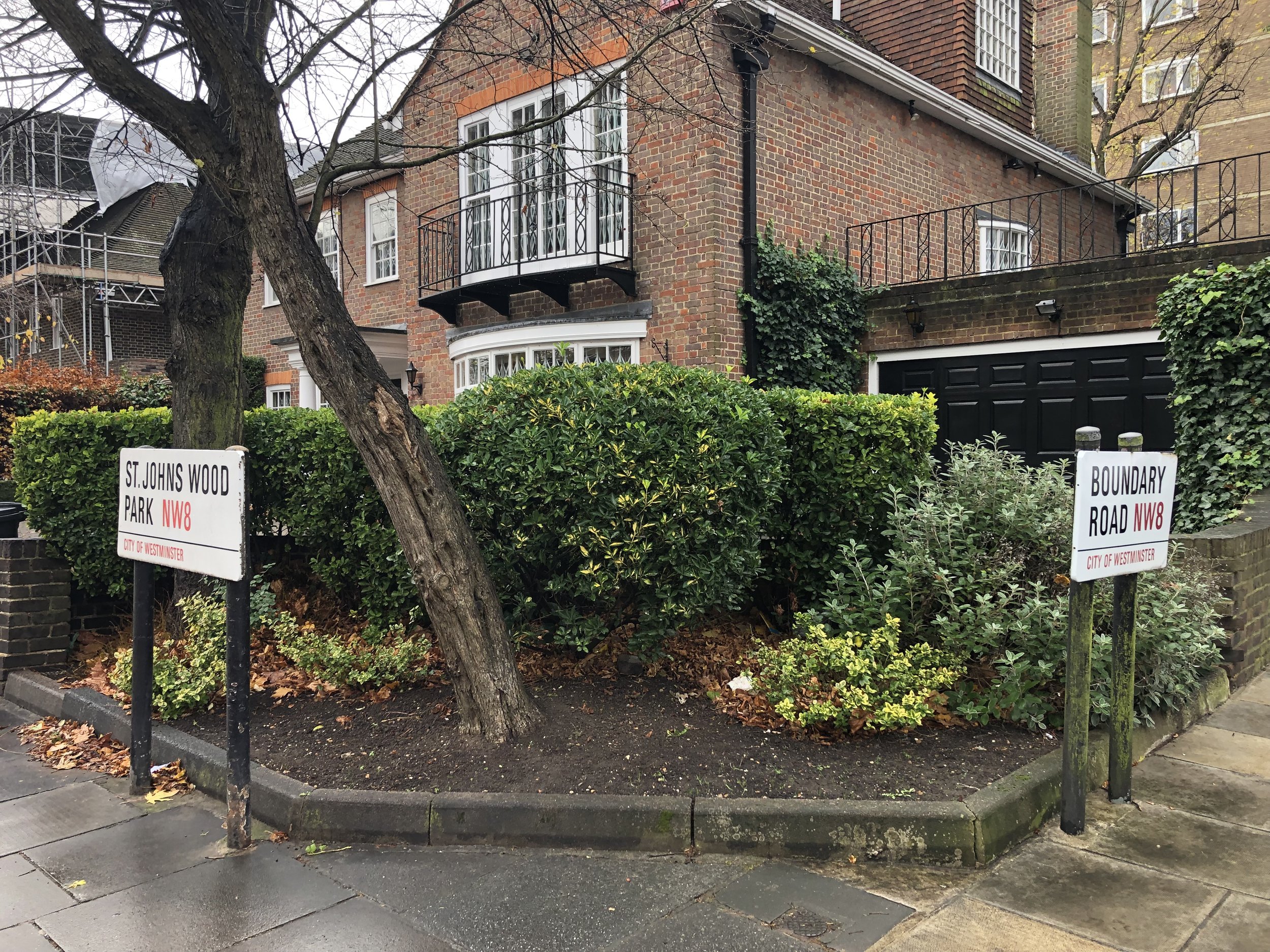
Saint John's Wood Park
Significance: Highest peak in London Borough of City of Westminster
Member of: N/A
Parent Peak: Haddington Hill (Wendover Woods). NHN = Primrose Hill
Historic County: Middlesex (of which Bushey Heath is the County Top)
Elevation: 52m
Date “climbed”: 3rd December 2021
Coordinates: 51° 32' 22'' N, 0° 10' 26'' W
Nearest Station: South Hampstead (Overground): 0.5 km
On route of: N/A. The Regents Canal / Jubilee Greenway is 1.1 km to the south
Map: OS Explorer Map (173) London North, The City, West End, Enfield, Ealing, Harrow & Watford
Links: Wikipedia (City of Westminster), Peakbagger, Hillbagging
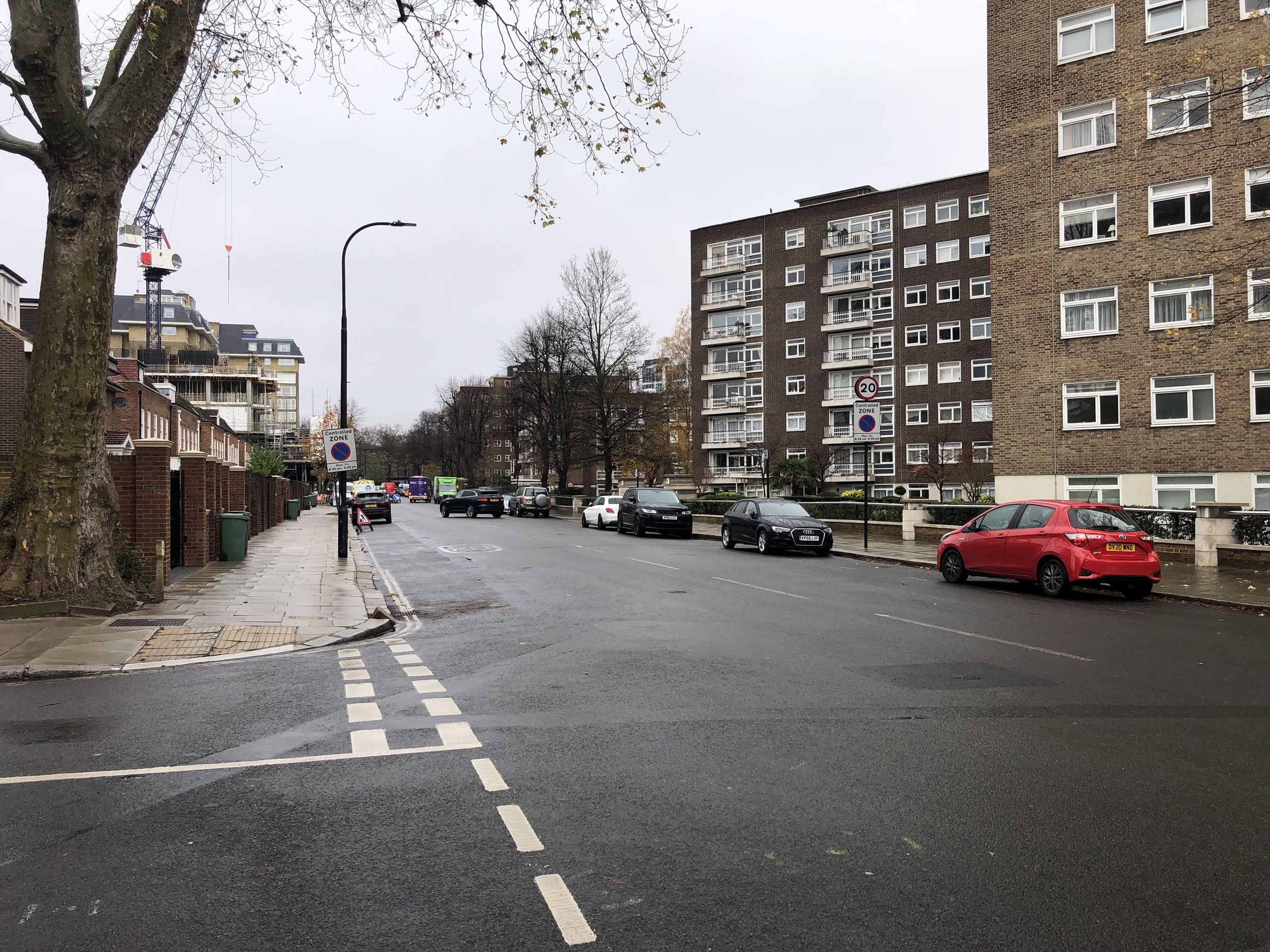
The high point of the City of Westminster is no more interesting than the previous two. The upside is that if you can continue the walk to Primrose Hill (a proper summit) and pass some very nice houses along the way. The City of Westminster High point is at the south corner of Boundary Road and St Johns Wood Road.
Seven Sisters Road

Significance: Highest peak in London Borough of Hackney
Member of: N/A
Parent Peak: Haddington Hill (Wendover Woods). NHN = Highgate Hill
Historic County: Middlesex (of which Bushey Heath is the County Top)
Elevation: 39m
Date “climbed”: 3rd December 2021
Coordinates: 51° 34' 8'' N, 0° 5' 54'' W
Nearest Station: Manor House (Piccadilly Line): 0.2 km
On route of: N/A. The Capital Ring is 0.4 km to the north-west
Map: OS Explorer Map (173) London North, The City, West End, Enfield, Ealing, Harrow & Watford
Links: Wikipedia (Hackney), Peakbagger, Hillbagging
Although Manor House is the closest Tube to this high point I got off at Finsbury Park to fully take in the vibrant splendor that is the Seven Sisters Road. Had I been bagging these high points earlier I could have done this one a few years ago as it’s just off the Finsbury parkrun course.
Hillbagging comments that there’s an alternative top 300m NE on Woodberry Grove, near Manor House Station. I didn’t visit that one. The excitement of the Seven Sisters Road was enough for me.
Swanfield Street
Significance: Highest peak in London Borough of Tower Hamlets
Member of: N/A
Parent Peak: Haddington Hill (Wendover Woods). NHN = High Holborn
Historic County: Middlesex (of which Bushey Heath is the County Top)
Elevation: 18m
Date “climbed”: 3rd December 2021
Coordinates: 51° 31' 31'' N, 0° 4' 23'' W
Nearest Station: Old Street (Great Northern Rail, Northern Line): 1.1 km
On route of: N/A. The Regents Canal / Jubilee Greenway is 1.6 km to the north
Map: OS Explorer Map (173) London North, The City, West End, Enfield, Ealing, Harrow & Watford
Links: Wikipedia (Tower Hamlets), Peakbagger, Hillbagging
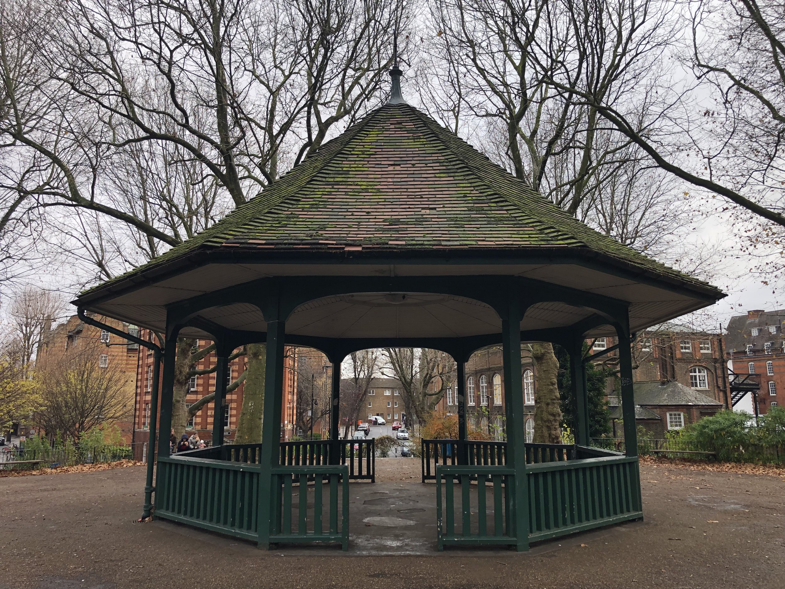
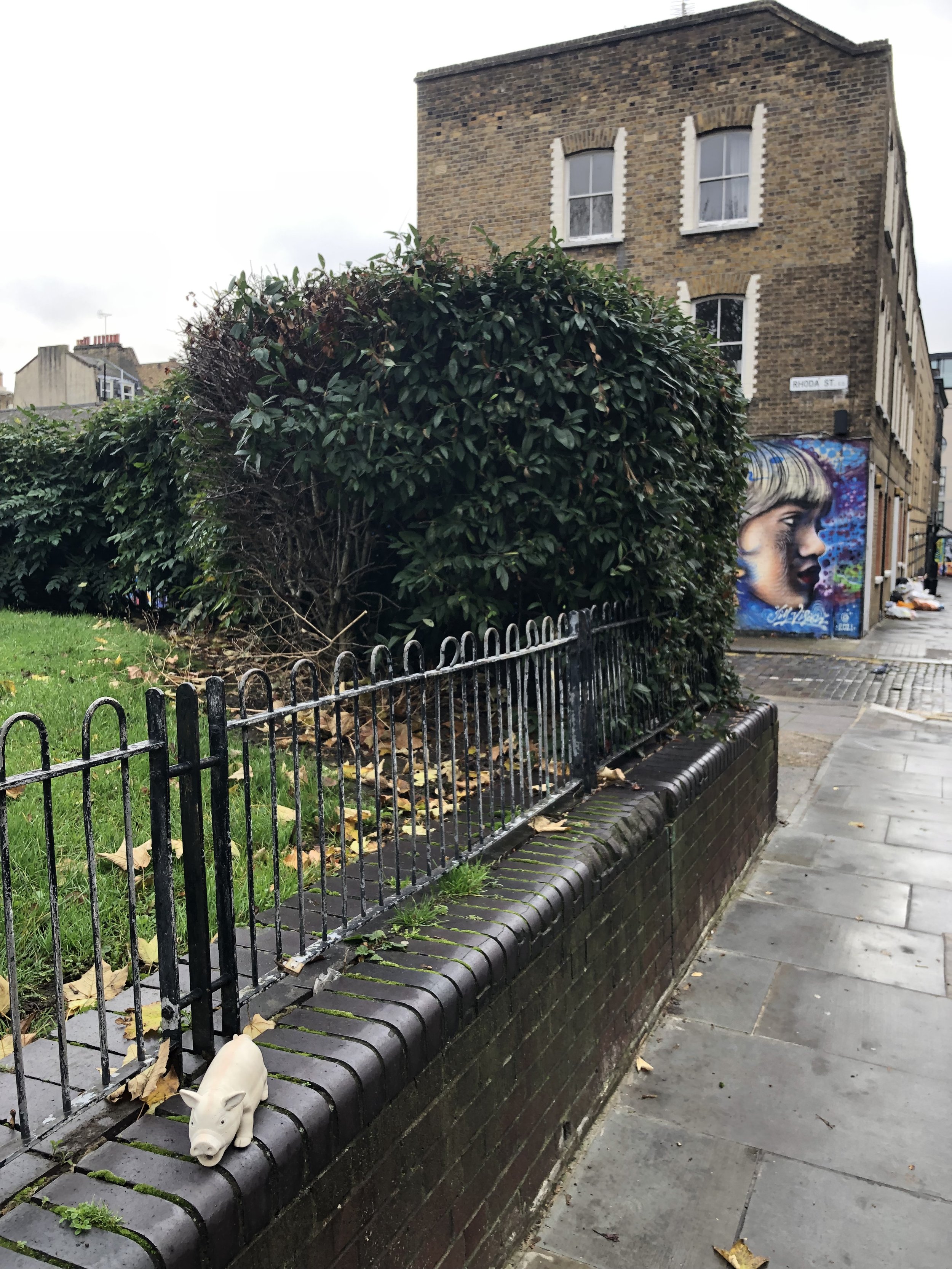
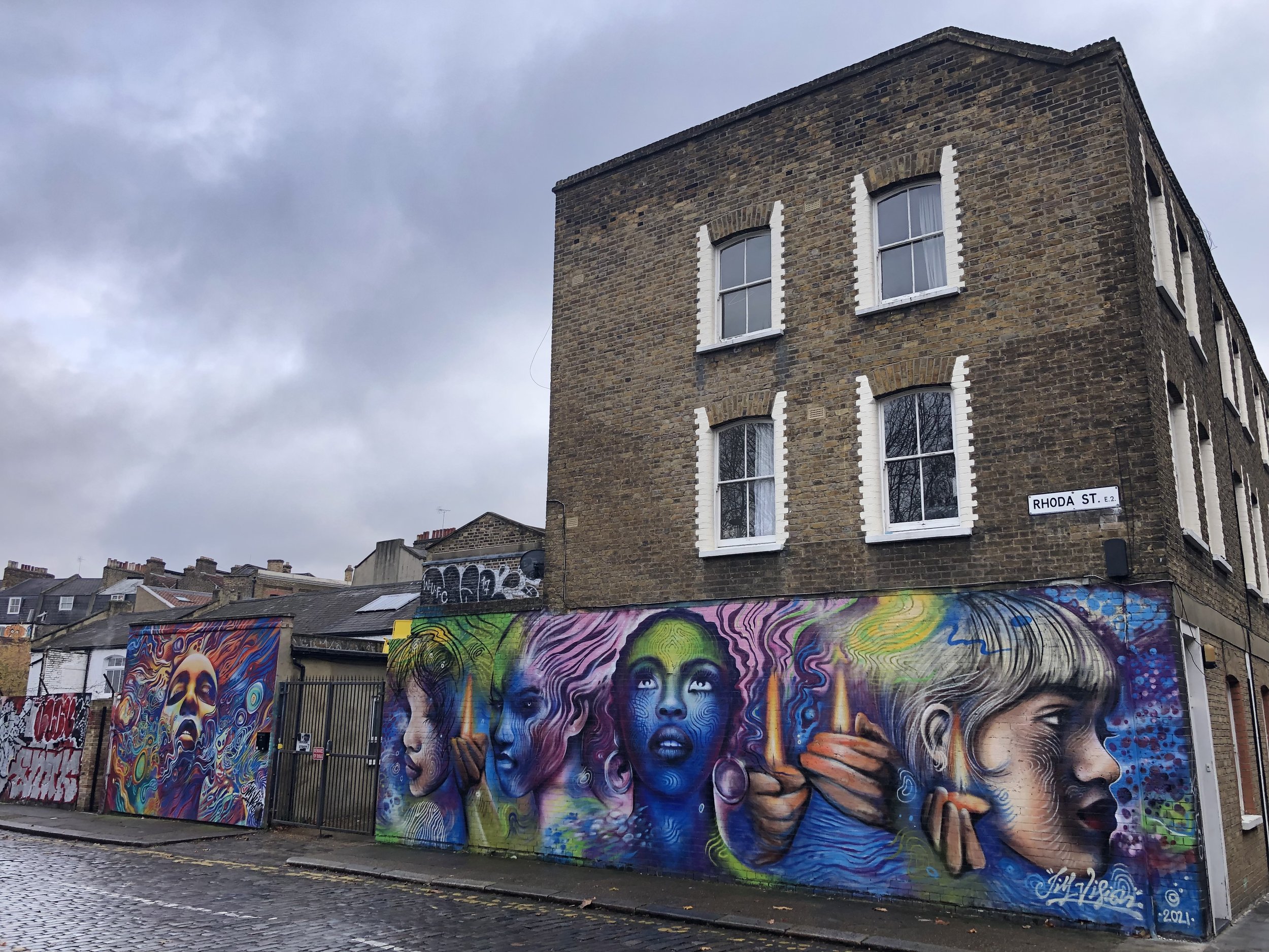
For the grand finale of the Central London high point trip I visited gentrified Shoreditch for the summit of Tower Hamlets. The bandstand on the route from Old Street Station is worth a visit. It’s higher than Swanfield Street but doesn’t count as it’s man-made. Look out for the mural on Rhoda Street next to the grassy mount that is the high point.
The Friends of Arnold Circus website tells of the fascinating history of Swanfield Street and the surrounding area. The street was at the heart of the weaving area. In the 18th century the area became a slum as cheaper imports impacted the industry and the slums were eventually replaced by the Victorian Boundary Estate. Thanks to Andy Sutcliffe for sharing this.