When: July 27th 2025
Where: The 3 Brewers of St. Albans, The Potato Shed, Symondshyde Farm, Symondshyde Lane, Hatfield AL10 9BB
Organiser: Racing Line Running
Distance: 10 km
Elevation: +/- 110m
Course: 2 lap loop of farmland to the north of the Brewery.
Other routes touched (Walk): Hertfordshire Way, The Romans and Nomansland Trail
Finish time: 57 minutes, 43 seconds
The Trig Pillar that stands in place of the northern Cannon
For anyone who has ever consulted an Ordnance Survey map, the precision and detail are immediately apparent. But few might realise that the foundations of this remarkable mapping endeavour lie in meticulously measured "baselines," and one of the most historically significant of these is the Salisbury Plain Baseline.
Established in 1794 by Captain William Mudge of the Royal Artillery, under the nascent Board of Ordnance (the precursor to today's Ordnance Survey), the Salisbury Plain Baseline was a crucial component of the "Principal Triangulation of Great Britain." This ambitious project aimed to accurately map the entire British Isles, driven in part by military considerations during a period of threatened French invasion.
The baseline on Salisbury Plain stretched for approximately 11.2 km between a point near Old Sarum Castle and Beacon Hill, east of Amesbury. The measurement was an incredibly painstaking process for the time. Surveyors used meticulously calibrated 100-foot steel chains, taking into account factors like temperature changes and the Earth's curvature. To mark the precise ends of this vital line, cannons were buried muzzle-up at both locations one of which can still be found today near Old Sarum, a testament to the enduring legacy of this work.
The significance of the Salisbury Plain Baseline cannot be overstated. By accurately measuring this fundamental distance, Mudge and his team could then use a large, precise theodolite (an instrument for measuring angles) to establish a network of triangles across the country. Through trigonometry, the precise positions of hundreds of landmarks could be determined, forming the bedrock for all subsequent, more detailed local surveys. The accuracy achieved by these early surveyors was remarkable; it's estimated that Mudge's overall survey across Britain was no more than 20 metres out compared to modern GPS measurements. The Salisbury Plain Baseline, therefore, stands as a tangible monument to the dawn of systematic, scientific mapping in Britain, a pivotal step in creating the detailed maps we rely on today.
Further Reading: Principal Triangulation of Great Britain
The Baseline route
I discovered the Hounslow Baseline in 2018 and cycled between the 2 cannons in Kingston and Heathrow. On discovering that there was another Baseline in Salisbury I was keen to cycle that too. I changed my plans when I discovered that you can’t cycle very close to the line itself. The route, which I drove instead, takes you along the busy A345, through Amesbury then onto the even busier A335 dual carriageway. Driving is much safer and there’s free parking spaces a short way from each cannon.
Salisbury Plain Baseline Cannon South
To access the southern cannon there’s a layby suitable for 5 cars opposite the Harvester Old Sarum Castle on Castle Road. If you’re visiting the Old Sarum English Heritage site you can also use their large car park although there is a charge.
Cross over the road to the eastern side and walk along the pavement in a northerly direction for approximately 500 metres until you reach the welcome to Salisbury sign. You’ll see the Mapping Monument Stone on the right of the pavement. Look behind the Monument Stone and you should be able to see the top of the Cannon poking up through the earth in the maize field. Some reports on Trigpointing say that they couldn’t see the Cannon due to hedge overgrowth or crops in the field but it was clearly visible on the day in July that I went.
Trigpointing.uk record: TP7570 - Salisbury Plain Baseline South
Salisbury Plain Baseline Cannon North
After the southern cannon drive north along the A345, then onto the A335 heading east after Amesbury. Shortly after the A3028 joins the road, pull into the small parking space at the side of the road. Be very careful getting out of the car here as it’s a very fast road.
Take the path on the left just east of the parking space and follow it up to the top of the hill. After ~650m you’ll reach the Trig Pillar, just off the main path. The Trig Pillar stands in place of the original cannon. From the pillar you can get great views across to Salisbury to the south-west.
Trigpointing.uk record: TP8928 - Salisbury Plain Baseline North
Trigpointing.uk record: TP0742 - Beacon Hill
Peakbagger record: Beacon Hill, England
Telegraph Hill is generally understood to be the highest point in the New Forest National Park. However, other sources list the high point as Piper’s Wait which is 0.5m higher. I had only discovered Piper’s Wait after having bagged Telegraph Hill, so I had to return a couple of years later to complete them both.
Telegraph Hill
Significance: New Forest National Park high Point
Member of: N/A
Nearest Higher Neighbour = Farley Mount
Elevation: 127m
Date “climbed”: December 28th 2022
Coordinates: 50° 56' 57'' N, 1° 40' 37'' W
On route of: N/A
Map: New Forest Map | Southampton, Ringwood, Ferndown, Lymington, Christchurch & Bournemouth | Ordnance Survey | OS Explorer Map OL22
Links: Wikipedia (New Forest), Peakbagger
Bagging Telegraph Hill is pretty simple as the high ground is at and around the car park. The car park can be a good base for walk around the area. We were there on a rainy day just after Christmas so opted for a quick drive-by instead. Two nearby OS Trig Pillars, Pound Bottom and Bramshaw can be bagged in either a walk based from the Telegraph Hill car park or as quick drive-bys.
The name Telegraph Hill is due to a semaphore telegraph station built here in 1795. The station was one of the points where the admiralty communications were transmitted to London. This station was on the uncompleted London to Plymouth line.
Piper’s Wait
Significance: New Forest National Park high Point (alternative)
Member of: N/A
Nearest Higher Neighbour = Farley Mount
Elevation: 128m
Date “climbed”: July 26th 2025
Coordinates: 50° 56' 52'' N, 1° 38' 53'' W
On route of: N/A
Map: New Forest Map | Southampton, Ringwood, Ferndown, Lymington, Christchurch & Bournemouth | Ordnance Survey | OS Explorer Map OL22
Links: Wikipedia (New Forest), Peakbagger
Piper’s Wait is an equally simple bag and worth doing in the same trip as it’s a very short drive from Telegraph Hill. There no need to wait 2.5 years between them like I did. Park at the Piper’s Wait Car Park, cross Forest Road and walk towards the reservoir. The natural high point is roughly half-way between the road and the reservoir. It’s very flat ground though, so use a GPS if you want to get to the exact point. It’s worth climbing up to the top of the reservoir for a better view.
View to the south from Ockley Hill
The North Downs Way is a National Trail that weaves its way for 153 miles (246 km) across the stunning landscapes of Surrey and Kent in southeast England. From its starting point in Farnham, Surrey, the trail extends eastward, culminating dramatically at the iconic White Cliffs of Dover in Kent. This well-marked route largely follows the chalk ridge of the North Downs, offering walkers a diverse range of terrain. You'll encounter ancient woodlands, chalk grasslands and panoramic views across the Weald.
Beyond its natural beauty, the North Downs Way is steeped in history. Sections of the trail closely trace the ancient Pilgrims' Way, a historic route used by pilgrims travelling to Canterbury Cathedral, famously immortalised in Chaucer's Canterbury Tales. Along the way, you'll encounter remnants of Roman roads, Norman castles like Rochester and Thurnham, and even Neolithic burial chambers such as Kit's Coty House. The trail passes through two designated National Landscape – the Surrey Hills and the Kent Downs – both recognised for their unique ecological importance and scenic charm. With excellent public transport links, including numerous train stations along its length, the North Downs Way is easily accessible, making it perfect for both multi-day expeditions and shorter day walks.
We completed the Surrey section of the North Downs Way in a series of 7 point-to-point walks over 2 years. This post details both the whole section through the Surrey Hills and links to the 7 individual sections. For further details there’s several books about the Trail and web resources including northdownsway.org and the National Trails’ site.
Point to Point: The full North Downs Way in The Surrey Hills
Start: Farnham Station, Farnham, GU9 8AG
Finish: The Velo Barn, Unit 1, Betsoms Farm, Pilgrims Way, Westerham TN16 2DS
Distance: 75 km (46.6 miles)
Elevation change: + 1,272m / - 1,186m. Net -86m
GPX File: get via Buy Me a Coffee
Maps:
- Guildford & Farnham Map | Godalming & Farnborough | Ordnance Survey | OS Explorer Map 145
- Dorking, Box Hill & Reigate Map | Leatherhead & Caterham | Ordnance Survey | OS Explorer Map 146
- Sevenoaks & Tonbridge Map | Royal Tunbridge Wells & Westerham | Ordnance Survey | OS Explorer Map 147
Guidebook: The North Downs Way National Trail from Farnham to Dover (Cicerone)
Links: LDWA: North Downs Way, National Trails: North Downs Way, northdownsway.org
See individual section posts linked below for other links.
Walking The North Downs Way in the Surrey Hills in 7 trips
If you’re not up for a 75km walk in one go, you can take in the North Downs in 7 point-to-point walks of between 9 and 13 km each. We chose this option, completing all 7 sections over a few years from 2021 to 2024.
Each number refers to a circular walk below. Base map: Esri Topo via RideWithGPS
Section 1: Farnham to Puttenham
Start: Farnham Station, Farnham, GU9 8AG
Finish: The Good Intent Pub, 60-62 The Street, Puttenham, Guildford, GU3 1AR
Distance: 10.6 km (6.6 miles)
Elevation change: +118m / -100m. Net +8m
Section 2: Puttenham to Newlands Corner
Start: The Good Intent Pub, 60-62 The Street, Puttenham, Guildford, GU3 1AR
Finish: Newlands Corner Car Park, A25 Shere Road, Newland's Corner, Albury, GU4 8S
Distance: 12.8 km (7.9 miles)
Elevation change: +256m / -181m. Net +75m
Section 3: Newlands Corner to Ranmore
Start: Newlands Corner Car Park, A25 Shere Road, Newland's Corner, Albury, GU4 8S
Finish: Ranmore Common East Car Park, Wotton, Dorking, RH5 6SR
Distance: 11.6 km (7.2 miles)
Elevation change: +128m / -107m. Net -21m
Section 4: Ranmore to Betchworth
Start: Ranmore Common East Car Park, Wotton, Dorking, RH5 6SR
Finish: Betchworth Station, Betchworth RH3 7BZ
Distance: 10 km (6.2 miles)
Elevation change: +192m / -292m. Net -100m
Section 5: Betchworth to Merstham
Start: Betchworth Station, Betchworth RH3 7BZ
Finish: Merstham Station, Station Rd, Merstham, Redhill, RH1 3ED
Distance: 11.1 km (6.9 miles)
Elevation change: +206m / -197m. Net -9m
Section 6: Merstham to Gangers Hill
Start: Merstham Station, Station Rd, Merstham, Redhill, RH1 3ED
Finish: Gangers Hill Car Park, Gangers Hill, Woldingham, Godstone, CR3 7AD
Distance: 11.8 km (7.3 miles)
Elevation change: +270m / -140m. Net -130m
Section 7: Gangers Hill to Westerham Hill
Start: Gangers Hill Car Park, Gangers Hill, Woldingham, Godstone, CR3 7AD
Finish: The Velo Barn, Unit 1, Betsoms Farm, Pilgrims Way, Westerham TN16 2DS
Distance: 9.1 km (5.6 miles)
Elevation change: +161m / -216m. Net -55m
If you’ve searched for or stumbled across this page then you probably already know what an OS Trig Pillar is. If you don’t then this article from the Ordnance Survey is a good place to start.
There were 30 OS Trig Pillars built in Greater London of which 24 are still in place. Of these some are on private land and are visible from a distance but not reachable. There’s a further 14 Trig Pillars that are outside of Greater London but inside of the M25. Special mention goes to TP9117 North Ockenden which is inside Greater London but outside of the M25.
I completed my mission to visit all accessible and visible Trig Pillars within Greater London and the M25. The definition of accessible is somewhat subjective though as some that I’ve listed as accessible are just off the public right of way. Looking at the logs, there’s others who have successfully bagged ones I’ve listed as inaccessible but I’ve taken a more risk-averse approach and avoided trespassing, causing damage or scaring animals. Always check the logs on Trigpointing.uk to see how easy it is to access a pillar.
The Map
Click on each icon to see the Trig Pillar name and a link to the page on Trigpointing.uk
The Spreadsheet
The Photos: Greater London Trig Pillars
No photo for TP5676 - Riddles Down
The Photos: Inside M25 but outside of Greater London Trig Pillars
The Log Sheet
If you would like a PDF version of my manual Greater London OS Trig Pillars Log Sheet, please BuyMeACoffee and let me know on the Contact Page. It’s a table of all Greater London Trig Pillars, plus a separate page for those outside of London but inside the M25. You can track your date completed and there’s space for your own Notes. It’s simple and you could easily make one yourself, but let me know if you want a copy of mine. 20% of each virtual coffee goes to one of the Causes that I support and the rest goes toward the running of this website.
When we think of historical English counties, Kent often conjures images of Canterbury Cathedral, hop fields, and a rich maritime past. But dig a little deeper into its administrative history, and you'll uncover a fascinating and uniquely Kentish set of subdivisions: the Lathes. Similar in concept to Sussex's Rapes, but with an even more ancient lineage, the Lathes of Kent represent a remarkable glimpse into Anglo-Saxon governance and the enduring legacy of early English kingdoms.
The term "Lathe" is believed to derive from an Old English word, possibly related to "læth," meaning a "division" or "district." These were large administrative and judicial units that predate the Norman Conquest, likely evolving during the Anglo-Saxon Kingdom of Kent. Unlike the more uniform shires that became common across much of England, the Lathes were particular to Kent and functioned as significant regional groupings, each with its own local assembly (or moot) and a degree of administrative autonomy. They effectively served as a tier of governance between the individual hundred (a smaller administrative unit) and the county as a whole.
Historically, Kent was divided into five main Lathes, each stretching roughly from the coast inland:
Sutton-at-Hone: The westernmost lathe, encompassing areas now part of Greater London.
Aylesford: Centred on the ancient crossing point of the River Medway at Aylesford.
Scray (or Shirley): A large central lathe, extending across much of mid-Kent.
St Augustine: Named after St Augustine's Abbey in Canterbury, reflecting its ecclesiastical importance.
Shepway: The southernmost lathe, bordering the coast and the Romney Marsh.
Having visited the high points of the Sussex Rapes in the previous year I set about visiting the high points of the Kent Lathes. I couldn’t find an established list of the Lathe High Points so I worked them out based on Trigpointing.uk and Peakbagger logs. Although I’m reasonably confident that these are the Lathe High Points, please leave a comment or reach me via the Contact form if you know of a different high point for any of the Lathes.
Lathe of Sutton-at-Hone
Highest Point: Betsom’s Hill
OS Trig Pillar: N/A
Links: Blog Post, Wikipedia, Wikishire, Peakbagger, Hillbagging
Flag Image Source: British County Flags
Lathe of Aylesford
Highest Point: Wrotham
OS Trig Pillar: TP7083 - Wrotham
Links: Blog Post, Wikishire, Peakbagger, Hillbagging
Flag Image Source: British County Flags
Lathe of Scray
Highest Point: Kingswood
OS Trig Pillar: TP4236 - Kingswood
Links: Blog Post, Wikipedia, Wikishire
Flag Image Source: British County Flags
Lathe of St Augustine
Highest Point: Farthingloe
OS Trig Pillar: TP3122 - Farthingloe
Links: Blog Post, Wikipedia, Wikishire
Flag Image Source: British County Flags
Lathe of Shepway
Highest Point: Paddlesworth
OS Trig Pillar: TP0449 - Paddlesworth
Links: Blog Post, Wikipedia, Wikishire
Flag Image Source: British County Flags
View to the south from nearby the high point
Significance: Highest point in the Kent Lathe of Aylesford
Parent Peak: Botley Hill
Nearest Higher Neighbour: Toys Hill
Elevation: 235m
Date “climbed”: 12th July 2025
Coordinates: 51° 19' N, 0° 17' E
Route Start / End: On street parking in Stansted village on Labour-In-Vain road west of the junction with Plaxdale Green Road.
Route Distance: 2.5 km (1.6 miles)
Route Elevation Change: +/- 31m
GPX File: get via Buy Me a Coffee
Other routes touched (walk): None
OS Trig Pillar: TP7083 - Wrotham
Map: Maidstone & the Medway Towns Map | Kent Downs | Ordnance Survey | OS Explorer Map 148
Links: Wikipedia: Stansted, Wikishire: Lathe of Aylesford, Peakbagger, Hillbagging
I visited the Wrotham Trig Pillar as a part of a mission to bag the High Points of the Kent Lathes, the historic sub-divisions of Kent. I couldn’t find an established list of the Lathe High Points so I worked them out based on Trigpointing.uk and Peakbagger logs. I’m pretty sure that Wrotham is the high point of the Lathe of Aylesford but please let me know if you think that the high point is somewhere else.
This is a short out-and-back walk from a parking space in Stansted village on Labour-In-Vain road west of the junction with Plaxdale Green Road. Walk south-east along Labour-in-Vain road, past the Hilltop Restaurant, then take the footpath on the right that crosses the A20. Continue along the footpath across the field and cross the bridge over the M20. Take the first footpath on the right to head in a south-westerly direction.
I was there in mid-summer and there were narrow, nettle-filled bushes surrounding the path but it was just about passable. Longer trousers and secateurs may have helped but it was OK apart from taking home a few scratches. There’s a lot of paths around the area and they didn’t exactly match up with the map so using the GPX file was very helpful here. Eventually I found the pillar in the middle of a thorny bush on the edge of a field.
Return via the same route, taking in the long views to the south.
When: July 13th 2025
Where: St. Martin's Field, New Romney, Kent
Organiser: Romney Marsh Rotary Club
Distance: 10 km
Elevation: +/- 24m
Course: 3 km arc out and back at start and end then a 4km loop near St Mary in the Marsh. Quiet country roads among wheat fields.
Other routes touched: None
Finish time: 57 minutes, 55 seconds
Significance: Highest point in the Lathe of Shepway
Elevation: 187m
Date “climbed”: 12th July 2025
Coordinates: 51°06'46.0"N 1°08'30.3"E
OS Trig Pillar: TP0449 - Paddlesworth
Map: Dover, Folkestone & Hythe Map | England Coast Path | Ordnance Survey | OS Explorer Map 138
Links: Wikipedia: (Lathe of Shepway, Paddlesworth), Wikishire: Lathe of Shepway
I visited the Paddlesworth Trig Pillar as a part of a mission to bag the High Points of the Kent Lathes, the historic sub-divisions of Kent. I couldn’t find an established list of the Lathe High Points so I worked them out based on Trigpointing.uk and Peakbagger logs. I’m pretty sure that Paddlesworth is the high point of the Lathe of Shepway but please let me know if you think that the high point is somewhere else.
This is a very quick drive-by bag. The pillar is in the grounds of a reservoir at the end of Fisher’s Lane in Paddlesworth. It’s private property but the pillar is very close to the gate. Easy to take a photo from a short distance or to hop over the gate to reach it.
View to Aycliffe and Dover Harbour from the descent from Farthingloe
Significance: Highest point in the Kent Lathe of St. Augustine
Elevation: 182m
Date “climbed”: July 12th 2025
Coordinates: 51°12'42.1"N 0°53'51.2"E
Route Start / End: On-street parking at junctions of St David’s Avenue and Old Folkestone Road, Aycliffe, Dover, CT17 9HJ, Kent
Route Distance: 1.8 km (1.1 miles)
Route Elevation Change: +/- 66m
GPX File: get via Buy Me a Coffee
Other routes touched (walk): none
OS Trig Pillar: TP3122 - Farthingloe
Map: Dover, Folkestone & Hythe Map | England Coast Path | Ordnance Survey | OS Explorer Map 138
Links: Wikipedia: Lathe of St Augustine, Wikishire: Lathe of St. Augustine, Dover Historian: Farthingloe
I visited the Farthingloe Trig Pillar as a part of a mission to bag the High Points of the Kent Lathes, the historic sub-divisions of Kent. I couldn’t find an established list of the Lathe High Points so I worked them out based on Trigpointing.uk and Peakbagger logs. I’m pretty sure that Farthingloe is the high point of the Lathe of St. Augustine but please let me know if you think that the high point is somewhere else.
This one can be a quick out-and-back if you know where to go. The area around the pillar is quite overgrown so be careful. Long trousers and secateurs are worth taking in the summer. If you’re driving there’s plenty of free on-street parking in Aycliffe.
From the corner of St. David’s Avenue and Old Folkestone Road take a path through a gate heading west then take the first footpath on the right to ascend the steep hill. Although the route up the the hill looks straight on the map you’ll need to navigate around and through bushes to get to the top. At the path junction take a left heading west.
The trig pillar is just off the path to the left. I missed it on the way out and ended up at the wheat field. The circle on the map below is where I ended up in some abandoned farm buildings in a thorny bush. It was an interesting accidental diversion but you don’t need to go that far.
The pillar is a rare English cylindrical one and the views from it, and the descent are well worth the scramble to it. Return to Aycliffe by the same route.
Start & Finish: Parking at Dover Patrol Memorial, Granville Road, St Margarets Bay, St Margaret's at Cliffe, Dover, CT15 6DS
Distance: 5.5 km (3.5 miles)
Elevation change: +/- 83m
GPX File: get via Buy Me a Coffee
Other routes touched (walk): Saxon Shore Way, England Coast Path, St Margaret’s Frontline Britain Trail
Other routes touched (cycle): NCN 1
OS Trig Pillar: TP4009 - Hope Farm
Pubs / Cafes on route: None
Map: Dover, Folkestone & Hythe Map | England Coast Path | Ordnance
Links: St Margaret's at Cliffe, Dover Patrol Memorial,
This is a short walk near St Margaret's at Cliffe in Kent that visits the most south easterly OS Trig Pillar in the UK. If you’ve searched for or stumbled across this page then you probably already know what an OS Trig Pillar is. If you don’t then this article from the Ordnance Survey is a good place to start.
The walk starts at the Dover Patrol Memorial where there’s a small free car park. Walk in a south westerly direction away from the Memorial and look out for a brown footpath sign indicating the St Margaret’s Frontline Britain Trail just before you reach the houses. Follow this path in a north-westerly direction until you reach The Droveway (road). Take a left onto The Droveway then take the footpath on the right that takes you to Kingsdown Road. Take a right onto Kingdown Road to follow it in a north-easterly direction for 1.1 km. The road quickly becomes a track which is part of the NCN 1 cycle route.
Leave the track at the path into the Bockhill Farm National Trust property and follow the left hand edge of the field to a path junction. When you reach some open scrubland cut across the to find the Trig Pillar on the golf-course side of the boundary fence. After the Trig Pillar follow the fence to the south east then turn left to follow the boundary path between the golf course and the edge of the farm. Look back to see a good view of the Trig Pillar across the golf course. Continue in a north-easterly direction along the field'/golf-course boundary then take the path on the right that leads down to the coastal path. Take a right onto the coastal path to follow it all the way back to the Memorial.
Significance: Highest point in the Kent Lathe of Scray
Elevation: 182m
Date “climbed”: 11th July 2025
Coordinates: 51°12'42.1"N 0°53'51.2"E
Route Start / End: Kings Wood Car Park, Challock, Ashford TN25 4AR
Route Distance: 450m (0.3 miles)
Route Elevation Change: +/- 3m
GPX File: get via Buy Me a Coffee
Other routes touched (walk): N/A
OS Trig Pillar: TP4236 - Kingswood
Map: Ashford Map | Headcorn, Chilham and Wye | Ordnance Survey | OS Explorer Map 137
Links: Wikipedia: Lathe of Scray, Wikishire: Lathe of Scray, Forestry England: Kingswood
I visited the Kingswood Trig Pillar as a part of a mission to bag the High Points of the Kent Lathes, the historic sub-divisions of Kent. I couldn’t find an established list of the Lathe High Points so I worked them out based on Trigpointing.uk and Peakbagger logs. I’m pretty sure that Kingswood is the high point of the Lathe of Scray but please let me know if you think that the high point is somewhere else.
This one is an easy drive-by bag from the Kingswood Forestry Commission Car Park. Take a left onto White Hill road and follow it for approx 150m. Enter the woods on the south side of the road and follow a faint path in the woods to find the Trig Pillar. You’ll notice a sign opposite the car park entrance saying “Private Wood. Keep Out”. I assume that this also covers the location of the Trig Pillar but it’s a very quick out-and back from the road without crossing any fences.
Old Eashing Bridge
Start and Finish: Crown Court Car Park, 41 The Burys, Godalming, GU7 1HR
Alternative Start and Finish: Godalming Station, Godalming GU7 1EU
Distance: 8.2 km (5.1 miles)
Elevation Change: +/- 90m
GPX File: get via Buy Me a Coffee
Other Routes Touched (walk): The Fox Way, Salgassens Path
Other Routes Touched (cycle): Surrey Cycleway
Cafe / pubs on route: Several at the start and end at Godalming. Plus: The Stag on the River (just off route at 4.2 km in)
Map: Guildford & Farnham Map | Godalming & Farnborough | Ordnance Survey | OS Explorer Map 145
Links: Wey Navigation, River Wey, Godalming, Eashing, Eashing National Trust
This is the ninth and last of a series of short circular walks along the River Wey and the Wey Navigation canal in Surrey. The guidance below will help you navigate but don’t use it as a fully accurate turn-by-turn guide. Always take a map and/or a GPX route and prepare well for the weather and terrain.
This walk picks up where section 8 left off at Godalming Station. If you’re driving there’s large car parks either at the station or at the Crown Court in the town centre. If you’re starting from the station head north onto Westbrook Road and take the Fox Way in an easterly direction to Borough Road. If you’re starting from the Crown Court Car Park then follow the Fox way in a westerly direction from the north-western corner of the car park to reach Borough Road.
Follow the path on the left hand side of Borough Road in a northerly direction then cross under the railway bridge. You’ll soon cross a cross bridge over Hell Ditch, a series of drainage channels following the northern side of the Wey near the town. Take the first path on the left after the railway bridge to leave Borough Road and follow Salgassens Path parallel to Hell Ditch.
This westerly-heading part of the walk is a quiet, pleasant section running by or close to the Wey as it meanders away from the town. We were there on a dry day buy I could imagine it being quite boggy after rain. There were a few bits that had recently been cut back and would likely be overgrown early summer.
Around the 4km mark the path ends at the road through Lower Eashing, rejoining the Fox Way. Take a left to follow the road over the National Trust Old Eashing Bridges. Take a right after the bridge to visit The Stag on The River pub. As well as a good place to rest half-way, this is the end of the walkable route next to the River Wey.
For the return section retrace your steps back to Eashing Bridge and follow the Fox Way. You’ll keep to the southern bank of the river for 200 metres before zig-zagging in an easterly direction back towards Godalming. When you reach New Way at the 6.5 km mark you have a choice: either take a left to follow the Fox Way back to Godalming Station or, the slightly longer route taking a right onto New Way to follow the railway line to Ockford Road then following Grove Road to Godalming High Street. I recommend taking the slightly longer route via the High Street to explore the old market town.
Previous section (north): Walking the River Wey Part 8: Guildford to Godalming
Bathwick Meadows
Start & Finish: Cleveland Walk Bus Stop on Bathwick Hill, Bath BA2 6EP
Distance: 9.4 km (5.8 miles)
Elevation change: +/- 169m
GPX File: get via Buy Me a Coffee
Other routes touched (walk): National Trust Family Discovery Trail
Other routes touched (cycle): None
Pubs / Cafes on route: None
Map: Bristol & Bath Map | Keynsham & Marshfield | Ordnance Survey | OS Explorer Map 155
Links: Bath, National Trust Bath Skyline
The Bath Skyline Walk offers a captivating escape into nature, just a stone's throw from the historic city of Bath. This National Trust trail winds through a diverse tapestry of landscapes, from ancient woodlands with dappled sunlight to open meadows bursting with wildflowers. As you traverse the route, you'll be treated to ever-changing, panoramic vistas that showcase Bath's iconic Georgian architecture, the winding River Avon, and the serene rolling hills beyond, providing a unique and breathtaking perspective of this UNESCO World Heritage city.
A good place to start is the Cleveland Walk Bus Stop on Bathwick Hill. Many people come here for the spectacular view of the city from Bathwick Meadows without actually doing the walk. If you are doing the walk then I recommend starting here and taking a clockwise direction so that you get to see the Bath city panorama as you approach the end of the walk. If you’re up for making the route a little bit longer you could also walk to the start from Bath City Centre or Bath Spa station. If you’re arriving by car and don’t want to pay the high city centre parking charges there’s free on-street parking on or near Cleveland Walk or North Road.
This post was originally published as the Run Report for Brickfields parkrun, Bath for Saturday June 28th 2025
Back in 2014 when I got my 50th parkrun Milestone T-Shirt I imagined a time in the far future when I get my 500th. It seemed so far off it was like Science Fiction back then. Based on a rough calculation of completing an average of 45 parkruns per year I worked out that I could complete 500 before my 50th birthday.
That plan would have happened if it wasn’t for Covid thwarting 70 weeks of parkrun opportunities. As we entered 2025, my year of turning 50, I worked out that I would do my 500th run just 6 weeks after my birthday. It also nicely coincided with a planned weekend in Bath with friends.
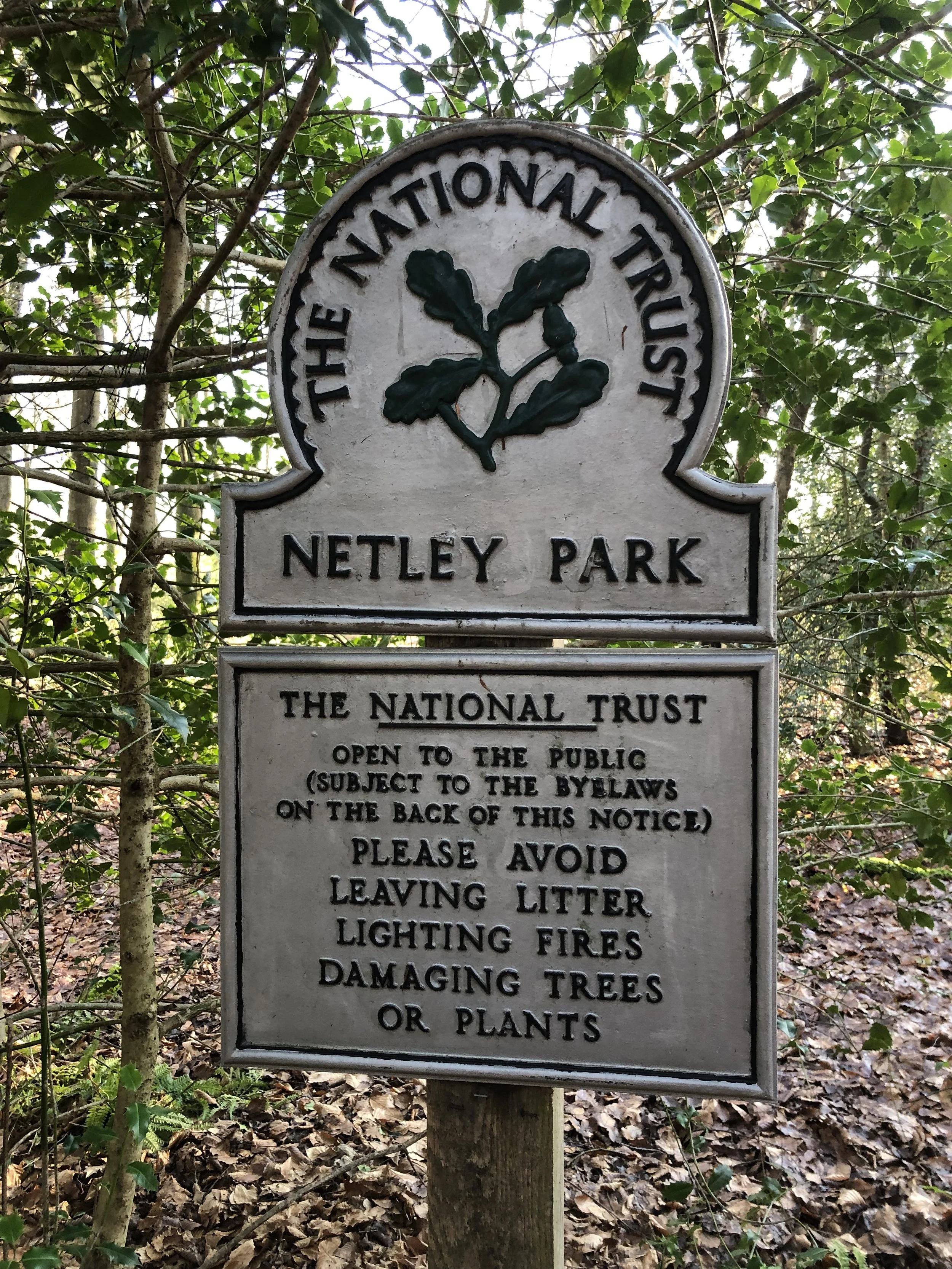
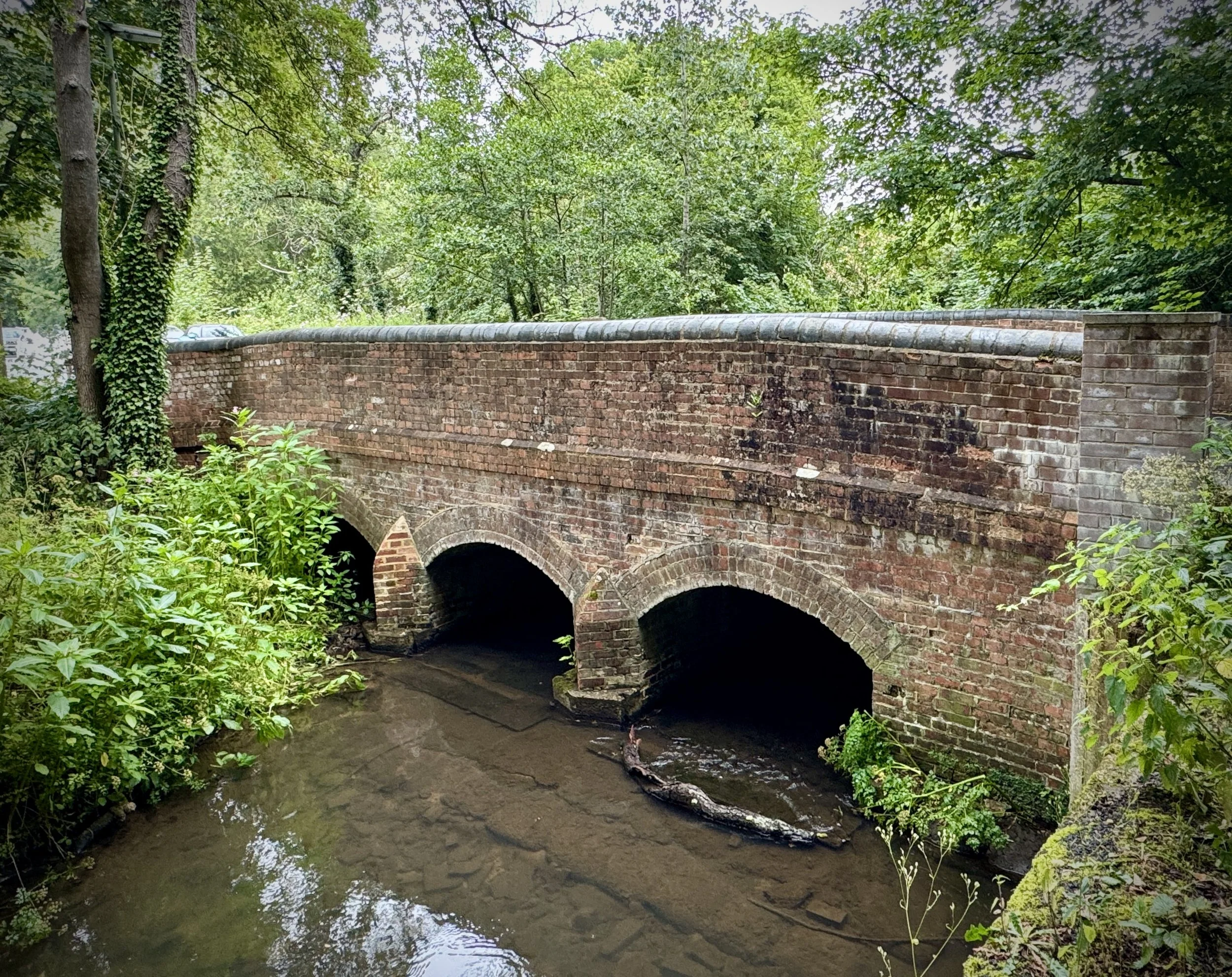
Having already done Bath Skyline earlier in the year I planned to do either Shepton Mallet or Somerdale Pavilion. My excitement grew when I noticed a brand new event pop up at Brickfields Park. It would also link to another obsession of mine, Disused Railways. With that the venue for my 500th run was set. It also set in motion a series of coincidences that would unfold during the day.
On hearing that my 500th would be in Bath, Paul, a colleague and fellow parkrun tourist, decided to also plan a weekend in Bath with his partner around the event. Coincidence #1 was that their hotel was just round the corner from our B&B. We planned to walk to the event together but after a late arrival on the Friday and some complicated logistics we decided to drive separately and meet at the start.
I arrived at 08:30 with my wife and the friends that we were staying with. Shortly ahead of the First Timers Briefing, Paul texted me to say they had parked a mile away and were on their way. That checked out as we also parked a mile away at the stadium. By the time of the start I couldn't see him but figured that he must be at the back of the group and I’d see him on the out-and-back sections. I didn’t see him at all so I thought that something must have gone awry.
On finishing the run I checked my phone to see a message from him at 09:01 to say “it’s Bath Skyline, right?”. I replied with a Facepalm emoji. He’d travelled from Manchester for a weekend away to be at the wrong parkrun. It was all caused by something wrong with his 5k app not showing new events, so Bath Skyline was the only Bath parkrun event that showed up for him.
The situation also meant that I had two 500 Milestone pre-event shoutouts at two different events on the same day. Yet another coincidence was that Paul had unknowingly booked dinner at the same restaurant at the same time as us later in the day.
The final coincidence was having an accidental race to the finish line with Danny Norman, host of the parkrun With Me Now Podcast. I had met Danny once before but too long ago that I didn’t recognise him. What I did notice was a guy in a 500 milestone T-shirt just ahead of me as I closed in on the finish line. My wife was at the line waiting to video my 500th finish and I thought it would be fun to cross the line next to a runner in a 500 shirt. I sped up a bit to slightly overtake him to get both of us in the video. It was only later in the morning when a different friend of mine noticed Danny in the results 1 second behind me.
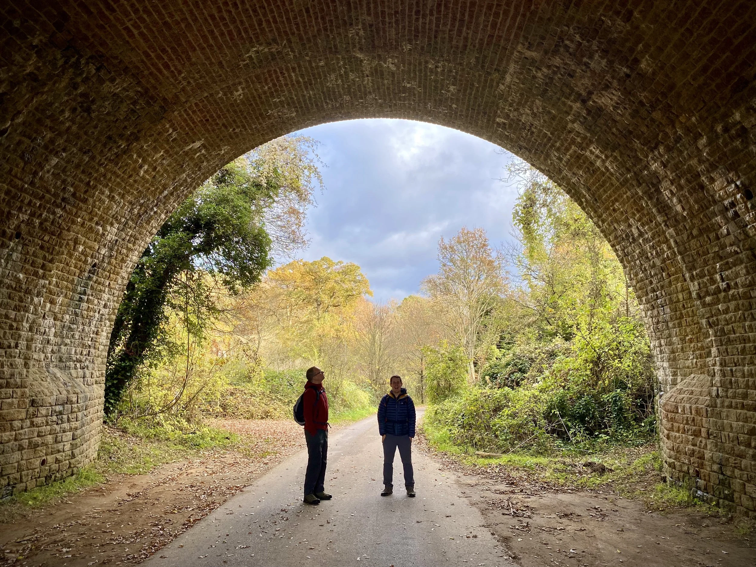
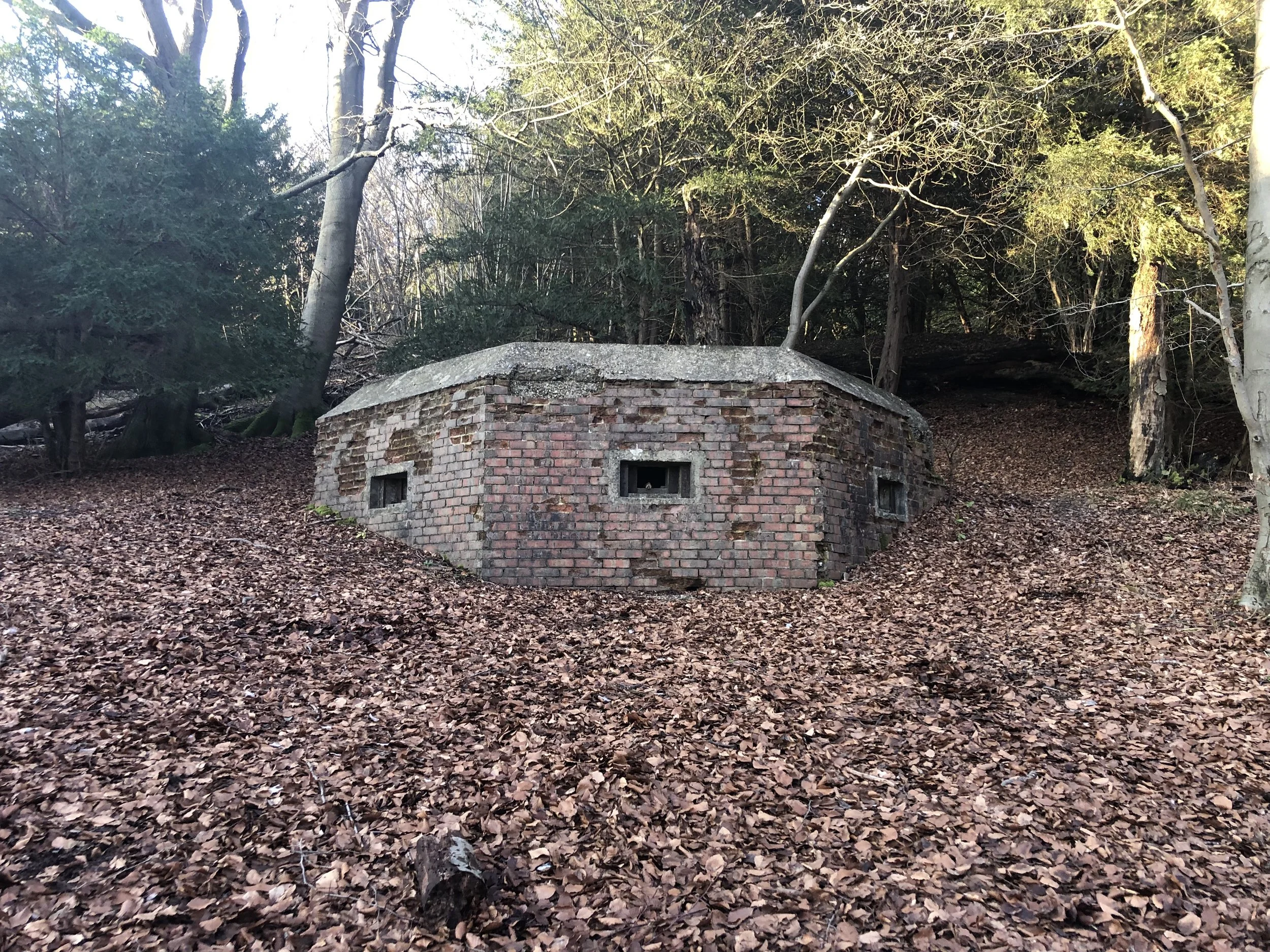
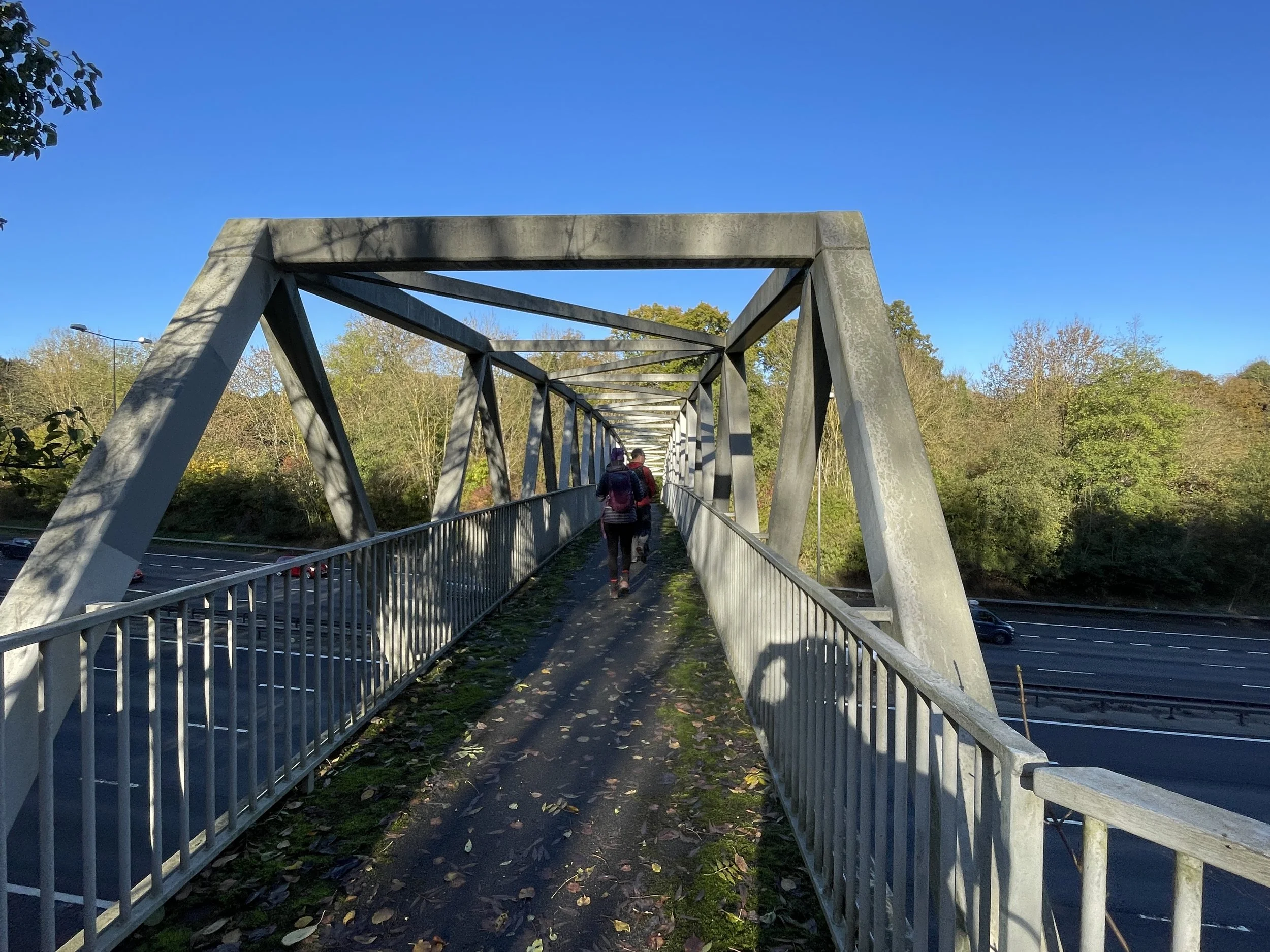
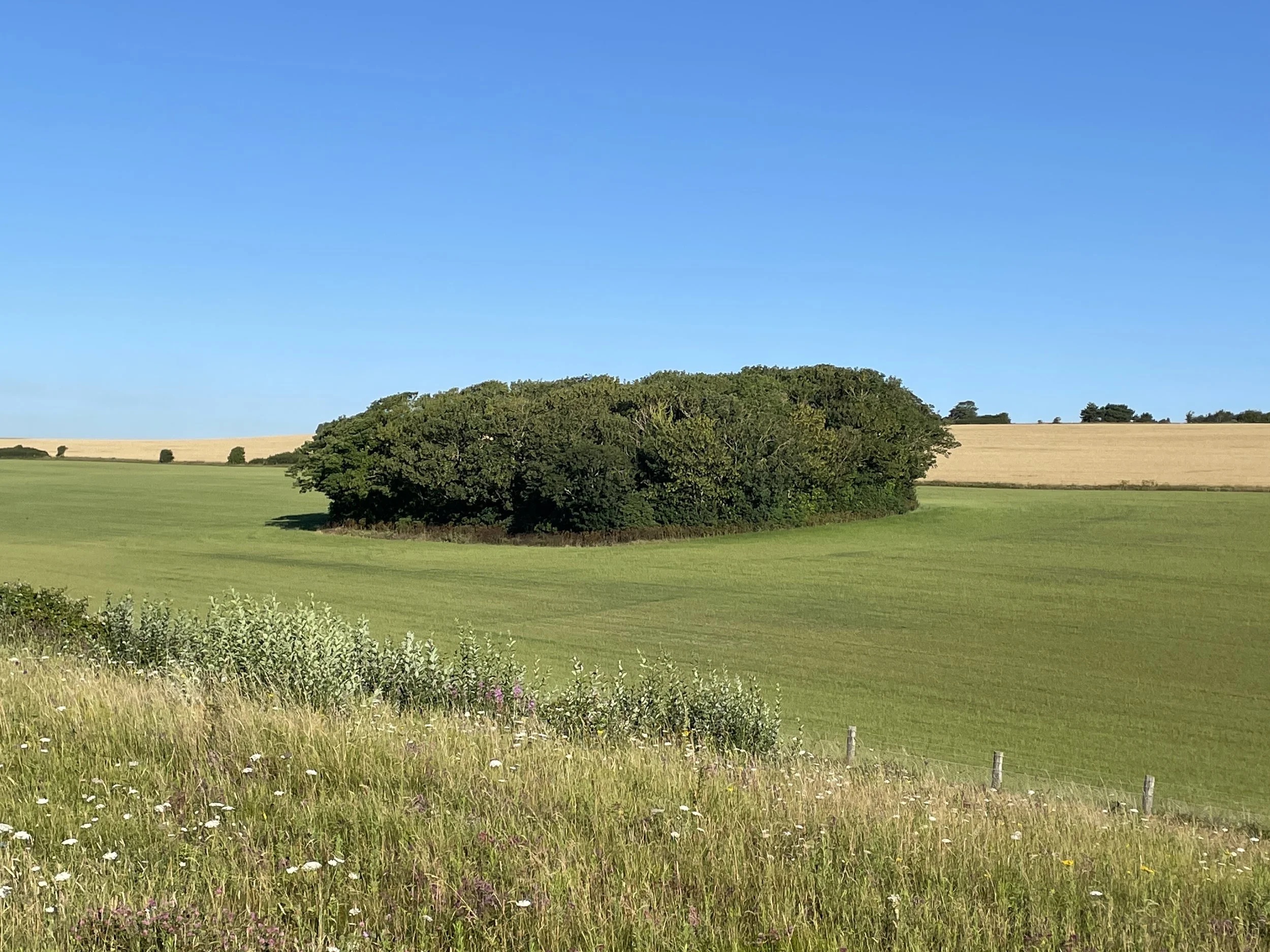
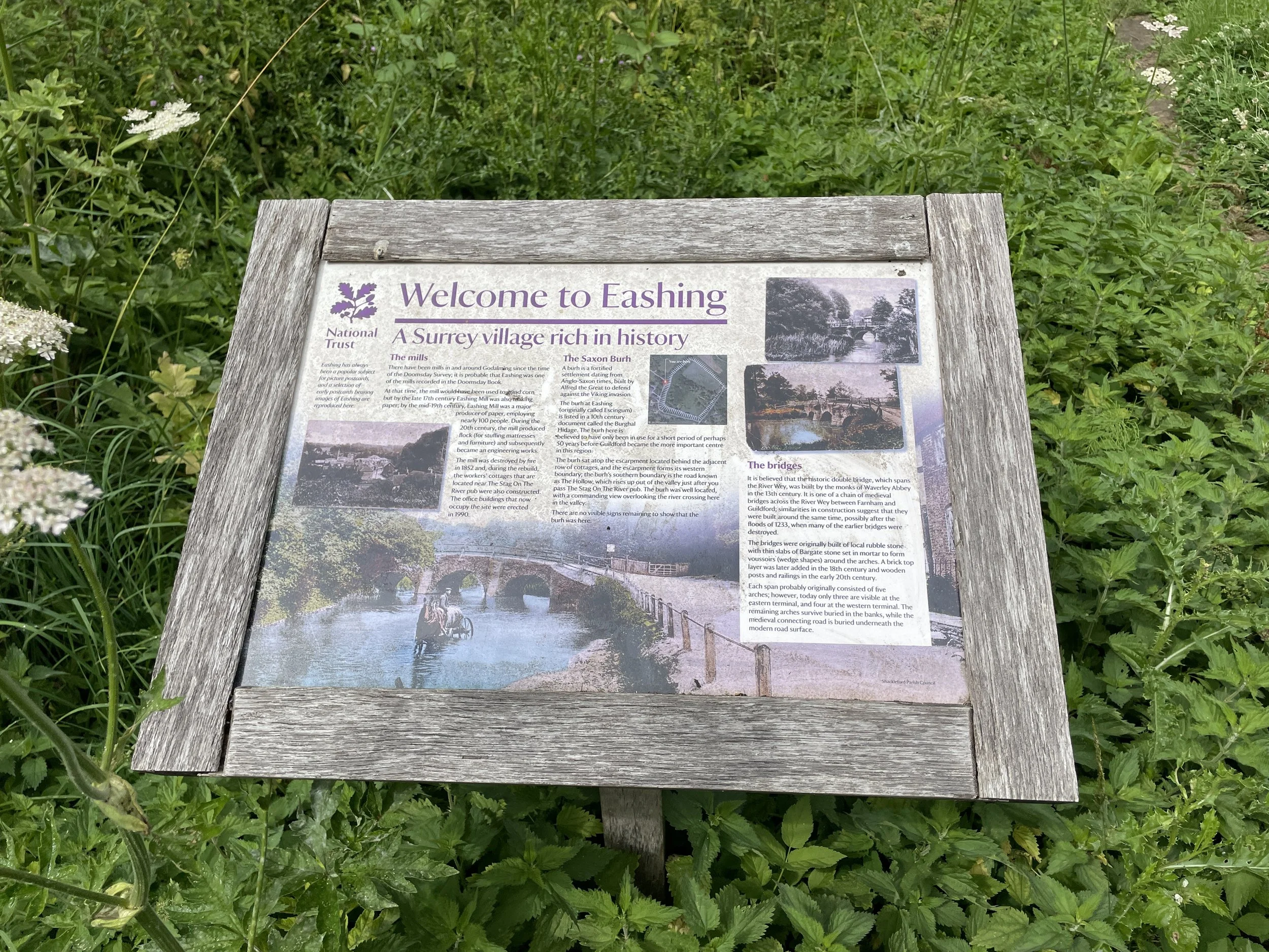
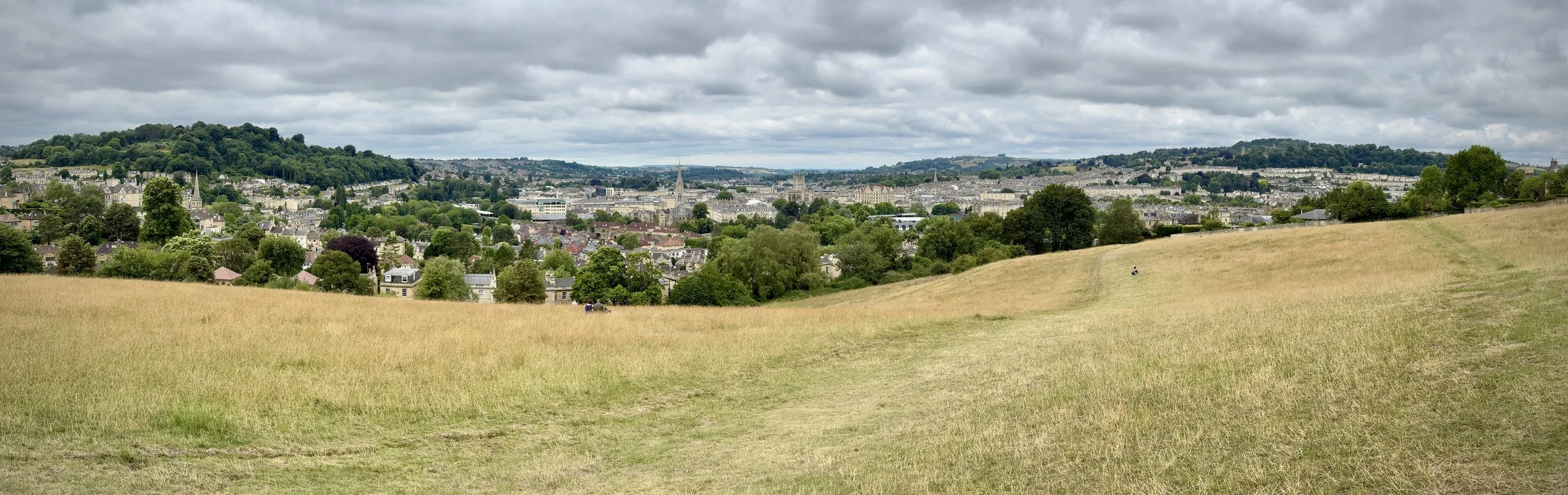
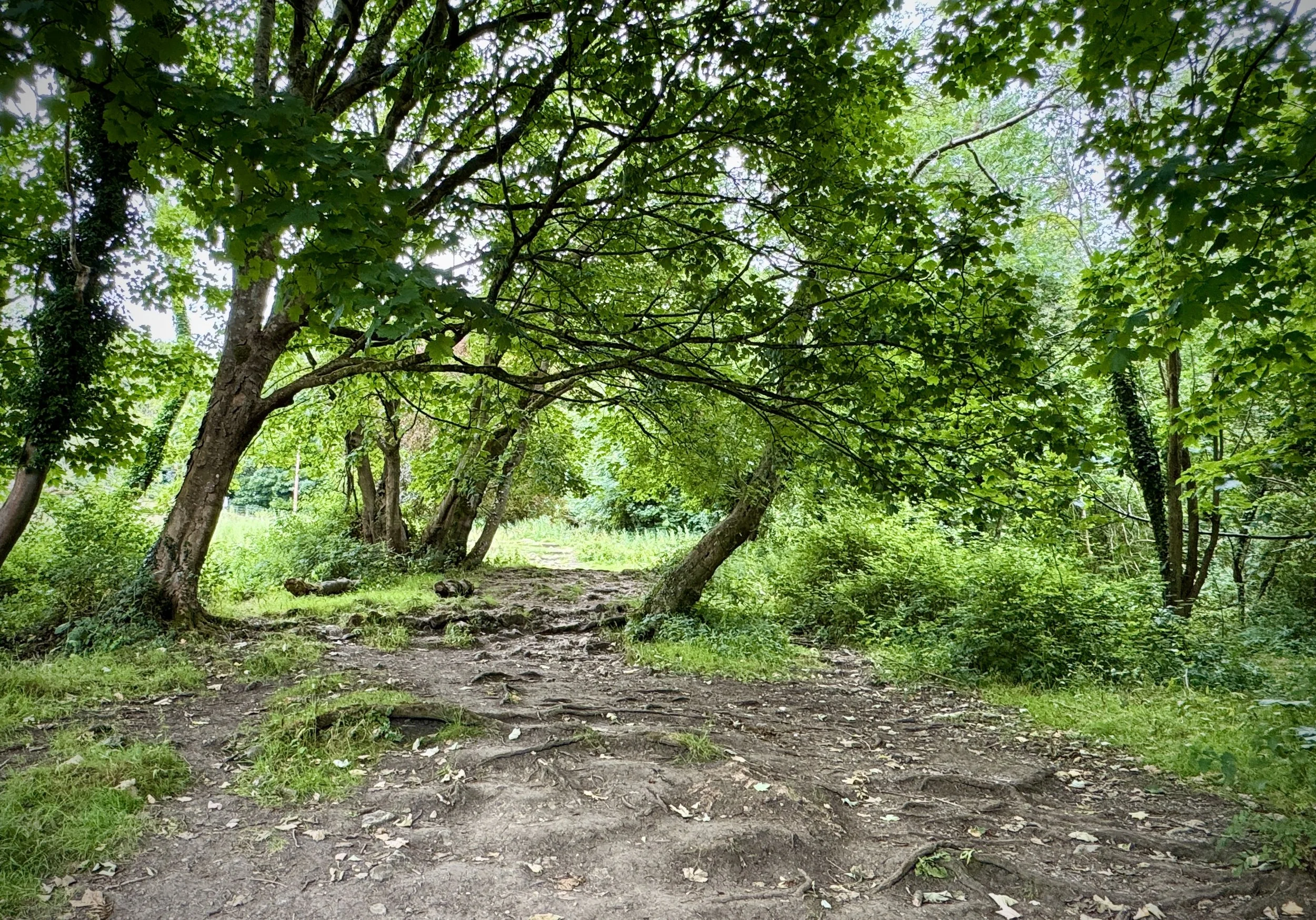
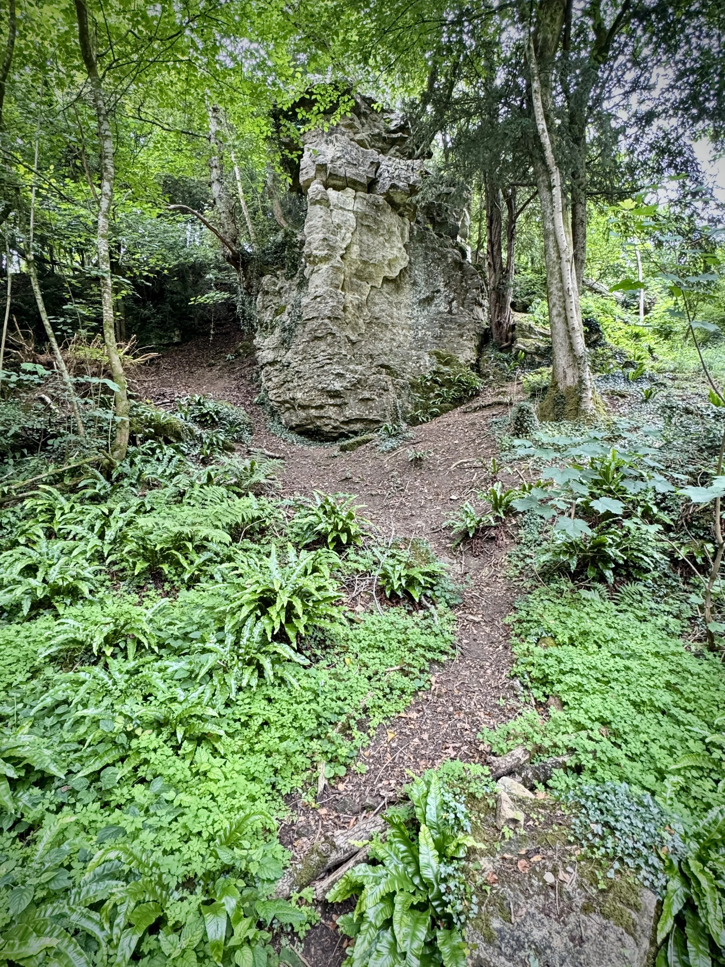
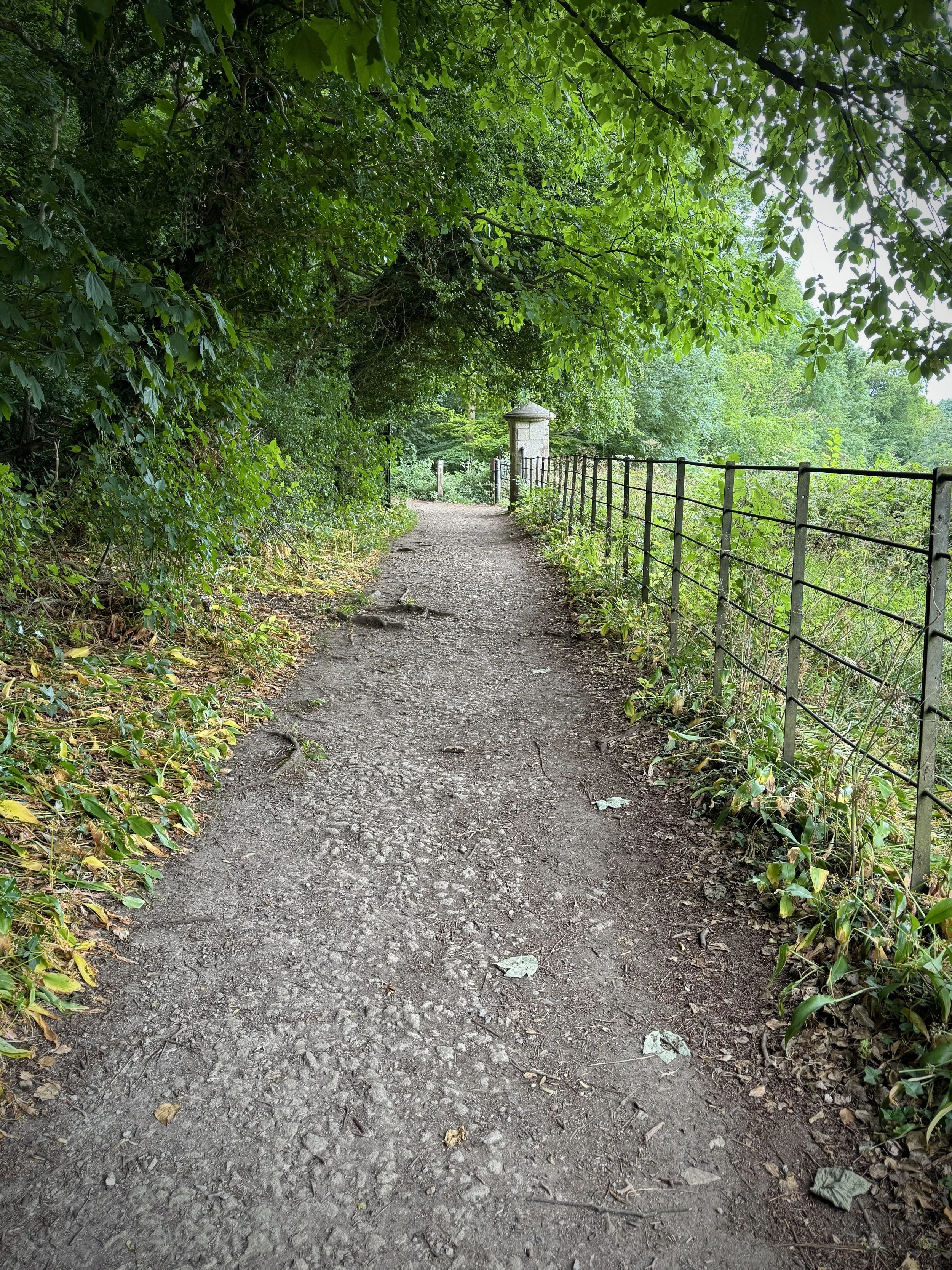
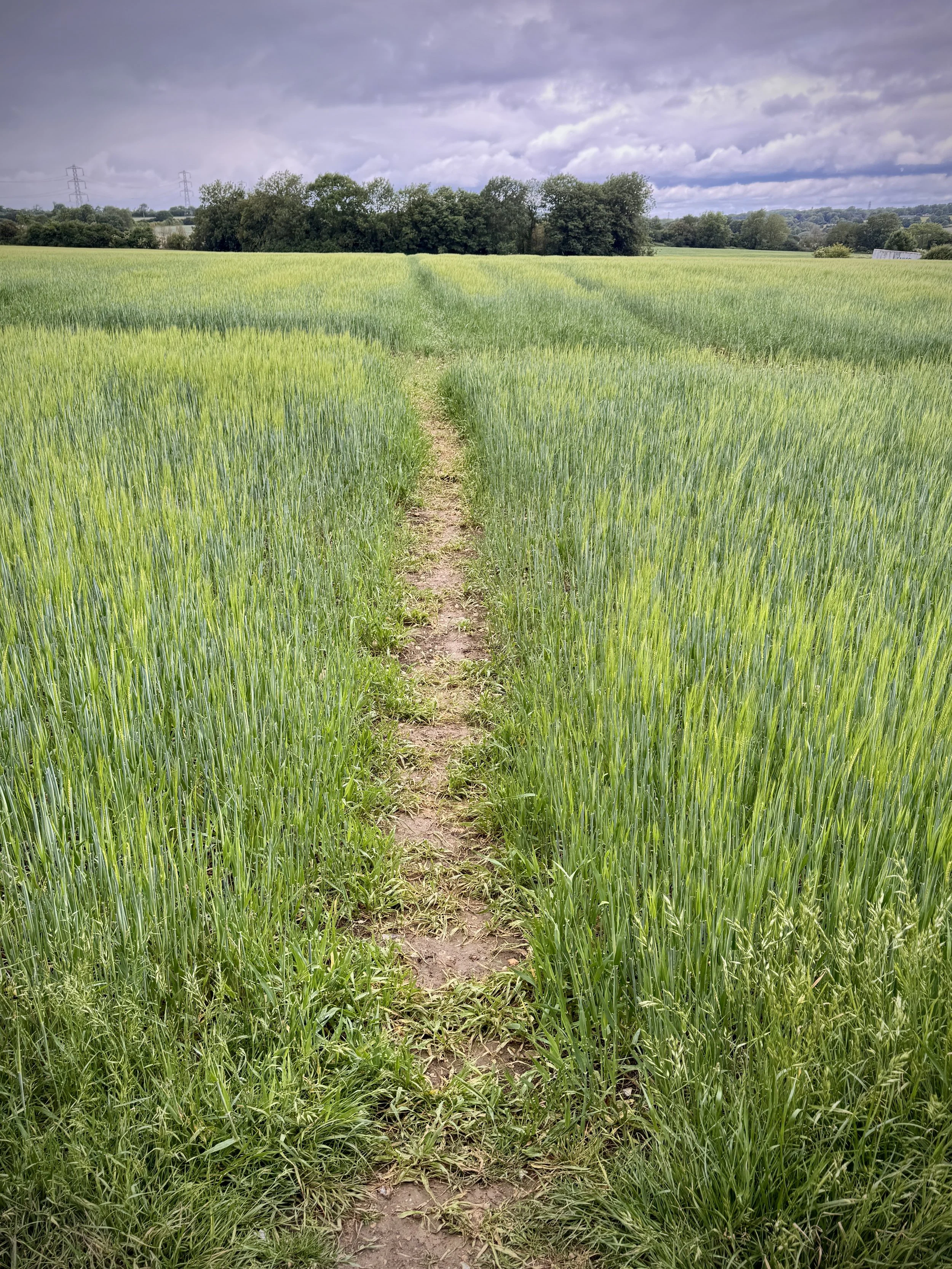
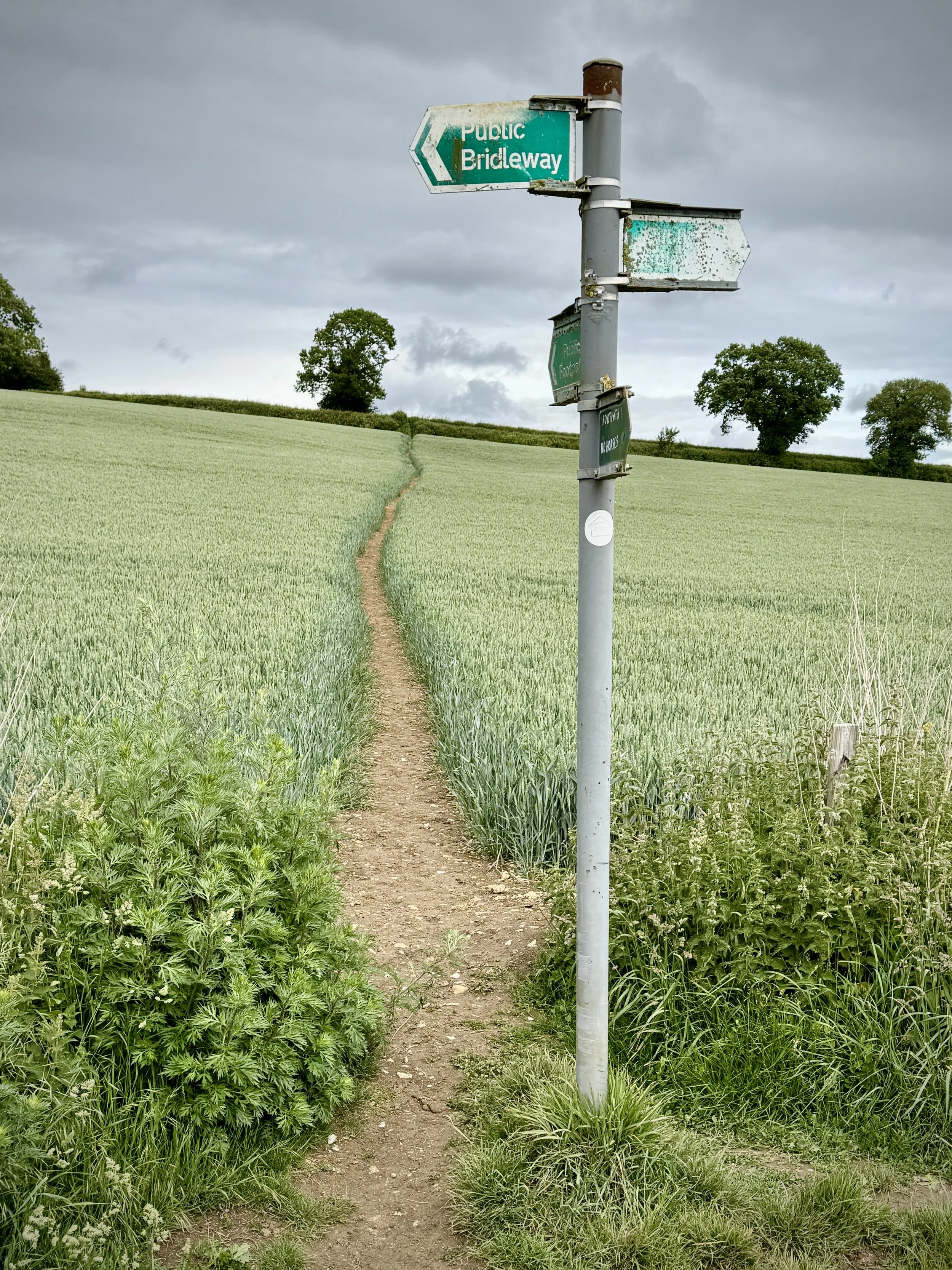
As well as all the funny coincidences, it was a lovely day for the run. It was a bright, warm summer day with a field of 282 runners and walkers. As a Disused Railway geek I loved the out-and-back on the old Somerset and Dorset Railway line.
First finisher was Harry McMurtrie coming in at 17:19 with a good spread of timings through to just over 1 hour. There were 174 First Timers to Brickfields Park and 32 PBs.
As always, a huge thanks to all of the volunteers who made the event possible. If you’ve not volunteered before or it’s been a while since you last did it, please consider signing up for one of your next events.
Thanks to everyone who helped make my 500th parkrun at Brickfields Park a fun and memorable event. A final special thanks goes to Neil Chapman who took me to my first parkrun on Boxing Day 2012. Saturday mornings have not been the same since.
More parkrun posts
parkruns are free, weekly, community 5k events all around the world. I started in December 2012 and have been obsessive about it ever since. See my parkrun Collection page for details.
Featured and popular parkrun posts:
Where the North Downs Way crosses the Wey Navigation
Start: Guildford Station, Guildford GU1 4UT
Finish: Godalming Station, Godalming GU7 1EU
Distance: 8.9 km (5.5 miles)
Elevation Change: +49m / - 42m. Net +7m
GPX File: get via Buy Me a Coffee
Other Routes Touched (walk): Wey Navigation Footpath, Wey-South Path, North Downs Way, Scholar’s Trail, Guildford and Shalford Disused Railways Walk, The Fox Way
Other Routes Touched (cycle): Surrey Cycleway
Cafe / pubs on route: Several at the start and end at Guildford and Godalming. Plus: The Ragged Robin (6.3 km in)
Map: Guildford & Farnham Map | Godalming & Farnborough | Ordnance Survey | OS Explorer Map 145
Links: Wey Navigation, River Wey, River Wey and Godalming Navigations (National Trust), Guildford, Godalming
This is the eighth of a series of short circular walks along the River Wey and the Wey Navigation canal in Surrey. The guidance below will help you navigate but don’t use it as a fully accurate turn-by-turn guide. Always take a map and/or a GPX route and prepare well for the weather and terrain.
Similar to Section 7 this is a station-to-station walk with a train connection between them. We parked near Guildford Station for the start of the walk and returned from Godalming Station at the end. There’s plenty of parking options at Guildford Station however we started 1 km away at Dapdune Wharf which has free parking for National Trust members.
Navigation is especially easy for this section as it follows the towpath on the north-western side of the canal for most of the way, crossing over to the southern side at Bridge Road Godalming. The only part to watch out for is at the start where the path across the islands at Millmead has been temporarily closed and you need to take a diversion of ~0.5km along Millbrook (A281), returning to the towpath after the Weyside pub.
Along the route you’ll pass the bridge where the North Downs Way crosses the canal with a very small beach next to it. We were there on a warm summer’s day and a lot of dogs were making the most of the beach for a dog party. Further down you’ll pass the disused section of the railway that once connected Shalford station to the mainline heading south. There’s also several WW2 Pill-boxes on the route guarding over the canal.
At Godalming you’ll reach the end of the navigable / canalised section. Beyond this the river Wey continues west towards Tilford where it splits with 2 sections leading to different sources. This is the final section of the Wey Navigation walks, but there’s one more walk that follows the river to Eashing.
Previous section (north): Walking the River Wey Part 7: Worpleston to Guildford
Next section (south): Walking the River Wey Part 9 - Godalming and Eashing
Ascent to Macdui with Loch Morlich in the background
Also Known As: Beinn Macduibh
Significance: Historic County Top for Aberdeenshire & Banffshire
Member of: UK County Tops, Scotland County/Unitary Authority High Points, Marilyns, Munros
Nearest Higher Neighbour: Ben Nevis
Elevation: 1,309m
Date climbed: June 13th 2025
Coordinates: 57° 4' 14'' N, 3° 40' 9'' W
Route Start & Finish: Cairngorm Mountain Upper Cas Car Park, Aviemore, PH22 1RB
Route Distance: 17.4 km (10.8 miles)
Route Elevation change: +/- 1.027m
Subsidiary tops on route: Ben Macdui - North Top (1,295m), Cairn Lochan (1,215m), Stob Coire an t-Sneachda (1,176m), Cairn Gorm - Fiacaill a' Choire Chois (1,141m), Cairn Gorm (1,244m)
GPX File: get via Buy Me a Coffee
Other routes touched (walk): Cairn Gorm Trail, Miadan Path
OS Trig Pillar: TP1286 - Ben Macdhui
Pubs / Cafes on route: Cairngorm Cafe at Cairngorm Mountain Base Station and at Ptarmigan Station
Map: Cairn Gorm & Aviemore: Sheet 403 (OS Explorer Map)
Links: Wikipedia: (Aberdeenshire / Banffshire / Ben Macdui), Peakbagger, Hillbagging
Ben Macdui is the Historic County Top for both Banffshire and Aberdeenshire and the 2nd highest of all of the UK County Tops. We bagged it in 2025 on our annual County Top weekend trip, along with the Historic County Tops of Nairnshire and Morayshire.
This was The Big One of our annual Scottish County Tops trips so far. Having worked our way through the southern Scottish summits it was now time to take on the 2nd highest summit in the UK. It was also the reason why we changed our trips from the end of September to mid-June. The Cairngorm plateau can be glorious in fine weather but dangerous in poor visibility. Moving to June would give us a highler chance of good weather and more hours of light to complete the trip. There’s several ways that you can approach Ben MacDui but we opted for a route that took in several other nearby peaks plus a trip on the Cairngorm Funicular.
Starting from the car park at the Cairngorm Mountain ski centre cross over the end of the ski runs to take the Cairn Gorm Trail in a south-westerly direction. After 4 km you’ll reach a split in the path where you’ll leave the Cairn Gorm Trail to keep on the Miadan Path heading south. You’ll reach the Trig Pillar at the summit of Ben Macdui after 8.5 km from the start.
At the summit we were grateful that we’d chosen to do the trip in June and that we had swapped from a rainy Saturday to a bright, dry Sunday. The views across the National Park were spectacular and made up for many cloudy ascents of UK high points in the past.
On a day of poor visibility the obvious route back would be to return the same way to the Base Station. As we had great weather and it was still early in the day we kept to our best-case plan and took the interesting route back, bagging more summits on the way. First up was Ben Macdui North-Top. This is just 700m from Ben Macdui summit and only 16m lower in elevation. From here you can decend carefully taking a north-westerly curve down the slope to rejoin the Miadan Path. Soon you’ll reach a split in the path where you’ll take the right-hand path heading north. At the 12 km mark leave the path to take a bearing up the slope to rejoin the Cairn Gorm Trail at the summit of Cairn Lochan.
After Cairn Lochan continue along the Cairn Gorm Trail in a north-easterly direction to the summit of Stob Coire an t-Sneachda then continue towards Cairn Gorm Mountain. Along the way you can take a minor diversion off the Trail to bag Fiacaill a' Choire Chois. After bagging Cairn Gorm, the 6th highest Munro, descend in a northerly direction to the Ptarmigan Station to visit the cafe, exhibition and the Funicular.
If you’re planning to take the Funicular check first that it’s running and don’t leave it too late in the day. We arrived an hour before the last train and were able to get onto one around 30 minutes after we arrived. If you miss the train or it’s not running you can also walk down via the Cairn Gorm Trail. Also note that you can only descend via the Funicular if you’ve been hiking as they don’t allow anyone out onto the hills if you’re using the train to ascend.
After the rain: descent of Carn a'Ghille Chearr
Significance: Historic County Top for Morayshire (formerly Elginshire)
Member of: UK County Tops, Scotland County/Unitary Authority High Points, Marilyns
Parent Peak:
Nearest Higher Neighbour: Creagan a' Chaise
Elevation: 710m
Date climbed: June 13th 2025
Coordinates: 57° 21' 4'' N, 3° 25' 53'' W
Route Start & Finish: Car park at Ballcorach off the B9136
Route Distance: 11.6 km (7.2 miles)
Route Elevation change: +/- 497m
Subsidiary tops on route: Carn Eachie (705m)
GPX File: get via Buy Me a Coffee
Other routes touched (walk): None
OS Trig Pillar: TP2604 - Cromdale
Pubs / Cafes on route: None
Map: OS Explorer OL61 Grantown-on-Spey & Hills of Cromdale
Links: Wikipedia: (Morayshire), Peakbagger, Hillbagging
Carn a'Ghille Chearr is the Historic County Top for Morayshire and the 33rd highest of all of the UK County Tops. We bagged it in 2025 on our annual County Top weekend trip, along with the Historic County Tops of Nairnshire, Aberdeenshire and Banffshire.
In our original plan we were going to do Ben Macdui on the Saturday of our weekend away but, on checking the weather, we moved it to the dryer Sunday and went for the shorter, easier walk of Carn a'Ghille Chearr instead. It turned out to be a good choice, but did mean that we hardly got any views. In Jonny Muir’s UK County Tops book he describes it as “a miserable trudge through sopping bog over grassy tussocks” on a miserable day. We had a miserable day and Jonny was 100% correct.
The start of the route is a small free car park at Ballcorach off the B9136. Before you start take a few minutes to walk down to the banks of the River Avon for a nice view of the river and the bridge that you will have just driven across. To start the walk, first head north keeping to the western side of the river. After ~200m take the footpath on the left heading towards the mountain.
The route is straightforward with just one path leading up to the Trig Pillar at the summit. The path is well defined for most of the way but loses itself in the bog near the point where is curves towards Carn Eachie. We were in drizzly cloud by then so we relied on the GPS to keep us on track. We had read that there’s remains of a crashed plane between Carn Eachie and the summit but we couldn’t find anything despite a bit of hunting. Maybe it would have been obvious on a clear day.
On the return to strayed off route a bit, taking a more direct route to the start, cutting off the big curve that we came up on.
Summit of Càrn Glas-choire
Significance: Historic County Top for Nairnshire
Member of: UK County Tops, Scotland County/Unitary Authority High Points, Marilyns, Grahams
Nearest Higher Neighbour: Geal-charn Mor
Elevation: 659m
Date climbed: June 13th 2025
Coordinates: 57° 20' 22'' N, 3° 50' 36'' W
Route Start & Finish: Parking spot 200m south of farm track to Aucherteang Cottage on the B9007.
Route Distance: 13.1 km (8.1 miles)
Route Elevation change: +/- 385m
Subsidiary tops on route: None
GPX File: get via Buy Me a Coffee
Other routes touched (walk): None
OS Trig Pillar: TP1956 - Carn Glas Choire
Pubs / Cafes on route: None
Map: Lochindorb, Grantown-on-Spey & Carrbridge Map | Caingorms National Park | Ordnance Survey | OS Explorer Map OL60
Links: Wikipedia: (Nairnshire), Peakbagger, Hillbagging
Càrn Glas-choire is the Historic County Top for Nairnshire and the 40th highest of all of the UK County Tops. We bagged it in 2025 on our annual County Top weekend trip, along with the Historic County Tops of Morayshire, Banffshire and Aberdeenshire.
We picked Càrn Glas-choire as the first of our weekend walks as it’s roughly 45 minutes from Inverness airport and on the way to Aviemore where we were staying. There’s not many options for parking but fortunately it’s not a popular mountain so it wasn’t a problem. We found a parking spot next to a gate a few minutes walk to the south of the route.
First find the track off the B9007 with the sign to Auchterteang Cottage and follow it in a north-easterly direction through the farm. The path soon crosses over Duthill Burn and continues to meander up the mountain to the trig point at the summit. It’s a well maintained path and navigation is simple. The only time that we needed to rely on our GPS was to check the return route down from the cloudy top.
We returned by the same route, completing the whole trek in just over 3 hours. After returning to the car we headed for a whisky at Glenlivet Distillery, a 10 minute drive away. It was a nice warm-up for the weekend but I don’t think this one will stand out in our memories of the full set of County Tops.
Approaching Flamstead with rain clouds behind
Start & Finish: Flamstead Recreation Ground, St Albans AL3 8BS
Distance: 12 km (7.5 miles)
Elevation change: +/- 135m
Hertfordshire Way section covered: Babies Wood to Flamstead: 4.3 km
GPX File: get via Buy Me a Coffee
Other routes touched (walk): Hertfordshire Way, Chiltern Way, Ver Valley Walk
Other routes touched (cycle): Chilterns Cycleway
Pubs / Cafes on route: The Spotted Dog or Three Blackbirds at the start in Flamstead. Several in Markyate, just off route at 2.8 km
Map: St Albans & Hatfield Map | Hemel Hempstead & Welwyn Garden City | Ordnance Survey | OS Explorer Map 182
Links: Flamstead, Markyate
The Hertfordshire Way offers an incredible opportunity to circumnavigate one of England's home counties, revealing its hidden charms and surprising variety. This circular long-distance footpath, stretching around 273 km (170 miles), guides walkers through the county's most picturesque landscapes, proving that green spaces are never far, even in this area close to London. We walked the Chilterns part of the Hertfordshire Way in 15 sections over a couple of years. We used my “Greater Chilterns” definition that takes the trail from the River Lea near Wheathampstead to the River Colne near Garston. This route is one of those 15 circular walks.
The guidance below will help you navigate but don’t use it as a fully accurate turn-by-turn guide. Always take a map and/or a GPX route and prepare well for the weather and terrain.
For this walk we parked at the free parking at Flamstead Recreation Ground off Hollybush Lane. From pick up the Hertfordshire Way on a footpath heading west, just south of Friendless Lane. Follow the path onto Friendless Lane then take a path on the right to cross farmland in a north-westerly direction to Markyate.
The Hertfordshire Way takes a loop around Markyate following Pickford Road and Buckwood Road then takes a southerly course across fields to Roe End Lane. Take a right onto Roe End Lane then a left onto a track to reach Beechwood Park Drive. Shortly after Beechwood Park School take a right to cross fields and woodland in a southerly direction until you meet the Chiltern Way at Gaddesden. Take a left onto the Chiltern Way and follow it in a north-easterly direction back to Flamstead.
Hertfordshire Way next section clockwise: Flamstead and Redbourn
Hertfordshire Way next section anti clockwise: Great Gaddesden and Gaddesdon Row