Walking The Bath Skyline
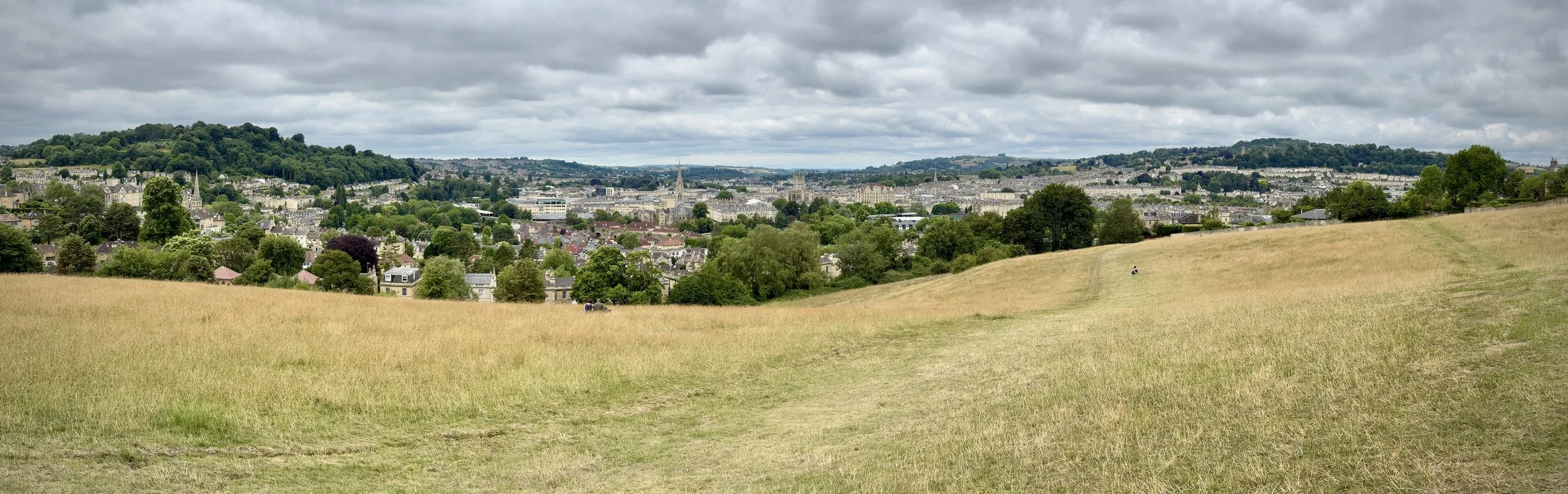
Bathwick Meadows
Start & Finish: Cleveland Walk Bus Stop on Bathwick Hill, Bath BA2 6EP
Distance: 9.4 km (5.8 miles)
Elevation change: +/- 169m
GPX File: get via Buy Me a Coffee
Other routes touched (walk): National Trust Family Discovery Trail
Other routes touched (cycle): None
Pubs / Cafes on route: None
Map: Bristol & Bath Map | Keynsham & Marshfield | Ordnance Survey | OS Explorer Map 155
Links: Bath, National Trust Bath Skyline
The Bath Skyline Walk offers a captivating escape into nature, just a stone's throw from the historic city of Bath. This National Trust trail winds through a diverse tapestry of landscapes, from ancient woodlands with dappled sunlight to open meadows bursting with wildflowers. As you traverse the route, you'll be treated to ever-changing, panoramic vistas that showcase Bath's iconic Georgian architecture, the winding River Avon, and the serene rolling hills beyond, providing a unique and breathtaking perspective of this UNESCO World Heritage city.
A good place to start is the Cleveland Walk Bus Stop on Bathwick Hill. Many people come here for the spectacular view of the city from Bathwick Meadows without actually doing the walk. If you are doing the walk then I recommend starting here and taking a clockwise direction so that you get to see the Bath city panorama as you approach the end of the walk. If you’re up for making the route a little bit longer you could also walk to the start from Bath City Centre or Bath Spa station. If you’re arriving by car and don’t want to pay the high city centre parking charges there’s free on-street parking on or near Cleveland Walk or North Road.