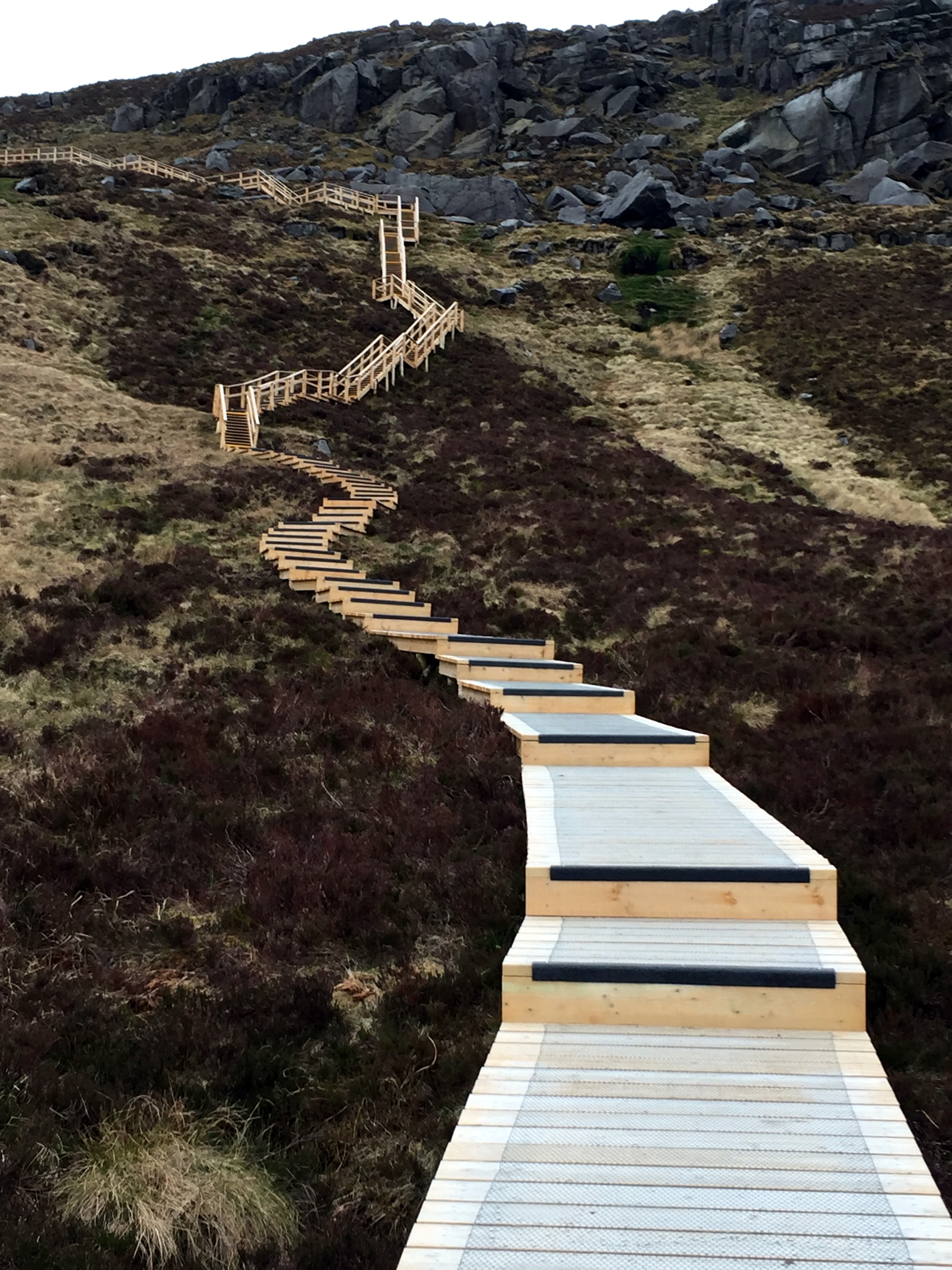
Zip-lining at Bethesda, Wales

Zip-lining at Bethesda, Wales
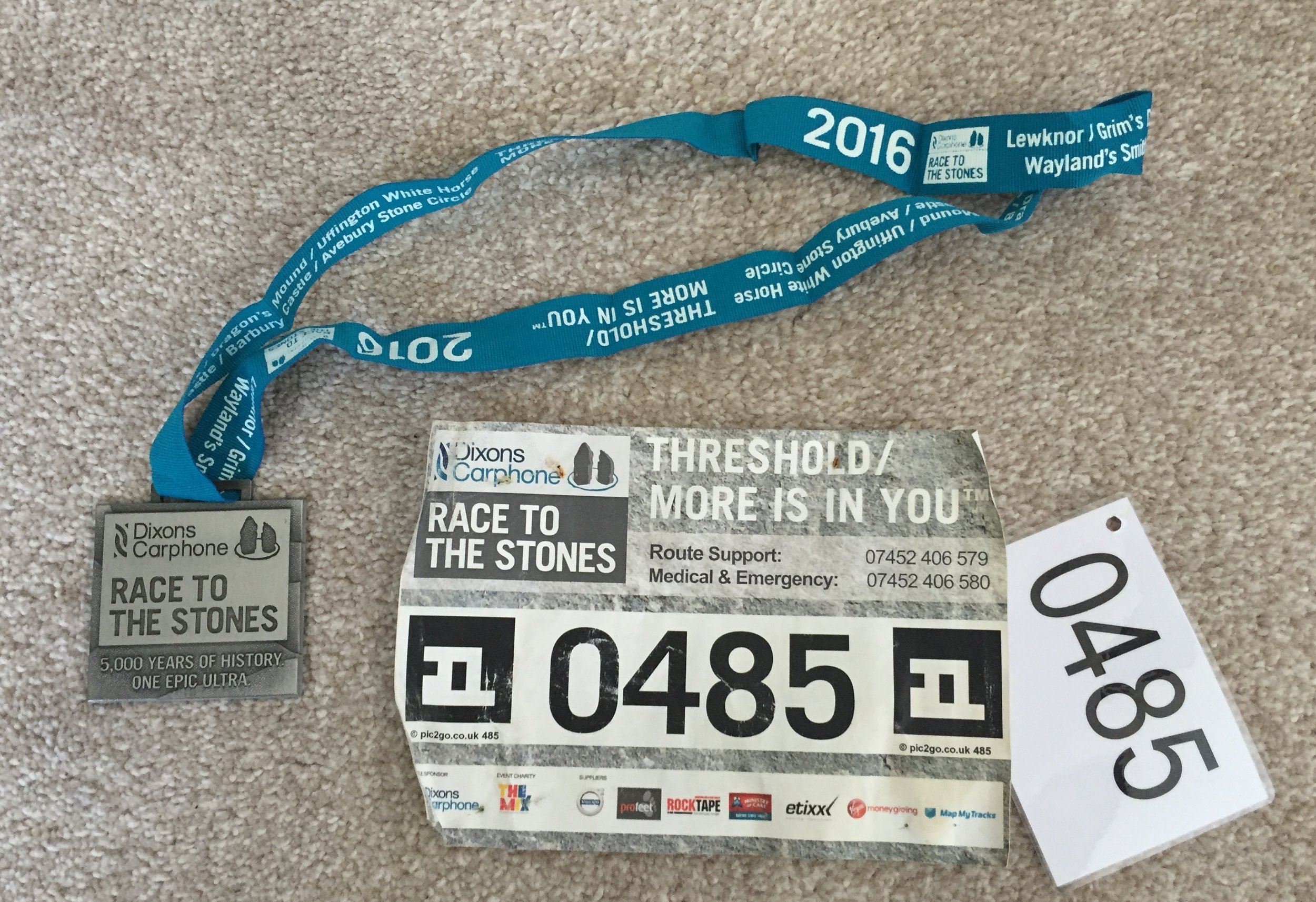
When: July 17th 2016
From: Field Farm, Shirburn Road, Lewknor, Oxfordshire
To: Avebury, Wiltshire
Distance: 100.8 km (62.3 miles)
Elevation change: +640m / - 611m. Net +29m
GPX File: get via Buy Me a Coffee
Other routes touched (walk): The Ridgeway, Shakespeare’s Way, Chiltern Way, Chiltern Way South Extension, Thames Path, Lambourne Valley Way, D’Arcy Dalton Way, White Horse Circular Walk, White Horse Trail, Great Stones Way, Avebury Archaeology Walk, Wessex Ridgeway, Oxfordshire Way
Other routes touched (cycle): Chilterns Cycleway, NCN 254, 403, 45, 482
Maps:
- OS Explorer Map (171) Chiltern Hills West, Henley-on-Thames and Wallingford
- OS Explorer Map (170) Abingdon, Wantage and Vale of White Horse
- OS Explorer Map (169) Cirencester and Swindon, Fairford and Cricklade
- OS Explorer Map (157) Marlborough and Savernake Forest
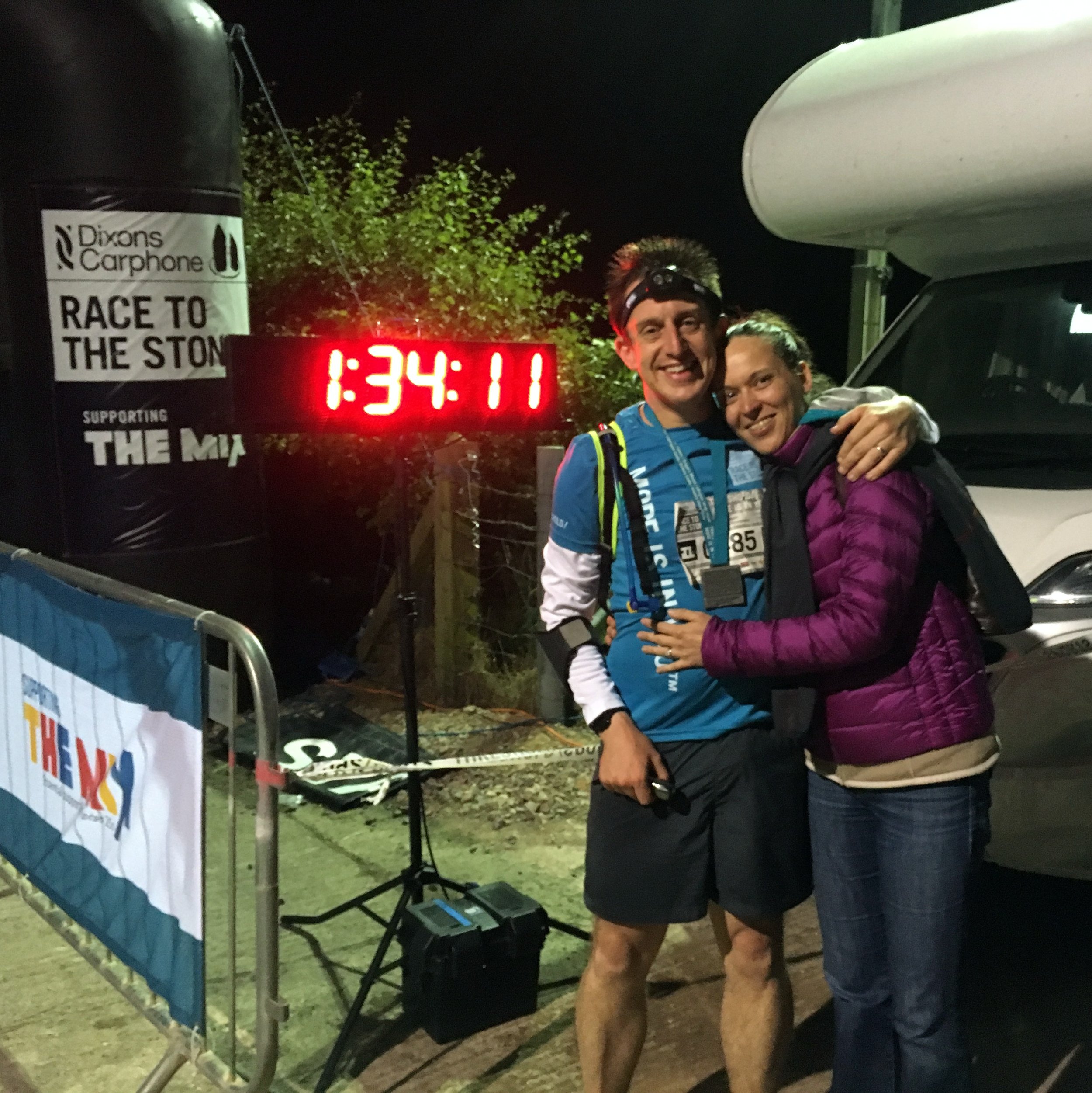
Finish time: 17 hours 33 minutes
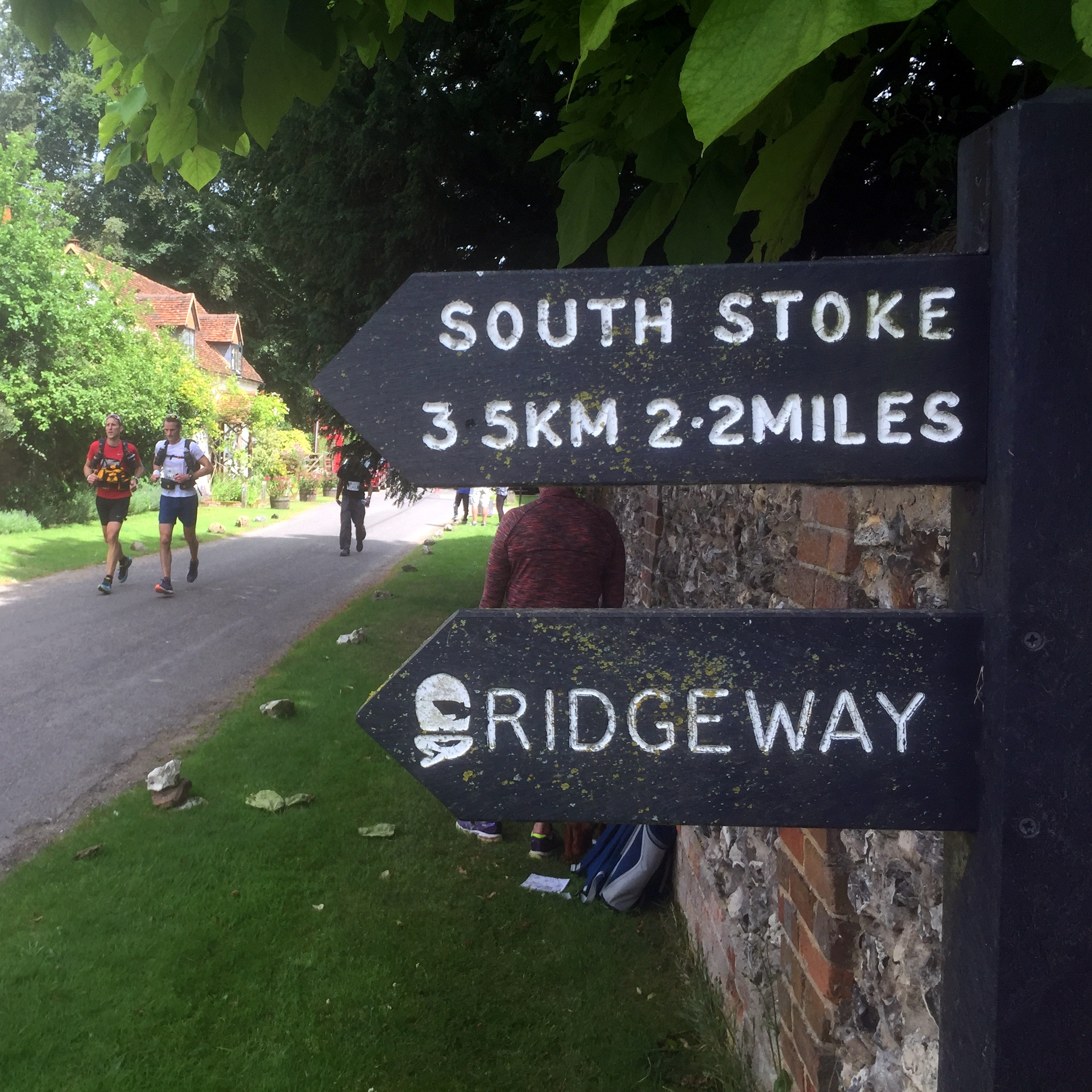
Links: The Ridgeway, Lewknor, South Stoke, Goring, Streatley, Ogbourne St George, Avebury, Avebury National Trust
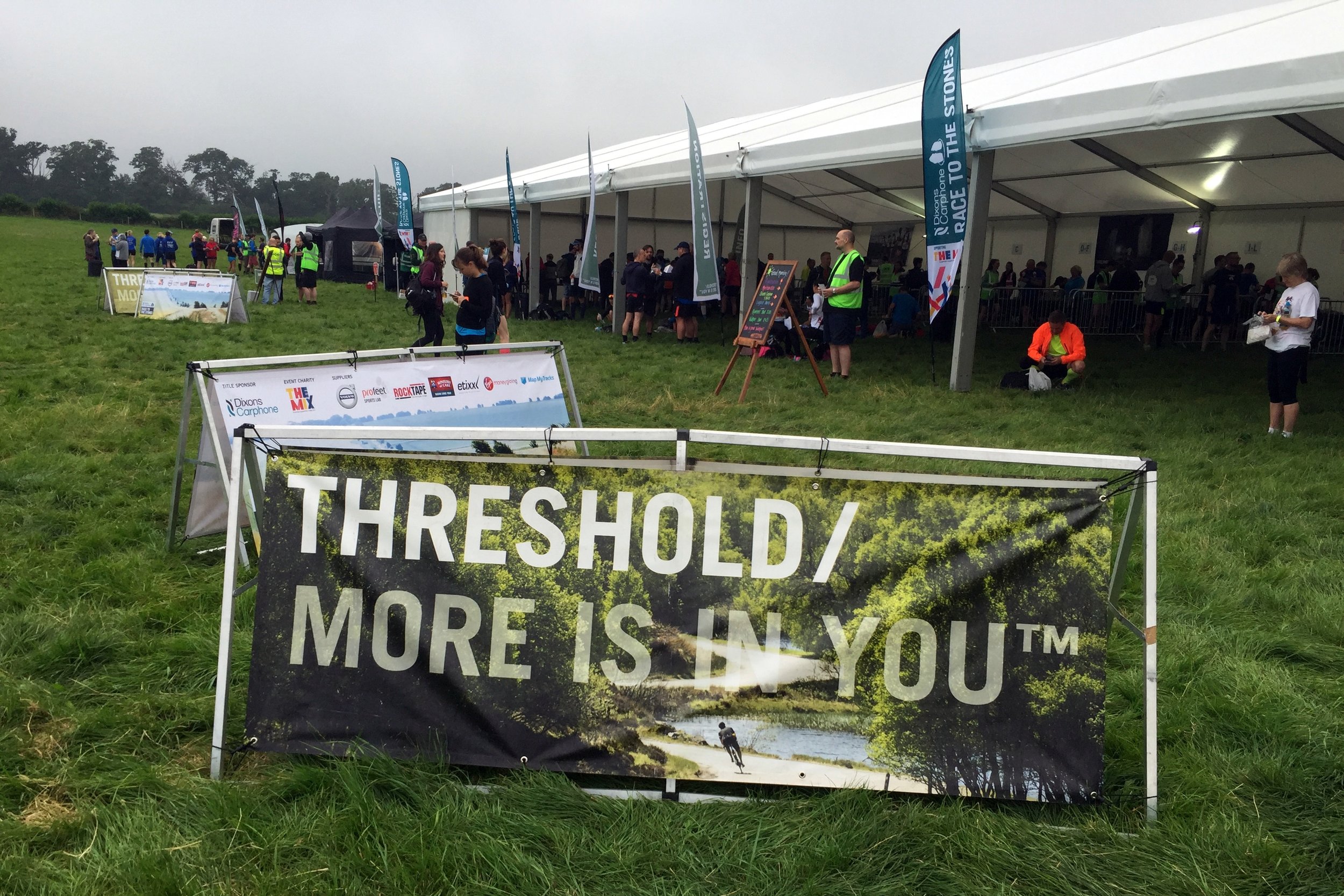
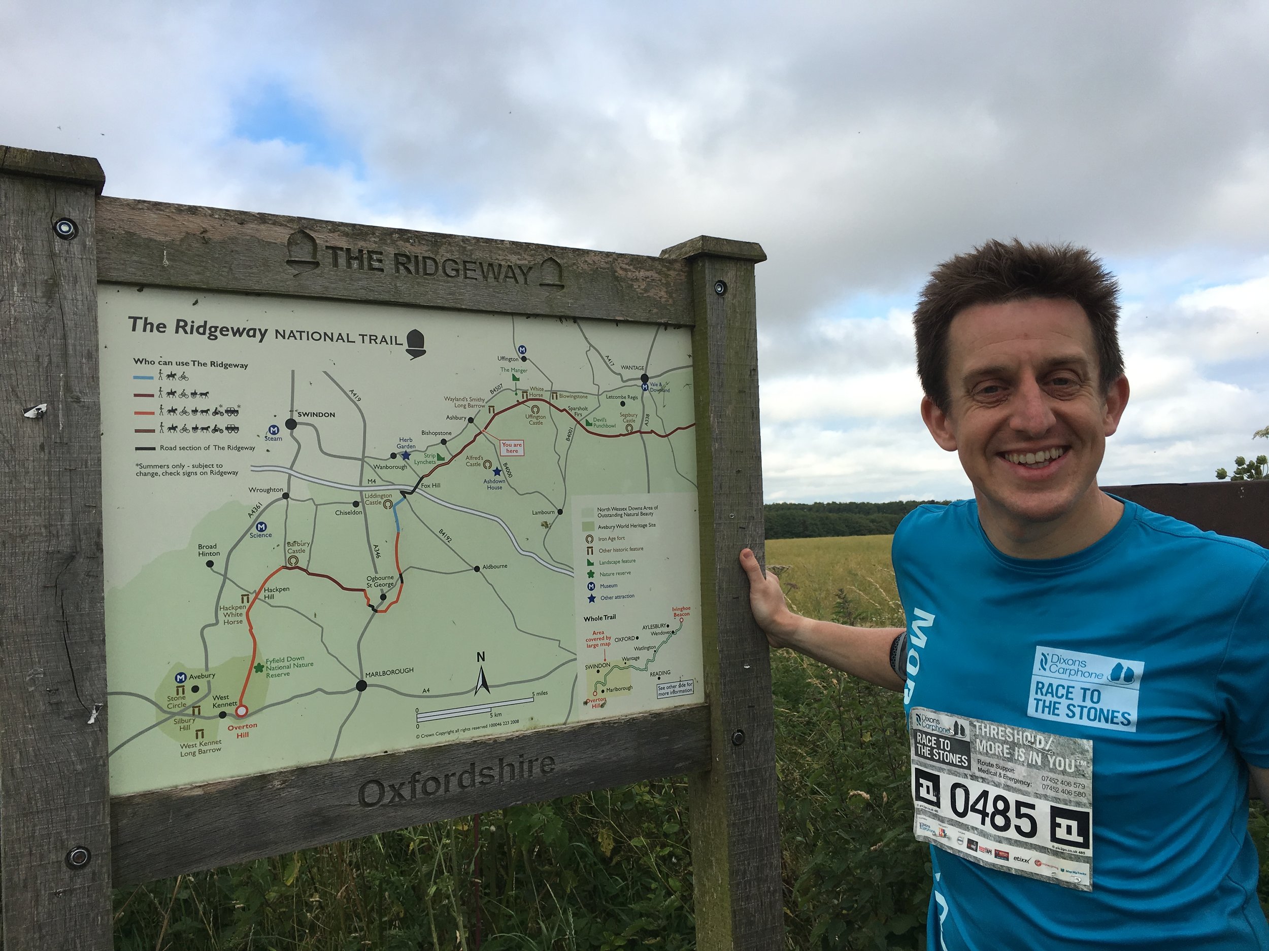
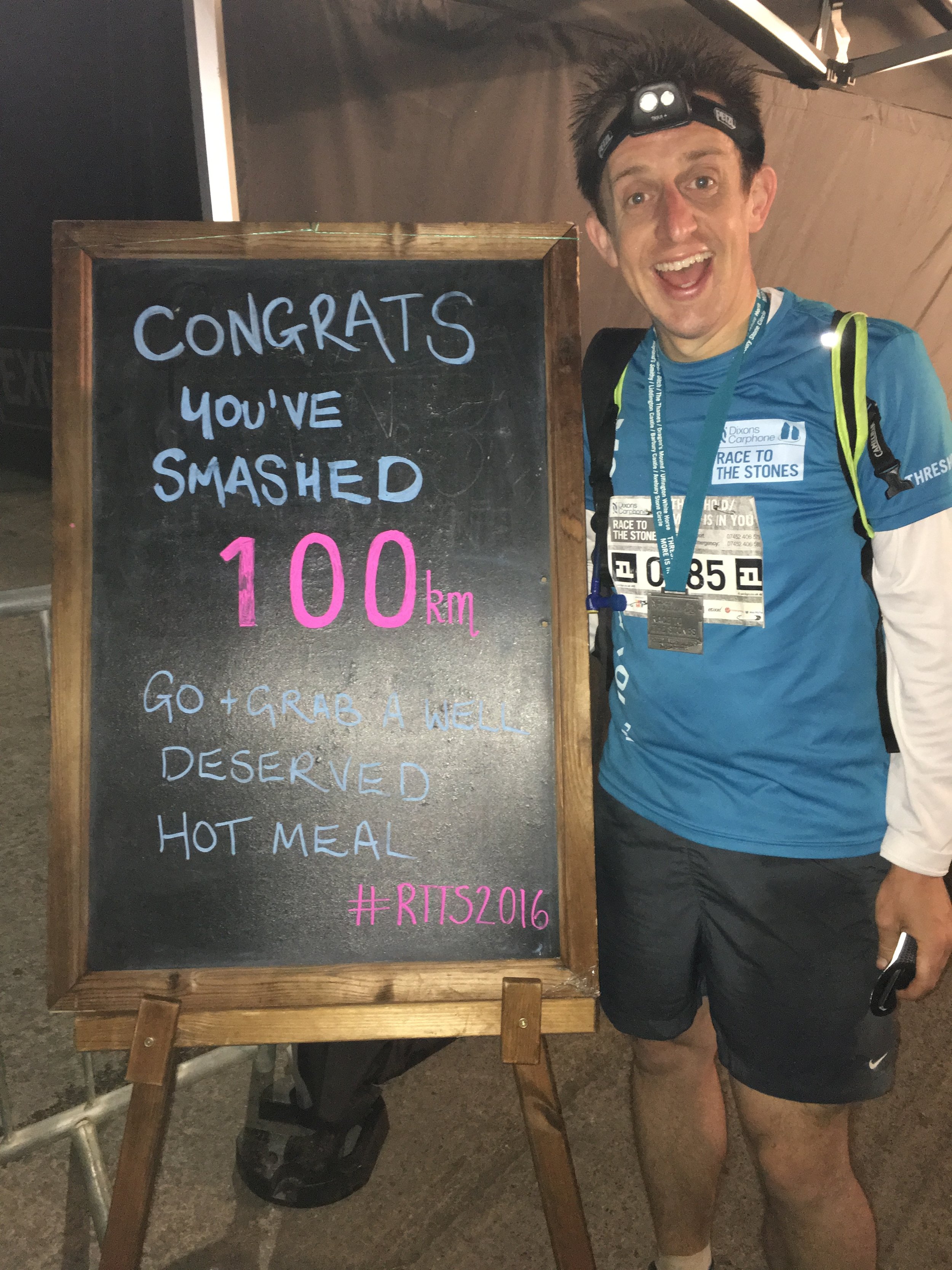
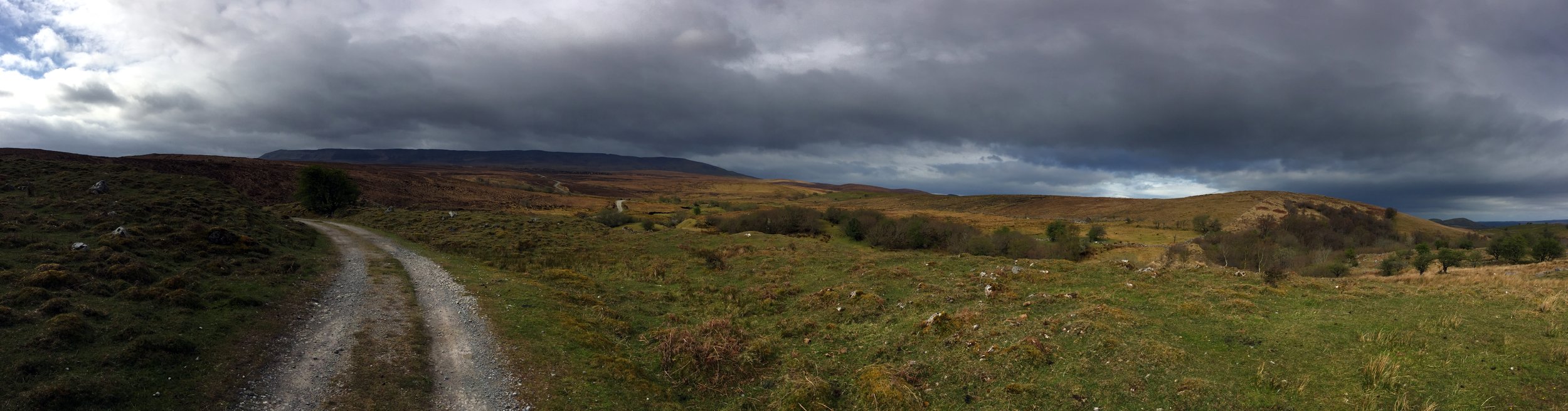
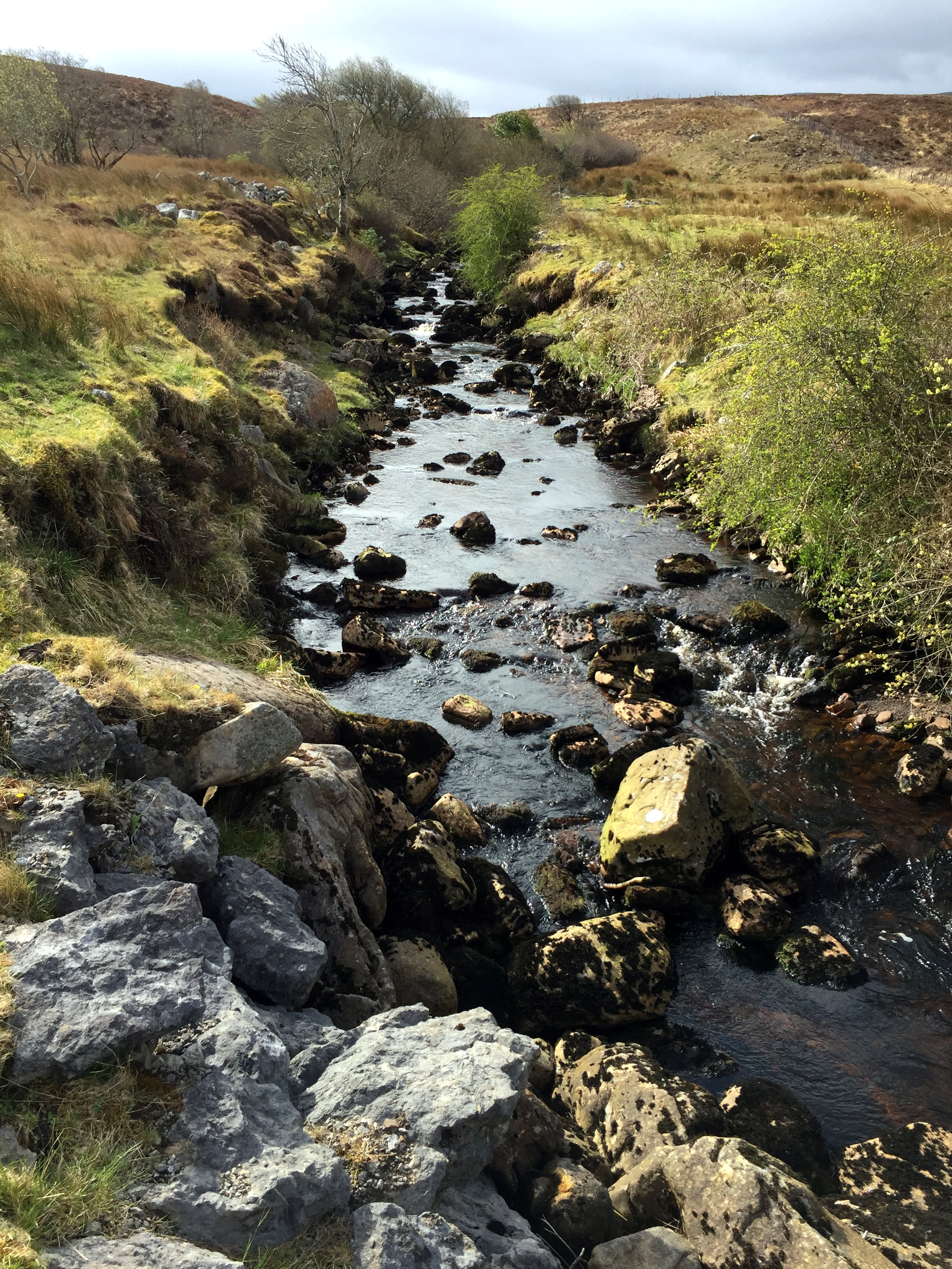
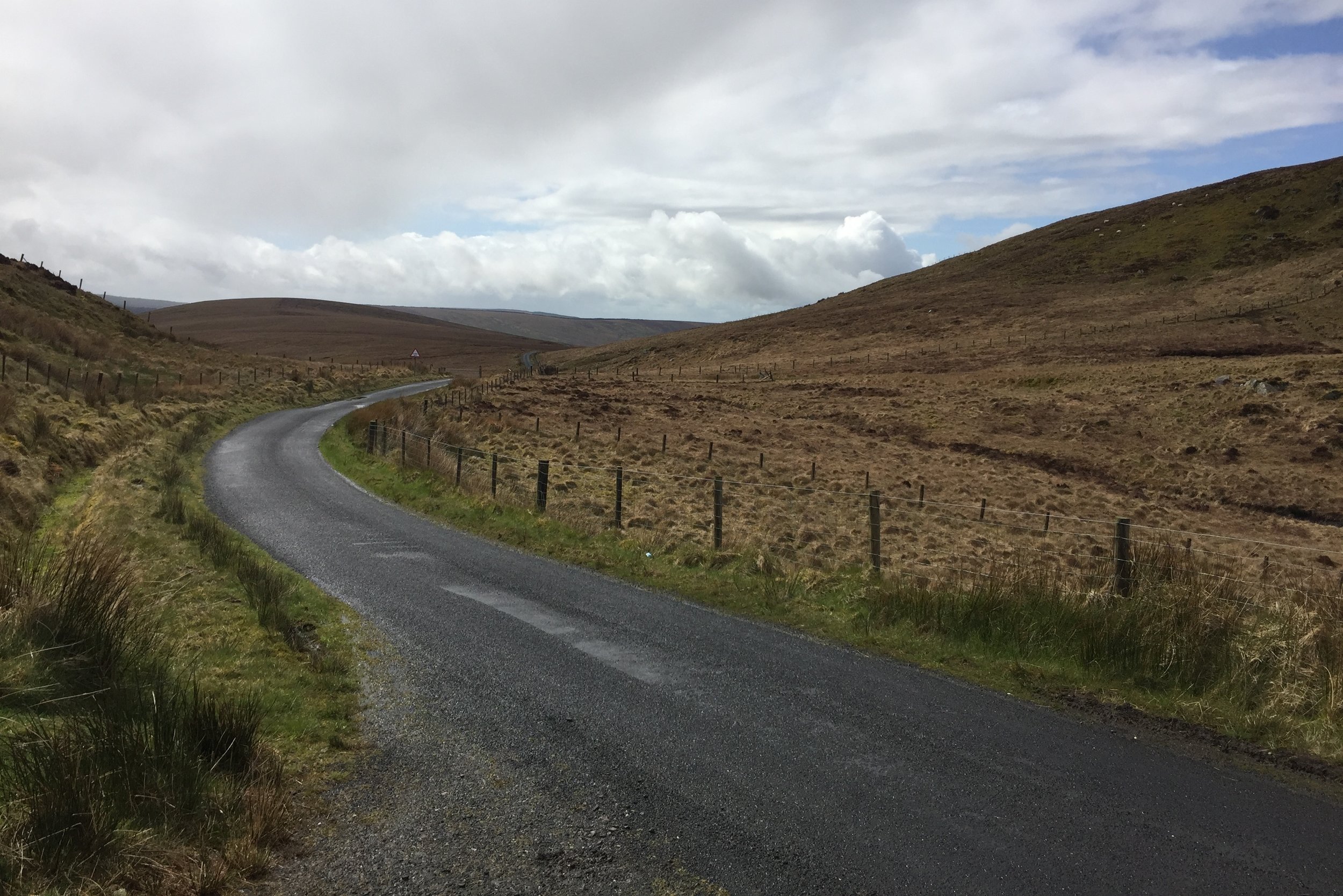
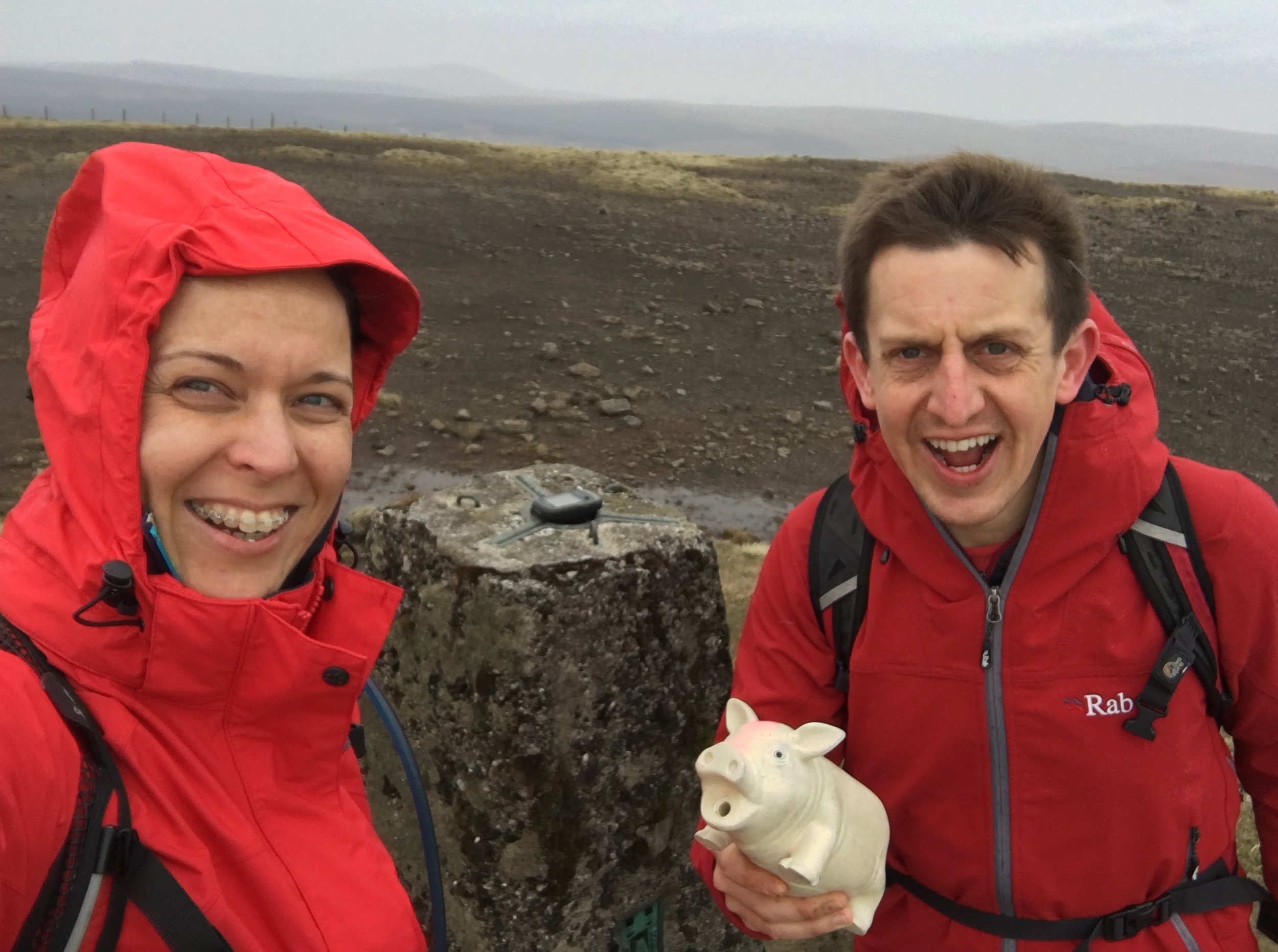
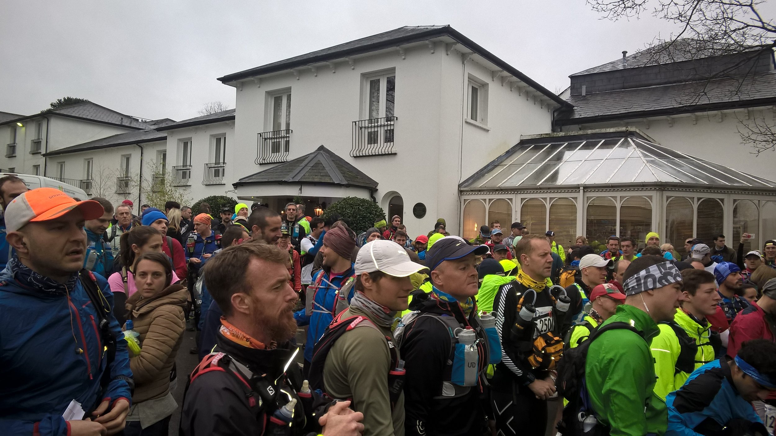
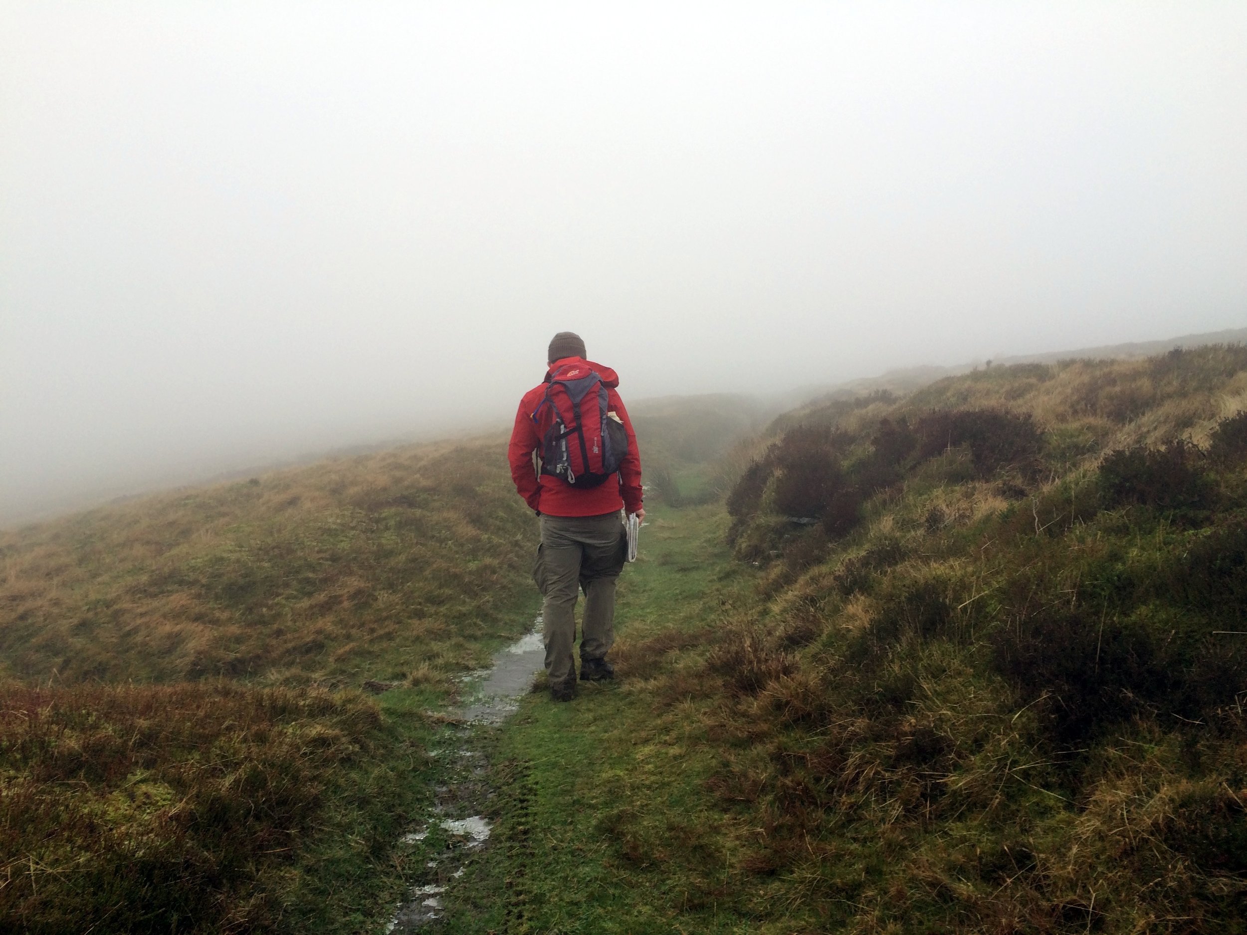
This was the one that I was really excited about. About 3 years ago I noticed an advert on the parkrun website for Race To The Stones. This is a 100km / 63 mile Ultra Marathon along the Ridgeway, the oldest path in the UK. Immediately I knew that I wanted to do it. For a couple of years the mid-July date of the event clashed with other things we were doing, so it wasn't until this year that I was able to fit it in. In the meantime I'd completed my first Ultra, the 45 mile Country To Capital, and an aborted attempt at the 50 mile Thames Trott earlier this year. By the day of the race I was over excited. As usual, I'd not done much in the way of specific training for the event, just my normal mix of events, parkruns and a single 20 mile run to break in my new trail shoes. Despite that, I'd got my nutrition right, slept enough and had upgraded my kit. I was ready to go and massively over excited. I arrived at the start line at Lewknor an hour before the run. Strangely none of my friends were interested in joining me on the race so I was on my own.
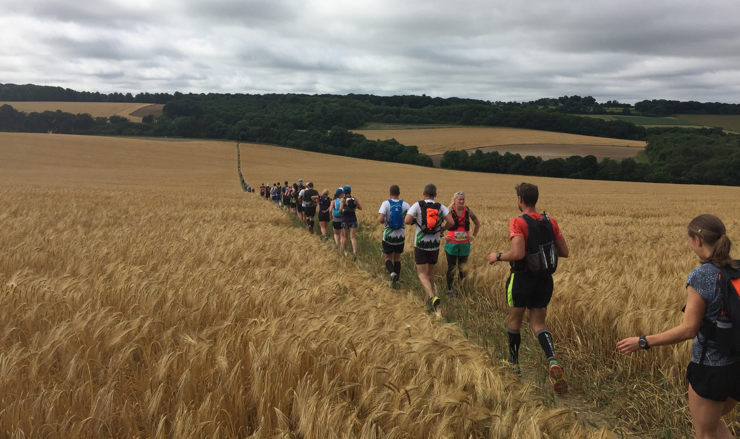
The first 30 miles to Goring were fairly straightforward. I kept to my game plan of 13 minute miles, resisting the urge to go faster through getting caught up in the buzz of all of the other runners. Watching a number of runners have nasty trips in the first 3 miles also kept me mindful of the rocks and roots on the trail.
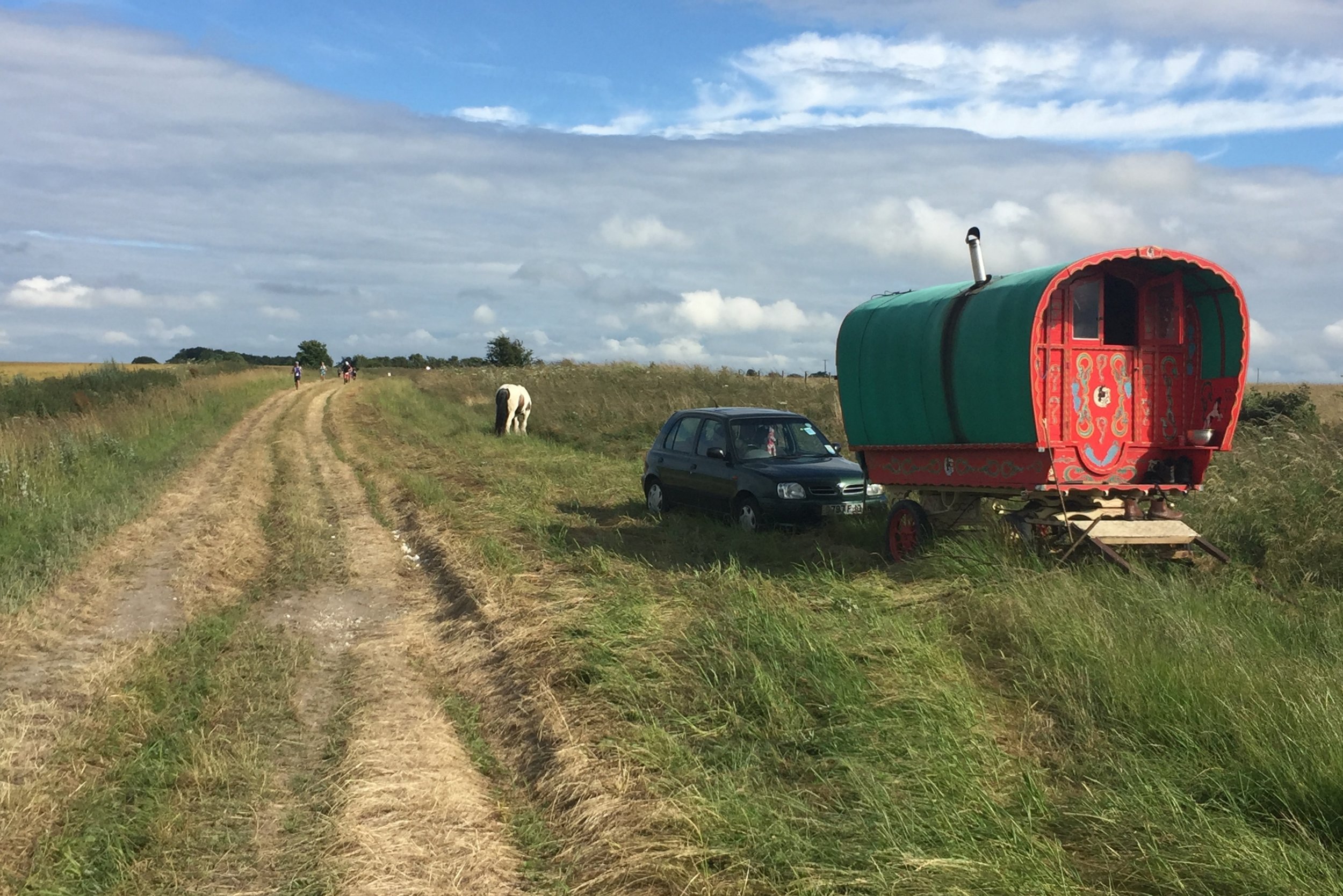
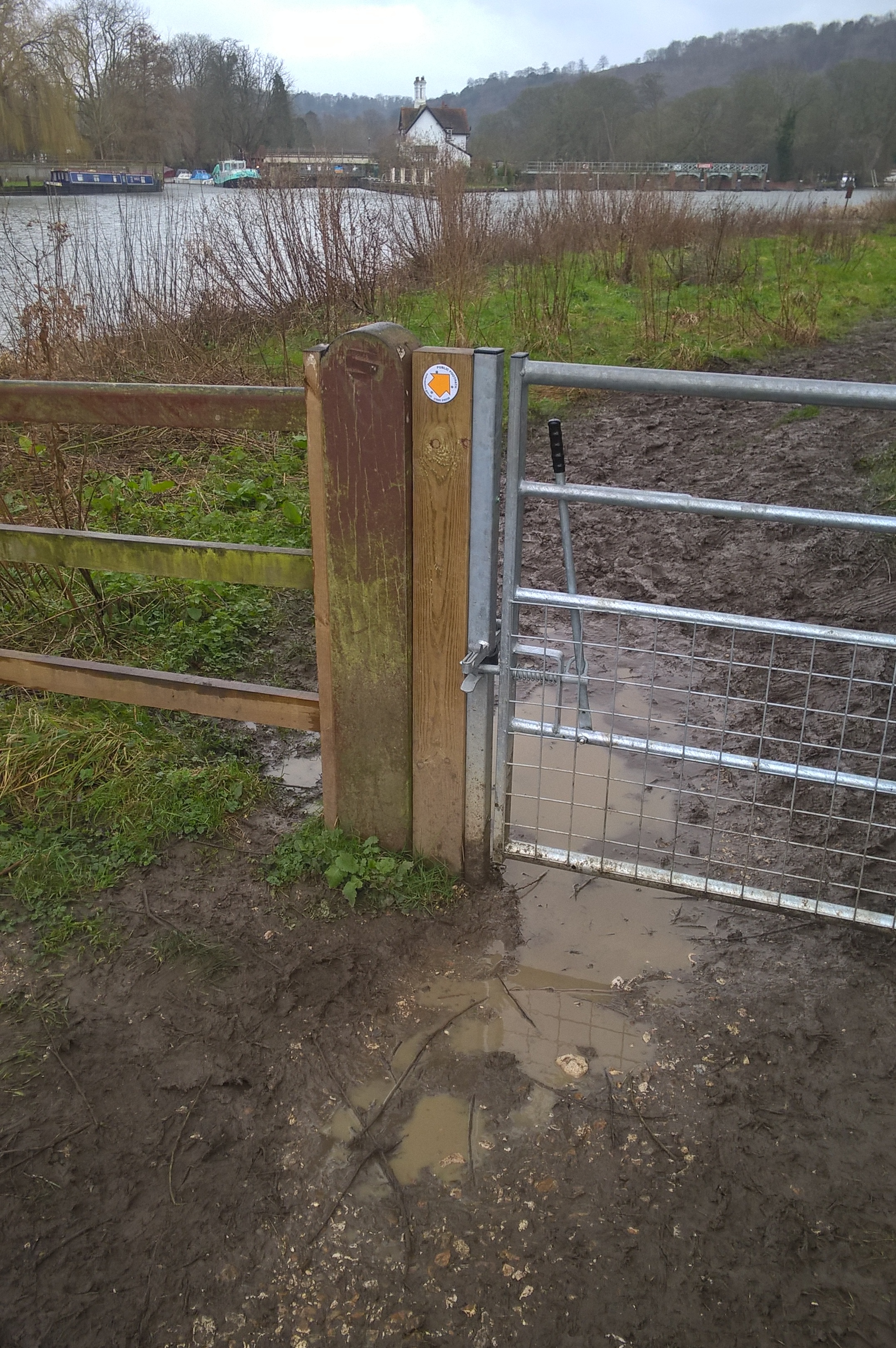
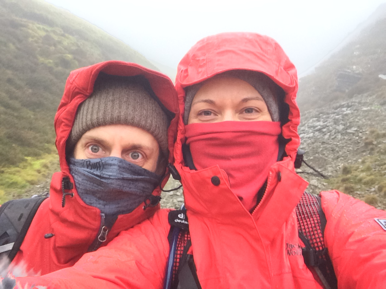
The Thames crossing between Goring and Streatley is a natural milestone on the route. It's the part where the Ridgeway is at its lowest elevation and a good place to stop for a break. This was where I met Timi and my mum, my Ultra support crew. They had planned to meet me a couple of times through the afternoon but ended up following me right through to the end.
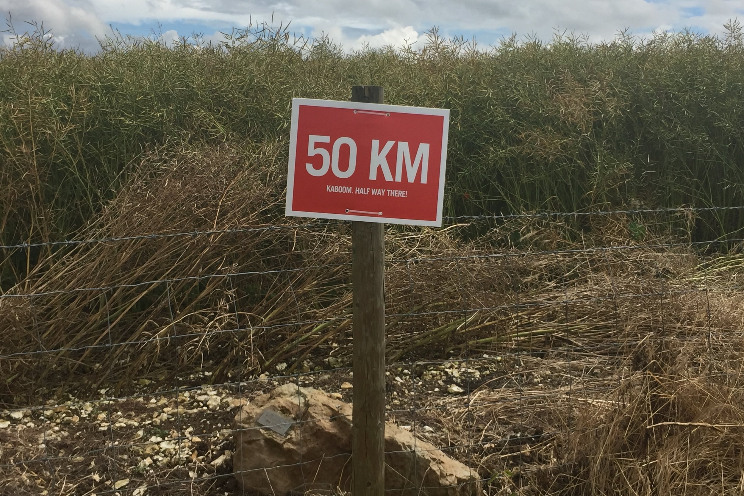
After Streatley the going got a bit tougher as the sun got stronger and the trail climbed up away from the Thames. My pace slowed but I'd build in some contingency around the checkpoints so I was able to stick to a 13 minute mile average pace.
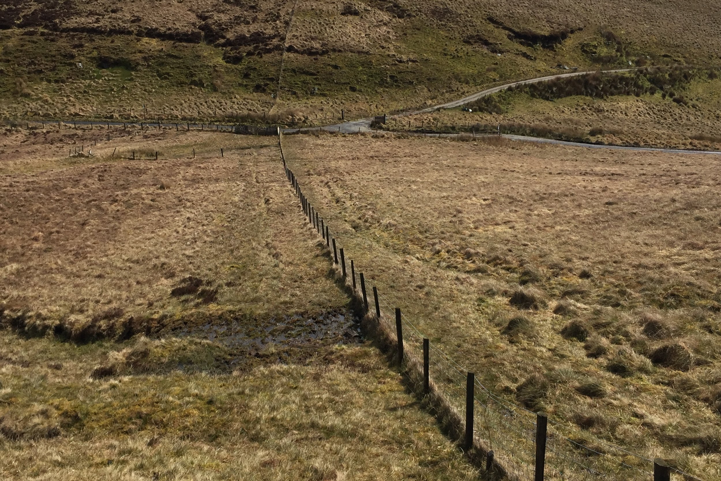
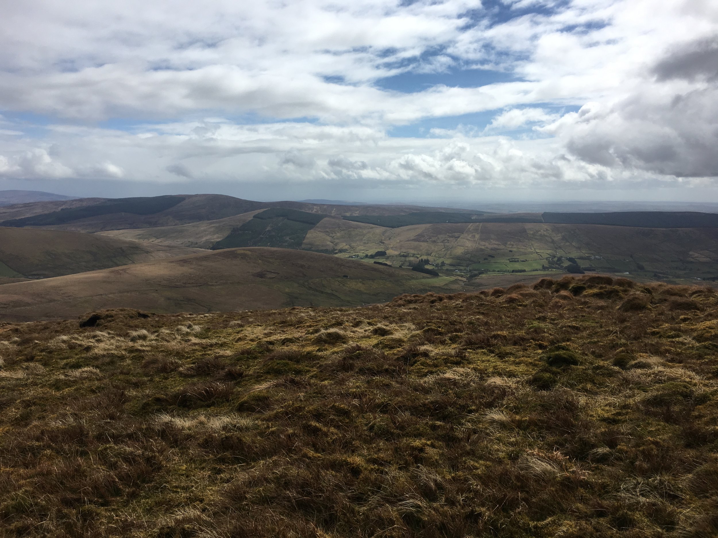
My rule of running new events rather than repeating old ones means that I get to see a lot of the countryside. As a location the Ridgeway is hard to beat. It's an ancient trail cutting through the Chilterns and North Downs passing beautiful villages, Iron Age Forts and Neolithic Burial Grounds. As with LEJOG, my last long distance event, I filled many hours making mental lists of places to come back to for a closer look.
By 21:00 I was approaching the 51 mile point where I'd agreed to meet Timi and Mum. The hill down to Ogbourne St George seemed to go on forever and I was slowing to 16 minute miles. Timi fed me a pasty and I turned on my head torch, ready for the night shift. For a lot of the day I'd alternated between listening to Podcasts and processing the random life thoughts that I now had enough time to work through. By the time I'd turned on my head torch my iPod battery was empty, as was my head. I'd got into a zen-like trance just focusing on the task at hand. My only thoughts were on the road surface ahead, my speed, cars and runners around me and was I taking on enough food and water.
By the final Pitstop there was less than 10k to go, but it was a long slog as I was down to around 3 miles per hour. Timi and Mum met me again at another car park just 2 miles from the Pitstop. I'd got really cold in those 2 miles, so the extra layer they gave me at the car park really helped.
The final 5k was especially tough. It was a long steep hill that eventually descended to the finish line at Avebury. It was also pitch black and foggy with visibility down to just a few metres. From the highest point I could just see the lights at the farm where the finish point was. By then I was feeling a bit dizzy and the path was really rutted so it was all I could do to keep upright. I could have quite happily have just laid down in the field and slept until morning.
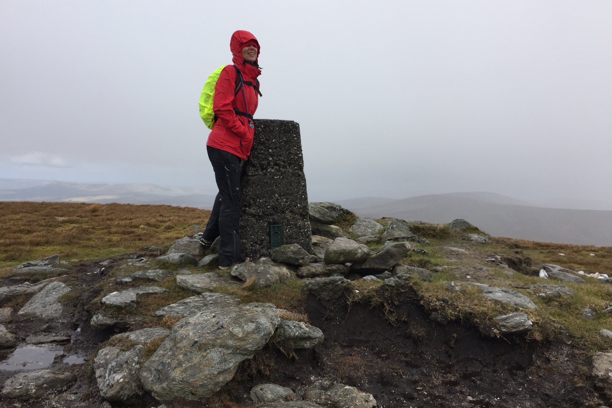
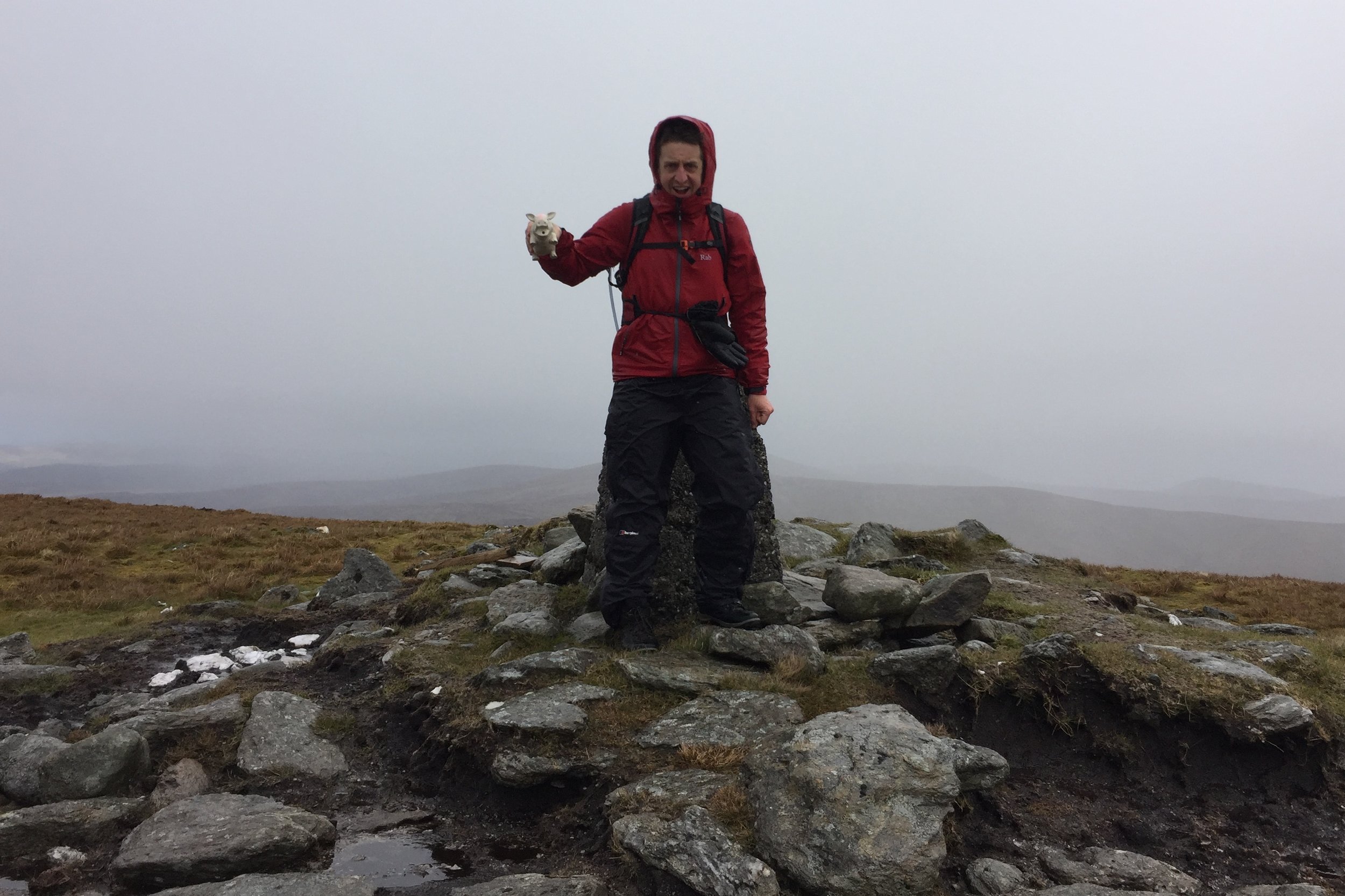
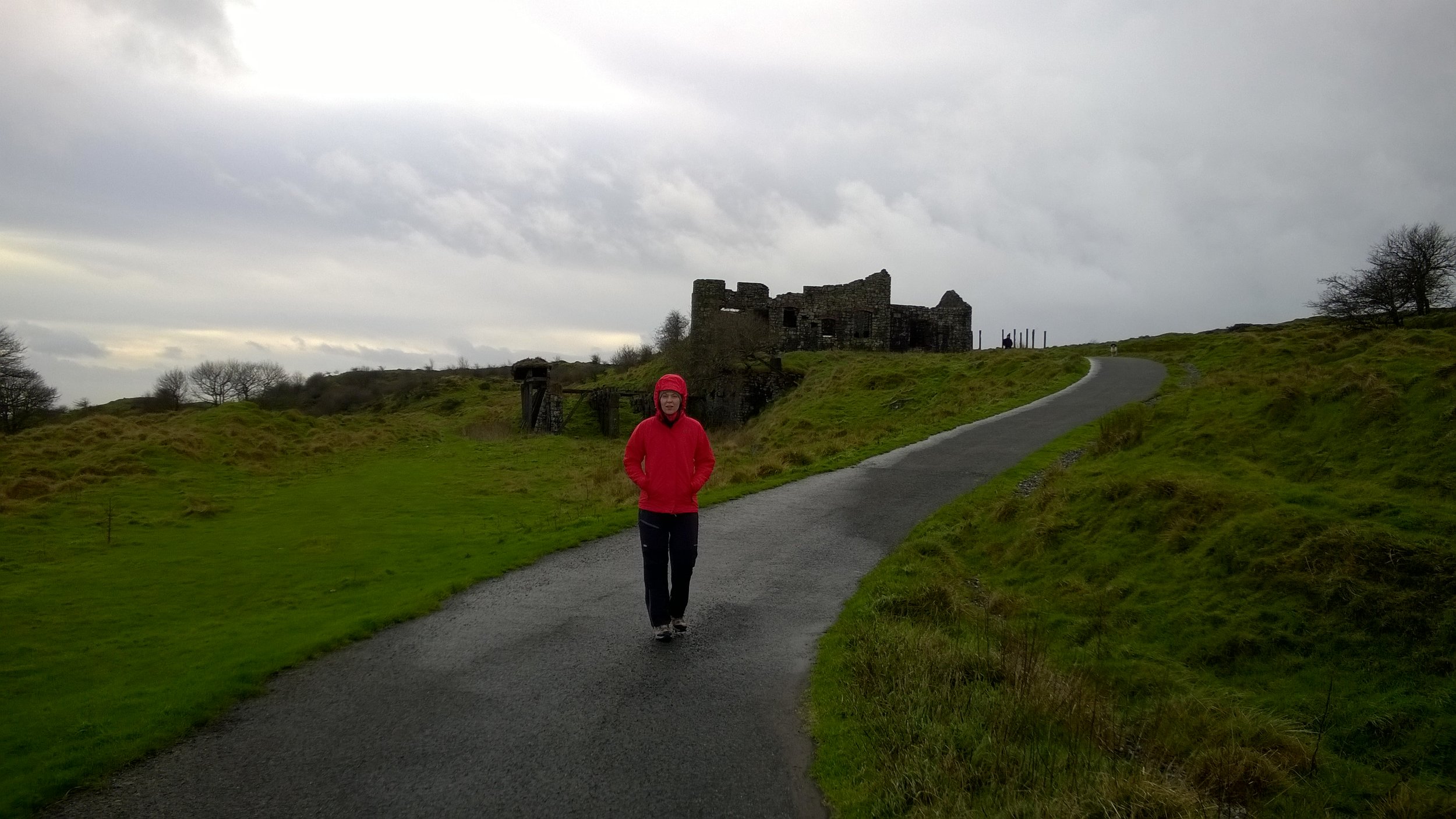
At the bottom of the hill the course teases you. The route takes you into the stone circle in the middle of Avebury village then back up the same route before turning off toward the finish line for the final 1k. This means that you have to pass the final turn on the way to the village and deal with the temptation of cutting off a kilometre. As tired as I was, the completer-finisher in me kept me on track and I got my official photo by the standing stones.
Running back out of Avebury village you pass the runners who are running in, 10 minutes behind you. You also get a good view of the head torches equally spaced out, coming down the hill like stacked planes coming into Heathrow. At the final turn its 400 metres to go and a straight path to the finish. I found a bit more energy and ran the final 200 metres in. It was 01:34 and 17.5 hours from the start line.
My biggest surprise was how I felt at the end. In the early days of running I often felt a wave of emotion at the end of a big event. I would also take several days to recover. Despite this being my longest running event by a considerable distance, the feeling after was very different. I just felt Awesome. No big wave of emotion, just a feeling of joy and the tiredness suddenly vanishing at the Finish Line. I didn't even feel sore the next day. My main emotion was a feeling of calm, having cracked something that I wouldn't have thought possible before I started running less than 10 years ago. This will be a day that I'll remember for a very long time.
When: July 10th 2016
Where: West Wycombe, Buckinghamshire, UK
Course: Mostly cross country and small rural villages
Other routes touched (walk): None
Other routes touched (Cycle): Chilterns Cycleway
Finish time: 2:15 (slow!)
The Wycombe Half has taken me a while to get round to. High Wycombe didn't feel very inspiring as a venue, but mostly because its a Summer race and I'm happier running in the cold. I had a free morning and noticed that entries were still open, so I signed up a week ago. It probably wasn't the best idea as I had a party the night before and did more wine-loading than carb-loading. Despite lack of sleep and a bit of grogginess, if felt relatively fine in the morning. The weather was also helping as it was a chilly July day with enough rain to be cooling but not enough to be a nuisance.
The start and end location, the Wycombe Wanderers football ground only confirmed by feeling that it would be an uninspiring run. The stadium is at the back of a trading estate in the arse end of the town. As it happened, the first and last miles were the only boring bit and the rest was lovely countryside and small villages to the west of the town. After mile 1, the route went into the West Wycombe Estate, with views up to the hill surrounding the Hellfire Caves. The next few miles went off-road through the estate with some steep, muddy hills an grassy sections. This is definitely not a Half to get a PB on. The middle section took a big loop out the the South West passing through small villages like Frieth and Lane End, before returning back to the start via the Estate.
The combination of the previous night's party and taking it slow to avoid pre-Ultra injuries kept my speed very low. My finish time was 2:15 which is 20 minutes slower than my normal effort. I was still pleased with it though as it was a nice way to spend a rainy Summer morning and a final bit of practice before next week's mega-run.
Finally got my 100 T-shirt after a year of waiting for the back-log to clear. Big Day!

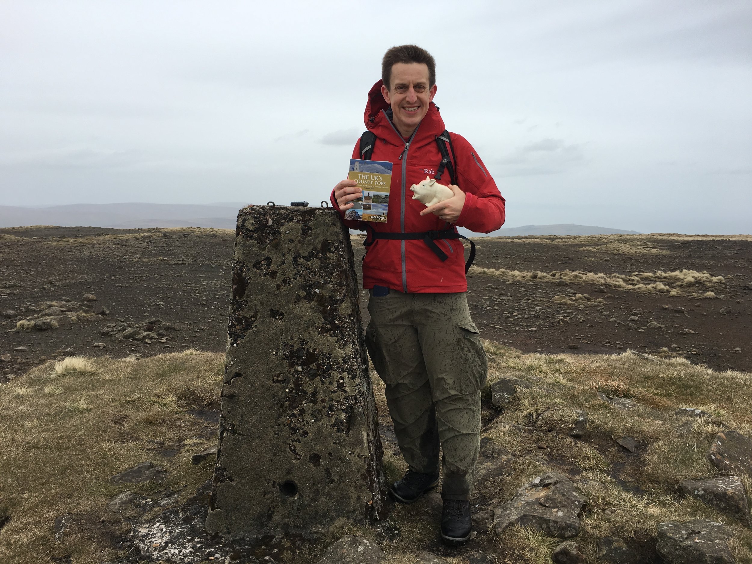
Slieve Donard. County Down. 850 metres.
Sawel Mountain. County Londonderry and County Tyrone. 678 metres. Completed
Cuilcagh. County Fermanagh. 666 metres. Completed
Slieve Gullion. County Armagh. 576 metres. Completed
Trostan. County Antrim. 550 metres. Completed
The idea for our Grand Tour of Northern Ireland came from how to solve the challenge of doing all 6 N.I. County Tops whilst making the trip "wife-friendly". Timi (the wife) loves travel as much as I do, enjoys trekking (to a point) but is not fond of mud and cold. We've learnt that the best combination is to do the adventure thing in the day but stay at nice places at night. A much as I could sleep in a tree, that's never a good option for Timi.
The plan was to start in Belfast, do some sight-seeing then take an anti-clockwise tour of the six counties, ticking off the County Tops. The anti-clockwise option works well as Trostan is a relatively straightforward warm-up and the others build up to the highest peak, Slieve Donard, at the end. In order to get the right balance of adventure and rest, we did no more than 1 walk per day and built in a day off between Trostan and Sawel Mountain to see the Giant's Causeway and Carrick-a-rede.
Driving Distances:
Belfast to Trostan: 46 miles
Trostan to Sawel Mountain: 50 miles
Sawel Mountain to Cuilcagh: 70 miles
Cuilcagh to Slieve Gullion: 80 miles
Slieve Gullion to Slieve Donard: 36 miles
Slieve Donard to Belfast: 40 miles
Total Trip: 322 miles
Driving distances above show direct routes between main stops. The map below shows a longer road-trip including a visit to Giant's Causeway and Carrick-a-rede and an overnight stay in Donegal between Cuilcagh and Slieve Gullion.
In 2015, Northern Ireland underwent a significant restructuring of its local government system, reducing the number of councils from 26 to 11. These newly formed larger councils, often dubbed "super councils," were established with the aim of enhancing efficiency, innovation, and cost-effectiveness in local governance. The reform also transferred additional responsibilities to the councils, including planning, local economic development, off-street car parking, and community investment, which were previously handled by the central government. This decentralization of power was intended to empower local councils to play a more prominent role in shaping their communities and responding to local needs.
Here are the highest points of the Northern Ireland Super Councils. The source of this list is Peakbagger.com. Note that other sources, including Wikipedia, show different high points. Please contact me if you have any information relavant to updating this list and I will donate £1 per correction to one of my Causes.
Slieve Donard. Newry City, Mourne and Down District. 850 metres.
Sawel Mountain. Derry City and Strabane District. 678 metres.
Cuilcagh. Fermanagh and Omagh District. 666 metres.
Mullaghaneany. Causeway Coast and Glens District. 627 metres.
Oughtmore. Mid-Ulster District. 569 metres.
Slievenanee. Mid and East Antrim District. 543 metres.
Divis. Belfast City. 478 metres.
Divis - West Slope. Antrim and Newtownabbey District. 455 metres.
Carrigatuke. Armagh City, Banbridge and Craigavon District. 365 metres.
Collin. Lisburn City and Castlereagh District. 328 metres.
Cairngaver. North Down and Ards District. 214 metres.
The highest 3 mountains in the super-council list (Slieve Donard, Sawel Mountain and Cuilcagh) are also Historic County Tops. Trostan is the Historic County Top of County Antrim but is now in the Causeway Coast and Glens District of which Mullaghaneany is the highest point. Slieve Gullion is the Historic County Top of County Armagh but is now in the Newry City, Mourne and Down District of which Slieve Donard is the highest point.


Slieve Donnard summit
Also known as: Sliabh Donairt
Significance: Highest peak in County Down (Historic County Top), Highest Peak in Northern Ireland, Mourne Mountains National Landscape High Point
Member of: Marilyn, Hewitt
Parent Peak: Wicklow Mountains National Park High Point
Elevation: 853m
Date climbed: May 6th 2016
Coordinates: 54.1804° N, 5.9223° W
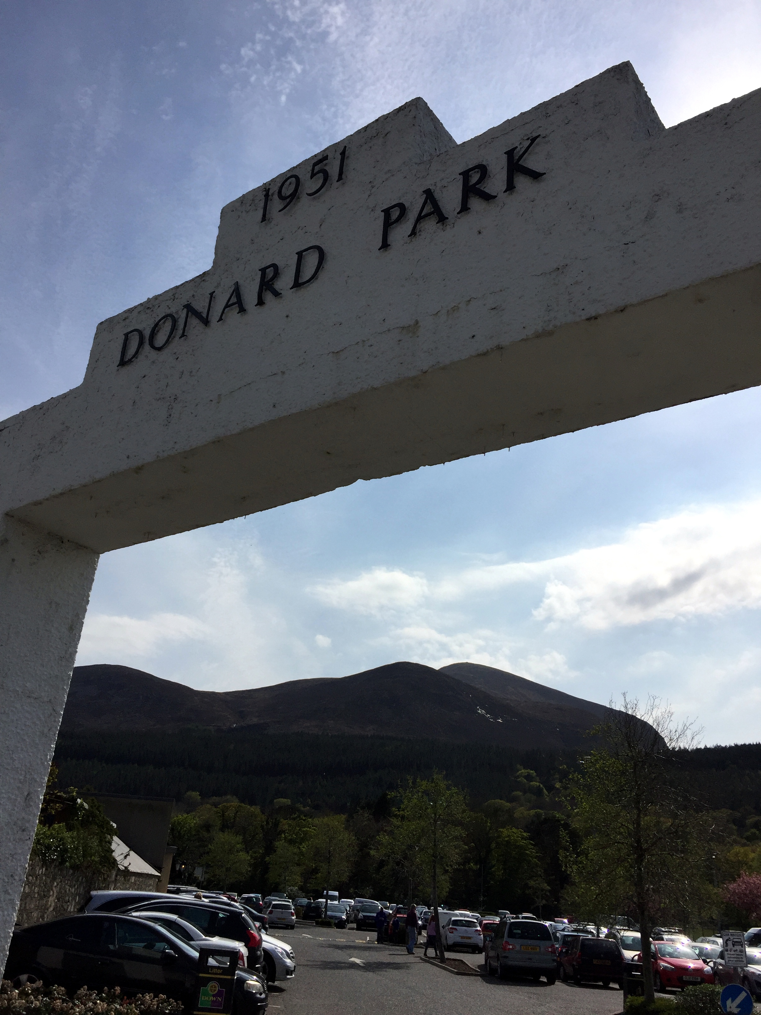
Route Start / End: Donard Park car park, Newcastle
Route Distance: 9.8 km (6 miles)
Route Elevation Change: +/- 908m
Subsidiary tops on route: None
GPX File: get via Buy Me a Coffee
Other routes touched (walk): Mourne Wall Challenge
Other routes touched (cycle): None
OS Trig Pillar: TP7678 - Slieve Donard (New)
Map: OS Northern Ireland Activity Maps: The Mournes (for Slieve Donard)
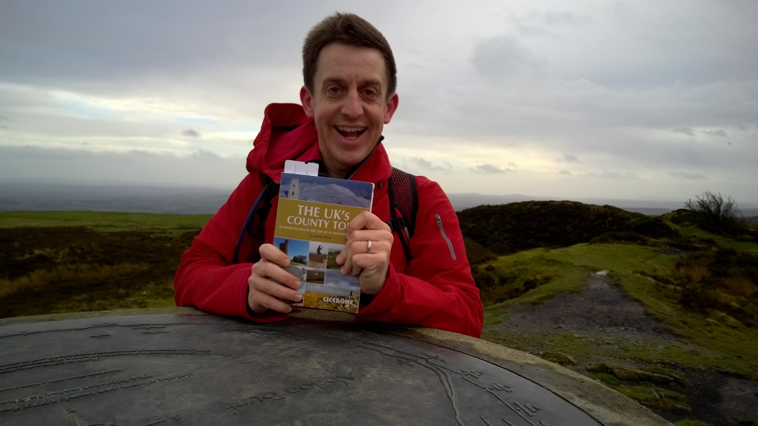
Guidebook: The UK's County Tops (Jonny Muir)
Links: Wikipedia (County Down), Wikipedia (Slieve Donard), Peakbagger, Hillbagging
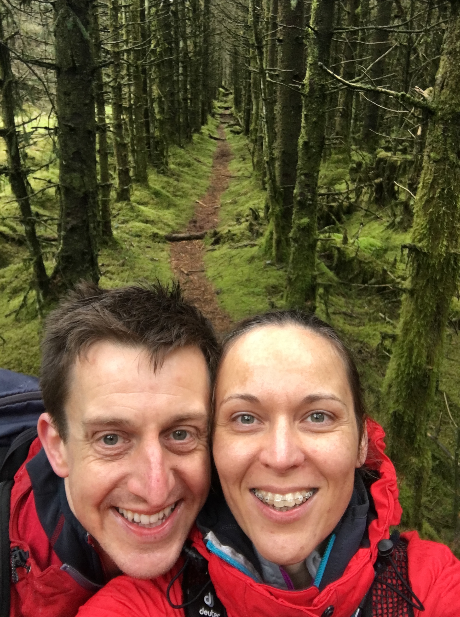
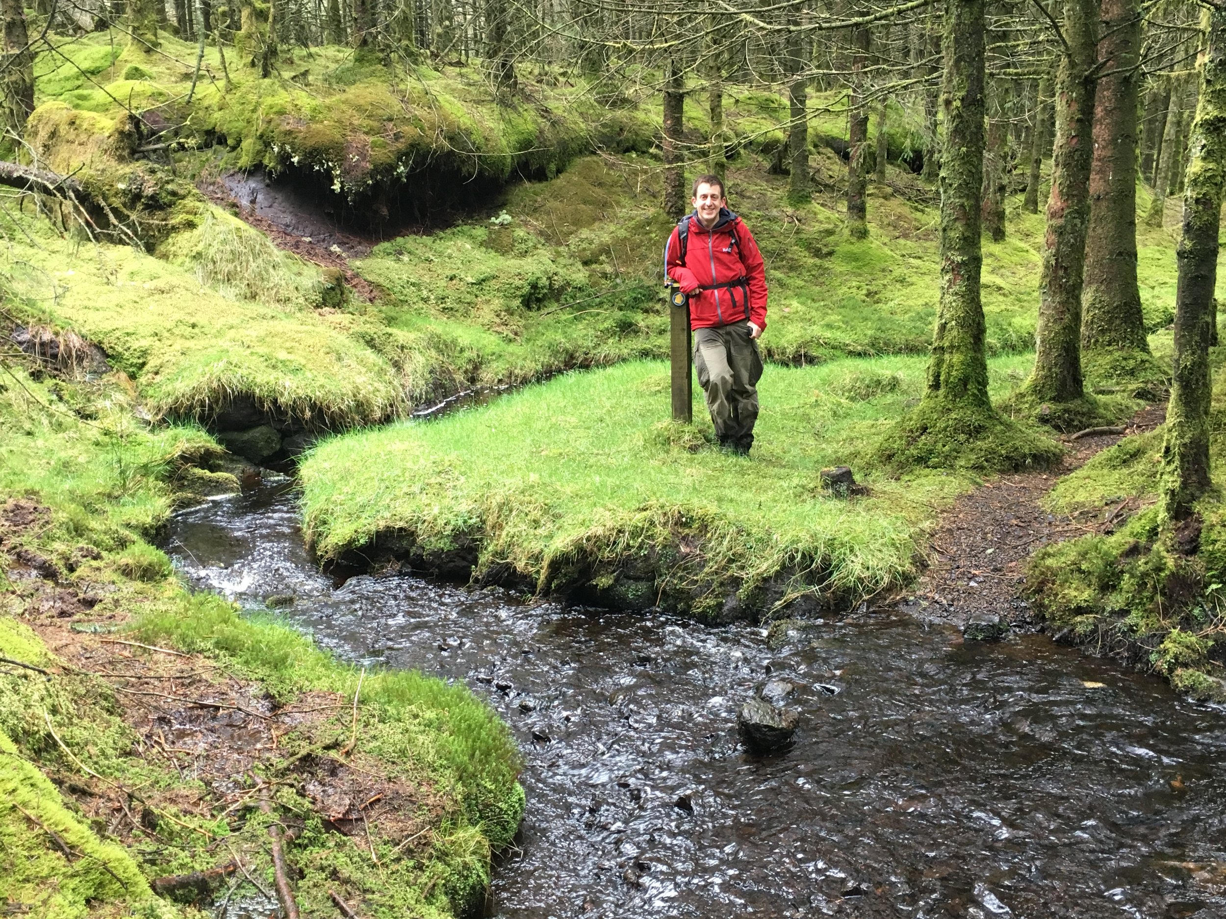
This trek was part of a tour of the Historic County Tops of Northern Ireland that Timea and I did in May 2016.
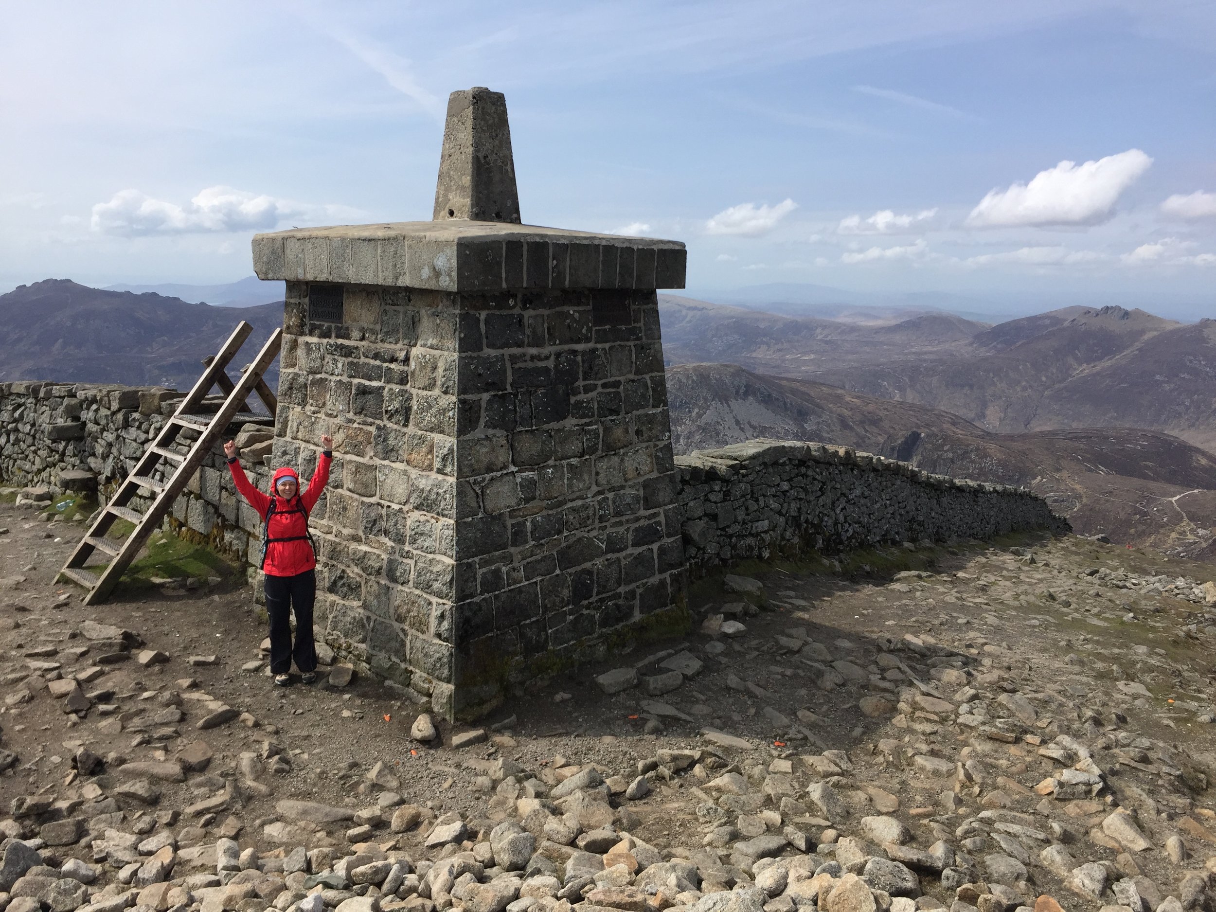
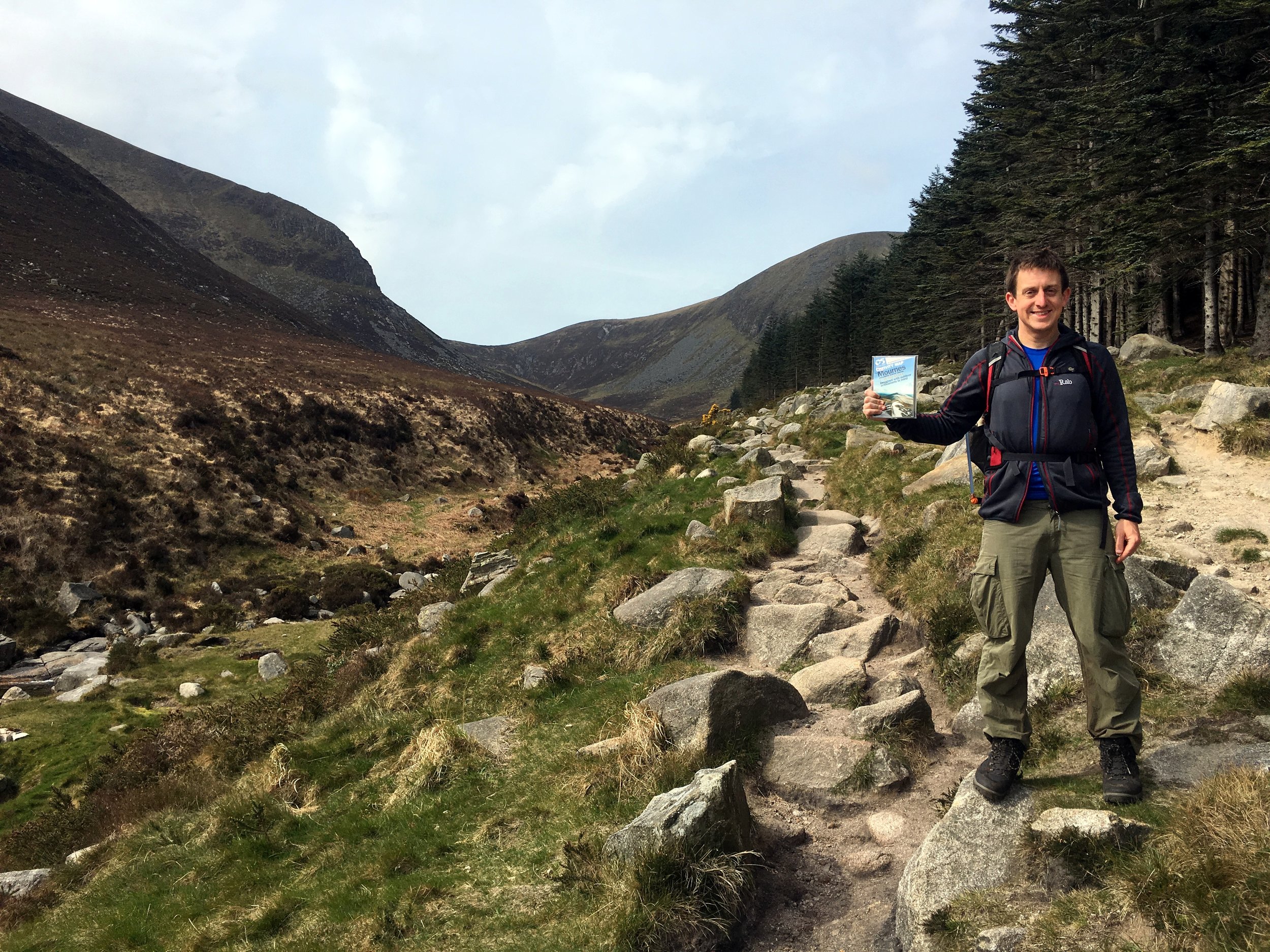
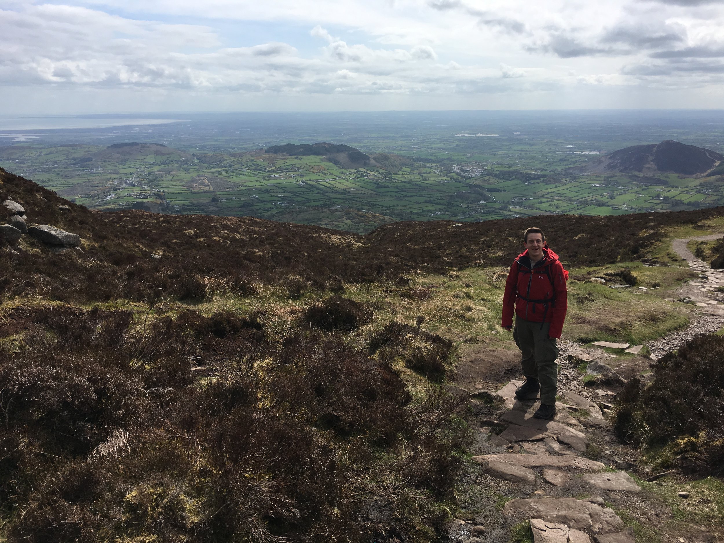
Our final day was the tallest mountain and the most enjoyable trek: Slieve Donard. The week up until this was had changeable weather with every season in every day. This day we were in luck as it was warm with great visibility. On a really clear day you can see England, Scotland, Wales and Ireland from the summit. We couldn't see that far, but we were pretty sure that we could see the Isle Of Man in the distance.
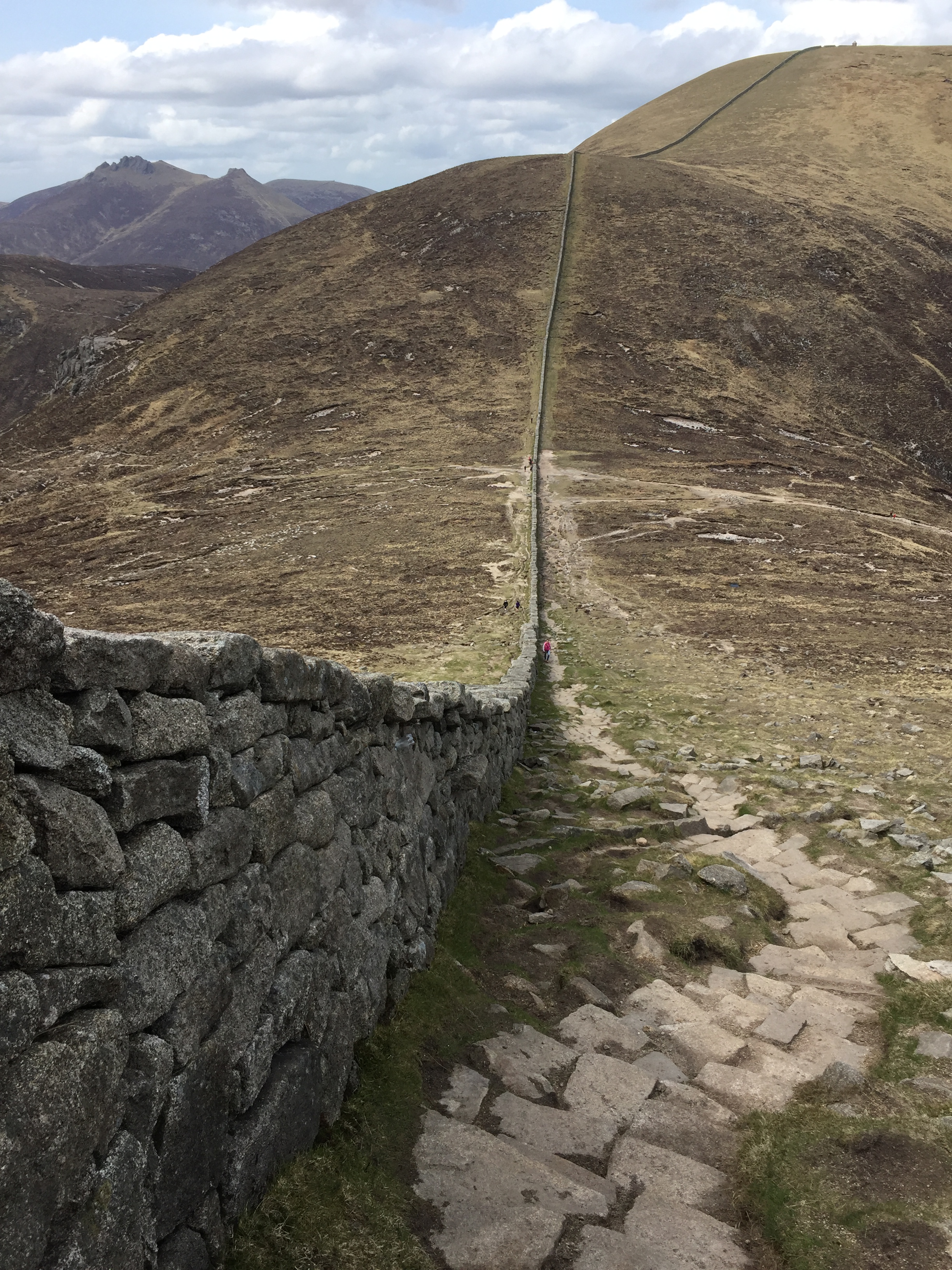
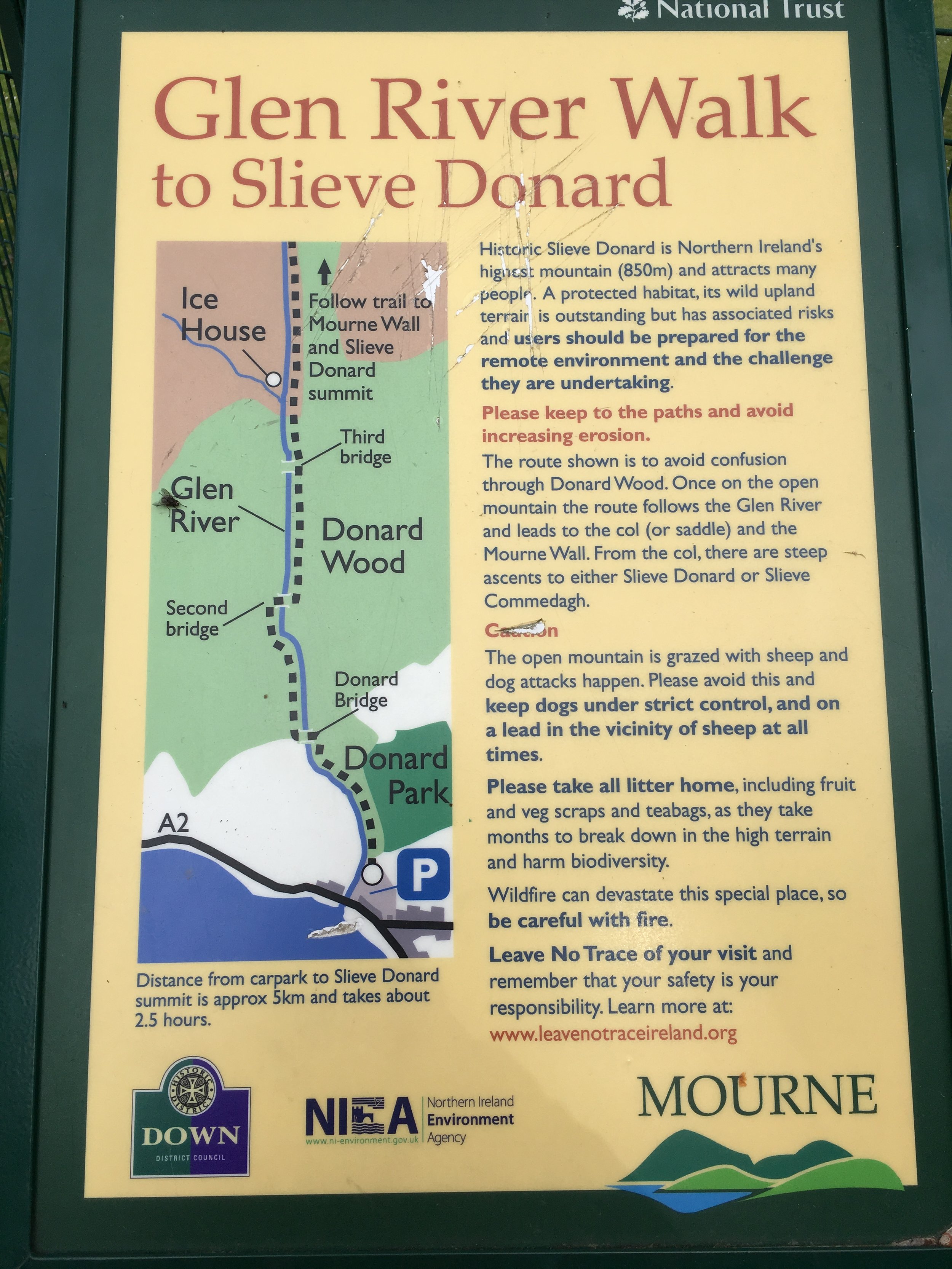
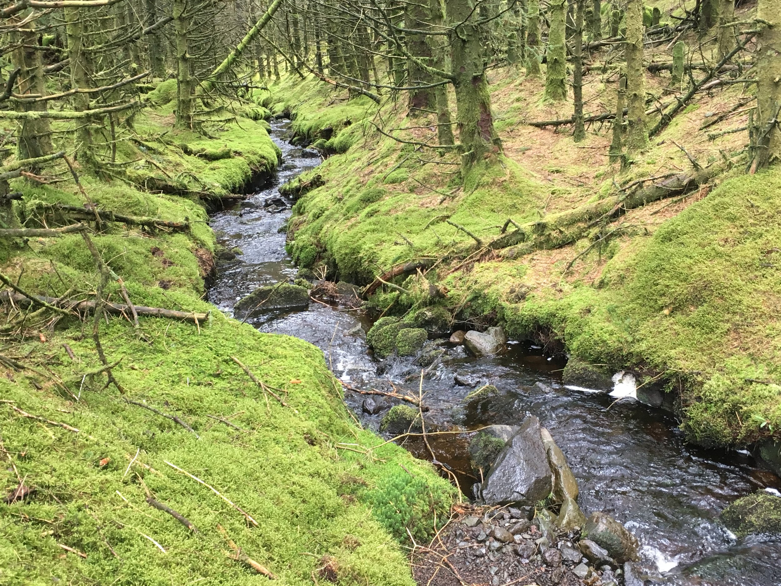
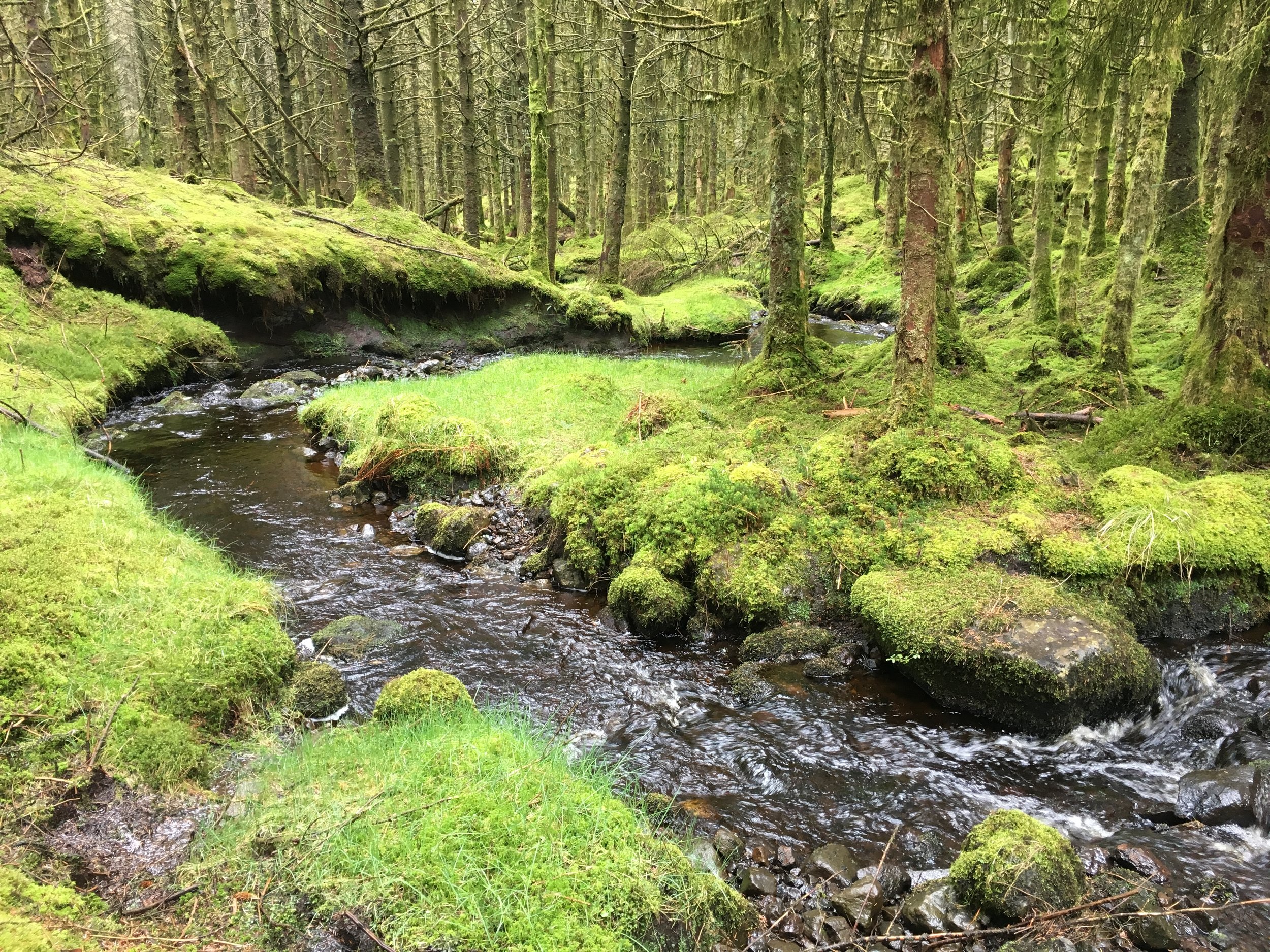
From the Donard Park car park in the centre of coastal Newcastle, the trail follows a stream up through a forest. The tree line ends about an hour in and passes the Annesley Ice House. From here the path continues to follow the stream until a bridge which marks the start of a steep climb up to the Saddle. This is the point where the Glen River Walk meets the Mourne Wall, a 35 km granite wall built in the early 1900s to mark the catchment area of the Silent Valley Reservoir which provides water for most of Belfast and County Down. From here, the summit is another steep climb, following the wall to the South-West.
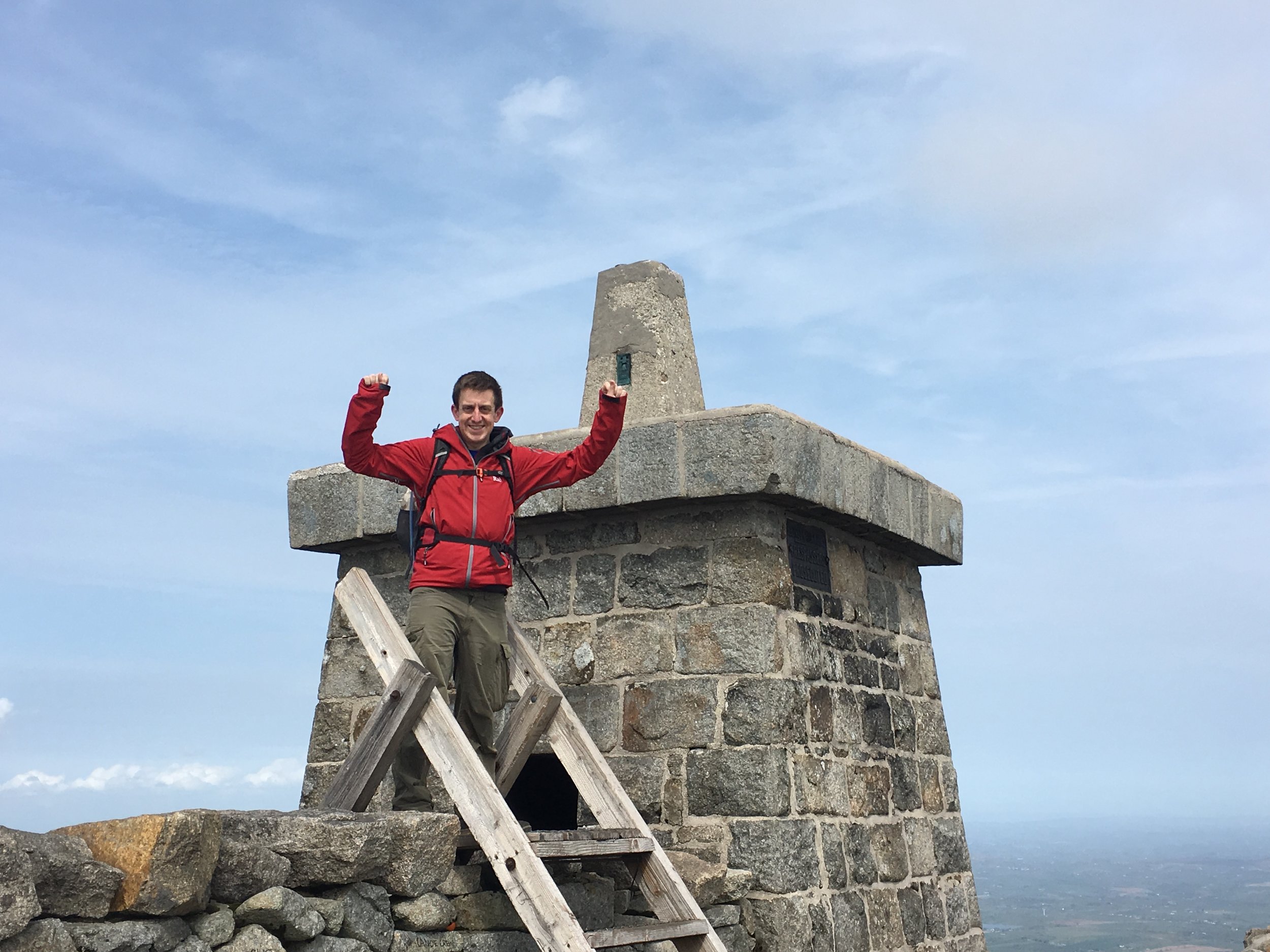
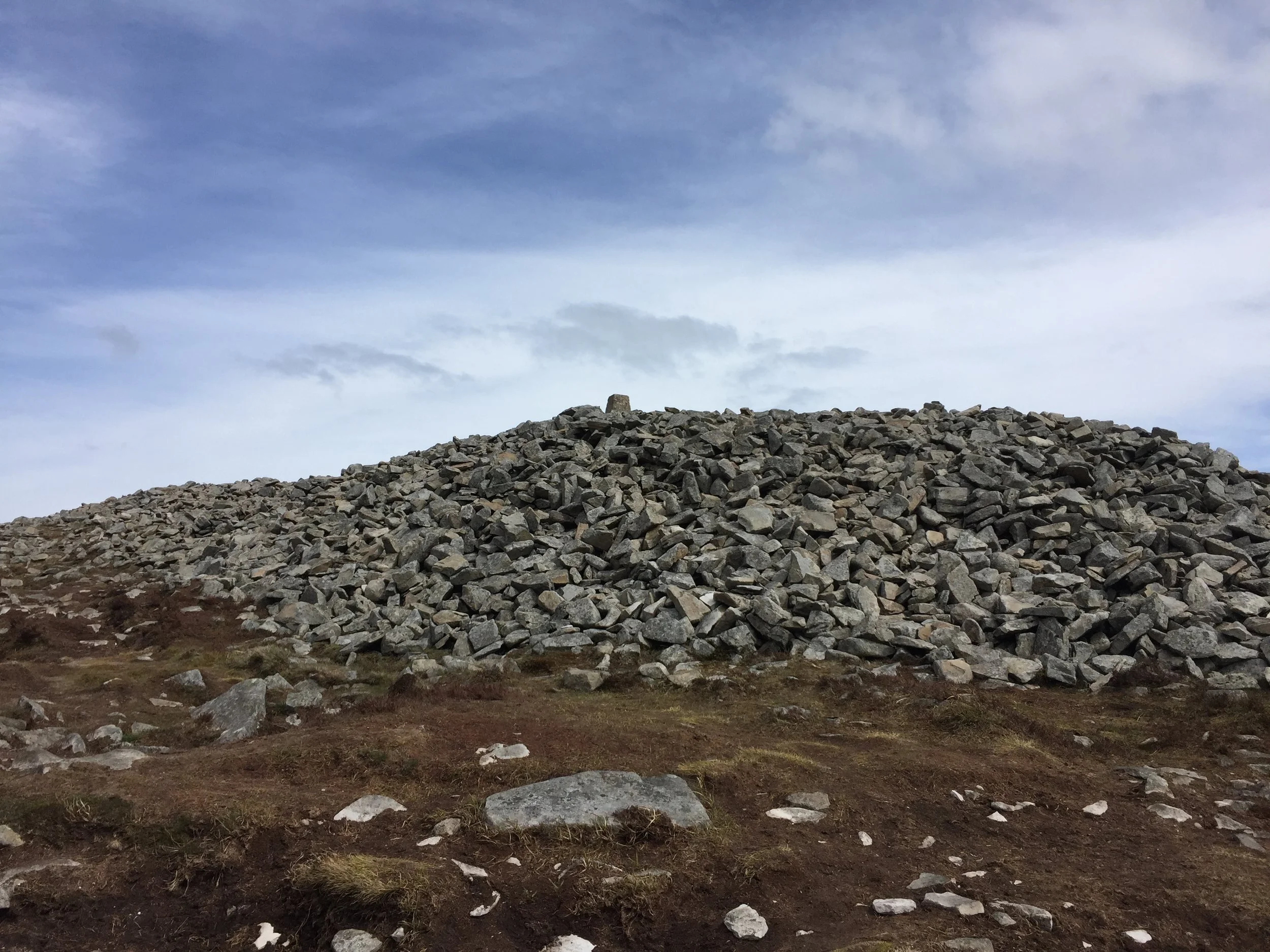
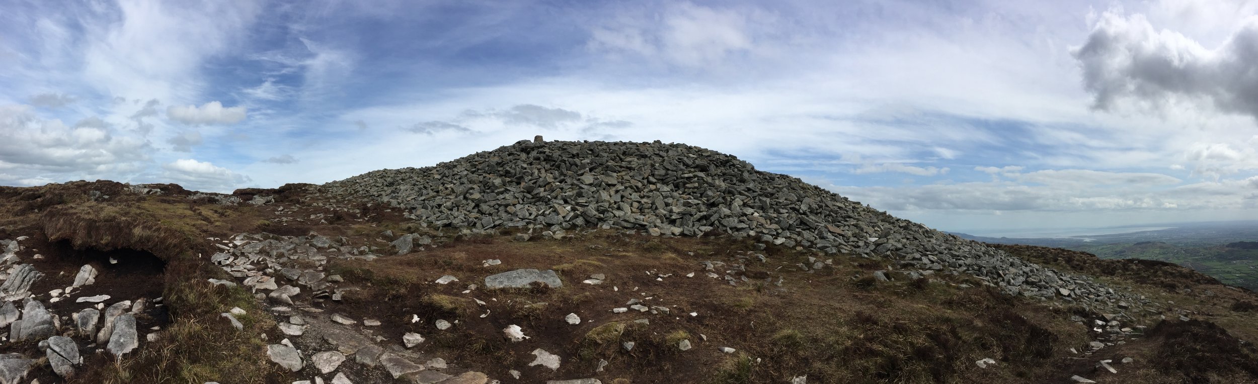
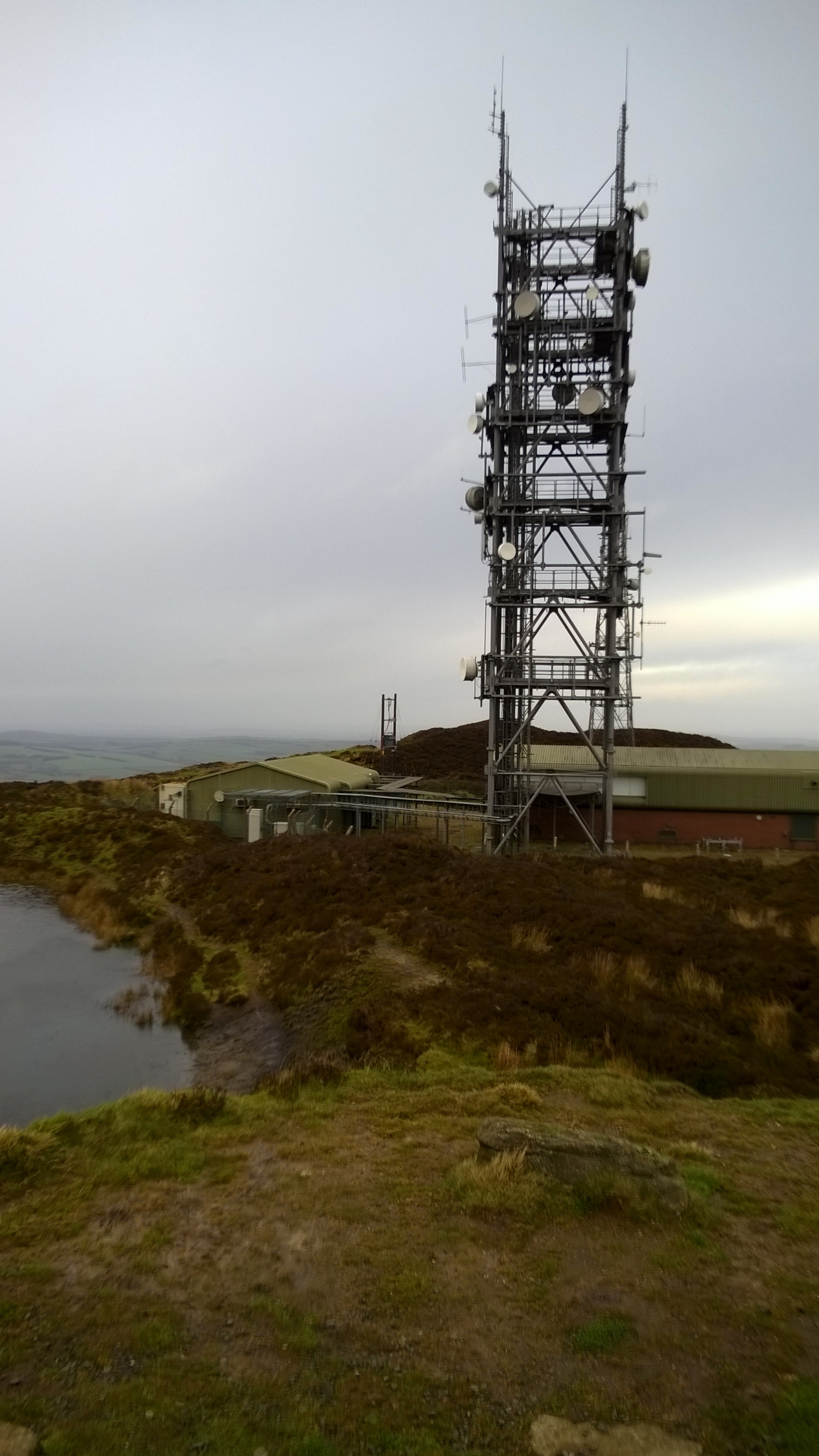
The summit of Donard is a large pile of stones next to a trig point on a stone tower. This is one of three similar towers originally built to provide shelter for the workers that built the wall. From the summit we could see one of the other towers on the way up to the neighboring Slieve Commedagh, the second highest of the Mourne Mountains at 767m
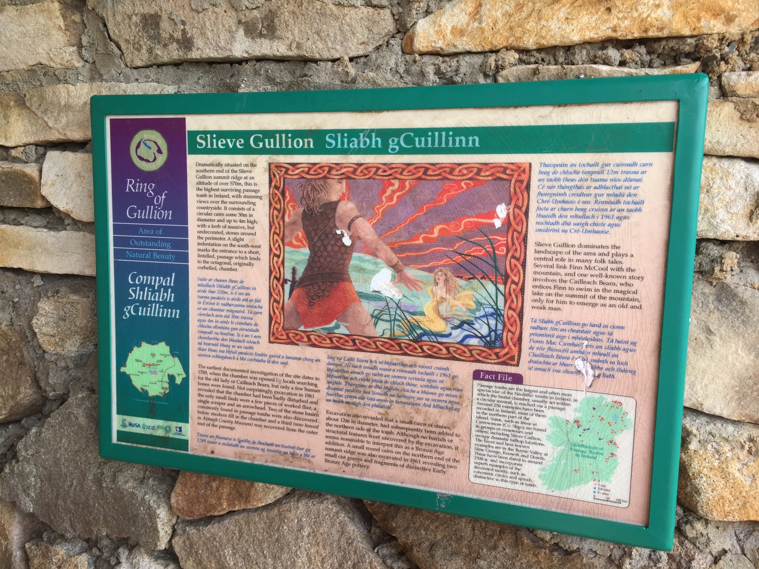
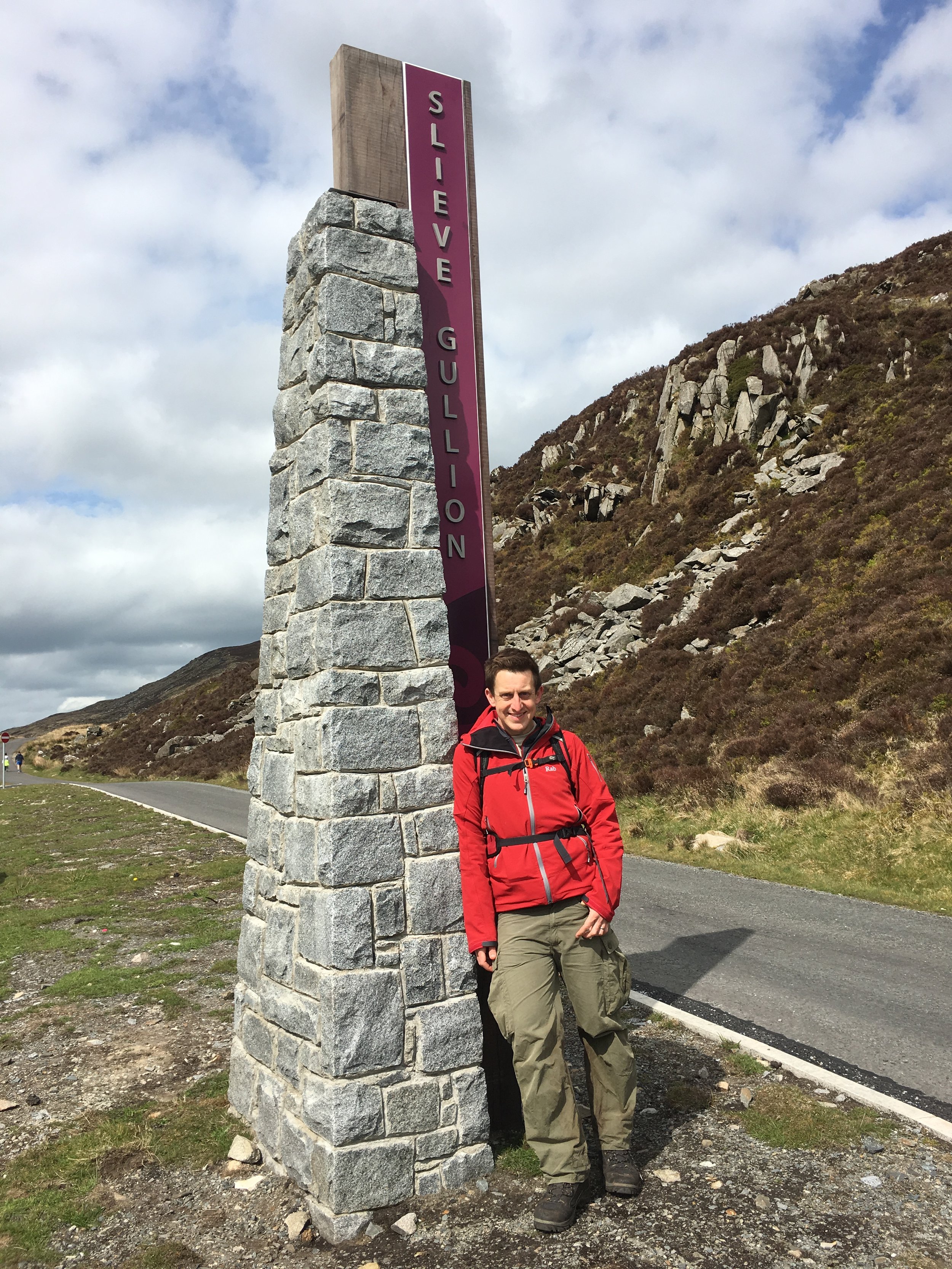
Slieve Gullion summit
Also known as: Sliabh gCuillinn
Significance: Highest peak in County Armagh (Historic County Top), Ring of Gullion National Landscape High Point
Member of: Marilyn
Parent Peak: TBC.
Nearest Higher Neighbour: Slieve Foye
Elevation: 576m
Date climbed: May 5th 2016
Coordinates: 54.1214° N, 6.4304° W
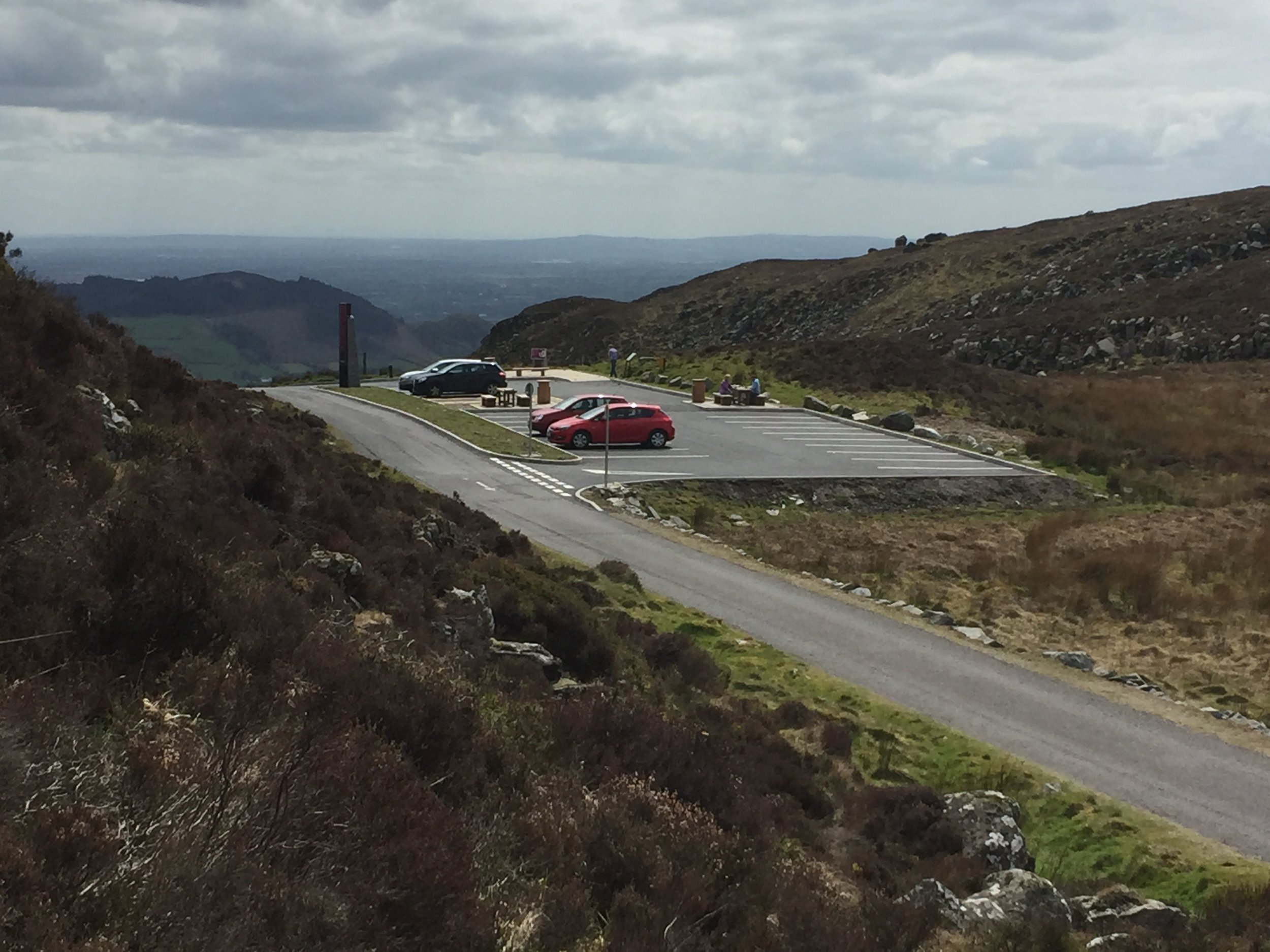
Route Start / End: Slieve Gullion viewing platform car park, Ring of Gullion AONB
Route Distance: 2.8 km (1.7 miles)
Route Elevation Change: +/- 196m
Subsidiary tops on route: None
GPX File: get via Buy Me a Coffee
Other routes touched: None
OS Trig Pillar: TP7352 - Slieve Gullion
Guidebook: The UK's County Tops (Jonny Muir)
Links: Wikipedia (County Armagh), Wikipedia (Slieve Gullion), Peakbagger, Hillbagging
This trek was part of a tour of the Historic County Tops of Northern Ireland that Timea and I did in May 2016.
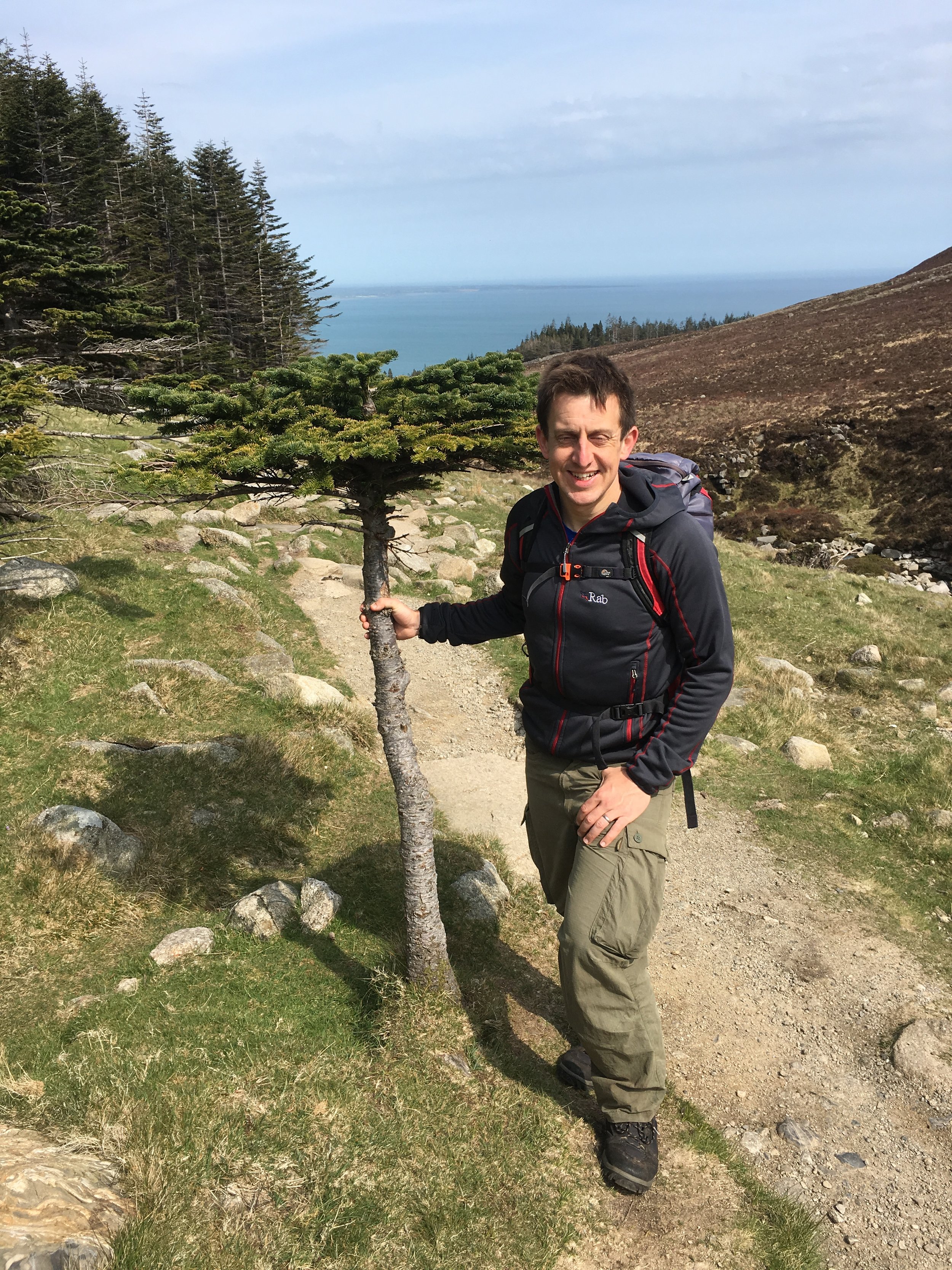
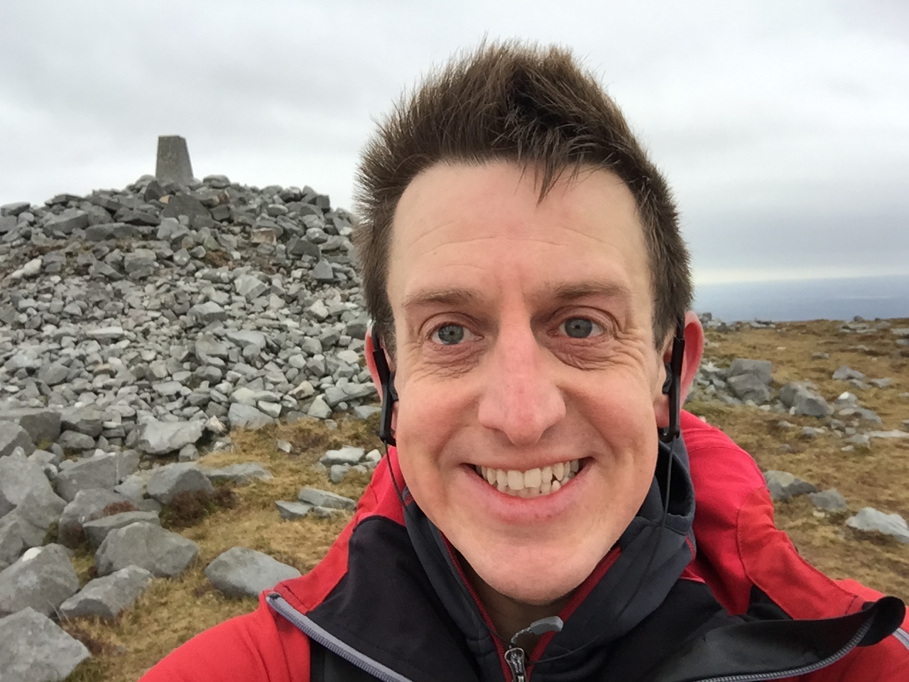
Slieve Gullion was a short walk after a long drive from Donegal. The trek was unexpectedly enjoyable as It looked fairly boring in the book but we really liked it. The mountain road up to the car park was worth the trip there in itself. From the parking spot, the trail snakes up for just over half a mile to the very obvious summit point. We had a clear day and could see for miles.
This was my birthday and the anniversary of our summit day on Mount Toubkal. Whilst a significantly smaller trek than Toubkal, this was still an amazing adventure day.
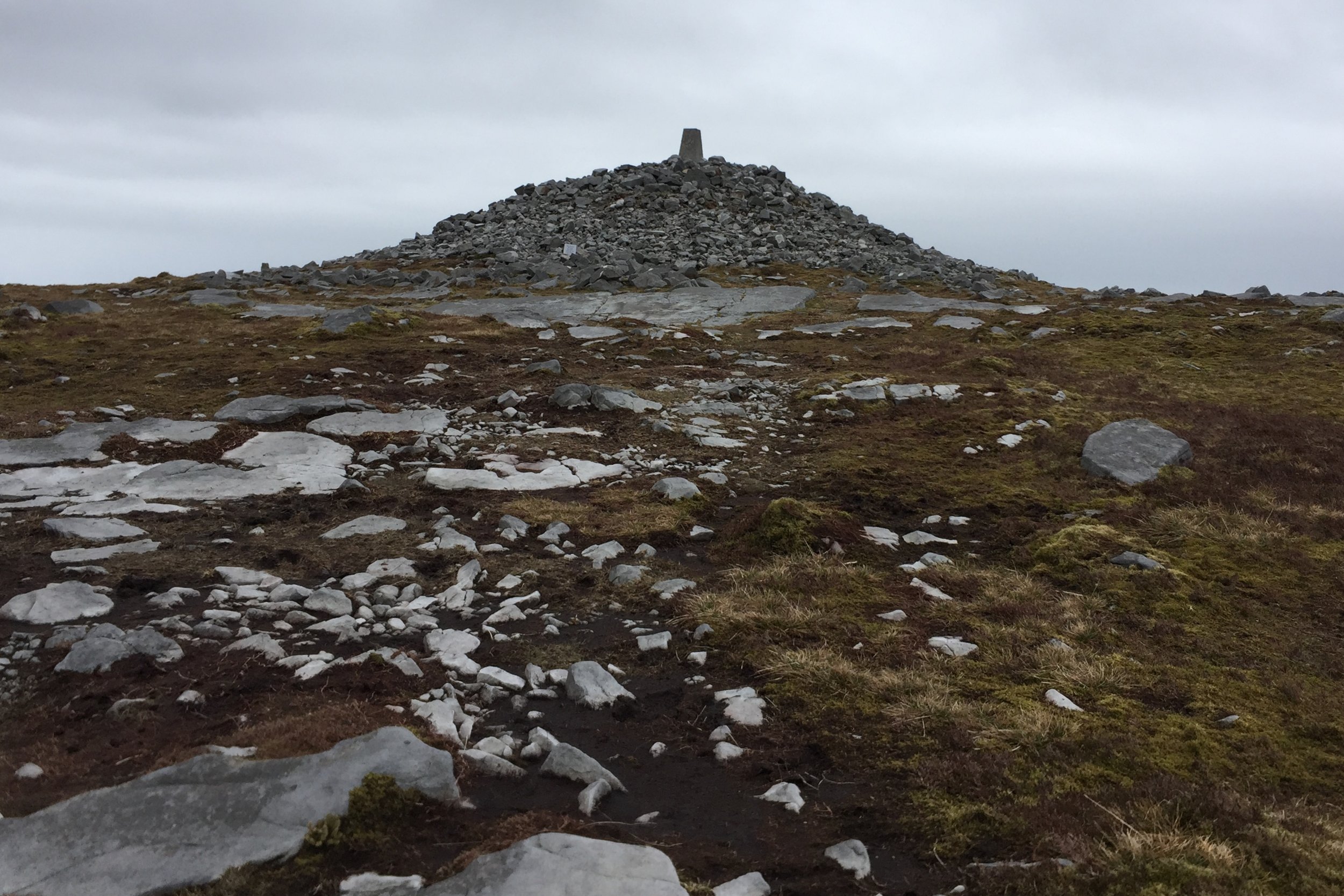
Cuilcagh summit
Also known as: Binn Chuilceach
Significance: Highest peak in County Fermanagh (Historic County Top)
Member of: Marilyn, Hewitt
Parent Peak: TBC. Nearest Higher Neighbour: Croaghgorm
Elevation: 666m
Date climbed: May 4th 2016
Coordinates: 54.2017° N, 7.8123° W
Route Start / End: Cark park at Cuilcagh Mountain Park
Route Distance: 13.5 km (8.4 miles)
Route Elevation Change: +/- 897m
Subsidiary tops on route: None
GPX File: get via Buy Me a Coffee
Other routes touched (walk): Cuilcagh Way
Other routes touched (cycle): None
OS Trig Pillar: TP7344 - Cuilcagh
Guidebook: The UK's County Tops (Jonny Muir)
Links: Wikipedia (County Fermanagh), Wikipedia (Cuilcagh), Peakbagger, Hillbagging
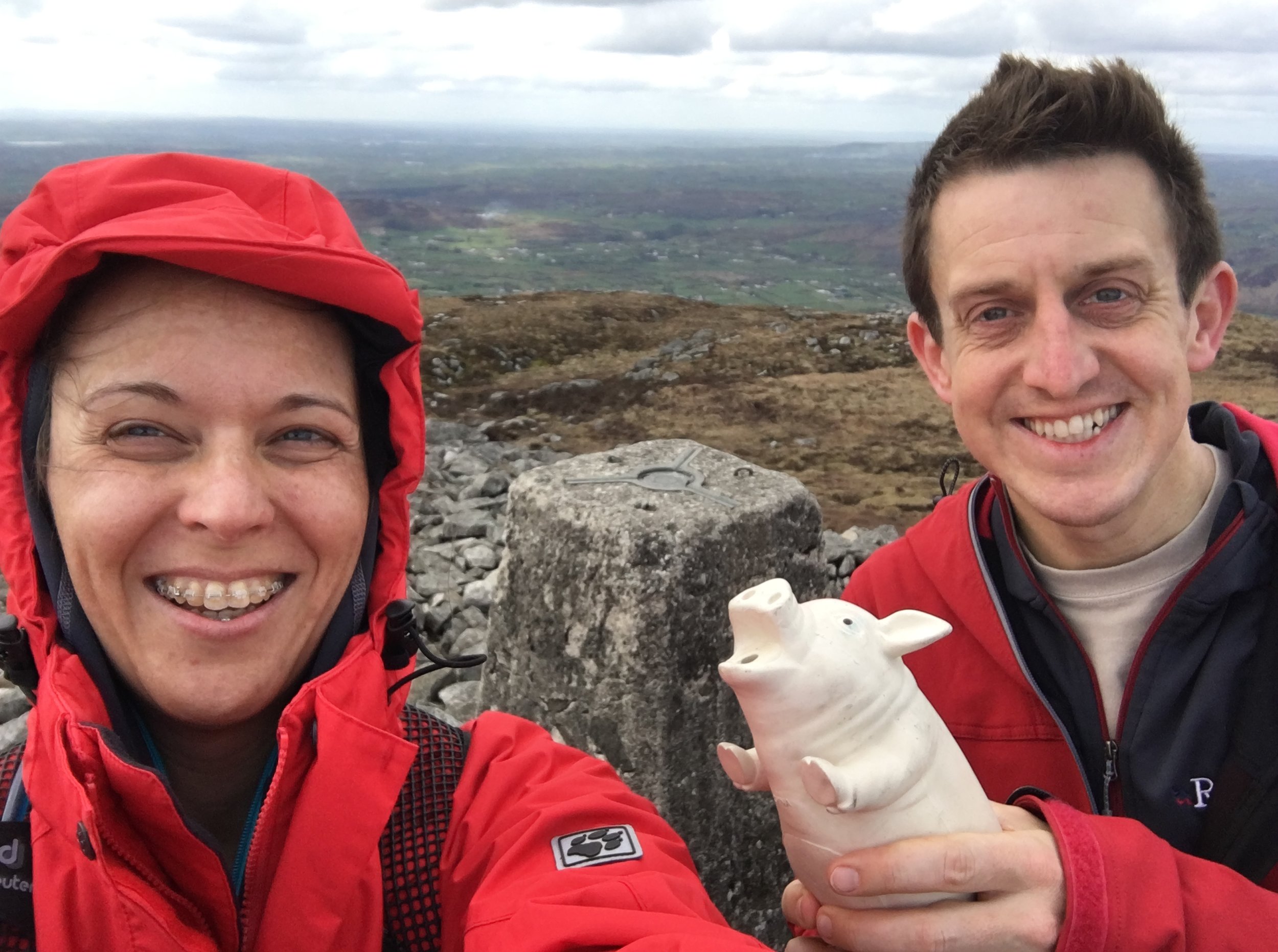
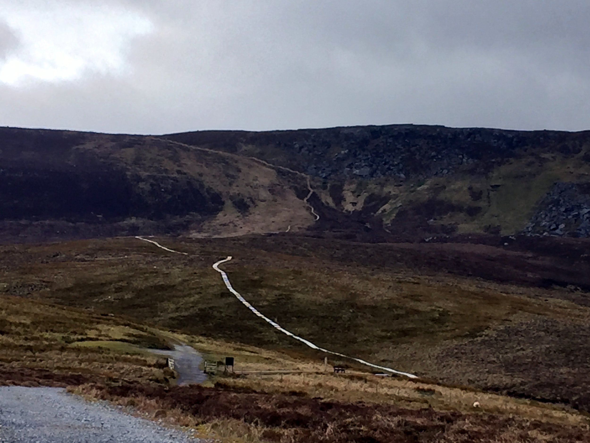
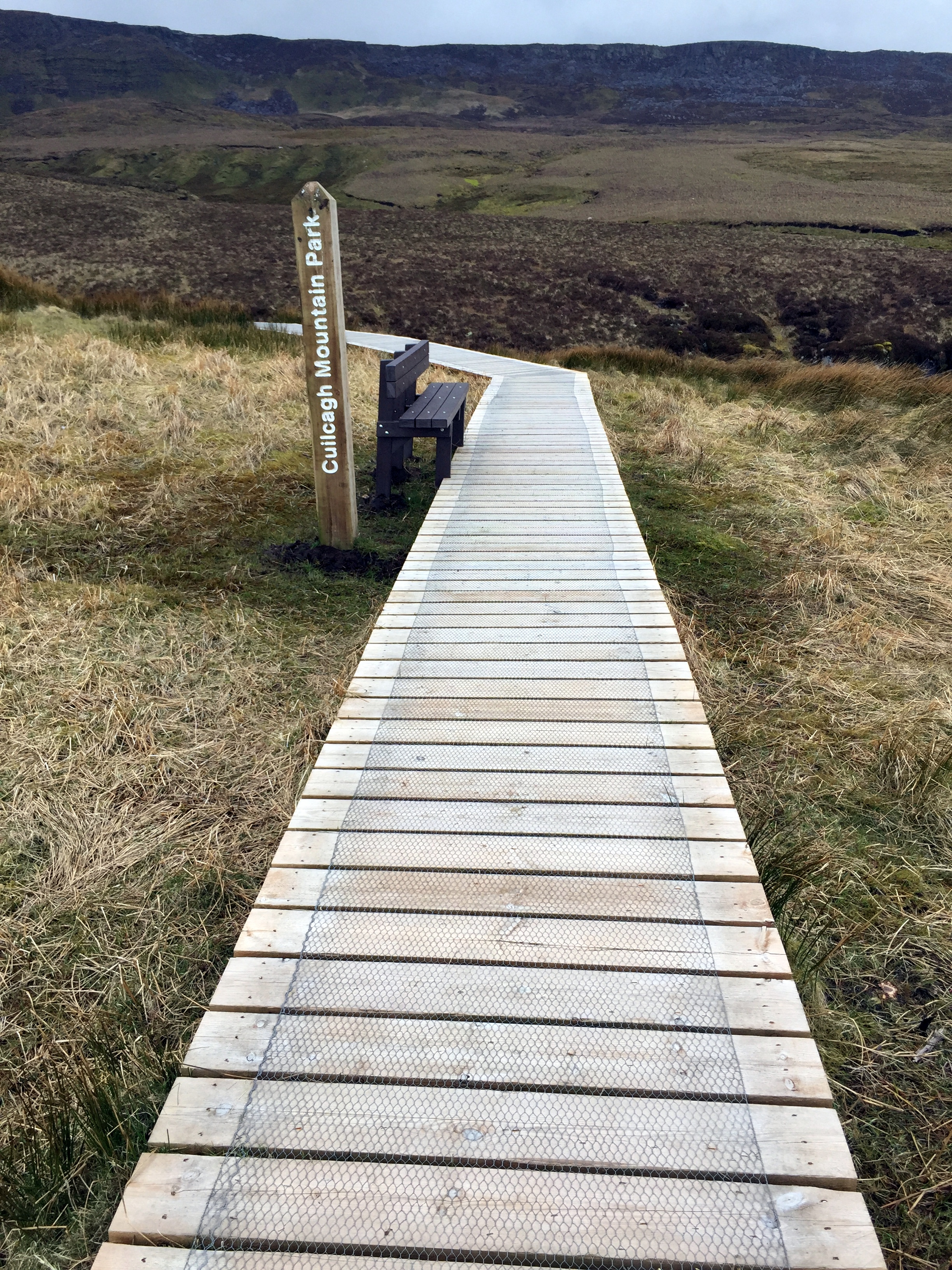
This trek was part of a tour of the Historic County Tops of Northern Ireland that Timea and I did in May 2016. Cuilcagh would be the first of the 2 more challenging County Tops of the trip. Timi decided to have a spa day at the hotel so I headed out on my own.
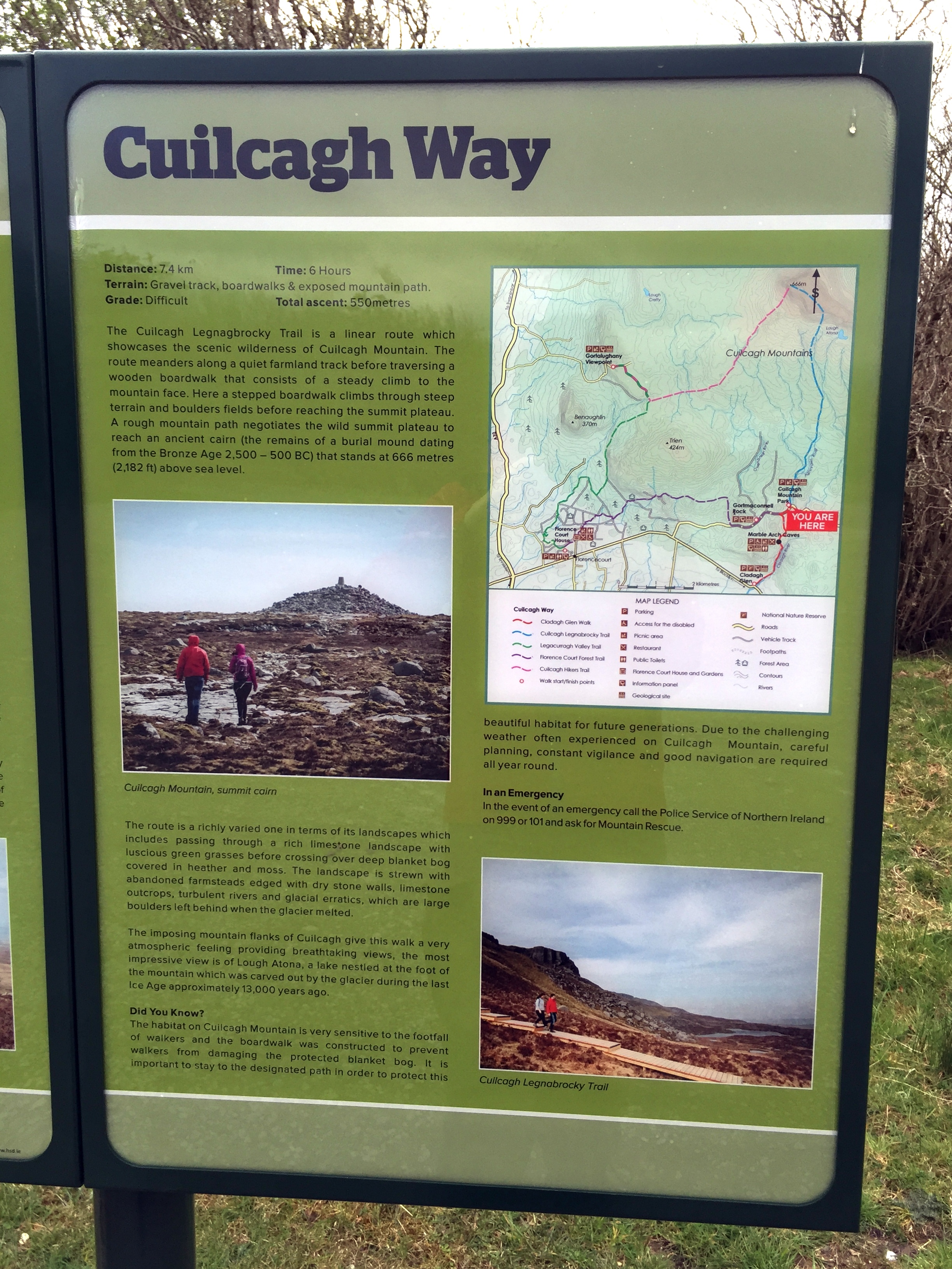
The start is near the Visitors' Centre for the Marble Arch Caves, part of the UNESCO Geopark that covers a lot of the surrounding area. The Visitors Centre sells maps which was pretty handy I'd found that OS maps of Northern Ireland pretty hard to find. From the Visitors Centre, turn right out of the car park and you'll see the car park for the Lenocky Trail very shortly on the left hand side.
The walk starts along a well maintained farm track heading South towards the mountain. You only have to walk a few minutes before Cuilcagh and the route to it are fully visible. The first 2.5 miles are a very gentle gradient along this track, making it pretty straightforward for most walkers. The next section is a wooden Boardwalk which looked like it had been recently made. It is raised by about half a metre to protect the ground underneath. This also makes the next half mile section significantly easier. At the step section leading up the cliffs the boardwalk turns into a well constructed staircase with railings to hang onto.
The boardwalk ends at the plateau and from there the summit is about 800m further. Up to now the navigation had been extremely simple, but this next section requires some care, especially in poor visibility. If you are using a GPS device, as I was, I recommend marking a waypoint at the top of the boardwalk. The top is just under the ridge and you can't see it until you get right to the edge and look down.
As the boardwalk ends, the trail heads across rocks and peat and is occasionally marked by the Cuilcagh Way's yellows leaf insignia, painted on some of the larger rocks. About half way on this section you'll reach a fence with a small opening. Through here turn left and follow the fence for about 50 metres then the summit will come into view directly ahead of you.
The summit is a Trig Point built up on a mound of rocks. It's rare that I can see much at all from the tops, but today was clear and I could see for miles across both Northern Ireland and the Republic. Cuilcagh sits right on the international border and is the County Top for both Fermanagh in the UK and Cavan in Ireland. The border is not marked so I had to use a combination of my Garmin and Google Maps to make sure I'd walked across both countries at the summit.
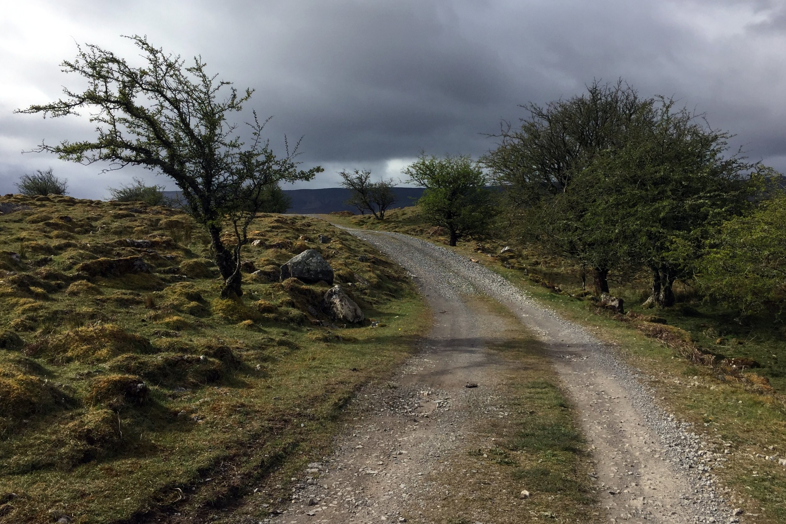
The way back was simple, especially as the visibility was good. This is the point to use the GPS waypoint to find the top of the boardwalk. Just after the boardwalk ended and I'd got back on the farmers track I saw the first signs of other people. Up til now I'd been on my own, and we didn't see anyone at all on the Trostan and Sawel treks. I'd been wondering if trekking is just not as popular in this area as treks like these on the mainland UK would attract many more people.
View from the ascent
Also known as: Samhail Phite Meabha
Significance: Highest peak in County Londonderry and County Tyrone (Historic County Top), Sperrins National Landscape High Point
Member of: Marilyn, Hewitt
Parent Peak: TBC.
Nearest Higher Neighbour: Errigal
Elevation: 678m
Date climbed: May 3rd 2016
Coordinates: 54.8189° N, 7.0386° W
Route Start / End: Layby just past cattle-grid on highest point of Park-Sperrin road
Route Distance: 6.4 km (3.4 miles)
Route Elevation Change: +/- 593m
Subsidiary tops on route: None
GPX File: get via Buy Me a Coffee
Other routes touched (walk): Sperrins Challenge Walk
Other routes touched (cycle): None
OS Trig Pillar: TP7350 - Sawel
Map: OS Northern Ireland Activity Maps: The Sperrins (for Sawel Mountain)
Guidebook: The UK's County Tops (Jonny Muir)
Links: Wikipedia (County Londonderry), Wikipedia (County Tyrone), Wikipedia (Sawel Mountain), Peakbagger, Hillbagging
This trek was part of a tour of the Historic County Tops of Northern Ireland that Timea and I did in May 2016.
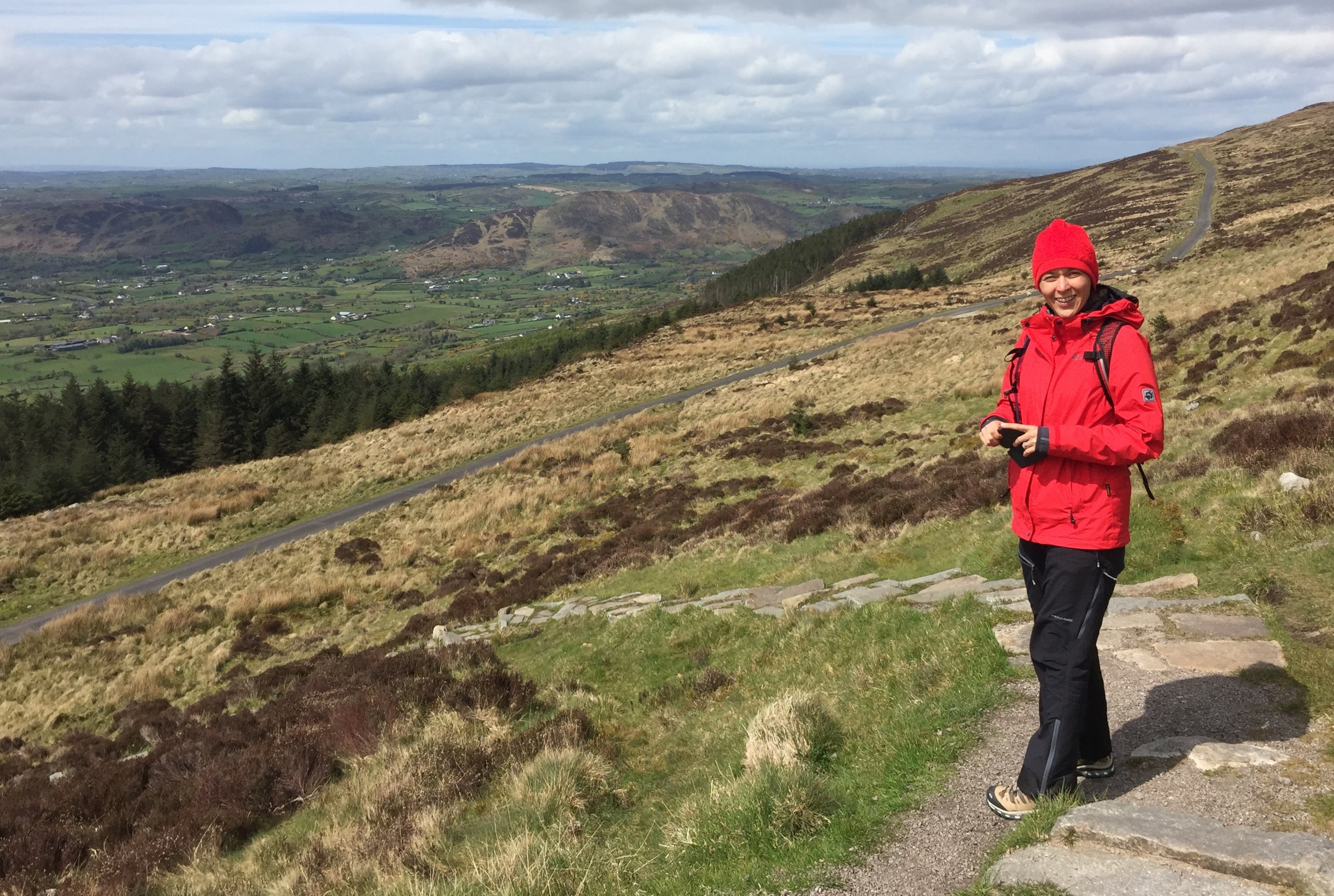
After a rest day at the Giants Causeway we drove South for an hour and a half to find Sawel Mountain. This is clearly not a popular route as the path is not signposted and you need to be careful to find the right spot on Sperrins road to start. Its fairly straightforward, however, and there's a good parking spot just before the cattle grid on the high point of the road.
Navigation is fairly simple as you just follow the fence from the cattle grid all the way up to (almost) the summit. Following either side of the fence is OK although we had to cross over a few times and found the south side to be generally dryer that day.
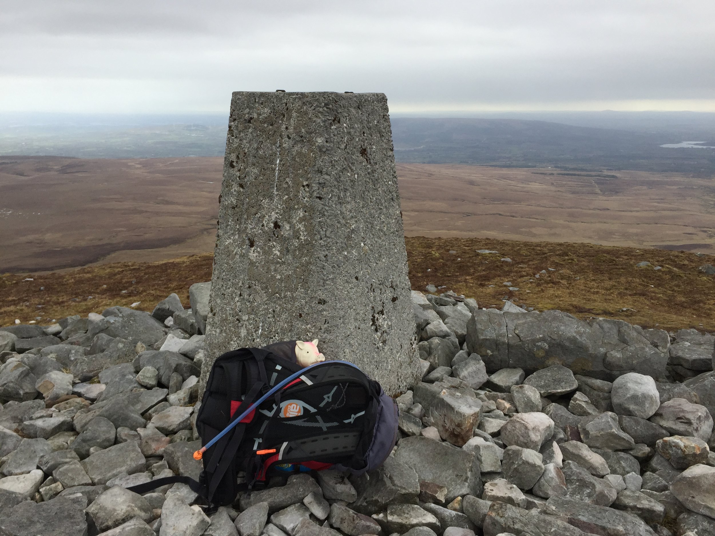
The ascent was a boggy slog taking about an hour and a half. Near the summit the fence veers off to the south for a few hundred metres before taking a right angle to the west. The summit is an obvious Trig Point about 80 metres up from the fence.
It was hailing and blowing a gale when we got to the Trig Point so we didn't hang around for long. We did hop back over the fence for a few minutes to find the closest bit of high ground to claim the County Tyrone high point.
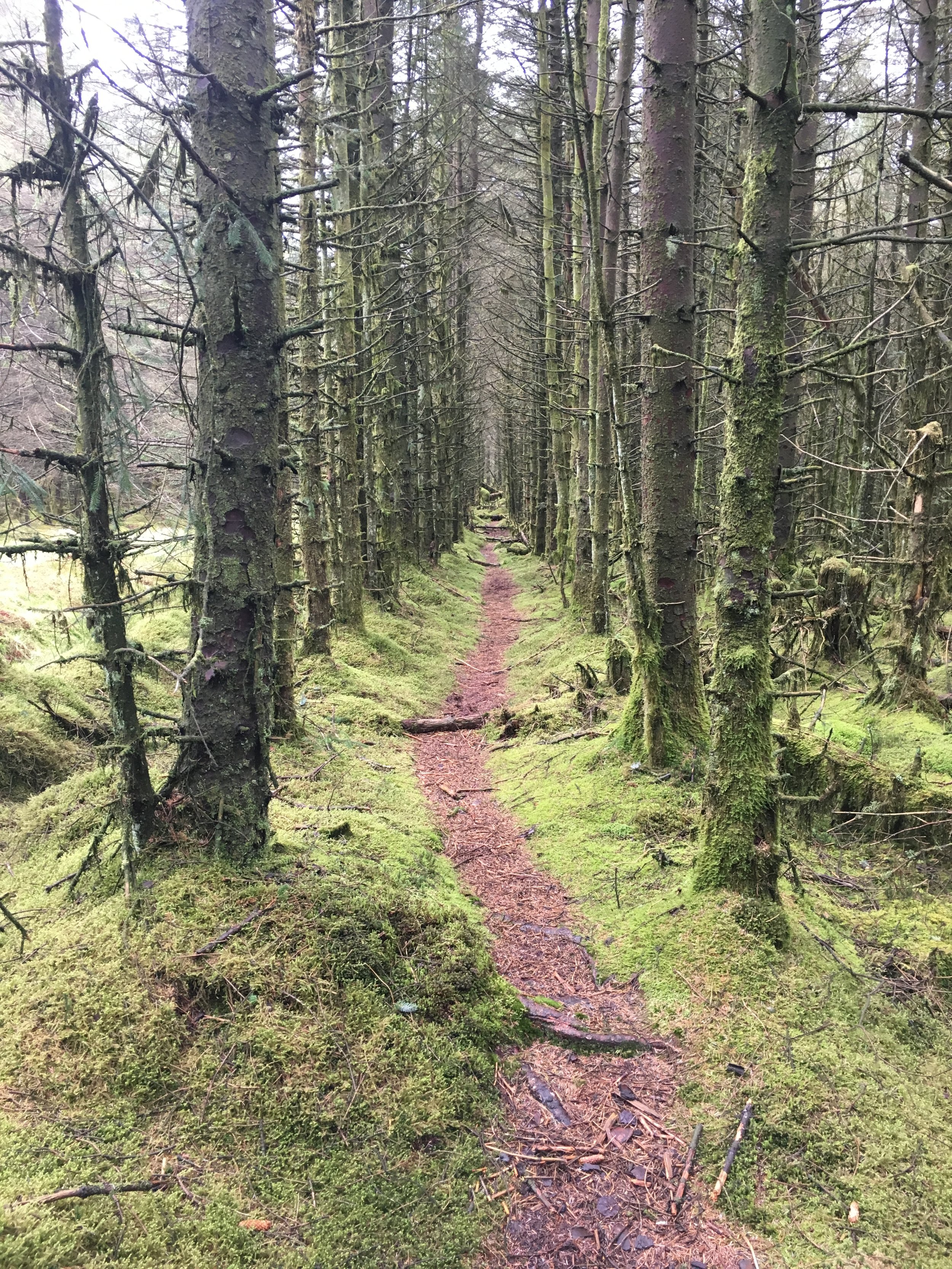
Emerald woods on the descent from Trostan
Significance: Highest peak in County Antrim (Historic County Top), Antrim Coast and Glens National Landscape High Point
Member of: Marilyn
Parent Peak: TBC.
Nearest Higher Neighbour: Oughtmore
Elevation: 550m
Date climbed: May 1st 2016
Coordinates: 55.0458° N, 6.1553° W
Route Start / End: Layby near Essathohan Bridge on Ballyeamon Road
Route Distance: 9.8 km (6 miles)
Route Elevation Change: +/- 724m
Subsidiary tops on route: None
GPX File: get via Buy Me a Coffee
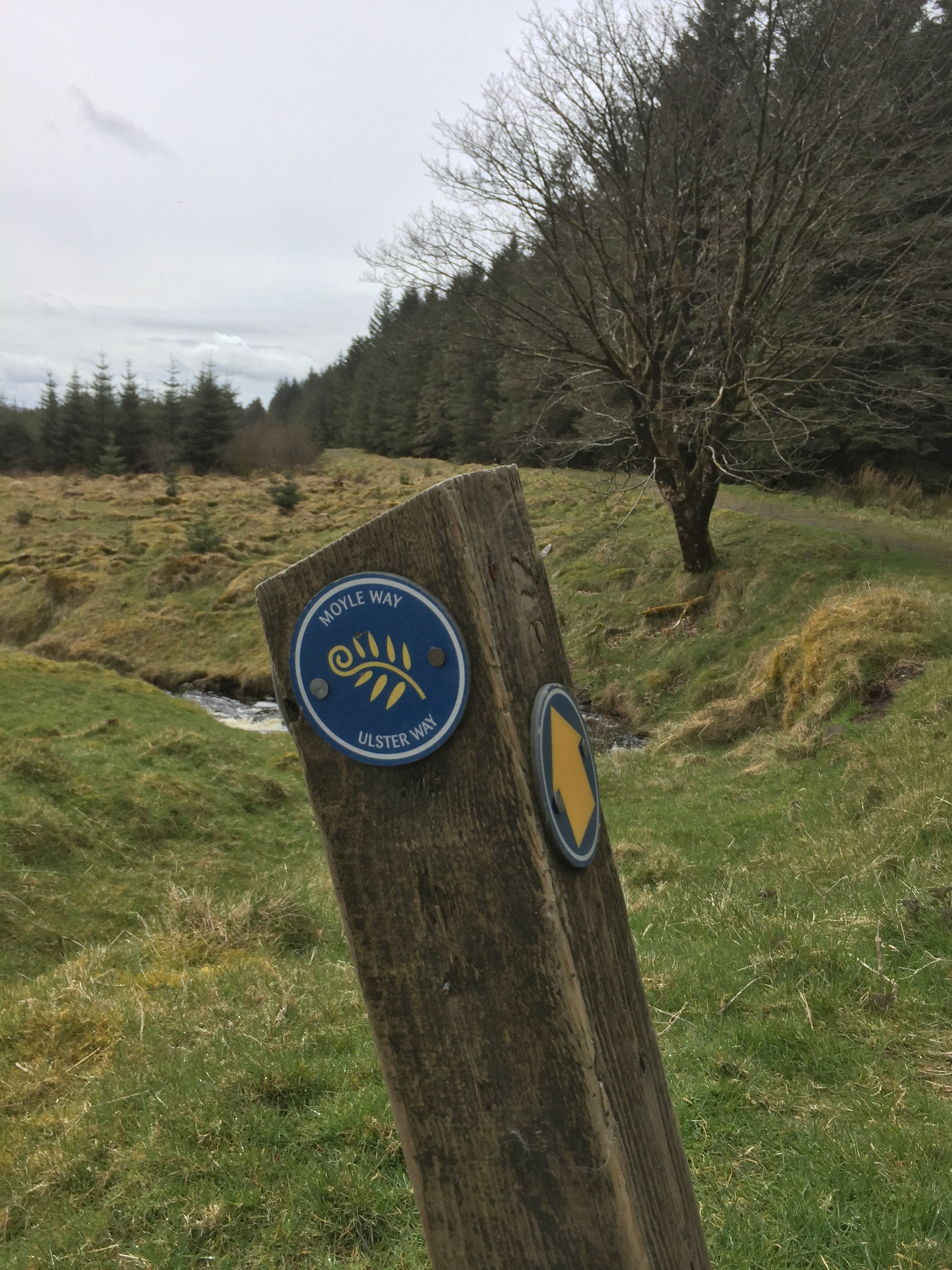
Other routes touched (walk): Moyle Way
Other routes touched (cycle): None
OS Trig Pillar: TP7349 - Trostan
Map: OS Northern Ireland Activity Maps: Glens of Antrim
Guidebook: The UK's County Tops (Jonny Muir)
Links: Wikipedia (County Antrim), Wikipedia (Trostan), Peakbagger, Hillbagging
This trek was part of a tour of the Historic County Tops of Northern Ireland that Timea and I did in May 2016.
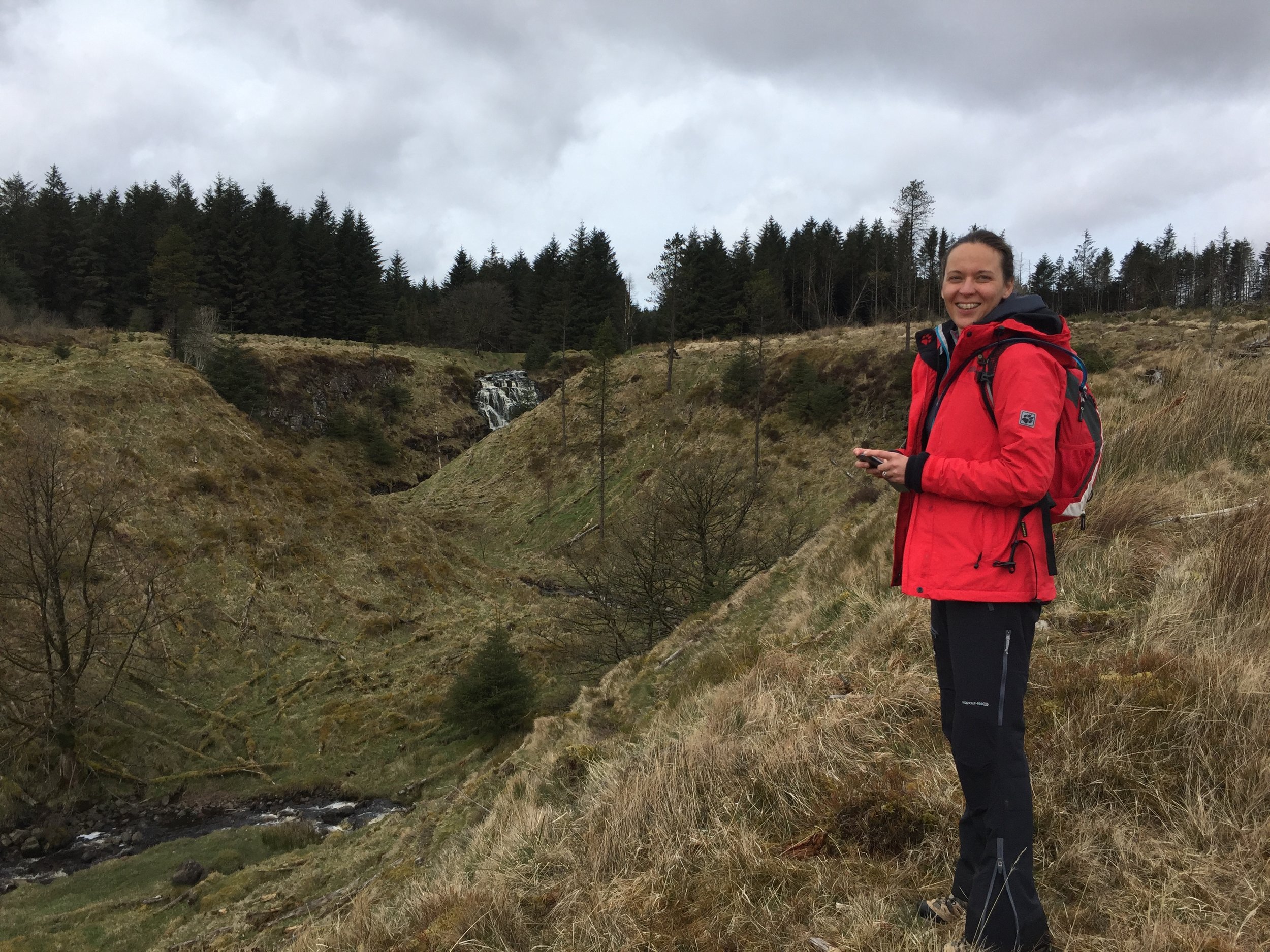
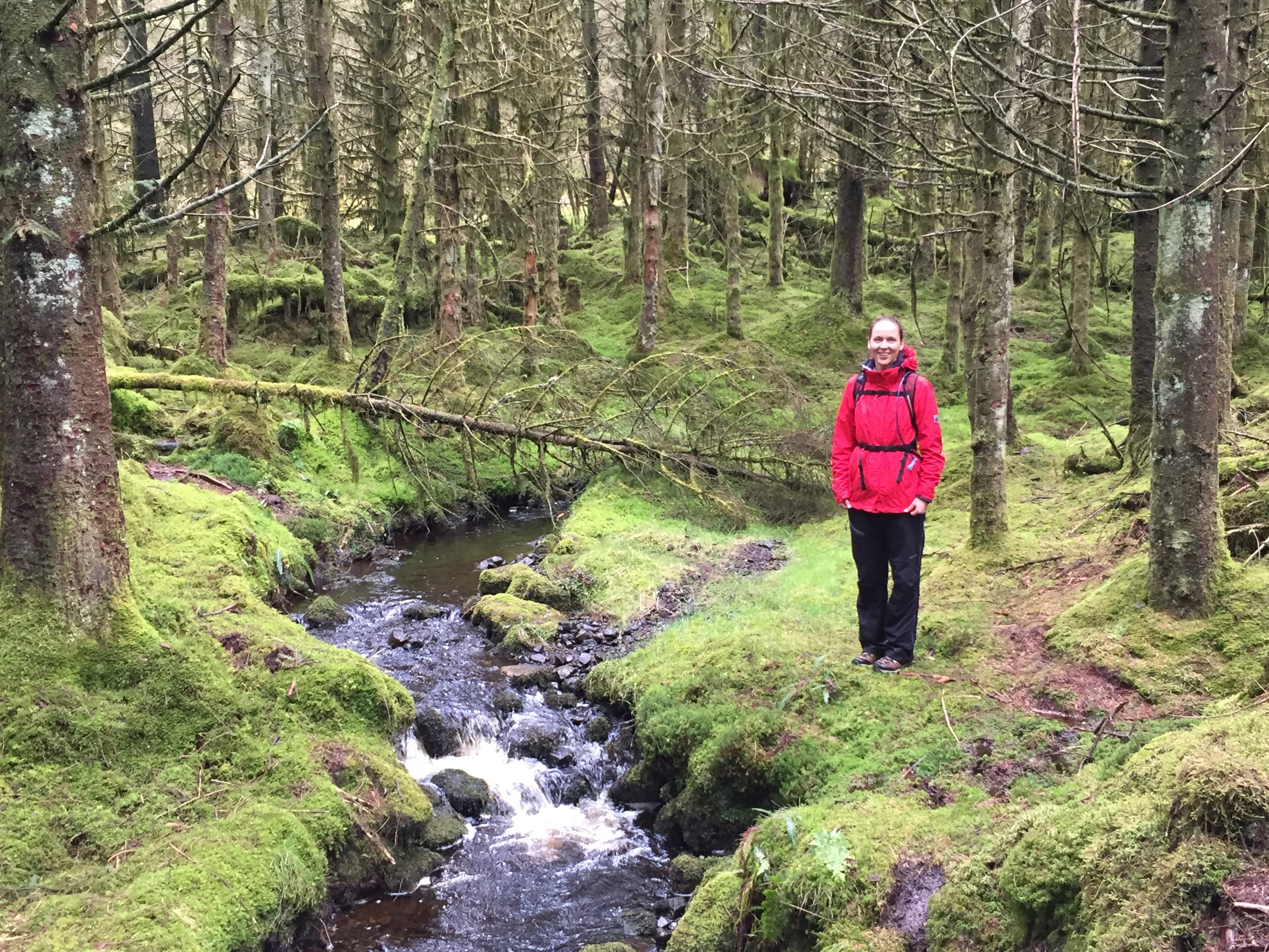
Our first walk was Trostan, about an hour North of Belfast in the centre of County Antrim. The weather was fairly good and the rain held off till the last 20 minutes. Even so, the ground was saturated and most of the route was through a peaty swamp. We followed the Moyle Way, initially along the right hand side of a stream to a waterfall and an old stone bridge. We turned left across the bridge, following a track for about 2 hundred metres, then turned right to follow another track up though the forest. This took us a little off course which we needed to correct once we got above the tree line. On the way back we discovered that the better route up would have been to have continued straight up past the stone bridge, following the course of the stream.
Once we were back on track after the forest, we relied on the GPS for navigation and the trek to the summit was mostly a matter of finding the driest and least bumpy route. The actual summit is enclosed by a fence with one dilapidated style that takes some skill to cross without impaling yourself. Once past the fence, we headed towards the 2 cairns and the summit Trig Point was very close-by and easy to see.
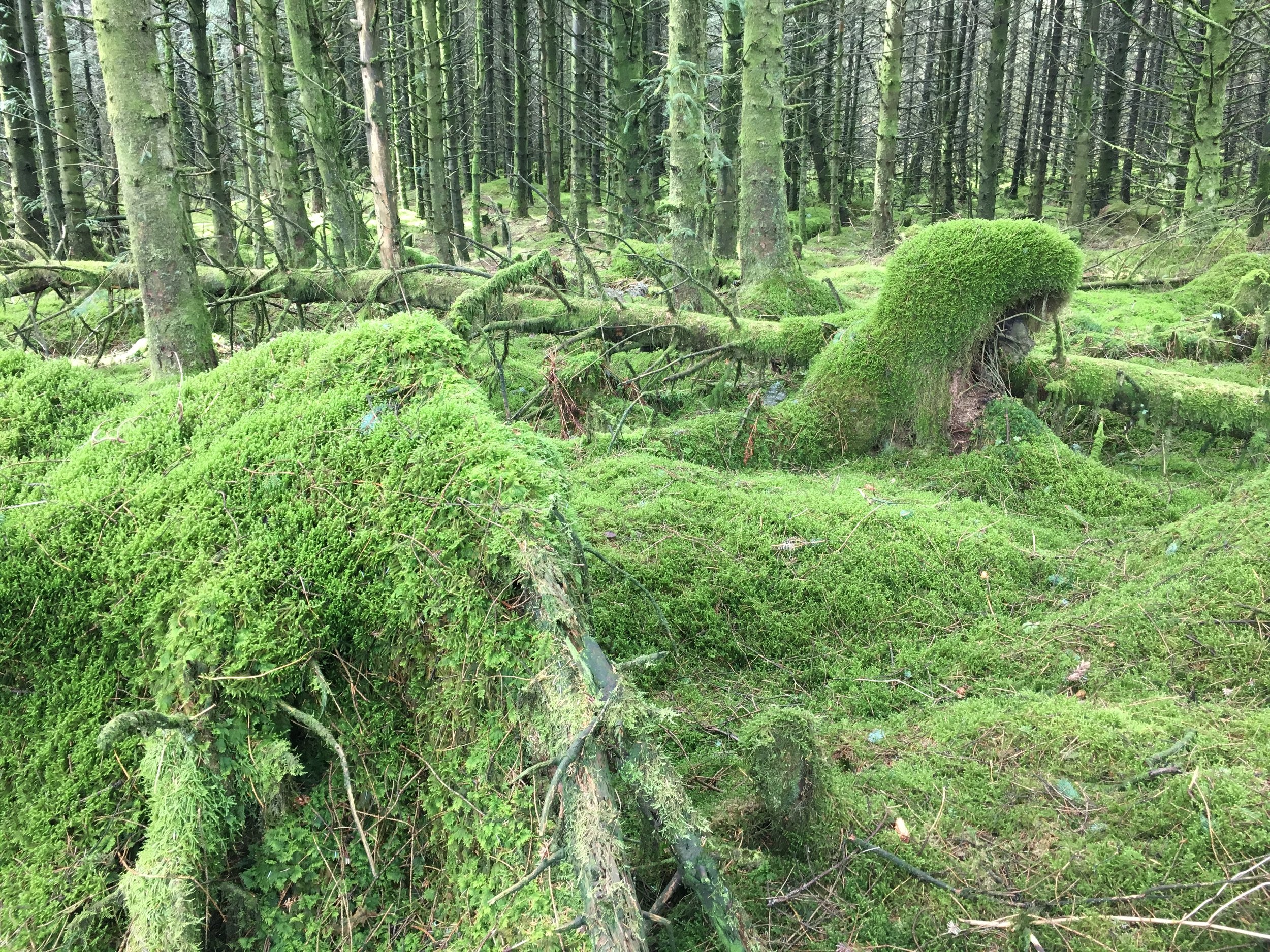
The descent was much more enjoyable as we took a more direct route down through the forest, following the stream. The colours of the moss covered trees were amazing, showing why they call this place the Emerald Isle. The path next to the stream was very boggy, but added to a fun walk down with many stops for photos.
From the lay-by where we parked we continued on towards Cushendun and picked up the Tor Point Scenic Drive. This is a off-shoot of the Causeway Scenic Route and takes in some dramatic cliff top lanes overlooking the North East Coast. The route passes through Ballycastle and a collection of National Trust properties, before reaching the Giants Causeway near Bushmills.
When: March 20th 2016
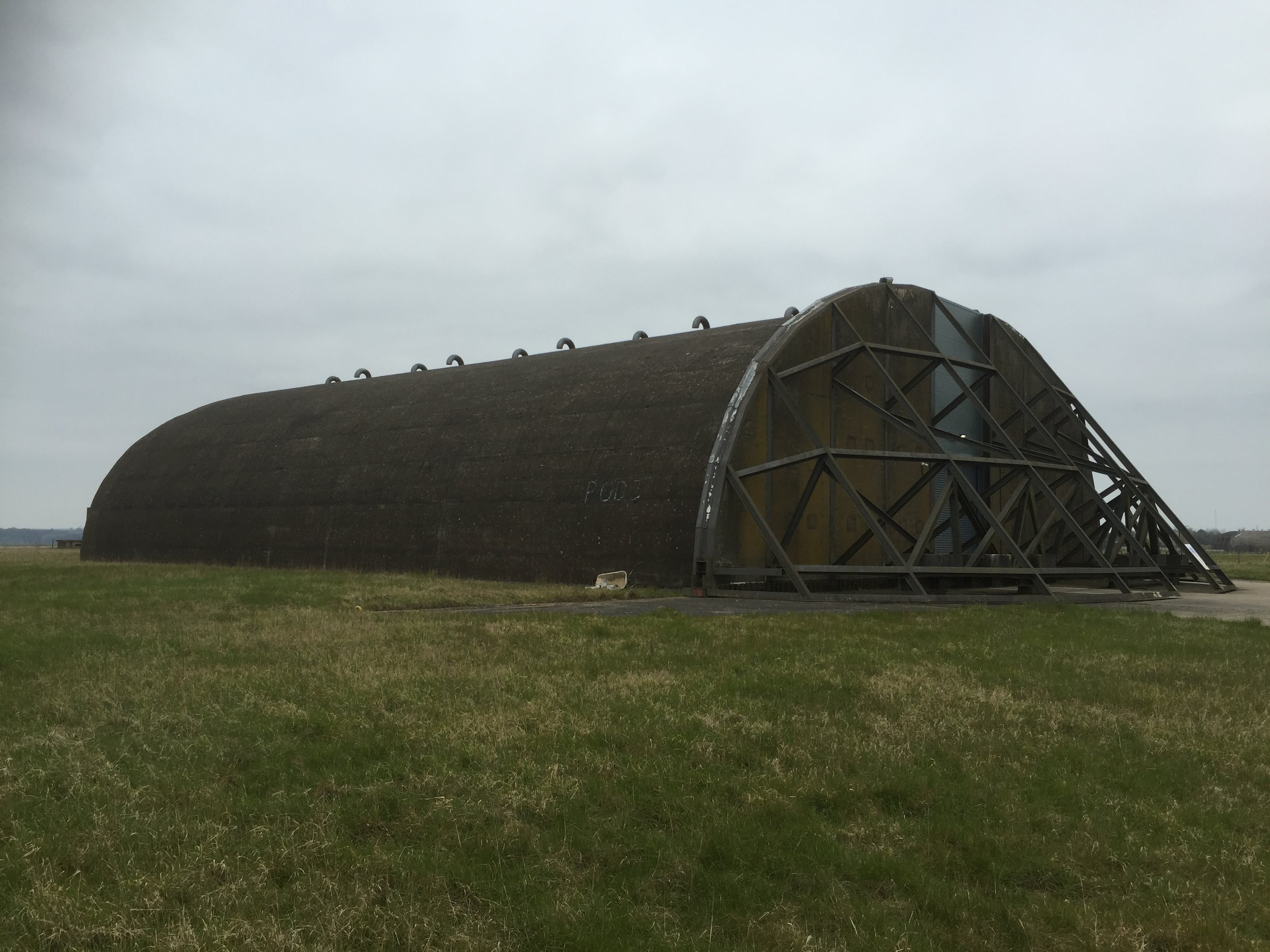
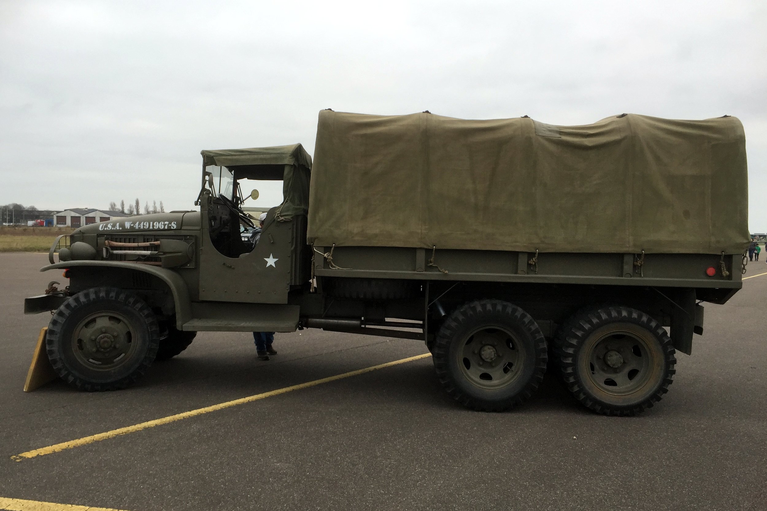
Where: Upper Heyford, Oxfordshire
Course: Runway and Service Roads around Heyford Airbase.
Other routes touched: None
Finish time: 1:59
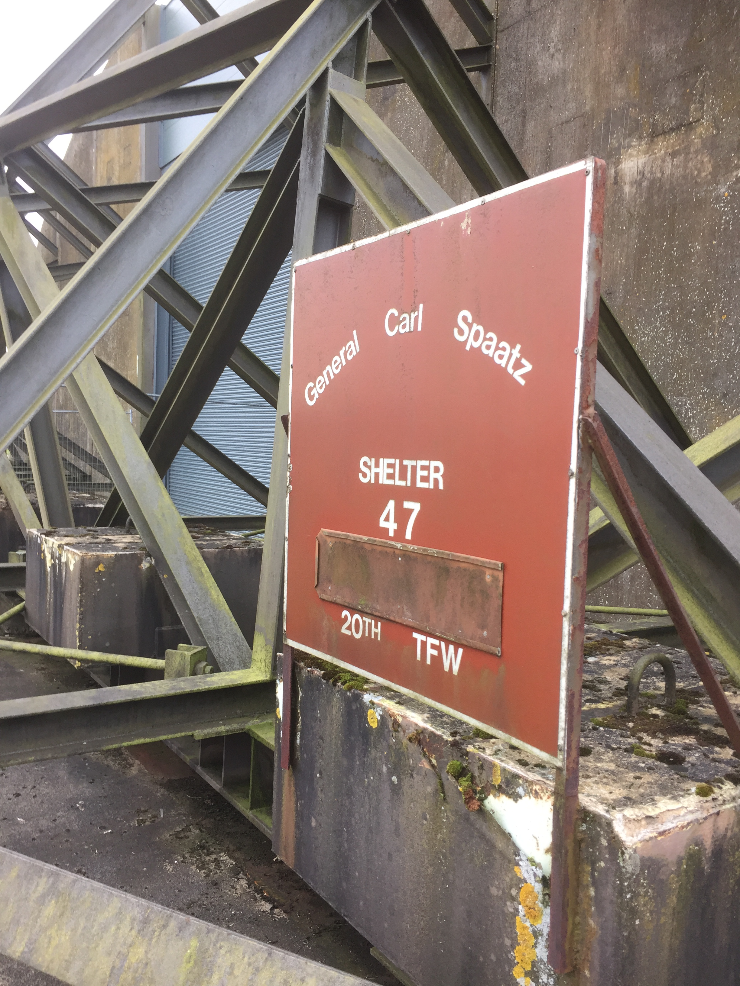
Half Marathon #26 of 50 at RAF Heyford near Oxford. A new route around the runways and service roads. Nice run and a bit quirky. Best bit was a brass band play the theme to the Muppet Show in a metal trailer in the middle of the runway as we all ran past.
For more information on Heyford Airbase, see Darmon Richter's blog post
When: March 13th 2016
Where: Woking, Surrey, UK
Course: 2 loops on country roads between Woking and Guildford
Other routes touched (walk): The Fox Way
Other routes touched (cycle): NCN 223
Finish time: 1:55
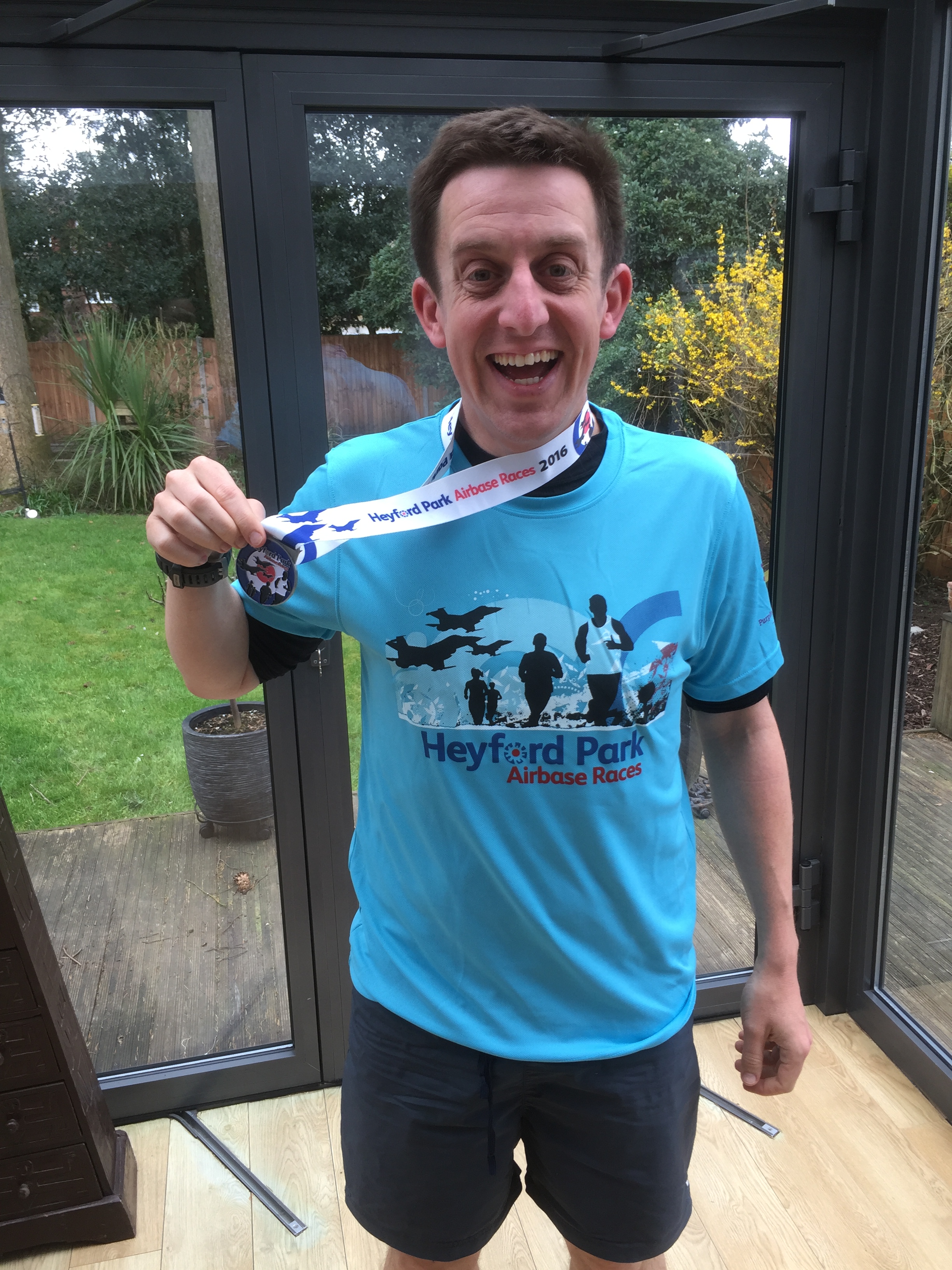
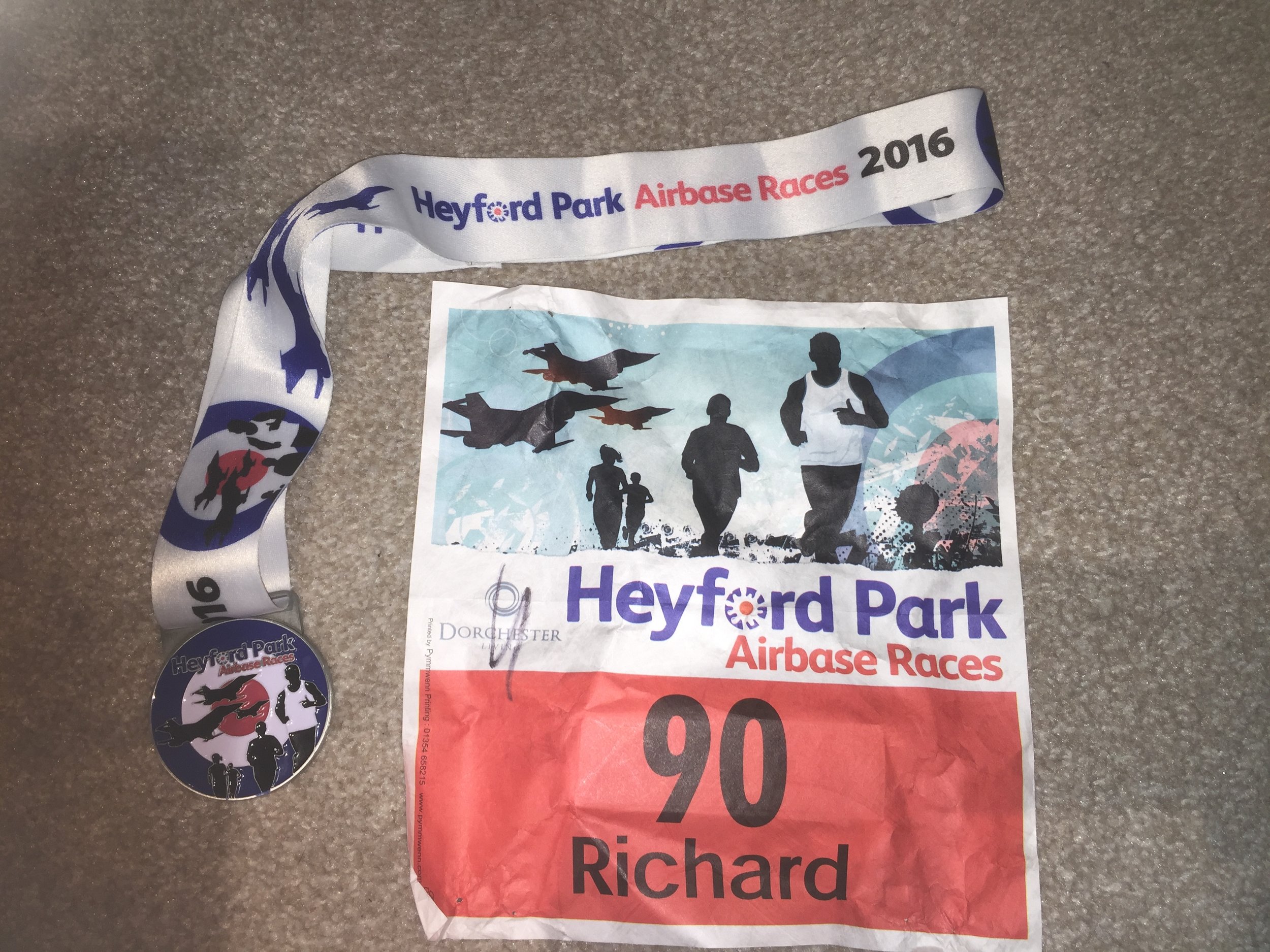
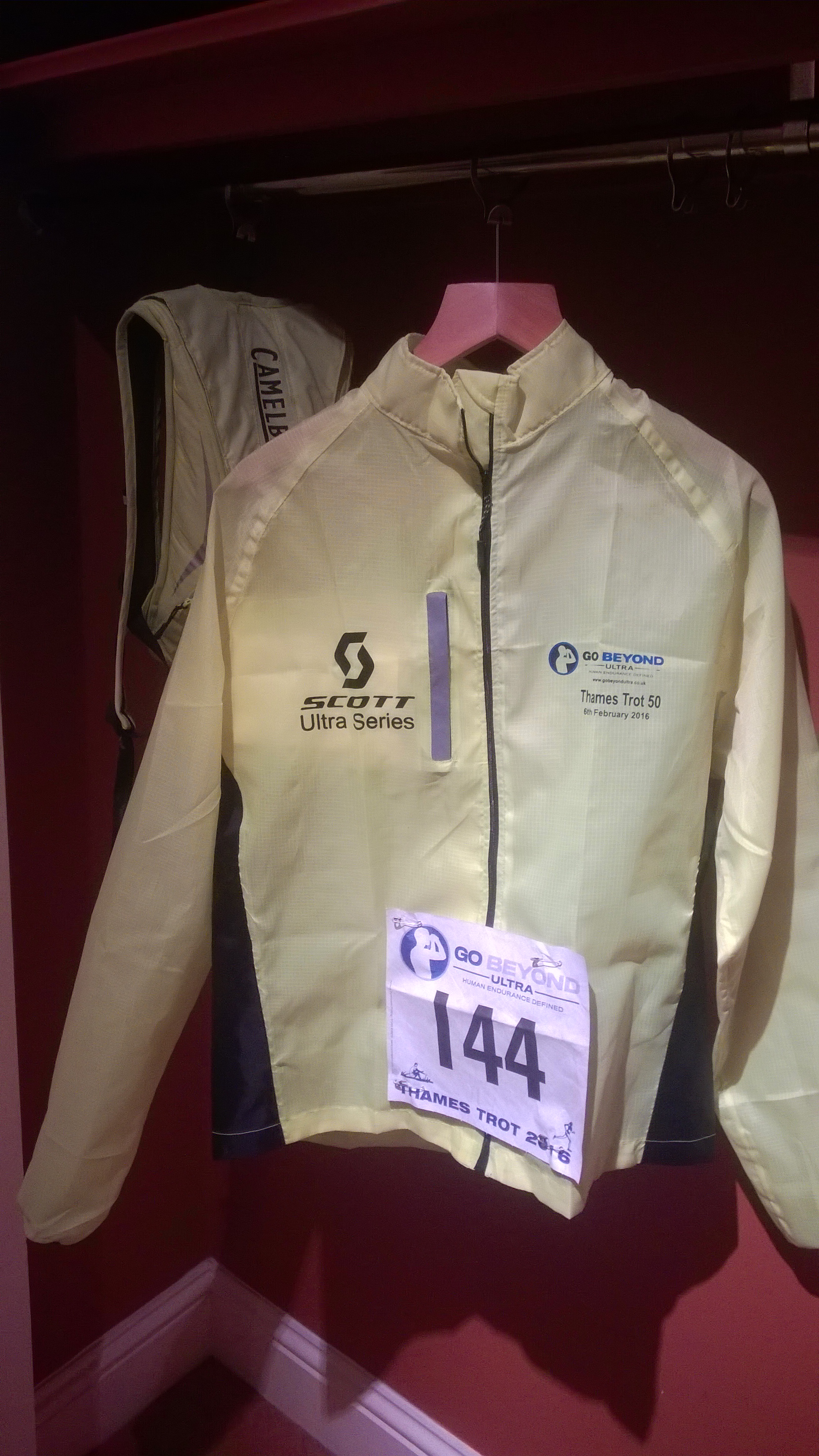
Well, that was tough. The Thames Trott 50 was my 2nd Ultramarathon and my first DNF (Did Not Finish). On paper it was all looking good. Despite being 5 miles longer than last year's Country To Capital 45, the Thames Path route made it flatter and easier to navigate. In reality it was so much harder. The mud, wind and rain all conspired to make it a pretty grim day.
Mile 1 was fine. A nice, gentle downhill from the start line in Oxford down to the river. Then the mud started. Till then I'd been trying to avoid puddles hoping to keep my feet dry. The path reached a fence which created a bottleneck and split the pack across different gates and gaps, all of which opened into large puddles. There was nearly a fight when two runners got into a barney about Kissing Gate etiquette. "I'll punch you in the mouth if you grin at me again" shouted a rough looking older guy to another runner. After a few hundred metres of taunting each other they disappeared separately into the distance.
The next 18 miles to Checkpoint 2 were just a trail of mud. I was wearing my usual trainers rather than trail shoes which didn't help. Everyone was slipping though and it was all I could do to keep upright for most of it. By Checkpoint 1, nearly 10 miles in, I was on track to my planned timing but only just. By Checkpoint 2 I was half an hour behind and I had already decided that I wasn't going to finish. My original plan would have got me to the finish line in 10 hours 30 minutes, half an hour before the cut off time. I had already eaten my contingency and I wasn't going to get faster from here.
10 years ago I would have been determined to have finished no matter what. Since then I've lost any need to prove myself and now do these events for the joy of it. If you ever want a lesson on why stopping or turning back is always the best plan, see the movie Everest. After deciding not to finish and to make my own plan I could relax a bit and enjoy the rest of the run. Checkpoint 3, at 27 miles would be the end of my Trott. This would take me to 1 mile over a Marathon and technically (but only just) within Ultra distance.
The final 8 miles to checkpoint 3 were slow. Without the need for speed, I walked the rest but still found it tough as the wind was picking up and the rain started. The wind was so strong in parts I couldn't hear my iPod on top volume. By the end I was happy to give up my timing chip, get in the car and go home. Despite not finishing and the grimness of the course, it was still an awesome day and I loved it all.

Significance: Highest peak in Radnorshire (Historic CT)
Member of: Marilyn, Hewitt, Nuttall
Parent Peak: Plynlimon. NHN = Twmpa
Elevation: 660m
Date climbed: New Years Day 2016
Coordinates: 52.2671°N 3.1998°W
Route Start / End: out and back from parking space near church at New Radnor High Street
Route Distance: 6 km (3.7 miles)
Route Elevation Change: +/- 416m
Subsidiary tops on route: none
GPX File: get via Buy Me a Coffee
Other routes touched: none
OS Trig Pillar: TP5567 - Radnor Forest
Map: OS Explorer 200 Llandrindod Wells & Elan Valley & Rhayader
Guidebook: The UK's County Tops (Jonny Muir)
Links: Wikipedia (Radnorshire), Wikipedia (Great Rhos), Peakbagger, Hillbagging
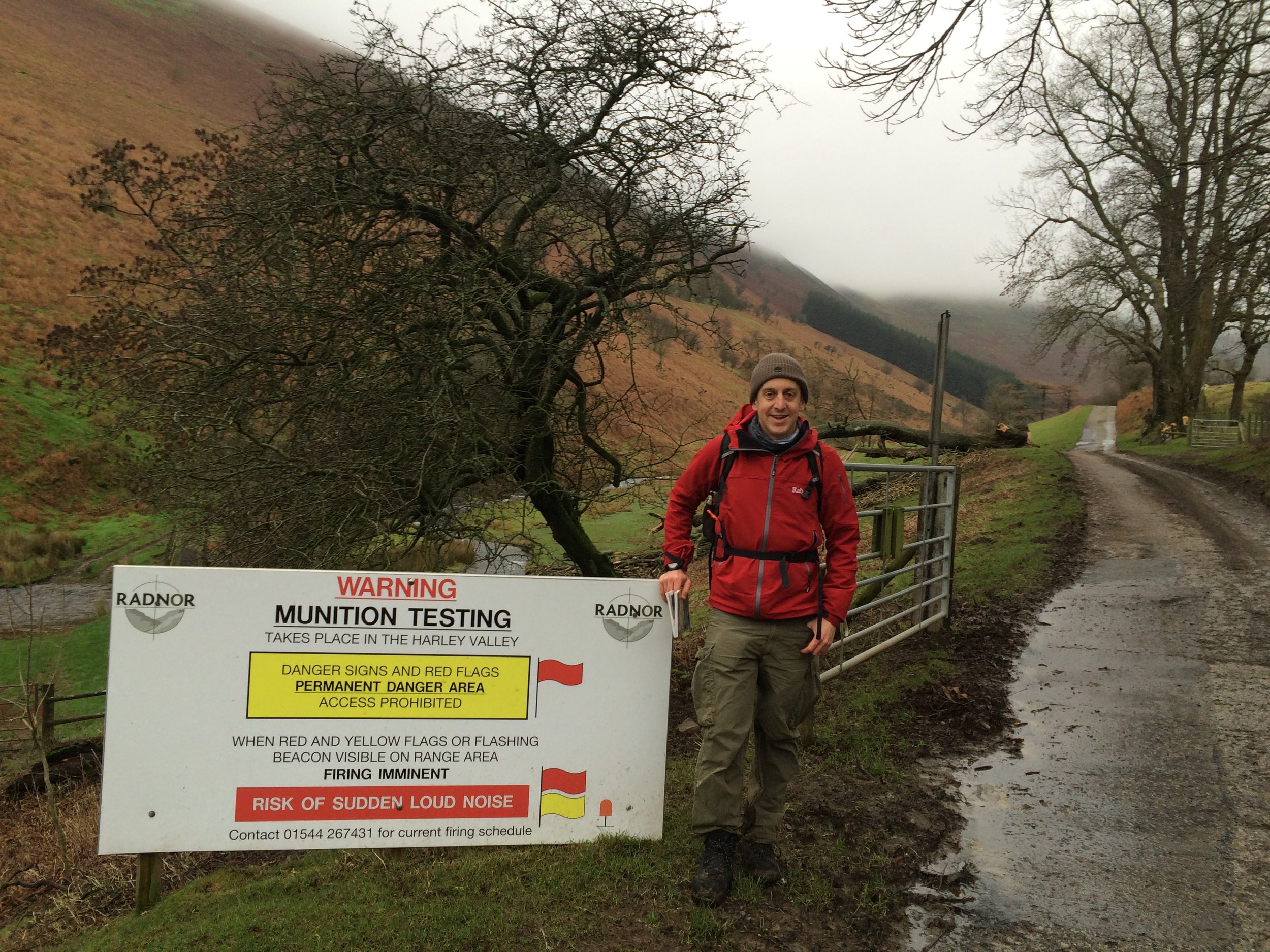
Pretty much no-one that I know has heard of Great Rhos. As a County Top it a bit of an undiscovered gem, sitting on its own in mid-Wales far enough away from both the Brecon Beacons and the Snowdonia peaks.
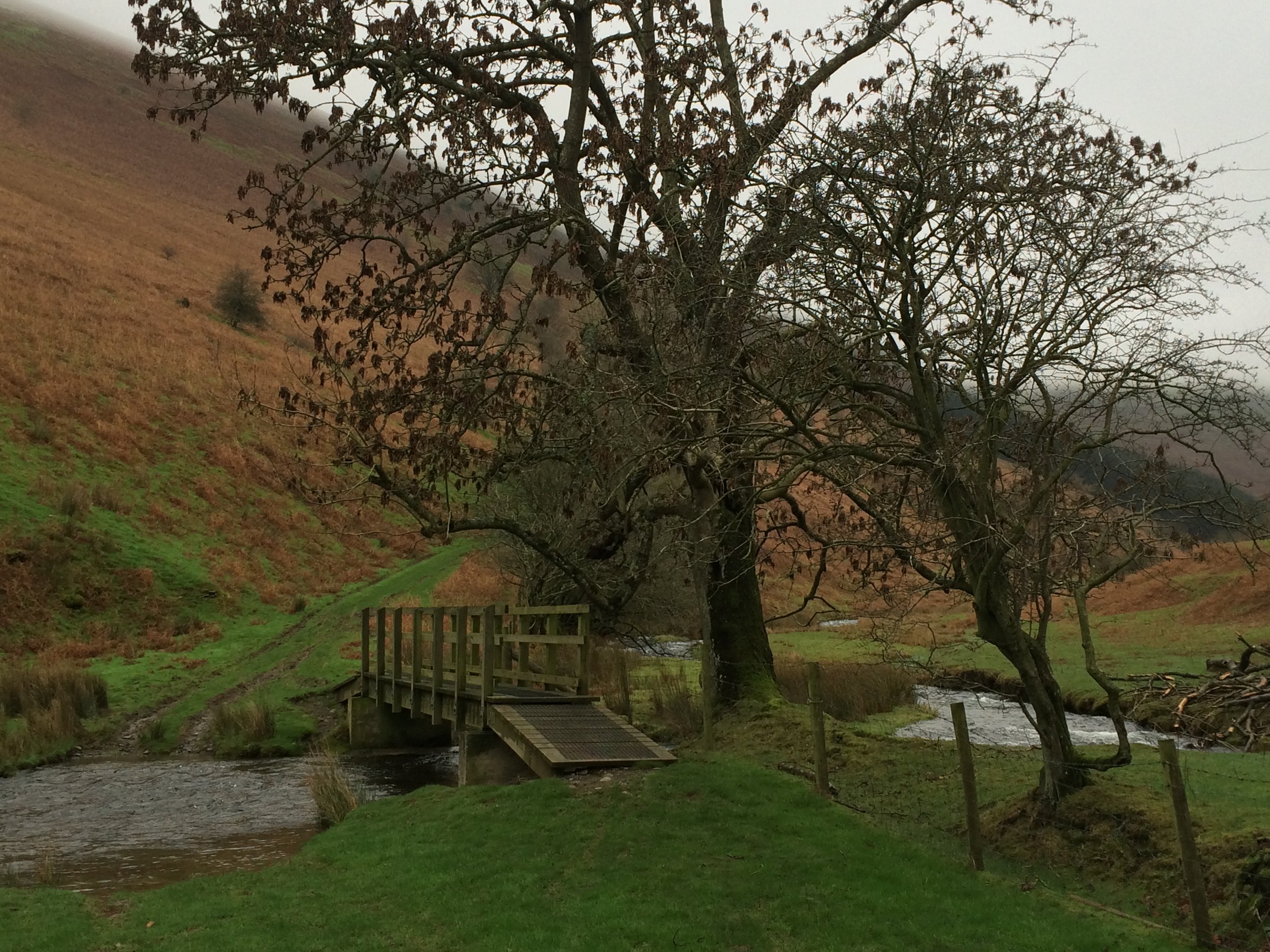
The obvious route starts from New Radnor where there's ample on-street parking. From the village centre, take the footpaths to the gates of the munition testing range. Cross the stream then take the path to the west of the valley. At the top of the valley you pass a warning sign and the valley disappears behind the Three Riggles. Follow the path north towards the summit until you reach a boundary fence and another warning sign. By this point you've pretty much done all of the elevation and the actual top, marked by a Trig Pilar is best found using a GPS device.
A nice New Year's Day walk for us with chilly but clear weather at the bottom and yet another cloud covered summit.


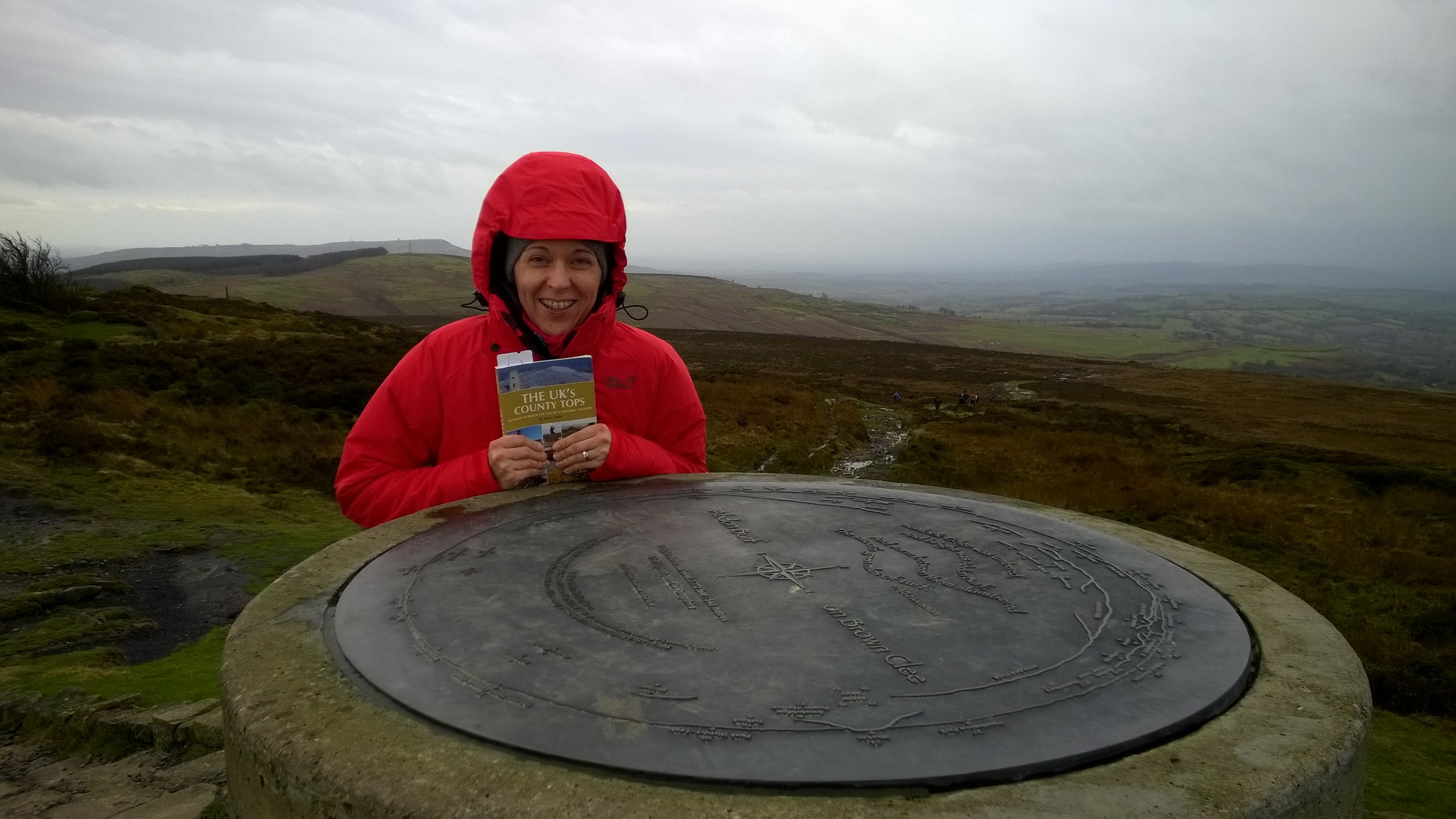
Also known as: Abdon Burf
Significance: Highest peak in Shropshire (Historic County Top), Shropshire Hills National Landscape High Point
Member of: Marilyn
Parent Peak: Plynlimon
Nearest Higher Neighbour: Beacon Hill, Wales
Elevation: 540m
Date climbed: 31st December 2015
Coordinates: 52°28′30″N 2°36′02″W
Route Start / End: Layby on Park Gate Road
Route Distance: 4.9 km (3 miles)
Route Elevation Change: +/- 214m
Subsidiary tops on route: None
GPX File: get via Buy Me a Coffee
Other routes touched (walk): Shropshire Way Main Route (South)
Other routes touched (cycle): None
Map: OS Explorer 217 The Long Mynd & Wenlock Edge
Guidebook: The UK's County Tops (Jonny Muir), Walking the County High Points of England (David Bathurst)
Links: Wikipedia, Peakbagger, Trigpointing
When planning a trip to Brown Clee Hill, don't be fooled that Google Maps shows you can drive all the way up the service Road to the transmitter. This would make it a 5 min walk, but the road is restricted and there's a locked gate where it meets the main road.
When you get to the forest there's a few routes up. We didn't find the one shown in the book, but it's not a problem as long as you're heading uphill. When you get to the open ground beyond the treeline, you'll easily see the transmitter at the summit. Take any safe path and you'll hit the service road, then he top is just to the south of the transmitter. We were there on New Year’s Eve and it was blowing a gale so we didn't hang around for long.
The descent was more easily navigable. We went back downtime service road for a few hundred metres and took the footpath right before the ruined building. At the treeline we turned left and took the bridal path for about 100 meters, re-entering the forest at a wooden gate. From there we followed a mountain bike trail back to the footpath at the bottom of the forest.
A short but pleasant walk, nice to blow off the cobwebs in the winter but best attempted on a sunny day.

The Wrekin (407m) Telford & Wrekin Unitary Authority High Point: Peakbagger / Hillbagging
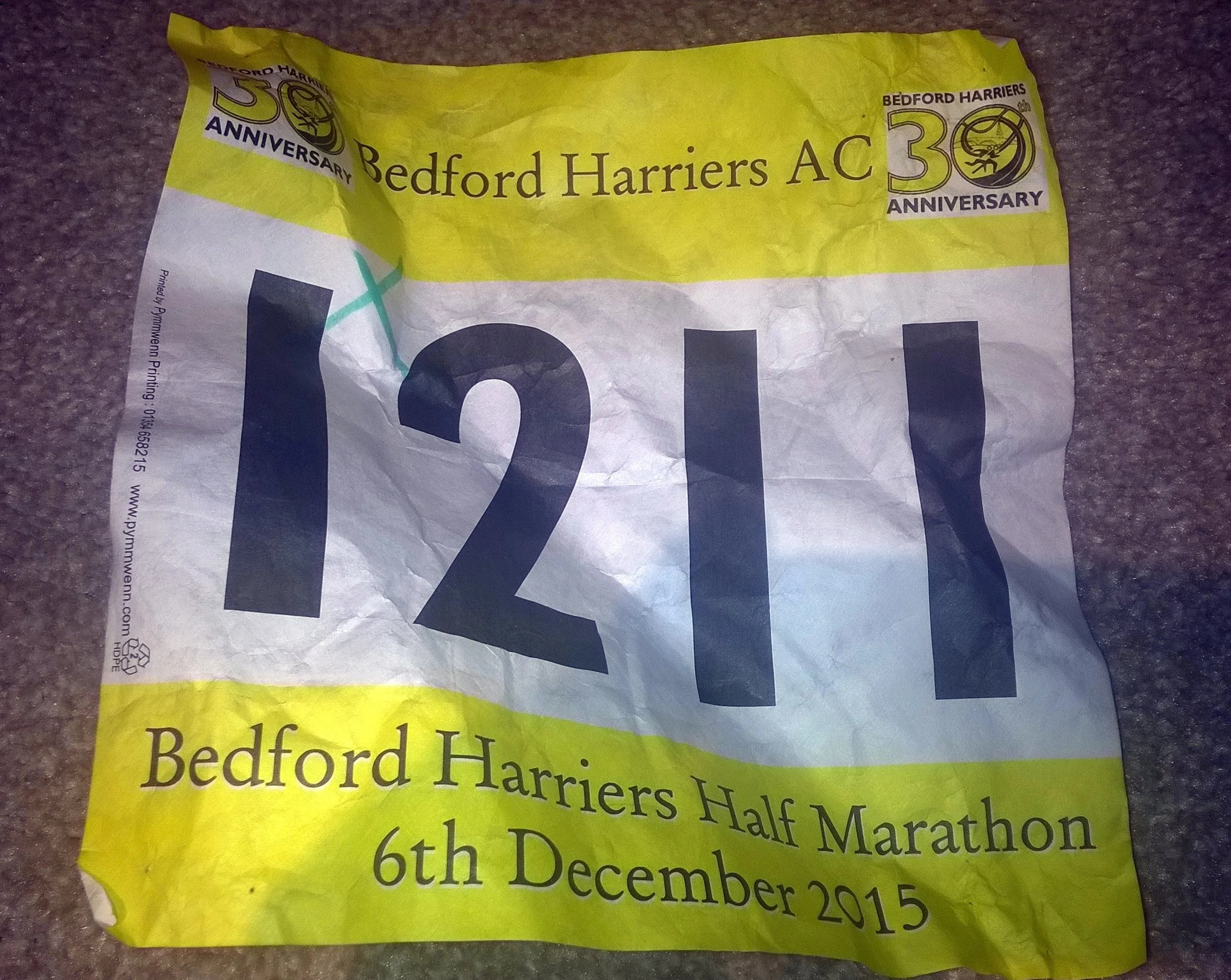
When: December 6th 2015
Where: Wootton, Bedfordshire, UK
Course: Single anti-clockwise loop on country roads
Other routes touched (walk): Clay Way, John Bunyan Trail
Other routes touched (cycle): NCN 51
Finish time: 2:01
Half Marathons in December are pretty few and far between. By mid November The cold weather puts most people off until the season kicks off again in March. I'd chosen the Bedford Half mostly because I wanted an event in December and it was the only one around. As it turned out it was a well organised event and an interesting countryside route, fairly similar to Basingstoke a couple of months earlier.
I found this one to be really tough. It wasn't so much about the course, more about my general lack of energy. Work was busy and I was very tired though not enough sleep. By the last 3 miles is was clear that I was going to be slower than my usual 1:50 pace. By the end I'd slipped across the 2 hour mark, finishing at 2:01. Annoying. Despite not my best or most memorable half, it was still got me out in December and its 1 race closer to my 50 Halfs target.


A year ago I did a made-up Half Marathon in central London. That time it was a loop, starting in Westminster, heading east and crossing every bridge to Tower Hill, then reversing to Chelsea bridge and looping back to Westminster.

This year I tried an alternative and more straightforward version. Starting at Tower Bridge I headed west, again crossing every bridge once until 13.1 miles just after Fulham Football Stadium. It's a more interesting route as there's twice as much to see without having to go back over the same ground. The only disadvantage is starting and ending at different points. I solved this by walking a mile and a half from the finish to Hammersmith, which, like Tower Hill, is also on the District Line.
Best time to do it is early Sunday morning when the Thames Path is quiet before the hordes of tourists take over. Here's the full route plan...

Start at Tower Hill Underground Station.
Cross Tower Bridge (S), now start heading west back towards Westminster
Cross London Bridge (N), head west
Cross Southwark Bridge (S), head west
Cross the Millenium Footbridge (N), head west
Cross Blackfriars Bridge (S), head west
Cross Waterloo Bridge (N), head west
Cross Hungerford Footbridge (S), head west
Cross Westminster Bridge (N), head west
Cross Lambeth Bridge (S), head west
Cross Vauxhall Bridge (N), head west
Cross Chelsea Bridge (S), head west
Cross Albert Bridge (N), head west
Cross Battersea Bridge (S), head west
Cross Wandsworth Bridge (N), head west
Cross Fulham Railway Bridge Footpath, (S), head west
Cross Putney Bridge (N), head west
(N) and (S) represent direction of travel across the bridge (North) / (South)
GPX File: get via Buy Me a Coffee
Other routes touched (walk): Thames Path, Jubilee Walkway, Jubilee Greenway
Other routes touched (cycle): NCN 4, CS3, CS8
Maps:
- OS Explorer Map (161) London South, Westminster, Greenwich, Croydon, Esher & Twickenham
- OS Explorer Map (173) London North, The City, West End, Enfield, Ealing, Harrow & Watford
See also: London Bridges Half Marathon 1 (Alternative Route)