There are currently 47 parkrun events in Northern Ireland of which I have completed 3. The first Northern Irish event was Waterworks which started on 6th November 2010 and the newest is Claudy Country Park which started on May 16th 2026. The name for having completed all parkrun events in Northern Ireland is “Northern Entireland”.
Two 5k parkrun events in Northern Ireland have been permanently cancelled: Knockbracken Reservoir and Stranmillis College.
Numbers exclude 2k Junior parkruns and any events that are not open to the general public such as prisons or armed forces facilities.

Northern Ireland parkruns by Historic County
The counties of Antrim and Down jointly have the highest number of parkrun events with 14 each. The full counts are:
15 parkrun events in County Antrim
14 parkrun events in County Down
7 parkrun events in County Derry/Londonderry
6 parkrun events in County Tyrone
3 parkrun events in County Armagh
2 parkrun events in County Fermanagh
All of the Northern Ireland parkrun events …
Below are each of the Northern Ireland 5k parkrun events in alphabetical order. A few things to note:
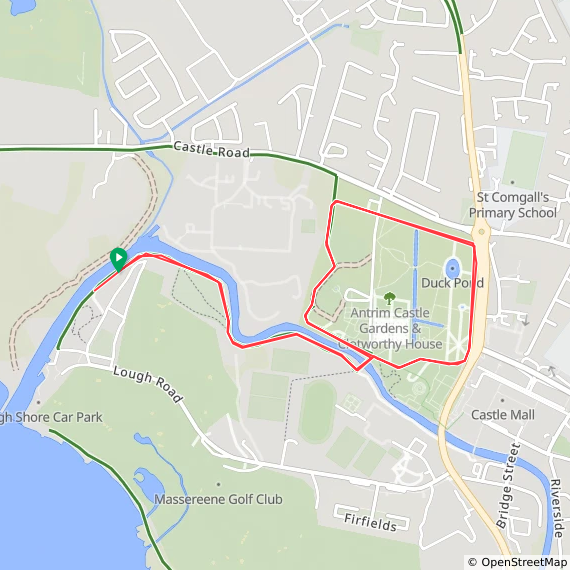
The interactive maps below take you to the approximate location for the course, typically the centre of the park. See the course instructions in the parkrun page for each event for specific directions to the start.
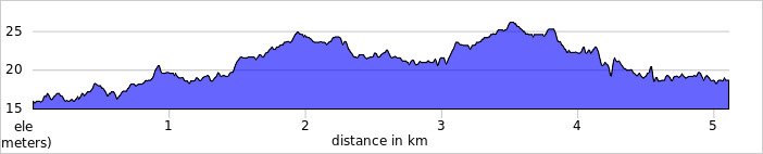
Course maps and elevation profiles show the route at the time that I ran it and may have changed since then. See the Course page in the event’s page on parkrun.org.uk for the current course outline. Note that course outlines are from Garmin data during a specific run and may vary from the officially measured distance.
Please contact me if you spot an event that doesn’t have a course map and elevation profile and you would like to donate one from your own run. I’m also interested in maps and elevation profiles for courses that have changed or where there’s a regular alternative route (e.g. Horsham). I’ll need a GPX file from your run plus the date. I’ll include a credit for you and will donate £1 to parkrun.
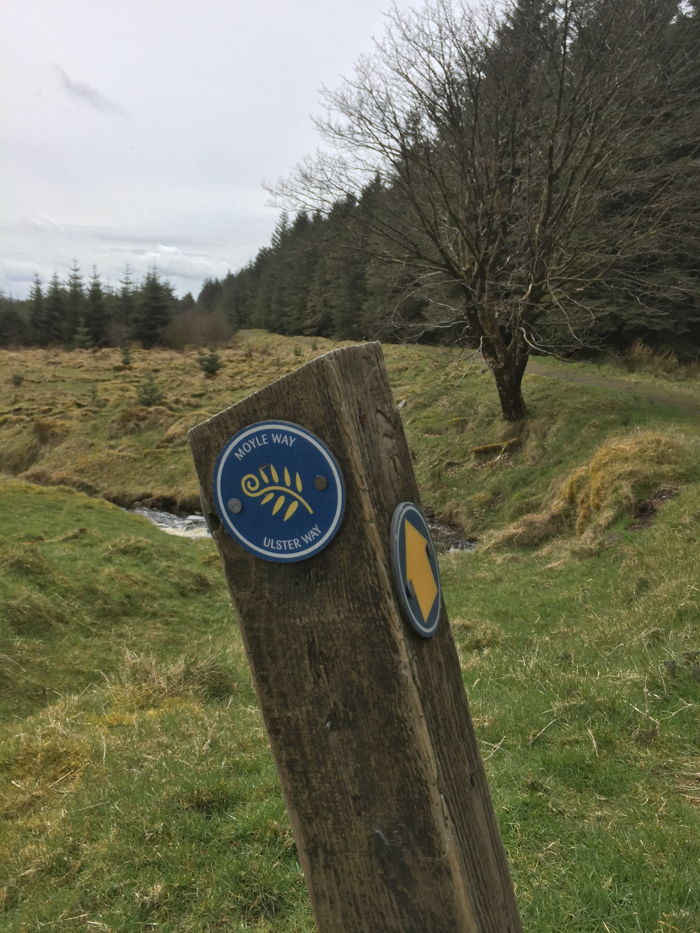
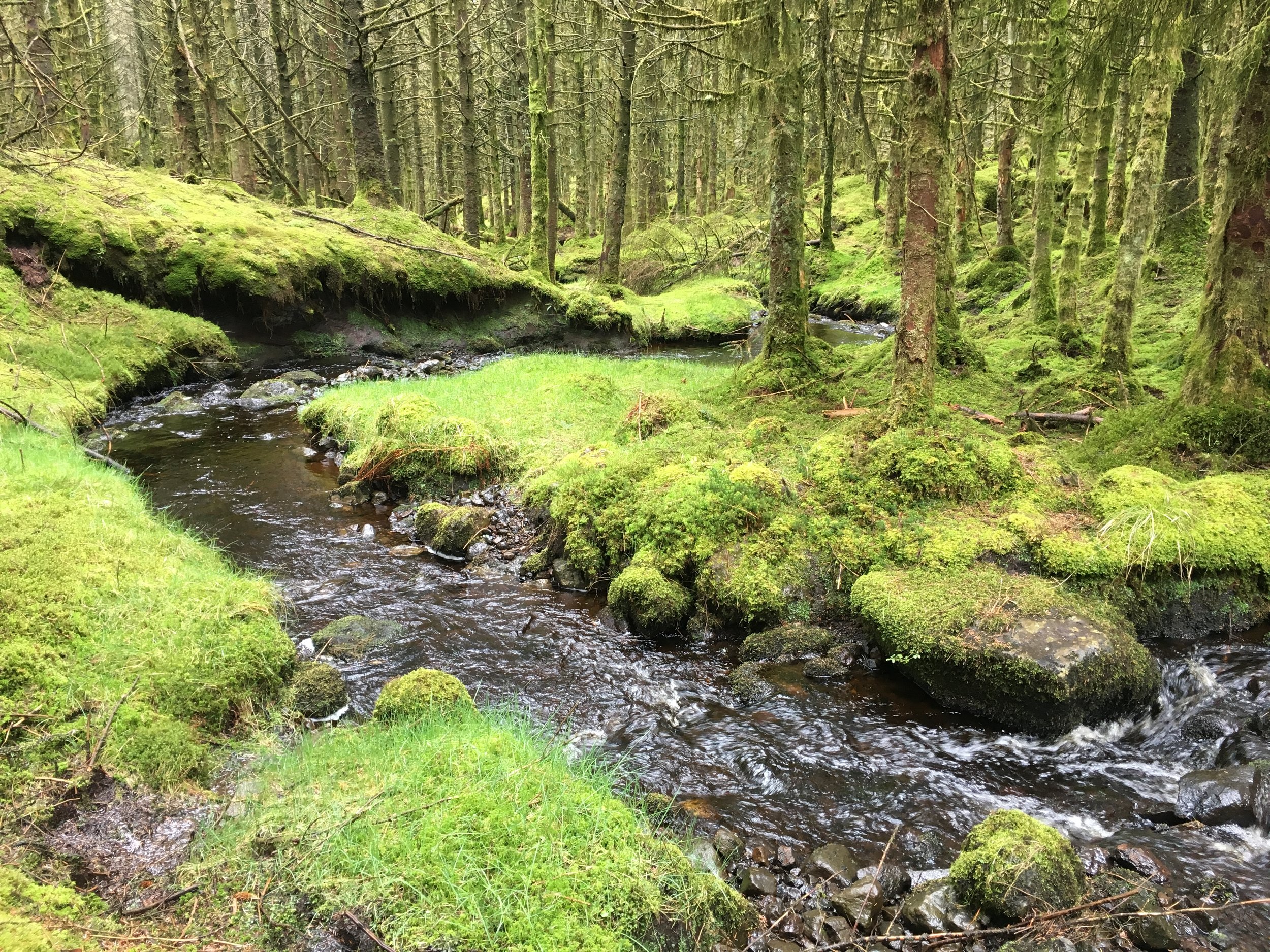
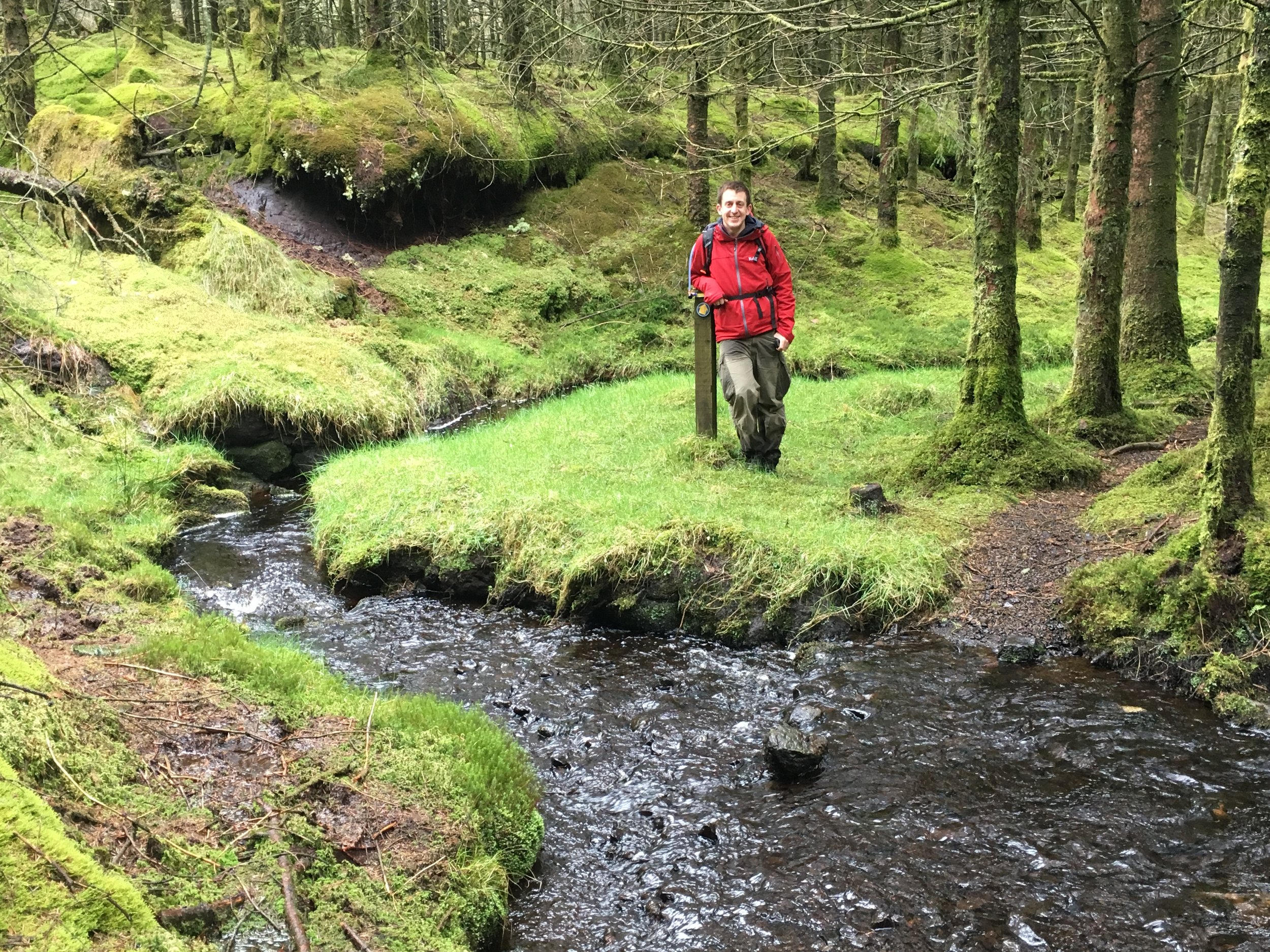
Antrim
I have not yet completed this event
Other routes touched (cycle): NCN 94
Historic County: Antrim
Inaugural: September 28th 2013
Course Map and Elevation Profile by: Tim McEvoy on May 9th 2026
Links: Event Home Page, Course Page
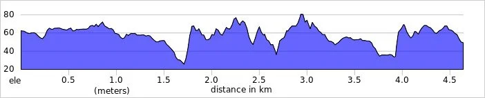
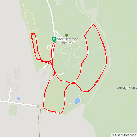
Armagh
I completed this event on: July 15th 2017 with a finish time of: 26:49
Other routes touched: None
Historic County: Armagh
Inaugural: October 12th 2013
Links: Event Home Page, Course Page
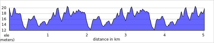
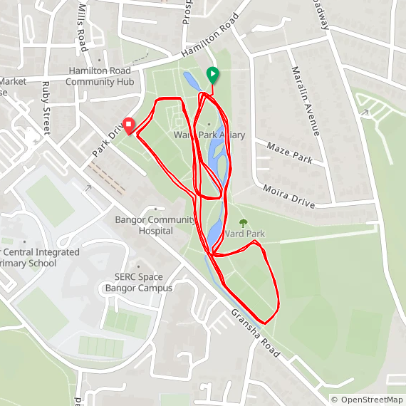
Bangor
I have not yet completed this event
Other routes touched: None
Historic County: Down
Inaugural: March 29th 2014
Course Map and Elevation Profile by: Joel Adcock on February 28th 2026
Links: Event Home Page, Course Page
Belfast Victoria
I have not yet completed this event
Historic County: Down
Inaugural: May 7th 2011
Links: Event Home Page, Course Page
Belvoir Forest
I have not yet completed this event
Historic County: Down
Inaugural: September 13th 2025
Links: Event Home Page, Course Page
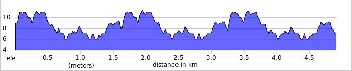
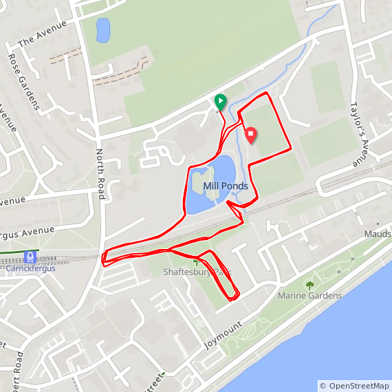
Carrickfergus
I have not yet completed this event
Other routes touched: None
Historic County: Antrim
Inaugural: February 1st 2014
Course Map and Elevation Profile by: Joel Adcock on April 26th 2025
Links: Event Home Page, Course Page
Castlewellan
I have not yet completed this event
Historic County: Down
Inaugural: September 23rd 2017
Links: Event Home Page, Course Page
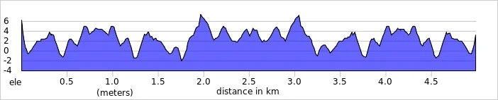
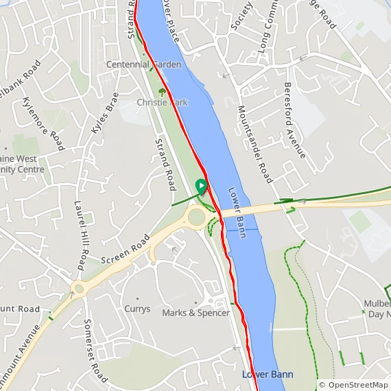
Christie
I have not yet completed this event
Other routes touched (cycle): NCN 96 Causeway Gateway
Historic County: Londonderry
Inaugural: May 17th 2025
Course Map and Elevation Profile by: Joel Adcock on May 17th 2025
Links: Event Home Page, Course Page
Citypark
I have not yet completed this event
Historic County: Armagh
Inaugural: August 11th 2012
Links: Event Home Page, Course Page
Claudy Country Park
I have not yet completed this event
Historic County: Londonderry
Inaugural: May 16th 2026
Links: Event Home Page, Course Page
Colin Glen
I have not yet completed this event
Historic County: Antrim
Inaugural: October 10th 2015
Links: Event Home Page, Course Page
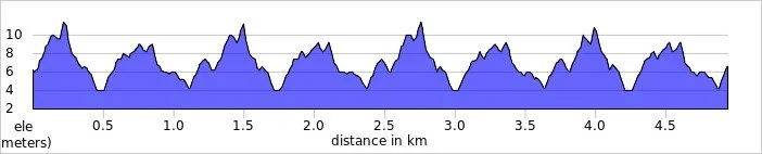
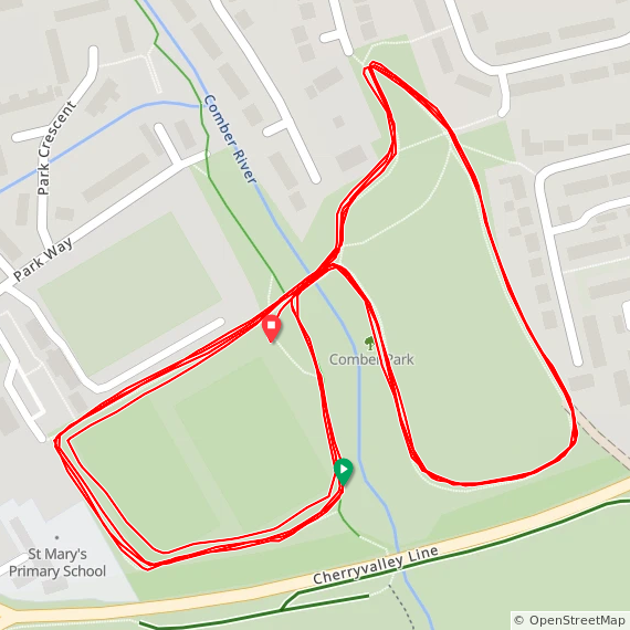
Comber
I have not yet completed this event
Other routes touched: None
Historic County: Down
Inaugural: May 31st 2014
Course Map and Elevation Profile by: Joel Adcock on November 29th 2025
Links: Event Home Page, Course Page
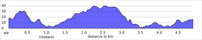
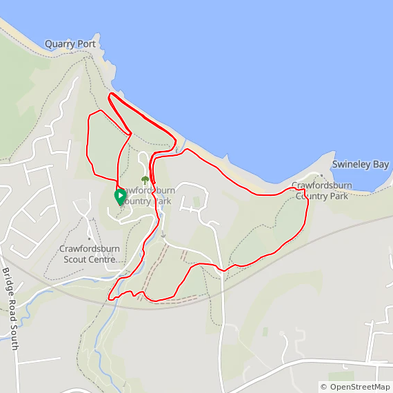
Crawfordsburn Country
I have not yet completed this event
Other routes touched (walk): North Down Coastal Path
Other routes touched (cycle): NCN 93
Historic County: Down
Inaugural: February 29th 2020
Course Map and Elevation Profile by: Joel Adcock on March 21st 2026
Links: Event Home Page, Course Page
Derry City
I have not yet completed this event
Historic County: Londonderry
Inaugural: January 12th 2013
Links: Event Home Page, Course Page
Derrynoid Forest
I have not yet completed this event
Historic County: Londonderry
Inaugural: February 26th 2022
Links: Event Home Page, Course Page
Dungannon Park
I have not yet completed this event
Historic County: Tyrone
Inaugural: August 18th 2018
Links: Event Home Page, Course Page
Dunleath Playing Fields
I have not yet completed this event
Historic County: Down
Inaugural: March 26th 2022
Links: Event Home Page, Course Page
Ecos
I have not yet completed this event
Historic County: Antrim
Inaugural: March 31st 2012
Links: Event Home Page, Course Page
Enniskillen
I have not yet completed this event
Historic County: Fermanagh
Inaugural: April 13th 2013
Links: Event Home Page, Course Page
Falls
I have not yet completed this event
Historic County: Antrim
Inaugural: May 26th 2012
Links: Event Home Page, Course Page
Garvagh Forest
I have not yet completed this event
Historic County: Londonderry
Inaugural: July 31st 2021
Links: Event Home Page, Course Page
Hillsborough Forest
I have not yet completed this event
Historic County: Down
Inaugural: June 26th 2021
Links: Event Home Page, Course Page
Holy Cross College
I have not yet completed this event
Historic County: Tyrone
Inaugural: June 15th 2019
Links: Event Home Page, Course Page
Knockbracken Reservoir
***Knockbracken Reservoir parkrun is now permanently cancelled ***
I did not complete this event before it was closed
Historic County: County Down
Inaugural: February 29th 2020. Final event: #189 on June 28th 2025
Reason for cancellation: Organisers couldn't reach a compromise with the landowner, Let's Go Hydro, regarding the use of their private grounds.
Replaced by: Belvoir Forest
Larne
I have not yet completed this event
Historic County: Antrim
Inaugural: November 9th 2013
Links: Event Home Page, Course Page
Limavady
I have not yet completed this event
Historic County: Londonderry
Inaugural: March 28th 2015
Links: Event Home Page, Course Page
Limepark Playing Fields
I have not yet completed this event
Historic County: Antrim
Inaugural: August 6th 2022
Links: Event Home Page, Course Page
Lough Head
I have not yet completed this event
Historic County: Fermanagh
Inaugural: September 20th 2025
Links: Event Home Page, Course Page
Loughmacrory
I have not yet completed this event
Historic County: Tyrone
Inaugural: May 10th 2025
Links: Event Home Page, Course Page
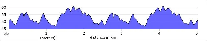
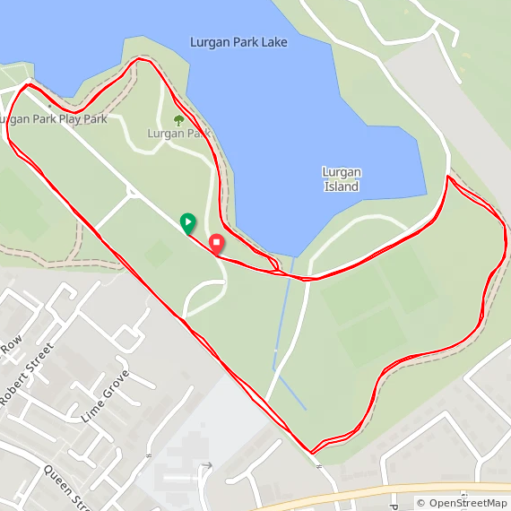
Lurgan Park
I have not yet completed this event
Other routes touched: None
Historic County: Armagh
Inaugural: May 10th 2025
Course Map and Elevation Profile by: Joel Adcock on April 4th 2026
Links: Event Home Page, Course Page
Montalto Estate
I have not yet completed this event
Historic County: Down
Inaugural: April 13th 2024
Links: Event Home Page, Course Page
MUSA Cookstown
I have not yet completed this event
Historic County: Tyrone
Inaugural: July 26th 2014
Links: Event Home Page, Course Page
Newry Greenway
I have not yet completed this event
Historic County: Down
Inaugural: May 31st 2025
Links: Event Home Page, Course Page
Omagh
I have not yet completed this event
Historic County: Tyrone
Inaugural: October 17th 2015
Links: Event Home Page, Course Page
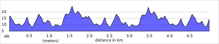
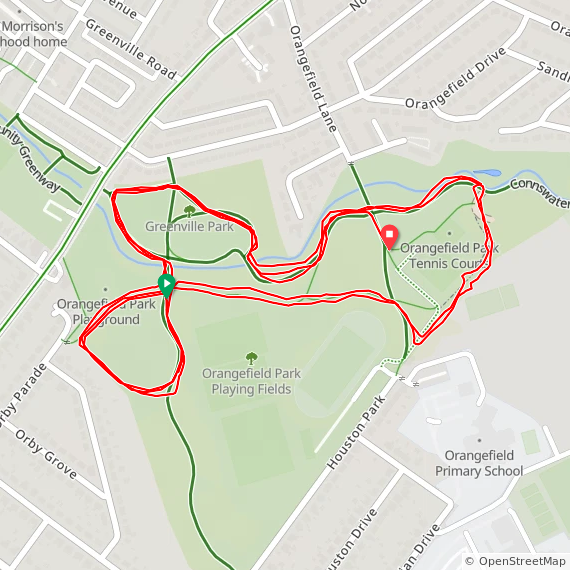
Orangefield
I have not yet completed this event
Other routes touched (walk): Connswater Community Greenway
Historic County: Down
Inaugural: August 4th 2018
Course Map and Elevation Profile by: Joel Adcock on January 10th 2026
Links: Event Home Page, Course Page
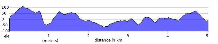
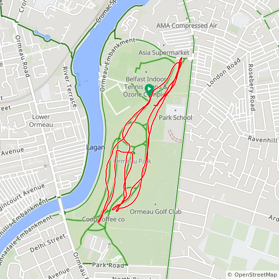
Ormeau
I completed this event on: April 30th 2016 with a finish time of: 25:39
Other routes touched (walk): None
Historic County: Down
Inaugural: June 22nd 2013
Links: Event Home Page, Course Page
Paisley Park
I have not yet completed this event
Historic County: Antrim
Inaugural: October 5th 2024
Links: Event Home Page, Course Page
Pomeroy Forest
I have not yet completed this event
Historic County: Tyrone
Inaugural: May 23rd 2026
Links: Event Home Page, Course Page
Portrush
I have not yet completed this event
Historic County: Antrim
Inaugural: September 8th 2012
Links: Event Home Page, Course Page
Queen’s, Belfast
I completed this event on: May 7th 2016 with a finish time of: 25:37
Other routes touched: None
Historic County: Antrim
Inaugural: February 25th 2012
Links: Event Home Page, Course Page
Riverside, Ballymoney
I have not yet completed this event
Historic County: Antrim
Inaugural: April 25th 2026
Course Map and Elevation Profile by: Tim McEvoy on April 25th 2026
Links: Event Home Page, Course Page


Rostrevor
I have not yet completed this event
Historic County: Down
Inaugural: November 11th 2017
Links: Event Home Page, Course Page
Sixmilewater
I have not yet completed this event
Historic County: Antrim
Inaugural: July 20th 2019
Links: Event Home Page, Course Page
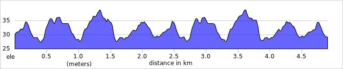
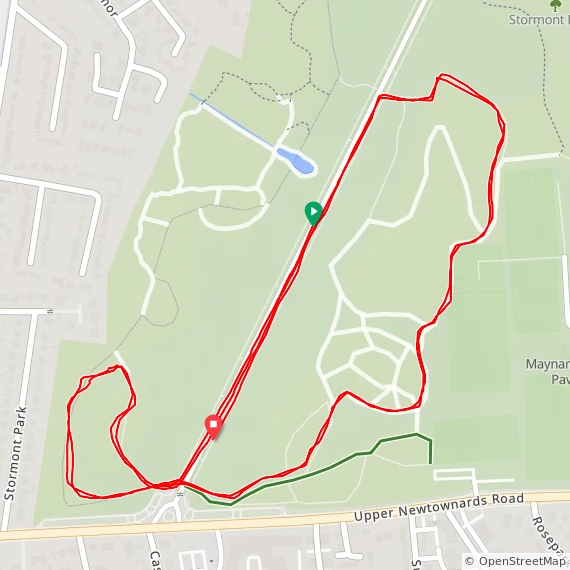
Stormont
I have not yet completed this event
Other routes touched: None
Historic County: Down
Inaugural: August 29th 2015
Course Map and Elevation Profile by: Joel Adcock on February 21st 2026
Links: Event Home Page, Course Page
Stranmillis College
***Stranmillis College parkrun is now permanently cancelled ***
I did not complete this event before it was closed
Historic County: County Antrim
Inaugural: February 2nd 2019. Final event: #54 on March 14th 2020
Reason for cancellation: Due to increasing conflicts with the college's sporting activities, particularly football, meaning the event couldn't safely run when pitches were in use from late summer to mid-February, leading to a mutual decision to stop the weekly run
The Fisherman‘s Walk
I have not yet completed this event
Historic County: Londonderry
Inaugural: May 11th 2024
Links: Event Home Page, Course Page
Valley
I have not yet completed this event
Historic County: Antrim
Inaugural: October 11th 2014
Links: Event Home Page, Course Page
Wallace
I have not yet completed this event
Historic County: Antrim
Inaugural: March 9th 2013
Links: Event Home Page, Course Page
Waterworks
I have not yet completed this event
Historic County: Antrim
Inaugural: November 6th 2010
Links: Event Home Page, Course Page
More parkrun posts
parkruns are free, weekly, community 5k events all around the world. I started in December 2012 and have been obsessive about it ever since. See my parkrun Collection page for details.
Featured and popular parkrun posts: