Cuilcagh: Fermanagh and Cavan County Tops
Cuilcagh summit
Also known as: Binn Chuilceach
Significance: Highest peak in County Fermanagh (Historic County Top)
Member of: Marilyn, Hewitt
Parent Peak: TBC. Nearest Higher Neighbour: Croaghgorm
Elevation: 666m
Date climbed: May 4th 2016
Coordinates: 54.2017° N, 7.8123° W
Route Start / End: Cark park at Cuilcagh Mountain Park
Route Distance: 13.5 km (8.4 miles)
Route Elevation Change: +/- 897m
Subsidiary tops on route: None
GPX File: get via Buy Me a Coffee
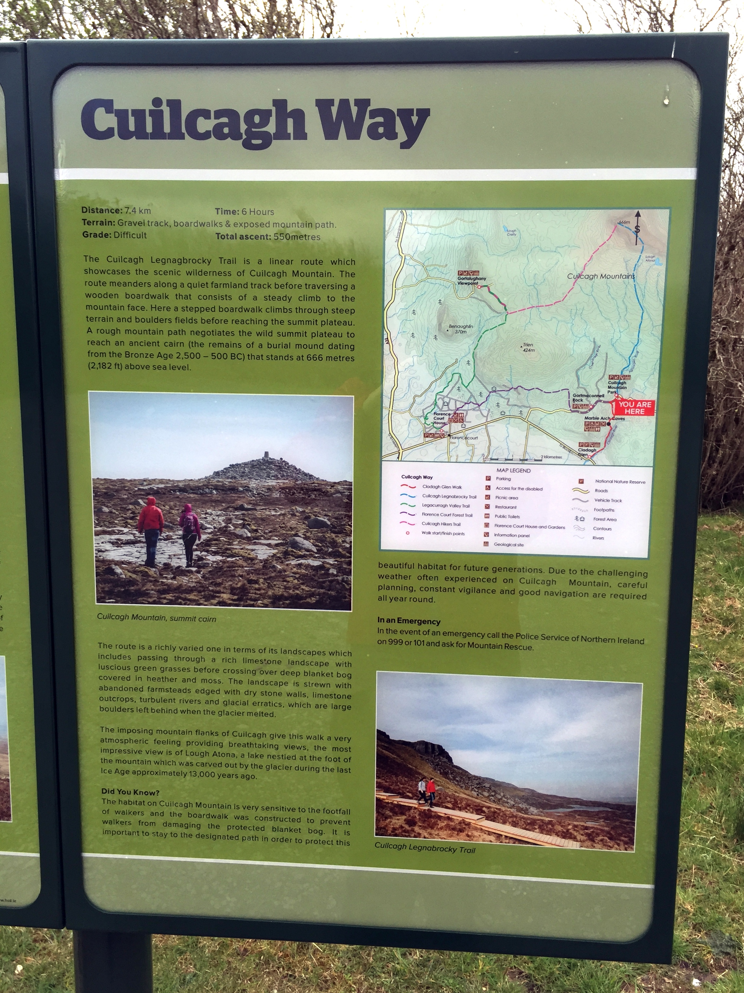
Other routes touched (walk): Cuilcagh Way
Other routes touched (cycle): None
OS Trig Pillar: TP7344 - Cuilcagh
Guidebook: The UK's County Tops (Jonny Muir)
Links: Wikipedia (County Fermanagh), Wikipedia (Cuilcagh), Peakbagger, Hillbagging
This trek was part of a tour of the Historic County Tops of Northern Ireland that Timea and I did in May 2016. Cuilcagh would be the first of the 2 more challenging County Tops of the trip. Timi decided to have a spa day at the hotel so I headed out on my own.
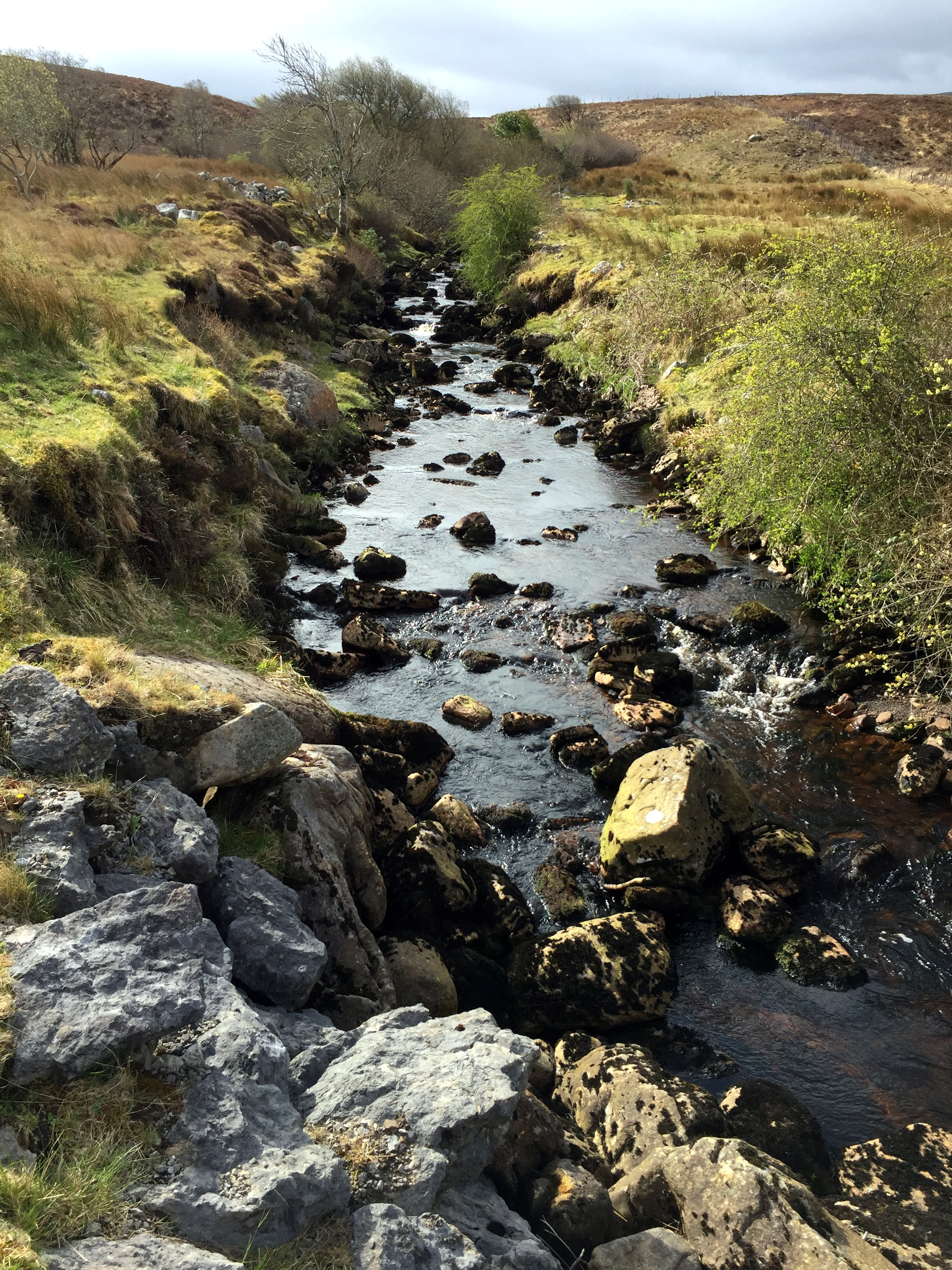
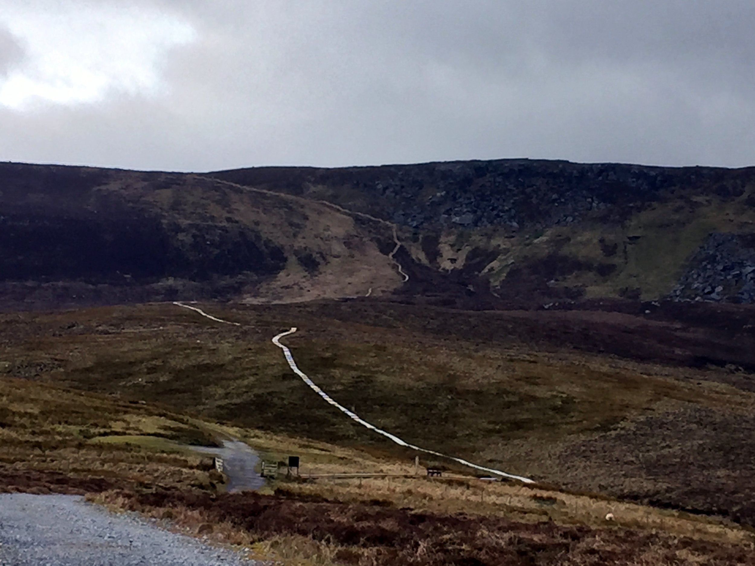
The start is near the Visitors' Centre for the Marble Arch Caves, part of the UNESCO Geopark that covers a lot of the surrounding area. The Visitors Centre sells maps which was pretty handy I'd found that OS maps of Northern Ireland pretty hard to find. From the Visitors Centre, turn right out of the car park and you'll see the car park for the Lenocky Trail very shortly on the left hand side.
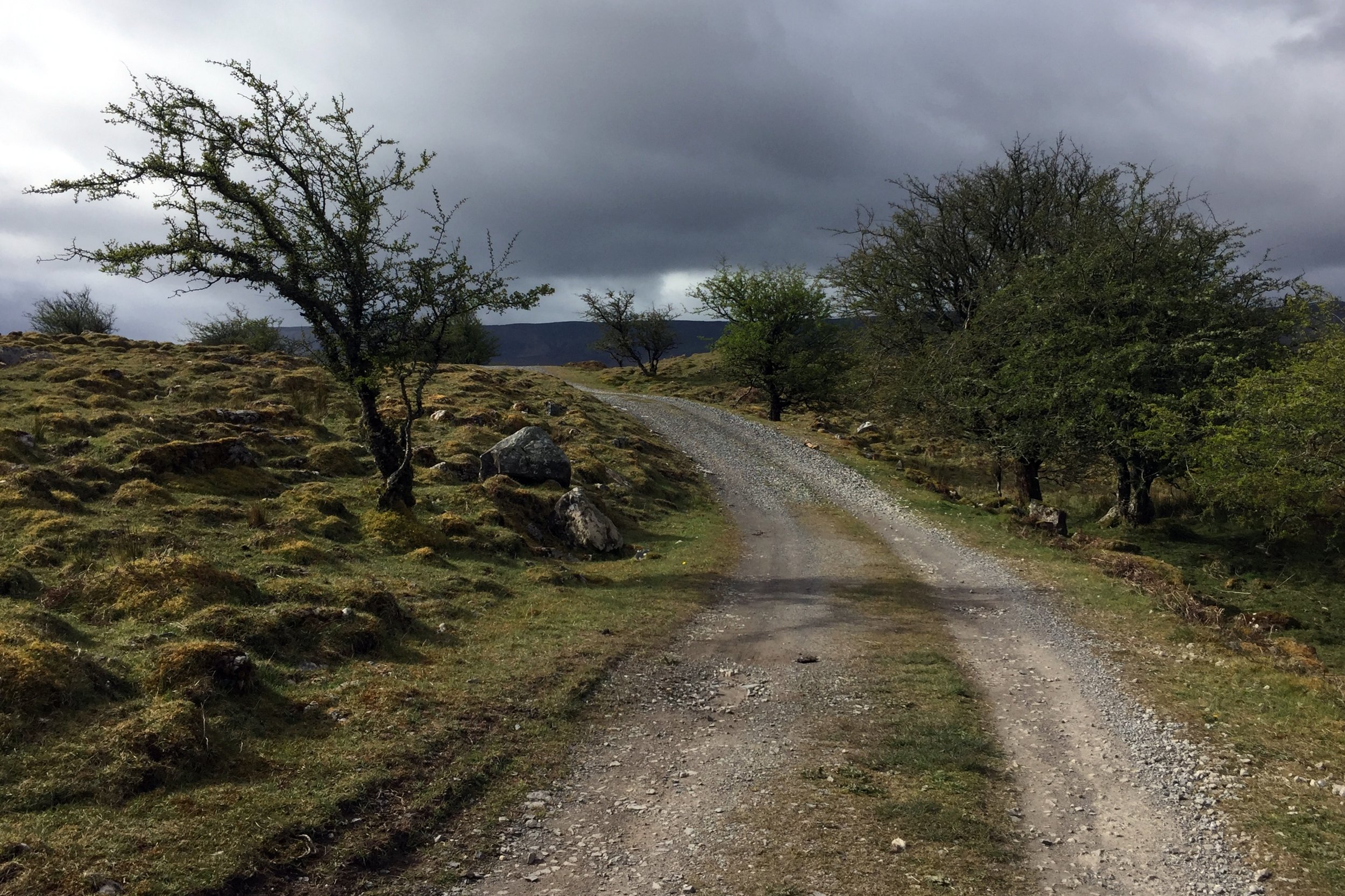
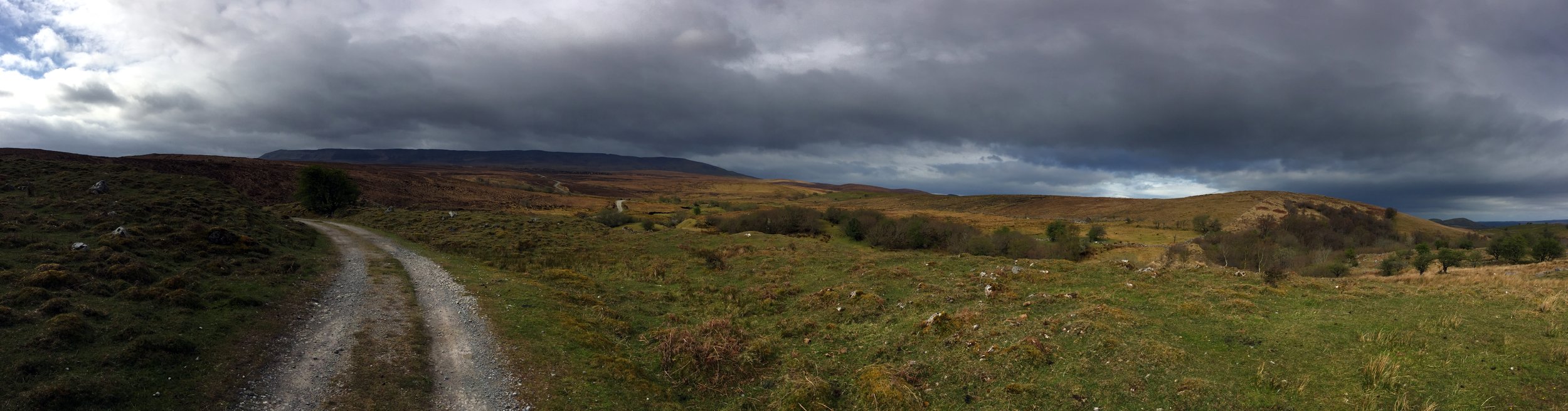
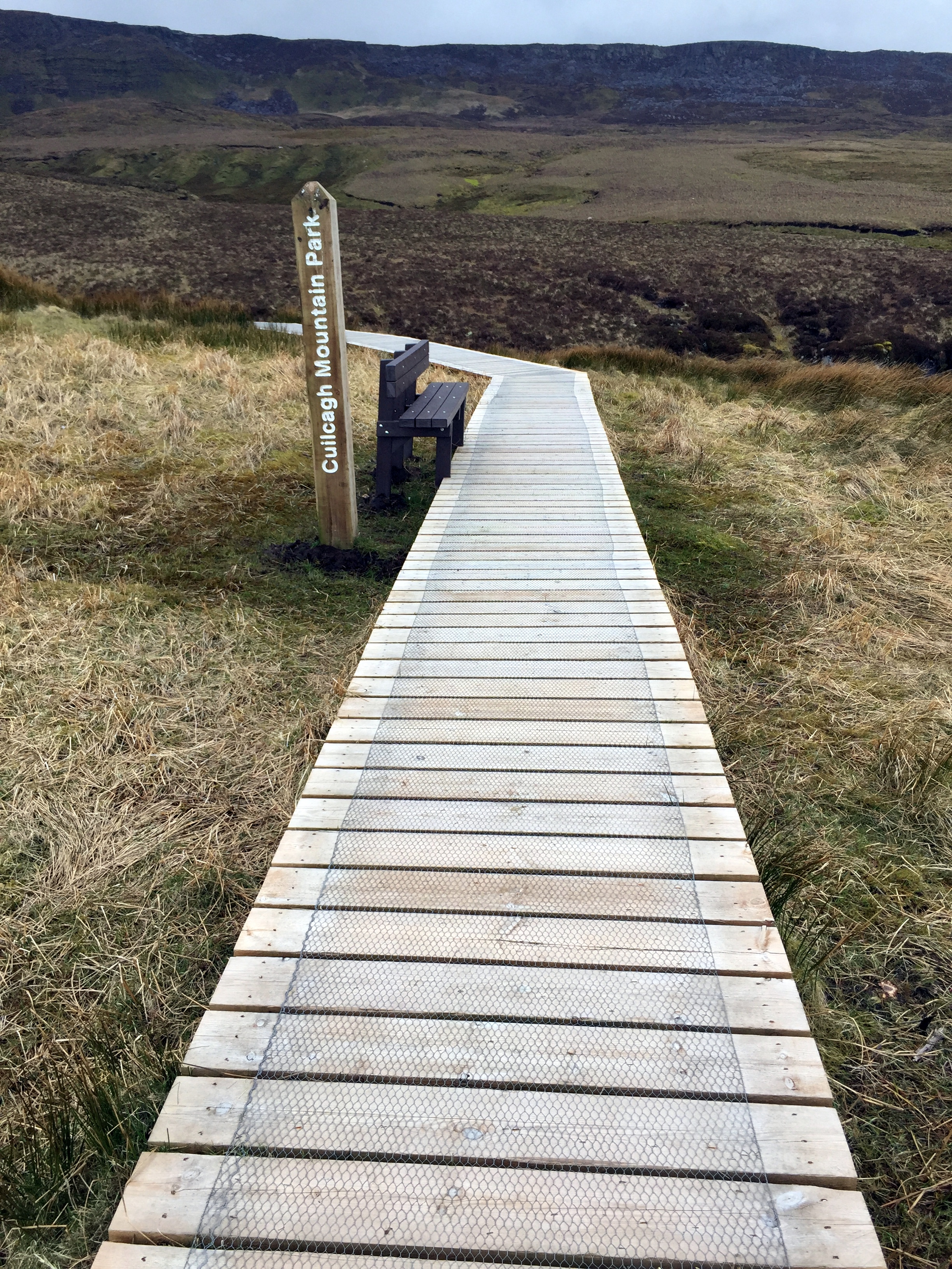
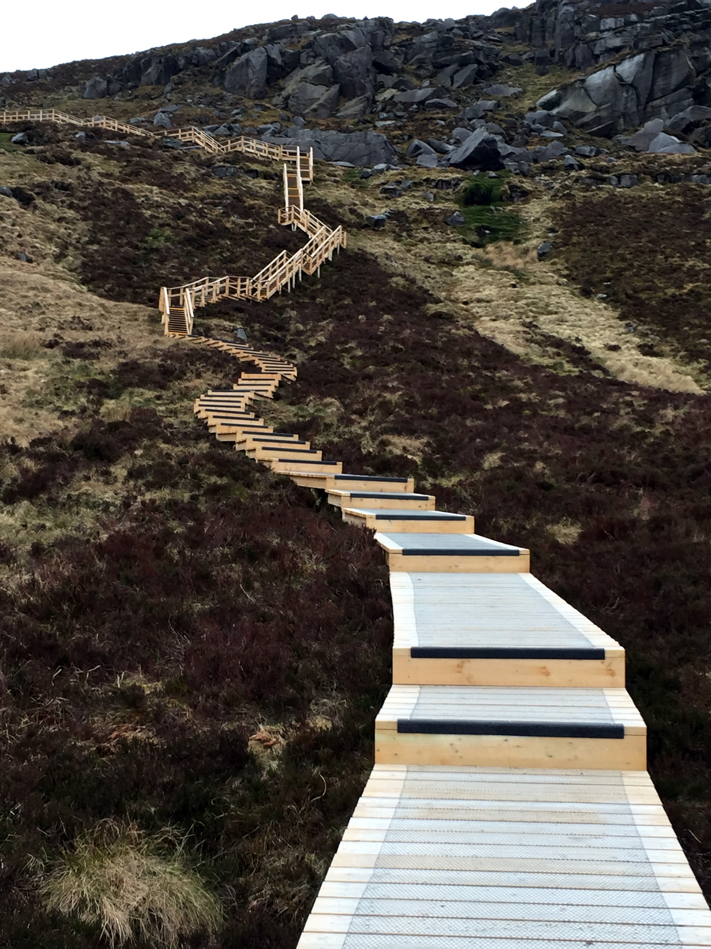
The walk starts along a well maintained farm track heading South towards the mountain. You only have to walk a few minutes before Cuilcagh and the route to it are fully visible. The first 2.5 miles are a very gentle gradient along this track, making it pretty straightforward for most walkers. The next section is a wooden Boardwalk which looked like it had been recently made. It is raised by about half a metre to protect the ground underneath. This also makes the next half mile section significantly easier. At the step section leading up the cliffs the boardwalk turns into a well constructed staircase with railings to hang onto.
The boardwalk ends at the plateau and from there the summit is about 800m further. Up to now the navigation had been extremely simple, but this next section requires some care, especially in poor visibility. If you are using a GPS device, as I was, I recommend marking a waypoint at the top of the boardwalk. The top is just under the ridge and you can't see it until you get right to the edge and look down.
As the boardwalk ends, the trail heads across rocks and peat and is occasionally marked by the Cuilcagh Way's yellows leaf insignia, painted on some of the larger rocks. About half way on this section you'll reach a fence with a small opening. Through here turn left and follow the fence for about 50 metres then the summit will come into view directly ahead of you.
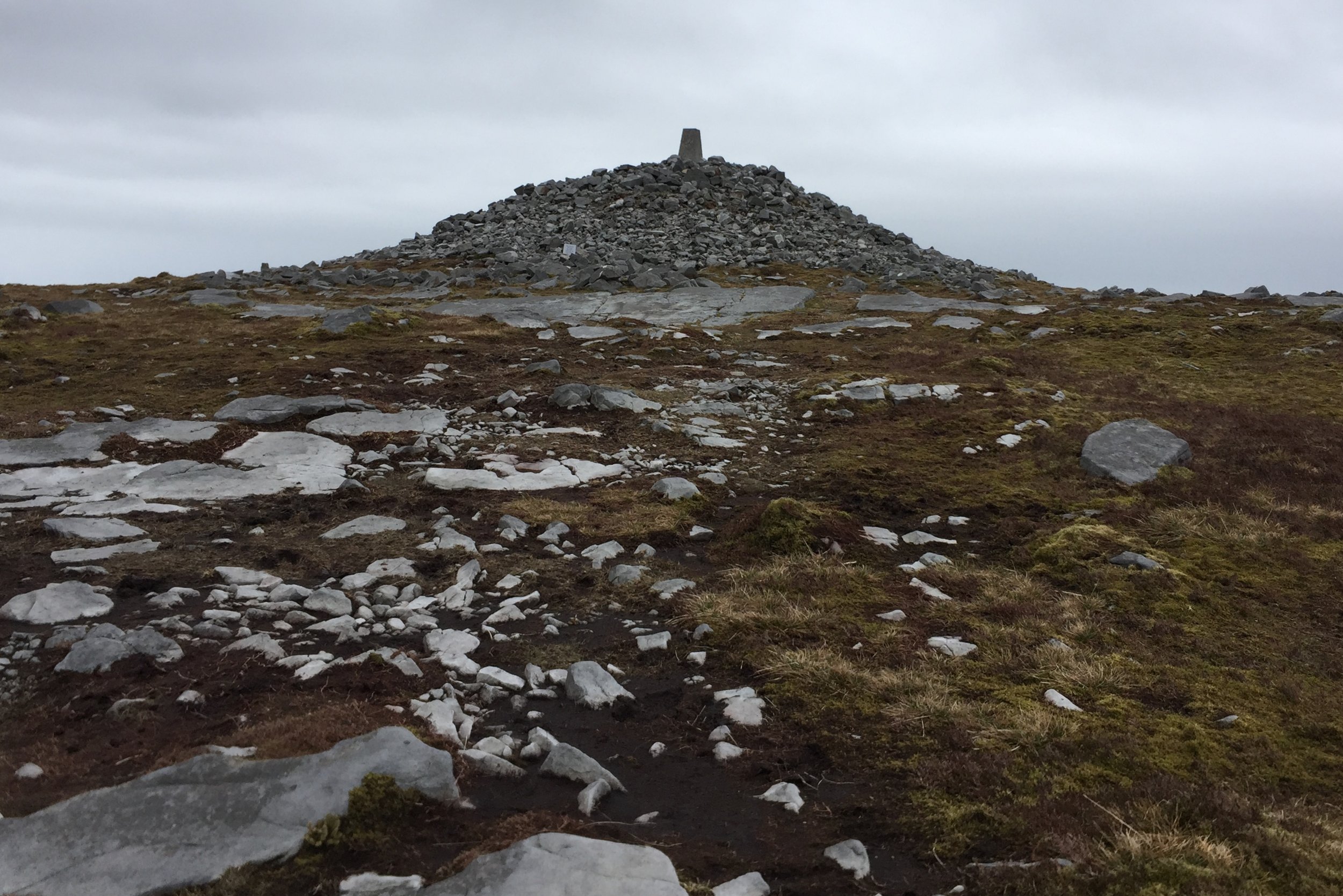
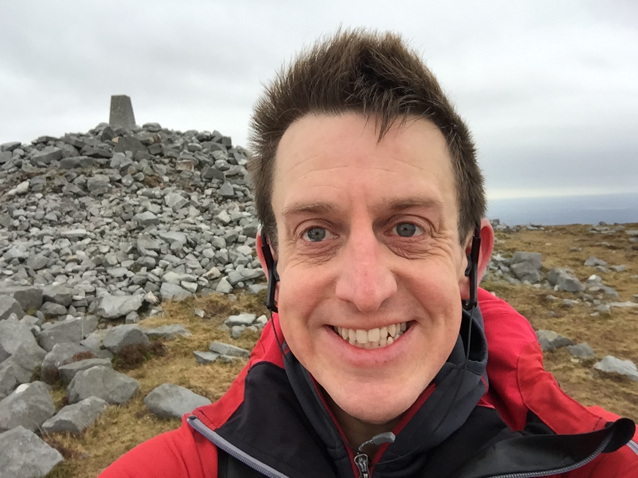
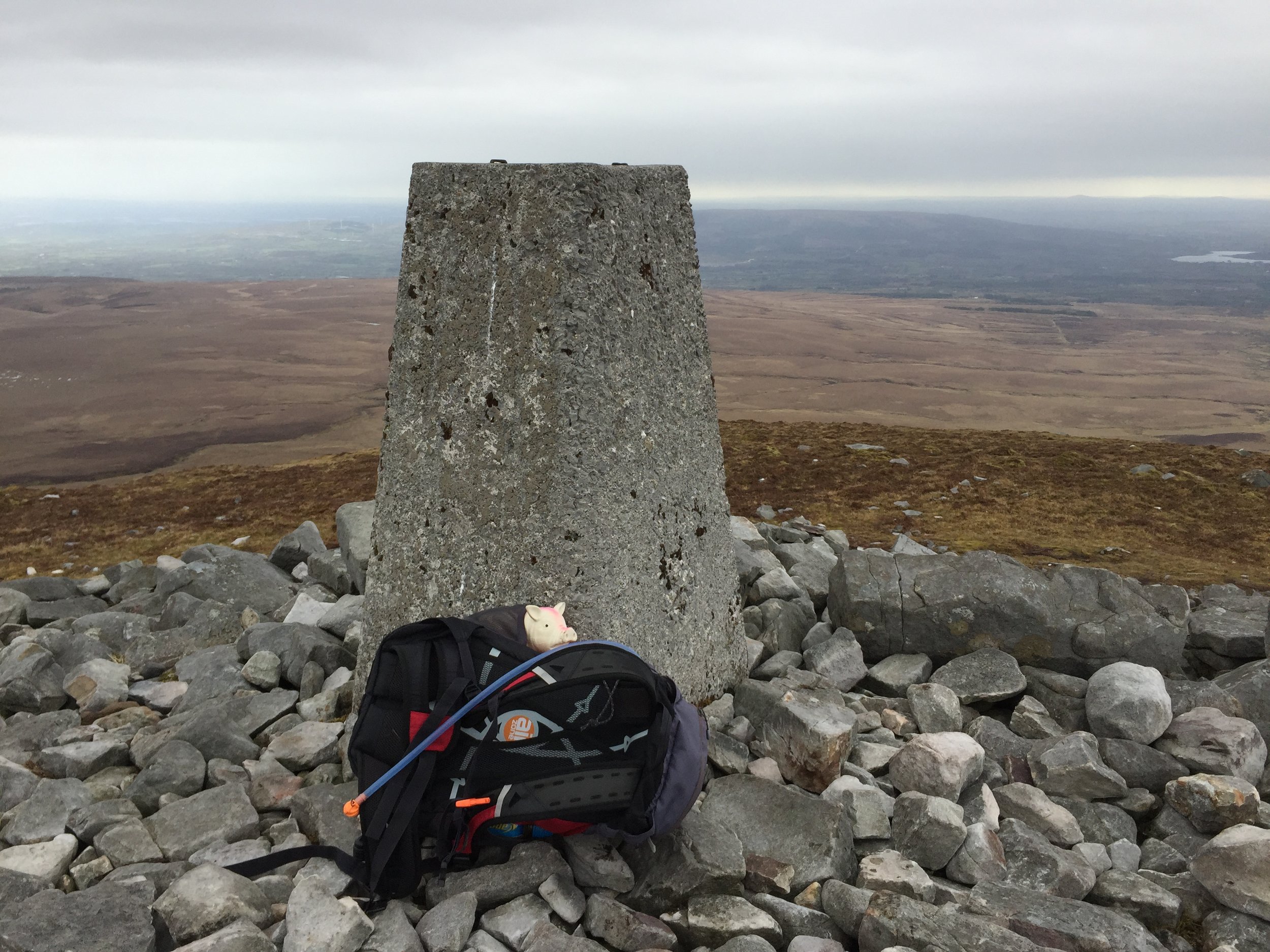
The summit is a Trig Point built up on a mound of rocks. It's rare that I can see much at all from the tops, but today was clear and I could see for miles across both Northern Ireland and the Republic. Cuilcagh sits right on the international border and is the County Top for both Fermanagh in the UK and Cavan in Ireland. The border is not marked so I had to use a combination of my Garmin and Google Maps to make sure I'd walked across both countries at the summit.
The way back was simple, especially as the visibility was good. This is the point to use the GPS waypoint to find the top of the boardwalk. Just after the boardwalk ended and I'd got back on the farmers track I saw the first signs of other people. Up til now I'd been on my own, and we didn't see anyone at all on the Trostan and Sawel treks. I'd been wondering if trekking is just not as popular in this area as treks like these on the mainland UK would attract many more people.