Walking Mount Toubkal, Morocco's Highest Peak

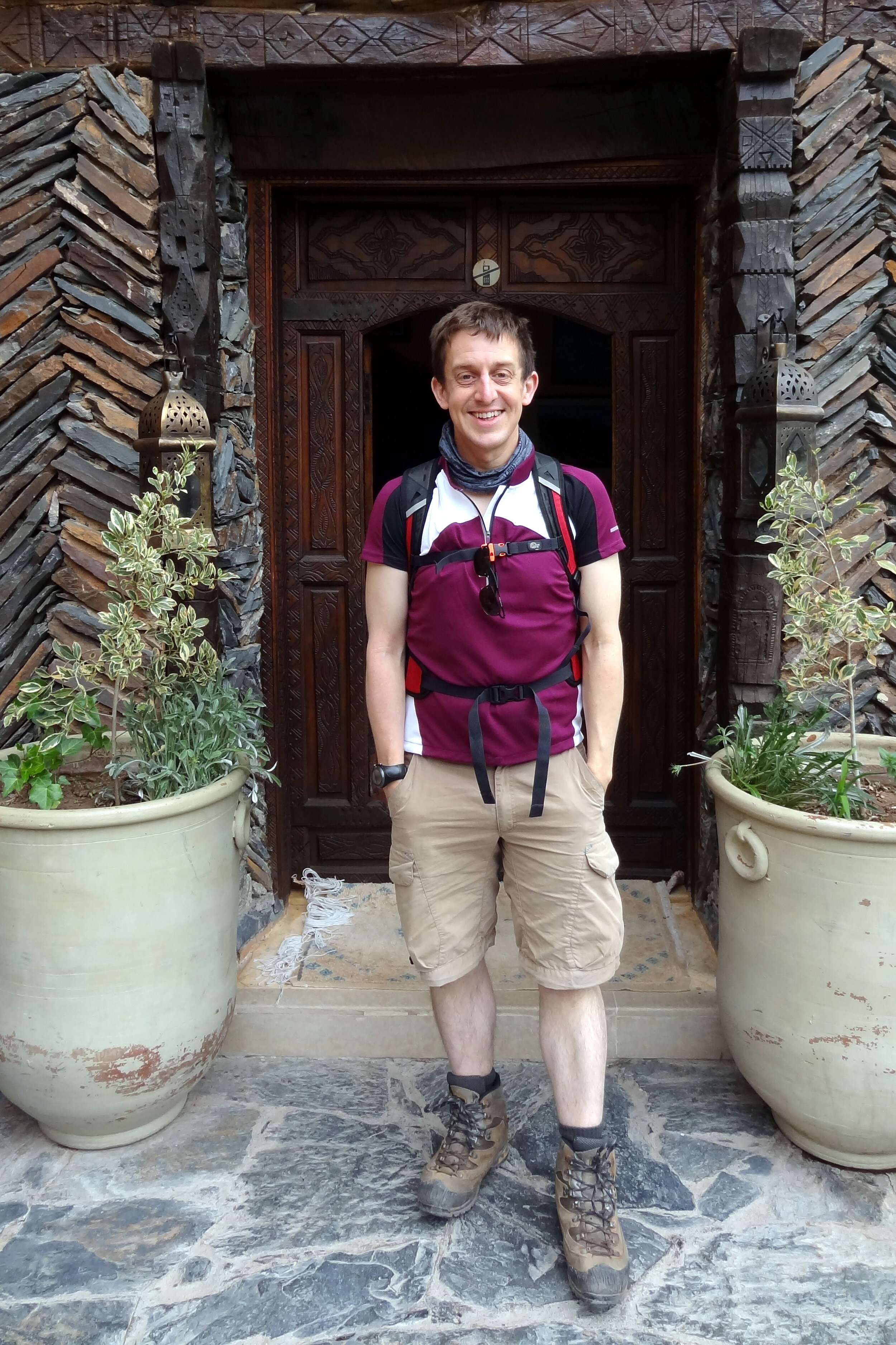
The idea for our Mount Toubkal trip came about 6 months earlier when Timi was making plans for my 40th birthday. Rather than having a big party I wanted to do something special together and Timi found an escorted trip run by Audley, the travel agency we’d used for our honeymoon. From the start I knew that it would be a special trip, not just because it would be a great adventure, but because we would be doing it together. Timi had got more into trekking in the last couple of years but this would be a huge step. At 4,167m, 3 times higher than the UK’s tallest peak, this would be a serious mountain.
Day 1: Imlil to Refuge Toubkal Les Mouflons
Date: May 4th 2015
Start: Kasbah du Toubkal, Imlil, 42152, Morocco
Finish: Refuge Toubkal Les Mouflons
Distance: 10.4 km (6.5 miles)
Elevation change: +1,317m / -20m. Net +1,297m
GPX File: get via Buy Me a Coffee
Other Routes Touched (Cycle): None
Other Routes Touched (Walk): None
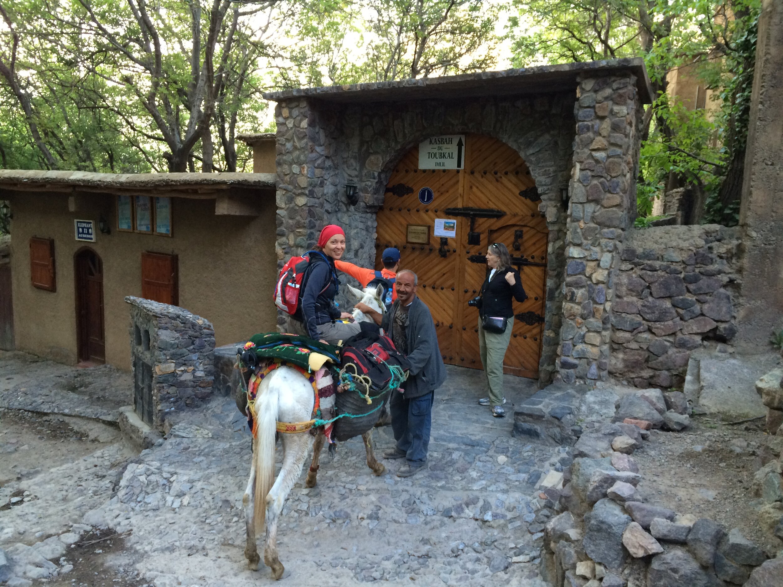
Our trek to the highest point in North Africa started from Kasbah du Toubkal in Imlil, the mountain’s trailhead village. We met our guide Mo at 09:00 on the morning of the trek. Mo introduced us to the team who would be accompanying us up the mountain. This included 5 mules and 4 muleteers who would carry our bags, the food and the overnight camp. Mo plus 1 mule, who we named Terry, and his muleteer walked with us whilst the rest went ahead.
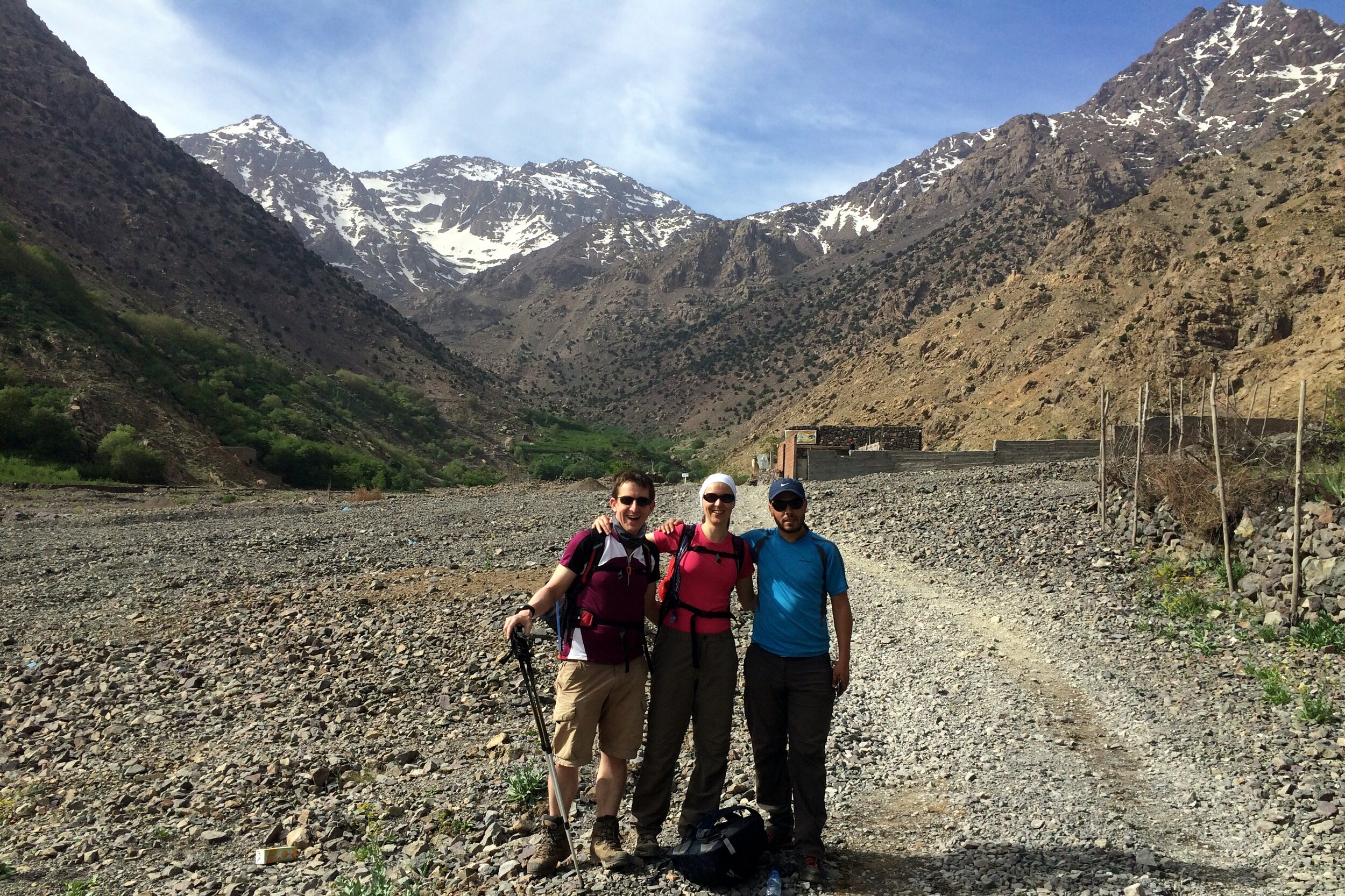
The first day of the trek followed a river up the valley towards Basecamp. We had walked the first hour of it the previous day on an acclimatization hike to Aroumd, the village where the road ends. It was a nice warm day and we walked the 10k in shorts and t-shirts.
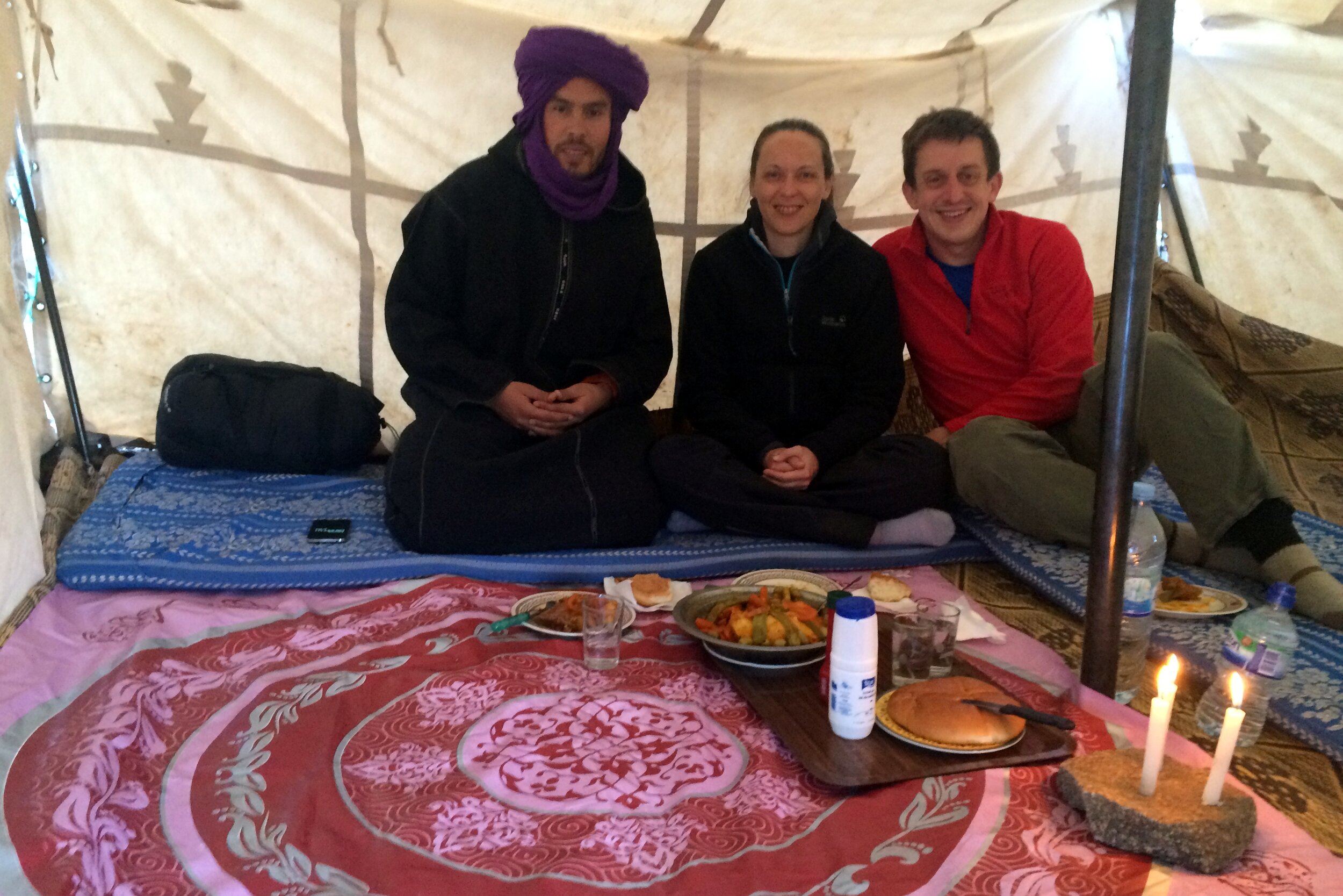
We got to know our guide Mo well over the course of the trip. Mo is short for Mohammed which is an Arabic name although he’s actually a Berber. Mo explained that the Berbers are the original inhabitants of much of North Africa and their culture has evolved with the various occupiers over the centuries. Their original name is Amazigh but when the Romans invaded they named them Berbers (“Barbarians”) due to their different language and customs. This naming is linked to the Bavarians in Southern Germany whom the Romans regarded similarly.
When the Arabs invaded in the 7th Century it brought a new language, religion and customs. The French occupation from the 1920s then introduced a third language. Although Mo considers himself to be a Muslim, he prefers to follow the spirit of the faith rather than practice it strictly. In talking to Mo it was clear that he had strong values around people and being honest. These are particularly good virtues to have when you trust your life to someone up a very high mountain.
About every kilometre there was a small Berber-run shop selling food, drink and souvenirs to the passing trekkers. We stopped at one of these for lunch which was a very large meal of meatballs, pasta and salad. We chatted to a young guy from Chicago whom we had seen a few times on the way. He was on his own with just one porter to carry his bags. His plan was to walk up to the summit then parachute down whilst filming it on his Go-Pro. His trip was a complete contrast to ours as he seemed to have just turned up without much of a plan, least of all about how his descent would go.
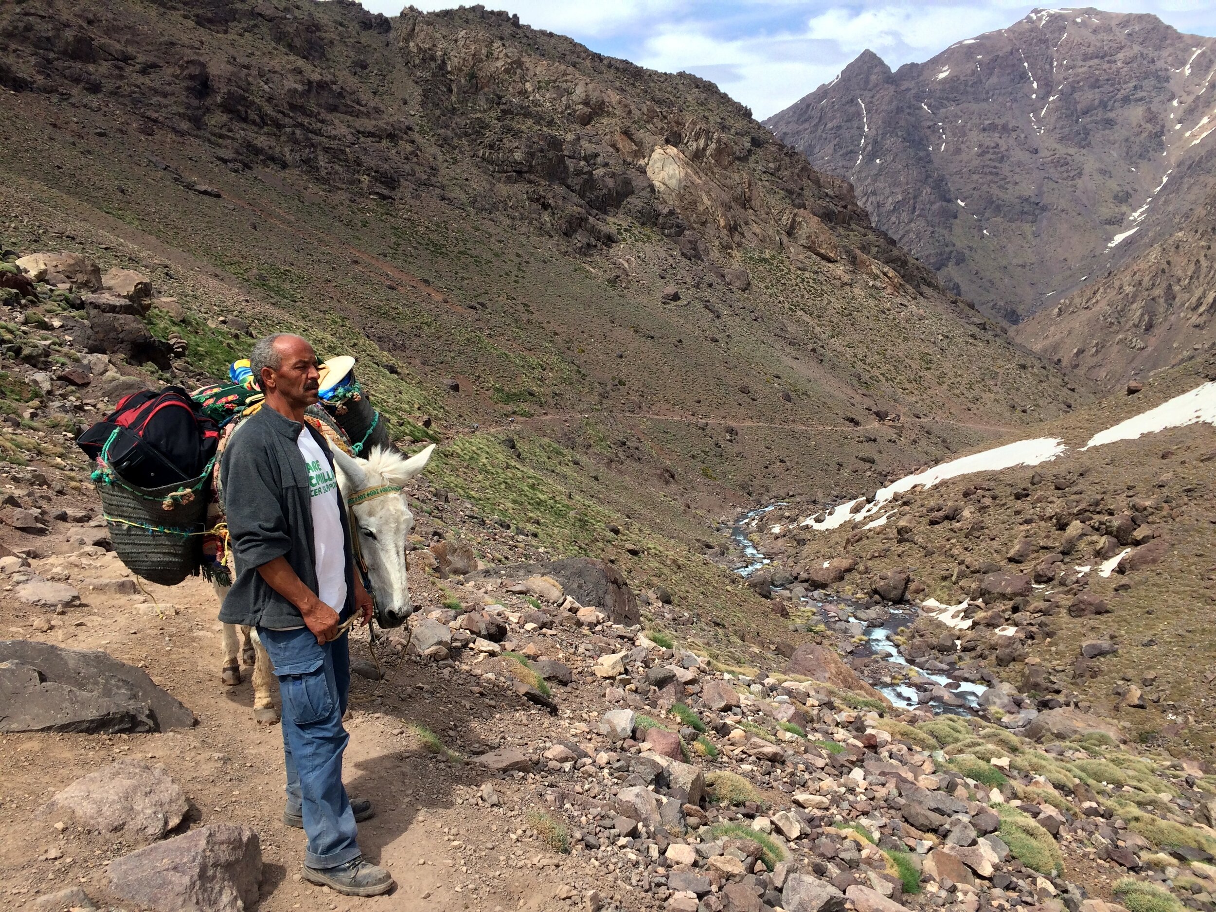
At one stop on route Mo pointed out that many of the mules supporting other groups were heavily overloaded. The 5 mules that carried our gear may sound a lot, but the camping and cooking equipment and the clothing for the trip soon adds up. 2 people’s gear split between 5 mules is a safe weight per animal. Many groups were going up with mules carrying twice our amount. It wasn’t nice to see, especially when we saw one fall over on a tricky corner due to the weight of his load.
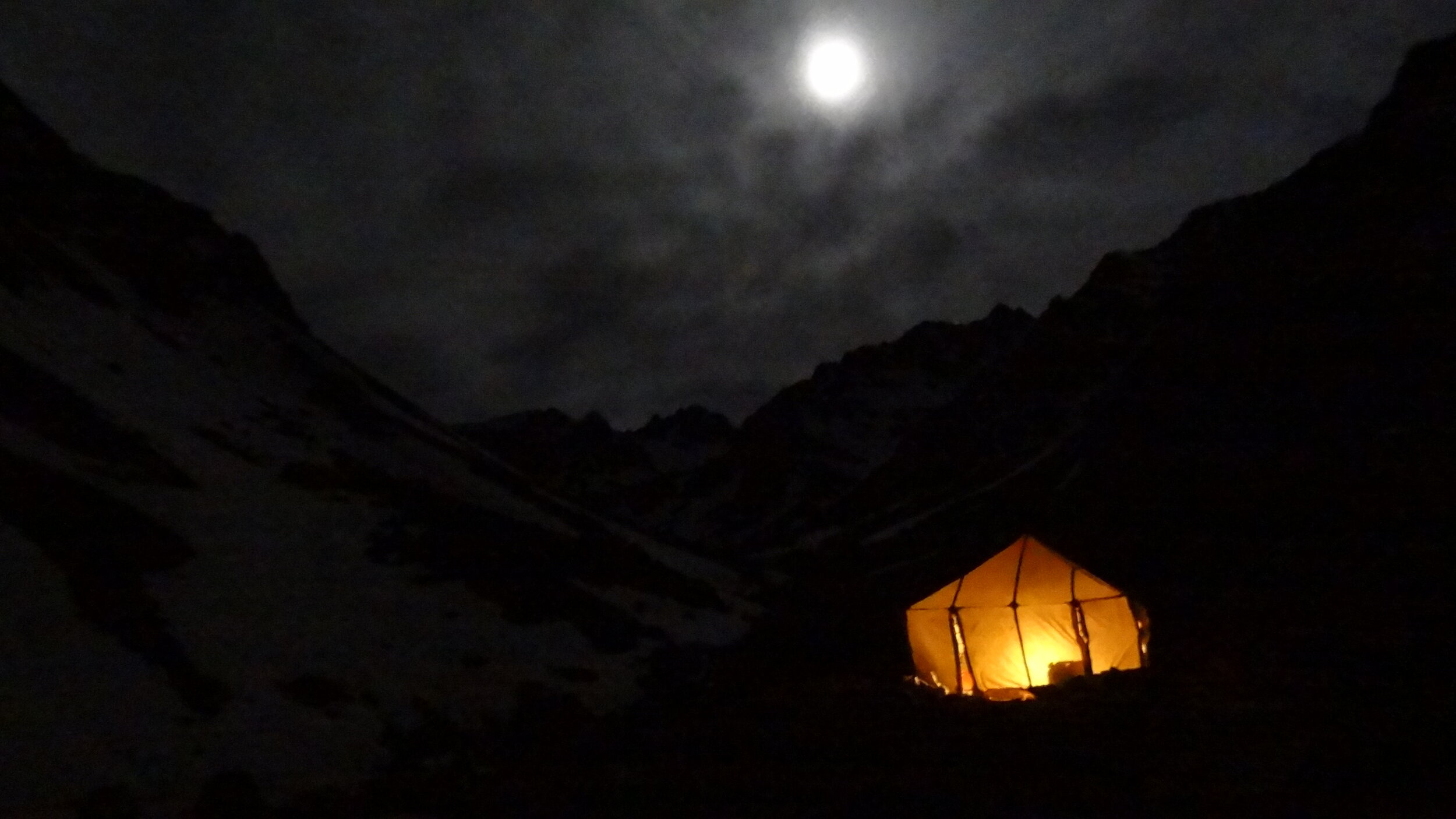
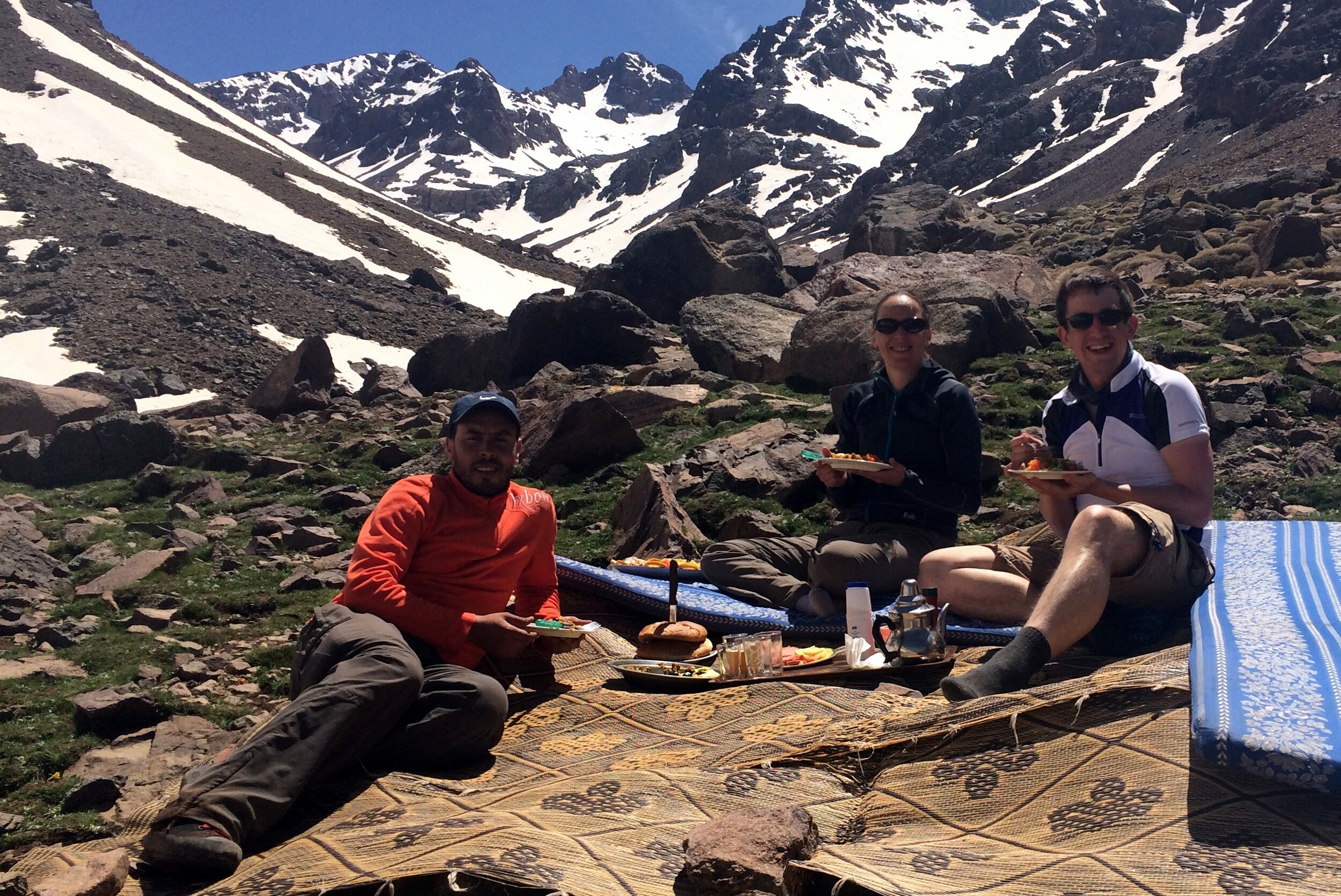
As we approached our camp for the night we were reaching the snowline and the free-flowing rivers and waterfalls were turning to snow and ice. Camp was a flat(ish) area next to the river, just short of Basecamp. When we arrived we rested by the river whilst the muleteers set up camp and prepared the evening meal.
Camp was 5 tents, 1 for us, 1 for Mo, a toilet tent plus a dining tent and a kitchen tent. The 4 muleteers would sleep in the dining & kitchen tents once we’d gone to bed. After another big meal we retired to our own tent for a few hours of restless sleep before the big summit day. The nice surprise of the night was the birthday present that Timi had brought with her and showed me that evening. It was a 15 minute video she had made of birthday wishes from my friends. It was a lovely thought and was really funny.It also made the remoteness of the location feel much closer to home.
Day 2: Refuge Toubkal Les Mouflons to Imlil
Date: May 5th 2015
Start: Refuge Toubkal Les Mouflons
Finish: Kasbah du Toubkal, Imlil, 42152, Morocco
Distance: 17.9 km (11.1 miles)
Elevation change: +1,020m / -2,331 m. Net -1,331m
GPX File: get via Buy Me a Coffee
Other Routes Touched (Cycle): None
Other Routes Touched (Walk): None
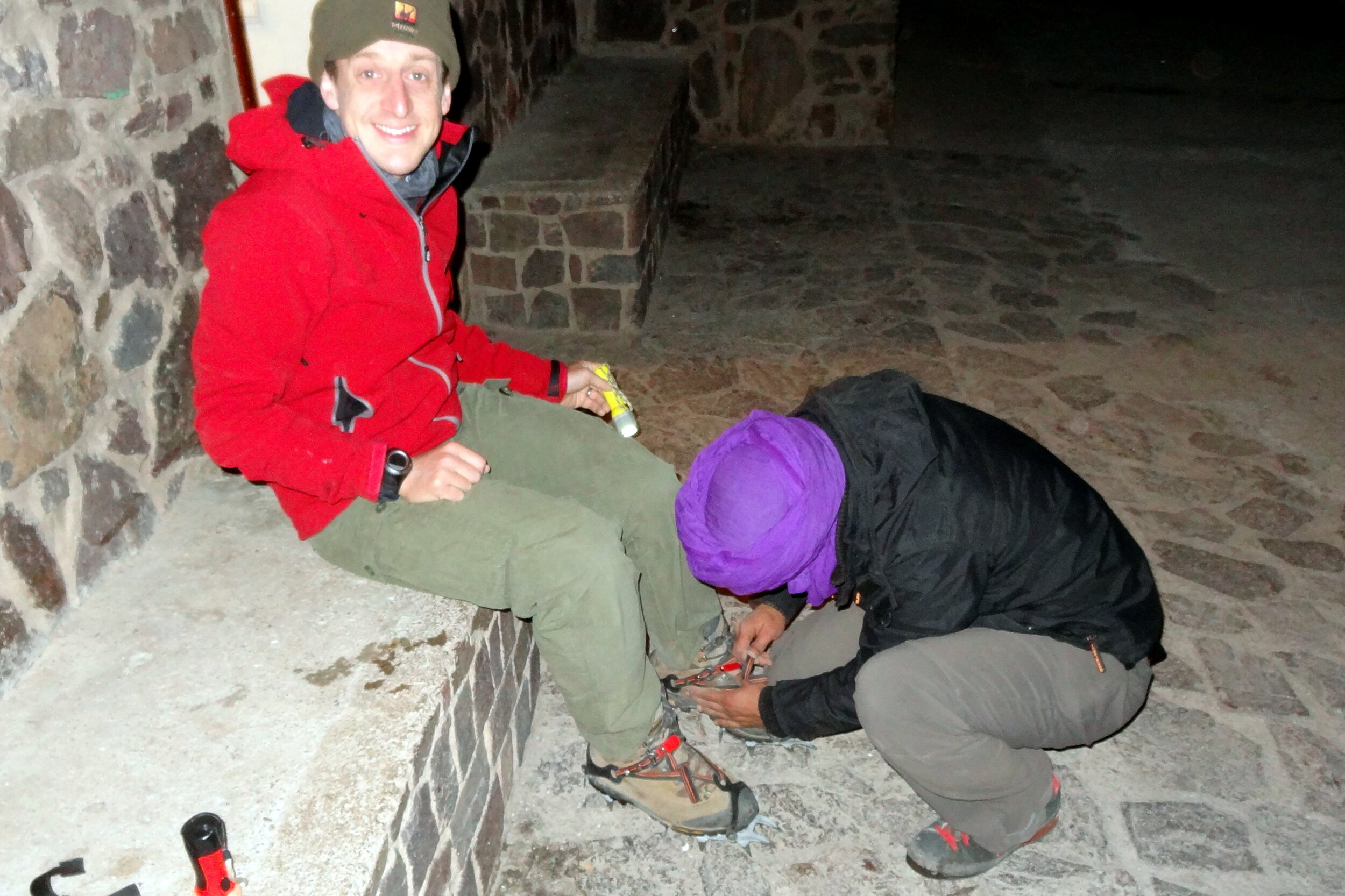
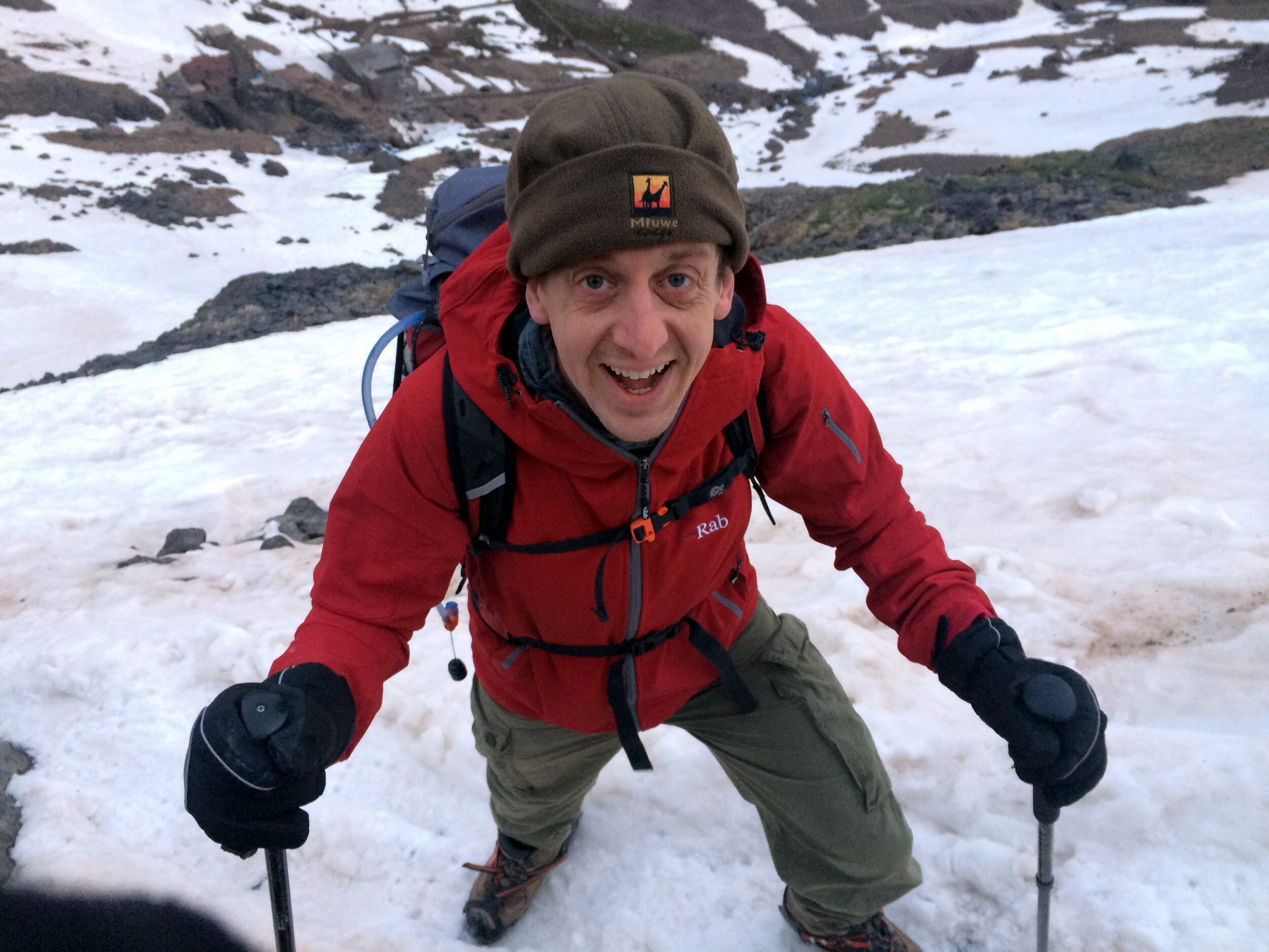
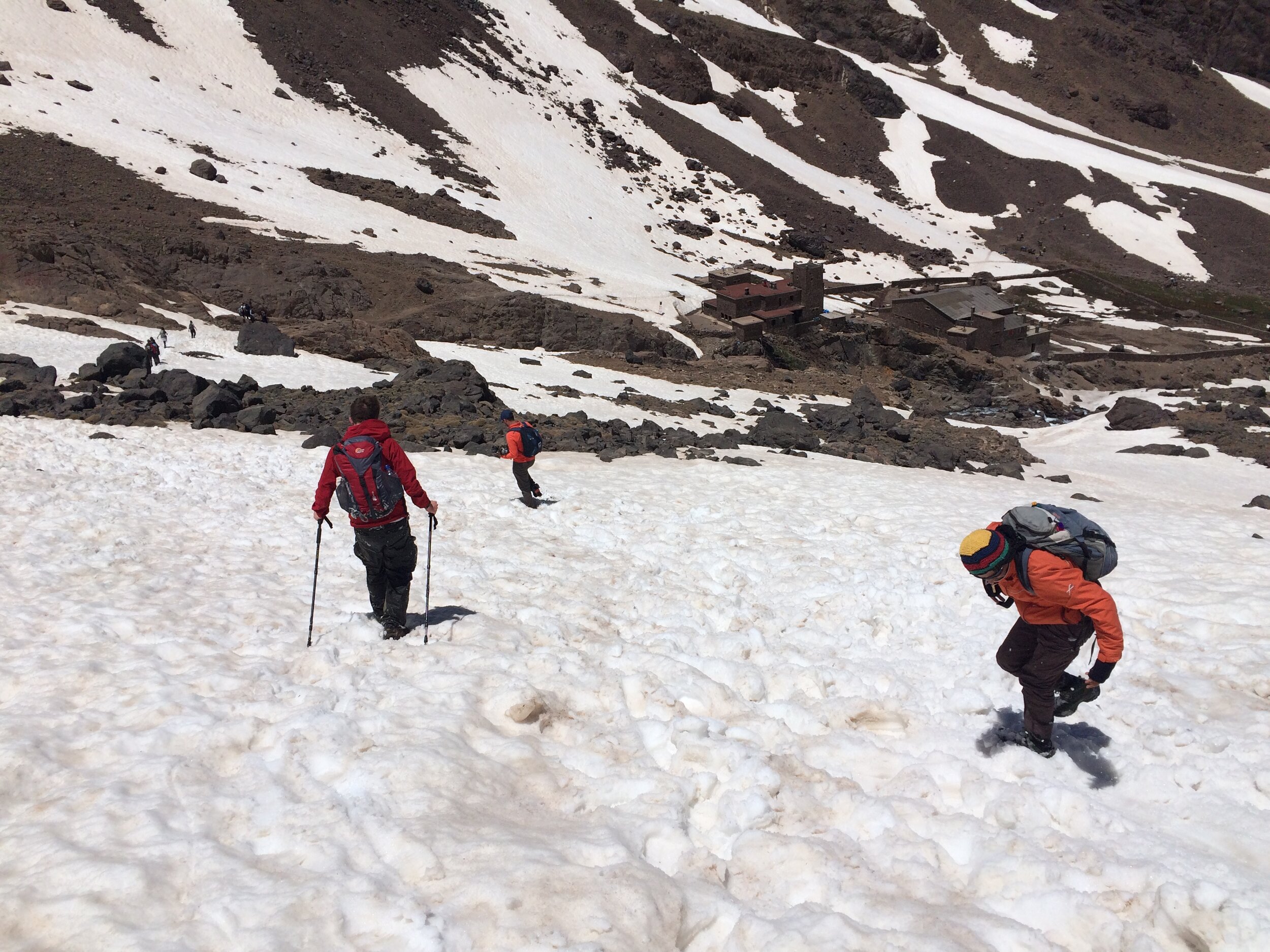
Day 2 started with a 04:00 alarm call and a dark stumble to the dining tent for breakfast. After getting kitted up and with head-torches on we started the ascent at 05:00. In 45 minutes we reached Basecamp, otherwise known as the Neltner Refuge. This is the part where the trail takes a sharp and steep turn to the left away from the river. We stopped for a while to strap crampons to our boots before tackling the snowy slope.
The first section from the Refuge was a hard slog up a kilometre of a steep snowy climb. We were still warming up and waking up and the dark didn’t help either. By the end of this part our energy levels were pretty low. This was the point that was the hardest for Timi and she was questioning whether she could complete the whole climb. A rest on a rock, some water and a bag of Haribo did the trick and we continued again for the next section.
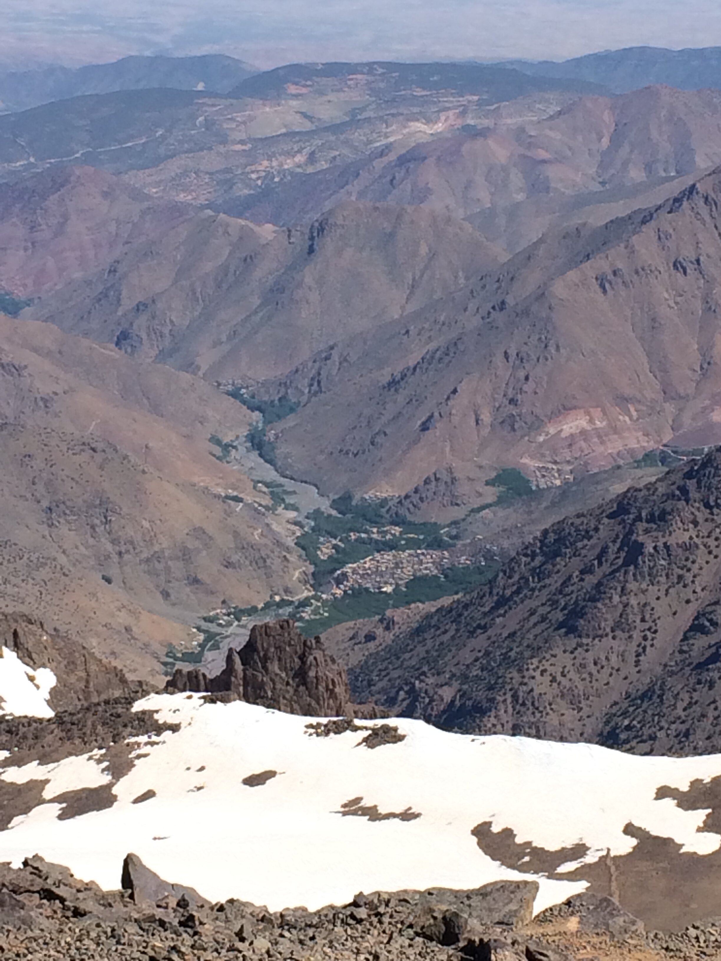
The ascent flattened out a bit and we took another hour to reach the top of the snow and ice. Now we could take our crampons off and walk the rest of the way on rock. This was also the point where the views became stunning as we could now see over the other side of the mountain across the High Atlas and beyond to the Sahara. In the distance we could see the parachute guy who we met the previous day slowly walking down. Obviously the parachute jump didn’t seem like such a good idea from the top.
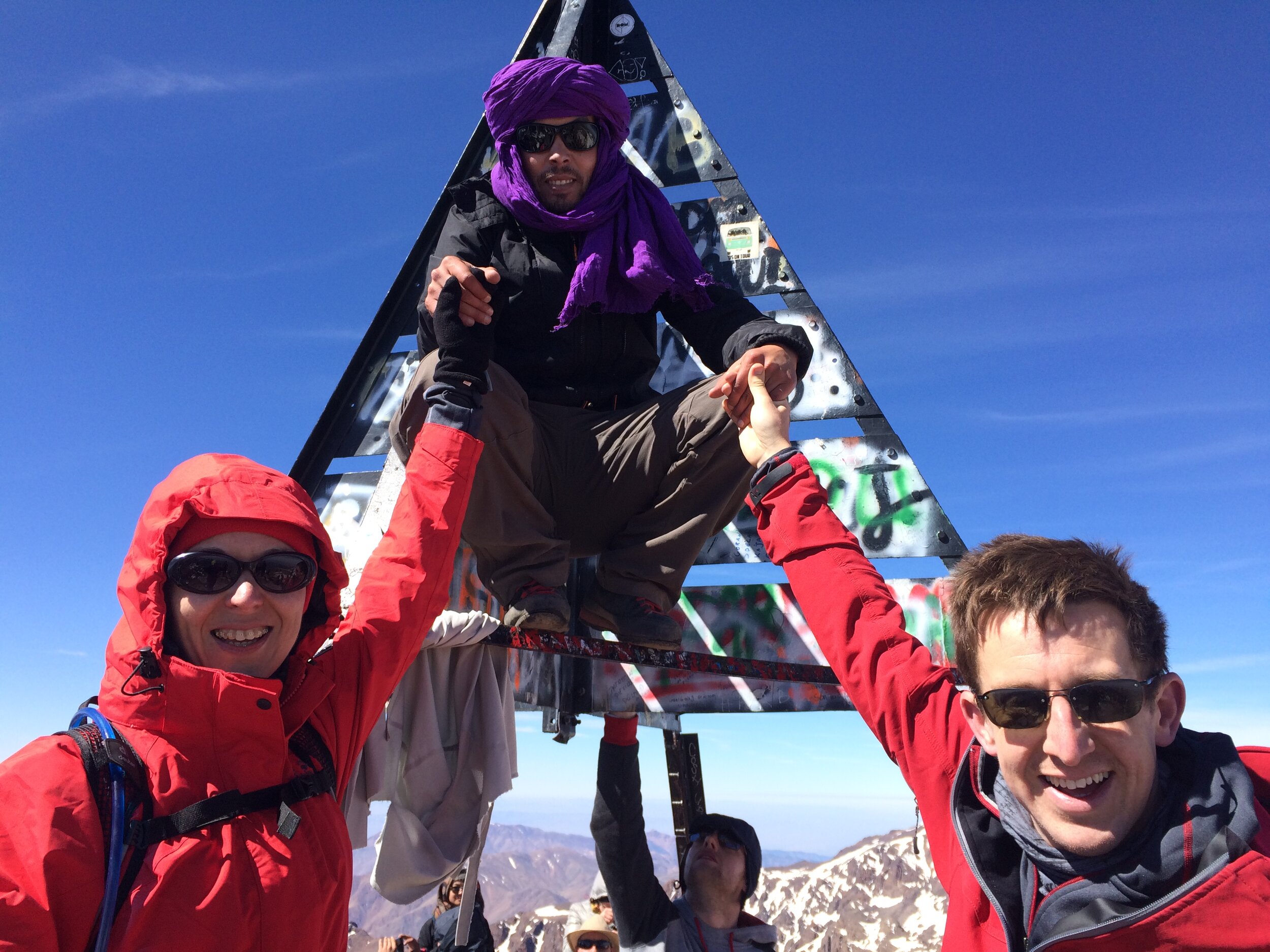
After another 30 minutes we could finally see the metal pyramid that marked the summit. Toubkal is positioned within a range of other peaks and there’s many twists and turns before you get to the top, so the summit is hidden for most of the trip. Suddenly we could see it, still a long way off but it was a morale booster as we knew we would make it.
The final section was steep and rocky and required careful footwork. There was a particularly scary 10 metre section that was a thin ledge of snow and ice over a sheer drop. Crossing it meant stepping into the compacted footprints in the snow left by the previous walkers. A slip would have been disastrous.
Finally we reached the Summit and entered into quite a party atmosphere of celebrating trekkers. It was really emotional for Timi as the 4 hours of focus and determination gave way to the huge sense of pride and achievement of getting there.
We took some time at the top to take photos, take in the view, rest and have lunch. From the Northern side of the plateau we could see all the way down to the start and end point at Imlil. It was a very long way in the distance and a daunting prospect as we would have to get all the way back down there before the evening.
As we ate lunch and looked across to the other Mountains, Mo told us stories of helicopter crashes in the area. I’m not sure if it was the best time for such stories, but they were interesting nonetheless. One crash happened only a few months ago when a helicopter was called out to rescue a distressed trekker and it hit the side of the mountain. Mo also told us of another story going back to the 1980s of an American Military helicopter crashing into the mountain during the winter. It was carrying weapons and money and was only found the following spring. The story is that the locals “retrieved” the contents and although the government got the weapons, the money was never seen again. There’s a rumour that the money found in the crash was used to fund the renovation of the Neltner Refuge. The descent was significantly easier and started off well. We were nervous about going back over the scary icy section but Mo took us a different way that avoided it. After about 20 minutes Timi was feeling pain in her knee. Mo had a knee support handy which helped a lot but it was still a worry as there was a lot of down still to go.
We reached the snowline again and Mo decided that we didn’t need to put the crampons back on. I wasn’t sure if this was a good idea as the first section was steep and I’m a bit nervous of slippery descents. Mo helped us down the tricky bits until it flattened out. Then came the fun part. Previous trekkers had created toboggan runs in the snow that were easy to follow. All we had to do was sit down in them, put our feet up and let gravity do the rest. We were able to take these runs down all the way to the Refuge. It was fun and exhilarating and was a great way to get down without putting pressure on Timi’s knee. We made the total descent to the Refuge in just over an hour, a quarter of the time it took to walk up.
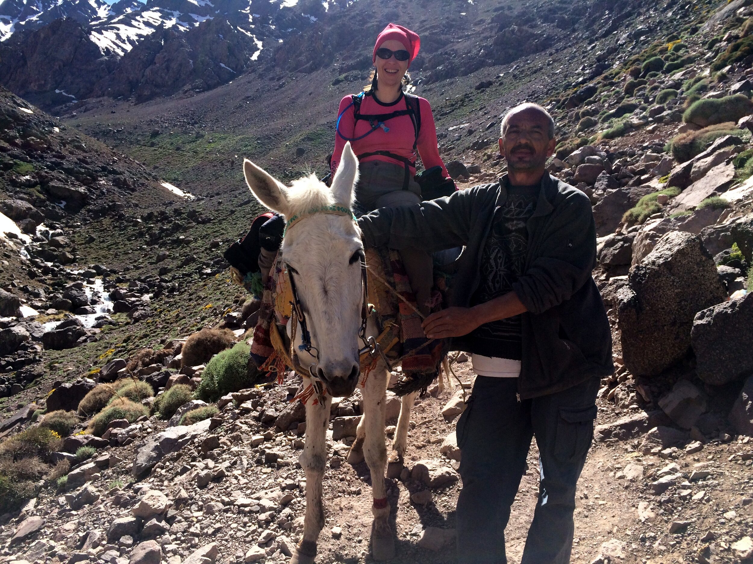
After a late lunch at our camp it was time to walk back to the Kasbah. Timi swapped walking for mule riding and she and Terry (the Mule) headed down the rocky path with Mo and the muleteer in front and me behind. The mules are amazing in how they can negotiate the uneven, often steep, trails with a fully laden pack. At a fast pace we were back down in 3 hours, arriving back at the Kasbah just before 19:00.
The rest of the evening was short. Despite being hungry and less than 100m from the dining room, we couldn’t find the energy to walk anymore and went straight to bed. All-in-all, a long, challenging, exhausting, exciting, fun and inspirational day.
Reflecting back on the trip a few weeks later, it was exactly the right way to celebrate my 40th birthday. Getting older doesn’t bother me as long as I’ve made the most of the time that I’ve had so before. So far I’ve loved all of it.