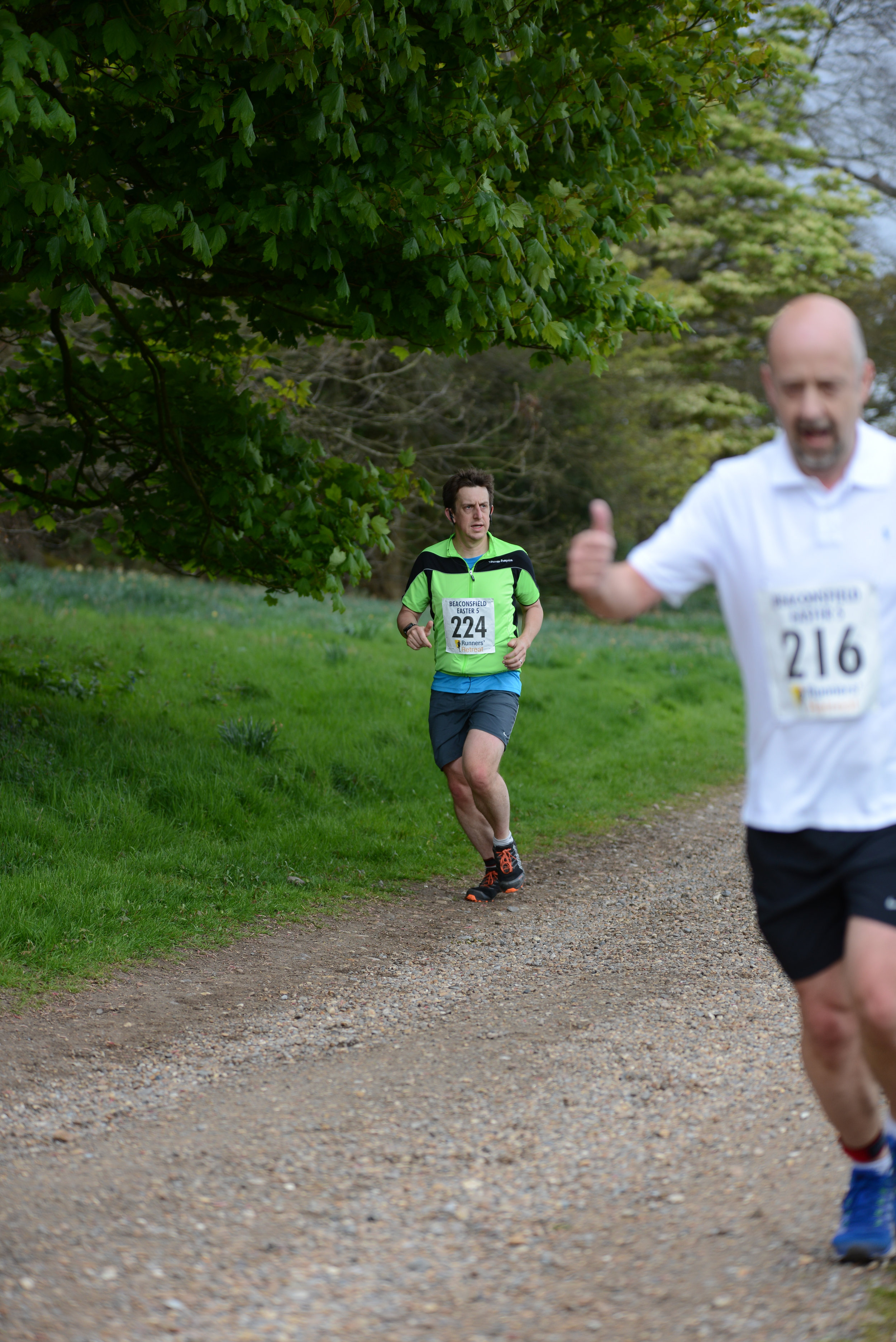
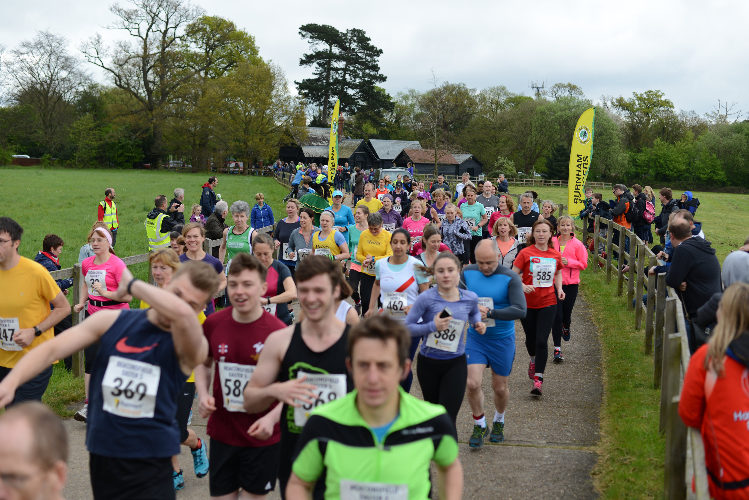
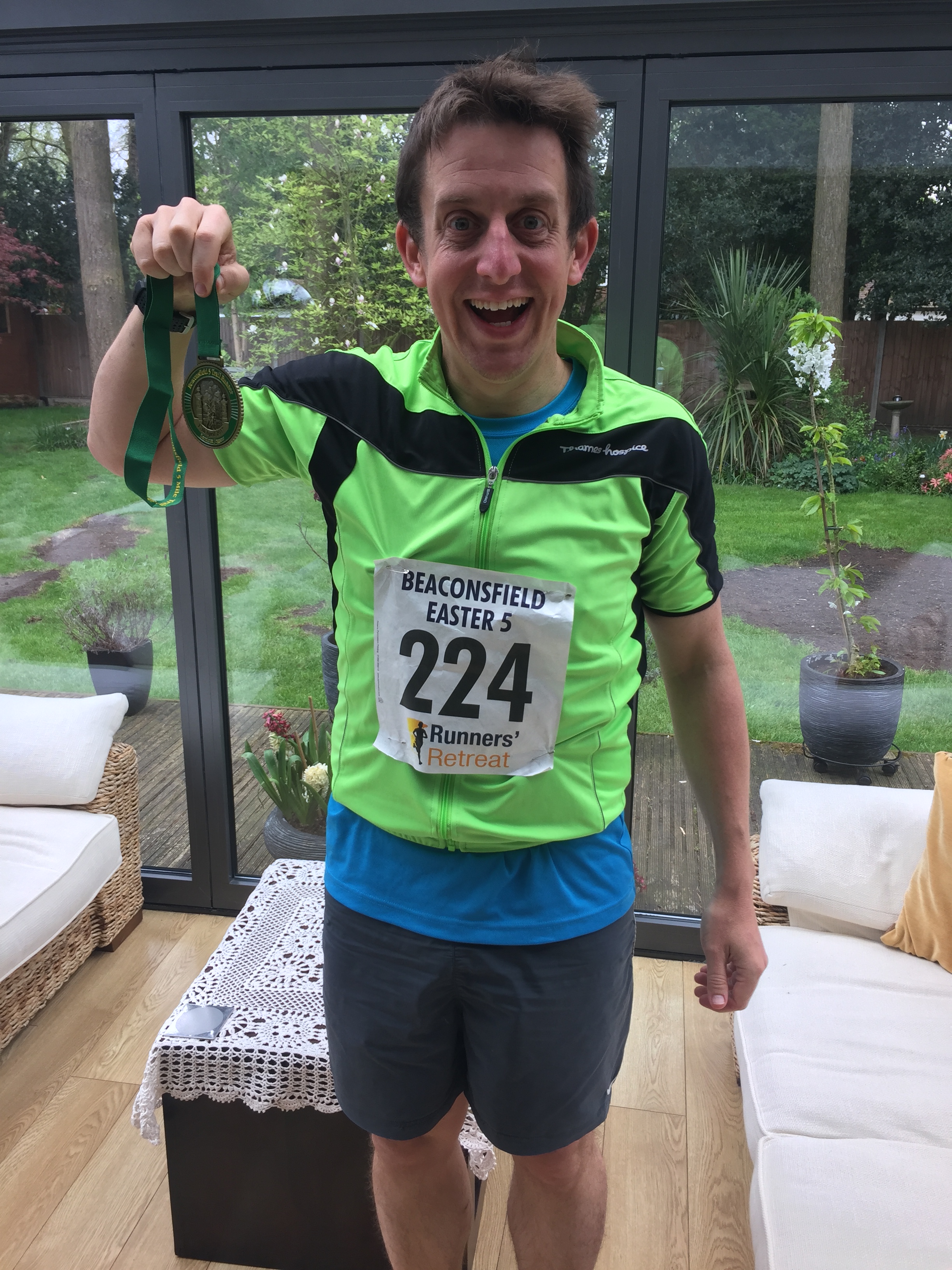
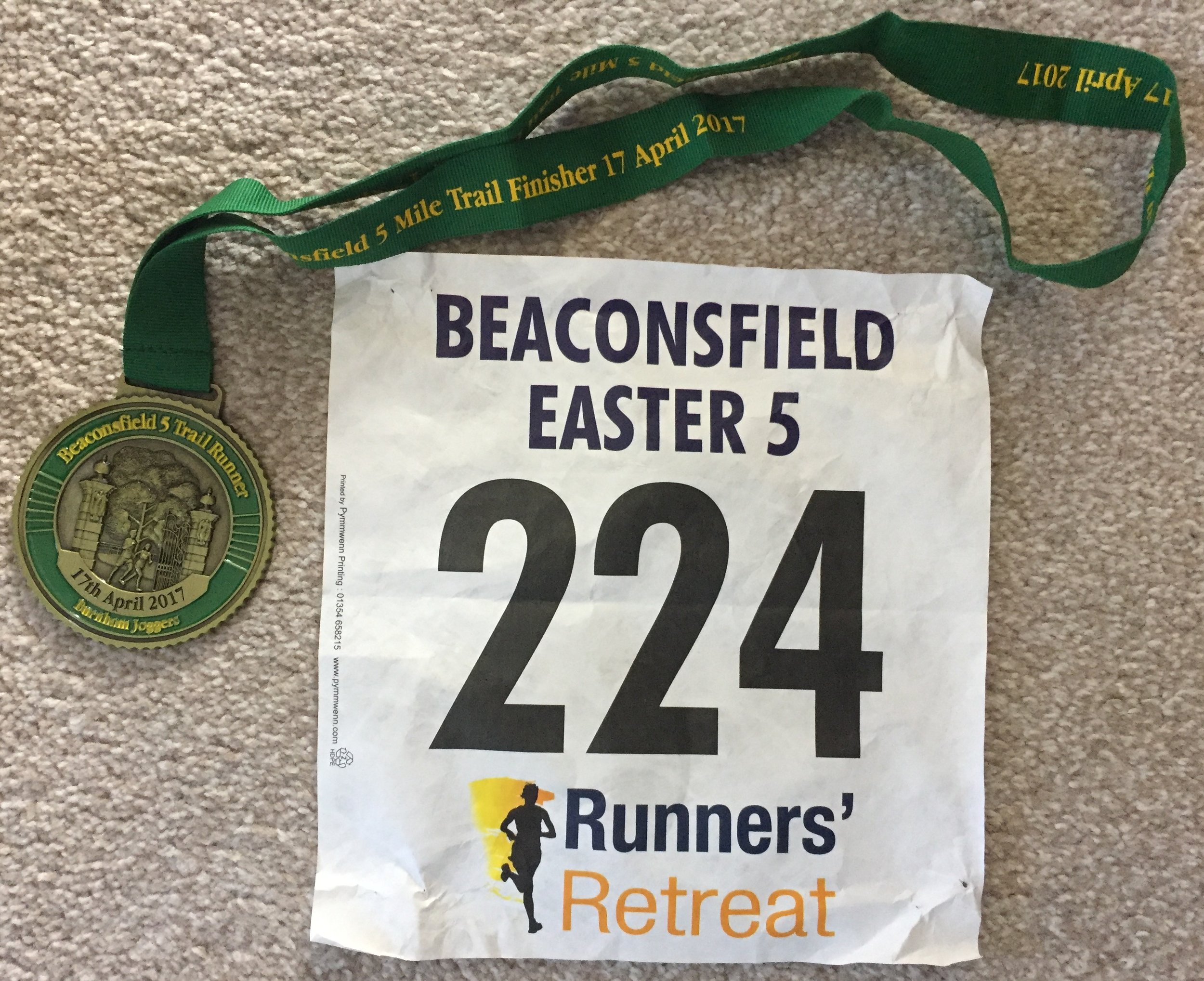
When: April 16th 2017
Where: Hall Place, Beaconsfield
Course: Start at Beaconsfield Rugby Club, then over the motorway for a circuit of Hall Place (normally closed to the public)
Other routes touched: None
Finish time: 44m
When: April 16th 2017
Where: Hall Place, Beaconsfield
Course: Start at Beaconsfield Rugby Club, then over the motorway for a circuit of Hall Place (normally closed to the public)
Other routes touched: None
Finish time: 44m

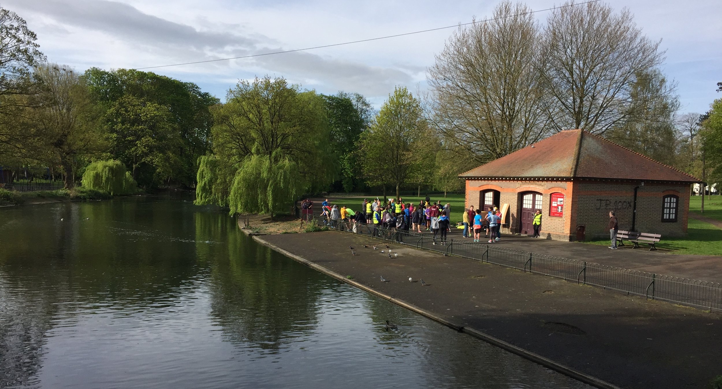
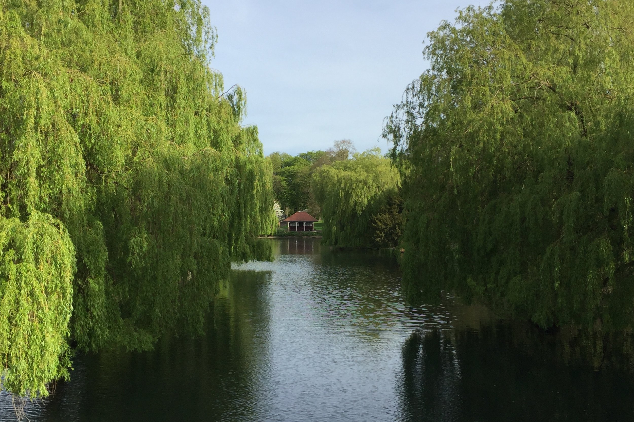
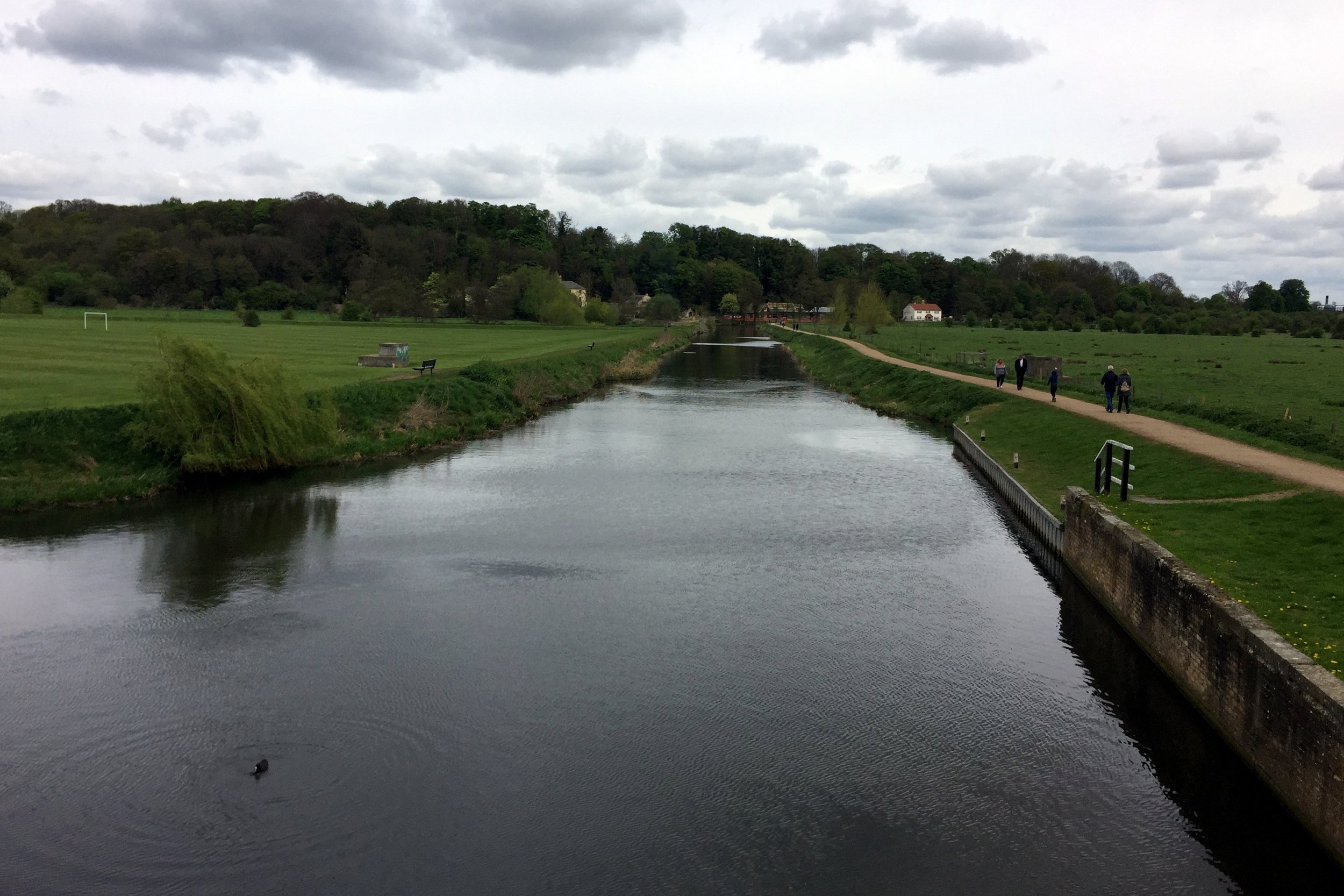
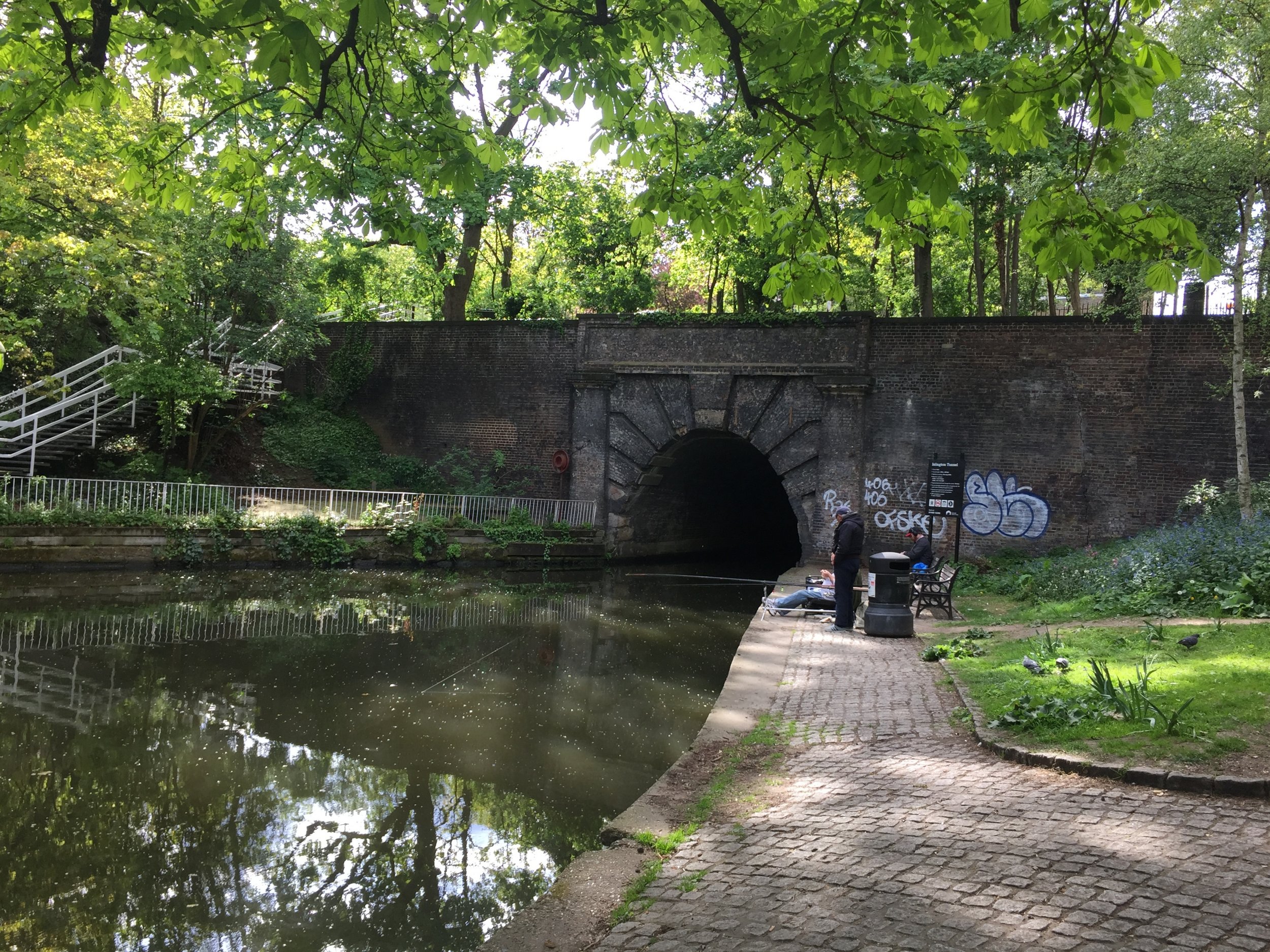
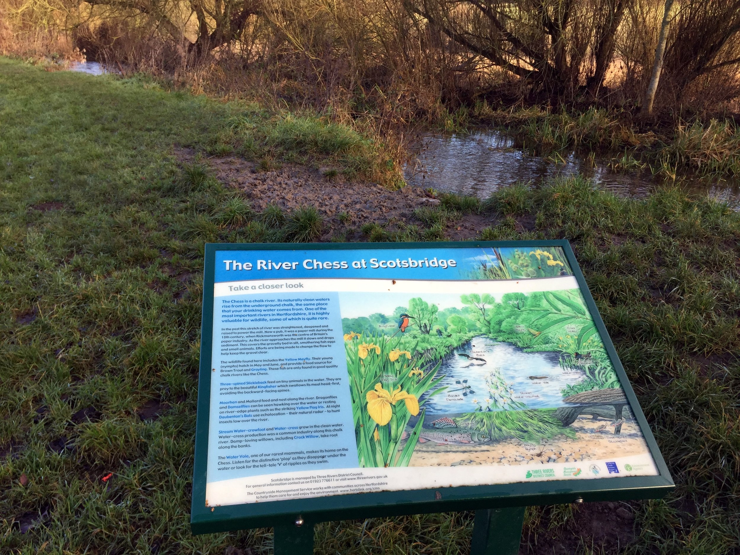
Near River Lee Country Park
Part of the Chiltern Rivers Series
River Lea start: Leagrave, Bedfordshire
River Lea end: Leamouth, Greater London
River Lea length: ~42 miles / 68 km
Cycle route start / end: Wardown Park, Luton, Bedfordshire
Cycle route length: ~58 miles / 94 km
Cycle route ascent: +420m / -507m
GPX File: get via Buy Me a Coffee
Other routes touched (walk): Lea Valley Walk, Chiltern Way, Hertfordshire Way, New River Path, Greenwich Meridian Trail, London Loop, Capital Ring, The Greenway, Jubilee Greenway, Regent’s Canal Towpath
Other routes touched (cycle): NCN Routes 1, 12, 57, 6, 61, Chilterns Cycleway, Ayot Greenway
Map: OS Explorer Map (193) Luton and Stevenage, OS Explorer Map (182) St. Albans and Hatfield, OS Explorer Map (174) Epping Forest & Lee Valley, OS Explorer Map (173) London North, The City, West End, Enfield, Ealing, Harrow & Watford
Links: River Lea, Leagrave, Luton, Lee Navigation, Limehouse Basin, Regent’s Canal
It was Easter Saturday and time to start proper training for July's Titanic Ireland cycle adventure. My cycling friends all opted out due to being "broken", "in Germany", "painting" or, strangely, "not fit enough to start training", so I was on my own for this one.
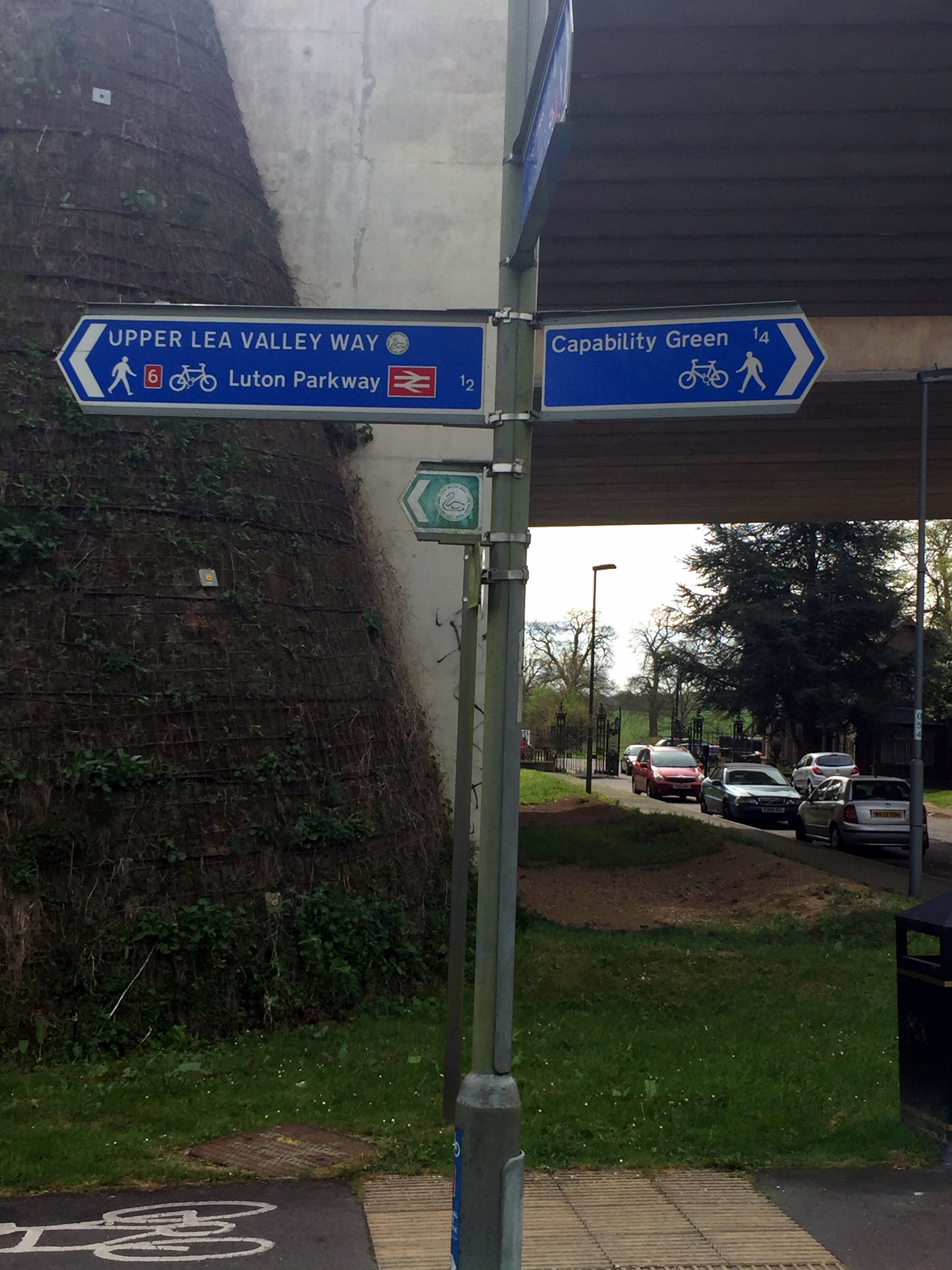
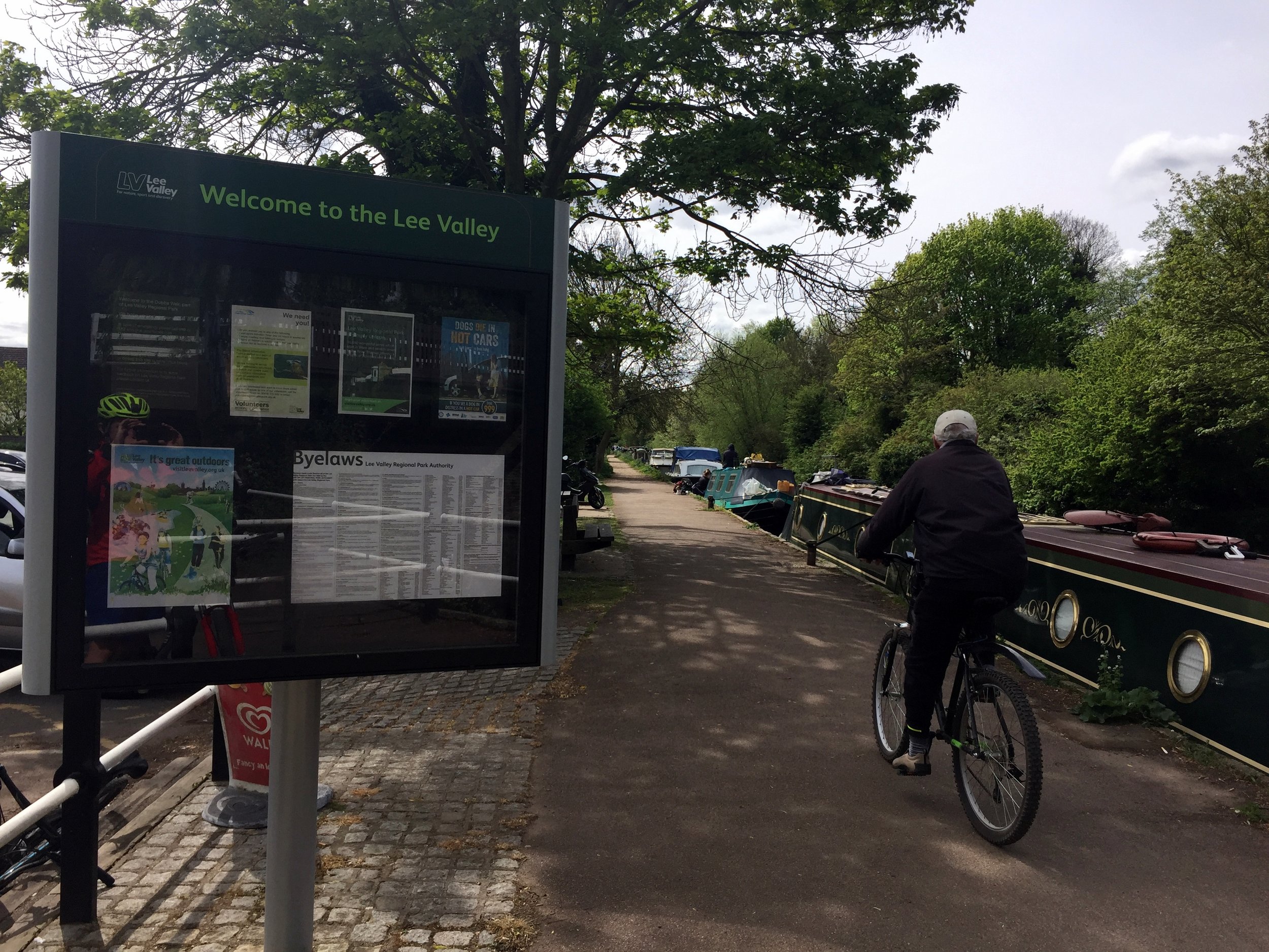
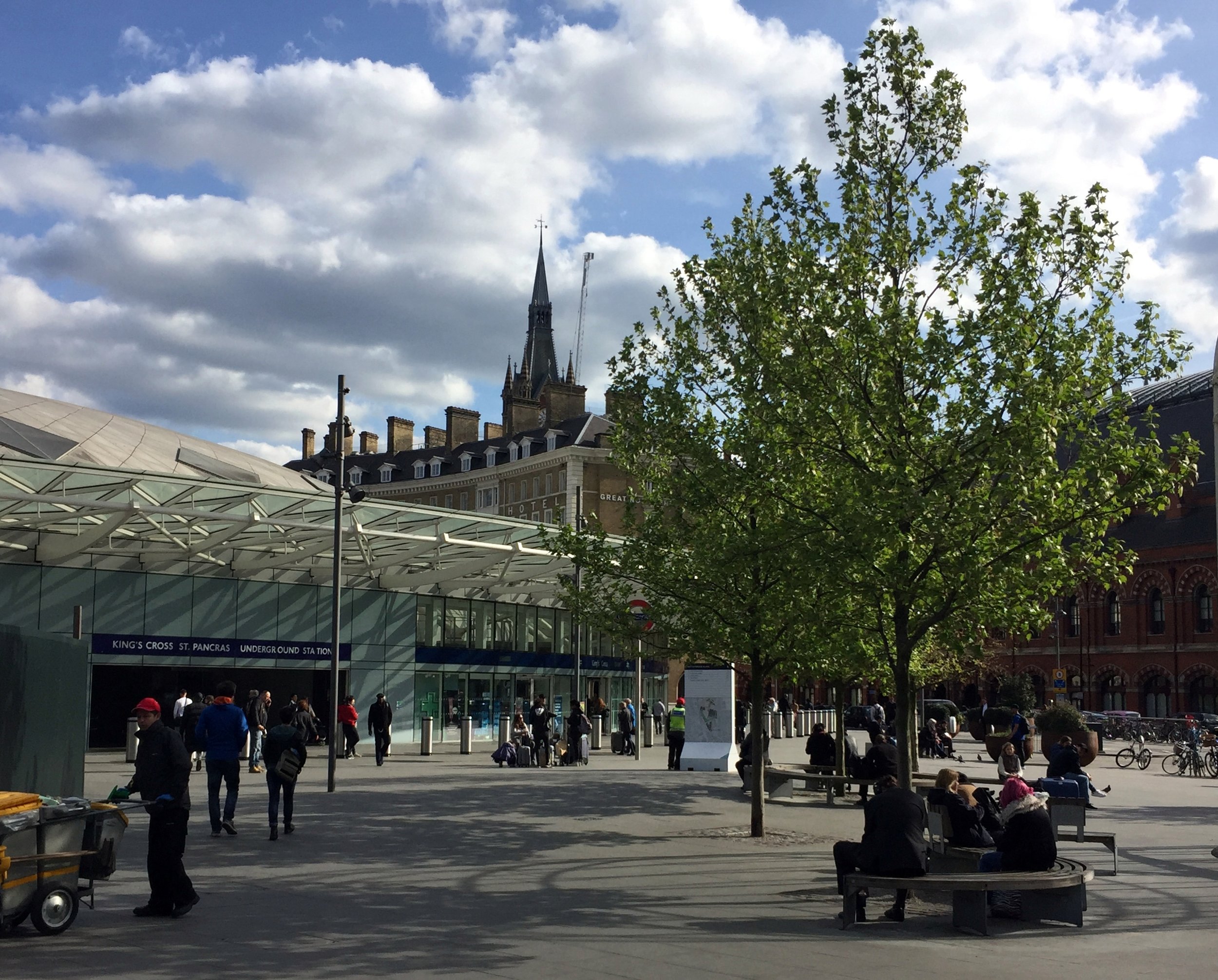
The route is a combination of National Cycle Routes (NCN), starting near the source of the Lea at Luton and ending at Limehouse Basin at the Thames in London. Getting back is easy enough as the Regent's canal takes you from the Basin to St Pancras station where there are frequent trains back to Luton.
The Lea starts in Leagrave, north of Luton. Although NCN 6 passes through it, I opted to start the trip 2.3 miles down at Wardown Park where the river fills a small lake. Its also the venue for Luton Wardown parkrun which, as it was Saturday, had to be done too. If I were to do the trip again I would start at the source as it’s very close to Leagrave Station which is on the same line to St Pancras. This additional section follows the Lea Valley Walk which is a footpath but there’s good options for cycling on nearby roads.
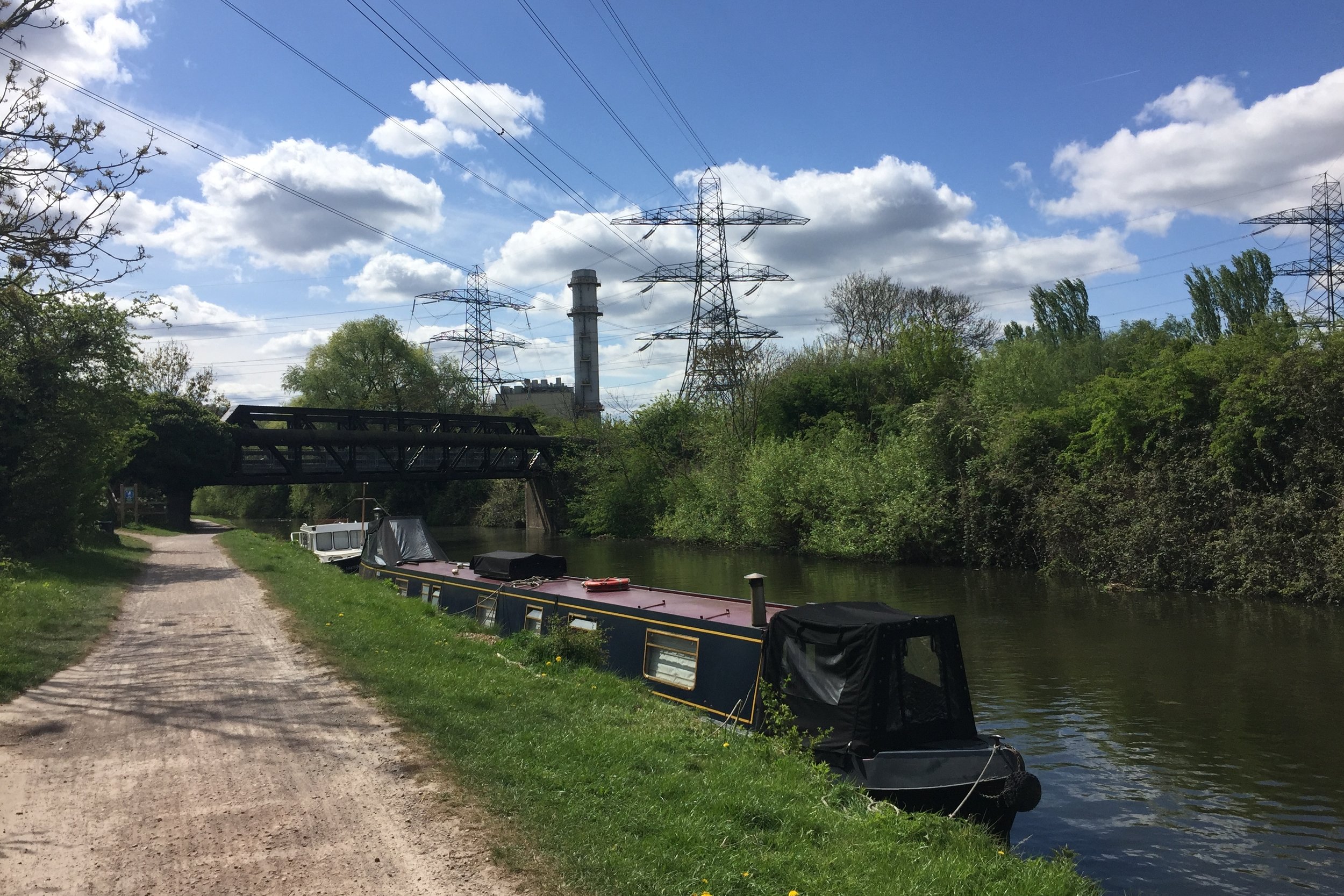
The trip is a nice combination of NCN routes 6, 57, 12, 61 and 1. It's easily navigable with only a small amount of planning and keeping your eyes out for signs along the way. The first 22 miles to Hertford is mostly disused post-Beeching railway lines, with the remainder following the Lea Navigation Canal.
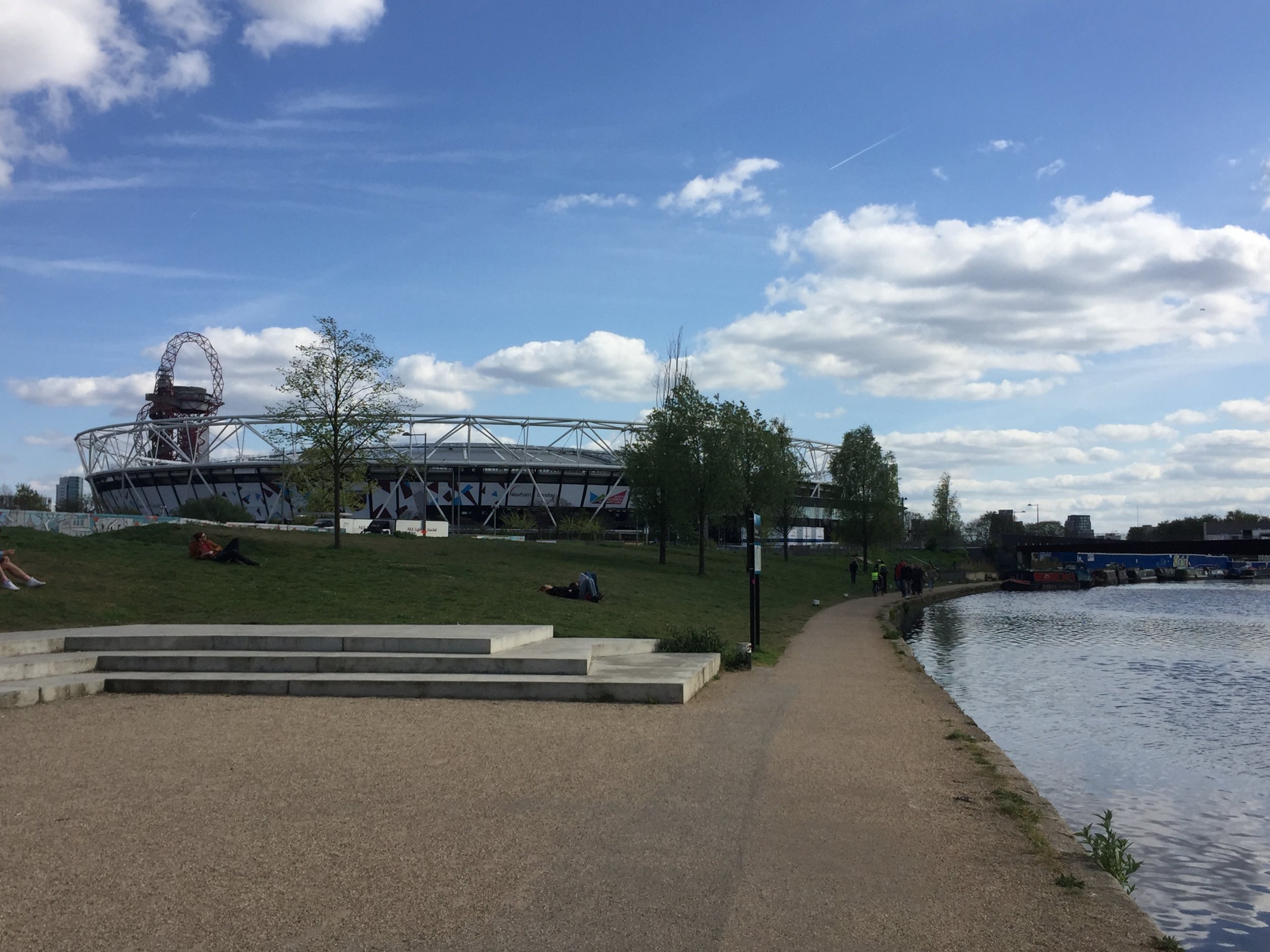
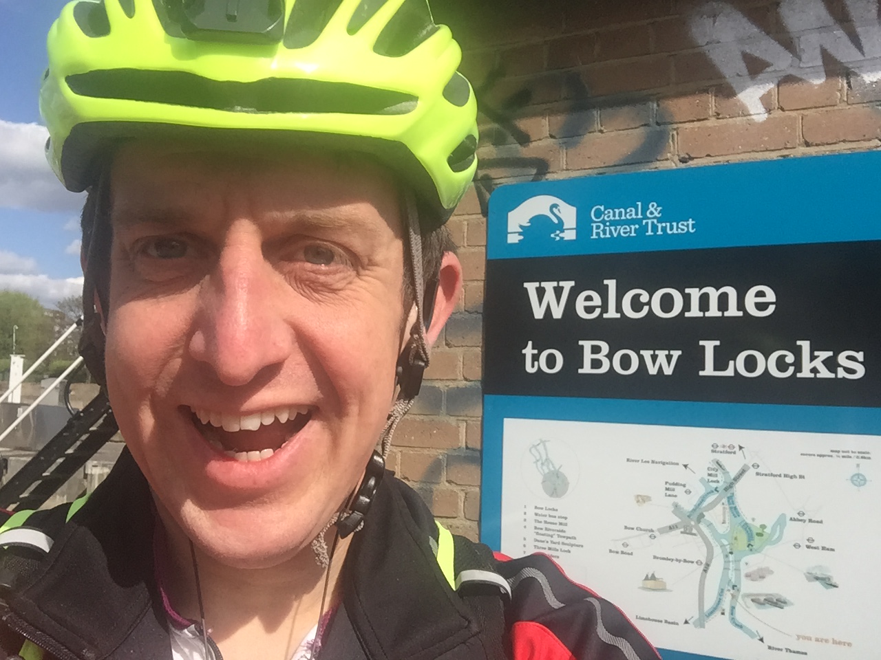
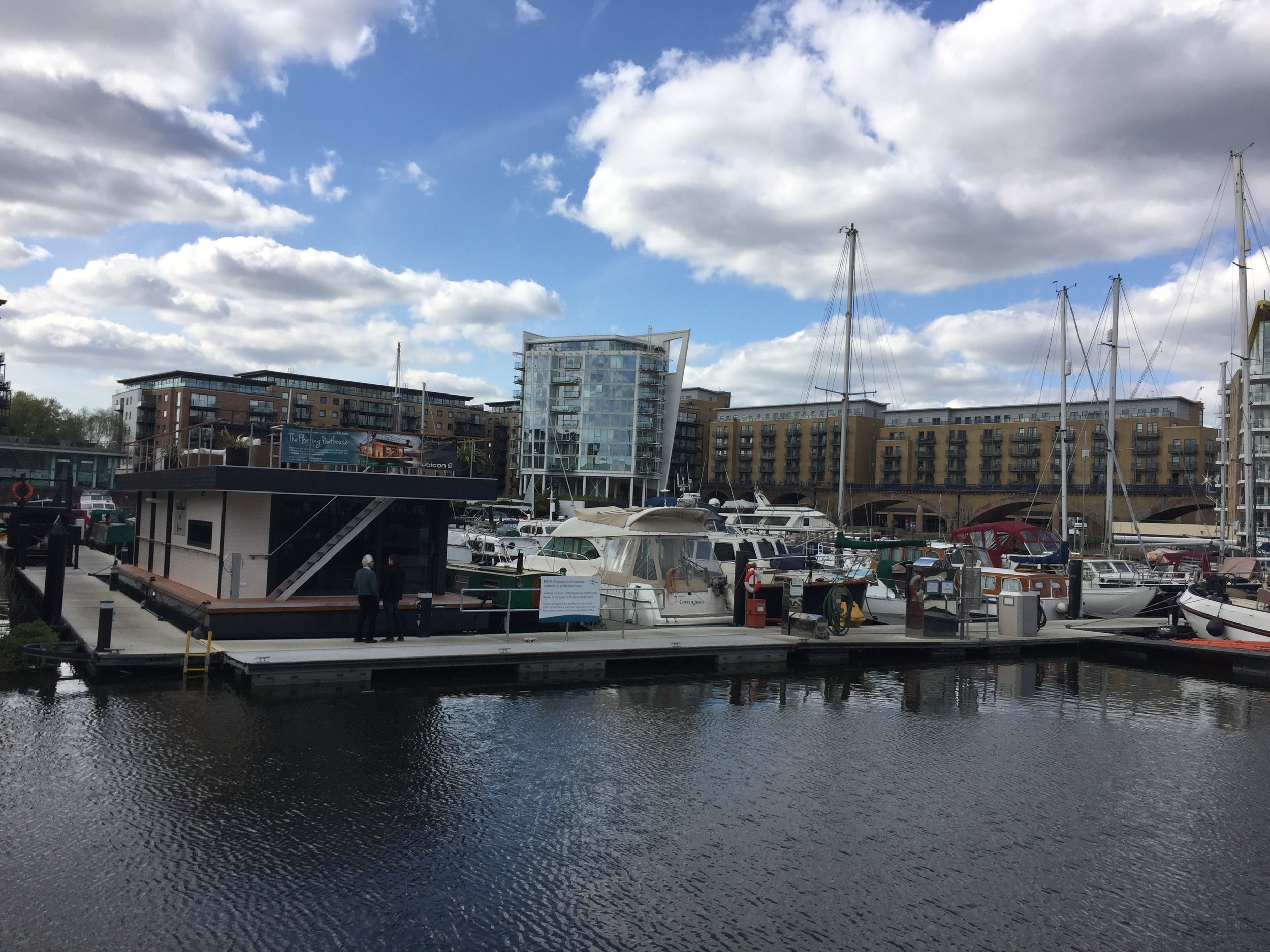
The River Lea joins the Thames near Canning Town, opposite the Greenwich Peninsula. Cycling right to the confluence is tricky so I opted to follow the Limehouse Cut from Bow Creek to the Limehouse Basin. From there I followed the Regent’s Canal back to King’s Cross station to get the train back to Luton where I had parked my car.
Red = course of the River Lea, Blue = Cycle Route including Regent’s Canal to King’s Cross.
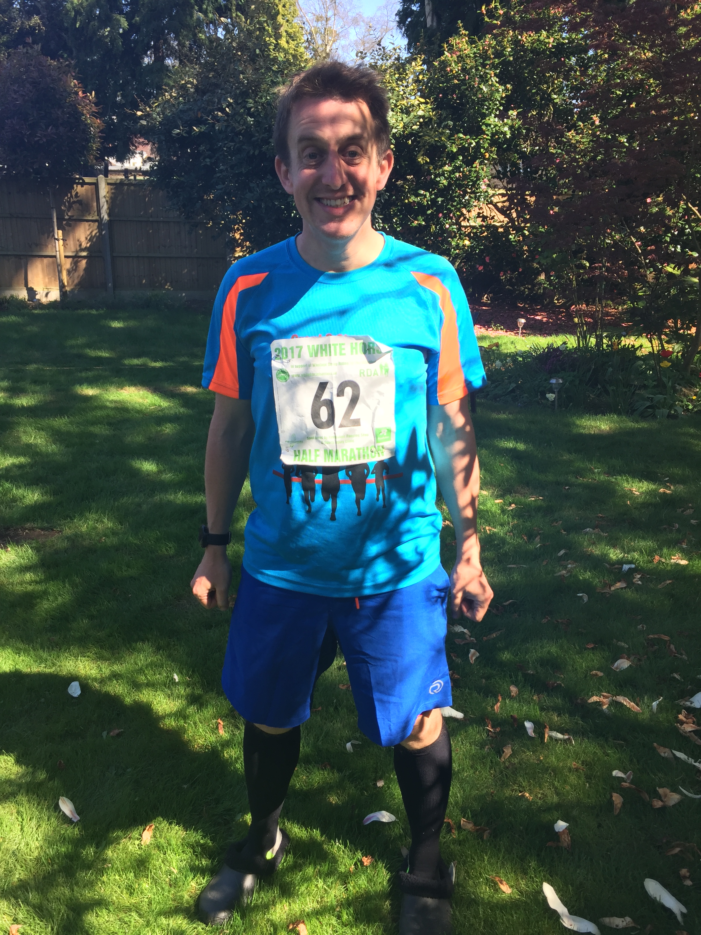
When: April 9th 2017
Where: Grove, Oxfordshire, UK
Course: Mostly flat country roads around Grove, Denchworth, Lyford, Charney Bassett and Goosey
Other routes touched: None
Finish time: 2:10 ... Hot and slow!

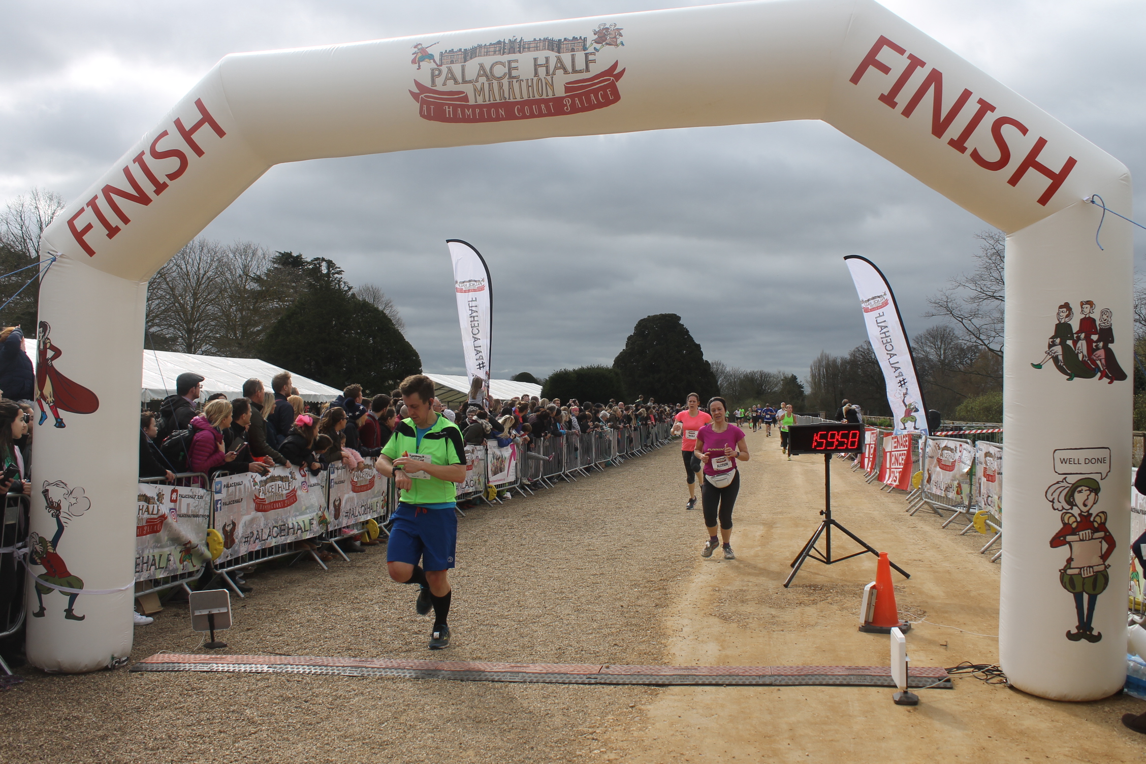
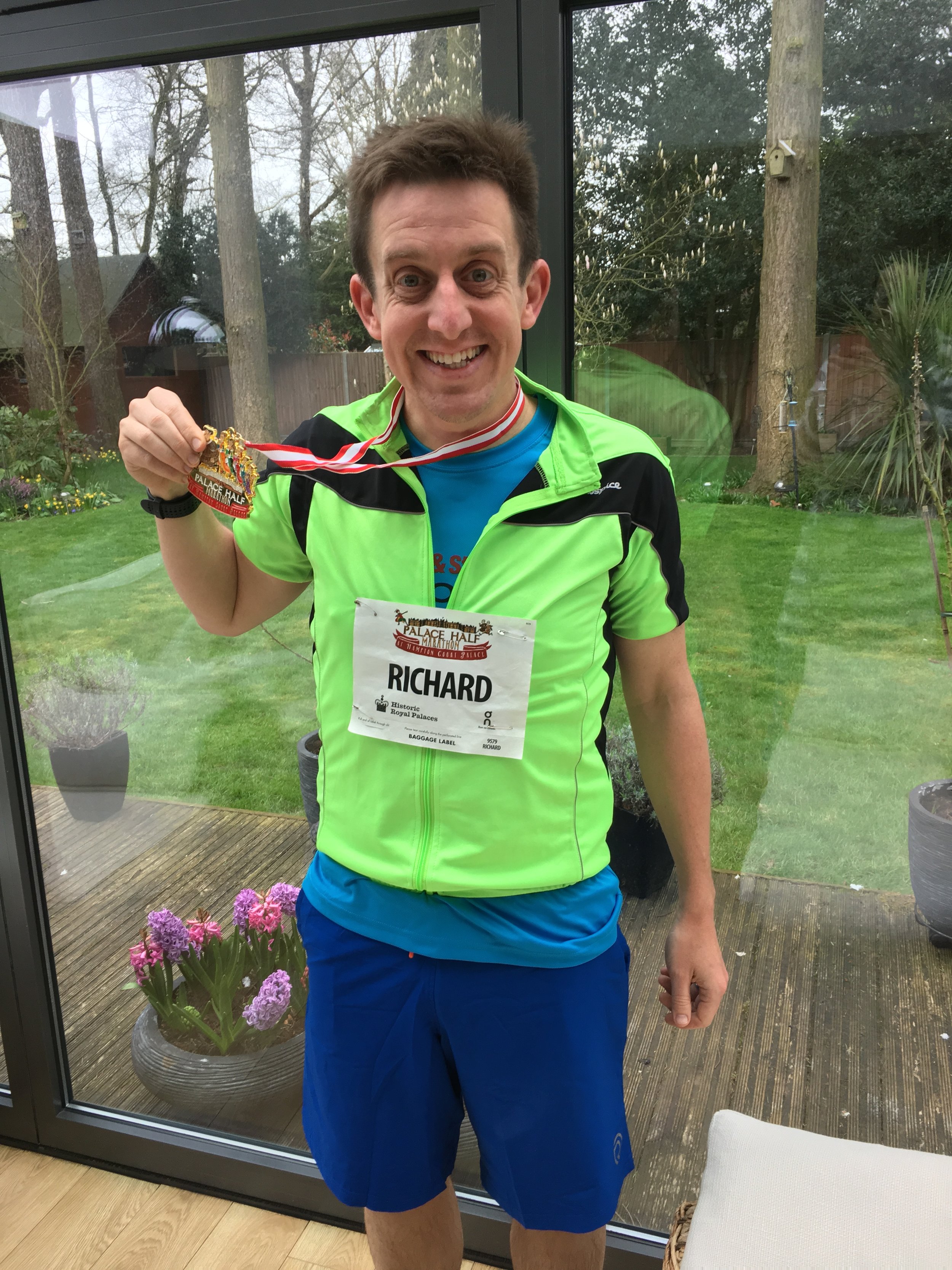
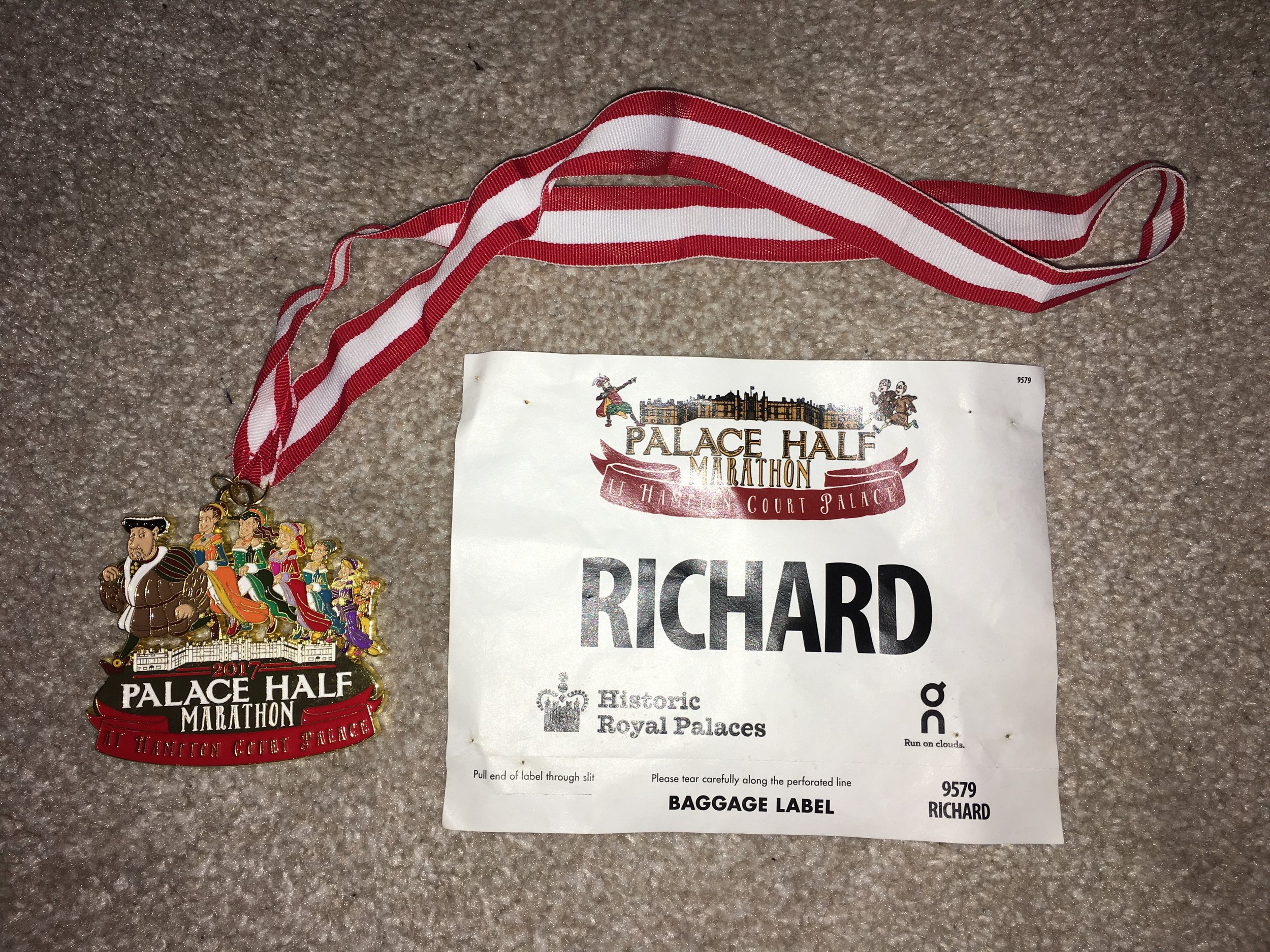
When: March 19th 2017
Where: Hampton Court Palace, Surrey, UK
Course: Thames Path between Hampton Court and Kingston, on road to Thames Ditton, off road through Hampton Court Golf Club
Other routes touched (walk): Thames Path
Other routes touched (cycle): NCN 4
Finish time: 1:57
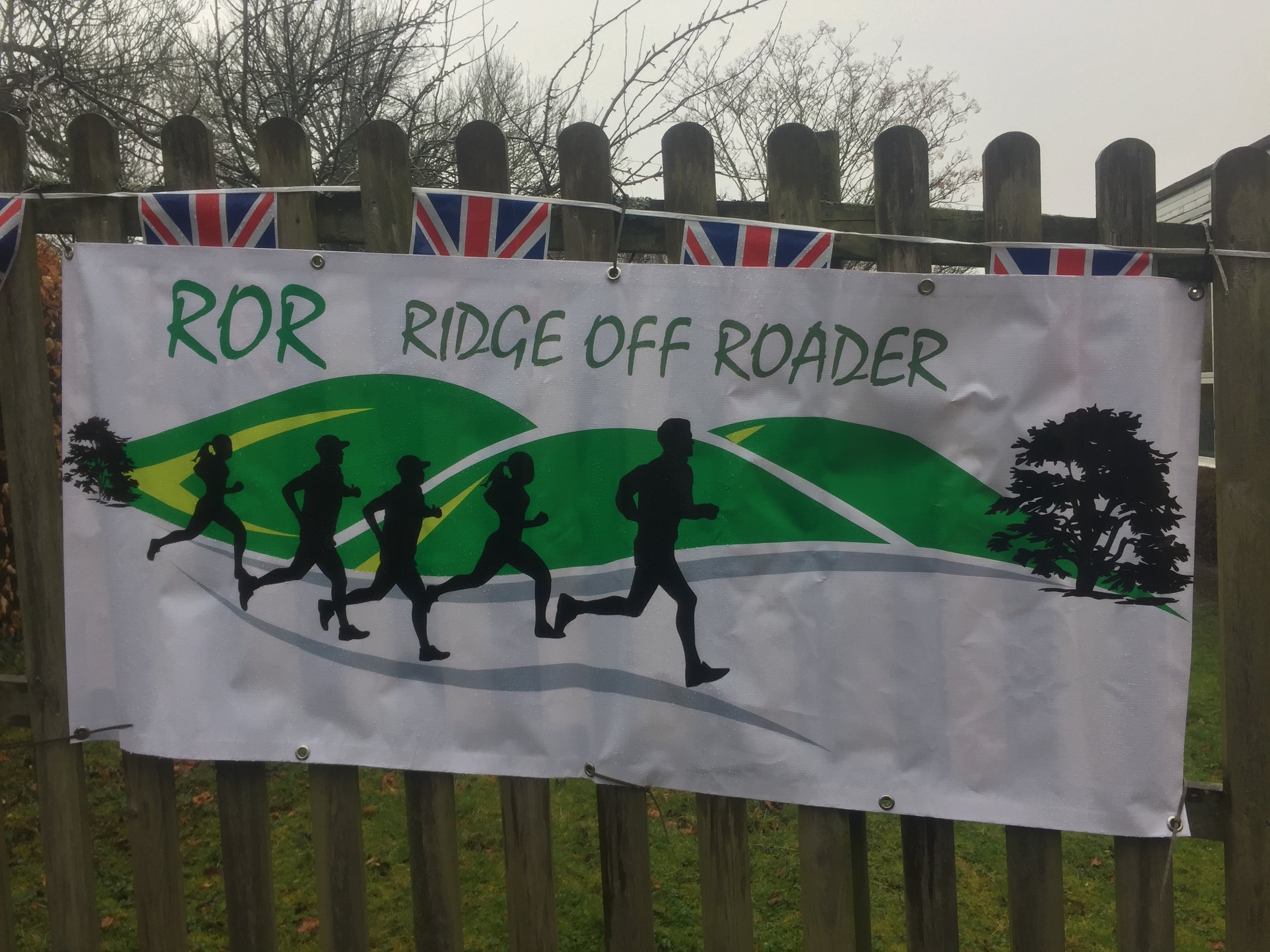
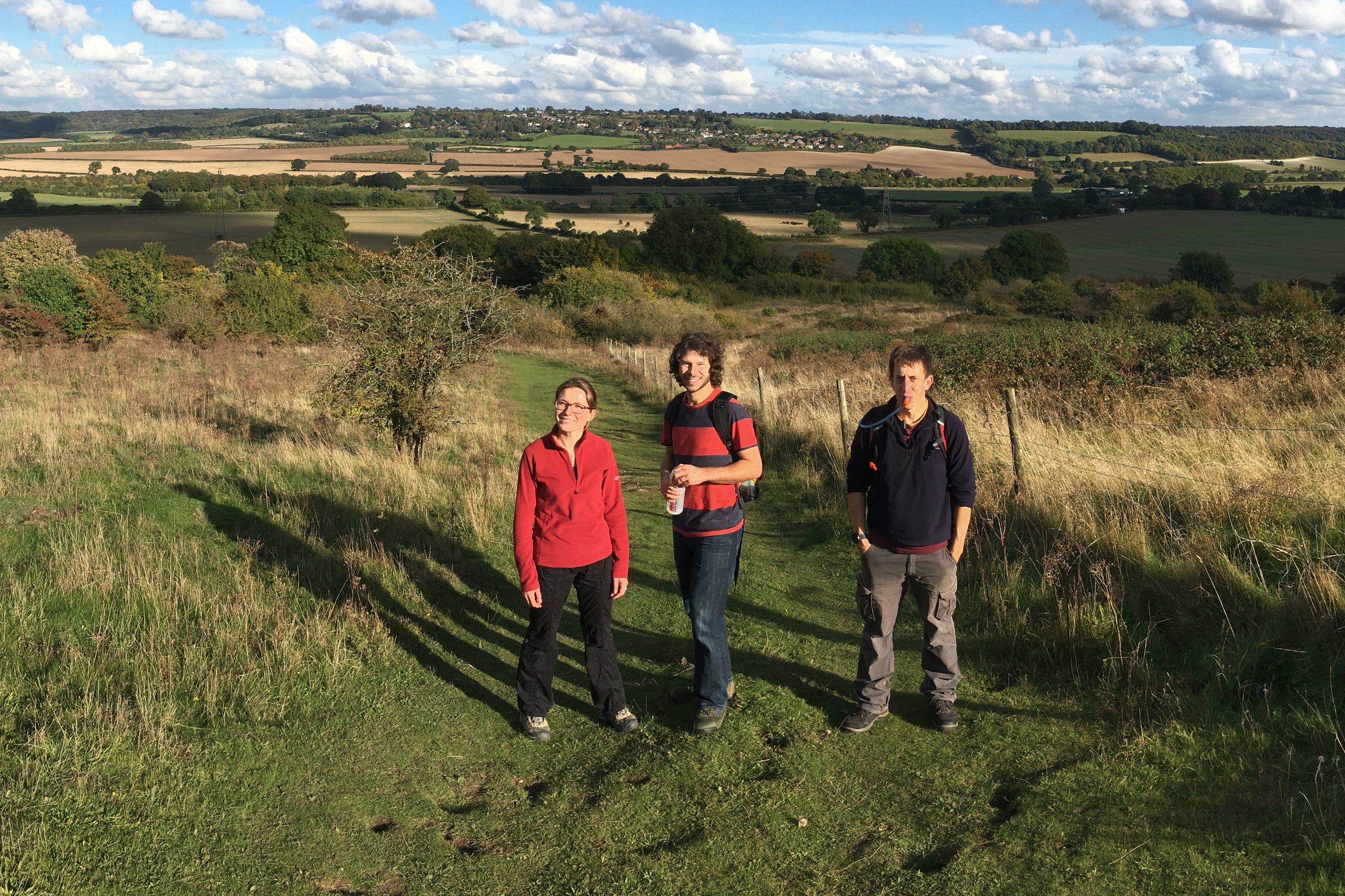
When: March 12th 2017
Where: Bledlow Ridge, Chiltern Hills, UK
Course: Very hilly, muddy off-road course following some of the Ridgeway
Other routes touched (walk): Chiltern Way, The Ridgeway, Midshires Way,
Other routes touched (cycle): Chilterns Cycleway
Finish time: 2:46 (slow!)
When: March 11th 2017
Where: Black Park, Buckinghamshire
Course: 2 laps of Black Park, home of the Black Park parkrun. Done at night with headtorches
Other routes touched (walk): Beeches Way
Other routes touched (cycle): None
Finish time: 54m


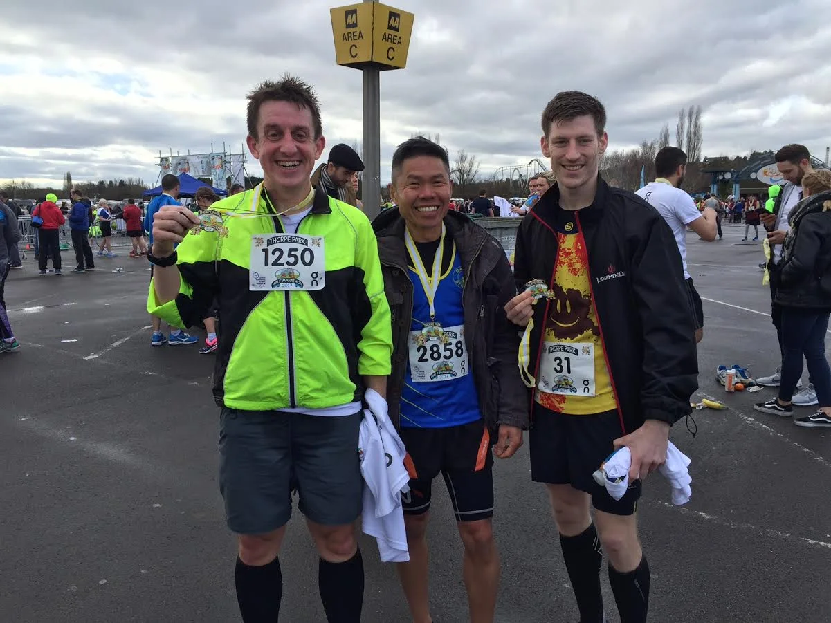
When: February 26th 2017
Where: Thorpe Park, Chertsey, UK
Course: On-road, start and end at Thorpe Park, out to Egham, Virgina Water & Lyne
Other routes touched: None
Finish time: 2:00

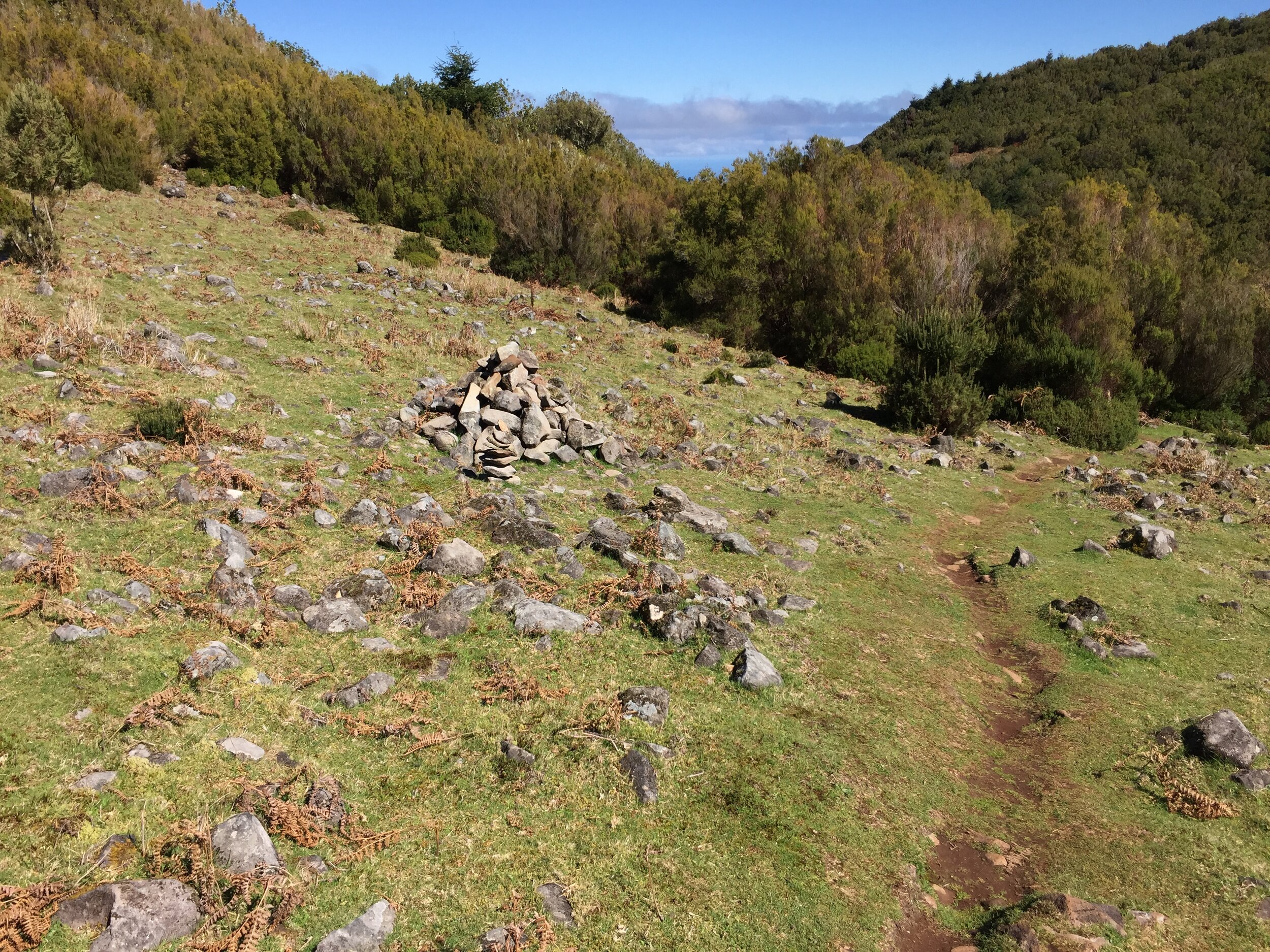
Pico Ruivo Trail
Madeira had always been a place that we thought we would go to one day, but it was never high up on our travel list. Maybe its reputation as a retirement holiday destination had put us off. It turned out that it’s an ideal winter break location for us: warm in the winter and loads of great walking trails. We could have easily spent a month there discovering all the Levada routes. For now, we made a start on three day trip walks.
Start: Botanical Garden Cable Car, Caminho das Voltas, 15 Ilha da Madeira, 9060-329 Funchal
Finish: Casa Velha Do Palheiro, R. da Estalagem, 23 - São Gonçalo, 9060-415 Funchal
Distance: 9.5 km (5.9 miles)
Elevation change: +272m / -307m. Net -35m
GPX File: get via Buy Me a Coffee
Other routes touched (walk): Levada de Bom Sucesso, Caminho Rev. Padre Eugénio Borgonovo, Levada dos Tornos,
Other routes touched (cycle): None
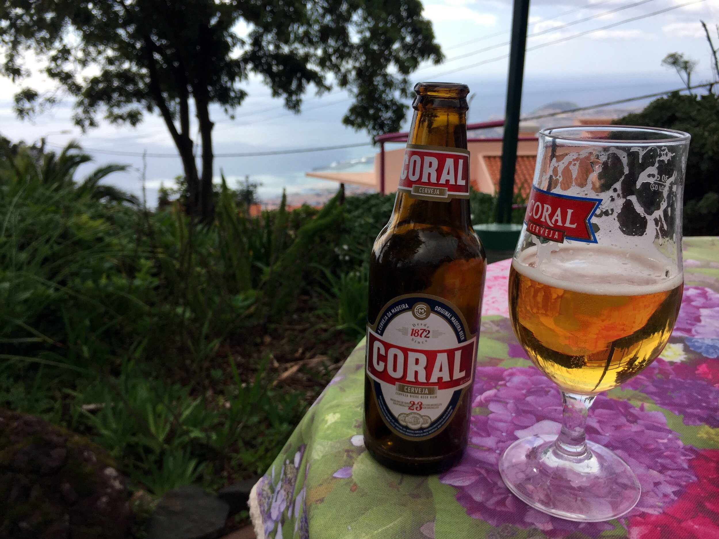
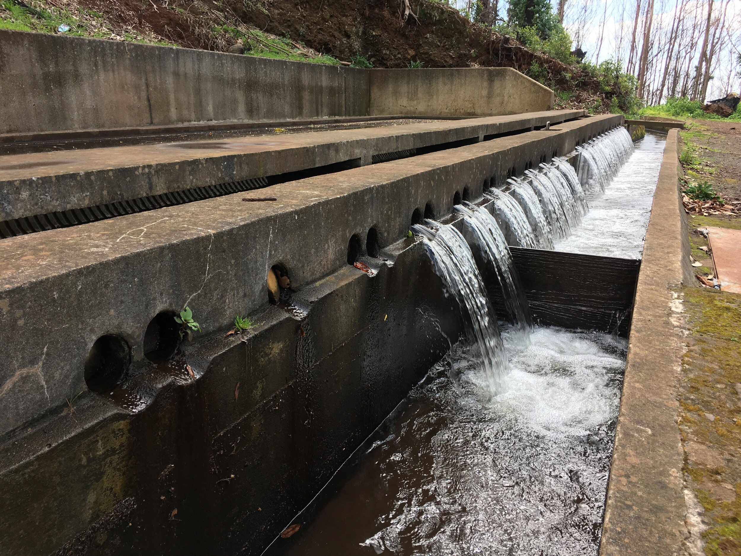
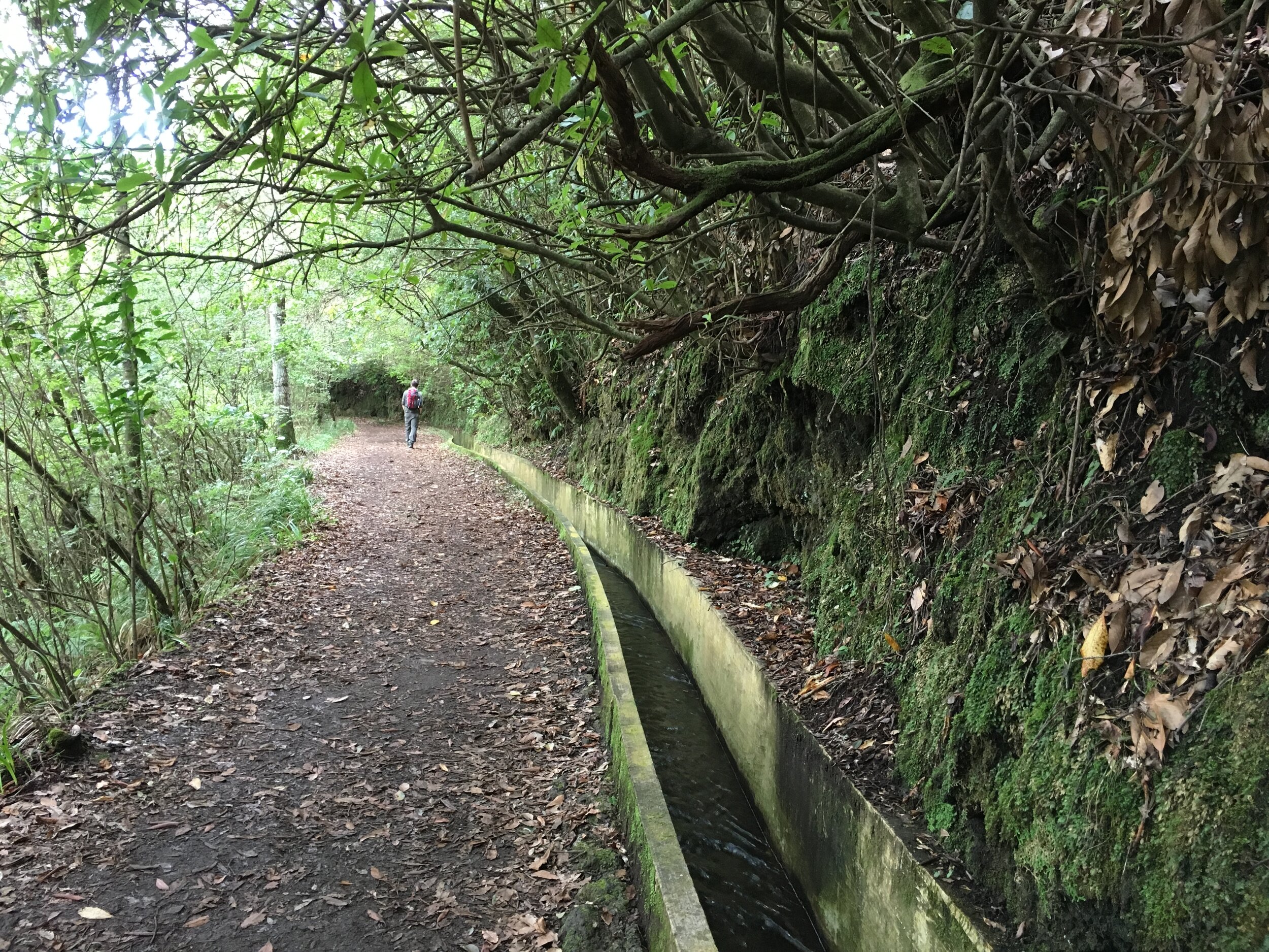
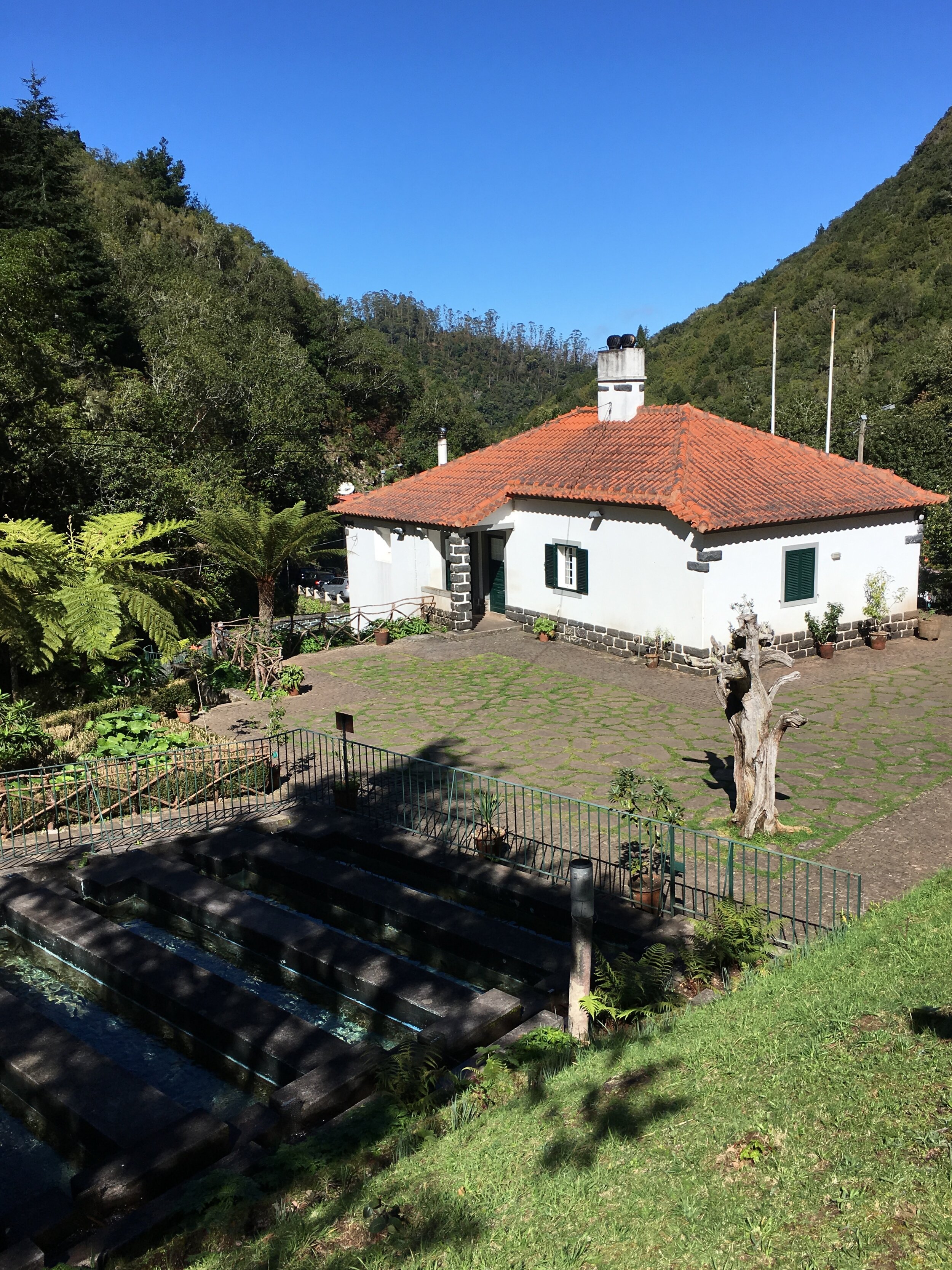
Like Tenerife, where I spent many childhood family holidays, Madeira has a north-south climate divide. The north and mountains get a lot of rain whilst the south is dry. Madeira solved this by laying over 2000 km of miles of drainage canals. These take the water down to the south where it's used both for irrigation and drinking water. Funchal, the capital, is positioned at the confluence of a few of the larger Levadas as they reach the sea.
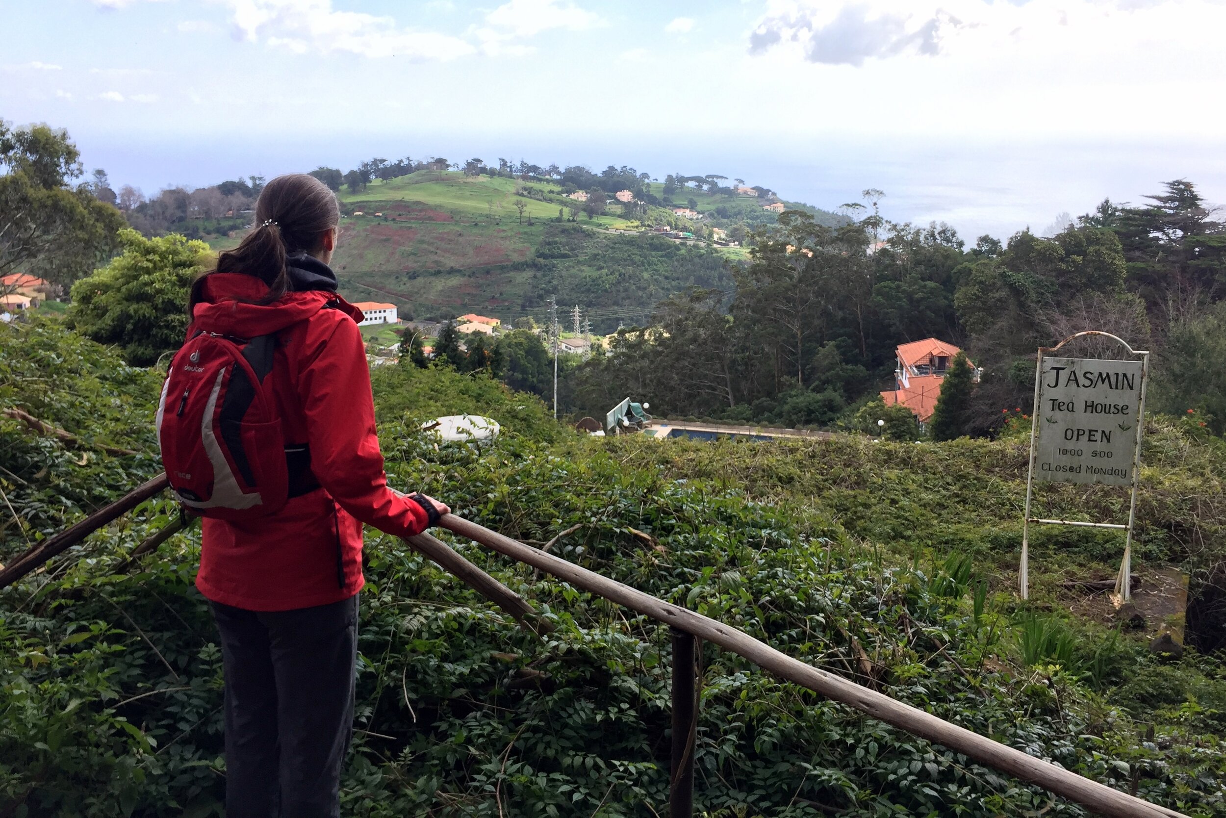
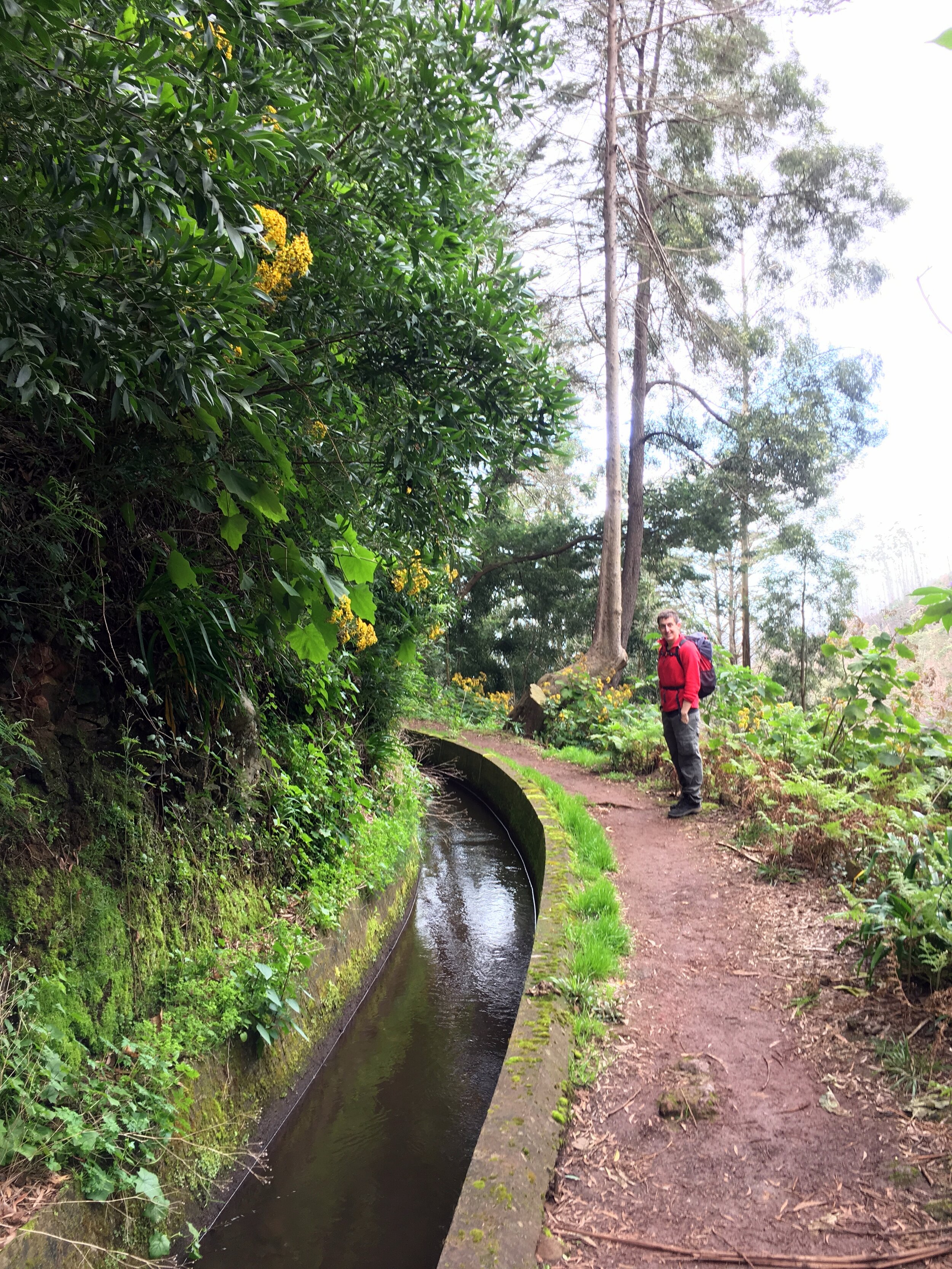
As a warm up for longer more adventurous hikes later in the week, we set off to do the Levada dos Tornos. This one is very easily accessible from Funchal. The start is about 10 minutes walk from the top of the cable car station that connects the Old Town to Monte and its Botanical Garden.
The thing we'd wish we had known about was that the start of the Levada walk was closed due to a huge forest fire in the summer of 2016. Signs at the bottom of the cable car would have been helpful. Obviously, no one had thought to warn people before spending 10 euro each to get to the top. We considered bypassing the barrier and giving it a go, but the locals at the cafe near the top were adamant that it would be a bad idea. Apparently someone had died attempting and several others had to be rescued. An enterprising taxi driver came to the rescue by offering us a ride to the other side if the valley for "only" 20 euro. As a ride back on the cable car would have cost the same, it seemed like a good option.
We started the walk at Choupana where the road crosses the Levada. This was the site of the Choupana Hills Resort, once a 5 star spa hotel which was completely destroyed in the fire. The diversion cut off the dangerous part, shortening the walk by an hour.
Immediately leaving the road you see the effects of the fire with trees barely clinging to life and others reduced to charred stumps. Villas and hotels that backed onto the Levada are now burnt out ruins. Look up and you can see the giant football stadium perched high up on the hill. It's one of the weirdest locations for a stadium, accessible only by steep, winding local roads.
One mile in and we reached the Hortensia Tea House. It's well situated for the full hike from Monte but felt a bit early for the reduced trip. We stopped anyway: we were on holiday so we didn't need much excuse for a cake, a beer and a nice view down to the coast.
The rest of the walk is a further 40 minutes down to Palheiro Gardens. This is part of a large privately owned estate which also has a golf course and 5 star hotel. It's a pleasant, quieter alternative to the bustling Botanical Gardens back at the cable car station.
We ended the trip at the hotel at the lower end of the gardens, taking a taxi back to the city. It would have been another hour to walk to the centre, but we opted for a nap and an early dinner instead.
Start: Parque de Estacionamento Pico do Areeiro
Finish: Rua Dr. João Abel de Freitas, Médico 6, Santana
Distance: 8.6 km (5.3 miles)
Elevation change: +493m / -708m. Net -215m
GPX File: get via Buy Me a Coffee
Other routes touched (walk): PR1 Vereda do Areeiro, PR1.2 Vereda do Pico Ruivo, Vereda da Ilha, Vereda da Faja da Nogueira,
Other routes touched (cycle): PR03a, PR17
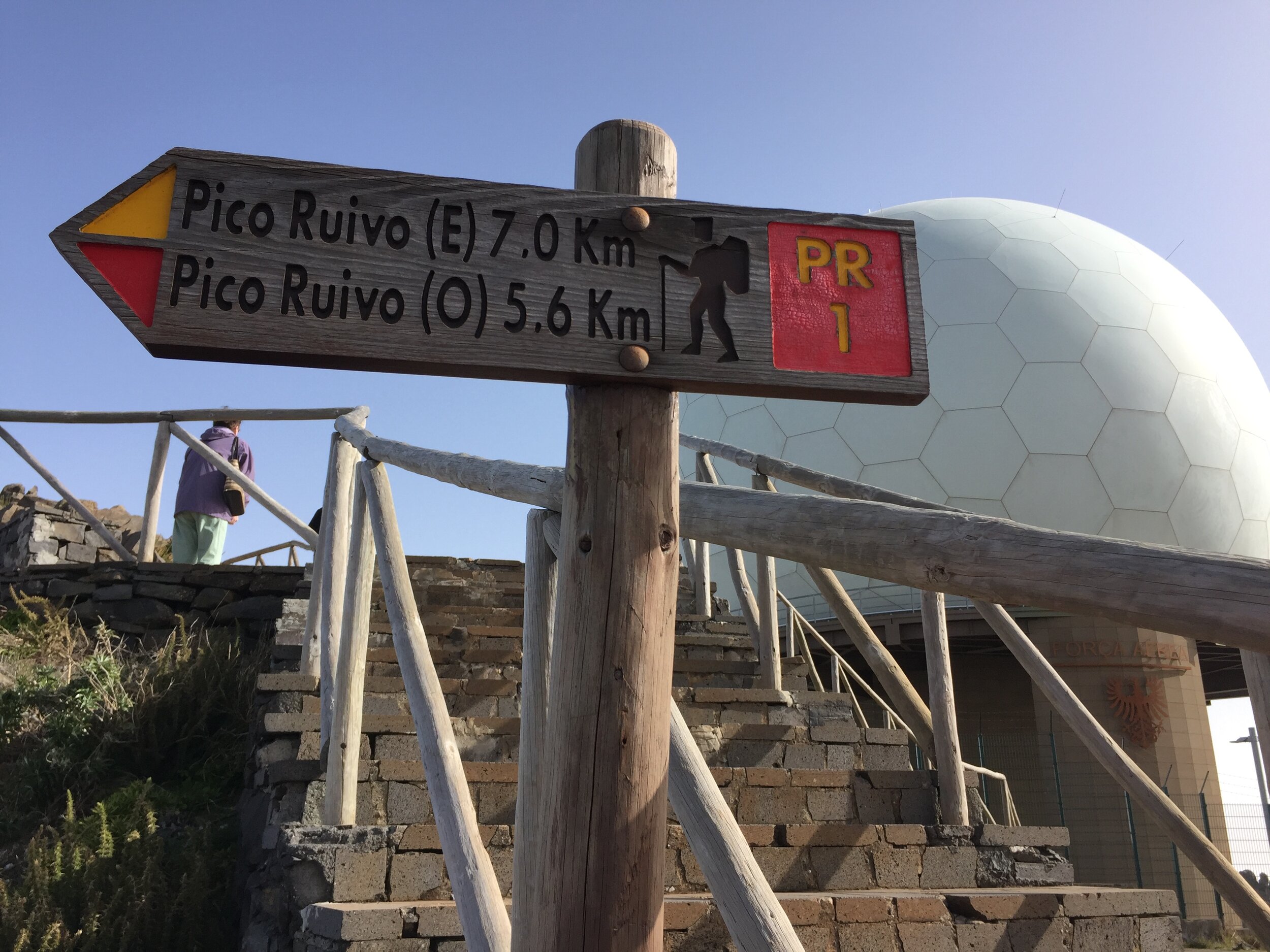
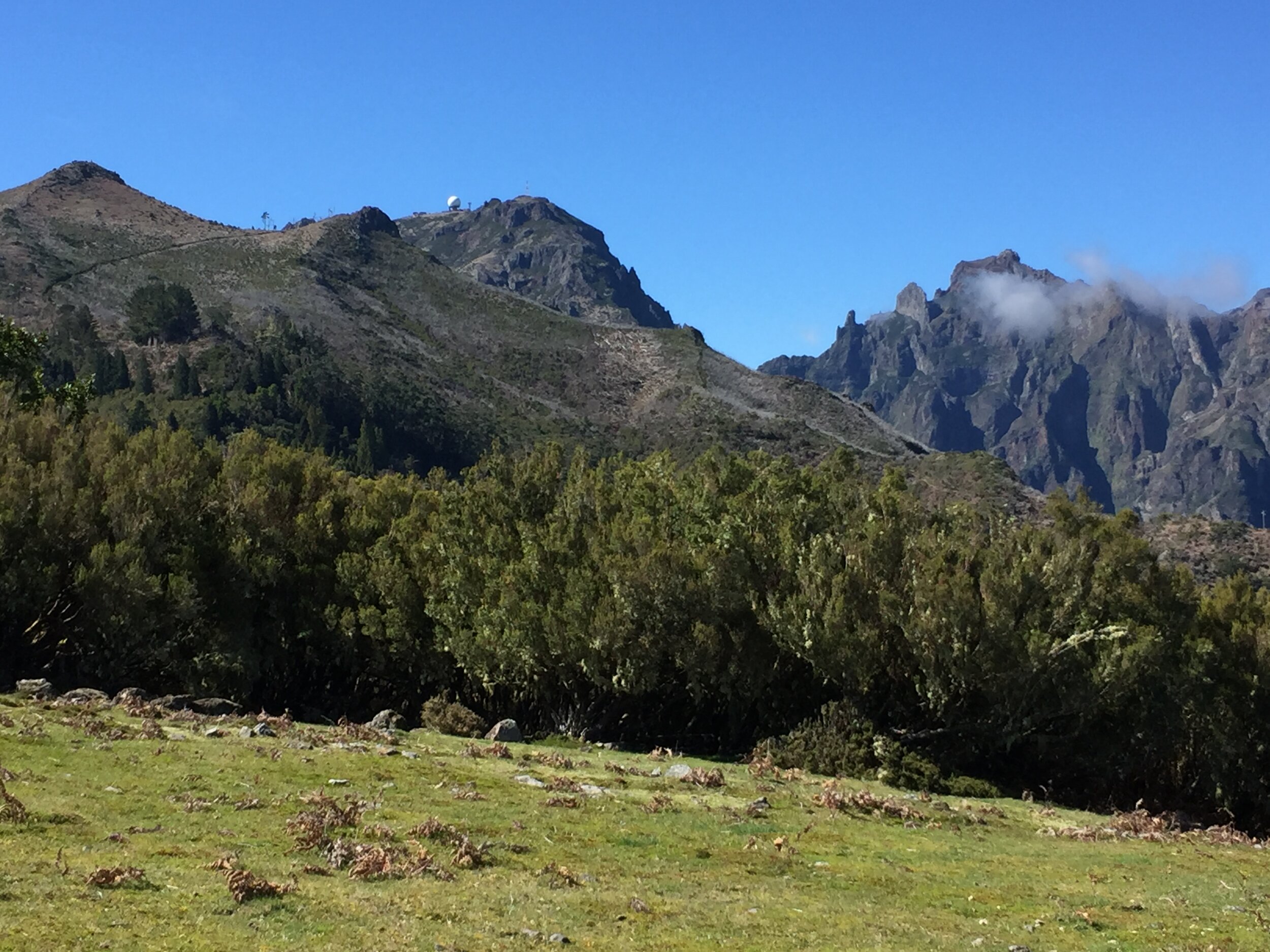
This was the highlight of our winter break in Madeira. Billed as the Madeira Three Peaks, it actually reaches the summits of the 1st and 3rd highest points on the island. The 2nd highest point was previously accessible but a land slip in 2016 has closed the path so the route now follows tunnels through Pico das Torres.
We chose to do the trek as a guided walk with Madeira Explorers. For the 2 of us it was only 20 euro more than hiring a car for the day and it solved the logistical issue of a point to point walk.
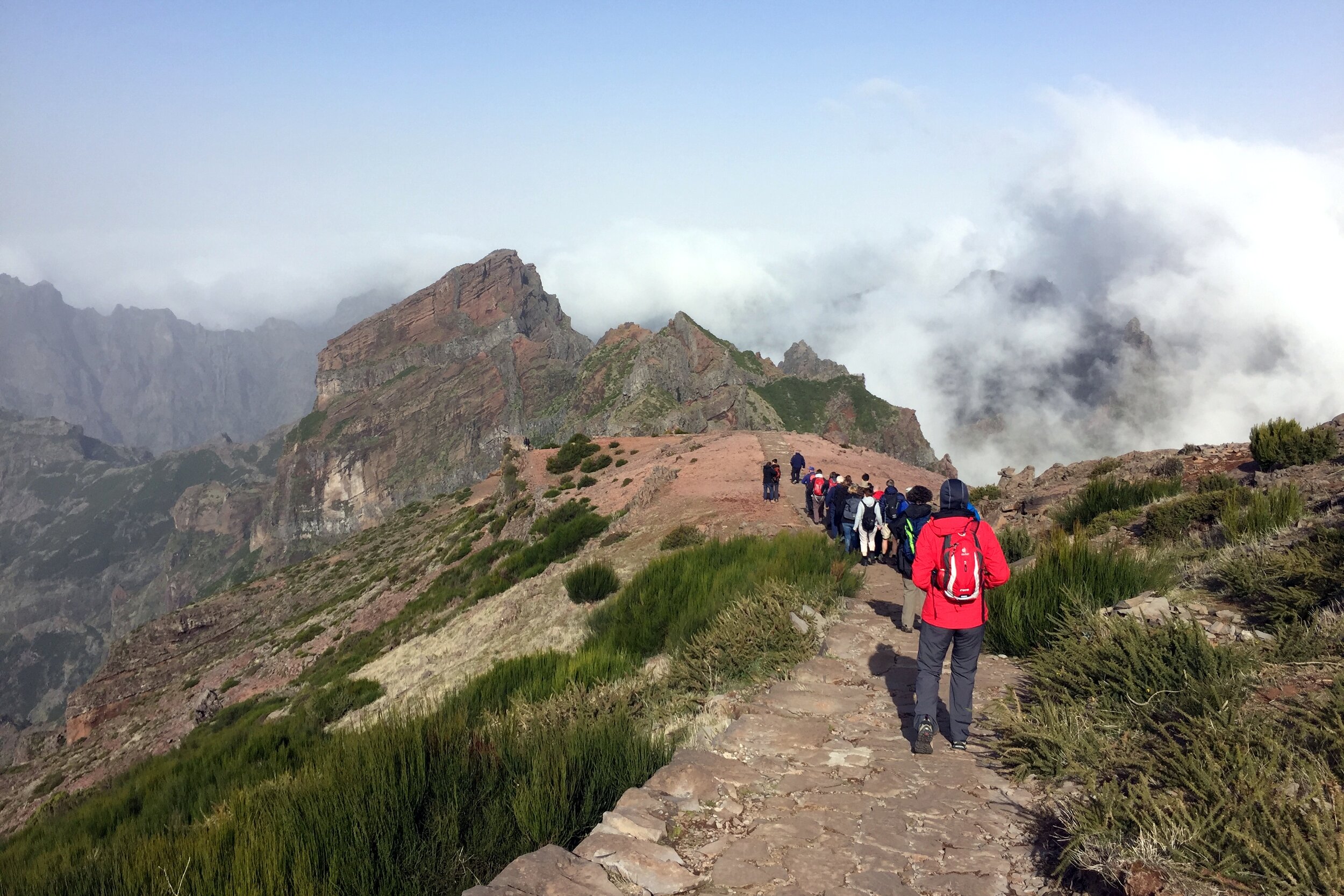
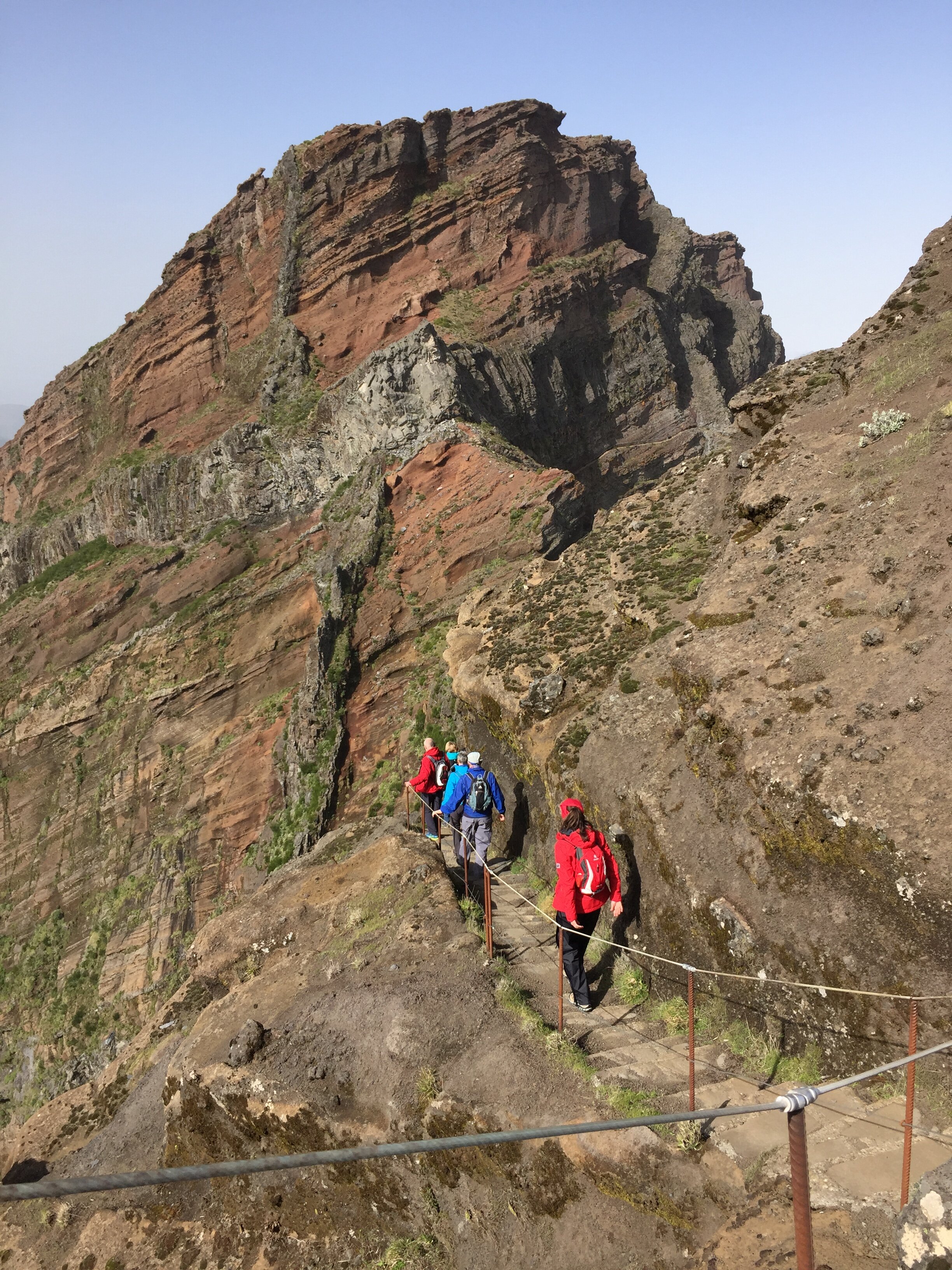
The route starts at Pico do Areeiro, the 3rd highest peak. You can drive all the way to the top where the summit is marked by a stone pillar behind the military "golf ball" radar station. From here the route descends gradually to a lookout point.
The stone path is well made and maintained. It's also exceptionally clean for a route that gets so many visitors. Much of the path also has strong cable handrails on the steep or exposed sections. Be careful though as some are loose or broken. Even without them it's not an especially dangerous walk.
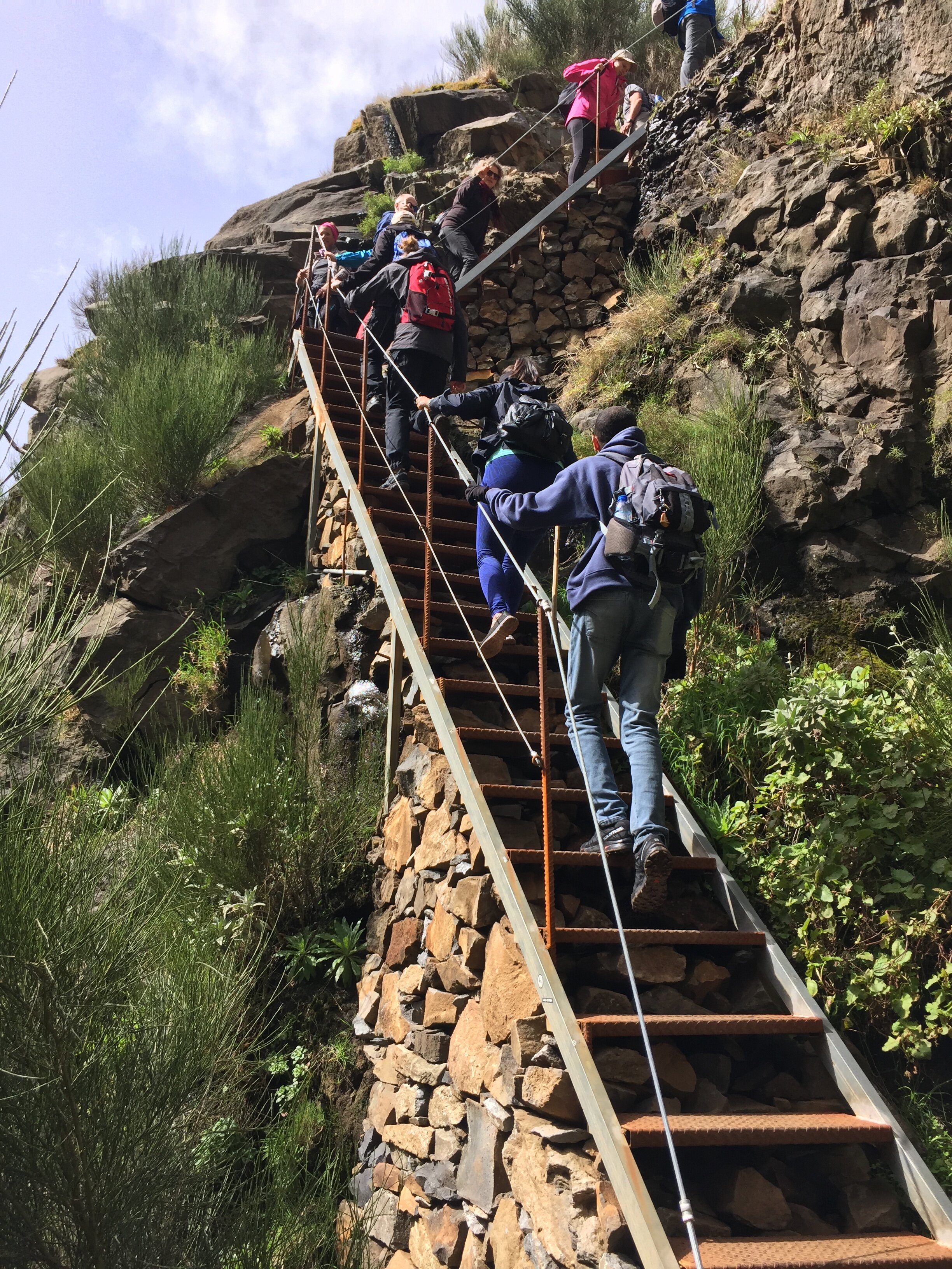
Around an hour in, you pass the junction to the closed path leading up to the top of Pico Torres. Avoiding this, the routes continues and enters Pico de Gato Tunnel, the first of three on the trip. This is the longest one at about 100m.
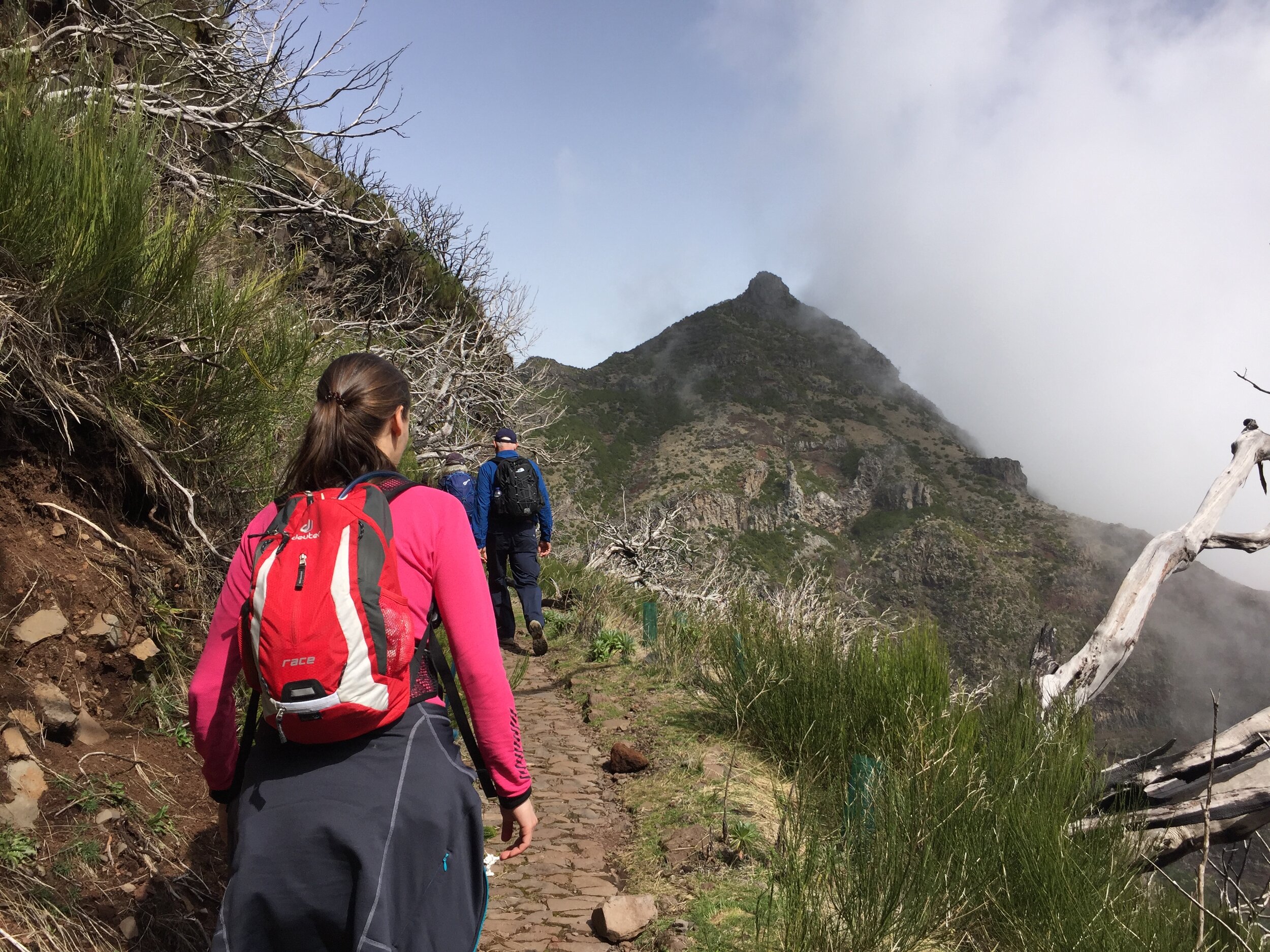
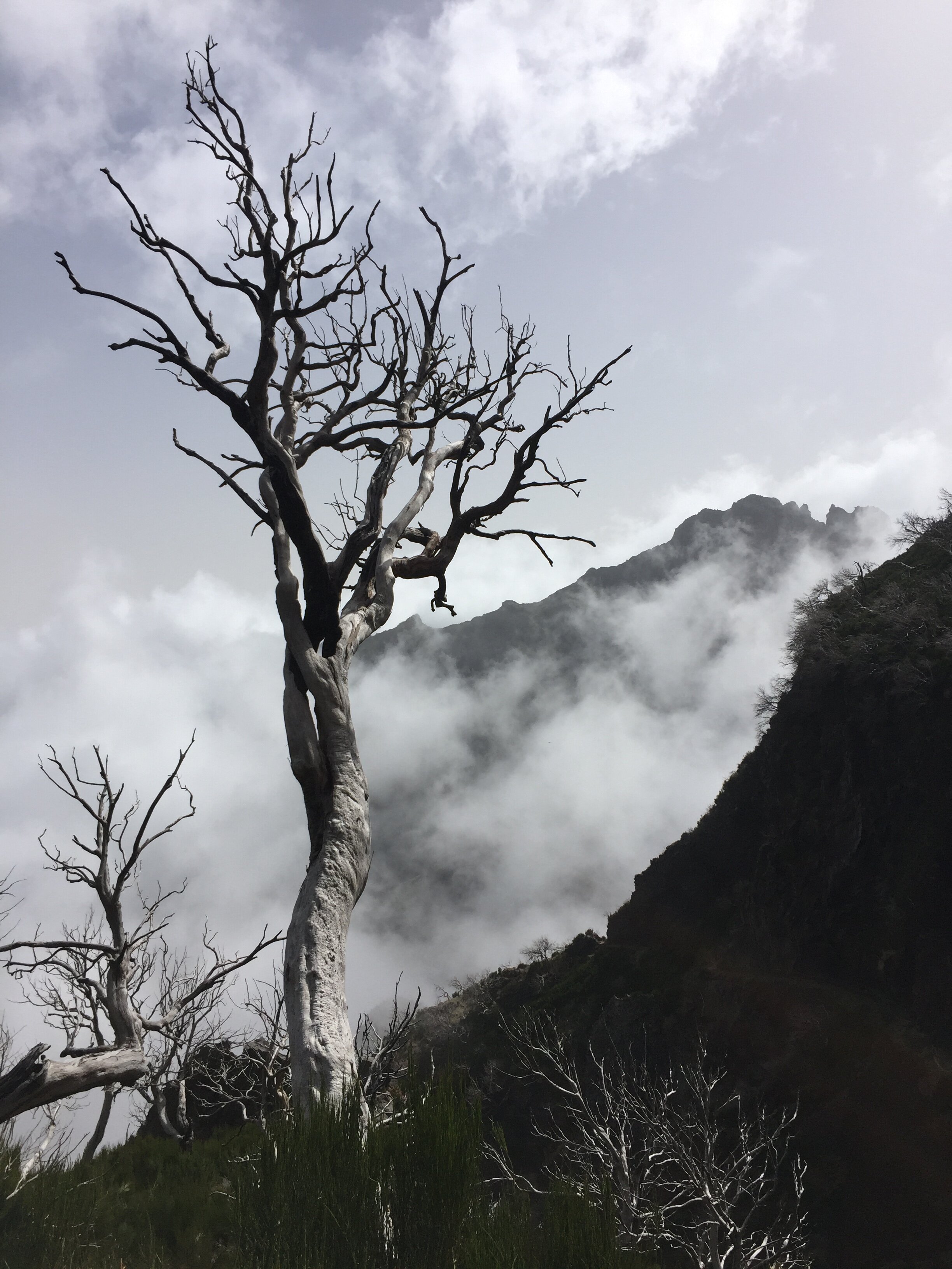
As the route ascends towards Pico Ruivo you see more greenery. This is part of the Laurisilva, a UNESCO designated heather forest covering much of the north of the island. At around 8k the path reaches a hut which is a good place for a rest before the final push to the summit.
The final climb is only 10 minutes from the hut along a steeper section of the stone path. Although cloudy on our trip we could still see Achada do Teixeira, the neighbouring peak to the west. The summit is marked by 2 stone columns.
The trip concluded with a 2km gentler walk down to the car park on the east side of Achada do Teixeira.
Start & Finish: Ribeiro Frio Restaurant, ER103, Funchal
Distance: 6.9 km (4.3 miles)
Elevation change: + / - 395m
GPX File: get via Buy Me a Coffee
Other routes touched (walk): Levada do Furado, Levada do Poco do Bezerra, Caminho Real 24
Other routes touched (cycle): None
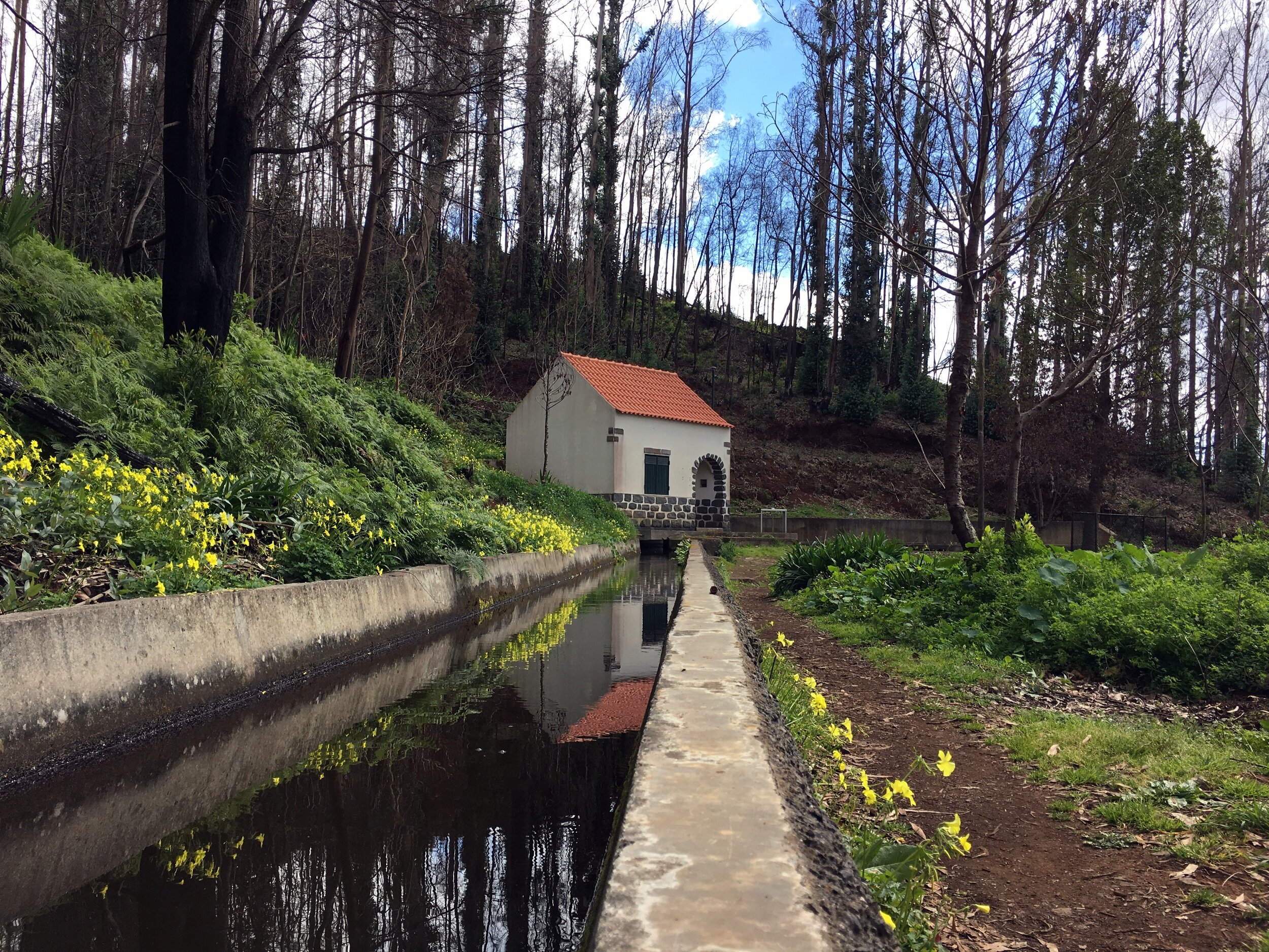
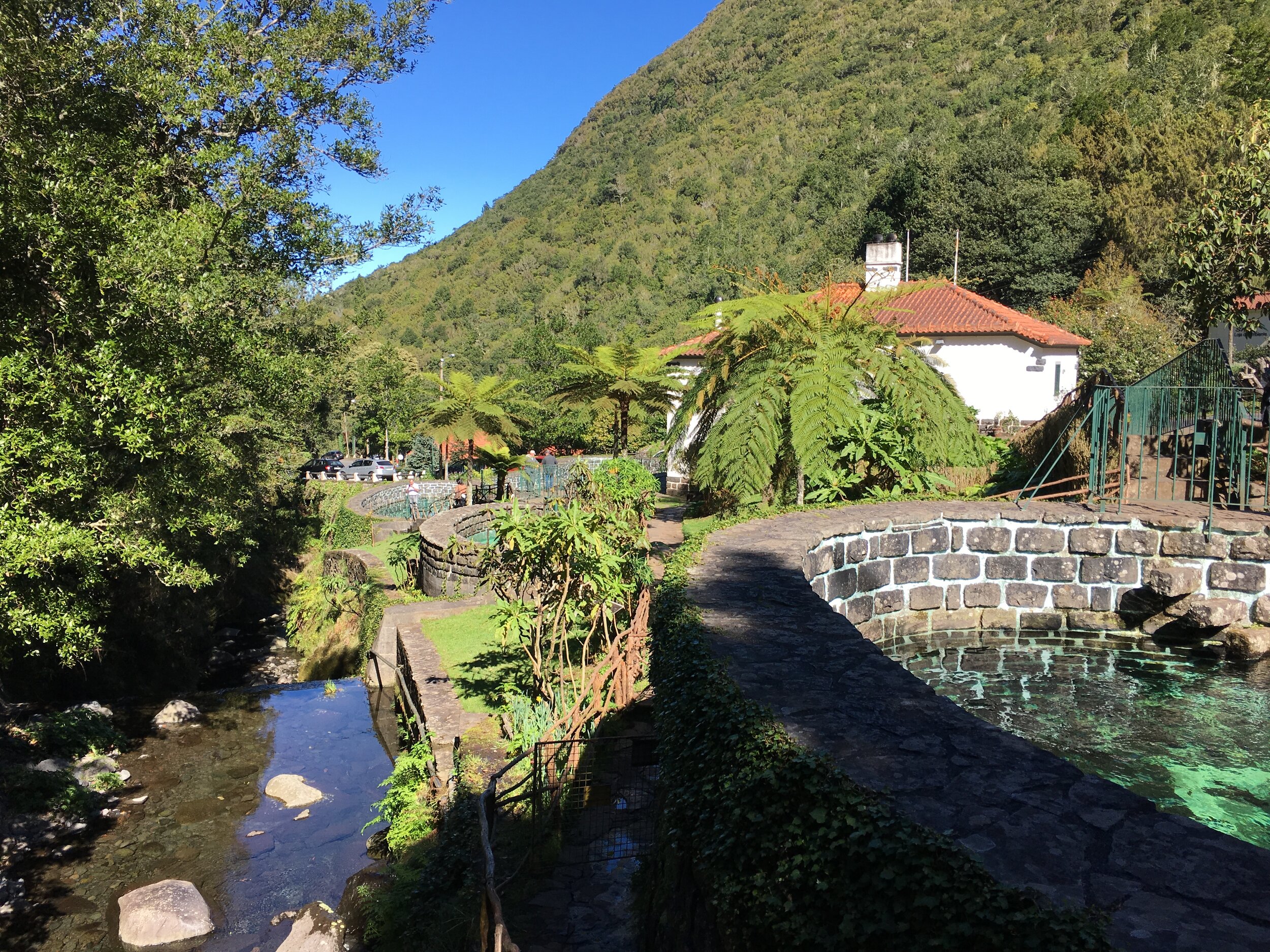
We did the Ribeiro Frio walk as a part of a 1 day east Madeira road trip. The 3 hour circular walk starts and ends at the Ribeiro Frio ("Cold River") restaurant. It's a 40 minute drive north of Funchal on some steep, and sometimes scary mountain roads. Once there, the walk is an oasis of calm and greenery.
The first hour of the walk follows the Levada do Furado. An alternative walk takes this all the way to Portala in the east, but our route branched off following the Levada do Bezerro. Whilst the first part was pretty busy, we had the route to ourselves apart from an American family that we occasionally met.
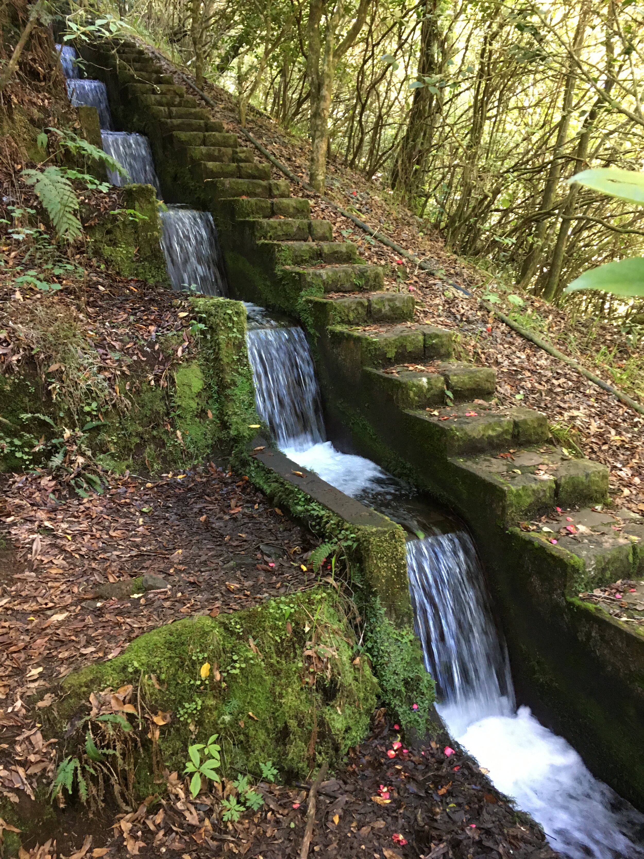
The Levada do Bezerro is a pretty steep climb. For the first 20 minutes were weren't convinced we were following the right path. The guide book said that there would be fast flowing water in the Levada but this was dry. The reason was clear about half way in, a landslide had damaged the conduit sending the water over the cliff to the river below. Further damage beyond this gave us some tricky places to clamber over.
The source of the Levada is a small series of pools on a cascade. The water here feeds the river below and some is siphoned off into the Levada. It's a nice, quiet place for a rest before the final 20-minute climb.
After the pools the path cuts up through the trees, reaching the Chao das Feiteiras plateau. Further on, at the highest point on the trip, is a small hill with some amazing views of the central mountain range. From here we could see the route of Wednesday's walk, from the radar station at Pico do Areeiro, through Pico das Torres, the summit of Pico Ruivo and Achada do Teixeira.
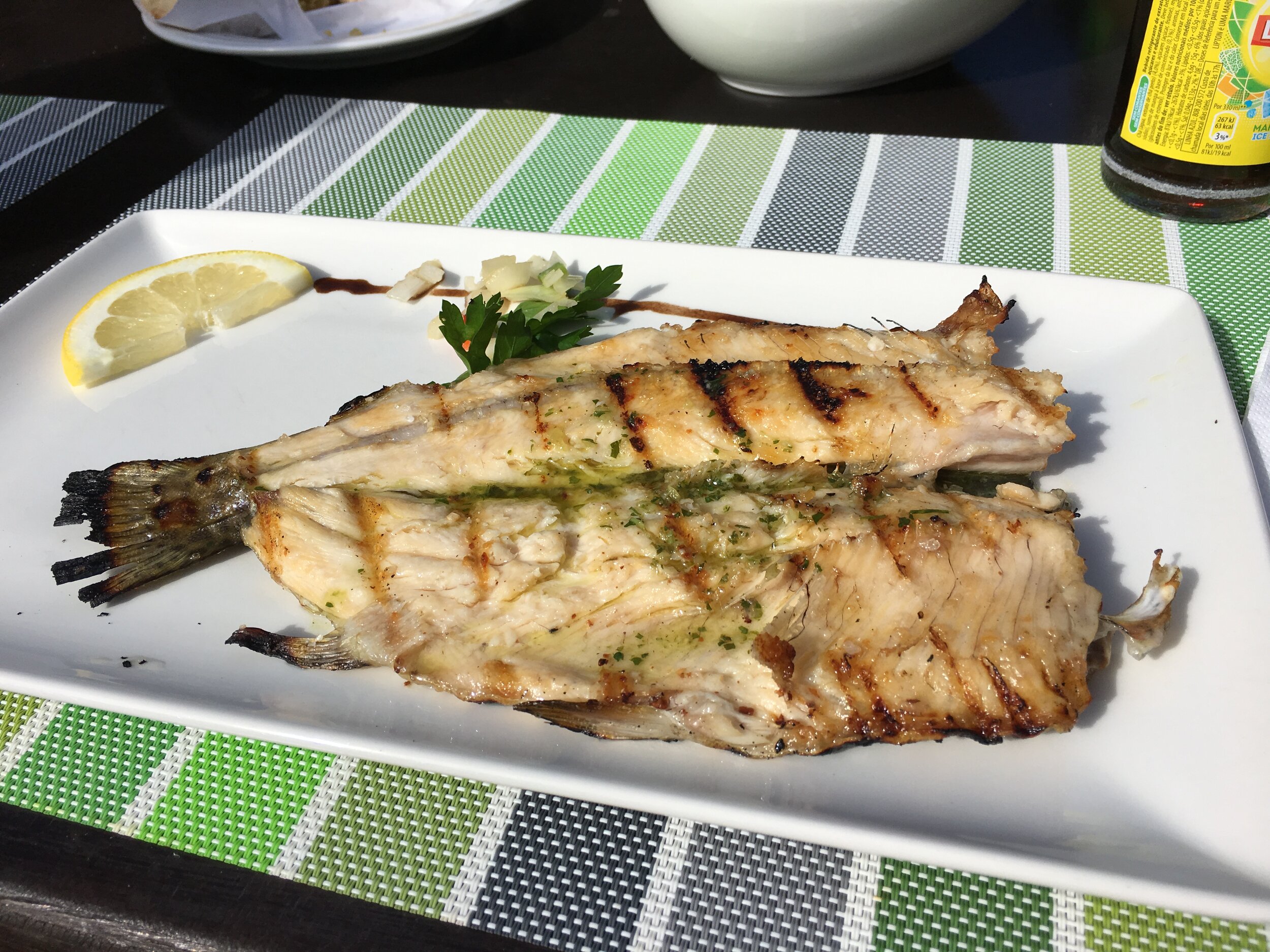
From here the path crosses some farm buildings and down a steep stone track meeting the Trout Farm. We'd timed it right as the restaurant at the bottom was quiet, with most of the tourist busses already having passed through earlier in the day. Grilled Trout with herbs and garlic bread were a great reward for one of the best short hikes I can remember.
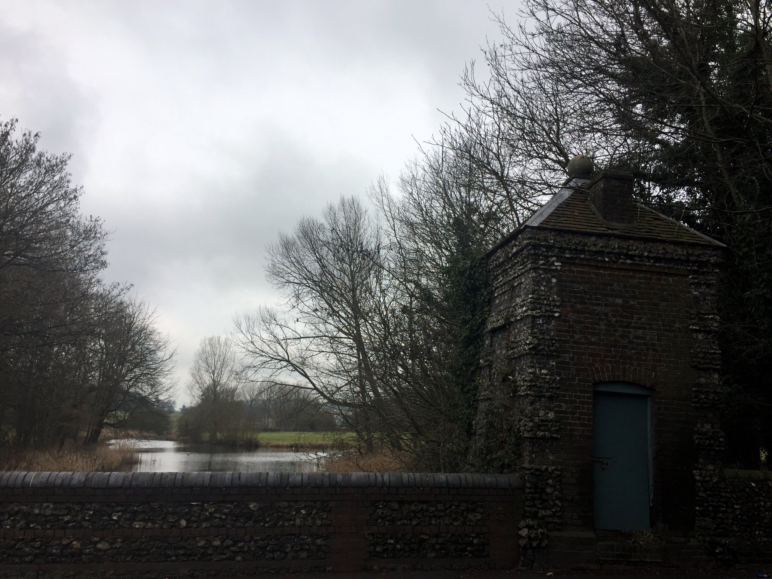
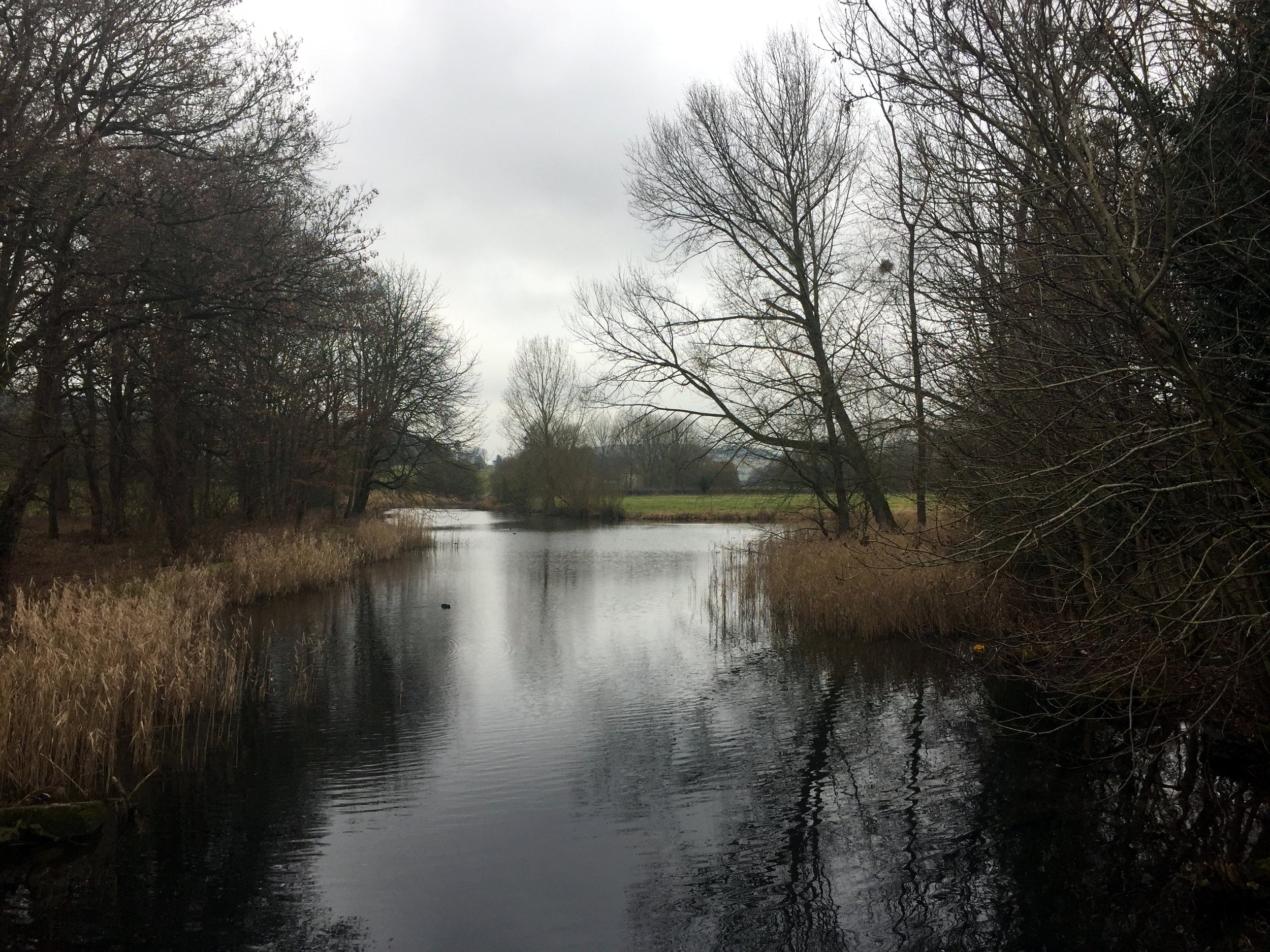
Near the source at West Wycombe Estate
Part of the Chiltern Rivers Series
River start: Bradenham, Buckinghamshire
River end: Confluence with Thames at Bourne End, Buckinghamshire
River length: 14 km (9 miles)
Cycle route start / end: Parking in Bourne End Village Centre
Cycle route length: 33.6 km (21 miles)
Cycle route ascent: +/- 223m
GPX File: get via Buy Me a Coffee
Other routes touched (walk): Chiltern Way, Wycombe To Bourne End Disused Railway Trail
Other routes touched (cycle): Chilterns Cycleway
Map: OS Explorer Map (172) Chiltern Hills East
Links: River Wye, Bradenham, West Wycombe, High Wycombe, Wooburn Green, Bourne End
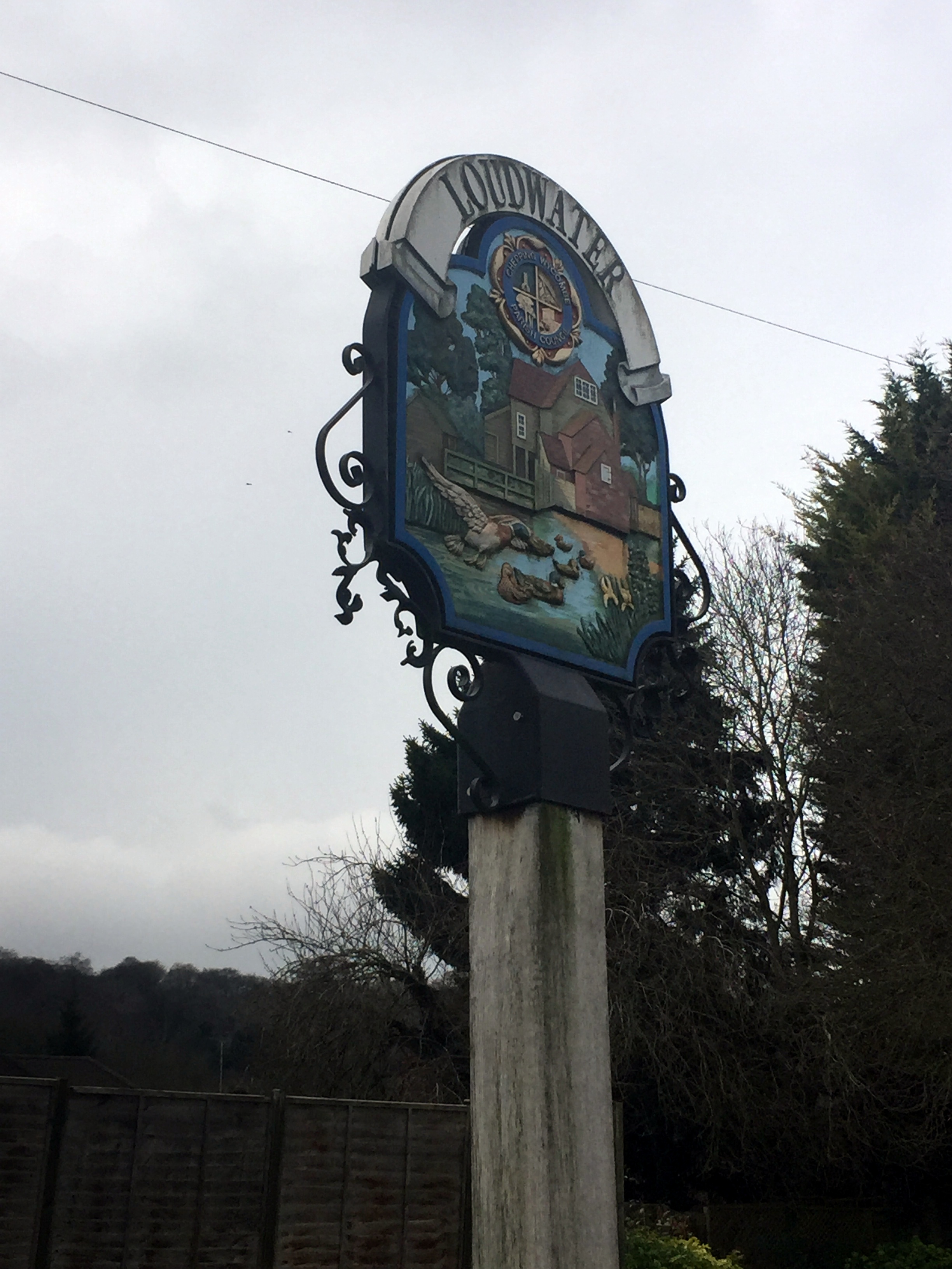
For my 3rd Chiltern River after the Chess and the Pinn, I chose the Wye for today's mini cycle adventure. The Wye, unlike its larger Welsh namesake, goes easily unnoticed. Despite having lived within 10 miles of it for most of my life, I'd barely heard of it until recently.
The Wye rises at Bradenham, near West Wycombe, travelling south-east for 9 miles before joining the Thames at Bourne End. The junction with the Thames is on private land so I started my trip on Bourne End High-Street, cycling toward the source.
The first couple of miles is fairly pleasant. After Bourne End, the river follows the A40 to Wooburn Common. From there navigation gets tricky as the river gets lost amidst housing and an unpleasant retail park hiding under the M40 flyover. The route through Loudwater continues along similarly unremarkable territory before a more pleasant cut through the Wycombe Rye park. One particular point of interest is where the Wye crosses under the route of the disused Wycombe to Bourne End Railway. You can see this by taking the small footpath from the A40 up onto the old railway embankment opposite Pinions Road shortly before Wycombe Town Centre.
The following mile or so, cutting past High Wycombe Town Centre and the Desborough Estate, is best completed as quickly as possible. It's only at the edge of town, approaching The border with West Wycombe, where there's anything worth slowing down for. The final place to see the Wye is on a bridge looking into the National Trust Estate at West Wycombe where you can see the lake that feeds the river.
West Wycombe High Street is a good place for a coffee stop before starting the second, much more pleasant, half of the trip. After West Wycombe, the route follows the A40 for a mile or so, joining the Chiltern Cycleway. Bullocks Farm Lane, now heading back South needs the lowest gear for 10 minutes of slog to the routes highest point.
From here, the Chiltern Countryside comes into its own as pleasant country lanes take you through Wheeler End, Lane End, Freith and down to Marlow. From here the A4155 forms an easy final 3.5 miles back to Bourne End.
When: January 22nd 2017
Where: Farnborough Airport, Hampshire
Course: Mostly airport perimeter roads, plus off-road trails & Basingstoke Canal
Other routes touched (walk): Basingstoke Canal Towpath
Other routes touched (cycle): None
Finish time: 1:53

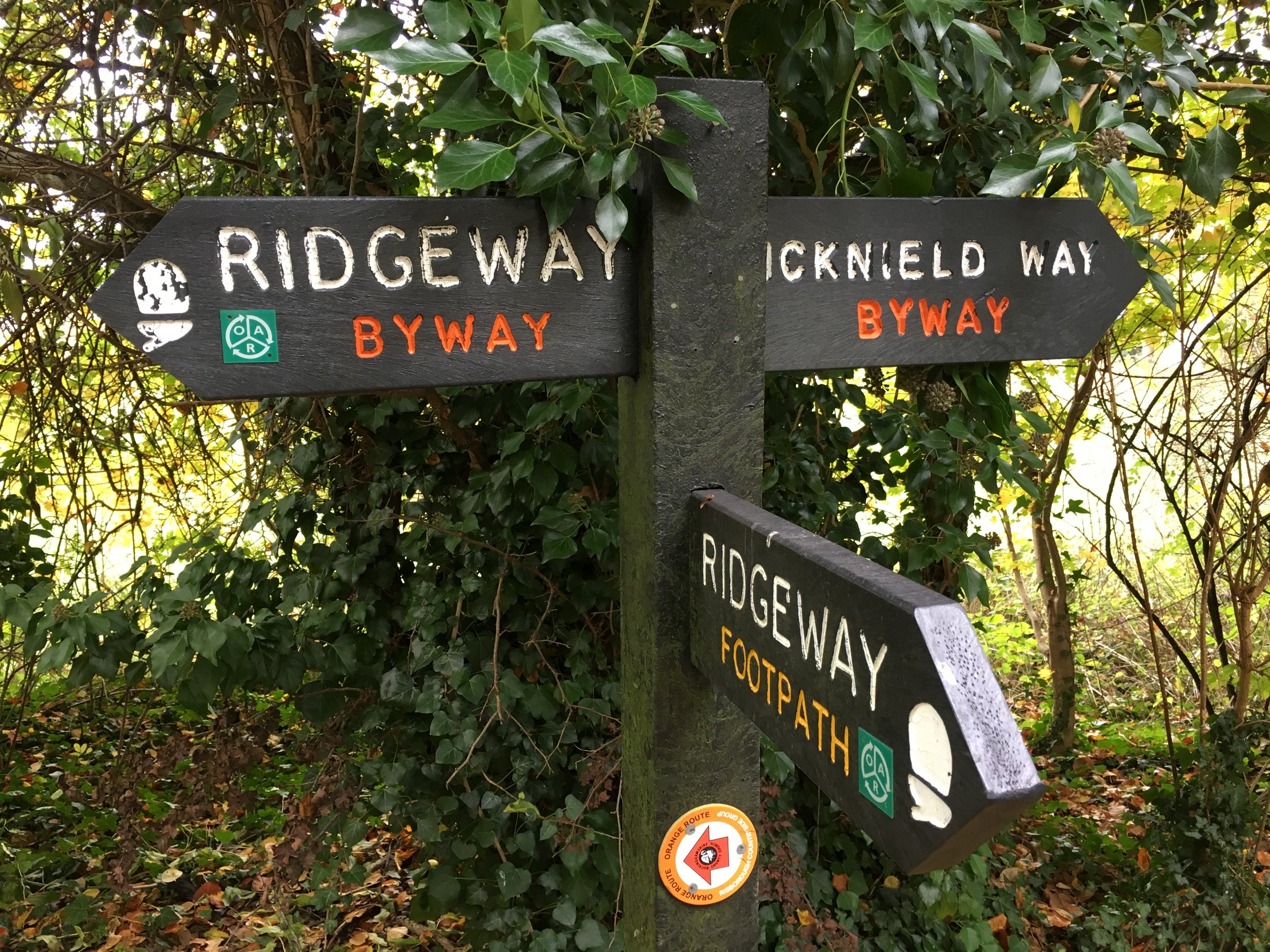
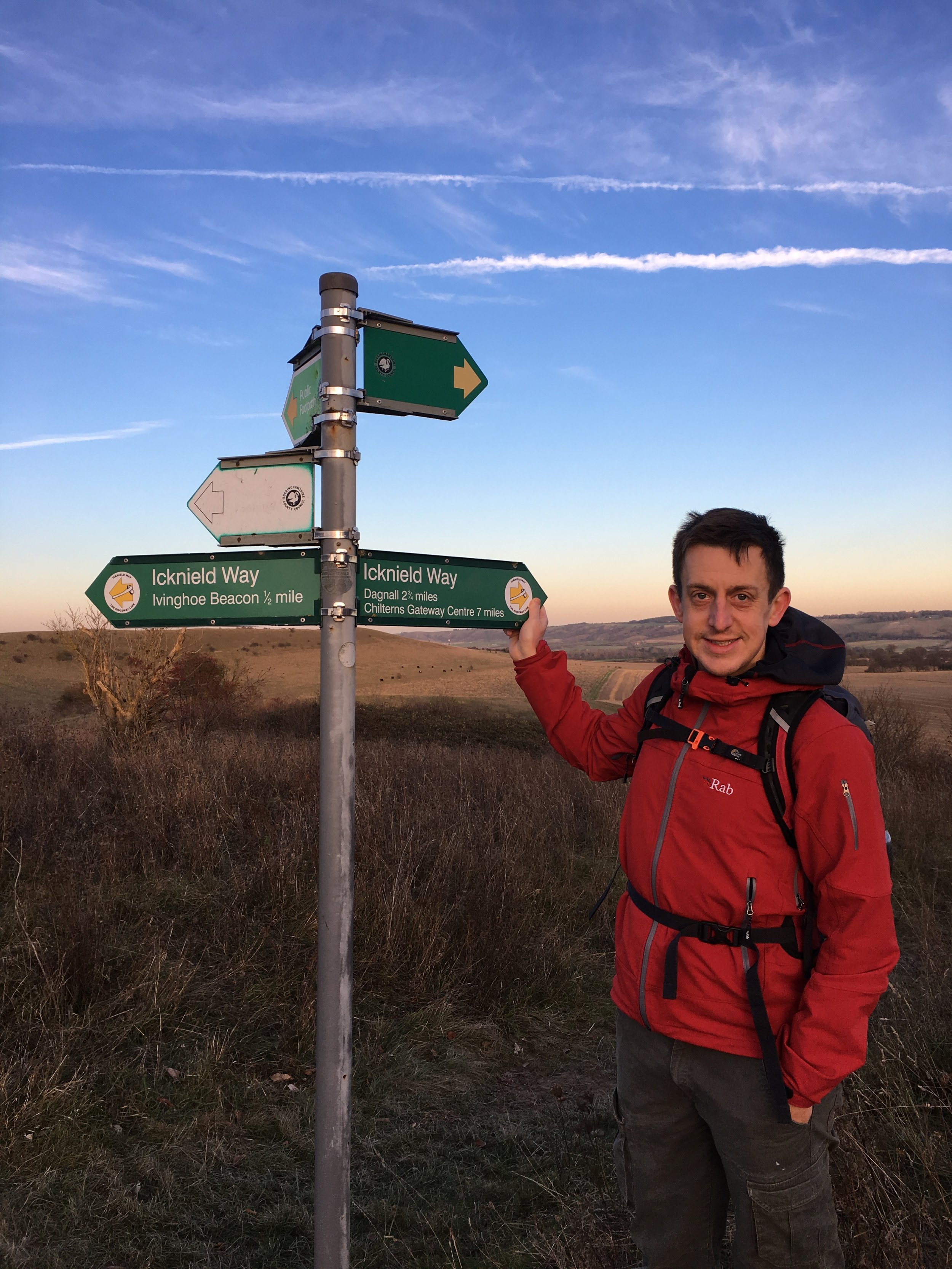
Having been on a (literal) high following our completion of the Ridgeway we were keen to continue our winter walking adventures. The Icknield Way was the obvious continuation as the 2 paths meet at Ivinghoe Beacon. From there the Icknield Way heads north-east for 110 miles to Knettishall Heath in Norfolk which is also the start of the Peddars Way. I loved the idea of connecting my 2 previous adventures, so Wife and I started our Icknield wander.
We broke our first section, Ivinghoe Beacon to Chalk Hill, into 2 separate Sundays. This worked well with our new routine of ~5 mile point-to-point winter walks leaving a car at each end. Although the sections of the Ridgeway trip were all short car trips from our home, the driving was getting long enough to start getting boring by the time we’d finished this first section. Next time I’d be back would be 2 years later for the next section.
The guidance below will help you navigate but don’t use it as a fully accurate turn-by-turn guide. Always take a map and/or a GPX route and prepare well for the weather and terrain.
Start: National Trust Car Park at Ivinghoe Beacon (LU6 2EG)
Finish: The White Lion Pub, Watling Street / A5 (LU6 1RS)
Distance: 17.5 km (11 miles)
Elevation: +197m / - 307m. Net -110m
GPX File: get via Buy Me a Coffee
Other Routes Touched (walk): Ashridge Boundary Trail, Chiltern Way
Other Routes Touched (cycle): NCN 6
Maps:
- OS Explorer Map (181) Chiltern Hills North
- OS Explorer Map (181) Chiltern Hills North
- OS Explorer Map (193) Luton and Stevenage
Guidebook: The Icknield Way Path: A Walkers' Guide
OS Trig Pillars: TP1099 - Beacon Hill and TP0379 - Dunstable Down
Links: Icknield Way Wikipedia entry, www.icknieldwaytrail.org.uk, www.icknieldwaypath.co.uk
- National Trails page on the Icknield Way Trail (Rider's Route and Walker's Route)
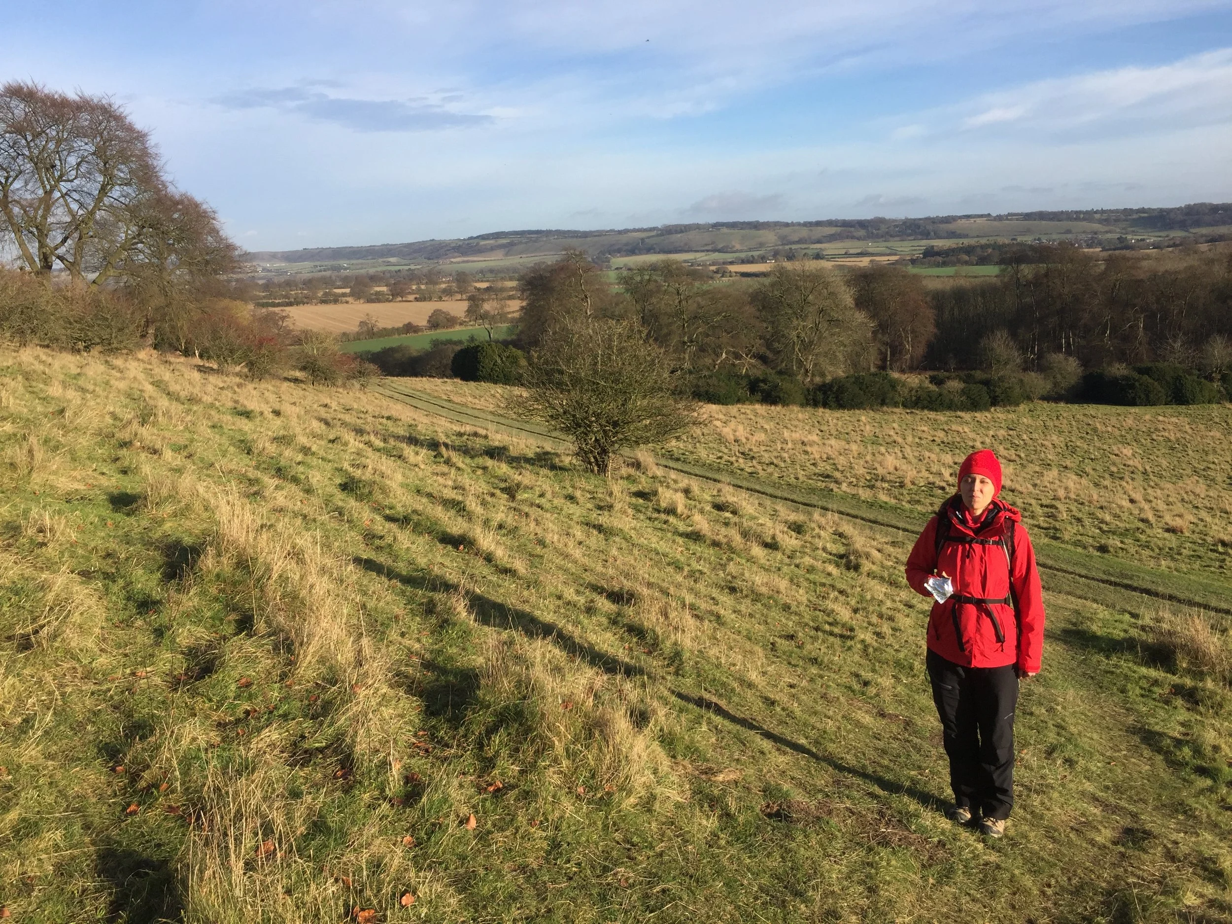
From Ivinghoe Beacon the Icknield Trail follows the Ashridge Boundary Trail for just over 2km before reaching a farm at the top of a hill. Leave the Boundary Trail here and turn left. Continue in a north-easterly direction to the B440 / Main Road East and turn right to pass through Dagnall. The Red Lion Pub is a nice place to stop and it’s also close to the start of the River Ver. After Dagnall School, take a left off the main road and follow the Trail as it passes through Whipsnade Park Golf Club and around the perimeter fence of Whipsnade Zoo.
Walk through Whipsnade Tree Cathedral. Just after the 1st km at Bison Hill the route will take a right angle and switch from a north-westerly to a north-easterly direction. The Trail will soon meet up with the Chiltern Way again as they pass over the top of Dunstable Downs. You can see for miles here and its a good place to stop and check out the National Trust Visitors’ Centre, the Bedfordshire County Top and have a picnic whilst watching the gliders take off and land below.
Follow the trail down off the Downs and cross the busy B489 onto Green Lane. After ~1k the Trail will take a sharp right off Green Lane into farmland. Follow the Trail for ~2km past Maiden Bower Hill Fort and Sewell Manor before reaching the A5 Watling Street and the end of this section.
Start: White Lion Pub Watling Street, Houghton Regis, Dunstable, LU6 1RS
Finish: The Motte & Bailey, 1 Great Green, Pirton, Hitchin, SG5 3QD
Distance: 31 km (19.4 Miles)
Elevation: +435m / -470m. Net -35m
GPX File: get via Buy Me a Coffee
Other Routes Touched (walk): Chiltern Way, John Bunyan Trail, Walk on the Wild Side
Other Routes Touched (cycle): Chilterns Cycleway, Icknield Way Trail (cycle route)
Map: OS Explorer Map (193) Luton and Stevenage
Guidebook: The Icknield Way Path: A Walkers' Guide
OS Trig Pillars: TP6734 - Warden Hill and TP2743 - Deacon Hill
Links: Icknield Way Wikipedia entry, www.icknieldwaytrail.org.uk, www.icknieldwaypath.co.uk
- National Trails page on the Icknield Way Trail (Rider's Route and Walker's Route)
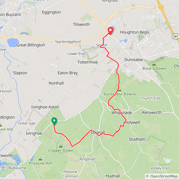
It had been 2 years since I’d started the Icknield Way and I was eager to get back to it. Other adventures had got in the way, but I had a new motivation for it once I’d decided to explore the “North Chilterns Exclave”. This is the north-eastern part of the Chiltern Hills National Landscape that’s cut off from the rest of it. The Chilterns’ rolling chalk hills stop abruptly after Dunstable Downs followed by a flat gap featuring Dunstable, Luton, the A5 and the M1. I’d have to get through this section before the pleasant parts start again near Sundon. So, when I was looking for this year’s Winter Solstice long walk, the next section of the Icknield Way was the obvious choice.
In a change to my previous Solstice walks, I wasn’t alone as my friend Brian came too. It was great to have a buddy this time and there was an added logistical advantage by being able to leave a car at each end. After a bit of parking logistics we set off from the White Lion pub as the sun rose over the newly built distribution centres. We were already firmly in logistics country: a corridor of fields along the M1 that are being gradually replaced by huge warehouses. Within a mile of our start we were already on a diversion of the trail as it skirted round a building site that would soon be a new growth on Dunstable.
At Wingfield we were back on course and in pleasant countryside again. The next 5k was fairly unremarkable as the trail crossed the gap between the 2 parts of the AONB, crossing the River Flit, M1 and mainline railway. Immediately after rail bridge, the trail ascends 60m reaching Upper Sundon and the border back into the Chilterns. This next section before lunch was lovely with great views for miles to the north and a pleasant route along the John Bunyan Trail and into Sharpenhoe National Trust land.
Streatley is a great stopping point a little over half-way into the route. It also had the only pub that we found on the trail and it conveniently opened for lunch shortly after we arrived. After a pretty large Surf-and-Turf and an hour of warming up we headed South back on the trail. The route briefly dips out of the AONB as it skirts the northern edge of Luton before a steep climb up through South Beds Golf Club to the top of Warden Hill. Here we took a minor diversion from the trail to bag our first Trig Pillar of the day. From the Trig you can see right across Luton, which sits right in the middle of the gap in the Chilterns, and Dunstable Downs in the distance.
The final few miles was on a straight path heading north-east and keeping on high ground. We took another diversion up Deacon Hill to bag the 2nd Trig Pilar of the day. By now it was getting dark and misty so we quickly returned to the trail and start the final descent to Pirton. My energy was noticeably depleted after Deacon Hill and the final mile seemed to go on for ever. The end point at the Motte and Bailey was a very welcome sight, as was the table by the fireplace to warm up next to before the drive home.

Red = Part 1: Ivinghoe Beacon to Chalk Hill. Blue Part 2: Chalk Hill to Pirton
Icknield Way Next Section: Icknield Way Part 3: Pirton to Knettishall Heath (cycling)

Icy Grand Union Canal near Denham
Part of the Chiltern Rivers Series
River start: Harrow Weald Common, Greater London
River end: Confluence with the Frays River at Yiewsley, Greater London
River length: 18.3 km / 11.4 miles
Cycle route start / end: Colne Visitors Centre, Denham, Uxbridge, UB9 5PG
Cycle route length: 46.9 km / 29 miles
Cycle route ascent: +/- 571m
GPX File: get via Buy Me a Coffee
Other routes touched (walk): London Loop, Grand Union Canal Towpath, Hillingdon Trail
Other routes touched (cycle): NCN routes 6, 61
Map: OS Explorer Map (172) Chiltern Hills East, OS Explorer Map (173) London North, The City, West End, Enfield, Ealing, Harrow & Watford
Links: Celandine Route along The River Pinn, Harrow Weald Common, Pinner, Ruislip, Hillingdon, Yiewsley
It was January 3rd and it was penis-vanishingly cold. It was also my last day of Christmas holiday before returning to work. Time for a cold, wet, muddy adventure to kick off 2017.
I chose the River Pinn and the Celandine Route that follows much of it. The source of the Pinn is Harrow Weald just south of the Harrow View Point, a good look-out point.
I'd chosen to do a 30-mile circular cycle ride that included the Pinn on the return half. My base was the car park at Denham Country Park. from there I hopped on the Grand Union heading North. A meandering north-easterly route through Harefield, Northwood and Oxhey. I probably could have found the actual source if I'd parked the bike and walked around the footpaths at Harrow View Point. Desperately cold and needing a wee, I decided to push on.
It's a few miles before the first sighting of the Pinn at the end of Pinner High Street. The town takes its name from the river and is the start of the Celestine Route. This is a well sign-posted route through parks and bridleways that follow the river to its end.
Within 10 minutes I had already missed a sign and added an extra mile in a loop that took me right back to the start at Pinner. Making better use of my map app on the second attempt, I was back on track. The majority of the route is off road and lots of it on grass. Following a couple of days of heavy rain, the mud was quickly turning my mountain bike brown.
As with the River Chess walk of 2 weeks before, I found the Pinn to be a pleasant find in an area that I thought I knew well. The route alternated between green riverside paths and bland suburbs. Two weeks ago I'd not heard of the Pinn and I would be surprised if many locals had either.
Towards the end, the Celandine Route diverts from the river as it crosses the A40 then into Hillingdon and Brunel University. It then joins back up at Yiewsley before abruptly stopping at the A408 in front of a Tesco Superstore. The Celandine Route joins the Grand Union canal just to the north of Tesco where there’s a footpath that you can follow between the High Street and the towpath. The river actually crosses the canal and joins the Fray’s river which meets the Colne about a mile south in West Drayton
My final 4 miles were a continuation of the Grand Union past Cowley and Uxbridge back to the start at Denham. The Pinn is certainly not pretty and there are more interesting routes, but for a cold, muddy New Year adventure it did the trick for me.

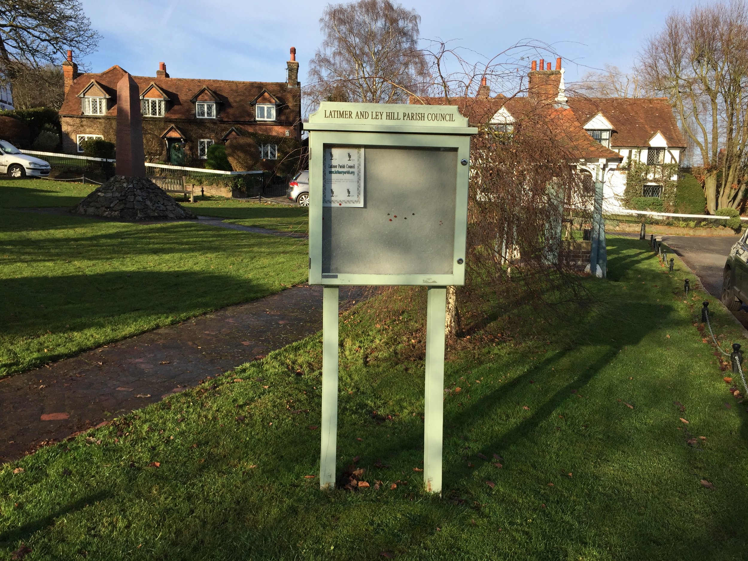
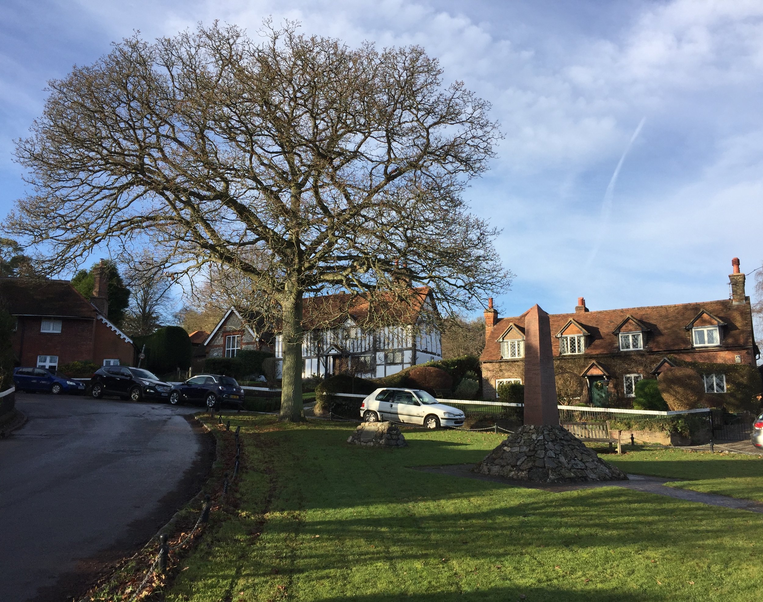
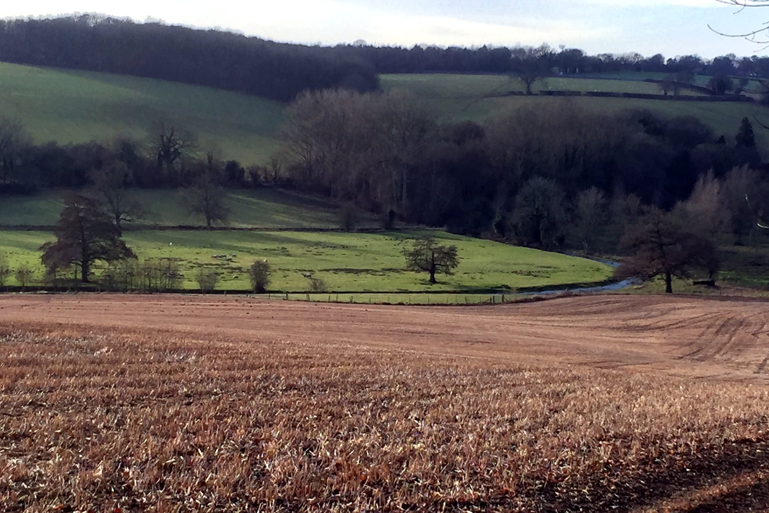
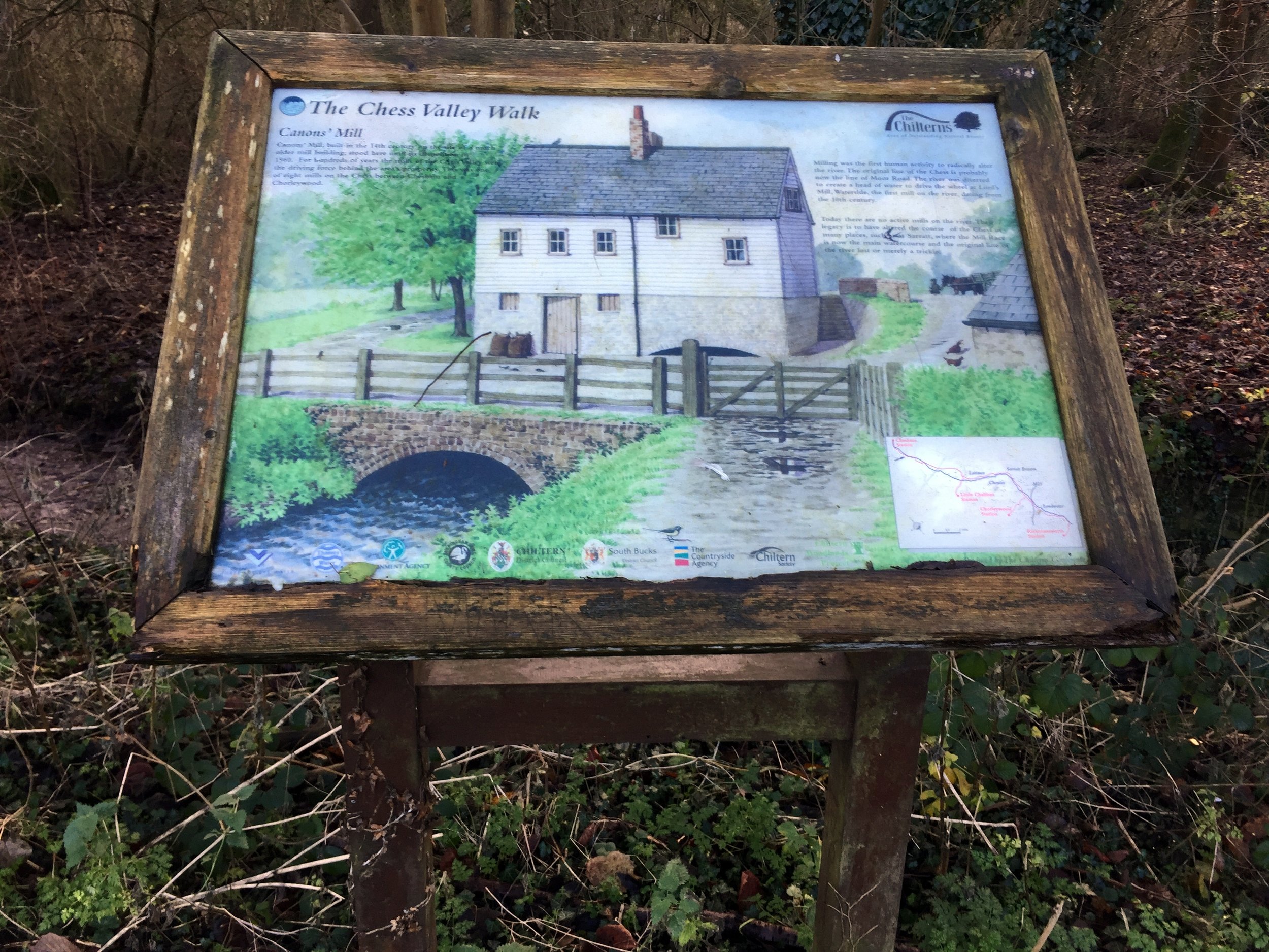
The Chess near Chenies
Part of the Chiltern Rivers Series
River start: Pednor, near Chesham, Buckinghamshire
River end: Confluence with River Colne at Rickmansworth
River length: 17.9 km (11.1 miles)
Walking route start / end: Rickmansworth Underground Station / Chesham Underground Station
Walking route length: 21.7 km (13.5 miles)
Walking route elevation change: +309m / -256m. Net -53
GPX File: get via Buy Me a Coffee
Other routes touched (walk): Chiltern Way
Other routes touched (cycle): Chilterns Cycleway, Hampden Route, Harding Route
Map: OS Explorer Map (181) Chiltern Hills North & OS Explorer Map (172) Chiltern Hills East
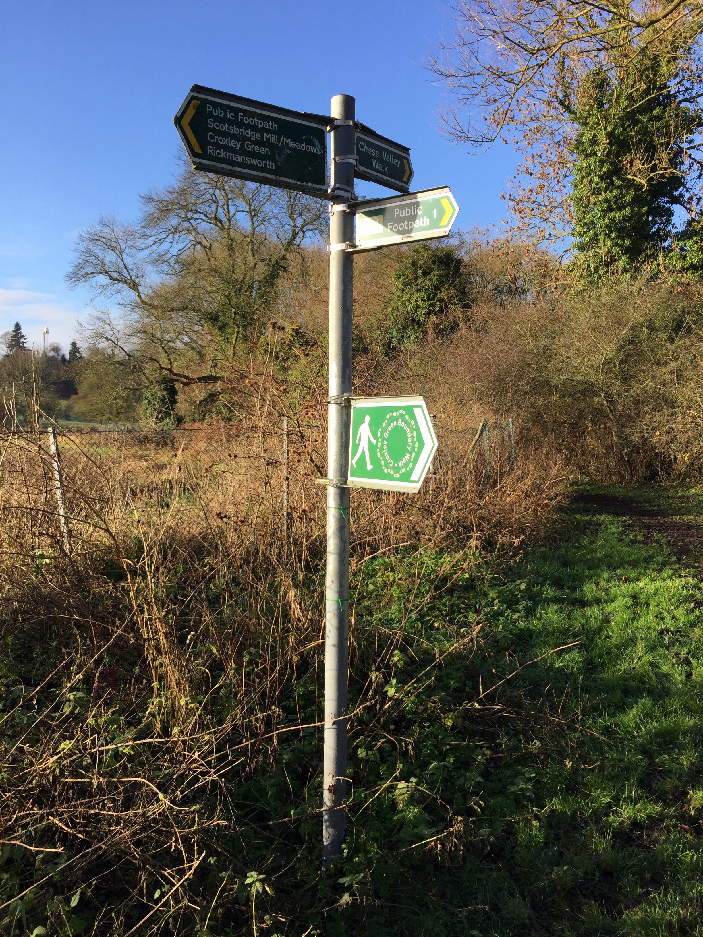
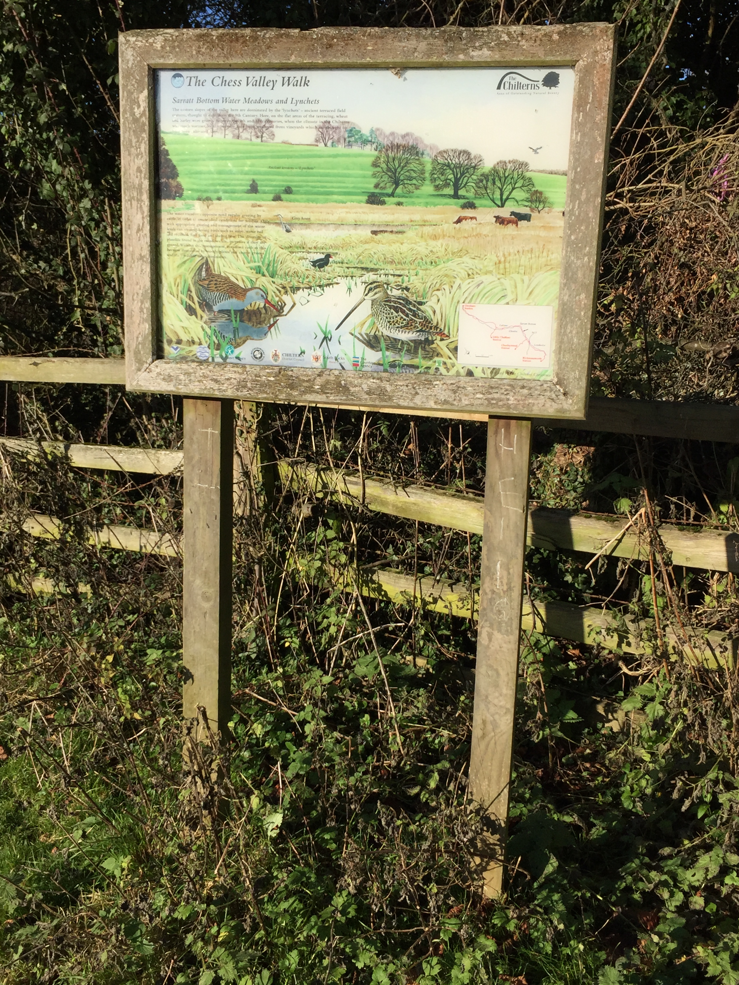
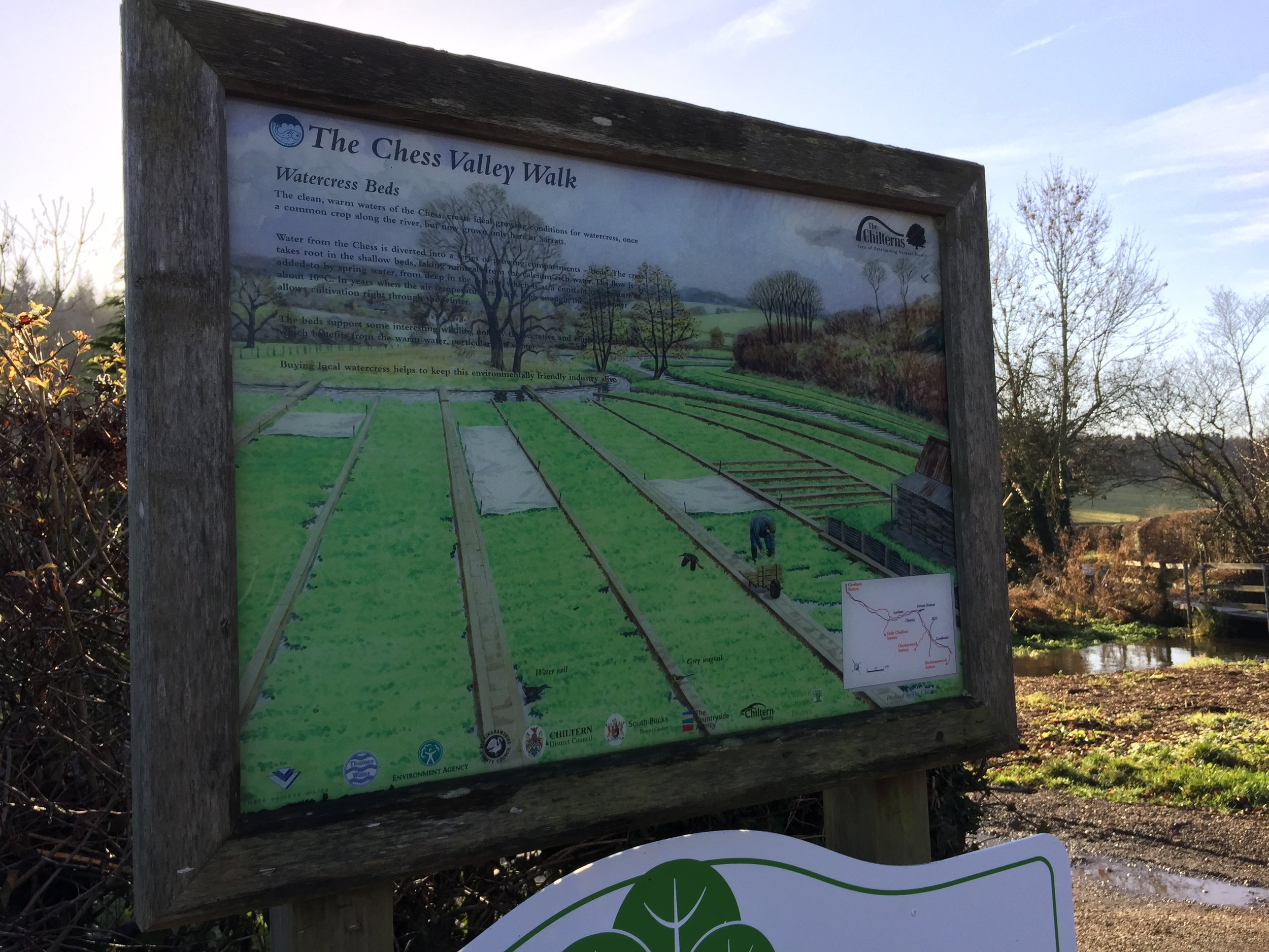
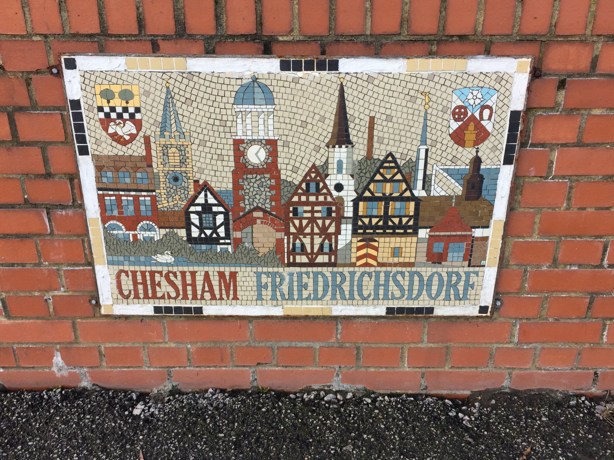
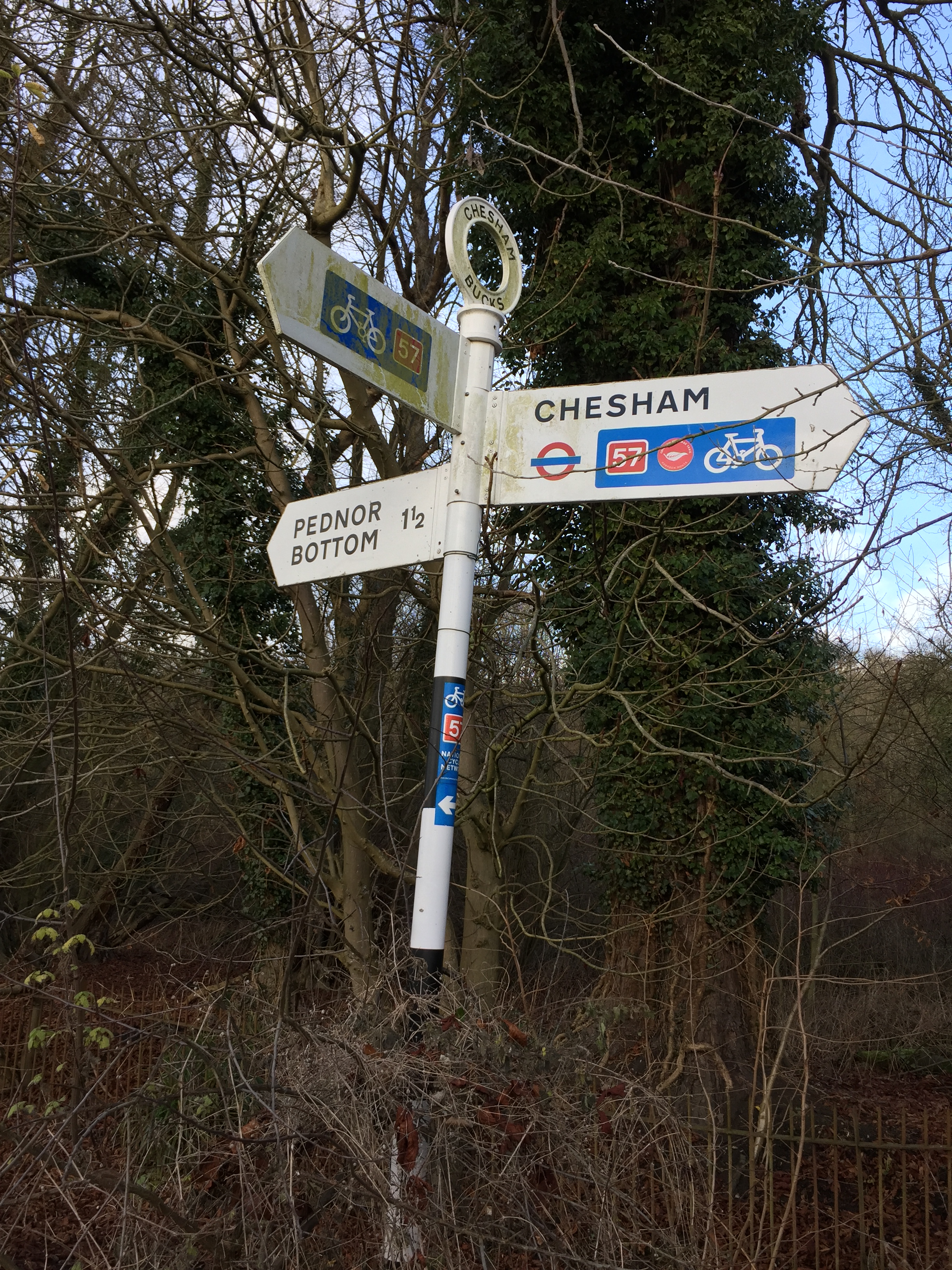
Links: River Chess, Rickmansworth, Rickmansworth Station, Sarratt Bottom, Latimer, Chesham, Chesham Station
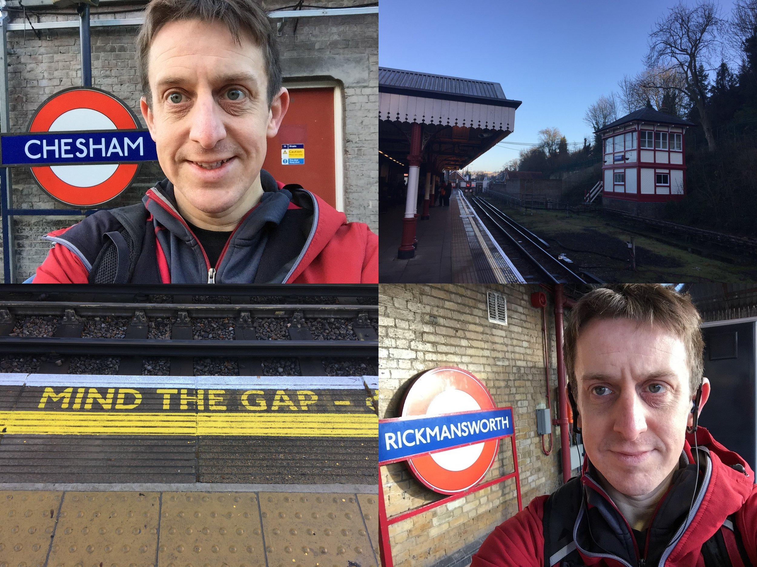
Having completed the Circle Line Run I was now excited about the London Underground. Today's adventure was going to be running the Bakerloo Line. However, once I'd checked out the route on Streetview I got a little uninspired by most of the Northern section. I needed some countryside and I definitely wouldn't get that on the Bakerloo.
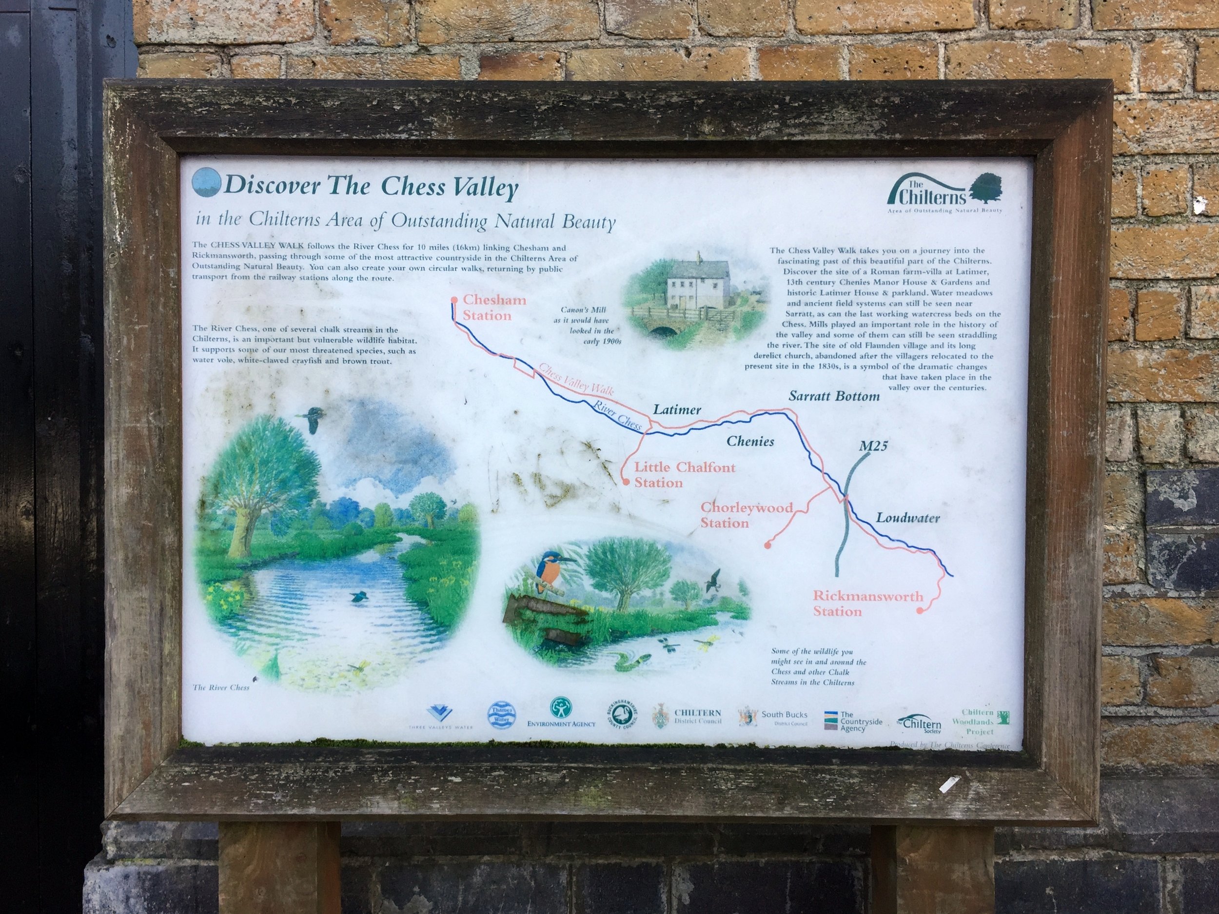
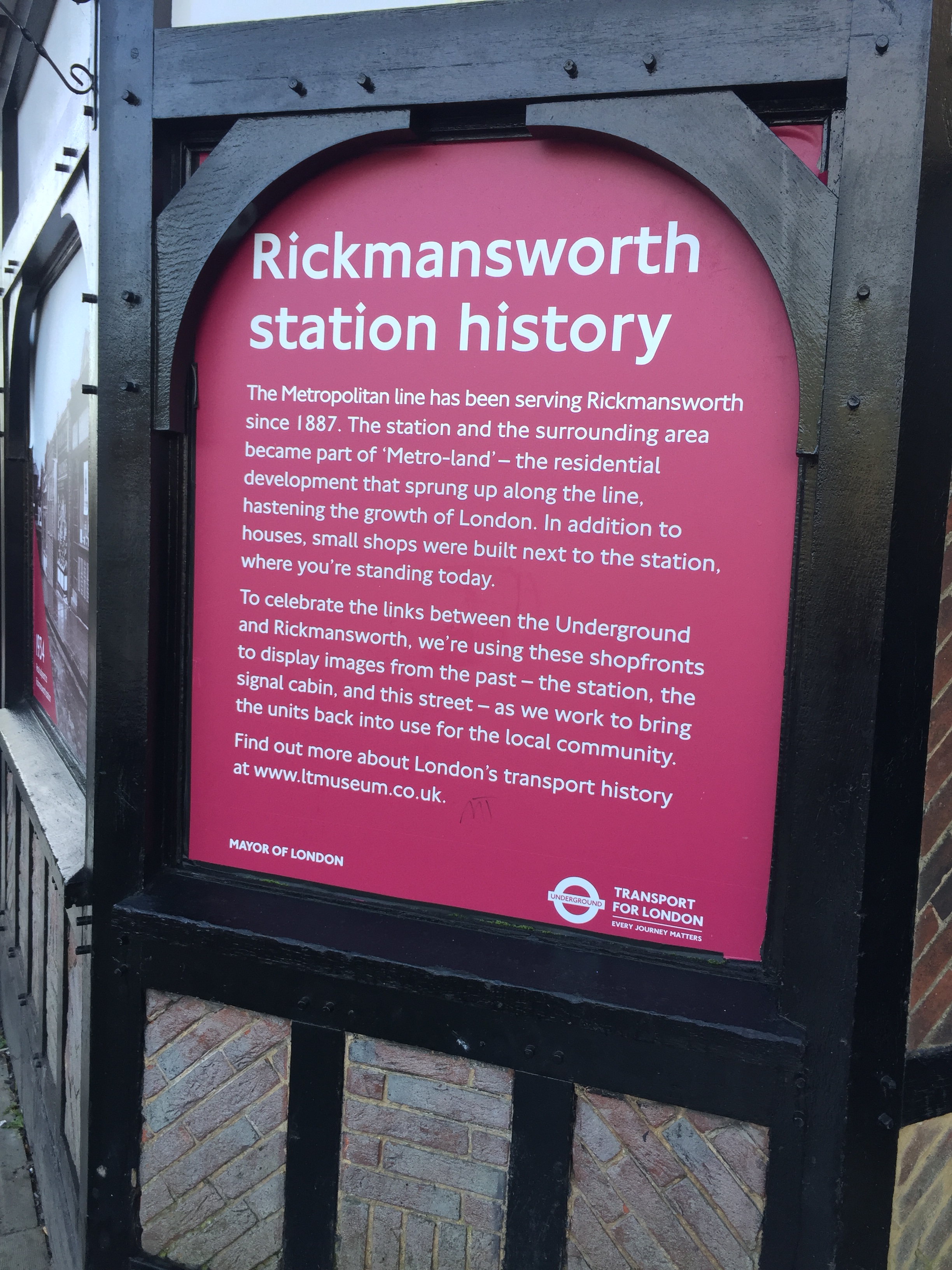
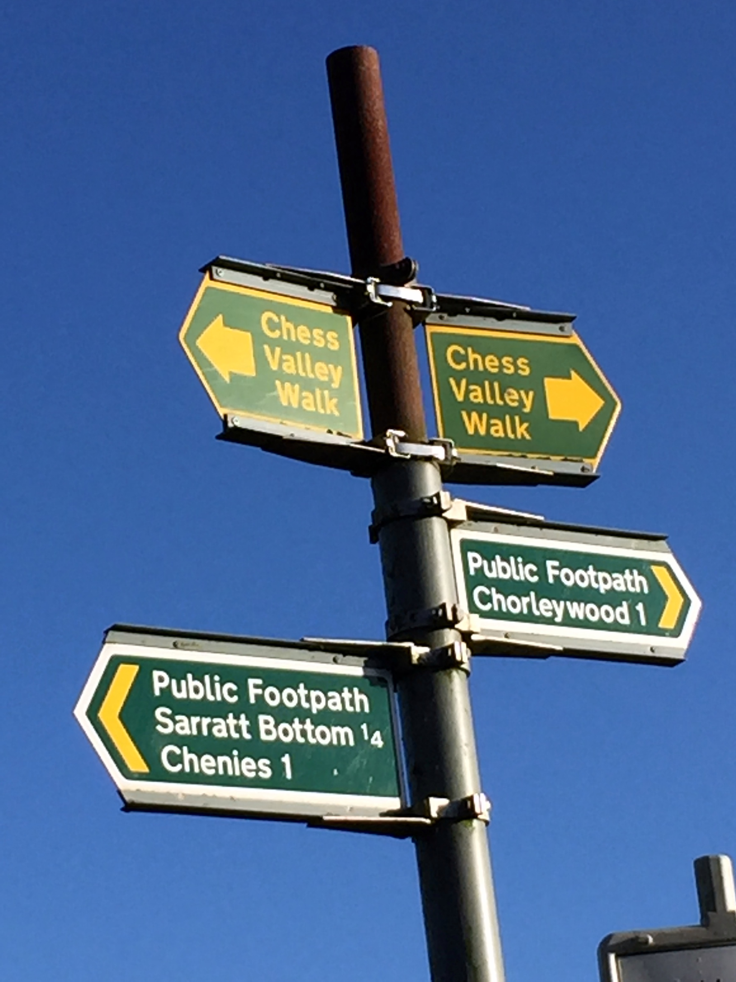
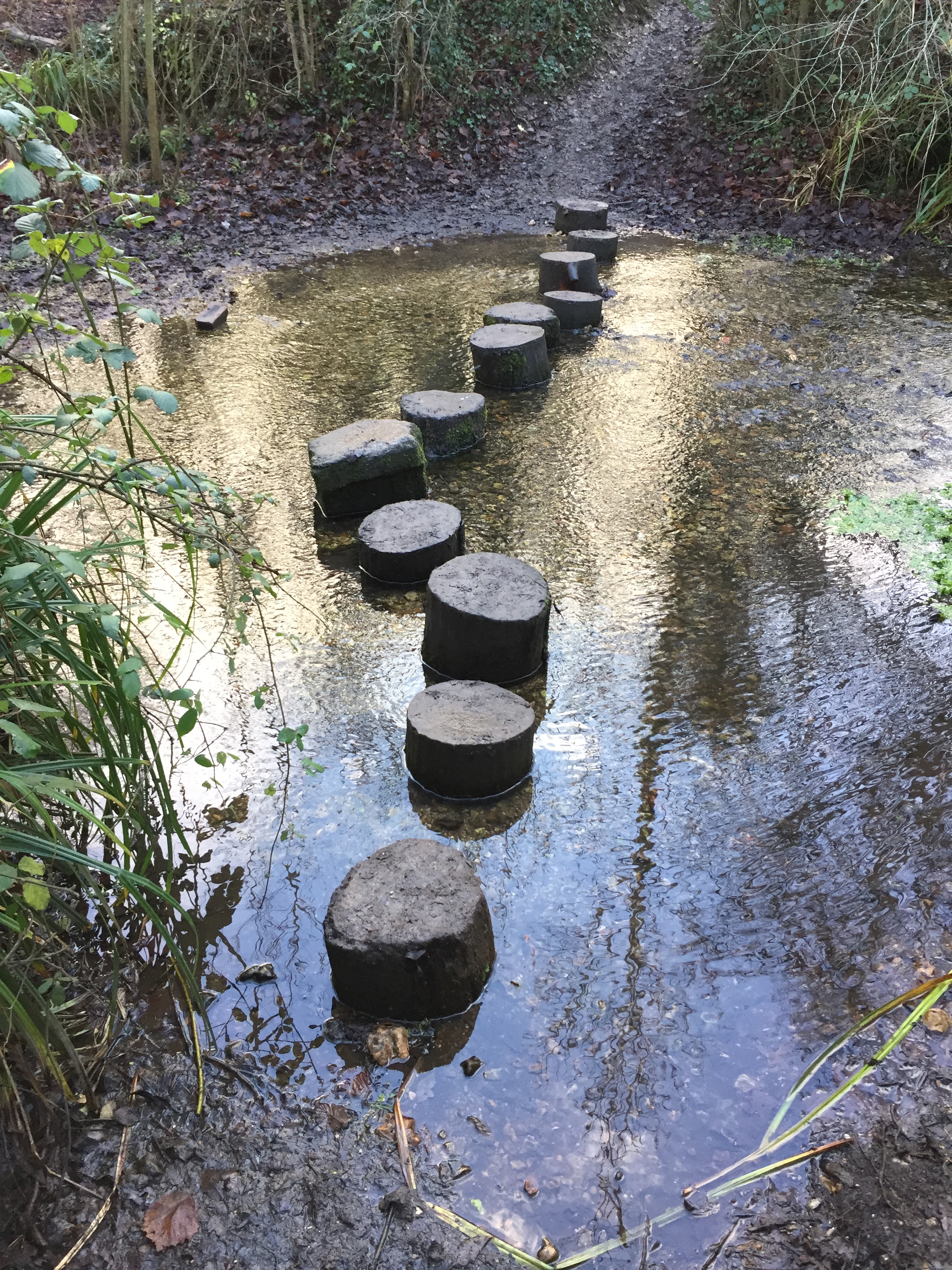
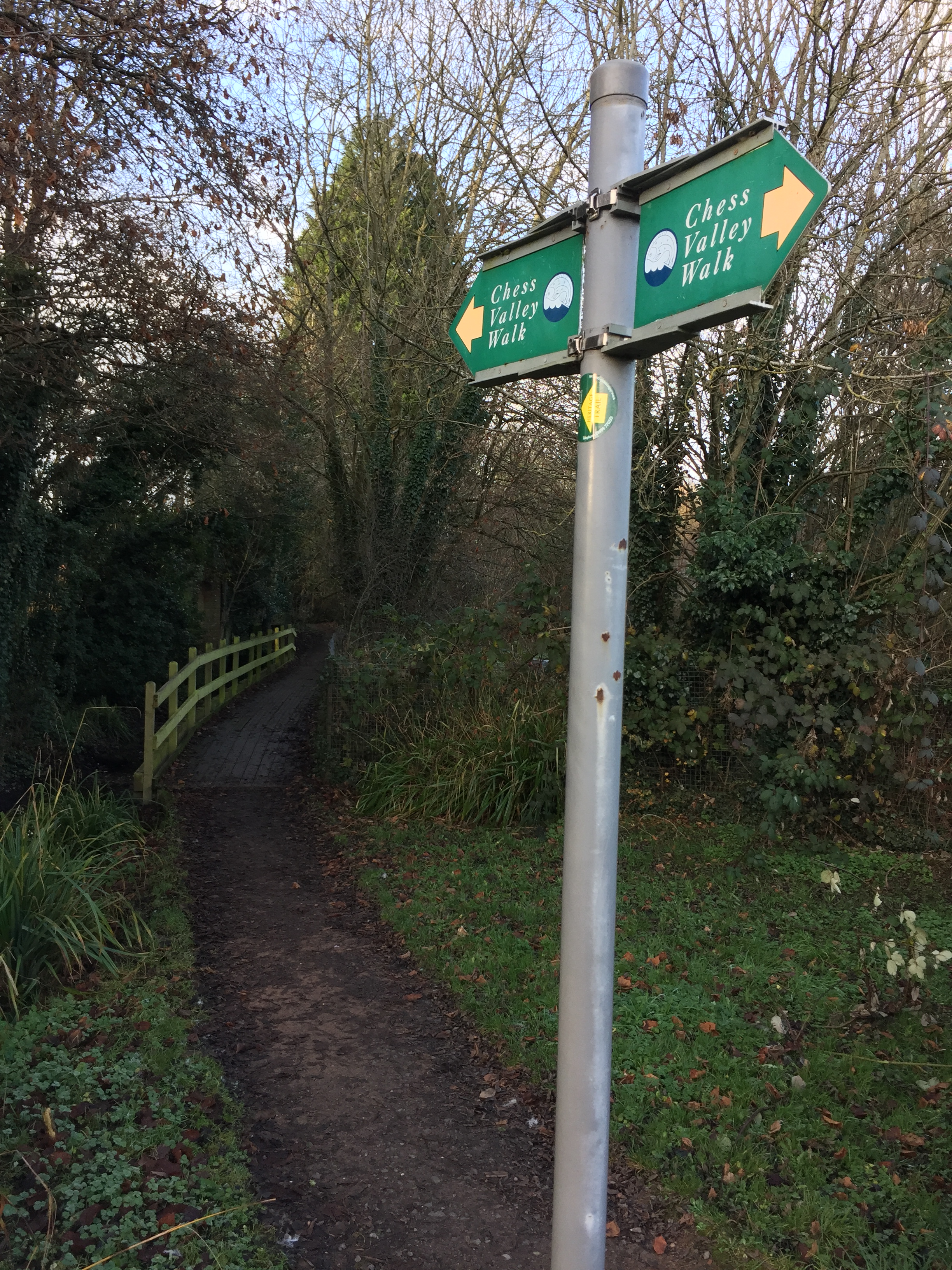
Google came to the rescue with a link to the Chess Valley Walk. It's a 10-mile sign posted walk following the River Chess between Rickmansworth and Chesham. Conveniently, it starts and ends at the Underground stations of each town. Both are on the Western end of the Metropolitan line, allowing for an easy point to point walk. Both are connected by a 16 minute Tube journey.
I chose the East to West direction starting at Rickmansworth where the Chess meets the Colne. I decided to do a longer version of the route by going as close to the source and the end as possible. The closest I could get was a small bridge near where the Underground crosses the river.
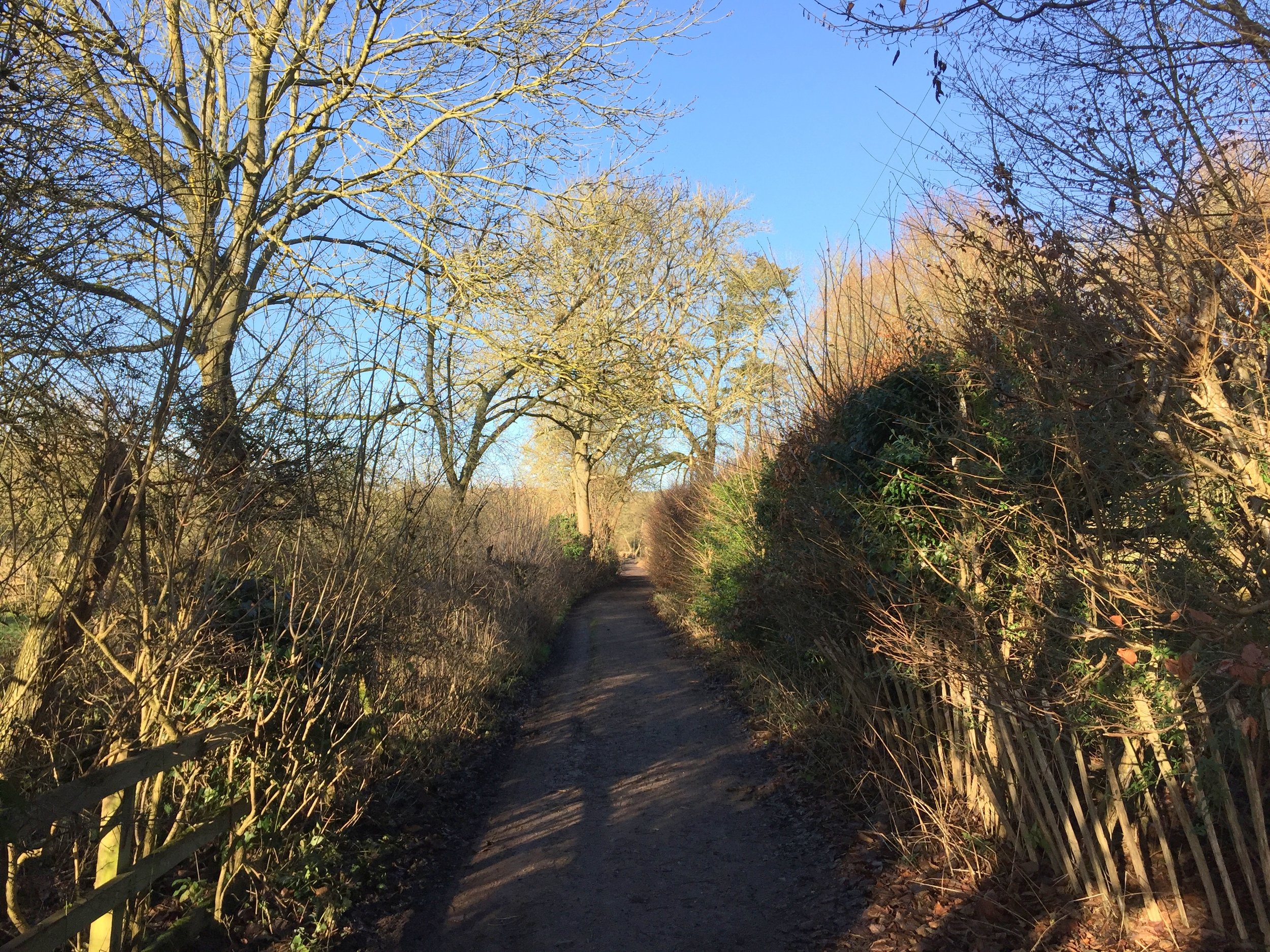
The actual route of the walk starts half a mile along after a small detour back towards the station. From here it meanders around the outskirts of the town, heading into the Chiltern countryside.
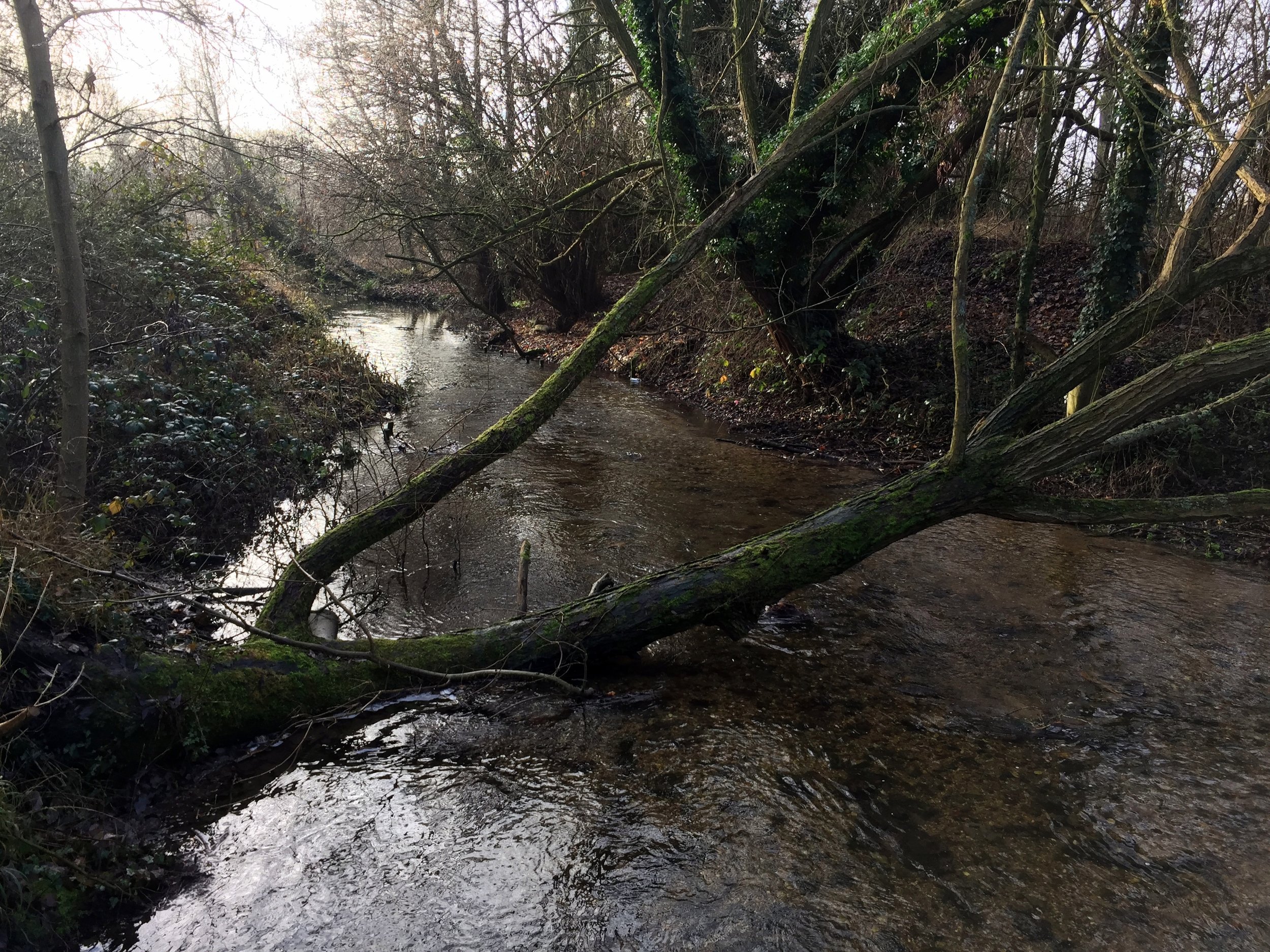
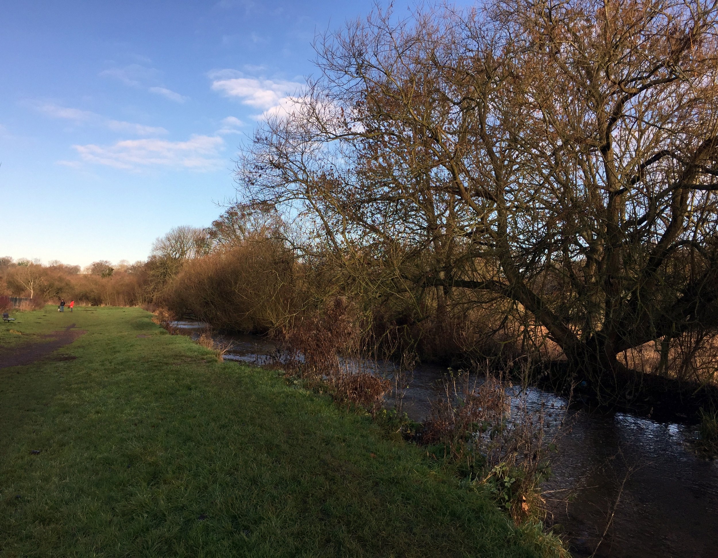
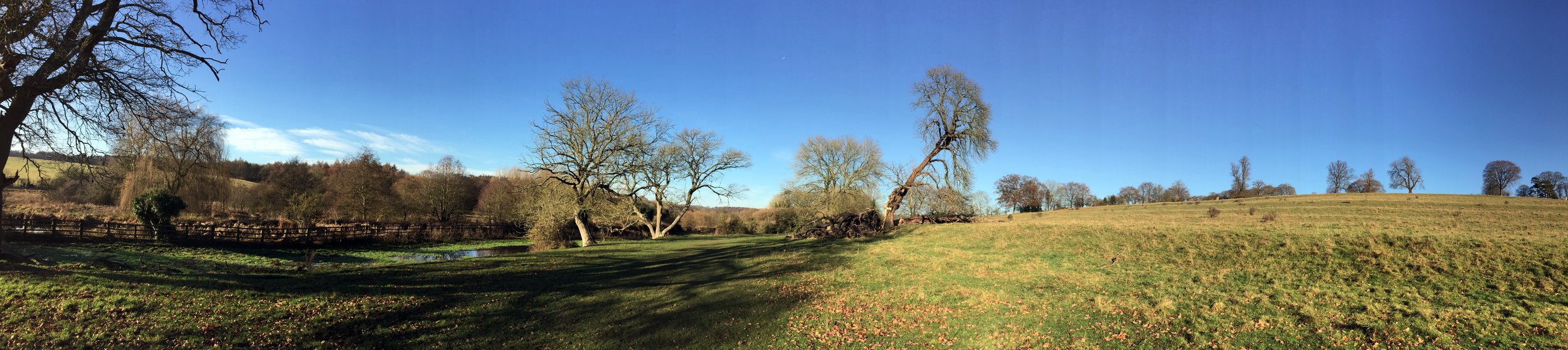
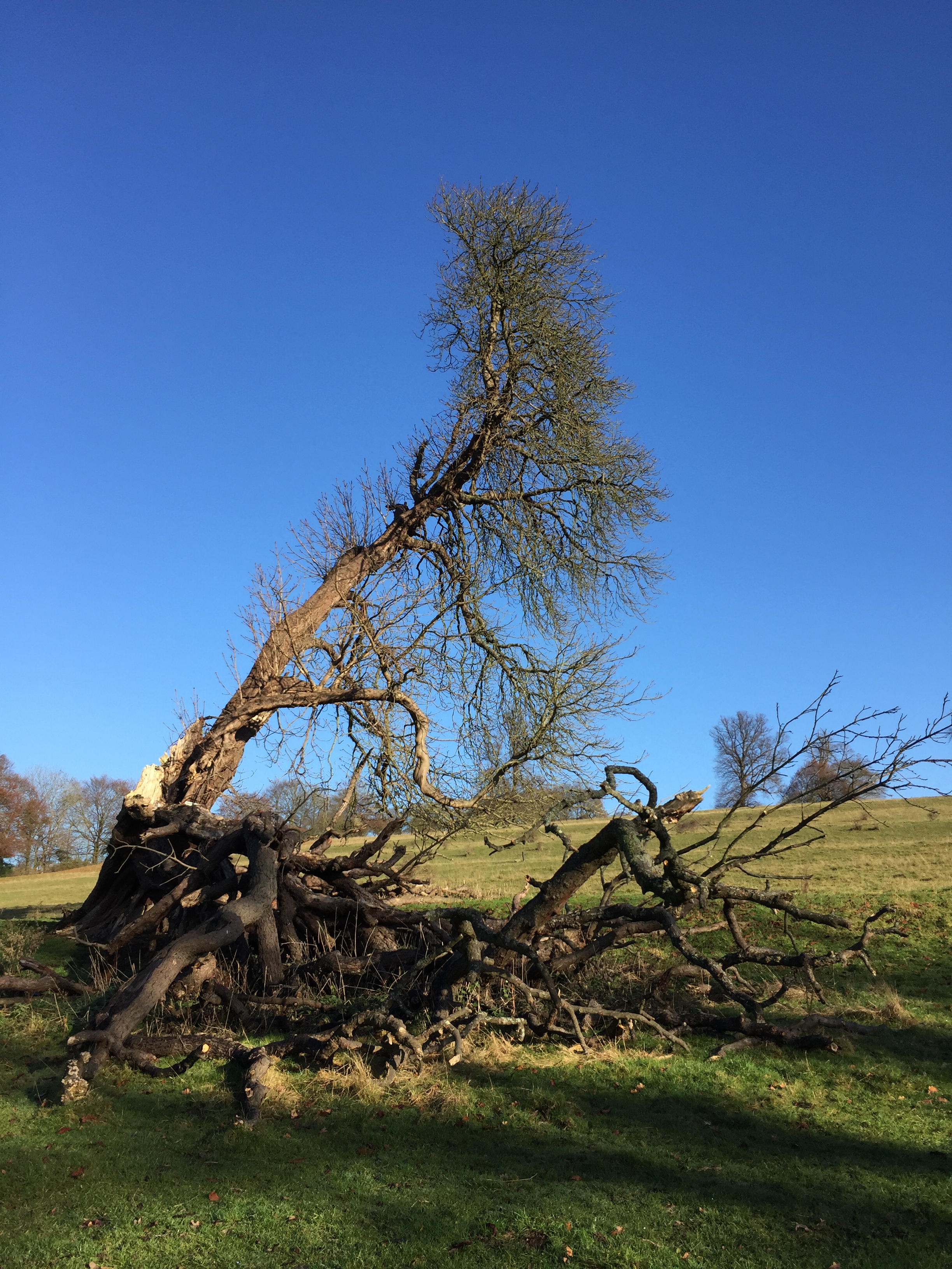
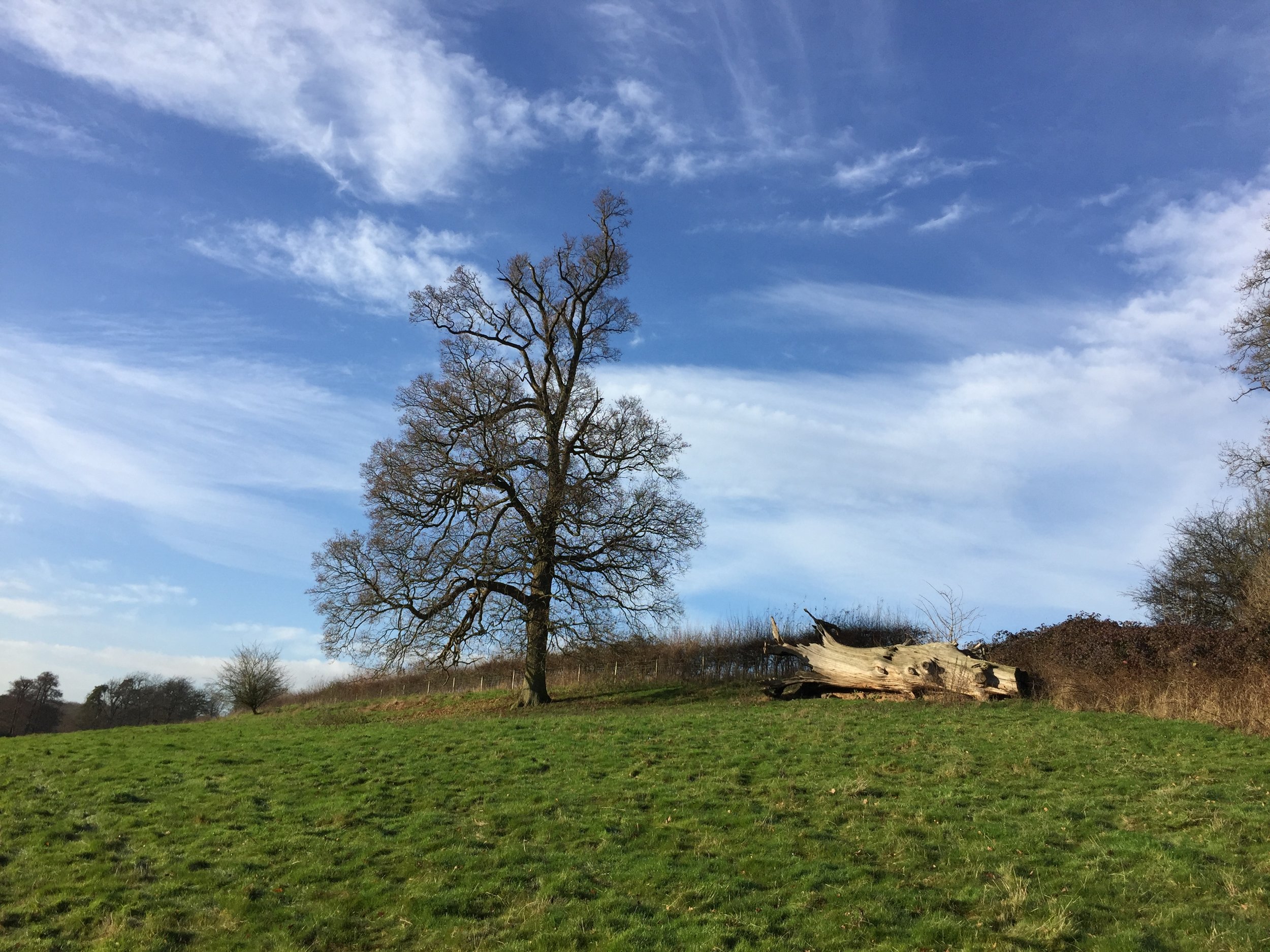
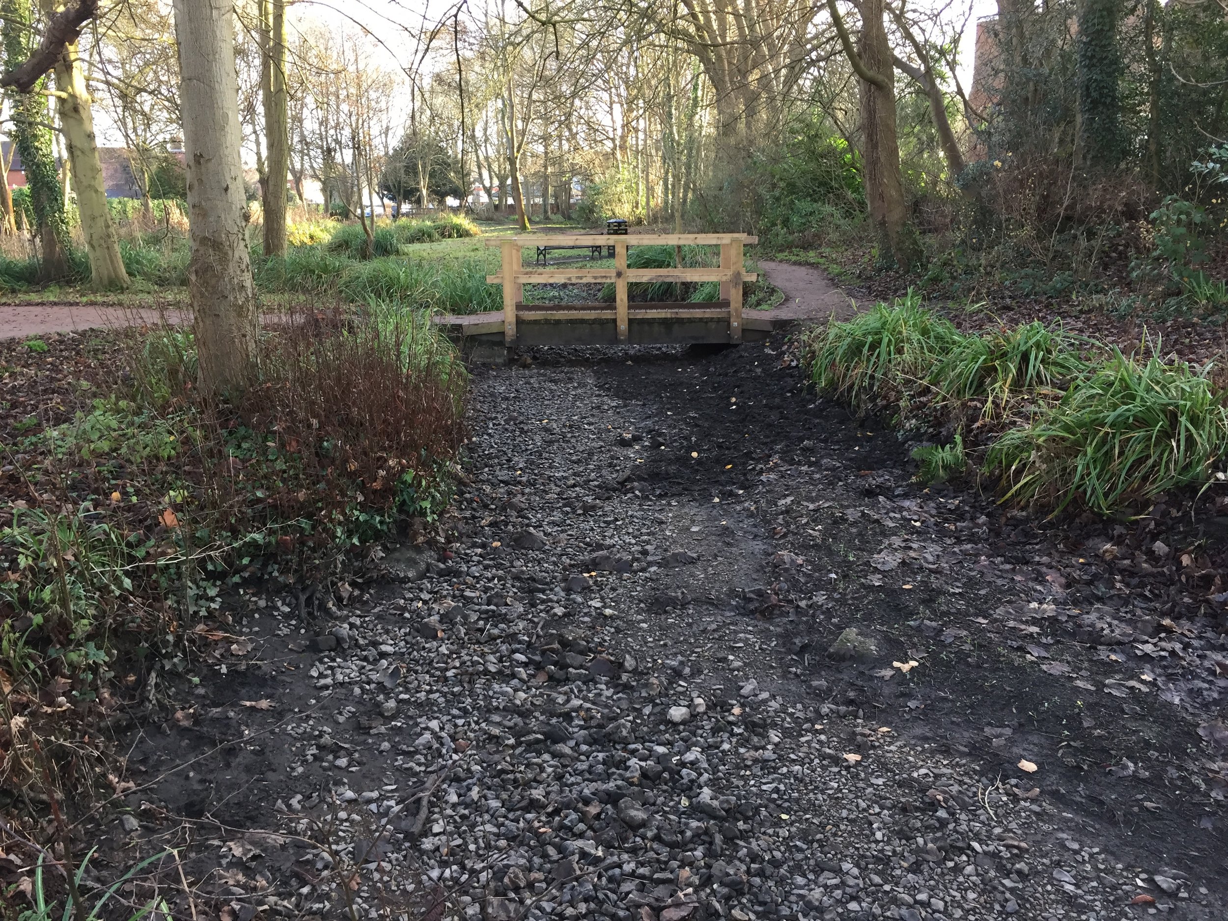
This was a cold, misty December day and I had the route mostly to myself. The path stays close to the river with some parts diverting off where it flows through private land.
Despite being well signposted, a few places can catch you out. Two spurs of the path divert to the Metropolitan Line stations on the route, Chorleywood and Chalfont and Latimer. This allows for the walk to be split into smaller sections, each linked by the Underground. I discovered that the signs for the spur were more obvious than those for the main path. Blindly following one, I ended up diverting towards Chorleywood for about a half a mile. It would have been easy to have made the same mistake further on in Latimer had I not been prepared for it.
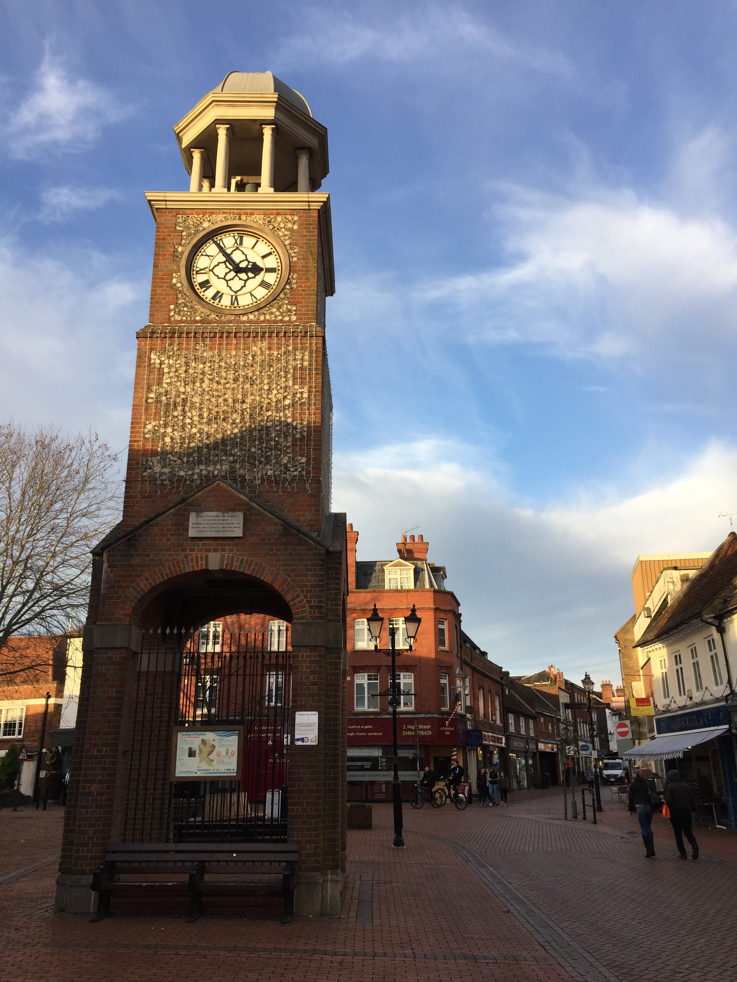
The path between Latimer and Chesham was familiar. I ran it in the opposite direction for the Country to Capital Ultra 2 years ago. Once in Chesham I left the signed path and headed to find the source. The river starts at Bury Pond, about half a mile North West of town. The pond is on private property but you can get a good view of it from Pednor Road that runs next to it.
My route was 13.5 miles, with the extra 2 miles on the official route made up of the extra bits at the start and end plus the Chorleywood diversion.
I really enjoyed the combination of a proper countryside walk connected by the Underground. It also gave me the inspiration for a few more Chiltern River trips. Next up: the Pinn, the Colne and the Wye.
Above: Red = course of the River Chess, red = walking route. You’d think it would be the other way around but I can’t get the colours to swap on the app I’m using #usererror.
Start & Finish: Marylebone Station, Melcombe Place, Marylebone, London, NW1 6JJ
Distance: 23.9 km (14.8 miles)
Elevation change: +/- 190m
GPX File: get via Buy Me a Coffee
Other routes touched (Walk): Thames Path, Jubilee Walkway, River Fleet Walk, River Westbourne Walk, Jubilee Greenway
Other routes touched (Cycle): CS3, CS6
Pubs / Cafes on route: Loads … it’s London.
Map:
- OS Explorer Map (161) London South, Westminster, Greenwich, Croydon, Esher & Twickenham
- OS Explorer Map (173) London North, The City, West End, Enfield, Ealing, Harrow & Watford
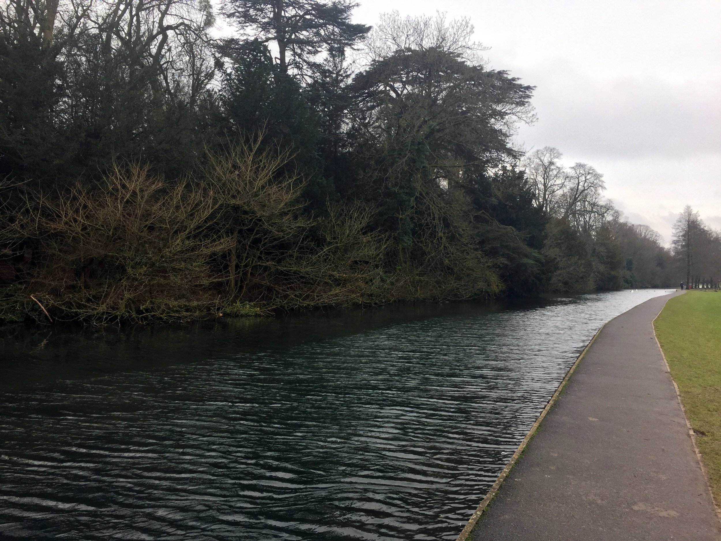
The idea of above-ground trips along the London Underground lines is not new. Mark Mason's 2011 book Walk The Lines is the best example and many other running geeks have also attempted them. Needing to escape an especially tiring year-end at work, I set off to conquer the Circle Line on a cold mid-December morning.
The Circle Line is great starting point for above-ground Tube adventures. All other lines have distant start and end points and need a bit more planning. At just over a half-marathon, the Circle is an easy half-day adventure.
My start point was Marylebone Station. Although not on the Circle line, it's on the route between Edgware Road and Baker Street, my star and end points. I set off clockwise with the aim of marking each station with a Selfie.
Despite knowing London pretty well, I still needed a bit of navigational help. The north and south sections are pretty straightforward, with the east and west trickier. The walking directions on Google Maps and a Google Keep checklist of all the stations were a big help.
The total distance underground is 14 miles, although that's by avoiding buildings. Negotiating the streets above ground adds at least a mile. Missing Temple station and having to run back to it from Embankment added another mile. Don't do that.
Once back at Marylebone I'd covered just over 16 miles. At around 3 hours it was no Personal Best. Speed is not something to be aimed for on a working day in central London. It was a fun trip though and a nice way to link up some familiar parts of London.

My To-Do list of adventures never gets smaller. On each trip I chat with someone who has done something interesting, or the event organiser emails me with a new thing to do. I get at least 2 new ideas for each trip.
The Race To The Stones, a big highlight for 2016, was no exception. This was a 100 km Ultra Marathon along the Ridgeway ending at the stone circle in Avebury. Within 2 days, just as my legs were getting back to normal, I was already planning how to complete the remaining 40 km.
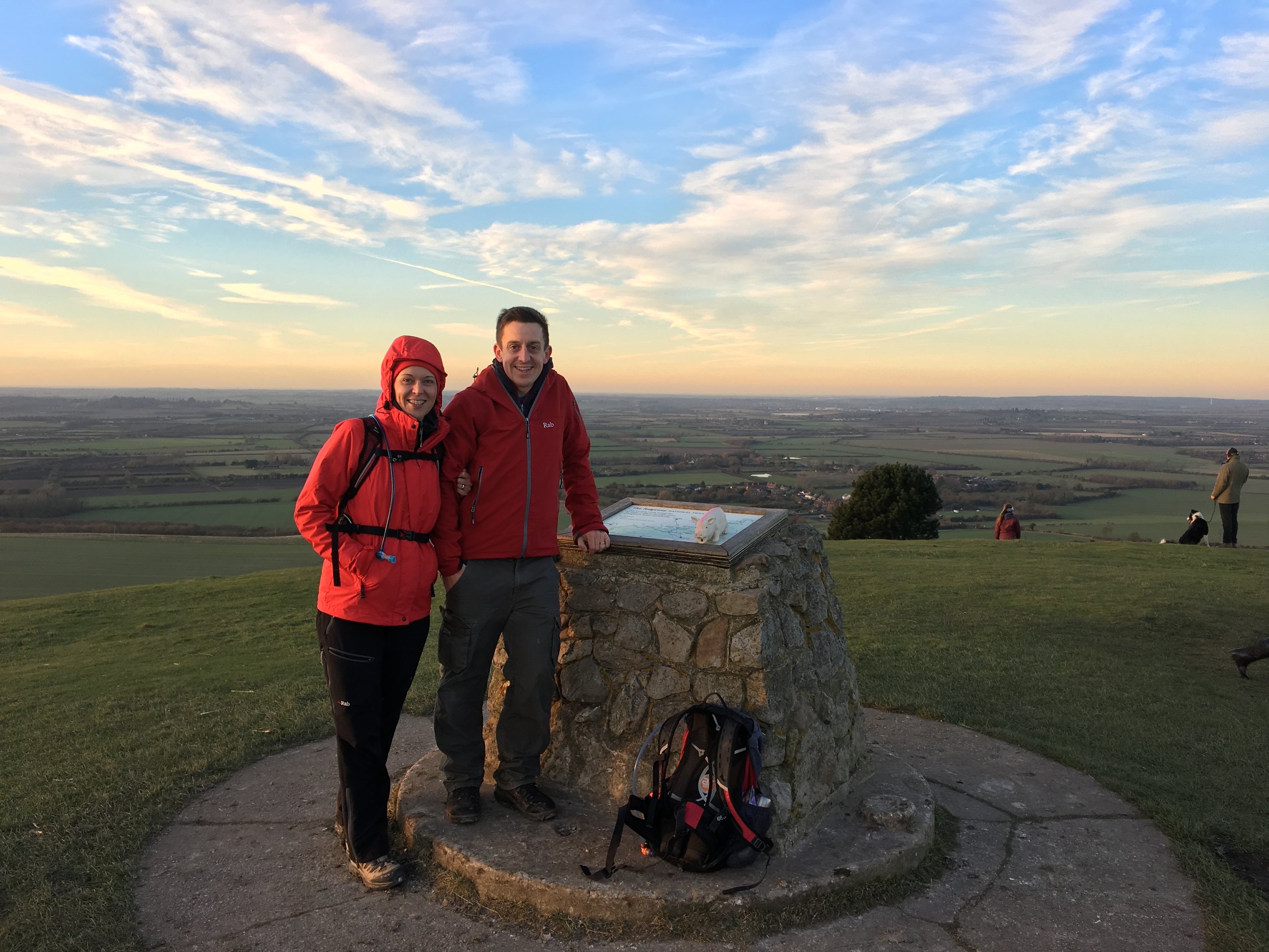
My first thought was to do it as a single near marathon-distance run. Wanting to take in more of the countryside and do it with my wife Timea, I broke it up into a series of 5 walks of between 5 and 7 miles each.
Each trip would be a point-to-point heading from west to east, the opposite direction of the Race To The Stones. Pleasant Chiltern market towns are well spaced out along the route making each a self-contained, easily accessible walk.
First there was some unfinished business at Avebury ....
Start: Standing Stones at Avebury, Marlborough, SN8 1RF
Finish: Ridgeway start sign at Overton Hil, A4, Marlborough, SN8 1QG
Distance: 5.5 km (3.4 Miles)
Elevation change: +89 / -74m. Net +15m
GPX File: get via Buy Me a Coffee
Other routes touched (walk): Wessex Ridgeway, Avebury Archeology Walk, Great Stones Way
Other routes touched (cycle): NCN 45, 403
Map: OS Explorer Map (157) Marlborough and Savernake Forest
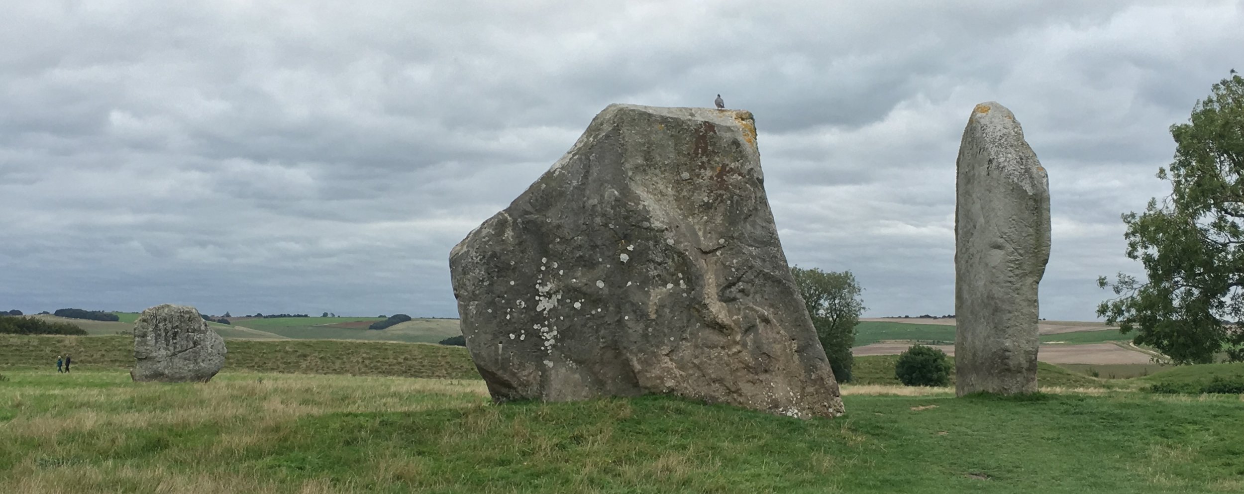
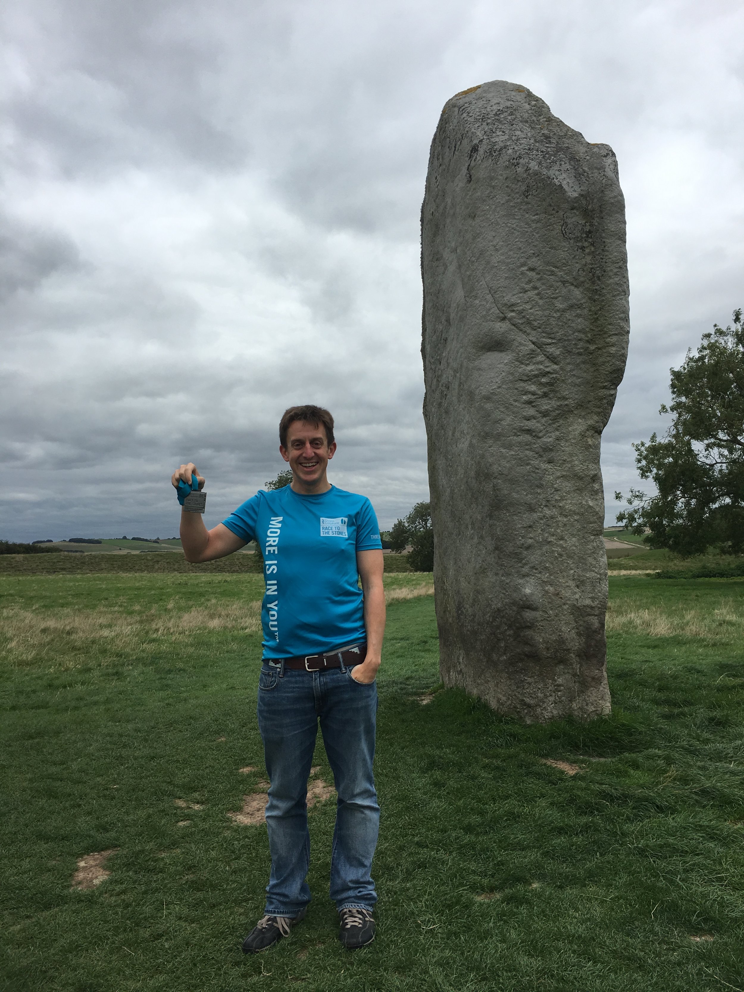
Avebury is a special place. It's the largest stone circle in Europe, a National Trust Property, A UNESCO World Heritage Site and a Scheduled Ancient Monument. It’s also the finish line for the Race To The Stones. Last time I was here I'd had my photo taken next to the standing stones before completing the final 2 miles to the end. It was 01:30 on Sunday morning and I'd been moving for over 17 hours so I wasn't in a good place to appreciate Avebury.
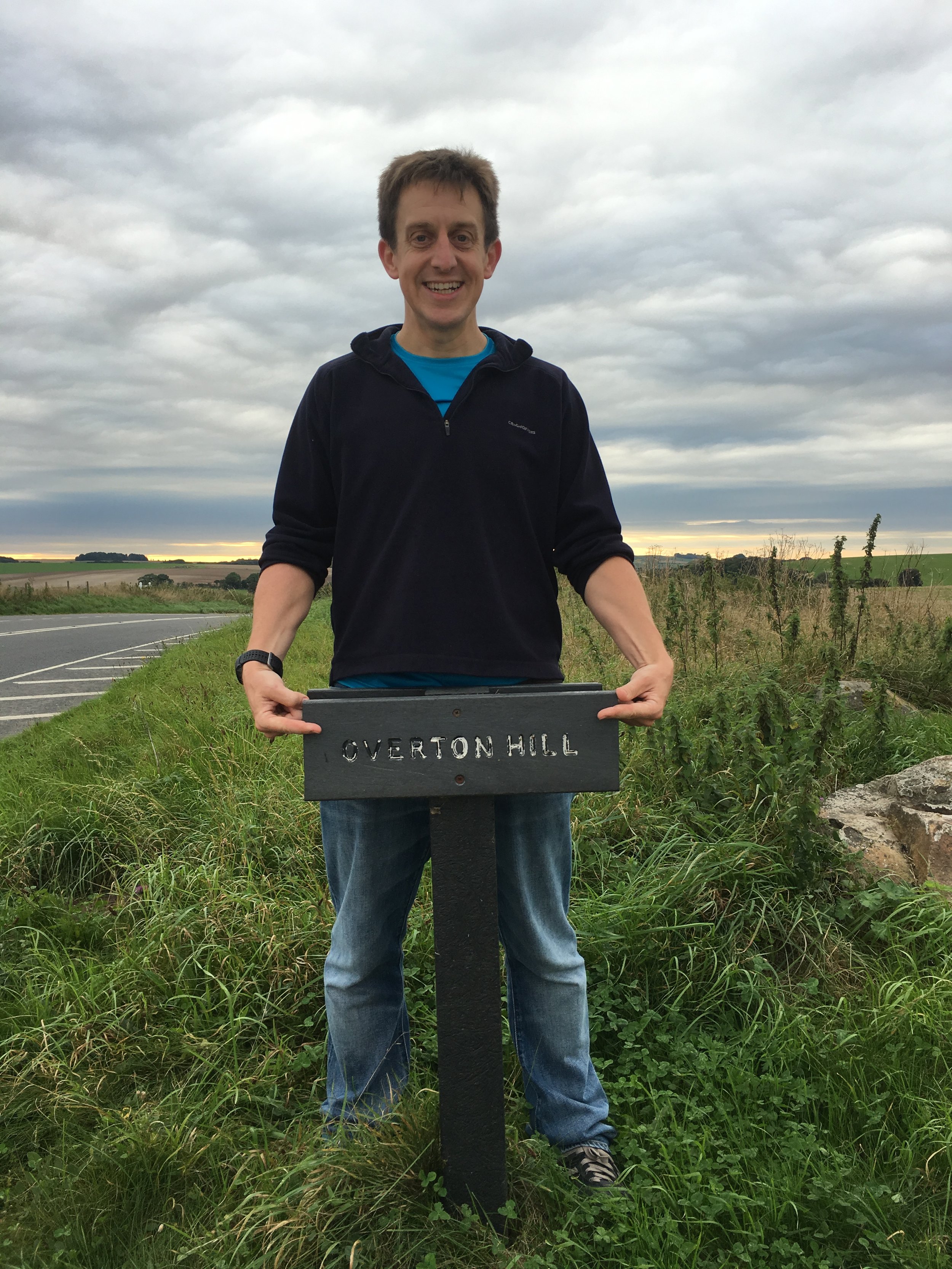
The other annoying thing was that Avebury isn't the same end of the Ridgeway. It's at Overton Hill, a mile and a half south of the village. I had to go back.
So, on a sunny September day, my Ultra Marathon support crew (wife and mother) and I headed back to Avebury. We had a guided tour of the village from the National Trust volunteer and the obligatory photo by the standing stones. Then it was down to business .... the final stretch.
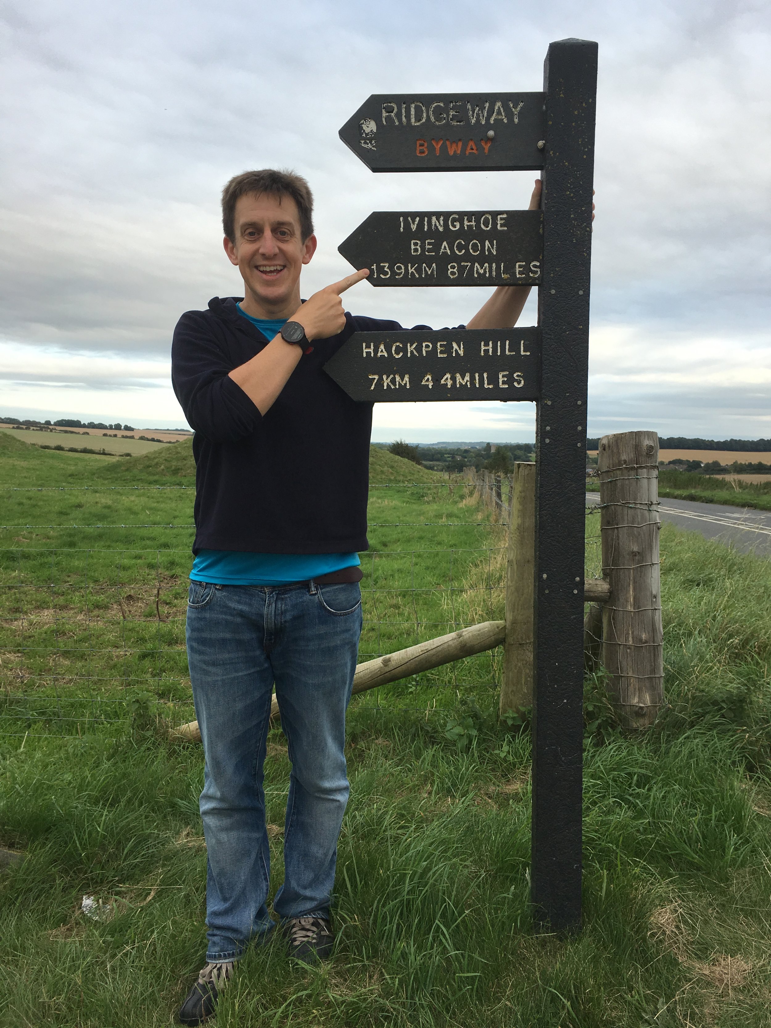
From the standing stones, I followed the route of the Ultra back up the hill away from Avebury to connect again with the Ridgeway. From here I took a right turn, heading south, reaching the A4 a mile later. As a destination point, Overton Hill is highly underwhelming. There's a field on the other side of the road with an information board about the Sanctuary, a wooden circle now long gone. The most important part of my trip was the National Trail sign marking the start of the Ridgeway. The sign points to Ivinghoe Beacon, 139km / 87 miles away.
Start: Parking spot at junction of The Ridgeway and Hill Road, Lewknor, OX49 5RT
Finish: Parking spot at junction of The Ridgeway and Chinnor Hill Road, OX39 4BB
Distance: 5.3 km (3.3 miles)
Elevation change: +34m / - 39m. Net -5m
GPX File: get via Buy Me a Coffee
Other routes touched (walk): N/A
Other routes touched (cycle): Icknield Way Trail
Map: OS Explorer Map (171) Chiltern Hills West, Henley-on-Thames and Wallingford
At 3.5 miles and dead-straight, the first section is a nice warm-up for the rest of the trip. We used the parking space at the intersection of the Ridgeway and Hill Road. This is the closest accessible point to Field Farm, the starting point for Race To The Stones. From here we headed north-east, soon passing under the M40 where it heads north after the Stokenchurch Gap.
Nearing Chinnor you can see the Chinnor and Princes Risborough Railway. Once part of the national rail network, it closed in 1989 after which it converted into a privately run heritage line. The railway centre is off Hill Road, less than half a mile north of the parking spot at the end of this section of the Ridgeway.
Start: Parking spot at junction of The Ridgeway and Chinnor Hill Road, OX39 4BB
Finish: Parking spot at junction of Poppy Road and A4010 Wycombe Road, HP27 9DB
Distance: 8.1 km (5.1 miles)
Elevation change: +85m / -118m. Net -33
GPX File: get via Buy Me a Coffee
Other routes touched (walk): Midshires Way, Chiltern Way, Risborough Green Route, Risborough Blue Route, Risborough Orange Route
Other routes touched (cycle): Icknield Way Trail, Chilterns Cycleway
Map: OS Explorer Map (181) Chiltern Hills North
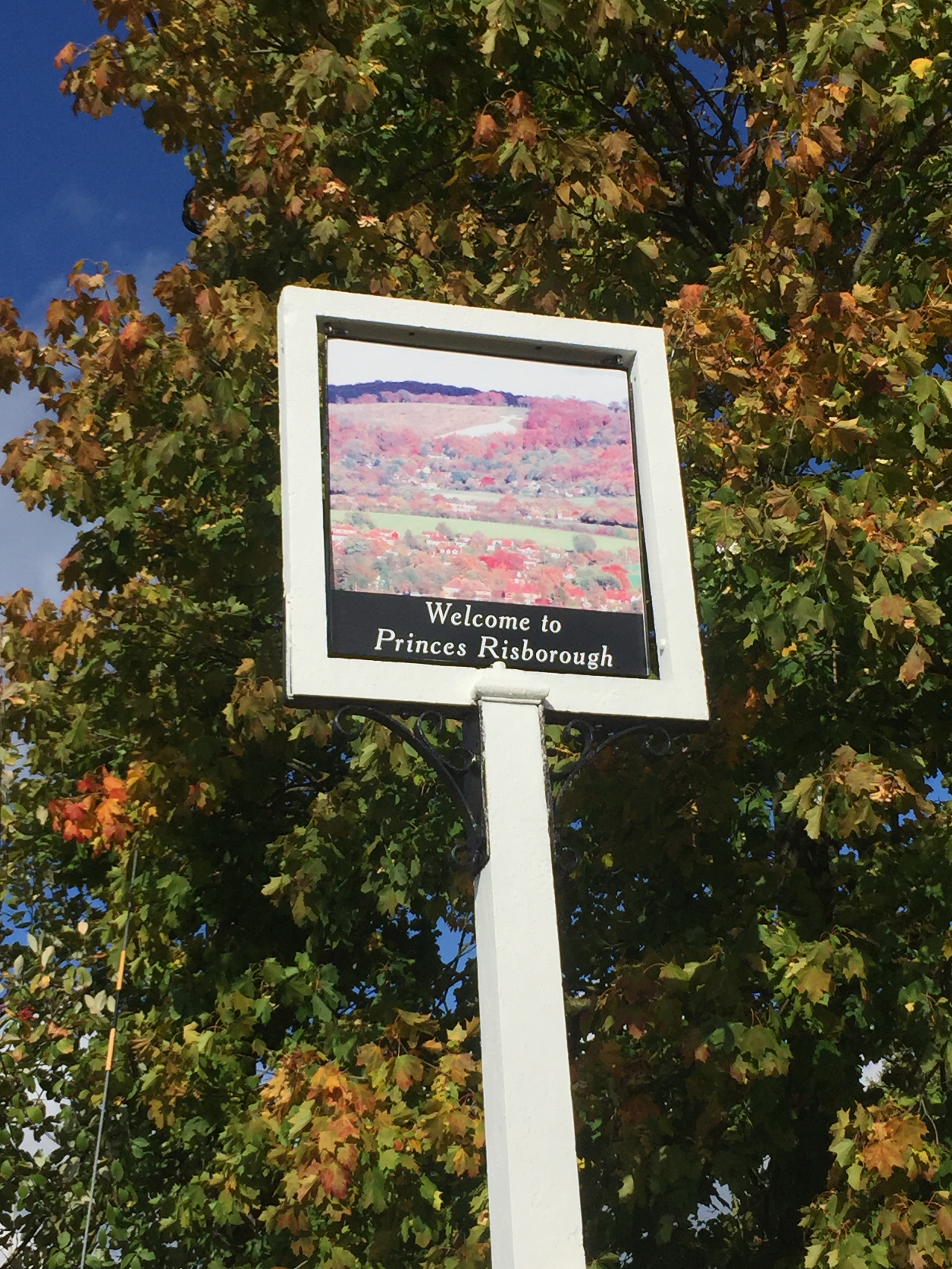
From the parking spot the route continues north-east for a mile before taking a sharp right. The next 2 miles are a steady climb towards Saunderton Lee before a steeper descent to Princes Risborough Golf Course.
A top tip for a pleasant post-walk rest, coffee and cake is the Crepe Escape in Princes Risborough. Its about 3/4 of a mile north of the Ridgeway, but well worth a detour.
Start: Parking spot at junction of Poppy Road and A4010 Wycombe Road, HP27 9DB
Finish: The Shoulder of Mutton Pub, 20 Pound Street, Wendover, Aylesbury HP22 6EJ
Distance: 11.6 km (7.2 miles)
Elevation change: +259m / -236m. Net -23m
GPX File: get via Buy Me a Coffee
Other routes touched (walk): Risborough Orange Route, South Bucks Way, Coombe Hill Orange Route, Coombe Hill Purple Route, Outer Ayeslbury Ring,
Other routes touched (cycle): Icknield Way Trail, Chilterns Cycleway
Map: OS Explorer Map (181) Chiltern Hills North
Trig Pillar: TP4899 - Monument Hill
This was the longest and most enjoyable section section of the walk for us. The route meanders between Princes Risborough and Wendover offering some nice panoramas along the way. Highlights of this section include viewpoints at Brush Hill and Whiteleaf Cross, the Chequers Estate and Bacombe Hill.
At the top of Coombe Hill the route takes a sharp right at the Boer War Monument, the highest point on the eastern Ridgeway. From here the route descends quickly to Wendover. The finish point for this section is the Shoulder of Mutton pub which was coincidentally the start point of my first Ultra, the Country to Capital.
Start: The Shoulder of Mutton Pub, 20 Pound Street, Wendover, Aylesbury HP22 6EJ
Finish: Hastoe Village Hall, Church Ln, Hastoe, HP23 6LU
Distance: 8.7 km (5.4 miles)
Elevation change: +146m / -53m. Net -93m
GPX File: get via Buy Me a Coffee
Other routes touched (walk): Outer Aylesbury Ring
Other routes touched (cycle): Harding Route, Icknield Way Trail, Chilterns Cycleway
Map: OS Explorer Map (181) Chiltern Hills North
Trig Pillar: TP4899 - Monument Hill
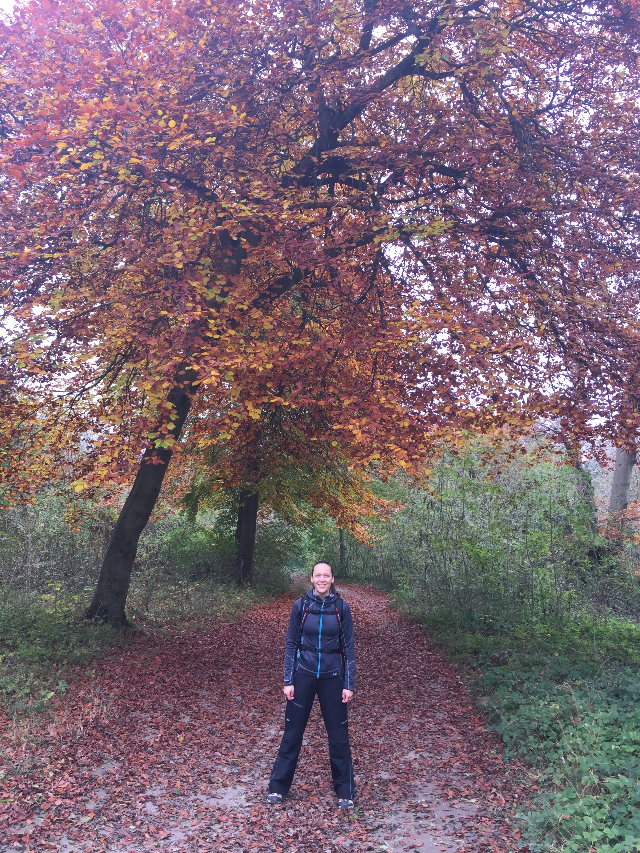
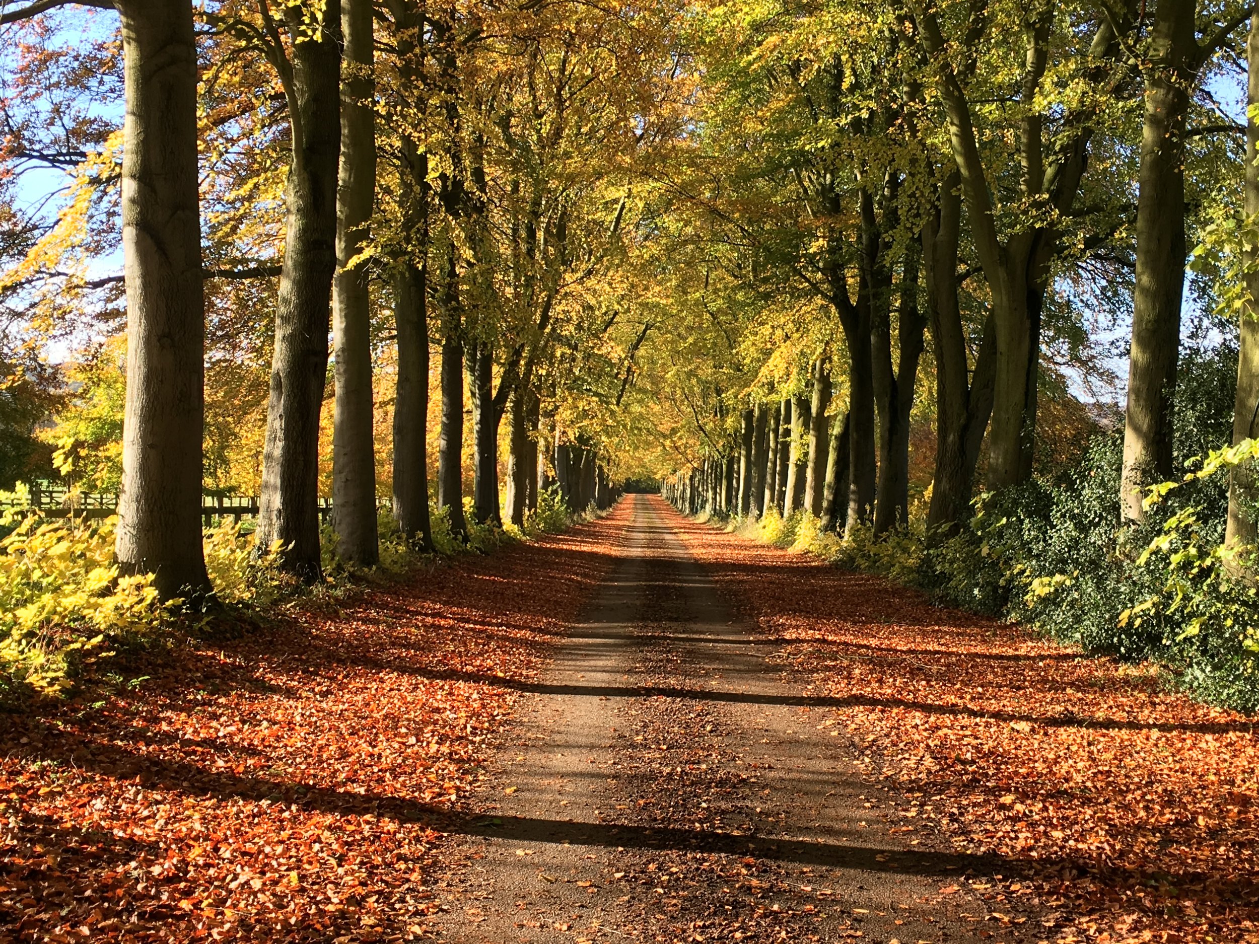
Although not as diverse as other sections, the route from Wendover to Hastoe is still a nice walk. We did this part in mid-November and were rewarded by some amazing Autumn colours.
Start: Hastoe Village Hall, Church Ln, Hastoe, HP23 6LU
Finish: Ivinghoe Beacon, Ivinghoe, Leighton Buzzard, LU7 9DJ
Distance: 10.9 km (6.8 miles)
Elevation change: +173m / -172m. Net +1m
GPX File: get via Buy Me a Coffee
Other routes touched (walk): Grand Union Canal Towpath, Icknield Way
Other routes touched (cycle): Icknield Way Trail, Tring 5 Route
Map: OS Explorer Map (181) Chiltern Hills North
Trig Pillar: TP2931 - Dunsley Farm and TP1099 - Beacon Hill
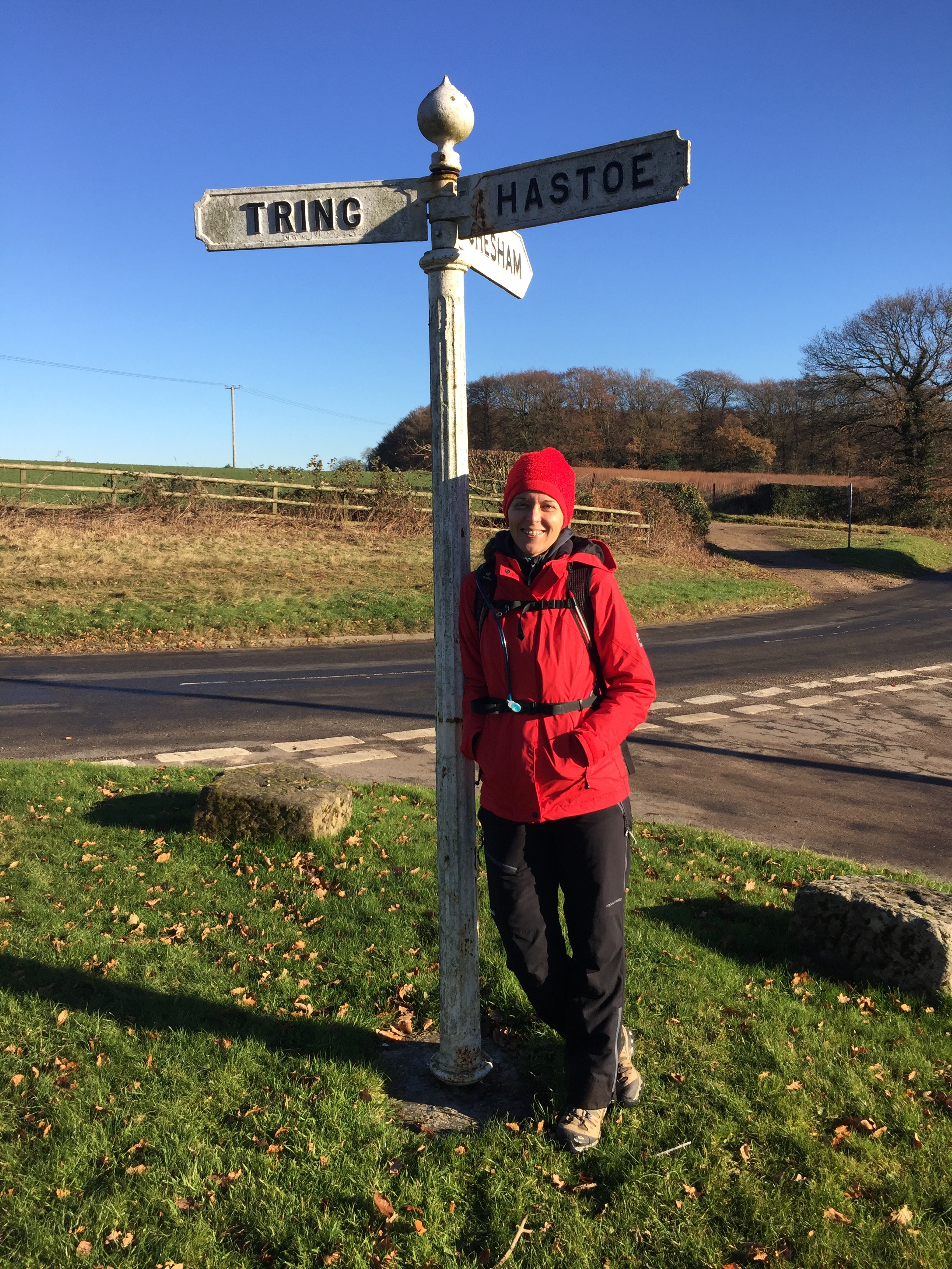
The Ridgeway holds back some of its best views for the final section. We tackled this in on a cold, crisp early December afternoon with some clear skys.
Just outside of Hastoe, the route follows the top of Tring Park. This was orignally the garden of Tring Mansion and now managed by the Woodland Trust. It was also home of Tring parkrun, one of the hilliest and most enjoyable that I've done so far.
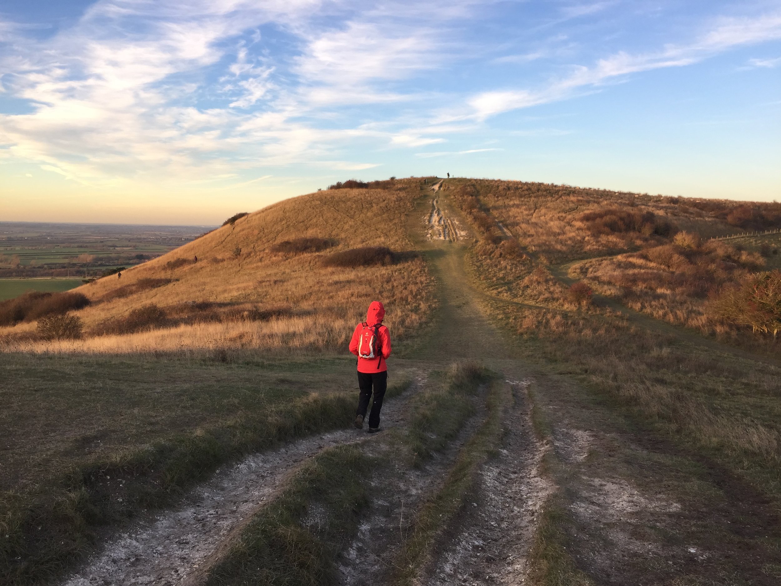
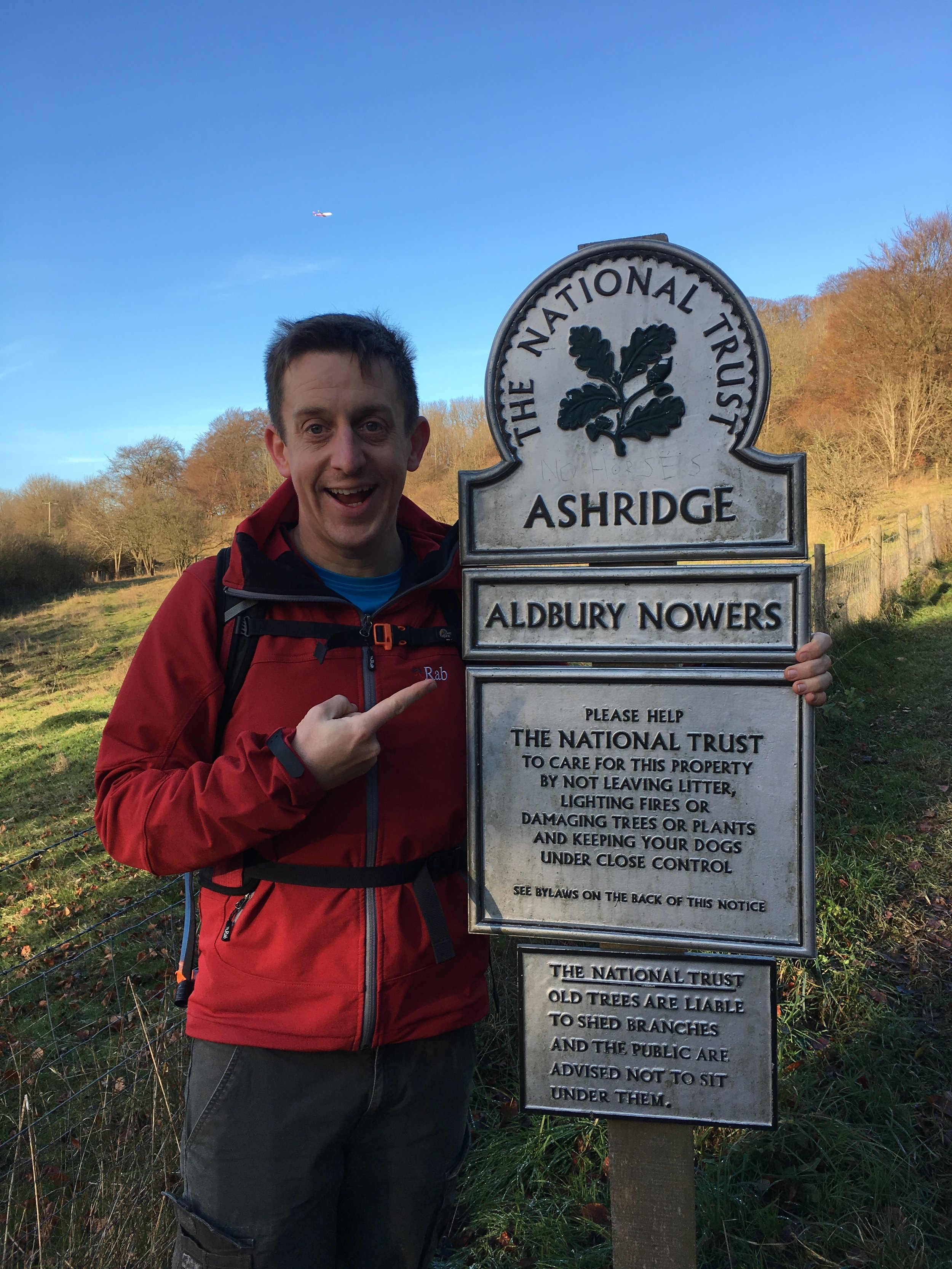
Once leaving the park the Ridgeway descents gradually, passing over the A41, the Grand Union Canal and the Chiltern Rail Line before climbing again towards Ivinghoe. Much of the rest of the route is through the Ashridge Estate, a large National Trust property with a large choice of walking routes. With more time its worth checking out other parts of the estate, including Pitstone Windmill and the Monument to the Duke of Bridgewater.
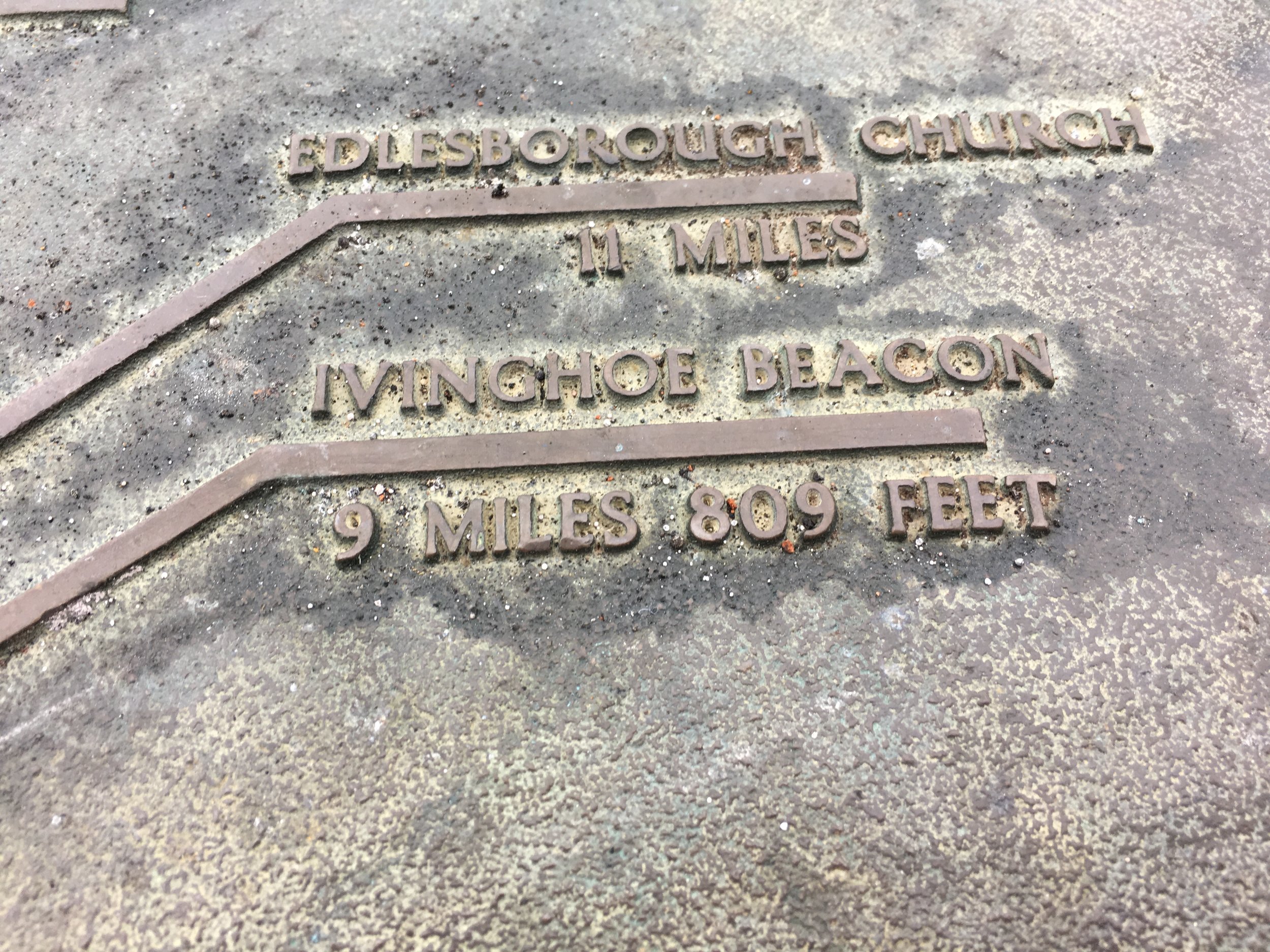
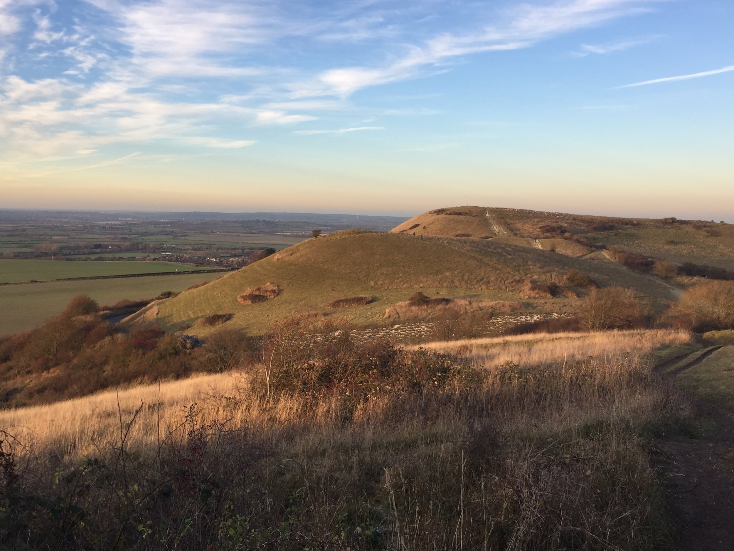
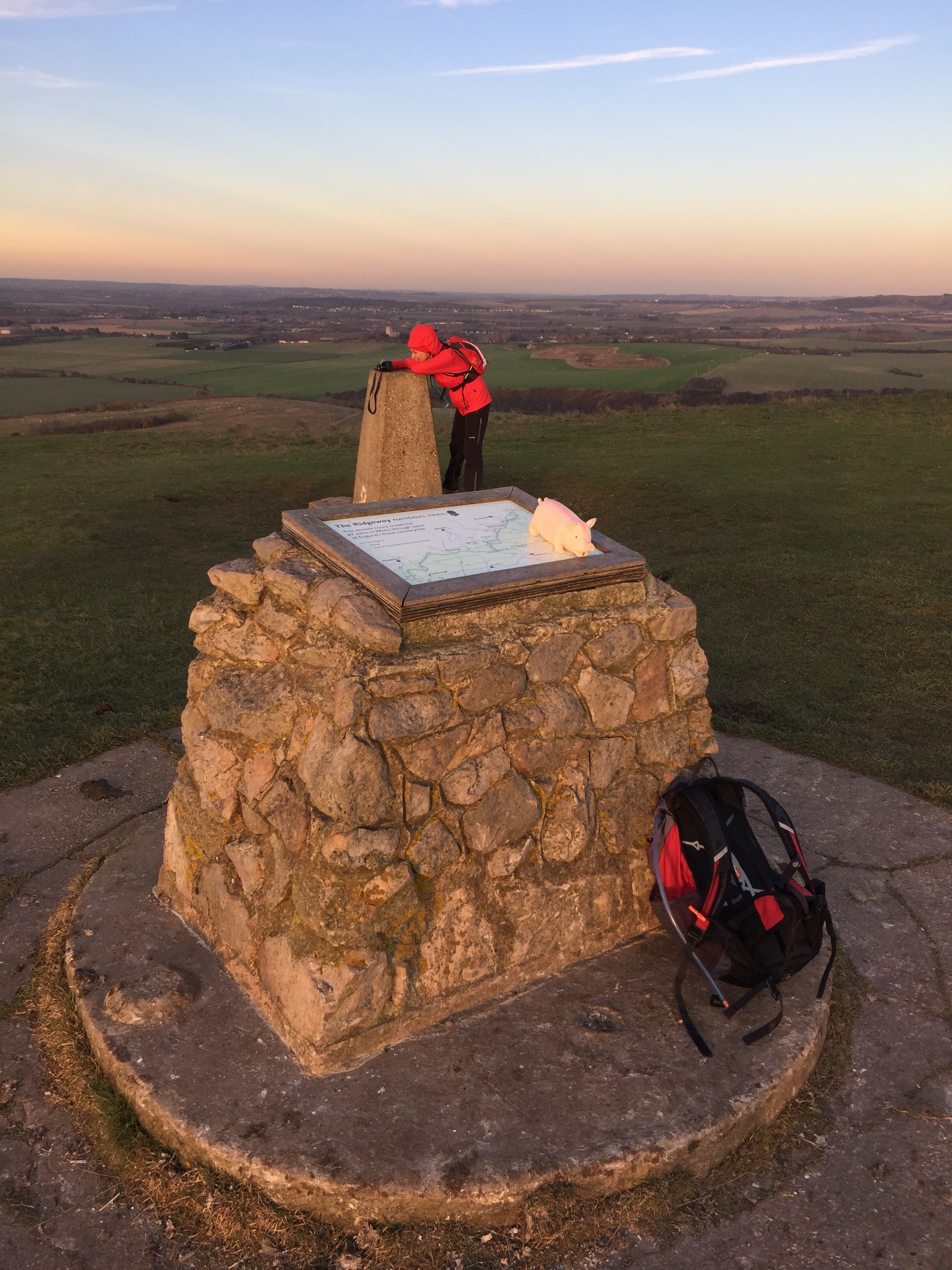
The summit of Ivinghoe Beacon and the end point of the Ridgeway is marked by a Trig-point and map of the Ridgeway showing the route back to the start at Overtone Hill. The clear skys also gave us a good view across to Dunstable Downs, part of our next adventure: the Icknield way to Norfolk!
Click on the image to enlarge.
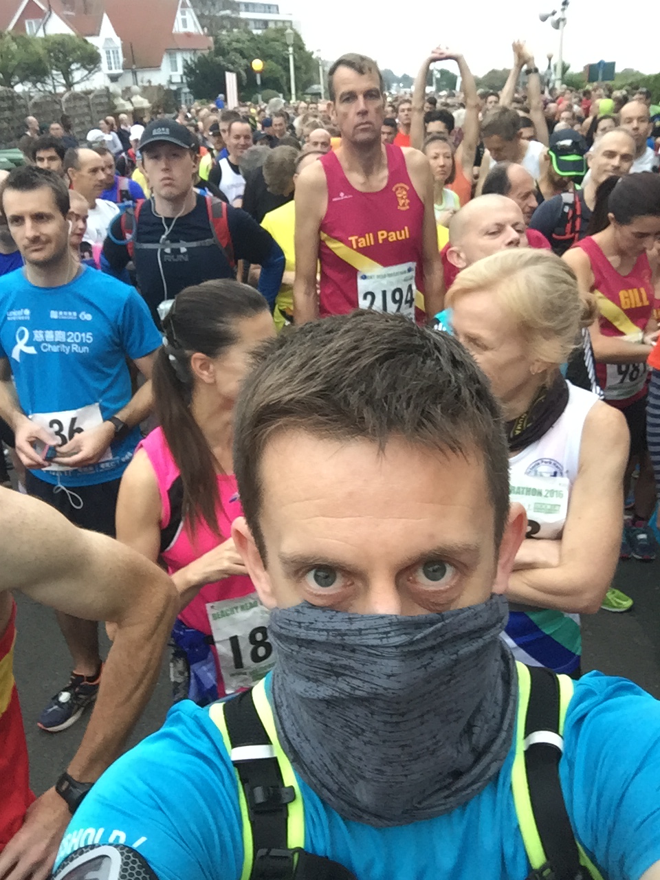
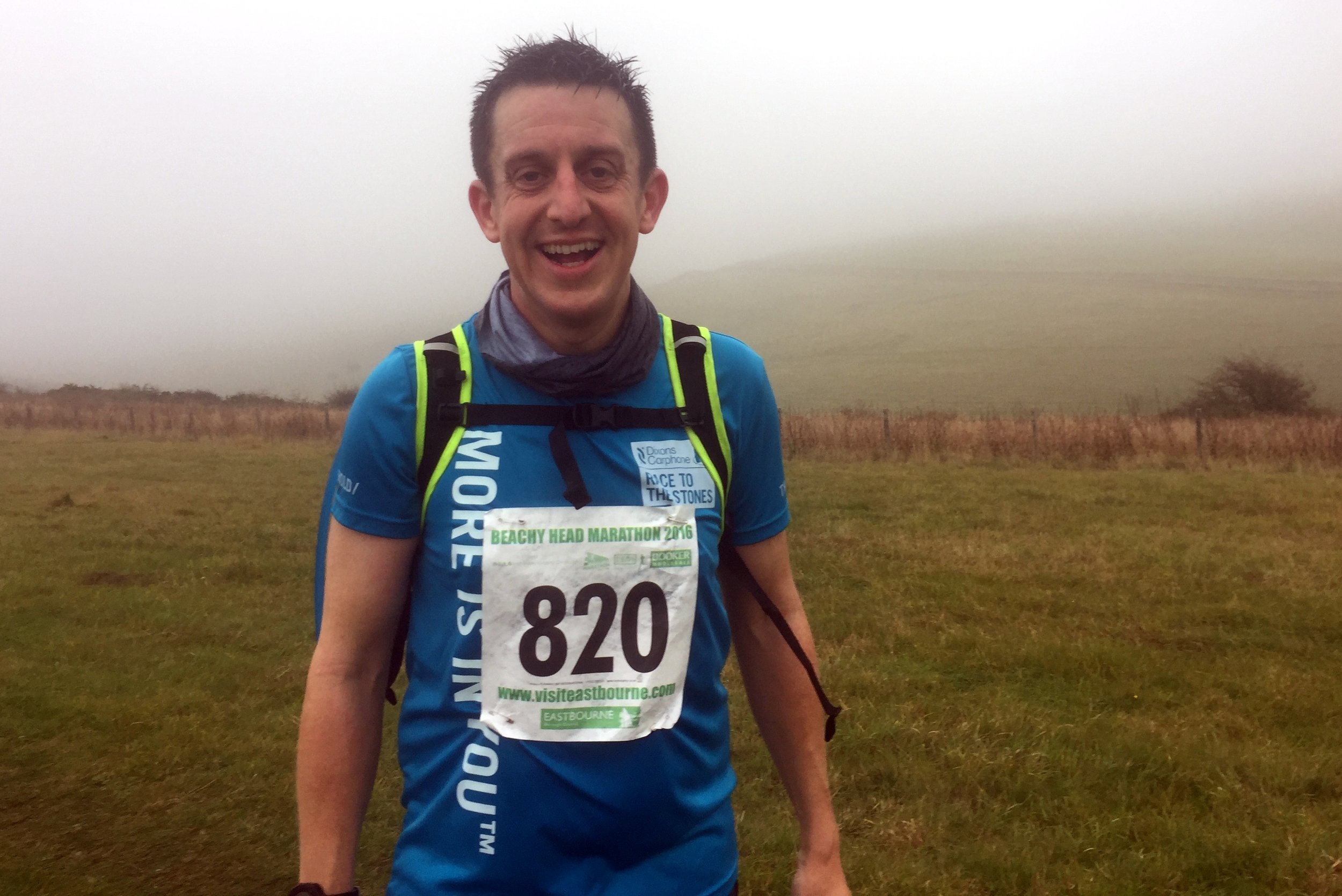
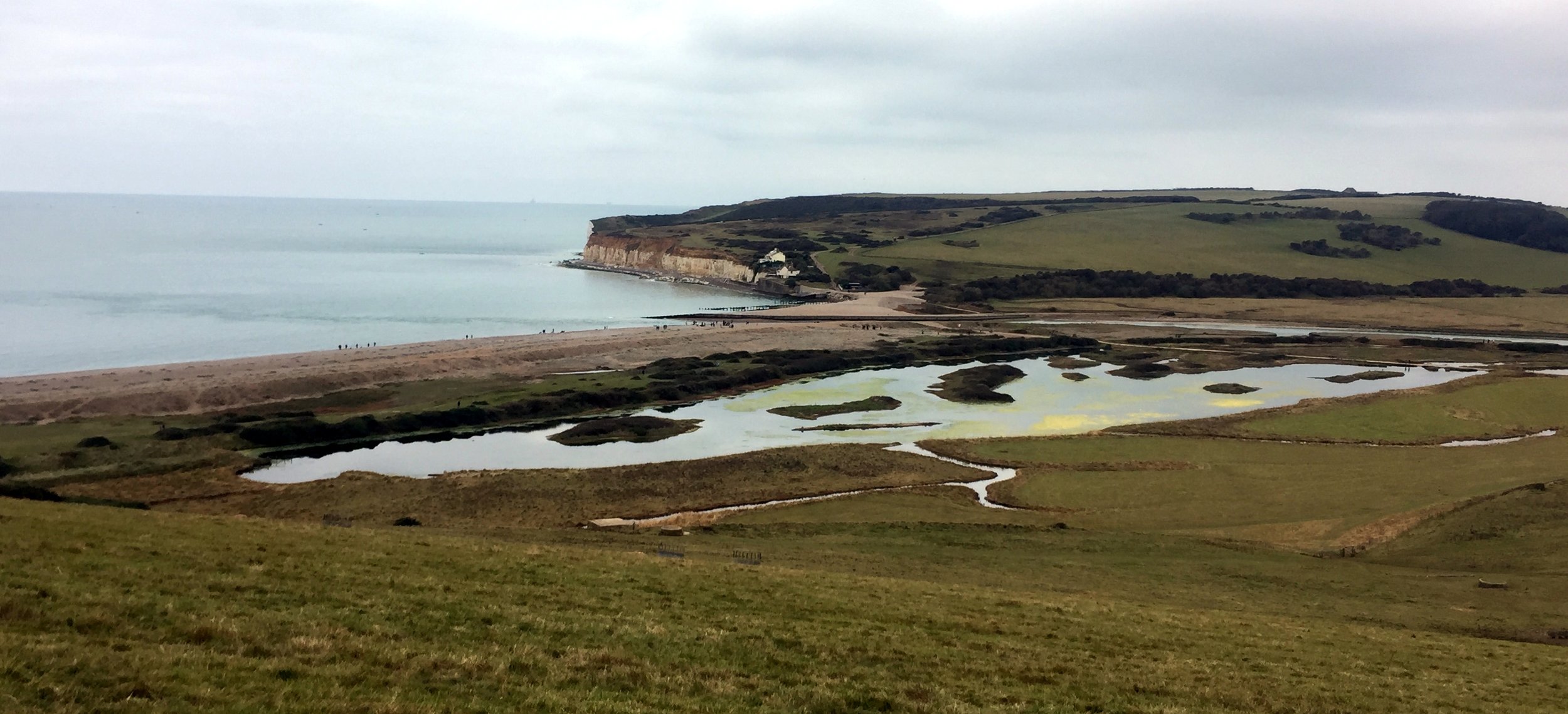
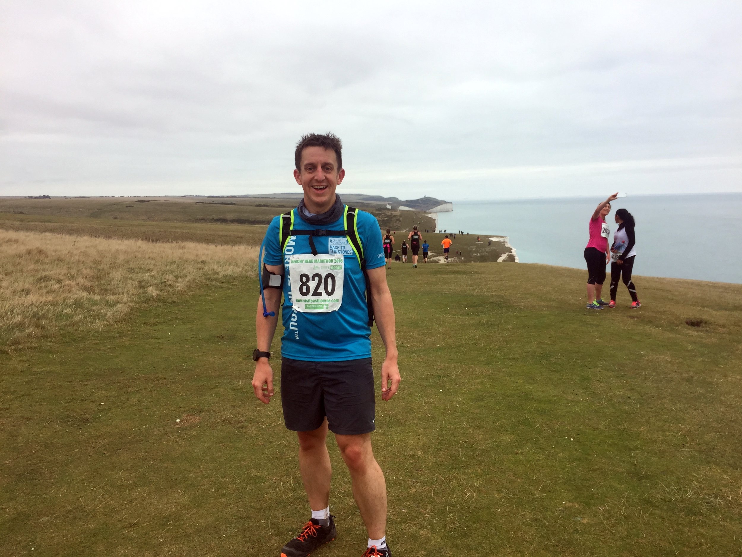
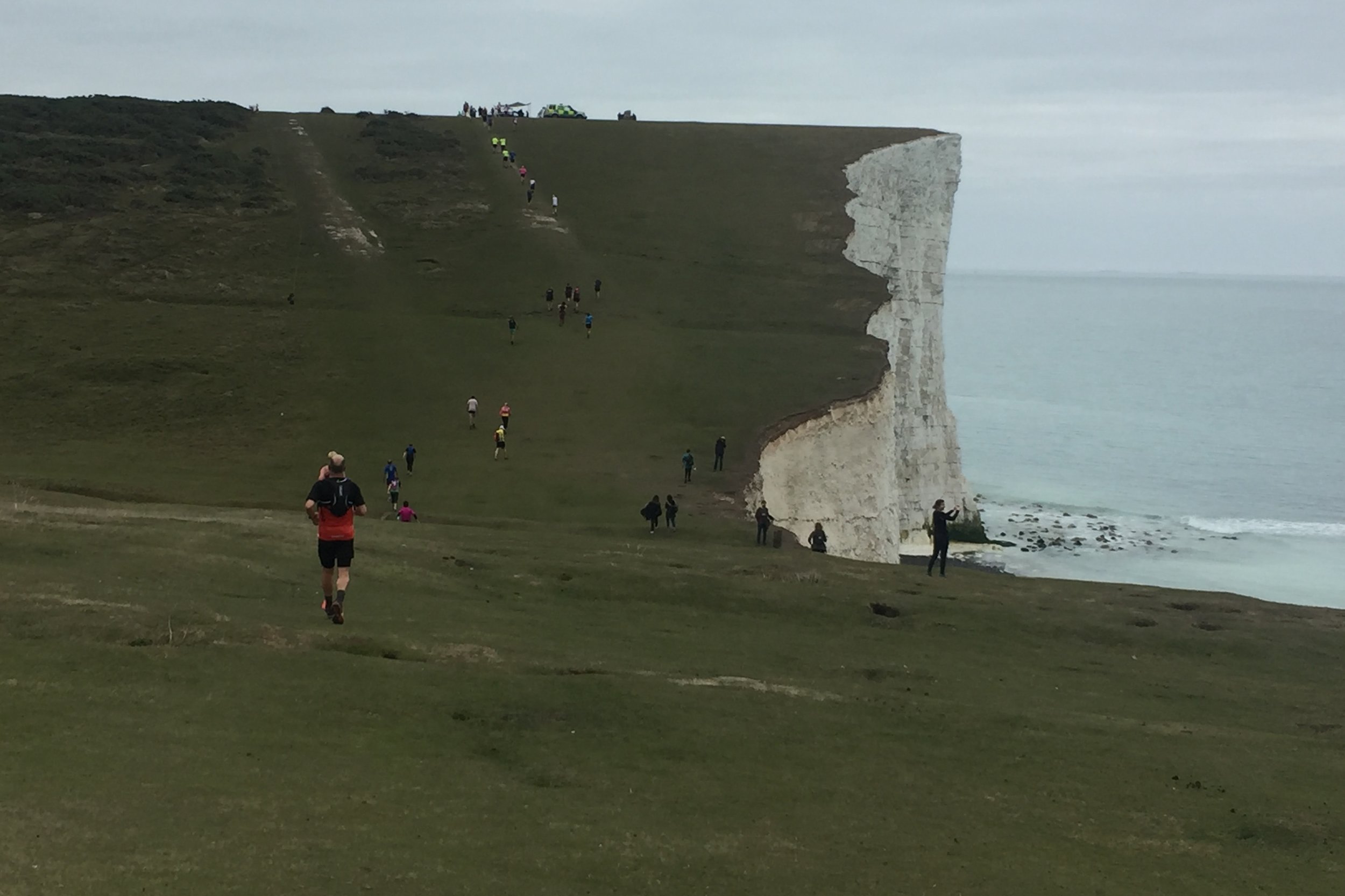
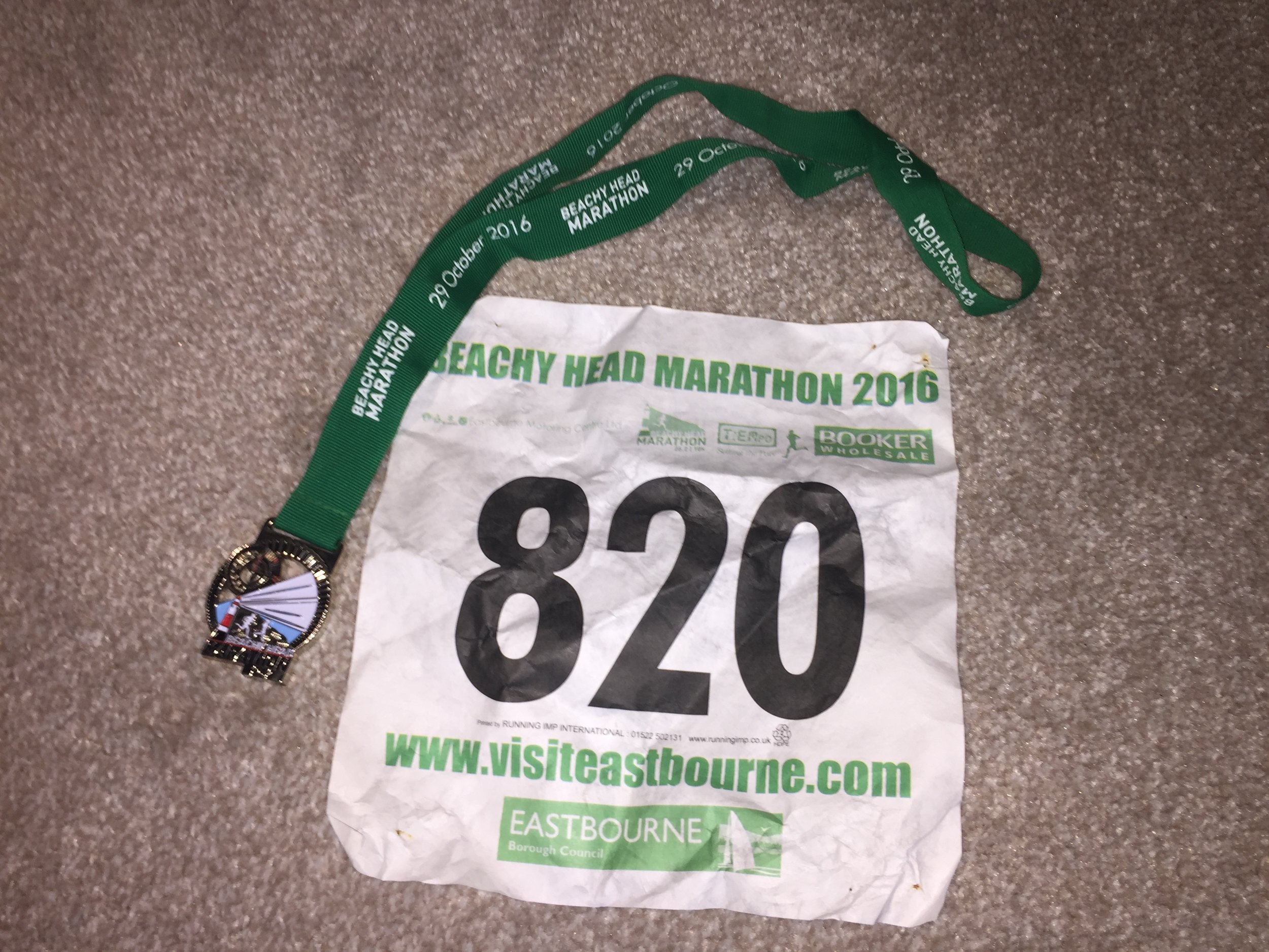
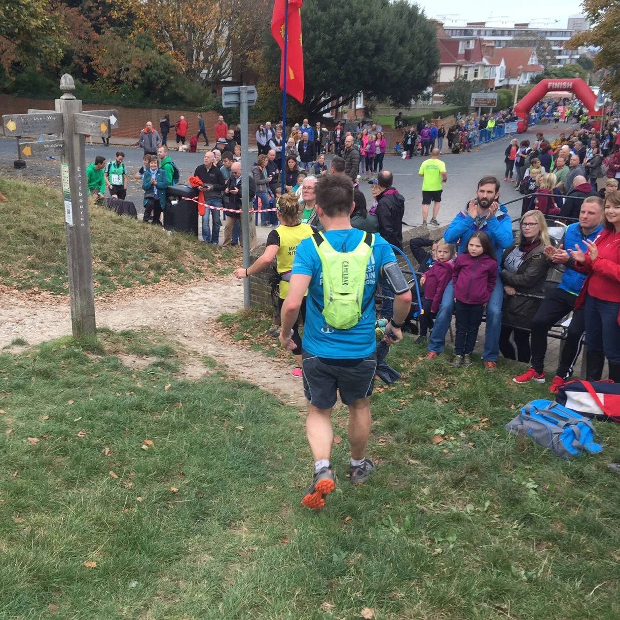
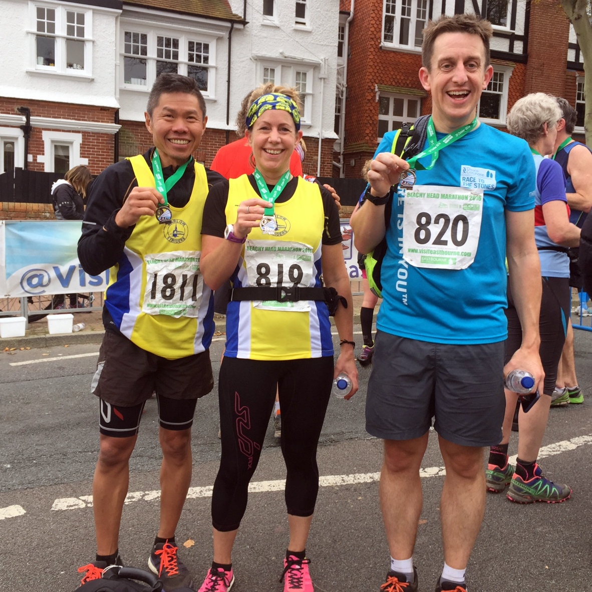
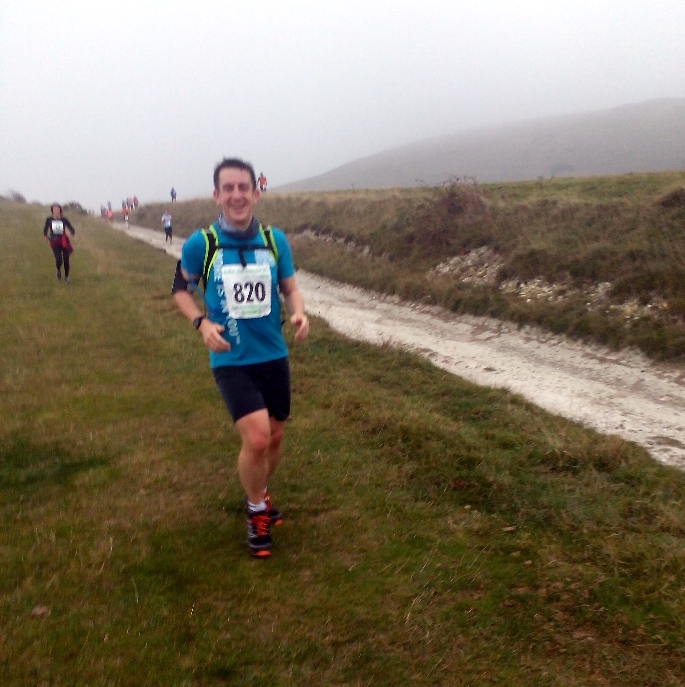
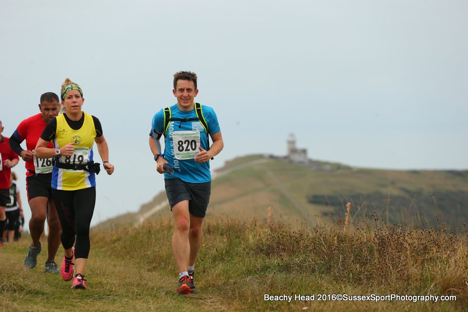
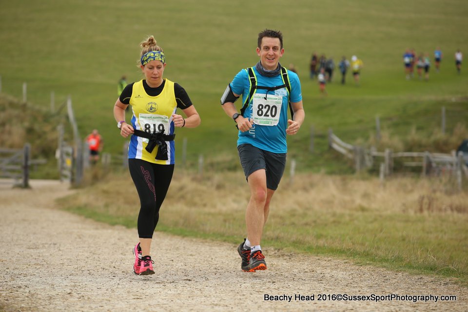
When: October 29th 2016
Where: Eastbourne
Course: Hilly! Mostly South Downs Way & other trails starting and ending at Bede's preparatory School in Eastbourne
Start & Finish: Bede's Prep School, Dukes Drive, Eastbourne, BN20 7XL
Distance: 42.2 km (26.2 miles)
Elevation change: +/- 1,099m
Other routes touched (walk): South Downs Way, Weald Way, Vanguard Way
Other routes touched (cycle): NCN 2
Finish time: 5:36
Links: Beachy Head Marathon, South Downs Way, Beachy Head, Eastbourne
When: October 2nd 2016
Where: Blenheim Palace, Oxfordshire, UK
Course: Country roads in and around the Blenheim Estate.
Other routes touched (walk): Wychwood Way
Other routes touched (cycle): None
Finish time: 1:58
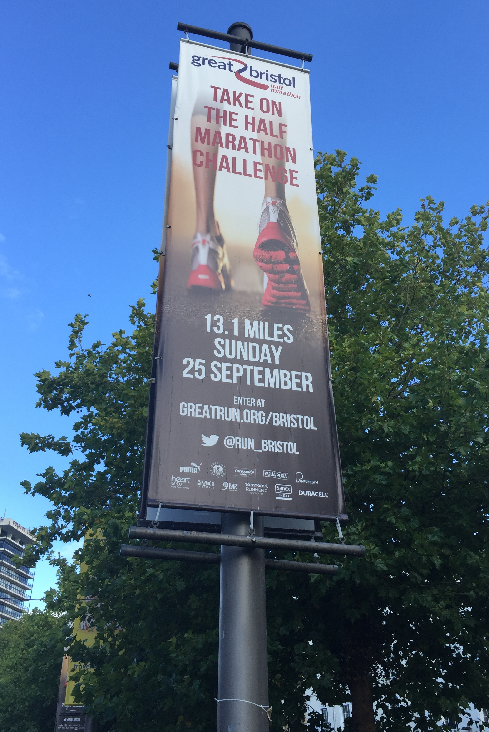
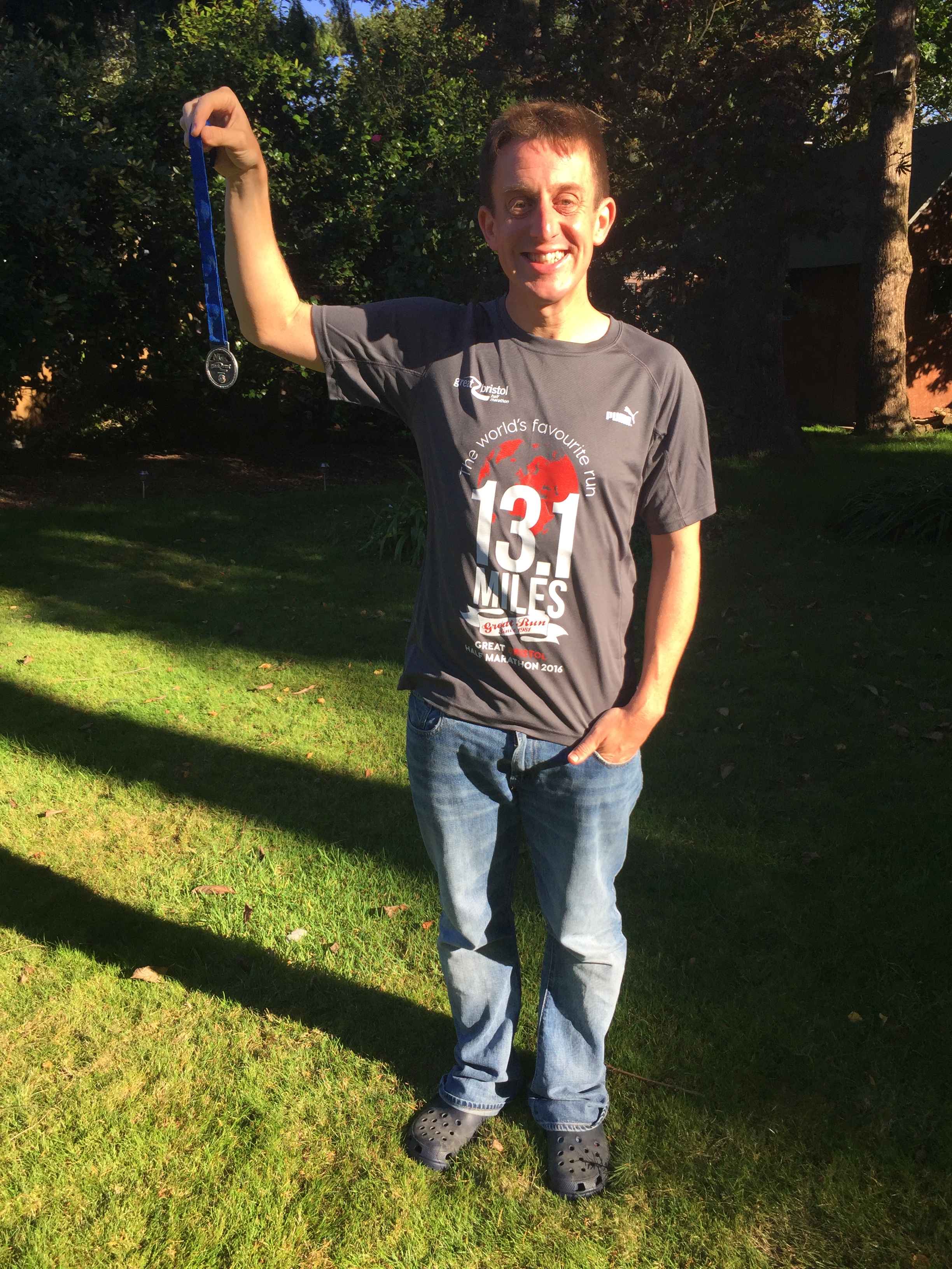
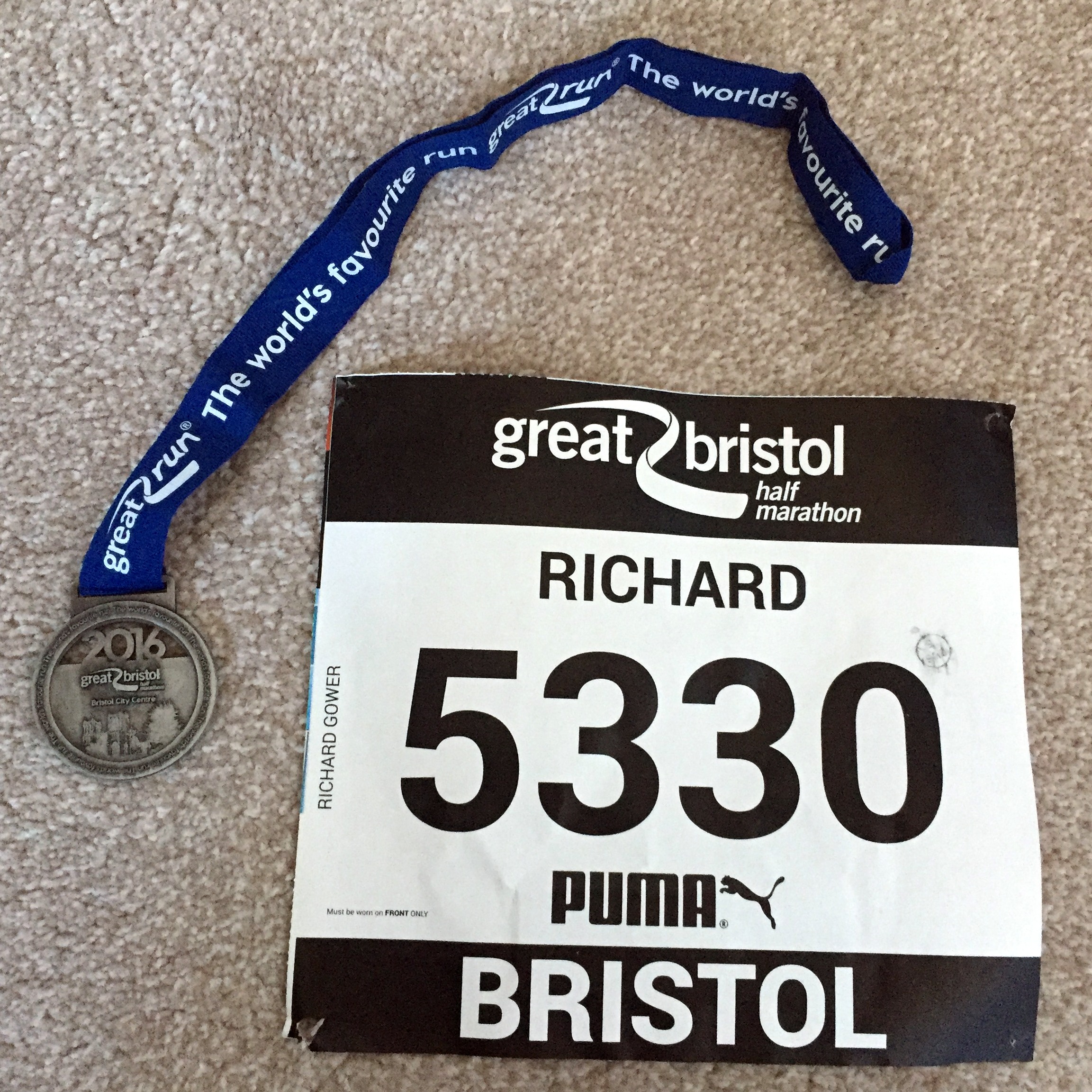
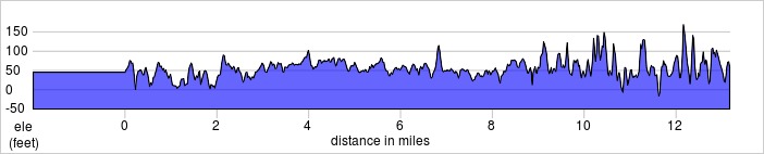
When: September 25th 2016
Where: Bristol City Centre and Avon Gorge, UK
Course: Nice flat course leading under the Clifton Suspension Bridge west along the Avon Gorge then the last 5 miles around the city. Had all sorts of weather from bright sunshine to wind and showers. Good start to the Autumn running season.
Other routes touched (walk): River Avon Trail, Bristol Triangular City Walk, Severn Way,
Other routes touched (cycle): NCN 3, 4, 33, 41
Finish time: 1:53

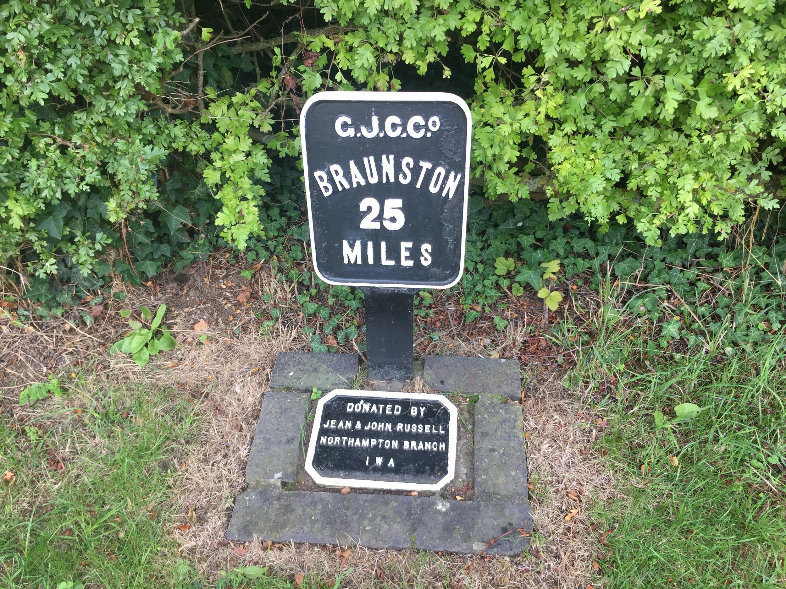
Braunston Marina
Start: Tongwell Street Car Park, Willen, Milton Keynes MK15
Finish: Braunston Marina, Brindley Quays, Braunston, Daventry NN11 7JH
Distance: 55.9 km (34.7 miles)
Elevation change: +249m / - 275 m / Net -26m
GPX File: get via Buy Me a Coffee
Other Routes Touched (Walk): Grand Union Canal Towpath, Jurassic Way, Nene Way, Macmillian Way, Midshires Way, Ouse Valley Way,
Other Routes Touched (Cycle): Hanslope Circular Ride. NCN 50, 6
OS Map(s):
- OS Explorer Map (222) Rugby and Daventry, Southam and Lutterworth
- OS Explorer Map (223) Northampton and Market Harborough
- OS Explorer Map (207) Newport Pagnell and Northampton South
- OS Explorer Map (192) Buckingham and Milton Keynes
This trip is the proof of what an obsessive completer-finisher I am. In April 2015 I cycled the Grand Union from Birmingham to London as a part of the training for the Land's End To John o' Groats trip. Well, not quite. Day 1: Birmingham to Milton Keynes was tough. It was ~80 miles with long stretches of thorn-covered grass. After several hours of fixing punctures we arrived at Braunston with not enough daylight or inner tubes left to get to Milton Keynes by canal. Instead we opted for the main roads to finish the final 35 miles. By day 2 the rest of the group had decided not to carry on so I finished the final stretch to London by myself. It bothered me that I'd missed a section of the canal. It didn't seem to bother anyone else so I ended up doing it on my own a year and a half later.
Greater obsessives would have had to start at Braunston and complete the journey in the same North-South direction. I wasn't too worried about that so I started at Milton Keynes, saving an hour of driving. It also gave me a chance to tick off Milton Keynes parkrun before the trip.
Milton Keynes has a reputation for being a pretty dull place, full of modern buildings and logistics centres. I've only really experienced it whilst running there or cycling through it and I actually like it. As a "New Town" it was designed in the 1960s with the car in mind, but it's also great for cyclists. Well designed cycle paths and underpasses mean you can get across town without fighting with cars like in other big towns.
The Grand Union passes near the centre and has good cycle paths next to it. That, however, quickly ends a couple of miles out and the towpath gets very narrow and grassy. It became very clear that we had made the right decision to avoid doing this part in the dark last time we were on the Grand Union.
Cosgrove, a nice village around 8 miles in, would have been a nice place to stop for a while. As I was on my own and on a mission I only stopped to take a photo of the 1790's bridge before pressing on.
1 mile from Cosgrove and the going got tougher as the path left the canal and diverted through some heavily rutted fields for another mile before returning at Isworth Farm. Looking back at the map now, I probably took the wrong side of the canal after Cosworth and missed a much easier section.
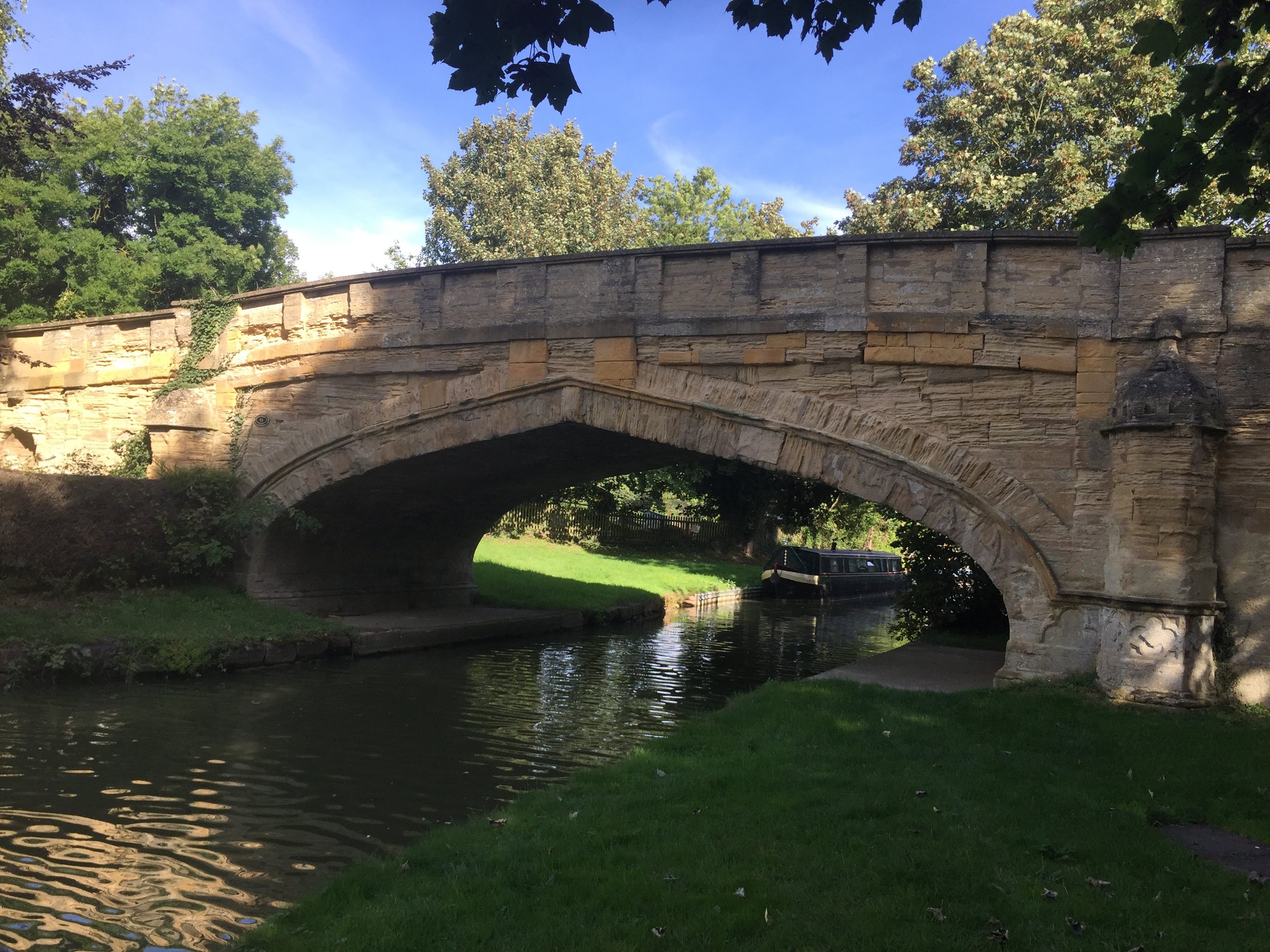
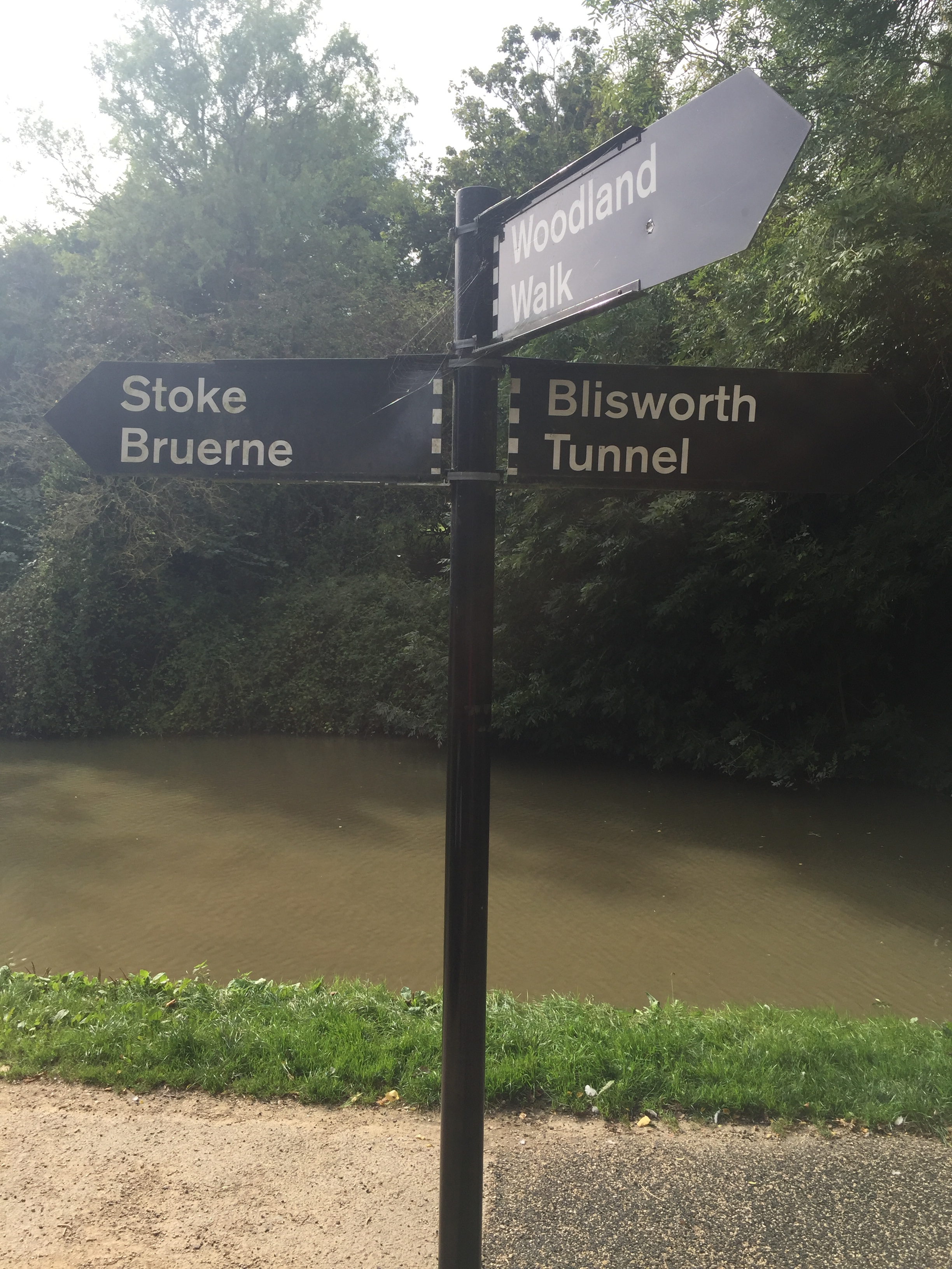
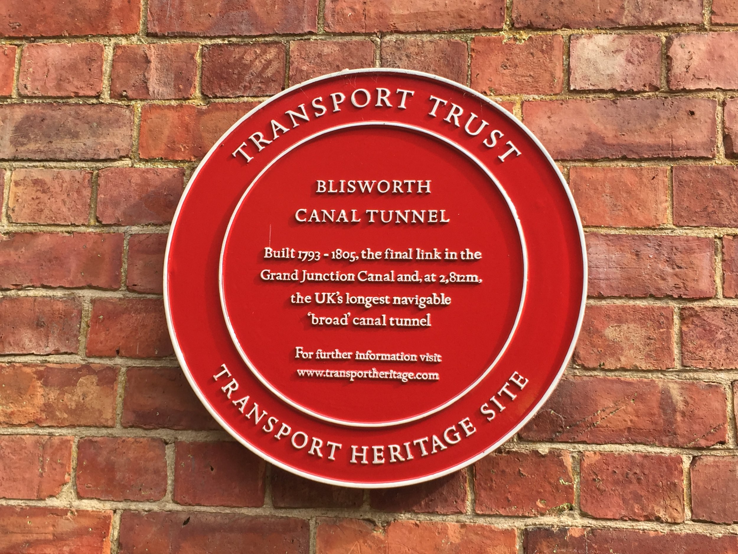
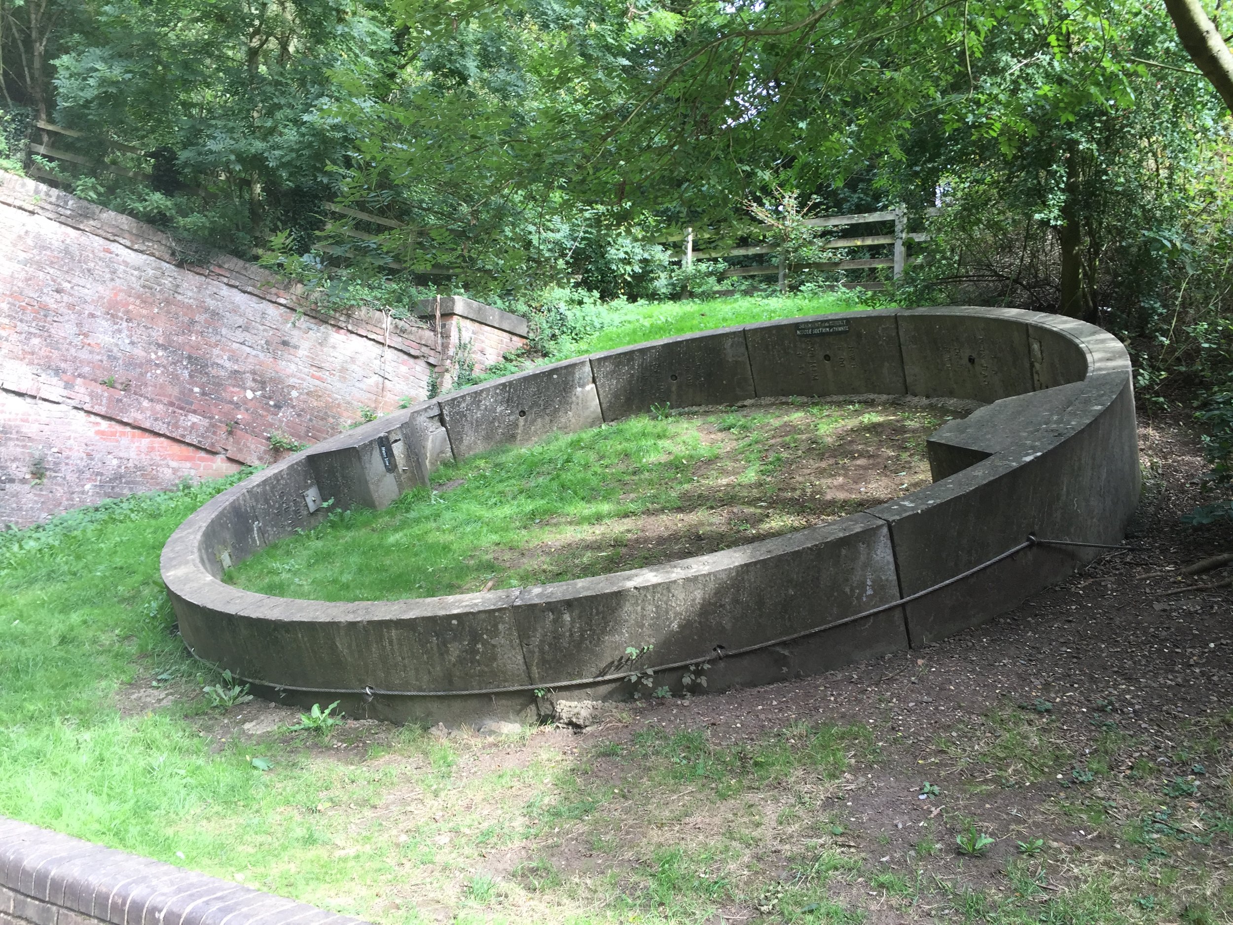
Around 15 miles from Milton Keynes the canal reaches the Blisworth Tunnel. It was built over 12 years from 1793 and connects Stoke Bruene to Blisworth 3km away. There's no towpath through the tunnel, so the cycle route takes a steep incline to the top of the hill and follows Stoke Road for about a mile before returning to the canal at the tunnel exit just south of Blisworth.
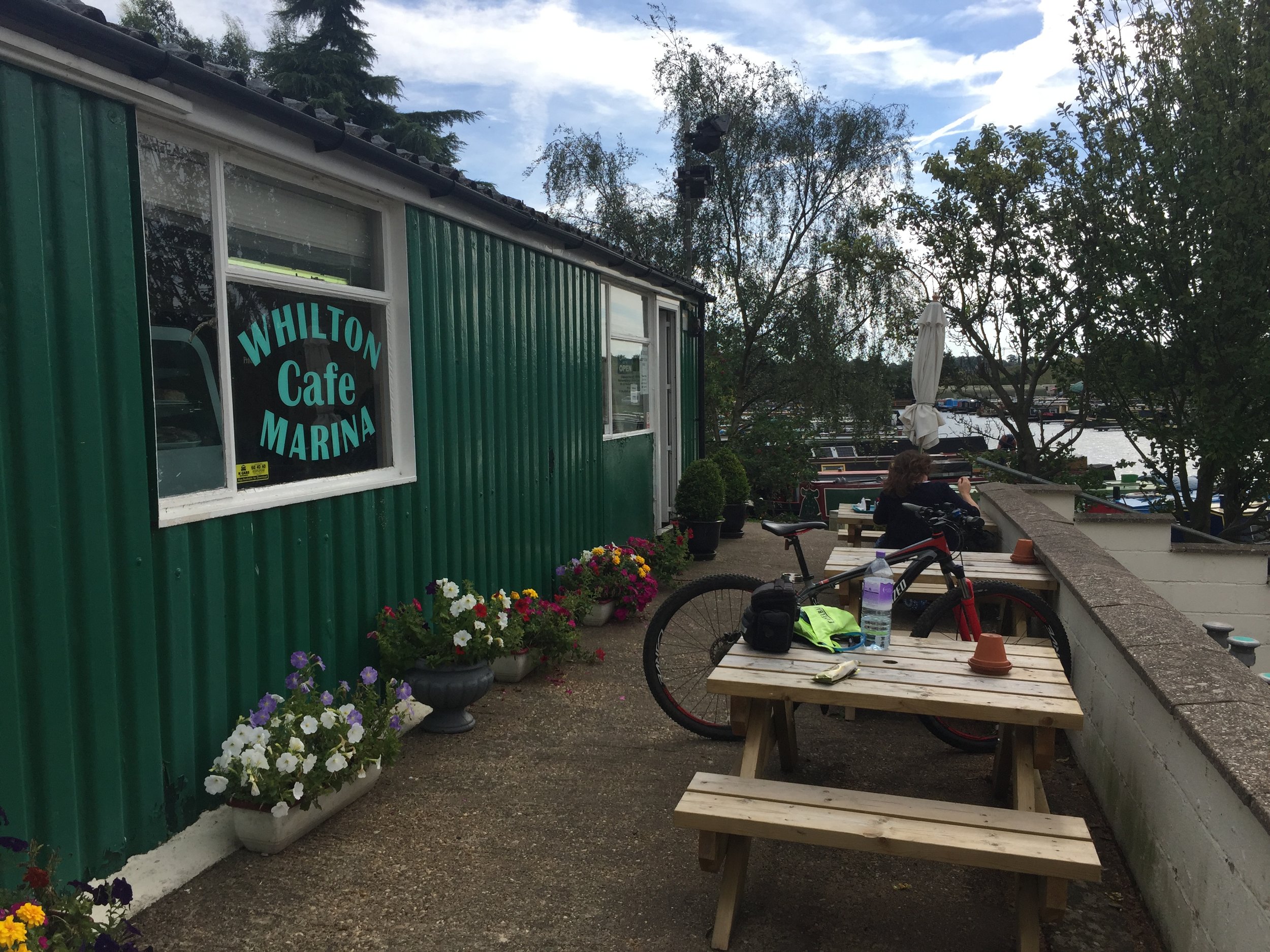
By now I was low on energy and starving so the Cafe at Whilton Marina was a handy place to stop. Squeezed in between the railway line, the canal and the M1, its not quiet or pretty, but still a nice quirky rest stop before the final push to Braunston.
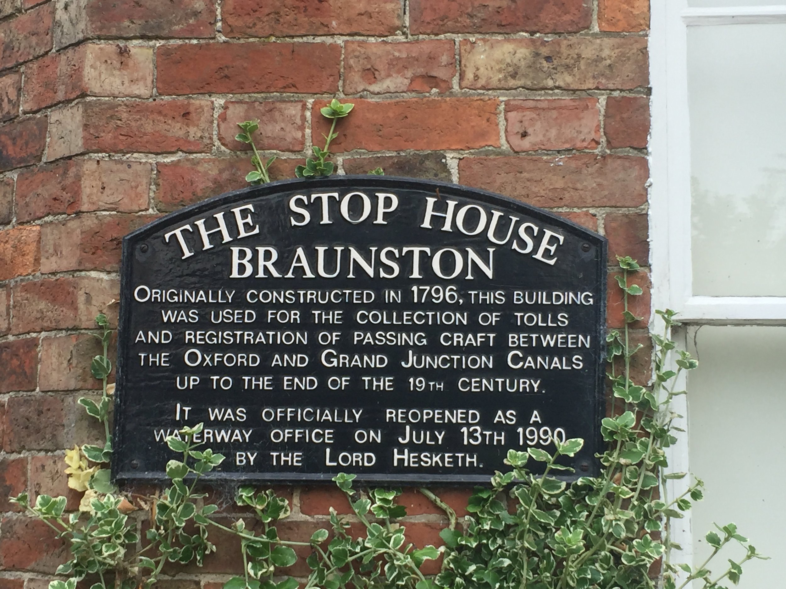
After passing over Braunston Tunnel, I reached my end point at Braunston Marina, finishing the missing link of the Grand Union adventure. Its a nice stretch of the canal with some interesting sections and I'm glad I made it back there to finish it off.

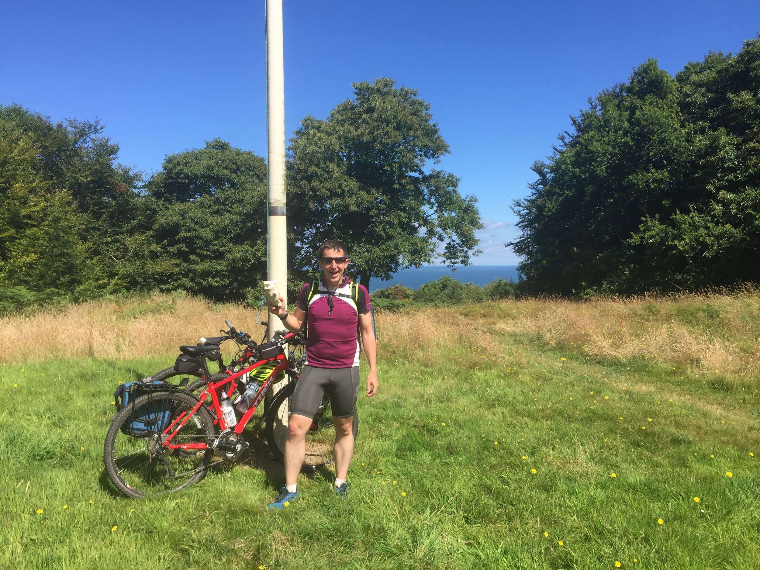
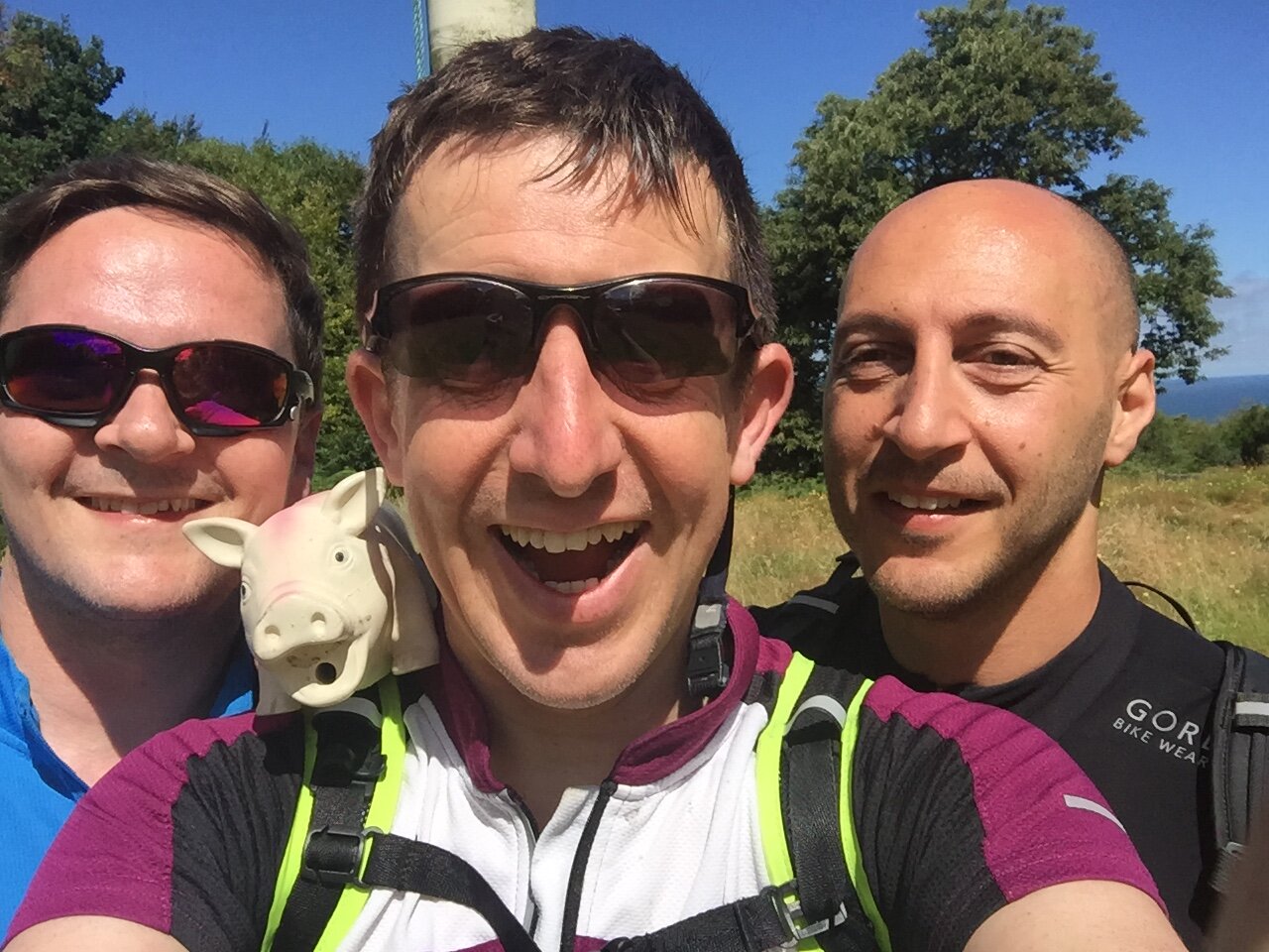
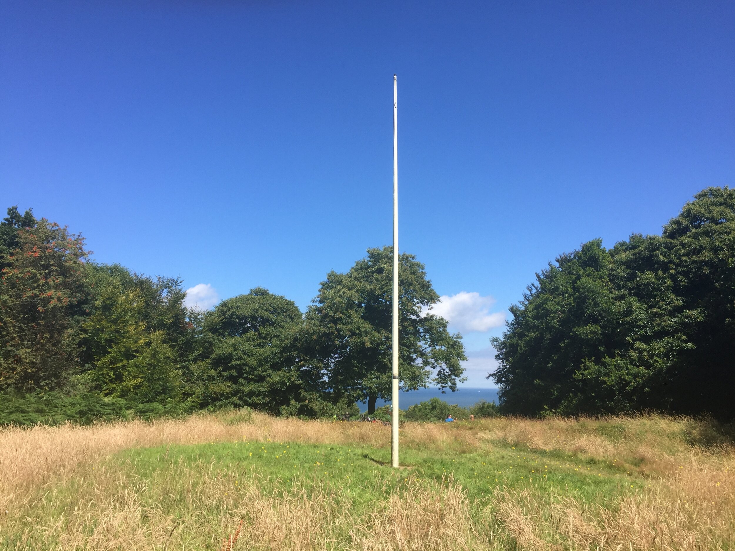
Significance: Highest peak in Norfolk (Historic County Top)
Parent Peak: Haddington Hill.
Nearest Higher Neighbour: Great Wood
Member of: N/A
Elevation: 105m
Date climbed: July 31st 2016
Coordinates: 52°55′30″N 1°15′05″E
GPX File: get via Buy Me a Coffee
Map: OS Explorer Map 252 Norfolk Coast East
Guidebook: The UK's County Tops (Jonny Muir), Walking the County High Points of England (David Bathurst)
Links: Wikipedia (Norfolk), Wikipedia (Beacon Hill), Peakbagger, Hillbagging
A few miles south-west of Cromer is Beacon Hill, the summit of a famously flat county and another on my list of Tops to be done as part of another adventure. We bagged Beacon Hill on a small diversion from our Peddars Way and North Norfolk Coast cycle trip. The summit is easily found as it’s marked with a huge flagpole on a clearing next to the National Trust Car park at Beeston Regis Heath. The bench near the summit was a nice place for us to rest, look out to sea and contemplate the final stage of the trip.