Walking In Madeira

Pico Ruivo Trail
Madeira had always been a place that we thought we would go to one day, but it was never high up on our travel list. Maybe its reputation as a retirement holiday destination had put us off. It turned out that it’s an ideal winter break location for us: warm in the winter and loads of great walking trails. We could have easily spent a month there discovering all the Levada routes. For now, we made a start on three day trip walks.
Trip1: Levada Dos Tornos
Start: Botanical Garden Cable Car, Caminho das Voltas, 15 Ilha da Madeira, 9060-329 Funchal
Finish: Casa Velha Do Palheiro, R. da Estalagem, 23 - São Gonçalo, 9060-415 Funchal
Distance: 9.5 km (5.9 miles)
Elevation change: +272m / -307m. Net -35m
GPX File: get via Buy Me a Coffee
Other routes touched (walk): Levada de Bom Sucesso, Caminho Rev. Padre Eugénio Borgonovo, Levada dos Tornos,
Other routes touched (cycle): None
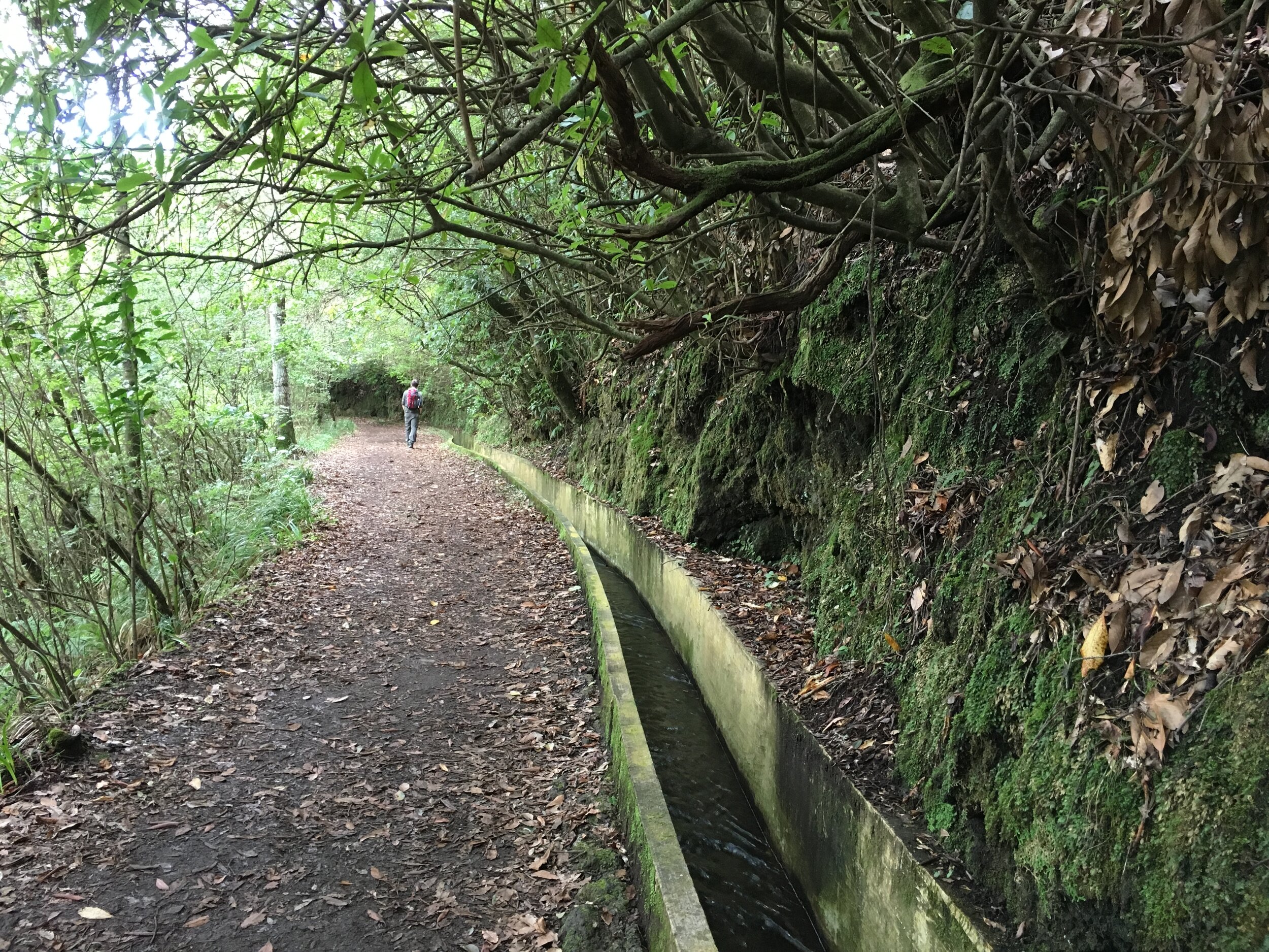
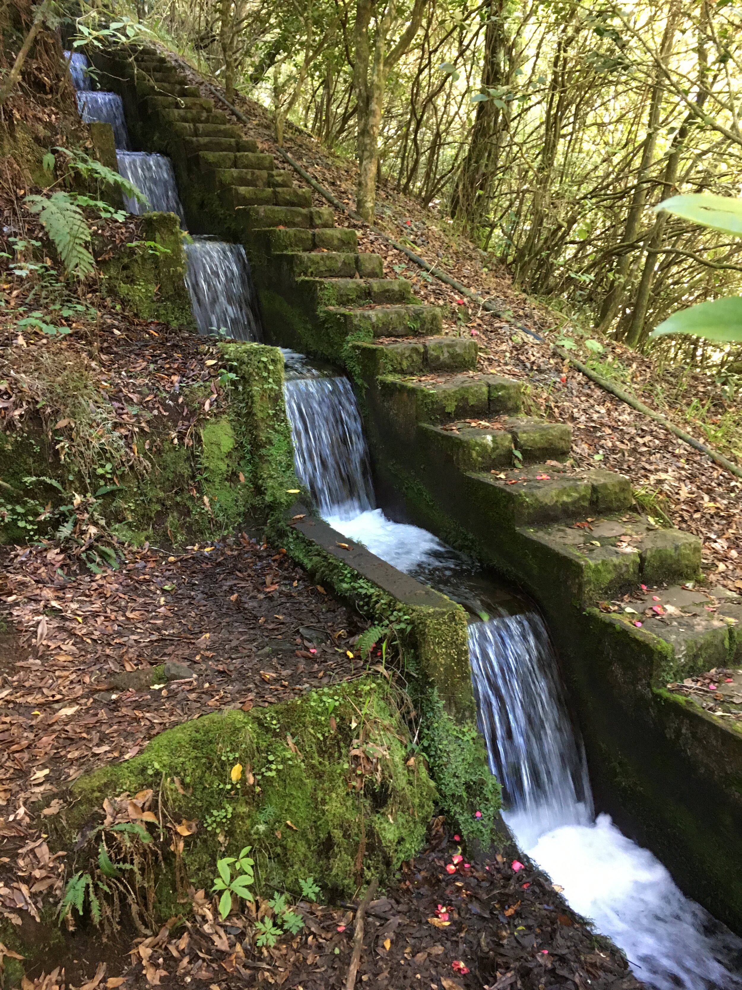
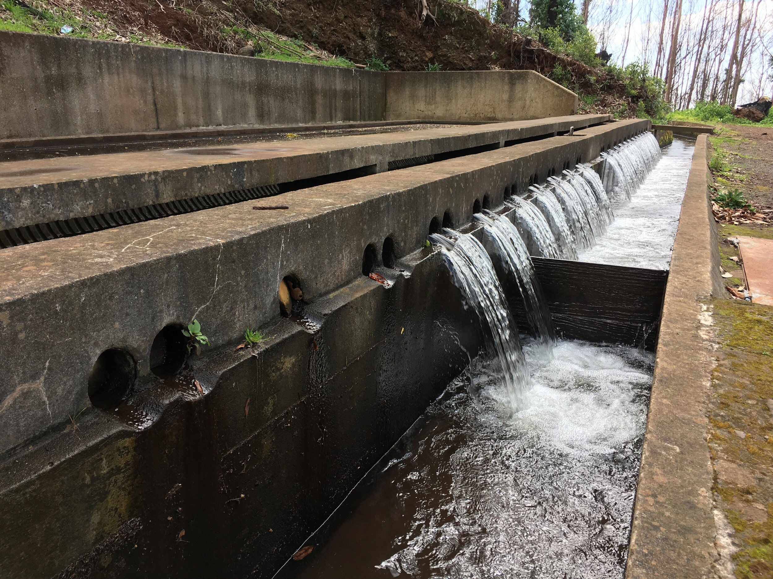
Like Tenerife, where I spent many childhood family holidays, Madeira has a north-south climate divide. The north and mountains get a lot of rain whilst the south is dry. Madeira solved this by laying over 2000 km of miles of drainage canals. These take the water down to the south where it's used both for irrigation and drinking water. Funchal, the capital, is positioned at the confluence of a few of the larger Levadas as they reach the sea.
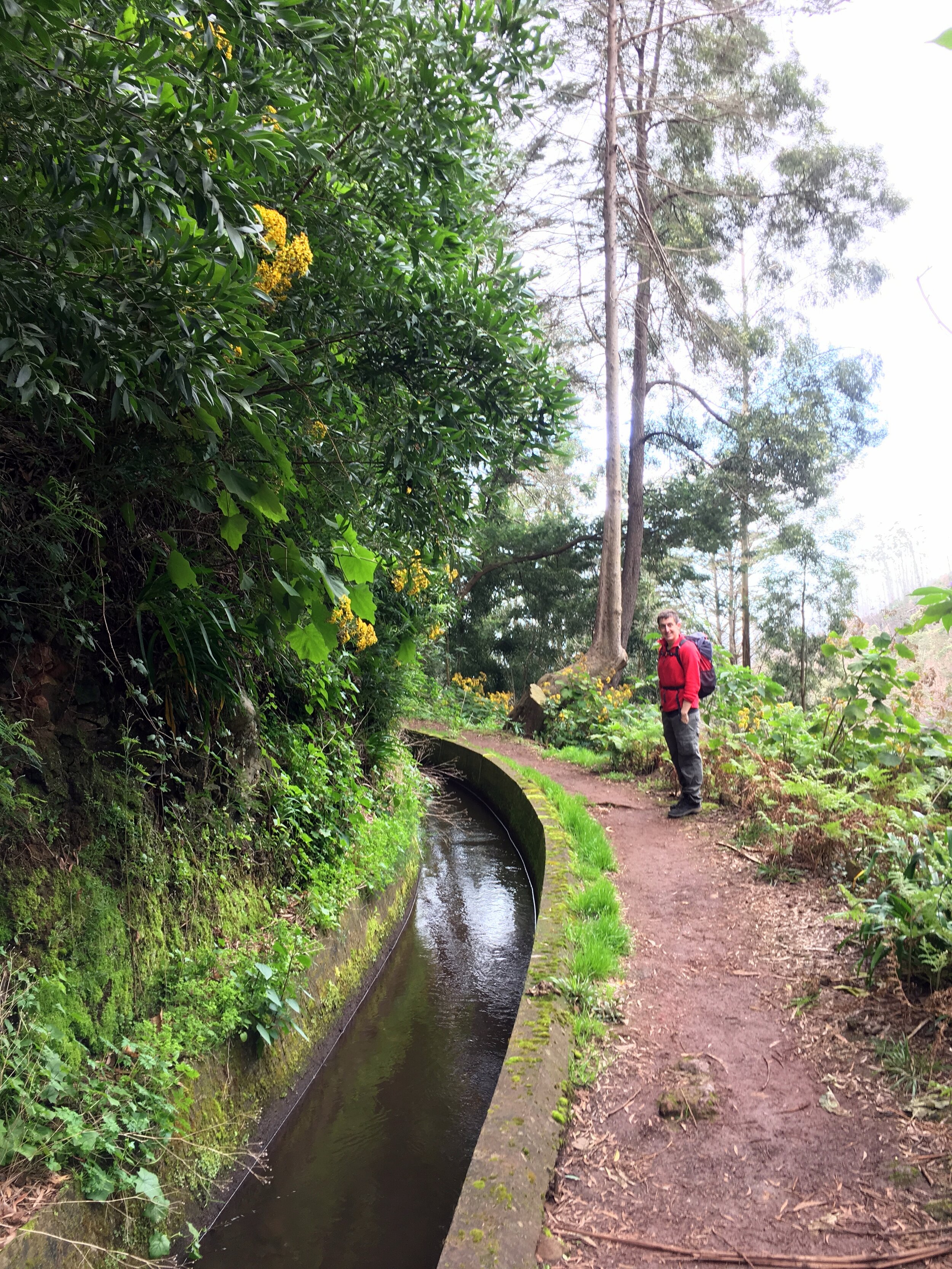
As a warm up for longer more adventurous hikes later in the week, we set off to do the Levada dos Tornos. This one is very easily accessible from Funchal. The start is about 10 minutes walk from the top of the cable car station that connects the Old Town to Monte and its Botanical Garden.
The thing we'd wish we had known about was that the start of the Levada walk was closed due to a huge forest fire in the summer of 2016. Signs at the bottom of the cable car would have been helpful. Obviously, no one had thought to warn people before spending 10 euro each to get to the top. We considered bypassing the barrier and giving it a go, but the locals at the cafe near the top were adamant that it would be a bad idea. Apparently someone had died attempting and several others had to be rescued. An enterprising taxi driver came to the rescue by offering us a ride to the other side if the valley for "only" 20 euro. As a ride back on the cable car would have cost the same, it seemed like a good option.
We started the walk at Choupana where the road crosses the Levada. This was the site of the Choupana Hills Resort, once a 5 star spa hotel which was completely destroyed in the fire. The diversion cut off the dangerous part, shortening the walk by an hour.
Immediately leaving the road you see the effects of the fire with trees barely clinging to life and others reduced to charred stumps. Villas and hotels that backed onto the Levada are now burnt out ruins. Look up and you can see the giant football stadium perched high up on the hill. It's one of the weirdest locations for a stadium, accessible only by steep, winding local roads.
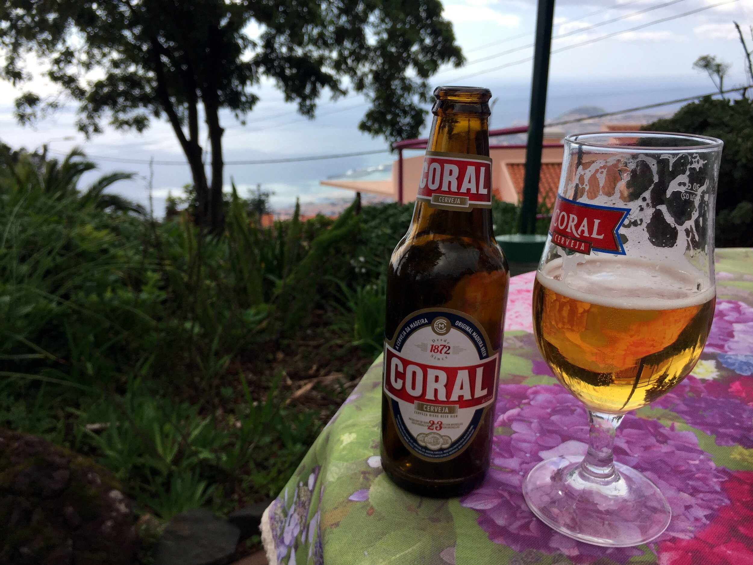
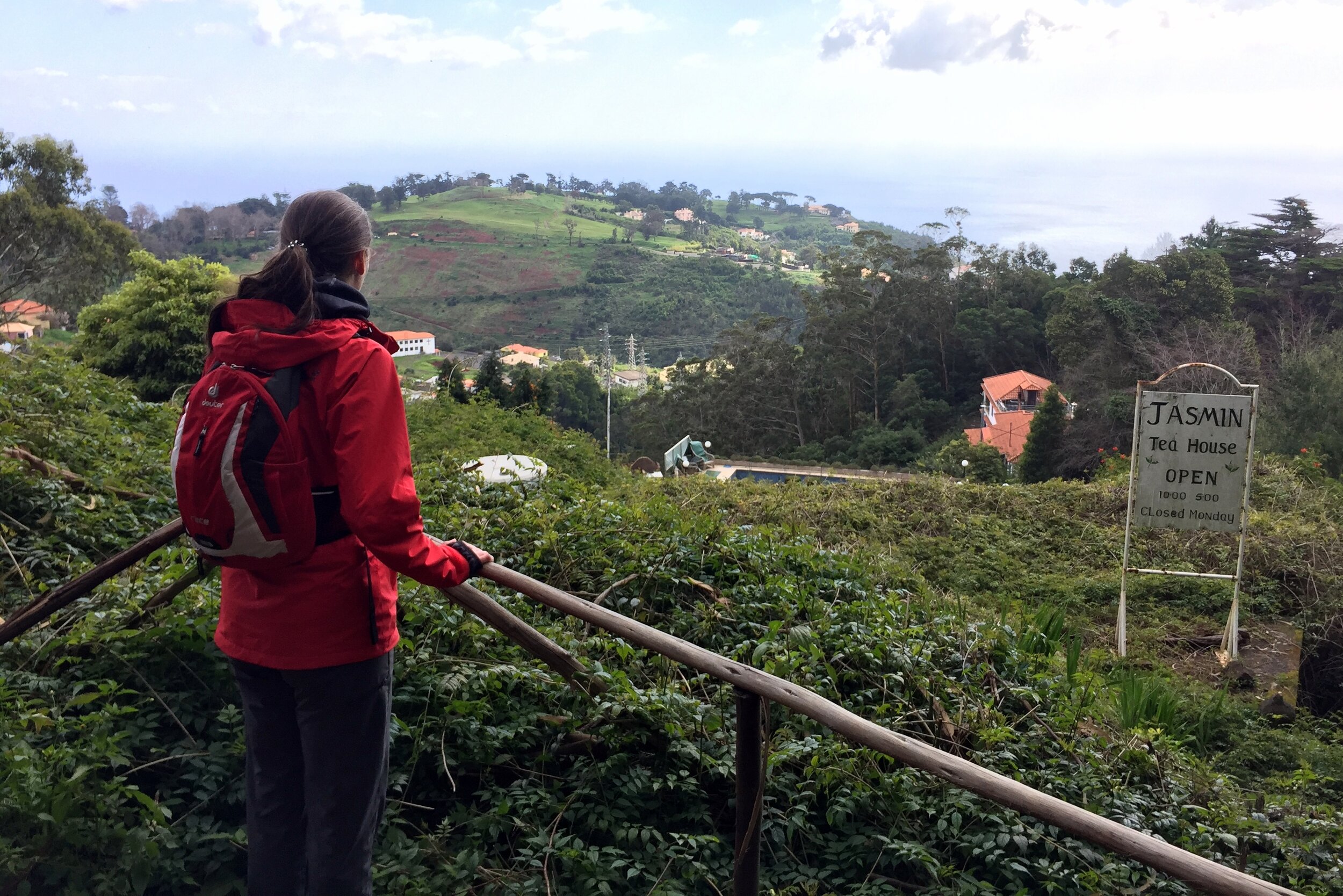
One mile in and we reached the Hortensia Tea House. It's well situated for the full hike from Monte but felt a bit early for the reduced trip. We stopped anyway: we were on holiday so we didn't need much excuse for a cake, a beer and a nice view down to the coast.
The rest of the walk is a further 40 minutes down to Palheiro Gardens. This is part of a large privately owned estate which also has a golf course and 5 star hotel. It's a pleasant, quieter alternative to the bustling Botanical Gardens back at the cable car station.
We ended the trip at the hotel at the lower end of the gardens, taking a taxi back to the city. It would have been another hour to walk to the centre, but we opted for a nap and an early dinner instead.

Trip 2: Pico Ruivo
Start: Parque de Estacionamento Pico do Areeiro
Finish: Rua Dr. João Abel de Freitas, Médico 6, Santana
Distance: 8.6 km (5.3 miles)
Elevation change: +493m / -708m. Net -215m
GPX File: get via Buy Me a Coffee
Other routes touched (walk): PR1 Vereda do Areeiro, PR1.2 Vereda do Pico Ruivo, Vereda da Ilha, Vereda da Faja da Nogueira,
Other routes touched (cycle): PR03a, PR17
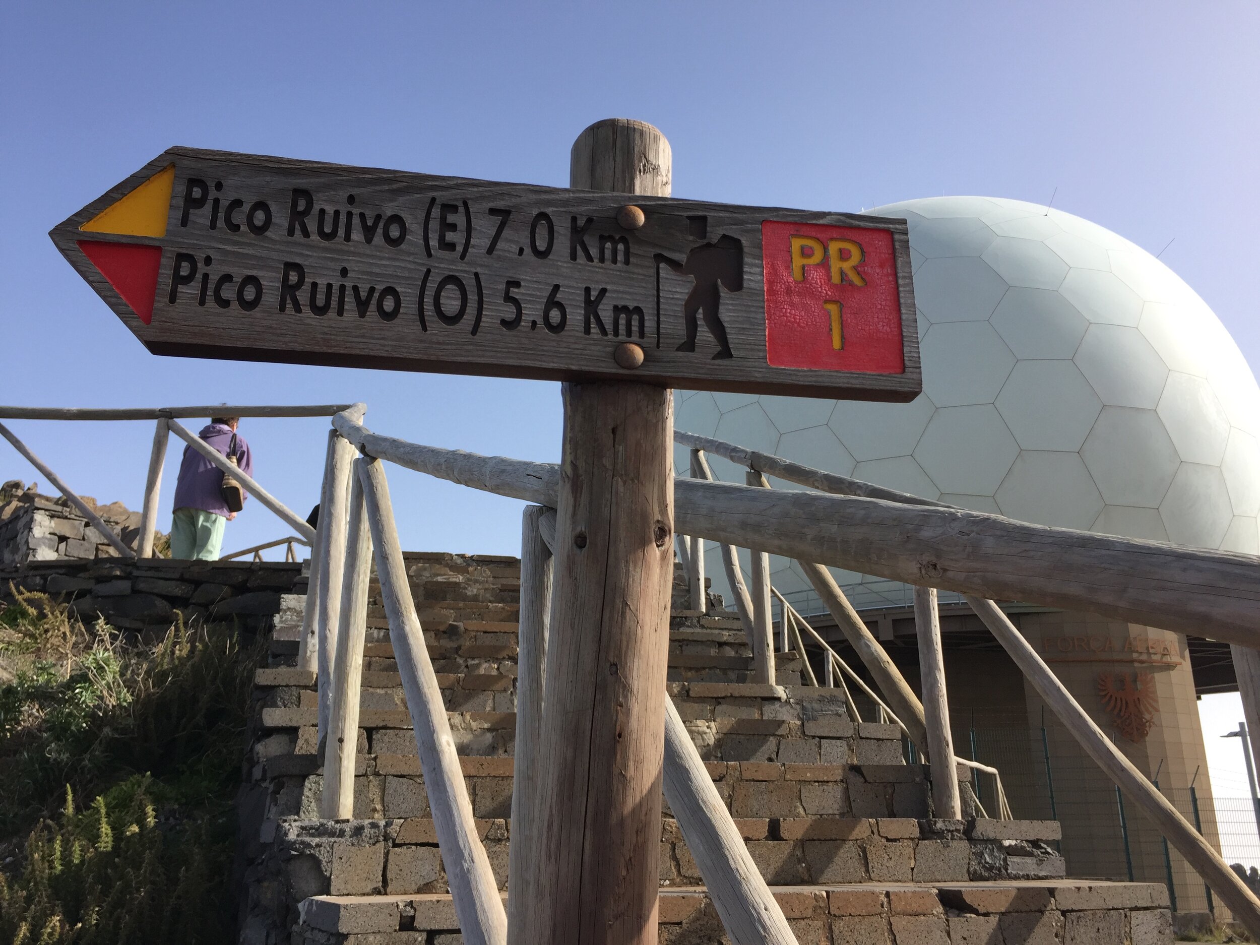
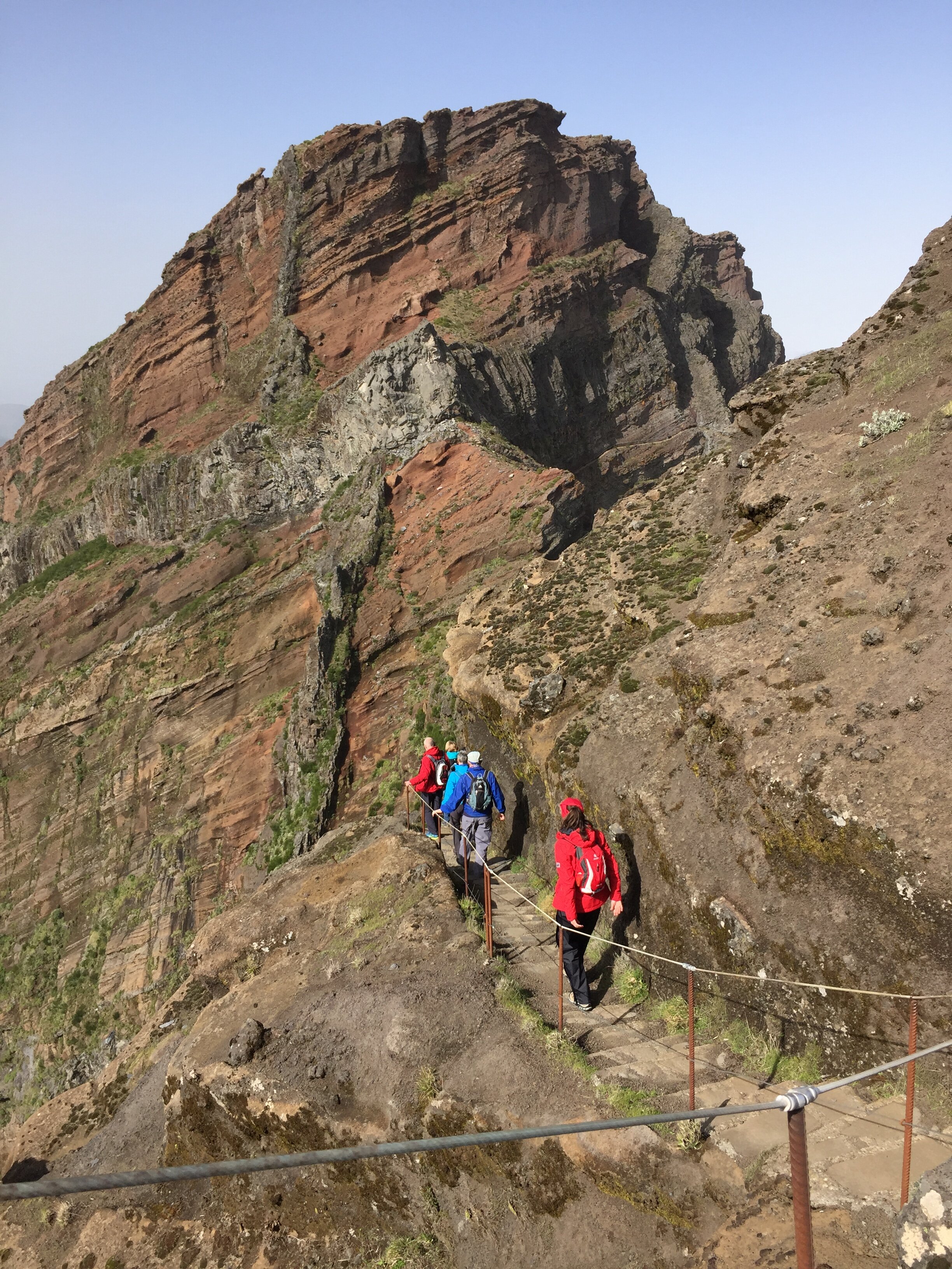
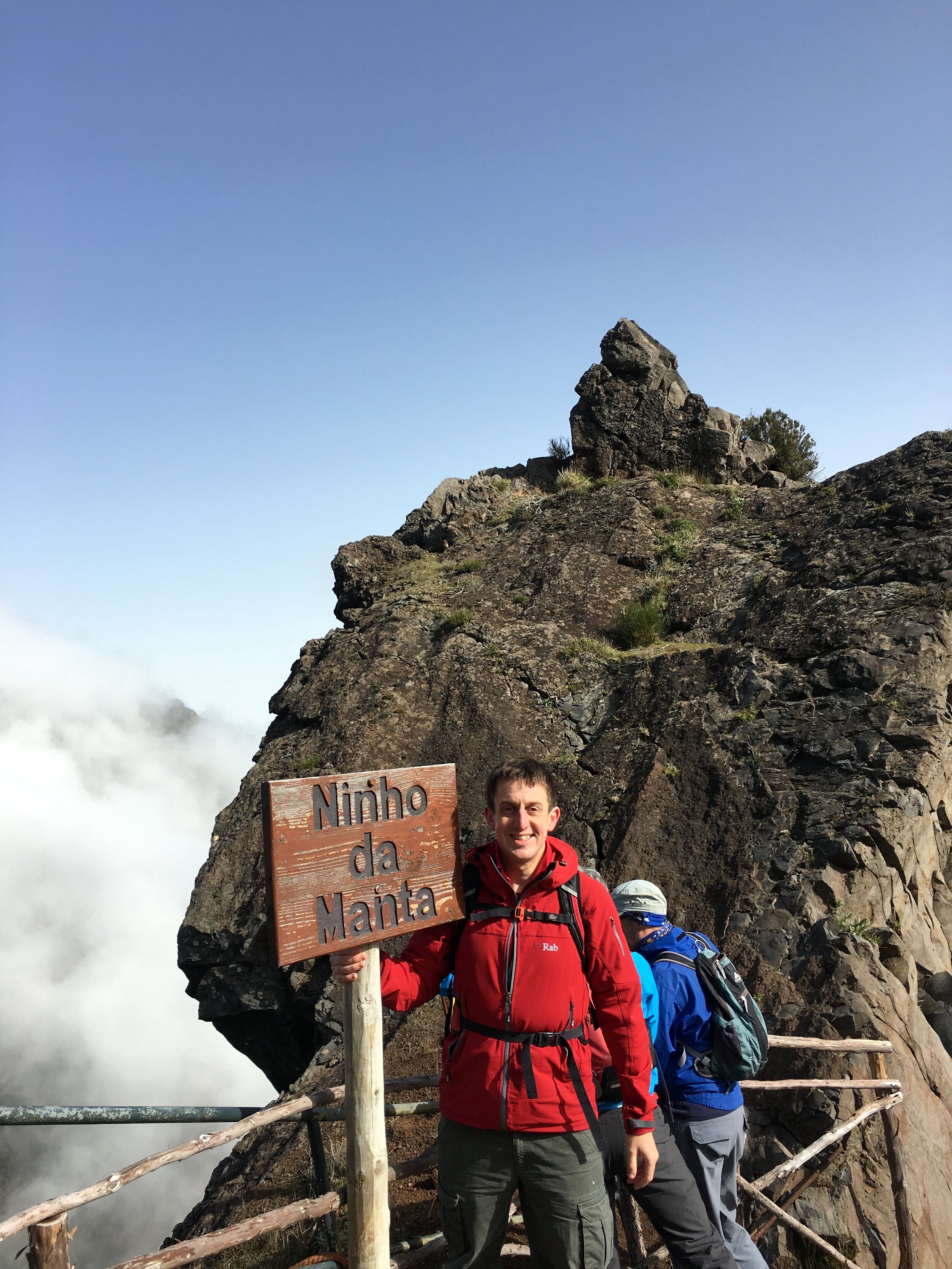
This was the highlight of our winter break in Madeira. Billed as the Madeira Three Peaks, it actually reaches the summits of the 1st and 3rd highest points on the island. The 2nd highest point was previously accessible but a land slip in 2016 has closed the path so the route now follows tunnels through Pico das Torres.
We chose to do the trek as a guided walk with Madeira Explorers. For the 2 of us it was only 20 euro more than hiring a car for the day and it solved the logistical issue of a point to point walk.
The route starts at Pico do Areeiro, the 3rd highest peak. You can drive all the way to the top where the summit is marked by a stone pillar behind the military "golf ball" radar station. From here the route descends gradually to a lookout point.
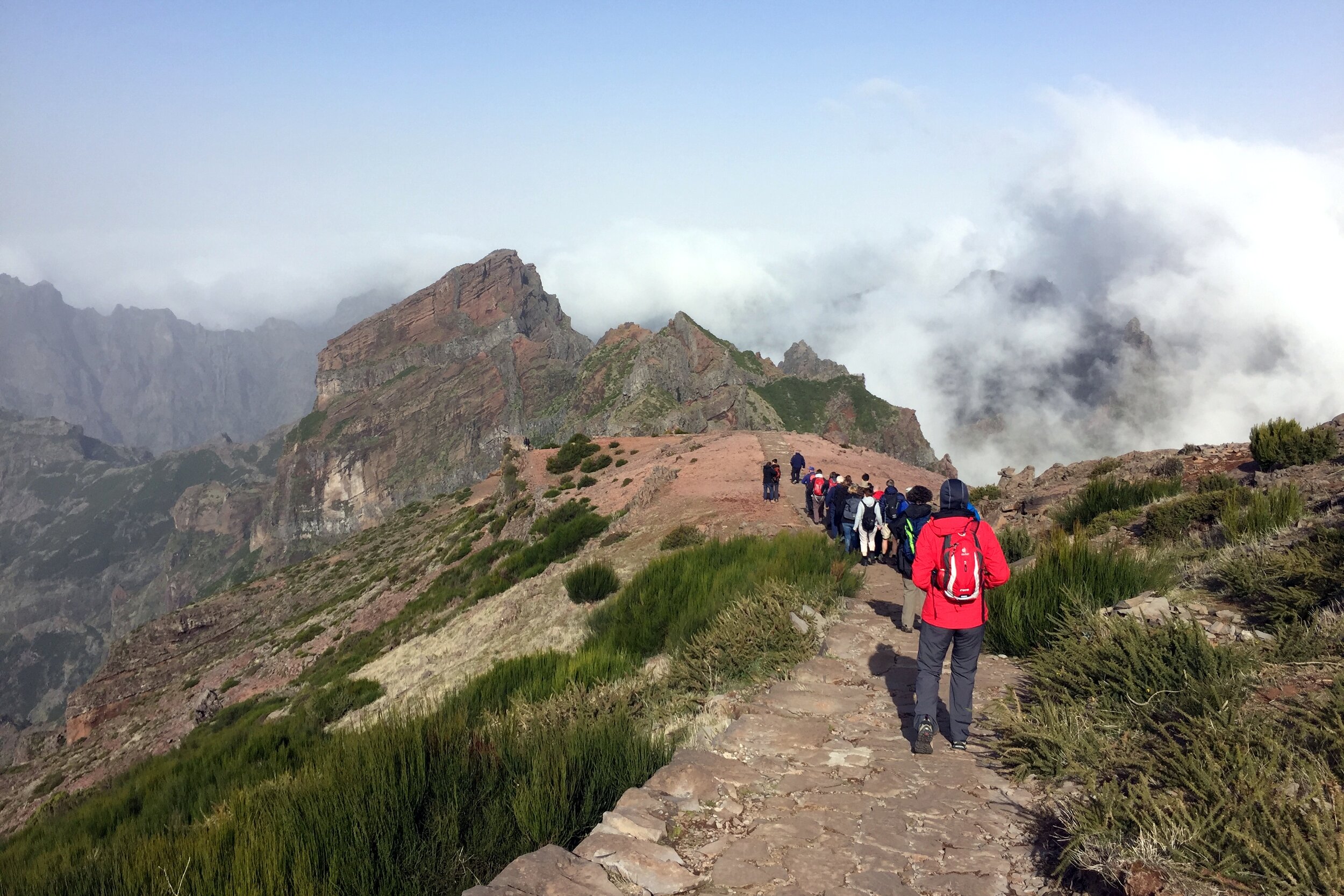
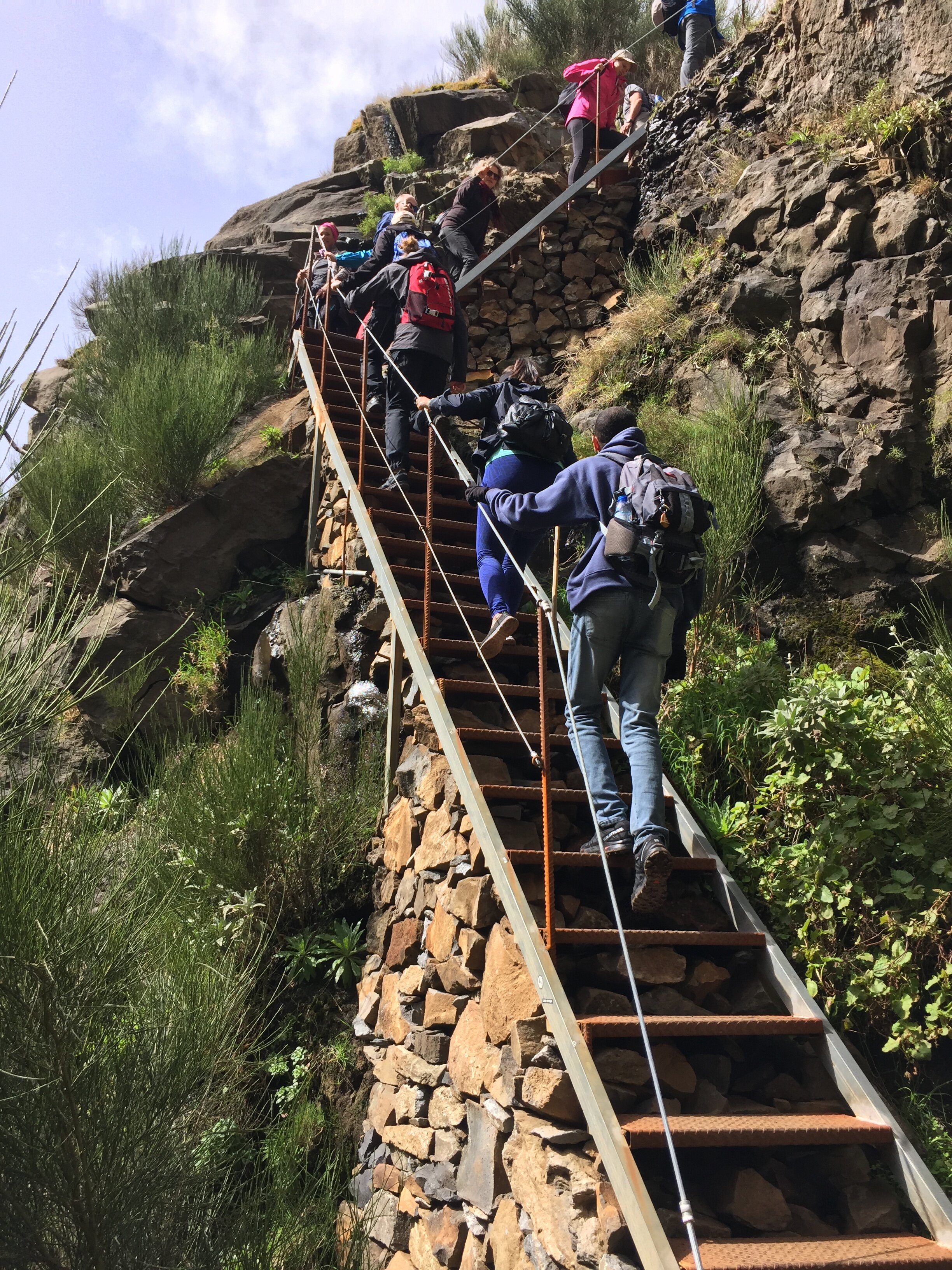
The stone path is well made and maintained. It's also exceptionally clean for a route that gets so many visitors. Much of the path also has strong cable handrails on the steep or exposed sections. Be careful though as some are loose or broken. Even without them it's not an especially dangerous walk.
Around an hour in, you pass the junction to the closed path leading up to the top of Pico Torres. Avoiding this, the routes continues and enters Pico de Gato Tunnel, the first of three on the trip. This is the longest one at about 100m.
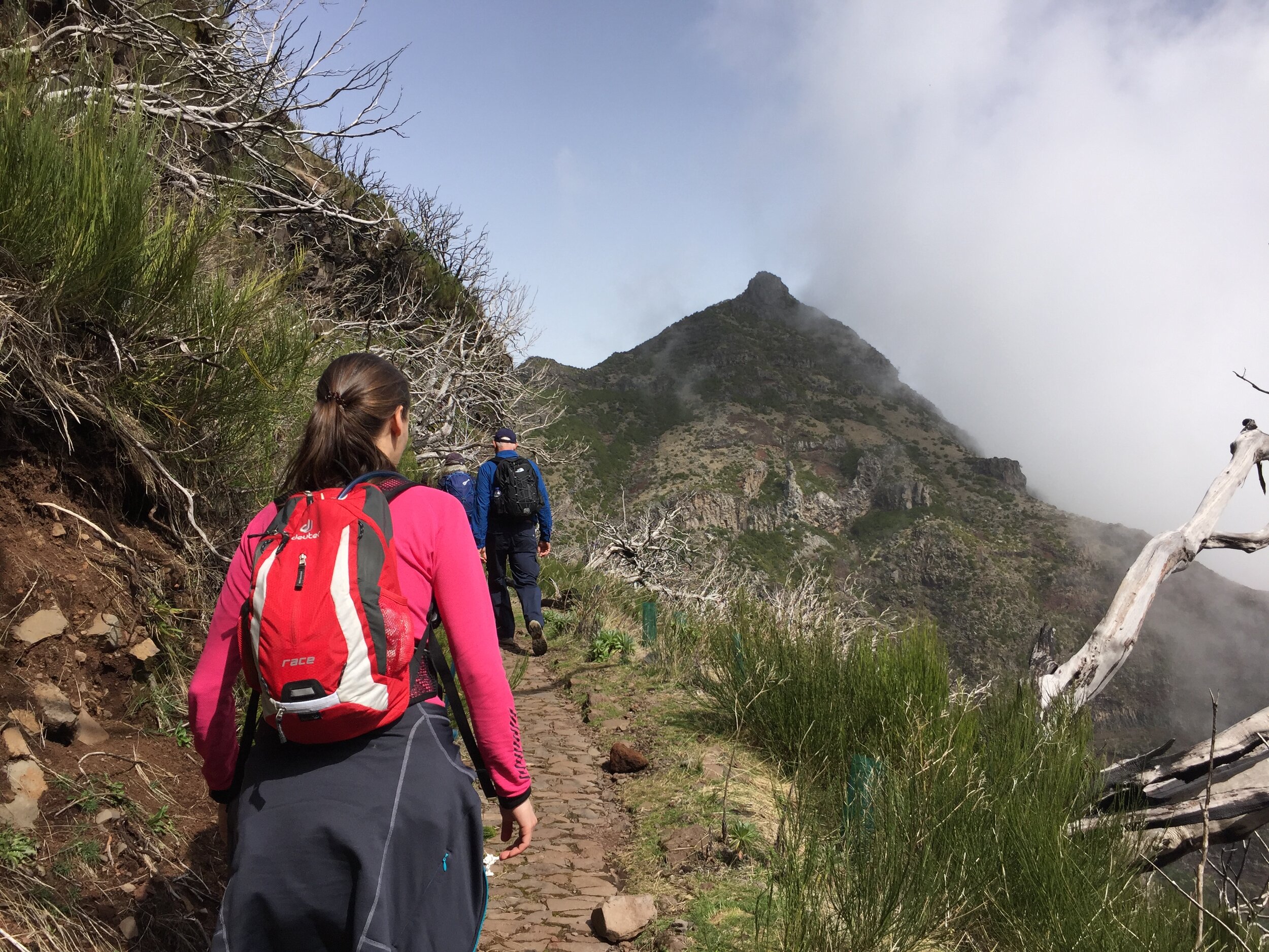
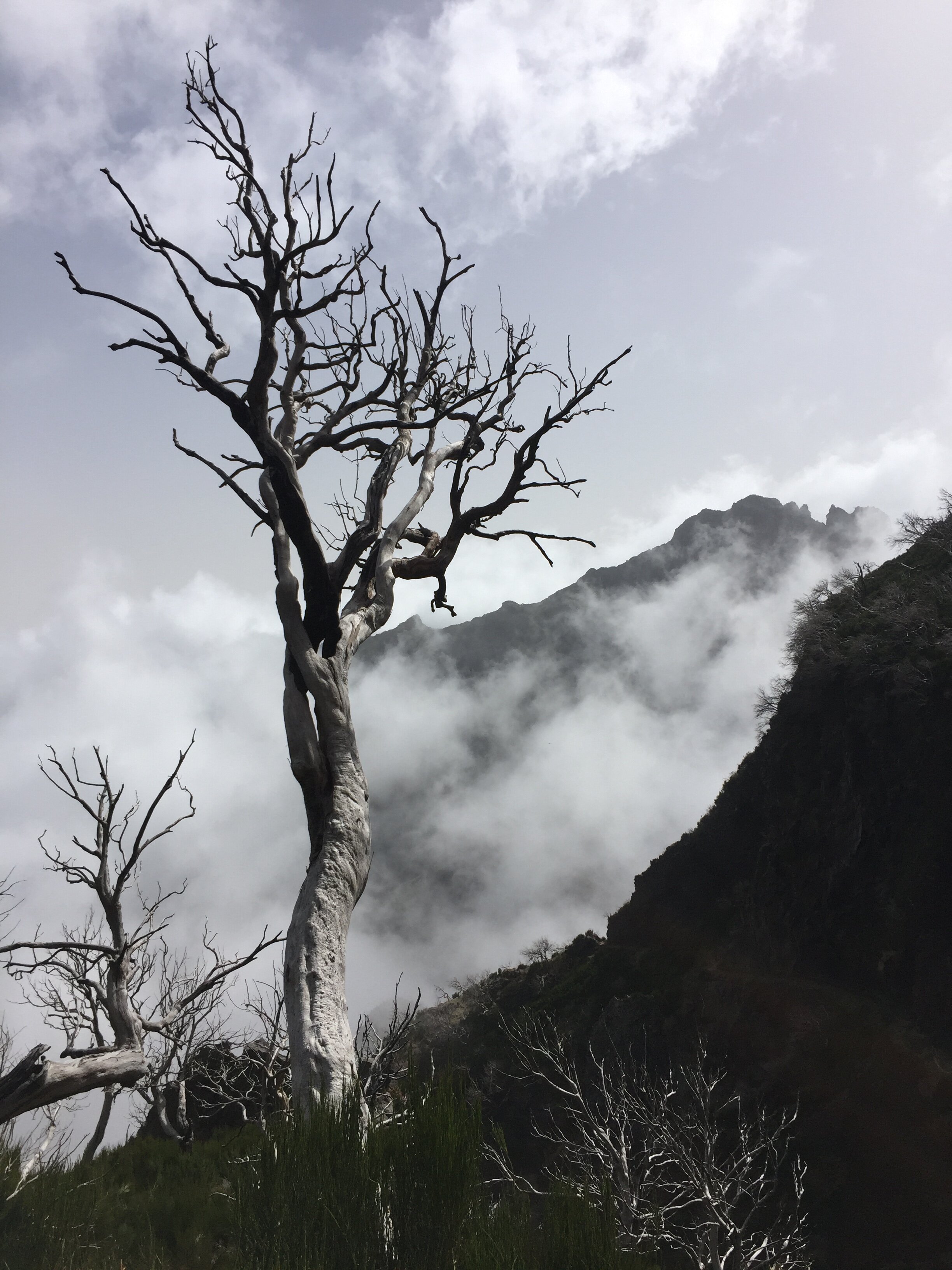
As the route ascends towards Pico Ruivo you see more greenery. This is part of the Laurisilva, a UNESCO designated heather forest covering much of the north of the island. At around 8k the path reaches a hut which is a good place for a rest before the final push to the summit.
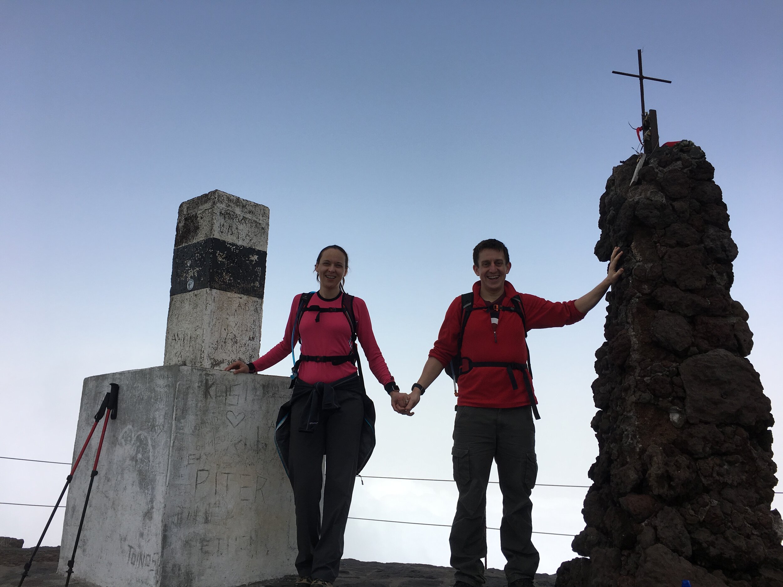
The final climb is only 10 minutes from the hut along a steeper section of the stone path. Although cloudy on our trip we could still see Achada do Teixeira, the neighbouring peak to the west. The summit is marked by 2 stone columns.
The trip concluded with a 2km gentler walk down to the car park on the east side of Achada do Teixeira.
Trip 3: Ribeiro Frio
Start & Finish: Ribeiro Frio Restaurant, ER103, Funchal
Distance: 6.9 km (4.3 miles)
Elevation change: + / - 395m
GPX File: get via Buy Me a Coffee
Other routes touched (walk): Levada do Furado, Levada do Poco do Bezerra, Caminho Real 24
Other routes touched (cycle): None
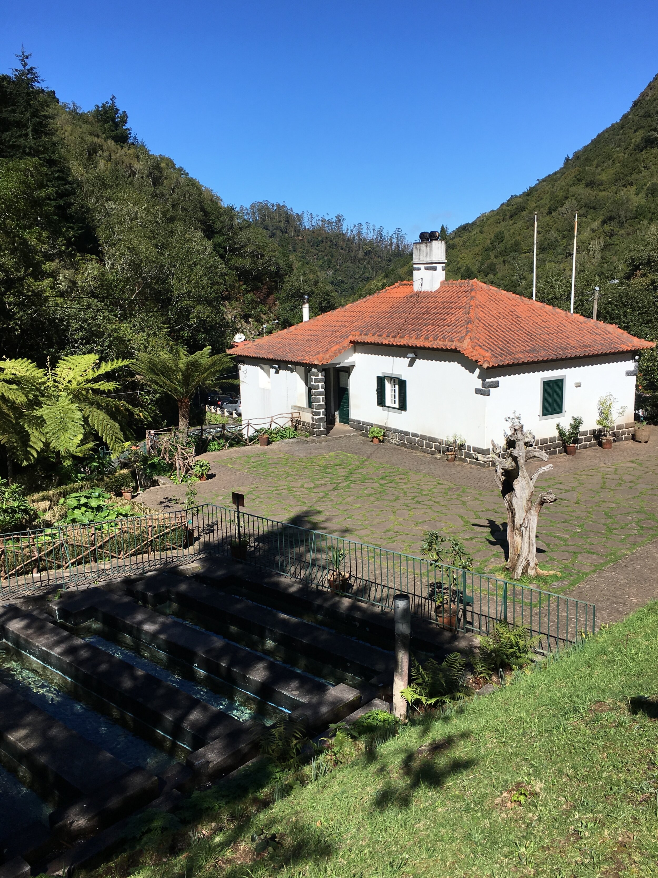
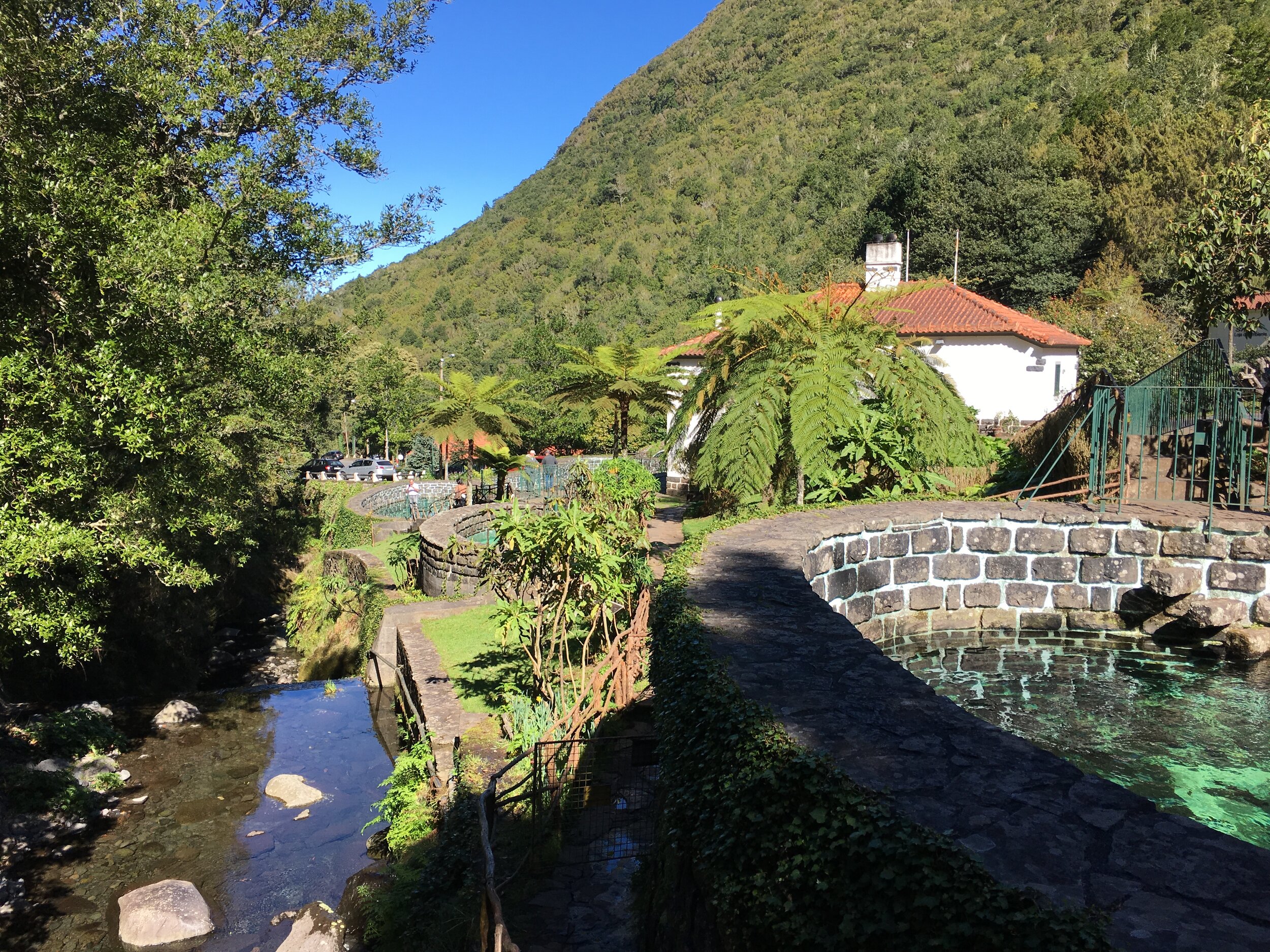
We did the Ribeiro Frio walk as a part of a 1 day east Madeira road trip. The 3 hour circular walk starts and ends at the Ribeiro Frio ("Cold River") restaurant. It's a 40 minute drive north of Funchal on some steep, and sometimes scary mountain roads. Once there, the walk is an oasis of calm and greenery.
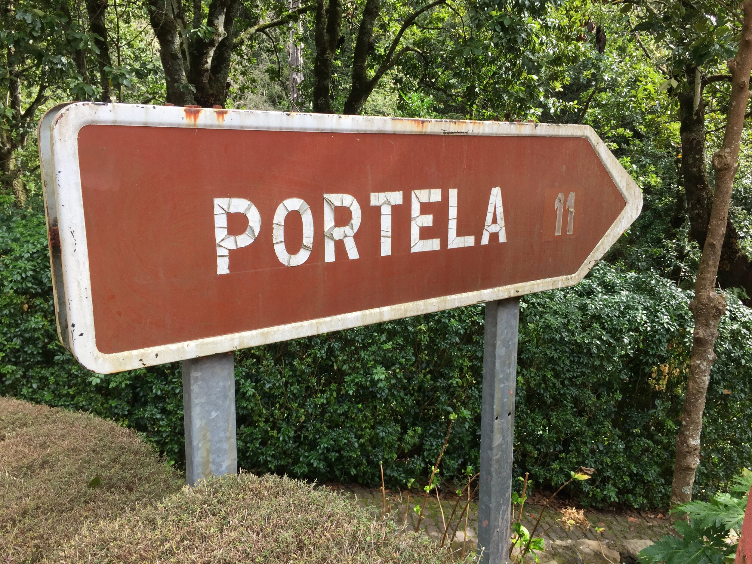
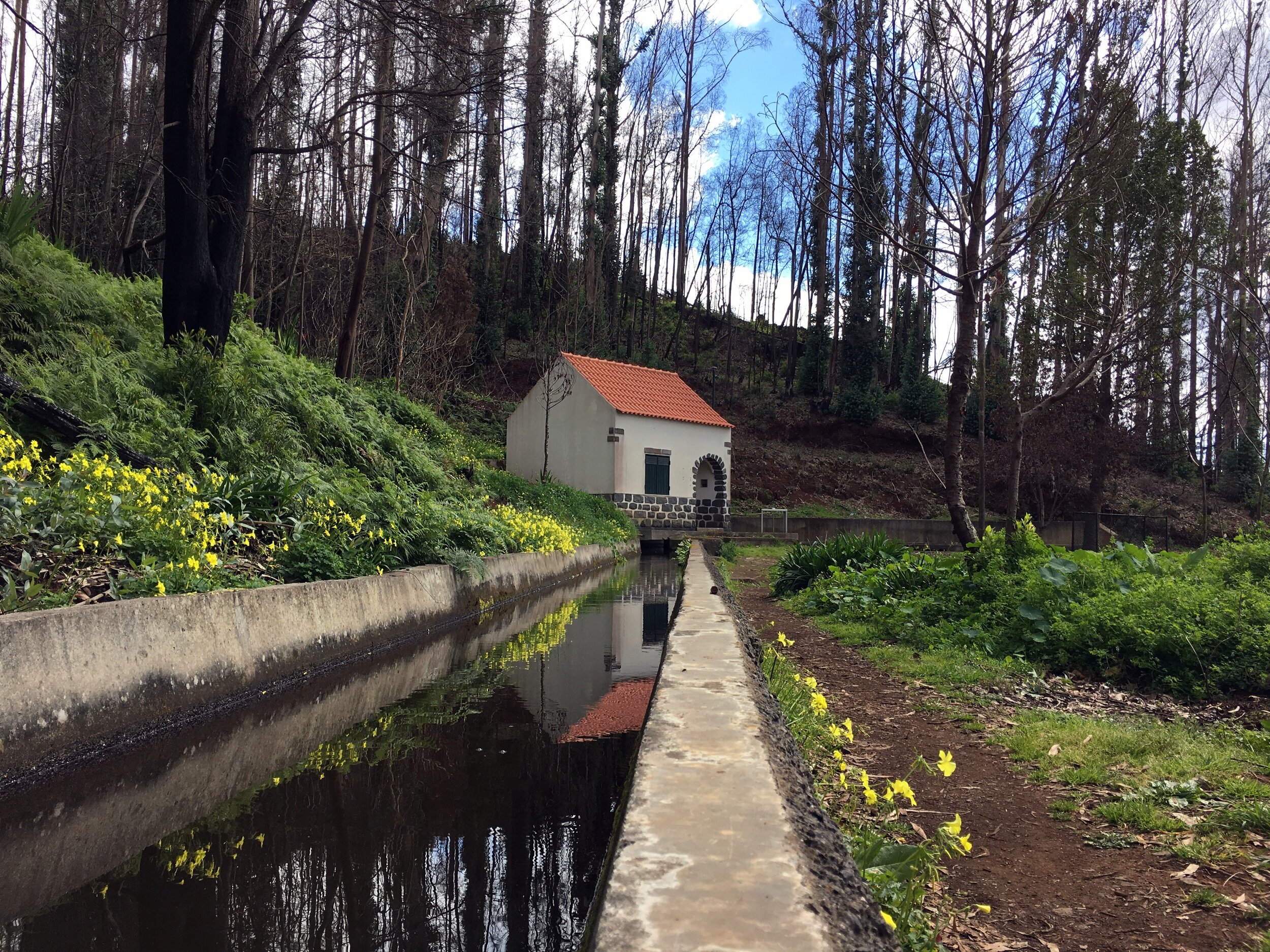
The first hour of the walk follows the Levada do Furado. An alternative walk takes this all the way to Portala in the east, but our route branched off following the Levada do Bezerro. Whilst the first part was pretty busy, we had the route to ourselves apart from an American family that we occasionally met.
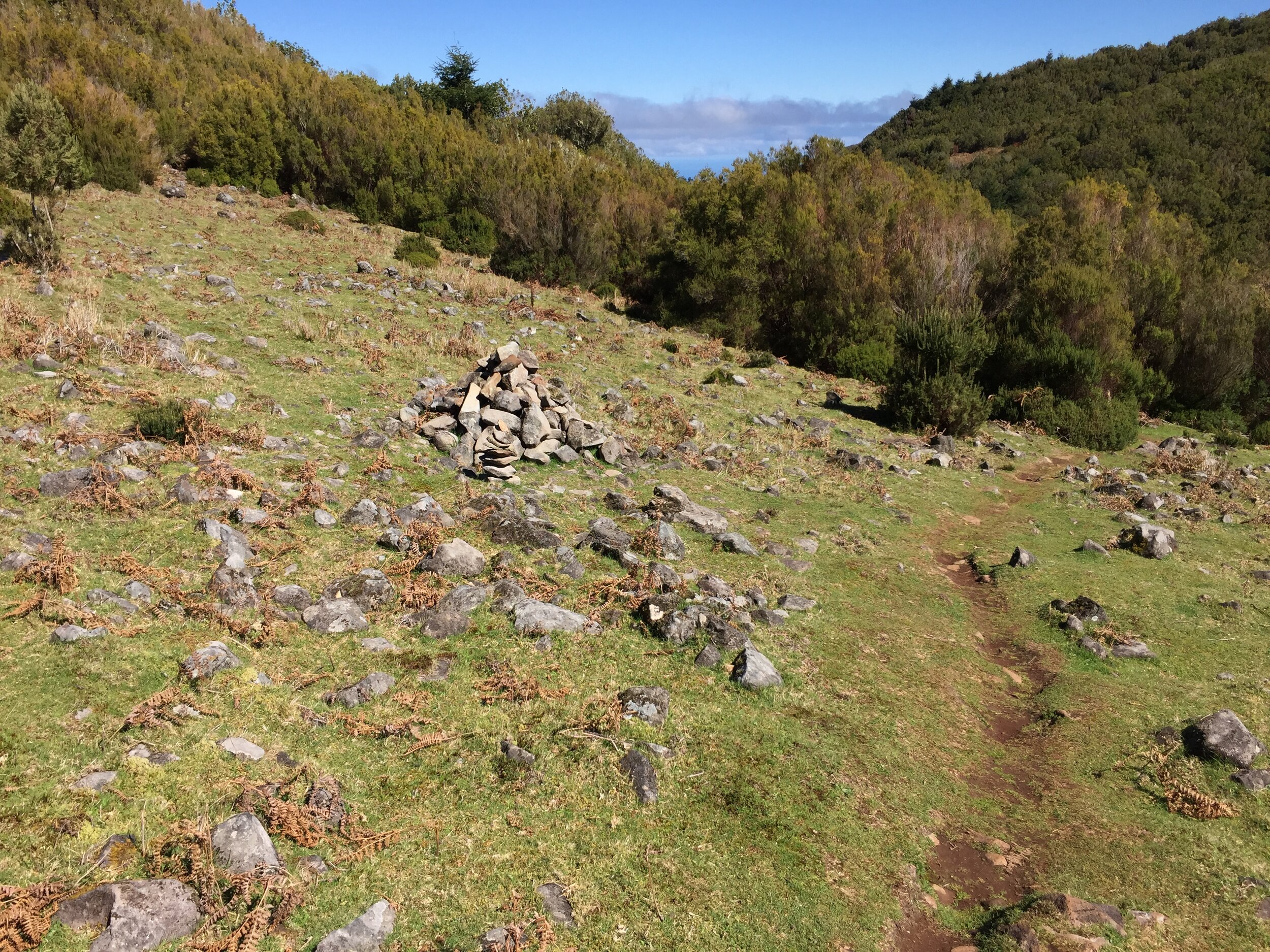
The Levada do Bezerro is a pretty steep climb. For the first 20 minutes were weren't convinced we were following the right path. The guide book said that there would be fast flowing water in the Levada but this was dry. The reason was clear about half way in, a landslide had damaged the conduit sending the water over the cliff to the river below. Further damage beyond this gave us some tricky places to clamber over.
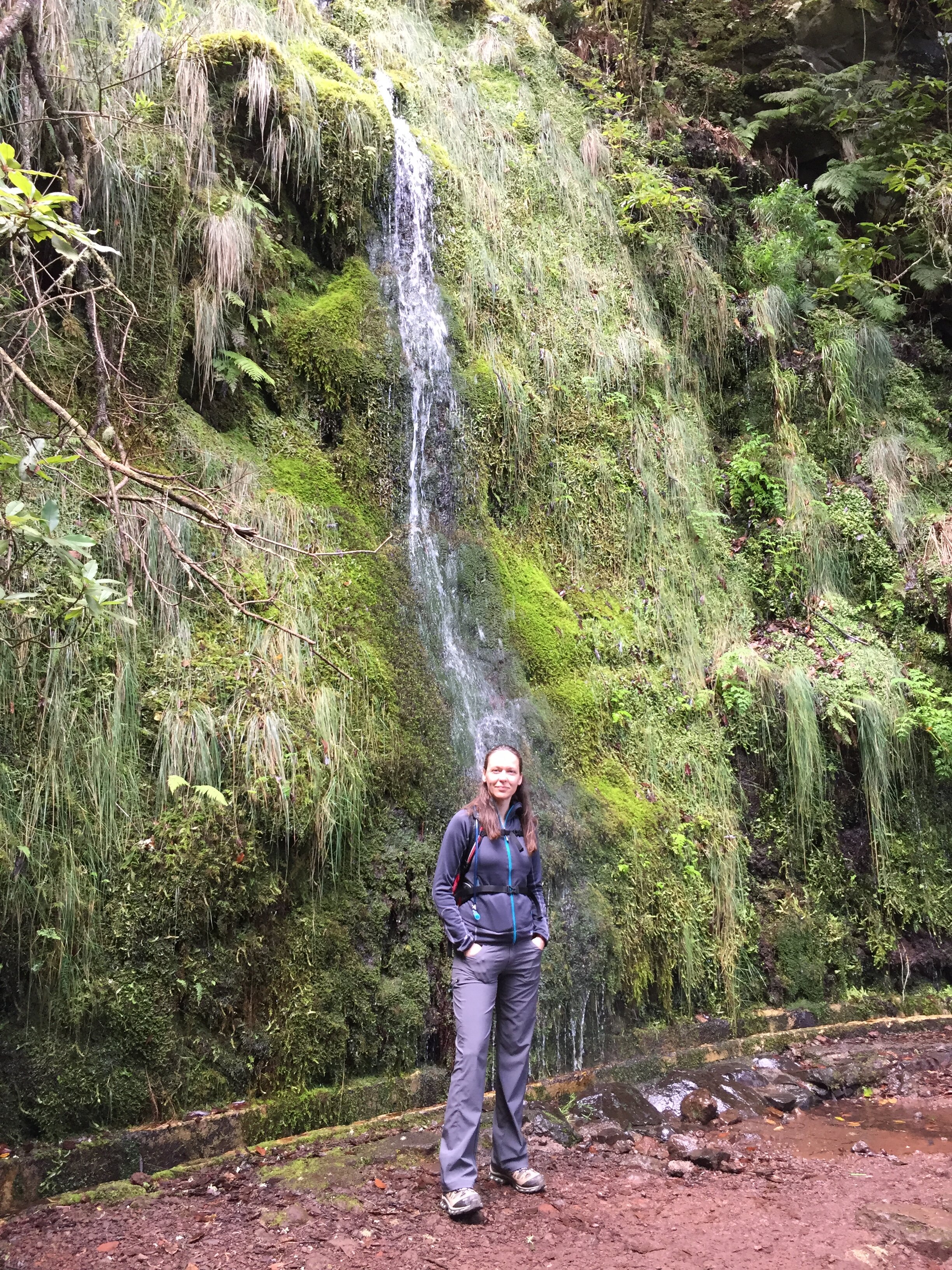
The source of the Levada is a small series of pools on a cascade. The water here feeds the river below and some is siphoned off into the Levada. It's a nice, quiet place for a rest before the final 20-minute climb.
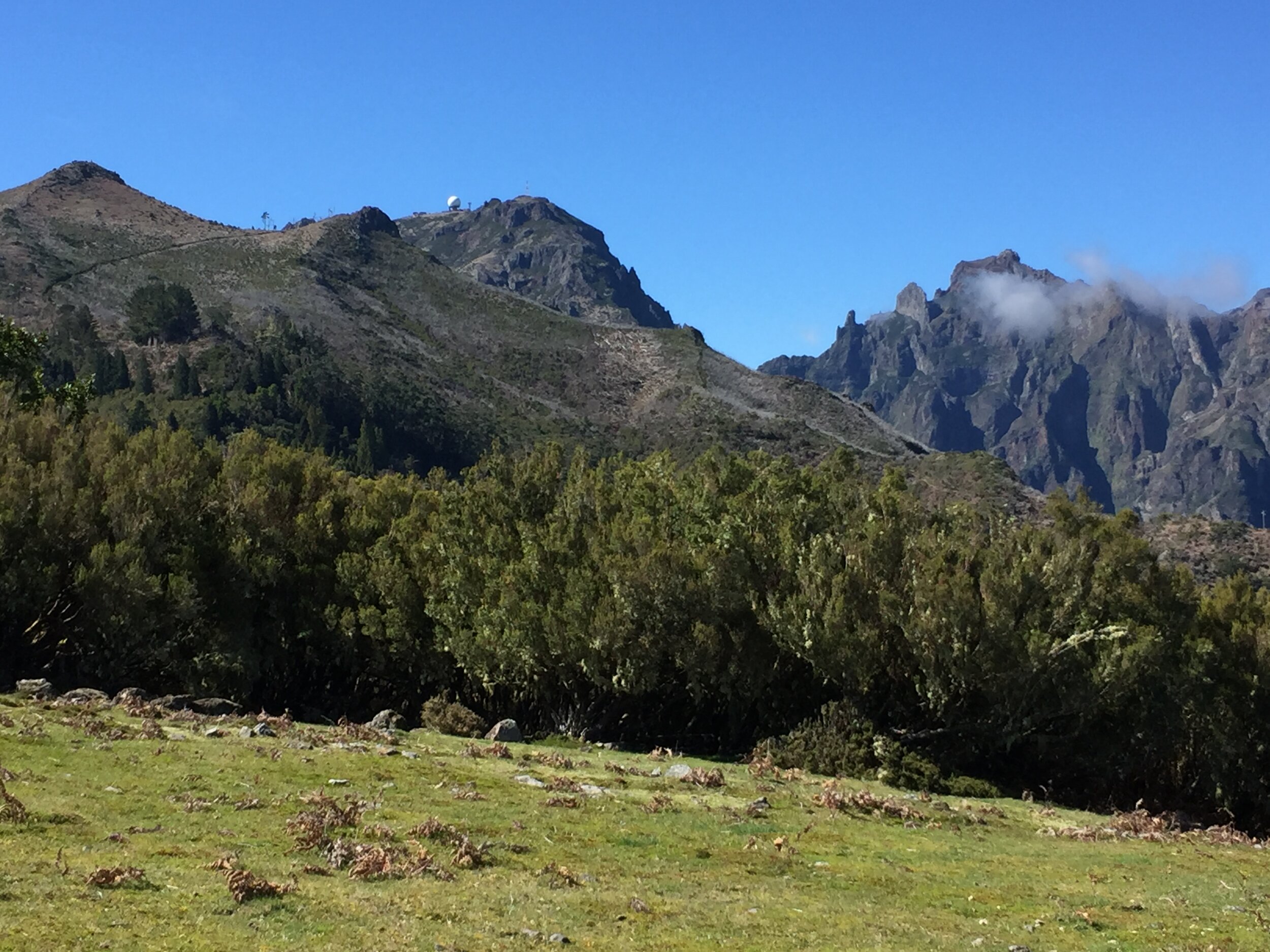
After the pools the path cuts up through the trees, reaching the Chao das Feiteiras plateau. Further on, at the highest point on the trip, is a small hill with some amazing views of the central mountain range. From here we could see the route of Wednesday's walk, from the radar station at Pico do Areeiro, through Pico das Torres, the summit of Pico Ruivo and Achada do Teixeira.
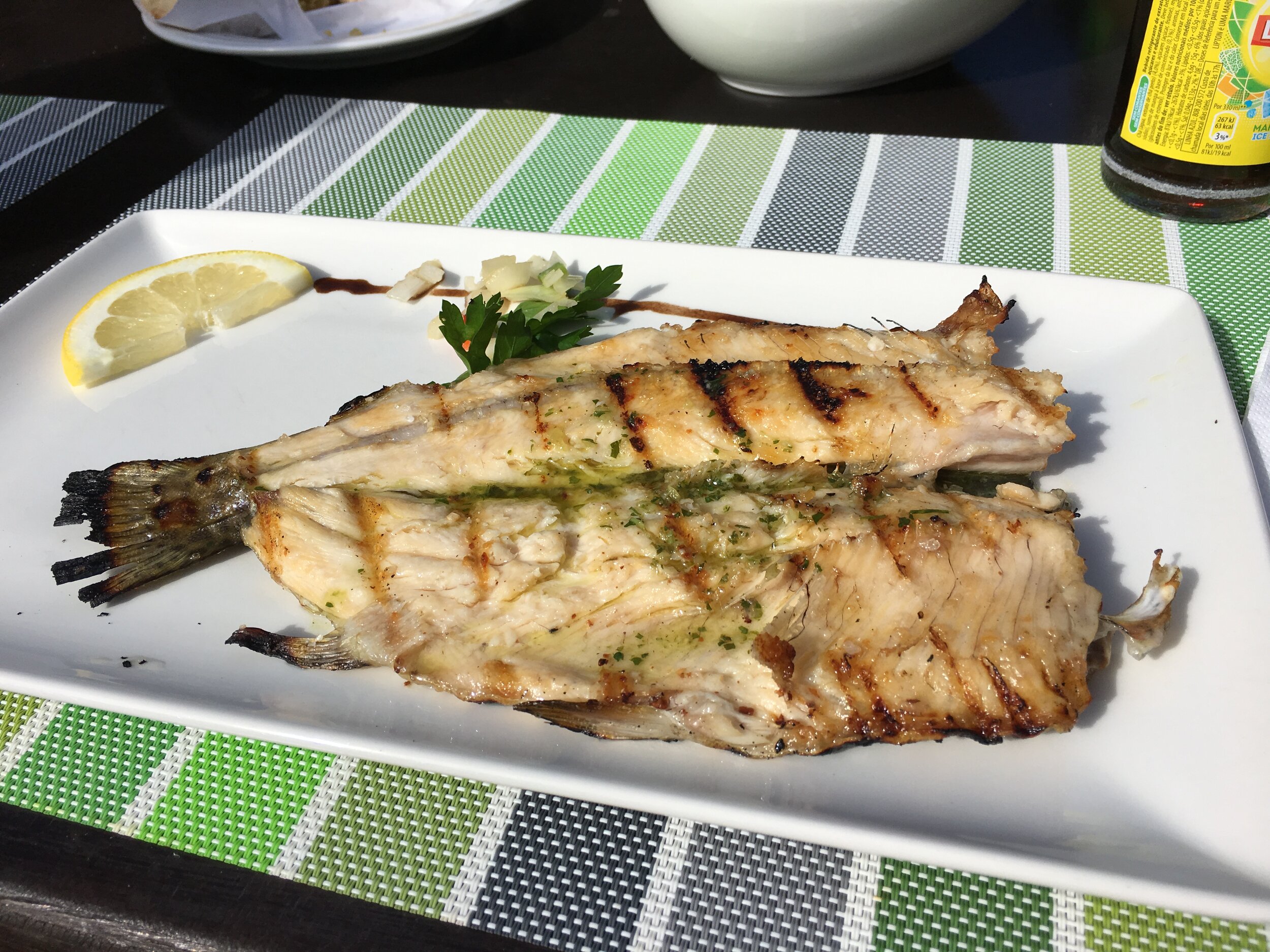
From here the path crosses some farm buildings and down a steep stone track meeting the Trout Farm. We'd timed it right as the restaurant at the bottom was quiet, with most of the tourist busses already having passed through earlier in the day. Grilled Trout with herbs and garlic bread were a great reward for one of the best short hikes I can remember.