Chiltern Walks: Skirmett The Frog
Fields to the north-west of Skirmett

Fields to the north-west of Skirmett


Start / Finish: The Frog at Skirmett, Henley-on-Thames RG9 6TG
Distance: 5.5km (3.4 miles)
Elevation Change: +/- 164m
Other Routes Touched (walk): Chiltern Way
Other Routes Touched (cycle): Chiltern Cycleway
GPX File: get via Buy Me a Coffee
Pubs / Cafes on route: The Frog at Skirmett (at start and end), The Chequers Inn (2.3 km in), The Bull & Butcher (3.4 km in),
Map: OS Explorer 171: Chiltern Hills West, Henley-on-Thames and Wallingford
Links: Skirmett, Turville, Fingest


This is a lovely, short walk in the heart of the Chilterns. Pick the right day, as we did, and you'll experience a wonderful walk in the hills, great views and an outstanding pub to start it from. We spent a leisurely couple of hours in the Frog's garden with some great food. They even catered well for the gluten and dairy frees amongst us. The guidance below will help you navigate but don’t use it as a fully accurate turn-by-turn guide. Always take a map and/or a GPX route and prepare well for the weather and terrain.

From the Frog: 

  • Head north on Fingest Lane and take the first footpath on the left.

  • Follow the footpath up the hill and continue as it meanders around the edge of Great Wood. You'll soon see the windmill above Fingest in the distance.

  • Keep on the footpath as it crosses Dolesden Lane, across the field and turn right onto the Chiltern Way.

  • Keep on the Chiltern Way through Turville Village, crossing Holloway Lane. The path turns right and runs parallel to Holloway Lane, eventually meeting Fingest Lane just before the Chequers Inn.

  • Shortly after the Chequers, keep on the Chiltern Way as it turns off Fingest Lane and climbs a steep hill.

  • Keep on the Chiltern Way as it enters the woods, and then descends back to the Frog and the end of the walk.

elevation_profile - Skirmett.jpg

Cycling The Hambleden Brook
Hambleden Church

Hambleden Church


Part of the Chiltern Rivers Series
River start:
Near junction of Watery Lane and Fingest Lane, North Skirmett, Oxfordshire
River end: Confluence with the River Thames at Mill End, Buckinghamshire
River length: 6.6 km (4.1 miles)
Cycle route start / end: Henley-on-Thames Town Centre
Cycle route length: 23.3 km (14.5 miles)
Cycle route ascent: +/- 240m
GPX File: get via Buy Me a Coffee
Other routes touched (walk): Oxfordshire Way, Shakespeare’s Way, Chiltern Way, The Wokingham Way, Thames Path
Other routes touched (cycle): Chilterns Cycleway
Map: OS Explorer Map (171) Chiltern Hills West, Henley-on-Thames and Wallingford
Links: Hambleden Brook, Skirmett, Hambleden


The Hambleden Brook is a 4.1 mile chalk stream running from Skirmett to Mill End near Henley on Thames. There's loads of options for scenic walks in the area, but I chose a 14.5 mile circular cycle route also taking in Henley, Lower Assendon and Fawley.

How To:

The maps below show a start & end point at the source of the Brook at Skirmett, however I recommend starting in Henley where there are a lot of parking options. From Henley Town Centre:

  • Head north-west on the A4120 toward Wallington & Nettlebed. This is a fairly busy road but there's protected cycle path on the left for most of the way.

  • Just before the A4120 becomes a dual carriageway, turn right onto the B480 toward Assendons and Stonor, then first left following the Chilterns Cycleway.

  • Follow the Chilterns Cycleway north for approx 5k through Fawley to the T-junction at Dudley Lane. Turn right, away from the Cycleway.

  • Take first right onto Drovers Lane, following it to Southend, turning right through the village.

  • Follow the steep Bridleway down to Dolesden Lane, and follow this right / east toward Fingest.

  • At the intersection of Dolesden Lane and Holloway Lane, turn right onto Watery Lane, following this until it meets Fingest Lane.

  • The source of the Hambleden Brook is in the field on the right hand side of Watery Lane, just before you reach Fingest Lane. As you turn right onto Fingest Lane, you'll see a dry ditch which follows the course of the Brook.

  • Follow Fingest Lane with the Brook on your right, past the Frog at Skirmett a recommended lunch stop.

  • Just past the Frog, Fingest Lane crosses a bridge over the Hambleden Brook and the road becomes Skirmett Lane.

  • Follow Skirmett Lane towards Hambleden, but turn left onto Colstrope Lane where you'll cross another bridge over the Brook.

  • After a short, steep section take a right and continue south toward Hambleden.

  • Re-join Skirmett Lane just past Hambleden Village and continue to A4155 at Mill End. Cross this and cut through the houses to Hambleden Marina.

  • Here you can walk your bike over the weir to Hamblden Lock, meeting the Thames Path. Follow this all the way back to Henley

Blue = course of the Hambleden Brook, Red = cycle route

Elevation of the circular route based on starting at the source of the Brook (rather than Henley)


High Point NJ & NJ,NY,PA Tri-State Point
High Point NJ

High Point NJ


Despite having travelled to New Jersey for work several times a year I'd not realised that the State High Point was just an hour from my company's NJ office. Even better, the Tri-Point monument marking the meeting point of New Jersey, New York and Pennsylvania is less than 20 minutes drive from the High Point. So, on a sunny May evening I embarked on a microadventure to find both.  

High Point New Jersey

Significance: Highest Point in New Jersey State, Sussex County NJ
Parent Peak: Sams Point Summit
Elevation: 550m
Date “climbed”: 14th May 2018
Coordinates: 41° 19' 15'' N, 74° 39' 42'' W
Links: Wikipedia / Peakbagger

New Jersey is a pretty flat state and High Point has an elevation of just 550 metres.  That makes it technically a mountain, but don't expect to bring your crampons for the trip. There's some good hiking options in the State Park that surrounds it and the Appalachian Trail runs close by. I was short on on time so drove straight to the car park that's 5 minutes walk from the summit. 

The summit is marked by the War Veterans' Monument, which you used to be able to climb, but it was closed for repairs when I visited. Despite this, there were great views and you can easily see the Tri-Point monument 


NJ,NY,PA Tri-State MONUMENT

The 3-state Tri-Point is in an almost-lovely location. The grave-stone like monument is at the tip of a peninsula at the southern end of Port Jervis at the confluence of the Delaware and Neversink rivers. It would be a very pleasant quiet place if it wasn't for the ugly highway overpass built right over the top of the monument. The monument is surrounded by the pretty Laurel Grove Cemetery. Although it is possible to drive to the tip, as several anglers had done, I parked at the cemetery gates and took a 10 minute walk through the grounds. 

Technically, the actual tri-state boundary is a few metres into the Delaware river. I was happy to stay on dry land and bag the monument stone as the marker point.


Dana Nature Reserve Trek, Jordan
IMG_E2627.jpg

Start: Dana Guest House, Dana Village, Dana, Jordan
Finish: Feynan Ecolodge, Dana Nature Reserve, Jordan
Distance: 14.2 km (8.8 miles)
Elevation change: +33m / -944m. Net -911m
GPX File: get via Buy Me a Coffee
Other routes touched (walk): Wadi Ghwayr Trail
Other routes touched (cycle): None


Dana is Jordan's largest nature reserve, located on the west side of the country just south of the Dead Sea. We visited for 2 nights with a trek to the Feynan Eco-Lodge. Our first night was at Dana Guesthouse, high on the cliffs overlooking the valley. On day 2 we took the 14 KM hike down through the valley. Its a pretty easy trek and hard to get lost. We had a local guide who was unusually talkative and helpful compared other guides we had experienced on our Jordan adventure. Whilst we could have found our way ourselves, the guide explained a lot of the local history and nature in the valley.

The Eco-Lodge at the end was a great experience. It's one of National Geographic's best 25 Eco-Lodges in the world. We were only there for a night, but with a lot more time there were many interesting excursions and local activities on offer. We arrived early afternoon and took advantage of the quiet, remoteness and lack of electricity and wi-fi in the rooms to get a good rest before the next stage of our Jordan trip in the morning.


Above: Location of Feynan Eco-Lodge at the end of the trail


Walking in Petra, Jordan

Many people say that you need a week to visit Petra. That may be true if you want to see everything in detail, but 2 well planned days can get you around the must-see parts. Here’s our 2 treks taking in the Petra Highlights

Day 1 - The Monastery Loop

Start & Finish: Petra Guest House, Wadi Musa, Jordan
Distance: 11.7 km (7.3 miles)
Elevation change: +/- 503 m
GPX File: get via Buy Me a Coffee

All routes start from the sun gates by the Petra Guest House. From here it’s a half mile gentle trek down to the Siq

The Siq is a narrow cavern created by an earthquake that split the rock thousands of years ago. The half-mile walk down through the Siq needs to be made slowly to take everything in. The Siq opens up at a T-junction with the Treasury rising up in front of you.

This is the point as far as most people, including myself before this, had heard about Petra. In reality, the Siq and The Treasury are a fraction of the site. Turning right and continuing along the main route, you’ll pass the theatre, Royal Tombs, the Collonade and the Basin. It was here that our useless guide left us and we paused at the Basin Restaurant for a break.

From the Basin there’s a few options but the main event is the walk up to The Monastery. It’s a 45 min to an hour climb and well worth the effort. In some ways the Monastery is even more impressive than the Treasury. Its huge, and the climb to get there makes it all the more rewarding.


Day 2 - Wadi al Farasa and Royal Tombs

Start & Finish: Petra Guest House, Wadi Musa, Jordan
Distance: 11.5 km (7.2 miles)
Elevation change: +/- 389 m
GPX File: get via Buy Me a Coffee

Take the same route as Day 1 to The Treasury. Turn left and you’ll see some steps leading steeply upwards. There will be local “guides” hanging round the base waiting to take you up. I’m not convinced it was necessary to take a guide. There was an official looking sign at the base so we negotiated 5 JD with a local boy to take us up.

There’s only 1 tricky section of the climb, but it’s otherwise an easy 10 minutes to a great view looking down to The Treasury. The boy pointed out a path to the High Place of Sacrifice where he would take us for an extra 10 JD. We offered 5 which was more than generous. This was the point that he revealed that the original 5 JD was a 1-way trip, not a return to the base. After a bit of a commotion where he spat at me, threaten to call the police and picked up a rock to throw at us, we sent him on his way and continued upwards on our own.

I found it best to assume that the local guides are all lying. They either say that the routes are long and difficult or you can only go with a guide. None are true and when you get one, as we did on Day 1, they’re pretty useless. Don't take this as a generalisation of all Jordanians though. Everyone else we met were friendly, generous and welcoming of tourists. Its just the local guides in the historic sites that are a particular breed of lazy arsehole.

The route to the High Place and the Wadi al Faraza trek are well worth the effort. They’re quieter than the main routes at ground level and have some amazing vistas and tombs to explore.

The trail ends at the Basin restaurant at the start of the route to the Monastery. It’s a great place to stop but be prepared for a fleecing on food and drinks. From here, you can return back to the Treasury via the Collonade, stopping off at the Royal Tombs on the way.


Below: The Treasury at Petra

 
Kent Spring Half Marathon

When: April 8th 2018
Where: Charing, Kent, UK
Course: Hour-glass shaped loop from Charing School through country lanes and part of the North Downs Way
Other routes touched (walk): North Downs Way, Shepherd Neame Walking Route,
Other routes touched (cycle): NCN 17
Finish time: 2:07 - slow due to [insert excuse here]

 
Cycling The River Colne
Colne meets the Thames at Staines

Colne meets the Thames at Staines


Part of the Chiltern Rivers Series
River start:
North Mymms Park in Hertfordshire.
River end: Confluence with the River Thames in Staines, Surrey
River length: 18 km (11.2 miles)
Cycle route start / end: parking in North Mimms town centre, Hertfordshire / River Thames in Staines.
Cycle route length: 57.8 km (36 miles)
Cycle route elevation change: +182m / -262m. Net -80m
GPX File: get via Buy Me a Coffee
Other routes touched (walk): Hertfordshire Way, Grand Union Canal Towpath, London Loop, Beeches Way, Colne Valley Trail, Thames Path
Other routes touched (cycle): NCN 12, 4, 6, 61
Map: OS Explorer Map (182) St. Albans and Hatfield / OS Explorer Map (172) Chiltern Hills East / OS Explorer Map (160) Windsor, Weybridge & Bracknell
Links: River Colne, Welham Green, North Mymms, Rickmansworth, Staines


The Colne is the daddy of the Chiltern Rivers. The Lee may be longer, but the Colne tells the real story of the Chilterns. From its start at North Mymms, the river flows south through Hertfordshire, Buckinghamshire, meeting the Thames at Staines in Surrey. Along the way it picks up water from smaller rivers such as the Ver, the Gade, the Chess , the Pinn and the Misbourne. Travel along these and you'll see some of the best scenery of the region.

The cycle route that I devised was awesome. I was fully prepared to get lost, stuck in the mud or work around non-cycle paths. As it turned out, it was a challenging but hugely enjoyable combination of trails, country roads, canal towpath and interesting industrial wasteland.

Unlike some of the other Chiltern Rivers, its possible to stay pretty close to the river itself. There's not one waymarked route to follow, but stringing a few together will get you there. Its complicated, so take a bike sat-nav and don't even think of attempting it on a road bike. Its muddy. And awesome.

How to do it.

Roughly its the following, but don't just rely on this. Take a map or GPX file.

  • Start at Welham Green, Hertordshire.

  • Follow Dixons Hill Road / Tolgate Road / Coursers road out of town.

  • Cross the fields, following the river until you get to the Watling Chase Timberland Trail

  • Follow the Trail to Lowbell Lane, crossing under the A1081

  • Passing through London Colney, take Shelney Lane over the M25

  • Follow Harper Lane to Watling Street, briefly turning right, then left onto a Bridleway

  • When passing though a farm/equestrian centre please dismount and walk the bikes through. The natives are friendly, but sounds like they have had a bad experience with people ignoring the "no cycles" sign.

  • Follow School Lane over the M1 to Garston.

  • By now you will be on NCN 61. Follow this all the to the Malt Shovel Pub on the Grand Union Canal at Iver.

  • This stretch of the NCN 61 also follows the Abbey Way and Ebury Way

  • Turn right off the canal then left onto Old Mill Lane.

  • Take the right hand path around Little Britain Lake, Following London Loop (section 1) then the Beeches Way to the Colne Valley Way

  • When the Colne Valley Way reaches Thorney Mill Road, take a left onto it until Wise Lane

  • Follow Wise Lane then the Colne Valley Trail onto Harmonsworth Moor.

  • Cross under the M4, then over the A4 through Stanwell Moor and under the A30.

  • Once past the A30, its a wiggle through Staines to the end of the river at the Thames opposite the Swan Hotel.


Recommended Lunch Stop

The Cafe in The Park at Rickmansworth Aquadrome is a great half-way stopping point. Their Courgette and Lime cake is amazing.

Elevation for cycle route


Cycling The River Alderbourne
Source of the Alderbourne near the M40 at Fulmer

Source of the Alderbourne near the M40 at Fulmer


Part of the Chiltern Rivers Series
River start:
Pond at Low Farm, off Framewood Road, Fulmer, Buckinghamshire
River end: Confluence with Colne Brook, next to M25 on Uxbridge Moor
River length: 8 km (5 miles)
Cycle route start / end: Black Horse Pub, Windmill Rd, Fulmer, Slough SL3 6HD
Cycle route length: 18 km (11 miles)
Cycle route elevation change: +/- 116m
GPX File: get via Buy Me a Coffee
Other routes touched (walk): Beeches Way
Other routes touched (cycle): Beeches Cycleway, NCN 61
Map: OS Explorer Map (172) Chiltern Hills East 
Links: Fulmer, Uxbridge Moor


The Alderbourne loves motorways. A long time ago it flowed through quiet South Buckinghamshire countryside. Now it's flanked by both the M40 and M25, crossing right through the junction of both. Despite this, there's some interesting routes near it, as I found out on this circular ride loosely based on the river's course.

The best base for the ride is the Black Horse in Fulmer. It’s a regular of mine and one of my favourite pubs in the area. From here, cross the main road and go down Hay Lane to the junction with Framewood Road. This is as far as you can go by bike as both directions of Framewood Road are private. To see the source, lock your bike here and continue straight on the footpath for a third of a mile. A junction in the path will take you through a gate where you can see the small lake that feeds the river at Low Farm.

An optional add-on is to continue north-west along the main path for 5 minutes. Here you can see the decaying remains of Picking Farm. Once a large manor house, its been rotting for years getting overtaken by Japanese Knotweed.

To follow the Alderbourne, retrace your steps to the Black Horse and take Alderbourne Lane, heading east. The lane will briefly join Hawkeswood Lane which is crossed by the river with a ford. As with many places around here, being close to Pinewood Studios, the ford was a location for a movie (Genevieve 1953). Follow Alderbourne Lane to the end and it will meet Pinewood Road at the corner of Black Park and the film studios.

The route continues down Silverhill Road while the river diverts north without public access. The closest route to the river would be to take Silverhill then the A412, however this is a very busy road and not a pleasant cycle. Instead take the bridleway on the right of Silverhll before the M25 crossing. This follows the boundary of the Pinewood Studios extension and meets Iver Heath. Keeping to bridleways next to the M25 for 2.5 miles, you'll reach the Alderbourne's end where it meets the Colne Brook.

To complete the circular route, continue along the bridleway and follow the Beeches Way / NCN Route 61 until Billet Lane next to Langley Country Park. Follow this north to the A412 and cross it into Black Park. From here you can follow the eastern perimeter of the park along the side of the original Pinewood Studios site. At the North End of the park you can take Fulmer Common Road, then Windmill Road back to the Black Horse.

Despite not seeing much of the Alderbourne except for the start and end, its a great excuse for an interesting 11 mile ride around the area. Don't miss out on the opportunity for a meal and a pint at the Black Horse too.


Blue = River, Red = Cycle Route

Elevation for cycle route


Cycling The Colne Brook, Wraysbury & Frays Rivers
Northern end of the route where the River Frays ducks under the Grand Union and meets the River Colne

Northern end of the route where the River Frays ducks under the Grand Union and meets the River Colne


Part of the Chiltern Rivers Series
Rivers start, end & length:
- Colne Brook:
Splits from the Colne at Uxbridge Moor, runs 14.4 km (9 miles) to the Thames at Hythe End near Staines, Surrey
- Wraysbury: Splits from the Colne at West Drayton, runs ~9 km (5.5 miles) and rejoins the Colne near the confluence with the Thames at Staines, Surrey
- Frays: Splits from the Colne at Uxbridge Moor, runs ~9 km (5.5 miles) and rejoins the Colne near the confluence with the Thames at West Drayton, Middlesex
Cycle route start / end: Colne Visitors Centre, Denham, Uxbridge, UB9 5PG
Cycle route length: 46 km (28.5 miles)
Cycle route elevation change: +/- 149m
GPX File: get via Buy Me a Coffee
Other routes touched (walk): Grand Union Canal Towpath, London Loop, Beeches Way, Colne Valley Trail, Thames Path
Other routes touched (cycle): NCN 4, 6, 61
Map: OS Explorer Map (172) Chiltern Hills East, OS Explorer Map (160) Windsor, Weybridge & Bracknell
Links: Colne Brook, Wraysbury River, Frays River, Uxbridge, West Drayton, Staines


This route is not pretty, but it is interesting. This is the lower Colne Valley, a land of marshland, rivers and moors sliced and diced by motorways, rail lines and dirty industry. It’s a place that few people discover and why would they? The Chilterns surround it to the north west and Windsor Great Park is not far to the south. What this area lacks in beauty it makes up for in intrigue. It’s a chance to get lost in a place you’ve wizzed by on the way to somewhere else.

I'd made a failed attempt at this trip in January. It's been a winter of cancelled running events and I've added a few extra kilos. I was eager to get back on my bike for another attempt and a short window in a rainy Easter weekend gave me a chance. It was wet, muddy and cold. I loved it.

The best place to start the trip is car park at the Colne Valley Regional Park Visitors Centre. From here, its a 2.5 mile cycle down the Grand Union to the start of the Colne Brook. You can see the split from the River Colne from a bridge on the A4007 at Cowley. About 500m further on, a footpath next to the M25 follows the end of the Alderbourne before it meets the Colne Brook. The cycle route stays as close to the river as possible, passing through Iver, Thorney Park Golf Course, Colnebrook village and the back of Heathrow T5 industrial estates.

Once past Heathrow the route gets more pleasant as it weaves through the Wraysbury reservoirs, emerging at Hythe End. After passing the start of the Staines Reservoirs Aqueduct, the route joins the footbridge on the M25 river crossing. From here you can see the confluence with the Thames opposite the Runnymede Hotel.

After a short ride east along the Thames, cross back over the river and you'll find the point where the River Colne reaches the Thames near the old Town Hall. The junction of the Colne and the Wraysbury can be seen from a bridge off Church Street a couple of hundred meters to the north.

From Staines, the cycle route stays in sight of the Wraysbury river for most of the route except for a diversion around a grotty industrial estate at the back of T5. The start of the river at West Drayton is within a stone's throw of the end of the Fray's River. This end of the Frays is hard to keep close to, so the route diverts through West Drayton and Yiewsley before meeting the river at Little Britain Lake. From here the river can be tracked pretty closely through Uxbridge up to the junction with the Colne at Denham Lock.

Yellow = Cycle Route, Red = River Colne Brook, Blue = Wraysbury River, Green = River Frays

Elevation for cycle route


Tenerife & La Gomera: Then & Now

Coming back to Tenerife wasn't very appealing to me until recently. I must have been there about 20 times with my family when I was growing up. My parents had a half share in an apartment in Las Americas with my Dad's’ business partner’s family . We had some great times there and it was the setting for some of my fondest memories.

I only got the travel bug in my mid twenties and since then I’ve been on a mission to see the world. I developed a rule about not going back to places, so Tenerife never got a look in. It was going to Madeira last year and walking the Levadas that started to change my mind. I realised that I’d only seen holiday resort Tenerife, not the outdoor wonderland that most tourists never visit. It was time to return and to show Timi the holiday places of my childhood.

First up, a 5 mile walk of the resort to recreate some old moments...


Playa de las Americas

Playa de las Americas beach - early 1980s 

Playa de las Americas beach - early 1980s 

2018

2018

Dad: view to Villamar, Bouganville Playa and Gran Tinerfe - early 1980s

Dad: view to Villamar, Bouganville Playa and Gran Tinerfe - early 1980s

2018: Same view from lower position. Upper walkway now closed for building works.

2018: Same view from lower position. Upper walkway now closed for building works.

Dad: view to Parque Santiago 1,2,4 and Conquistador - late 1980s

Dad: view to Parque Santiago 1,2,4 and Conquistador - late 1980s

Richard - 2018

Richard - 2018

Los Angeles cafe & view to Roque del Conde mountain: mid 1980s

Los Angeles cafe & view to Roque del Conde mountain: mid 1980s

Flanagans: the scene of some epic 1980s dad dancing.

Flanagans: the scene of some epic 1980s dad dancing.

Cafe amazingly still there in 2018. Mountain obscured by palm trees

Cafe amazingly still there in 2018. Mountain obscured by palm trees

2018: Flanagan's is long gone. Still classy though.

2018: Flanagan's is long gone. Still classy though.


Parque Santiago 3

Parque Santiago 3 was the resort where my parents shared an apartment with the Blore's, the family of my dad's business partner. 

Mum in front of Parque Santiago 3 being built in the 1980s

Mum in front of Parque Santiago 3 being built in the 1980s

Mum: late 1980s. The big ugly block in the distance is the now-demolished Europa hotel

Mum: late 1980s. The big ugly block in the distance is the now-demolished Europa hotel

Timi in 2018

Timi in 2018

Same bridge 30 years later.

Same bridge 30 years later.

Late 1980s: Perfecting my smug grin

Late 1980s: Perfecting my smug grin

2018: Smugness comes naturally now. Bigger me, bigger tree. 

2018: Smugness comes naturally now. Bigger me, bigger tree. 


Mount Teide Cable Car

Summit of Teide, early 1980s

Summit of Teide, early 1980s

2018: slightly different angle, bit colder, but still there.

2018: slightly different angle, bit colder, but still there.

Old cable car: mid 1980s

Old cable car: mid 1980s

2018: new cable car. Click here for the Teide website's history of the cable car

2018: new cable car. Click here for the Teide website's history of the cable car

1980s low tech sign on the cable car station

1980s low tech sign on the cable car station

2018: same building, new tech.

2018: same building, new tech.


Dragon Tree, Icod de los Vinos

800 year old Dragon Tree in 1980s

800 year old Dragon Tree in 1980s

835 year old Dragon Tree.

835 year old Dragon Tree.


La Gomera

Roque de Agando - mid 1980s, rocking the Comic Relief T-shirt

Roque de Agando - mid 1980s, rocking the Comic Relief T-shirt

Ruins of old banana harbour - mid 1980s

Ruins of old banana harbour - mid 1980s

View of Tenerife from La Gomera ferry: mid 1980s

View of Tenerife from La Gomera ferry: mid 1980s

Roque de Agando - looking a bit older in 2018

Roque de Agando - looking a bit older in 2018

2018 - still ruined but looks like someone lives there now.

2018 - still ruined but looks like someone lives there now.

2018: much more development. Think there's a volcano in there somewhere.

2018: much more development. Think there's a volcano in there somewhere.


And finally, one of my favourite photos: The Gowers and The Blores at the Santiago 3 apartment before a night out (late '80s). Sadly, no 2018 recreation for this one as not all of the original cast are still with us. 

ERNE6501.JPG

Not Walking to Teide and Alto de Garajonay
Mt Teide

Mt Teide


Mt Teide

Significance: High point of Tenerife, The Canary Islands and Spain
Summit height: 3,717m
Highest point reached: 3,555m


I don’t remember much about visiting Mt Teide. I’ve definitely been before, at least to the bottom of the Teleferico (cable car). Judging from the old photos it must have been about 35 years ago.

I do remember talking with my dad about going up again when I was an early teenager. This was in my less adventurous days and I was scared when my dad told me that the air would be thinner up there. I had this fear that it would be too thin for him and he would have a heart attack. I realised today that he would have been about the same age as I am now ... which I’ve now decided is really really young.

So, on my first trip back in over 20 years and with a well developed adventure obsession, I had to make it to the top. I’d made all the plans: permit, pre booked tickets, all the right clothing. The only problem was that it was February and the trail from the upper cable car station was shut due to ice.

Despite the near miss of reaching the summit, Timi and I had an amazing day. We ticked off the Teide National Park UNESCO site and got some amazing photos of the peak and Los Roques de Garcia before the clouds came down.

I was a bit disappointed in not getting to the top but February is always a risk. It’s was the same reason we didn’t get to Mt Olympus in Cyprus 3 years ago. After all, our mission for the week was to have a relaxing end of winter break, not to get to the summit. Anway, I figured that we would have better luck climbing Alto de Garajonay on Friday.

IMG_0842.JPG
 

Alto de Garajonay

Significance: High point of La Gomera
Summit height: 1,487m
Highest point reached: 1,250m


Whilst a Teide trip is simple to organise, La Gomera is trickier. We wanted a 1 day trip from where we were staying in Costa Adeje, Tenerife. I started researching 6 weeks before. The first company that I emailed obviously hadn’t got the knack of using computers. After 2 weeks with no reply to my enquiry I emailed again. Apparently their reply was stuck in their draft folder. They sent me as brief an email as they could muster, so I replied with a few basic questions. No response.

With a bit more research I found another company that had a few interesting trekking options on their website. I picked one and paid online, giving all the details they asked for, including the hotel where we were staying it. It was a good sign that I got a response straight away, but strange that they were asking me again where I was staying. I told them our hotel name and within minutes got a refund with a blunt email saying I that I could not join the trip as I was not staying on the island. After a bit of back and forth with me trying to explain how god customer service works, I gave up.

Attempt #3 was prompted by an email from my hotel asking if there was anything they could do to help with our upcoming stay. They even had an Experience Centre with a dedicated email address. I wrote to them to explain what we wanted to do on La Gomera. No reply. Was the island was actively trying to discourage tourists? By now I’d given up hope of making arrangements in advance and decided to chill out and sort out when I got to Tenerife.

Once we’d arrived at the hotel and settled in Timi and I went to the hotel’s Experience Centre to ask about La Gomera. Having not quite got to the top of Teide we were determined to bag at least one island summit. I asked whether the jeep safari they offered would go to Alto de Garajonay, the highest point on the island. The guy made a phone call and confirmed that yes, it definitely did. Result.

On the day of the trip we were picked up early and taken on the ferry from Los Cristianos to San Sebastián de la Gomera. Soon after arriving the jeep convoy stopped at a nearby viewpoint and the main guide explained the day’s agenda. It all sounded great but was a bit odd that he didn’t mention to stop at the summit. I asked him about it... “no, unfortunately we don’t go there, it’s a bit of a hike and no tour company goes there.” I was, as you could imagine, not amused.

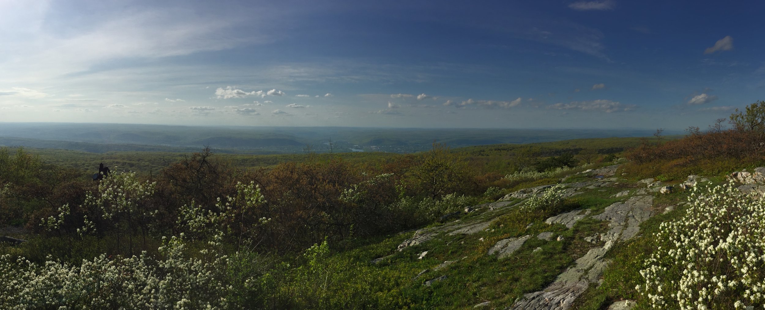
The tour itself was OK but not special and certainly nothing to make up for the lack of summiting. We did the usual stops for the Aloe Vera Farm, Banana Plantation, local lunch and Botanical Gardens. All fairly interesting but not worth the money we’d paid for, especially as I’d been there before. So close.

Back at the hotel I made sure they understood my frustration and eventually got my money back. I’ll spare you the details here as my Tripadvisor review explains it well.

So, the learning for La Gomera is not to go with an excursion if you want to get to the high point. Don’t believe anyone who tells you they go there unless you’re sure they completely understand that Alto de Garajonay doesn’t mean just the National Park that surrounds it. You may have better luck than I did with a local company on Gomera, just don’t expect good customer service.

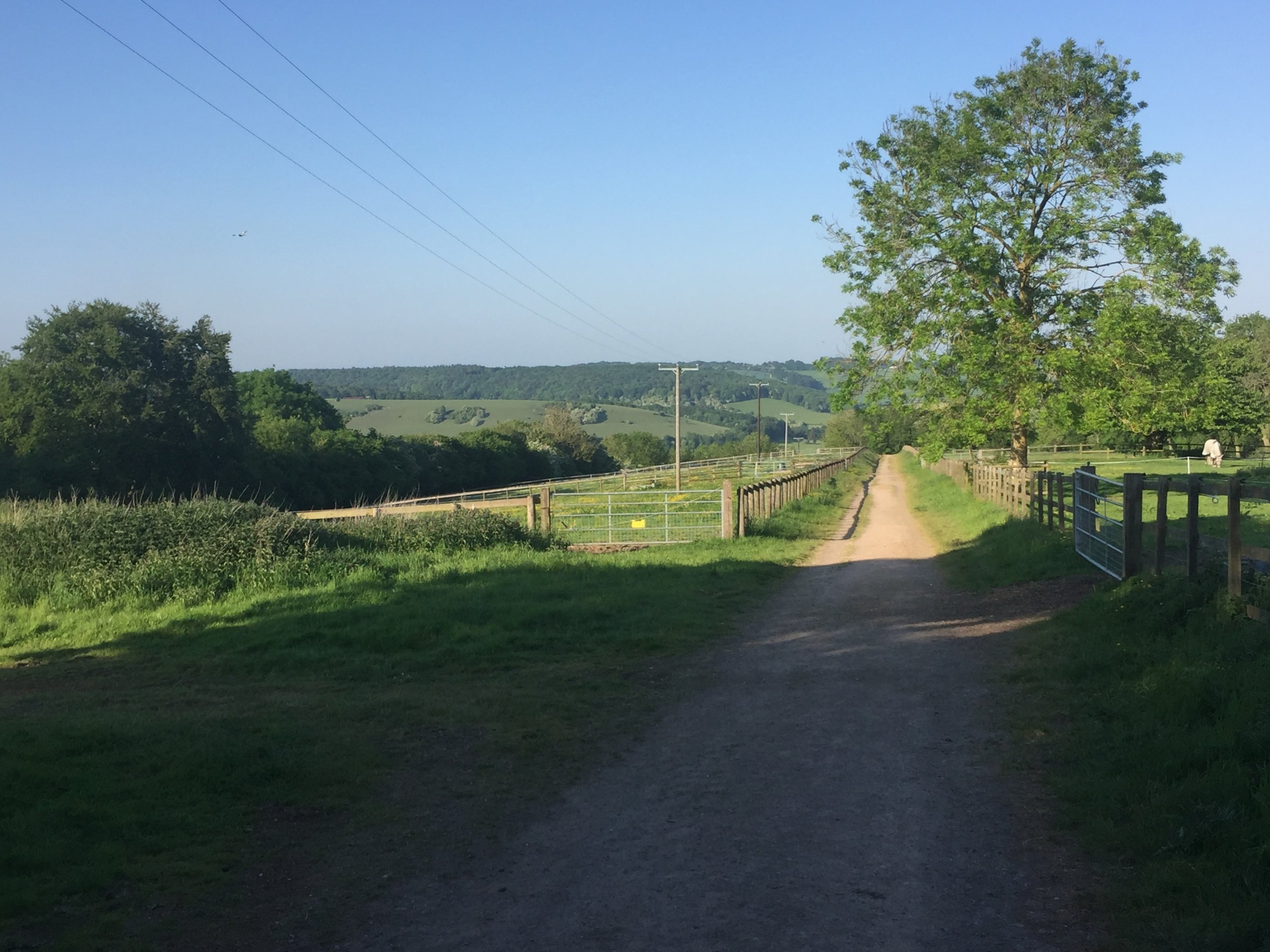
We plan to go back but we’ll organise it ourselves now that we know what to do and where to go. The best plan seems to be to go by ferry on foot and hire a car on La. Gomera. Our first plan had been to take our Tenerife based rental car over on the ferry, then we found out that most rental companies don’t allow it. The island roads from the port to the national park are good and there’s several parking spots around the trail to the summit. We will probably stay on the island for a few days and check out the many other trails too.

IMG_6159.JPG

So close

Roque de Agando - volcanic plug, a highlight of the centre of La Gomera

Roque de Agando - volcanic plug, a highlight of the centre of La Gomera


Adventures in Food: Archipelago, London

This was a Christmas present from Timi after a bit of heavy hinting. A great Saturday double-bill of the Adventure Travel Show in London followed by the Archipelago restaurant. My new favourite place in London. Had the zebra to start with, crocodile curry main course with silkworm pupae side dish and chocolate covered scorpion for desert. Awesome 

 
2017 in numbers

Total Distance in 2017

  • Run: 455 miles

  • Cycle: 1,256 miles

  • Trek: 284 miles

  • Total = 1,975 miles

Trek = recorded hiking & walking events, not general steps.

Key Events in 2017

  • 1 Ultra Marathon

  • 10 Half Marathons

  • 44 Total parkruns

  • 25 New parkruns

  • 4 New County Tops (Goatfell, Kinder Scout, Cheeks Hill, Black Hill)

  • 2 New Countries (Romania, Peru)

Stats from 2010 .. first year of tracking via Garmin

Stats from 2010 .. first year of tracking via Garmin

Richard gowerRun, Cycle, TrekComment
Walking The Clarendon Way
IMG_5743.JPG

Start: Salisbury Cathedral, The Close, Salisbury, SP1 2EJ
Finish: Winchester Cathedral, 9 The Close, Winchester, SO23 9LS
Distance: 44 km (27.3 miles)
Elevation change: +599m / -605m m. Net -6m
GPX File: get via Buy Me a Coffee
Other routes touched (walk): Old Sarum Way, Monarch’s Way, Test Way,
Other routes touched (cycle): NCN 23, 24, 246,
Map:
-
OS Explorer Map (130) Salisbury and Stonehenge
- OS Explorer Map (131) Romsey, Andover and Test Valley
- OS Explorer OL32 Winchester, New Alresford & East Meon
Links: Clarendon Way, Salisbury, River Test, Winchester


I struggle with December. I don't know whether its real Seasonal Affective Disorder, but I'm definitely affected by the short, dark days. By the time I finished work on the 20th I was barely clinging on for the break. What I needed was a 1 day microadventure: a whole day outside and to get physically rather than mentally tired. The Clarendon Way solved this.

The route is a 20 mile sign posted trail between Salisbury and Winchester. It has the feel of a Pilgrimage route with a cathedral at either end and long, straight ancient paths. It connects 2 old Royal Palaces, including Clarendon Palace after which it is named.

There's a lot of pleasant countryside and some interesting sections at either end. Much of the middle is unremarkable though. Maybe I've been spoilt by other trails like the Ridgeway that have more to see. That wasn't really the point of today's trip though.

The day started with a head full of unfinished work thoughts, re-mortgaging details and annoyances about dodgy builders. Thoughts came and went over the course of the 8 hour trip. Ideas rumbled around, solutions presented themselves and some things lost their importance. I've read about people finding enlightenment on a Pilgrimage. I wasn't going to get that on a 1-day walk, but I understand where it comes from. For some its a religious experience, for me its the head-clearing power of exercising outdoors.

Getting there:

The Clarendon Way is a good 1-day walk or, in summer, a trail marathon run. Although it can be broken into sections, the completed journey in a day is enormously satisfying. I parked at Basingstoke station and took a 45 minute train to Salisbury, returning from Winchester to Basingstoke. This is the best solution if you're coming from the north and there's a similar option using Southampton station as the connector. The train station in each city is about half a mile from the cathedral.


For an alternative 2-day option on walking the Clarendon way, check out Hiker Hero’s blog about the trail. It’s a great article with some awesome photos and more description on the route.