Cycling The Semaphore Line: Portsmouth to London
HMS Warrior at the Portmouth Historic Dockyard
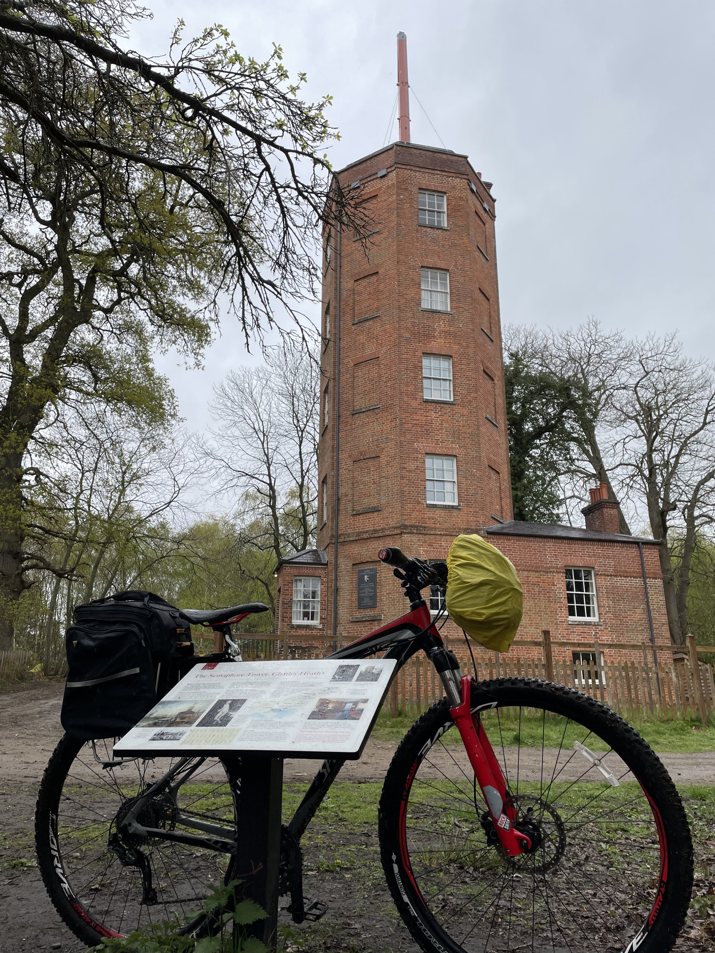
The idea for this trip came from a short walk that I did a few years ago in Surrey called Discover Downside. Half way through the walk we came across the Chatley Heath Semphore Tower, the best preserved of a series of towers that formed a line between London and Portsmouth in the 1800s. As I was reading the information board a new adventure started forming. I didn’t have to say anything I could almost hear my wife’s eyes rolling and wondering “what’s he up to now?”.
As described on the Chatley Heath information board: “In 1792, Frenchman Claude Chappe invented the Semaphore using moveable arms on a T-shaped mast. The British Initially stuck with their existing shutter or ball signalling systems even though they were less effective. In 1814 the Admiralty prematurely decommissioned their existing signalling stations. After Napoleon’s escape from Elba and the Battle of Waterloo in 1815, the governament decided to reinstate a signal line from London to Portsmouth Dockyard. They chose to use the semaphore system invested by Sir Home Riggs Popham, as the most advanced of the day.”
“The Chatley Heath Tower was the fifth station in the 75 mile long line, which started on the roof of the Admiraly in Whitehall. It was to have been the junction for a further line to Plymouth, but this was never completed. […] The invention of the electric telegraph in 1839 meant the end for the mechanical semaphore. New telegraph lines were laid alongside the railways and messages travelled instantly down the wires. In 1847 the semaphore line was decommissioned and the mast dismantled.”
Over the next year the back-of-my-mind potential trip became a fully-planned weekend cycle trip for spring 2023. It turned out to be a weekend adventure with a Friday evening drive down to Portsmouth, a long Saturday ride to Godalming and a shorter section on the Sunday before heading back home. The original plan was to take the bikes down to Portsmouth by train but some organizational faffing meant that we left it too late to book and there we no bike spaces available. Instead we did a one-way van rental which was slightly more expensive than the trains would have been but got us there more quickly with less hassle.
The choice of doing the trip from Portsmouth to London rather than the other way around was mostly based on getting in a new (for me) parkrun at Southsea on the Saturday morning. Arriving in London on Sunday afternoon also gave us a shorter journey home.
I need to credit the excellent account of walking the Semaphore Line in the Jont.org.uk blog. This blog was invaluable in the planning process and provides more detail on the stations and route between them than I have covered here. In my post below I’ve covered some key details of the semaphore stations it’s not intended to be a turn-by-turn route guide. I’ll be happy to share my GPX files for the 2 days in return for a virtual coffee.
Day 1: Portsmouth to Godalming
Start: Semaphore Building, HMNB Portsmouth, Victory Gate, HM Naval Base, Portsmouth, PO1 3LJ
Finish: A3100 Meadrow (road), Godalming, GU7 3HS
Distance: 88 km (55 miles)
Elevation change: + 1,301m / -1265m (Net +36m)
GPX File: get via Buy Me a Coffee
Other routes touched (walk): Solent Way, The Shipwright’s Way, Langstone Harbour Waterfront Route, Wayfarers Way, Sussex Border Path, Monarch’s Way, Octagon Way, South Downs Way, The Serpent Trail, New Lipchis Way, Grayswood Walk, Greensand Way, The Fox Way
Other routes touched (cycle): NCN 2, 22, 222, Surrey Cycleway
Semaphore Station 1: Portsmouth Historic Dockyard
Condition: The Semaphore Building was destroyed by fire in 1913, but it was rebuilt in 1930.
Distance into route: 0 km
Address: Semaphore Building, HMNB Portsmouth, Victory Gate, HM Naval Base, Portsmouth, PO1 3LJ
Coordinates: 50°47'60"N 1°6'36"W
Grid Reference: SU 62826 00415
Elevation: 1m
Map: Meon Valley Map | Portsmouth, Gosport & Fareham | Ordnance Survey | OS Explorer Map OL3
Links: Jont Blog Post, Portsmouth, Portsmouth Historic Dockyard
To get close to the Semaphore Building you need to pay to enter the Historic Dockyard. It’s well worth visiting but I had been before a few years ago and didn’t need to go back. The tower is tall though and can be easily seen from outside of the Historic Dockyard.
Semaphore Station 2: The Square Tower
Condition: Well maintained and now used for hosting functions such as weddings, christenings and funerals.
Distance into route: 1.7 km
Address: Broad St, Old Portsmouth, Portsmouth PO1 2ND
Coordinates: 50°47'22.0"N 1°06'23.0"W
Grid Reference: SZ 63076 99244
Elevation: 2m
Map: Meon Valley Map | Portsmouth, Gosport & Fareham | Ordnance Survey | OS Explorer Map OL3
Links: Jont Blog Post, The Square Tower, Old Portsmouth
There seems to be some ambiguity about whether this was the first/last semaphore tower in the chain vs the one at Portsmouth Historic Dockyard. For the purposes of this trip there was no need to decide as it’s easy to visit both.
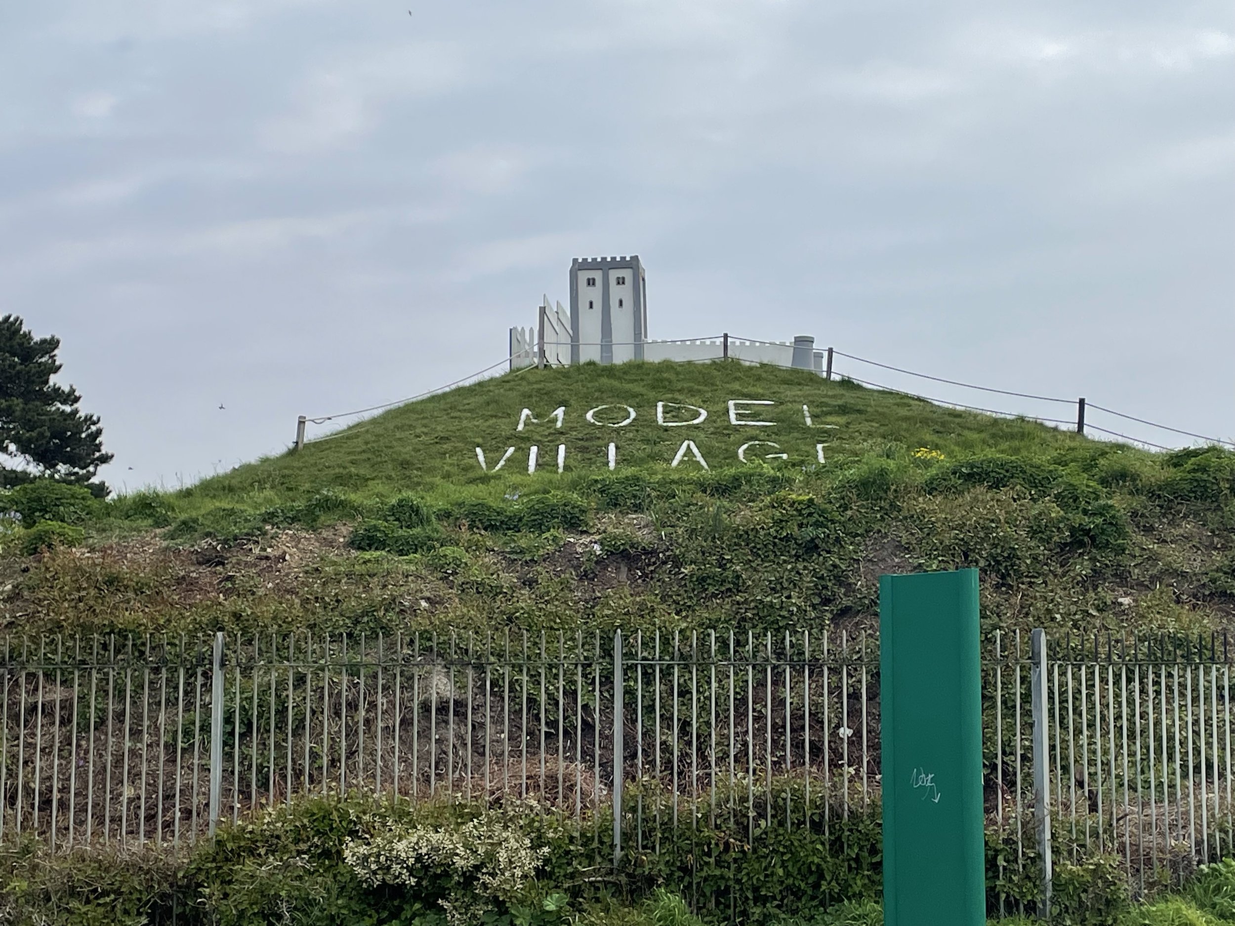
Semaphore Station 3: Lumps Fort
Condition: Demolished after World War 1, now a Japanese Rose Garden and a Model Village
Distance into route: 5.0 km
Address: Japanse Garden, Southsea, Portsmouth, Southsea PO4 9RU
Coordinates: 50°46'52.0"N 1°04'04.6"W
Grid Reference: SZ 65807 98359
Elevation: 5m
Map: Meon Valley Map | Portsmouth, Gosport & Fareham | Ordnance Survey | OS Explorer Map OL3
Links: Jont Blog Post, Lumps Fort, Southsea
Semaphore Station 4: Camp Down
Condition: Demolished, now a waste transfer facility.
Distance into route: 18.1 km
Address: L&S Waste Management Limited, Portsdown Hill Road, Farlington, Redoubt PO6 1BW
Coordinates: 50°51'13.0"N 1°01'34.0"W
Grid Reference: SU 68648 06449
Elevation: 60m
Map: Meon Valley Map | Portsmouth, Gosport & Fareham | Ordnance Survey | OS Explorer Map OL3
Links: Jont Blog Post, Camp Down, Portsdown Hill
Semaphore Station 5: Compton Down
Condition: Building now a private house without a tower.
Distance into route: 33.9 km
Address: Telegraph House, Telegraph Hill, Compton, Chichester, PO18 9QL
Coordinates: 50°55'40.0"N 0°53'12.0"W
Grid Reference: SU 78332 14861
Elevation: 161m
Map: Chichester Map | South Harting & Selsey | Ordnance Survey | OS Explorer Map OL08
Links: Jont Blog Post, Compton Down, Compton
Semaphore Station 6: Beacon Hill
Condition: The original semaphore house no longer exists, apart from some original footings. Beacon Hill House was built in connection with the area.
Distance into route: 43.4 km
Address: Telegraph House, North Marden, Chichester, PO18 9JX
Coordinates: 50°57'03.0"N 0°50'55.0"W
Grid Reference: SU 80980 17445
Elevation: 190m
Map: Chichester Map | South Harting & Selsey | Ordnance Survey | OS Explorer Map OL08
Links: Jont Blog Post, Beacon Hill, West Sussex
Semaphore Station 7: Older Hill (Holder Hill)
Condition: Building possibly still remains but within private property.
Distance into route: 57.5 km
Address: Pine Hill House, Telegraph Hill, Midhurst, GU29 0BN
Coordinates: 51°01'50.0"N 0°45'34.0"W
Grid Reference: SU 87081 26429
Elevation: 203m
Map: Haslemere & Petersfield Map | Midhurst & Selborne | Ordnance Survey | OS Explorer Map OL33
Links: Jont Blog Post, Woolbedding
Semaphore Station 8: Haste Hill
Condition: Demolished. Property became the Royal Naval Signals School then Whitwell Hatch Hotel and now private apartments.
Distance into route: 69.1 km
Address: Whitwell Hatch, Scotland Lane, Haslemere, GU27 3AW
Coordinates: 51°04'51.0"N 0°42'17.0"W
Grid Reference: SU 90828 32065
Elevation: 206m
Map: Haslemere & Petersfield Map | Midhurst & Selborne | Ordnance Survey | OS Explorer Map OL33
Links: Jont Blog Post, Haste Hill
Semaphore Station 9: Bannicle Hill
Condition: Demolished, likely replaced by Hill House.
Distance into route: 77 km
Address: The Hill House, Church Lane, Witley, Godalming
Coordinates: 51°08'12.0"N 0°39'36.0"W
Grid Reference: SU 93847 38347
Elevation: 147m
Map: Haslemere & Petersfield Map | Midhurst & Selborne | Ordnance Survey | OS Explorer Map OL33
Links: Jont Blog Post, Witley
Day 2: Godalming to The Admiralty, London
Start: A3100 Meadrow (road), Godalming, GU7 3HS
Finish: Admiralty House, Whitehall, London, SW1A 2AY
Distance: 62.3 km (38.7 miles)
Elevation change: + 435m / -458m (Net -23m)
GPX File: get via Buy Me a Coffee
Other routes touched (walk): Wey-South Path, The Scholar’s Trail, North Downs Way, The Fox Way, Hogsmill Valley Walk, Thames Down Link, Beverley Brook Walk, Thames Path, Jubilee Walkway
Other routes touched (cycle): NCN 2, 223, 4, Surrey Cycleway, C30, C3
Semaphore Station 10: Pewley Hill
Condition: Restored and now a listed building and a private house.
Distance into route (Day 2): 7 km / Full Route: 95 km
Address: Semaphore House, Pewley Hill, Guildford, GU1 3SN
Coordinates: 51°13'59.0"N 0°33'57.0"W
Grid Reference: TQ 00231 49197
Elevation: 112m
Map: Guildford & Farnham Map | Godalming & Farnborough | Ordnance Survey | OS Explorer Map 145
Links: Jont Blog Post, Pewley Hill, Semaphore House (Historic England), Semaphore House (British Listed Buildings)
Semaphore Station 11: Chatley Heath
Condition: Restored and now managed by the Landmark Trust.
Distance into route (Day 2): 22.6 km / Full Route: 110.6 km
Address: Pointers Road, Cobham, KT11 1PQ
Coordinates: 51°18'55.0"N 0°26'18.0"W
Grid Reference: TQ 08941 58501
Elevation: 55m
Map: Guildford & Farnham Map | Godalming & Farnborough | Ordnance Survey | OS Explorer Map 145
Links: Jont Blog Post, Chatley Heath, The Semaphore Tower (Landmark Trust),
Semaphore Station 12: Coopers Hill
Condition: Restored, now a private house.
Distance into route (Day 2): 35.5 km / Full Route: 124.3 km
Address: Semaphore House, Esher, KT10 0DX
Coordinates: 51°22'11.0"N 0°20'17.0"W
Grid Reference: TQ 15793 64726
Elevation: 49m
Map: London South Map | Westminster, Greenwich, Croydon, Esher & Twickenham | Ordnance Survey | OS Explorer Map 161
Links: Jont Blog Post, Claygate, Esher
Semaphore Station 13: Coombe Warren
Condition: Demolished, replaced by a large private house called Telegraph Cottage.
Distance into route (Day 2): 45 km / Full Route: 133.8 km
Address: Telegraph Cottage, Warren Road, Kingston upon Thames, KT2 7LF
Coordinates: 51°25'15.0"N 0°16'05.0"W
Grid Reference: TQ 20523 70523
Elevation: 53m
Map: London South Map | Westminster, Greenwich, Croydon, Esher & Twickenham | Ordnance Survey | OS Explorer Map 161
Links: Jont Blog Post, Coombe, Kingston upon Thames
Semaphore Station 14: Putney Heath
Condition: Demolished, presumably replaced by the Telegraph Pub
Distance into route (Day 2): 50 km / Full Route: 138.8 km
Address: The Telegraph, Putney Heath, London SW15 3TU
Coordinates: 51°26'55.0"N 0°13'34.0"W
Grid Reference: TQ 23359 73661
Elevation: 53m
Map: London South Map | Westminster, Greenwich, Croydon, Esher & Twickenham | Ordnance Survey | OS Explorer Map 161
Links: Jont Blog Post, The Telegrpaph Pub,
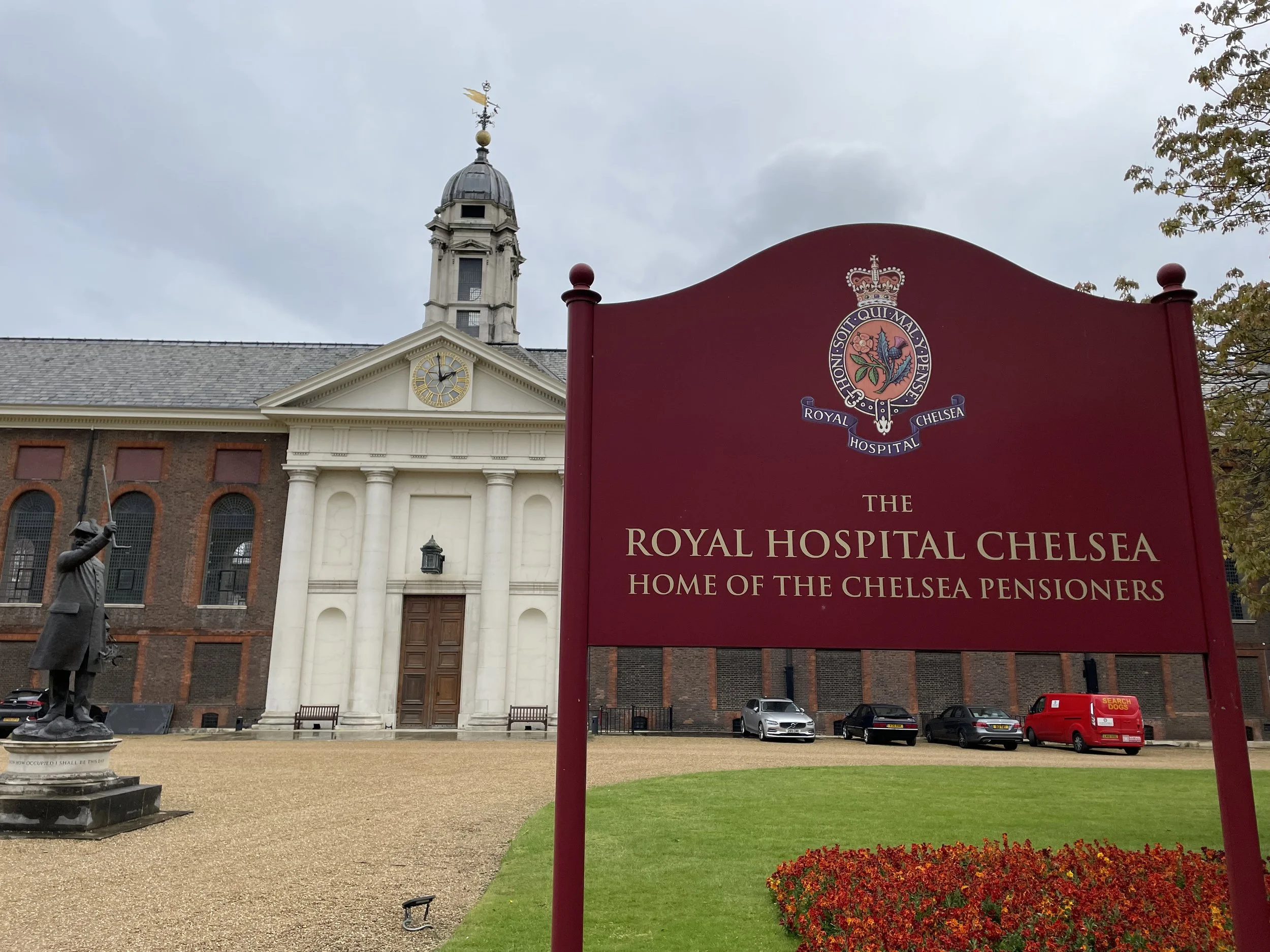
Semaphore Station 15: Chelsea
Condition: Tower no longer there / presumed site of this tower.
Distance into route (Day 2): 57.8 km / Full Route: 146.6 km
Address: Royal Hospital Chelsea, Royal Hospital Road, London SW3 4SR
Coordinates: 51°29'16.0"N 0°09'31.0"W
Grid Reference: TQ 27938 78142
Elevation: 6m
Map: London South Map | Westminster, Greenwich, Croydon, Esher & Twickenham | Ordnance Survey | OS Explorer Map 161
Links: Jont Blog Post, Royal Hospital Chelsea,
An alternative location of this telegraph station is the Duke of York's Headquarters, now the Saatchi Gallery. We dodged traffic on a very busy Sunday to visit both.
Semaphore Station 16: The Admiralty
Condition: Admiralty buildings still intact and in use by various government departments.
Distance into route (Day 2): 62.3 km / Full Route: 151.1 km
Address: Old Admiralty Building, London, SW1A 2AY
Coordinates: 51°30'22.0"N 0°07'43.0"W
Grid Reference: TQ 29979 80241
Elevation: 5m
Map: London South Map | Westminster, Greenwich, Croydon, Esher & Twickenham | Ordnance Survey | OS Explorer Map 161
Links: Jont Blog Post, Admiralty buildings, Horseguards Parade, Whitehall
A good learning from us if you’re planning to end your ride at The Admiralty is to not do it just as the London Marathon is finishing. It was only a few days before our trip that I discovered the dates clashed. The London Marathon uses Horseguards Parade as a post-race meeting spot for family and friends so it’s really busy. We still managed to get to our finish spot though after a bit of navigation around blocked off streets.
The Full 2-Day Route
Elevations of each Semaphore Station in metres
Day 2 cycling route elevation map
Day 2 cycling route elevation map


