Walking the City of London Boundary
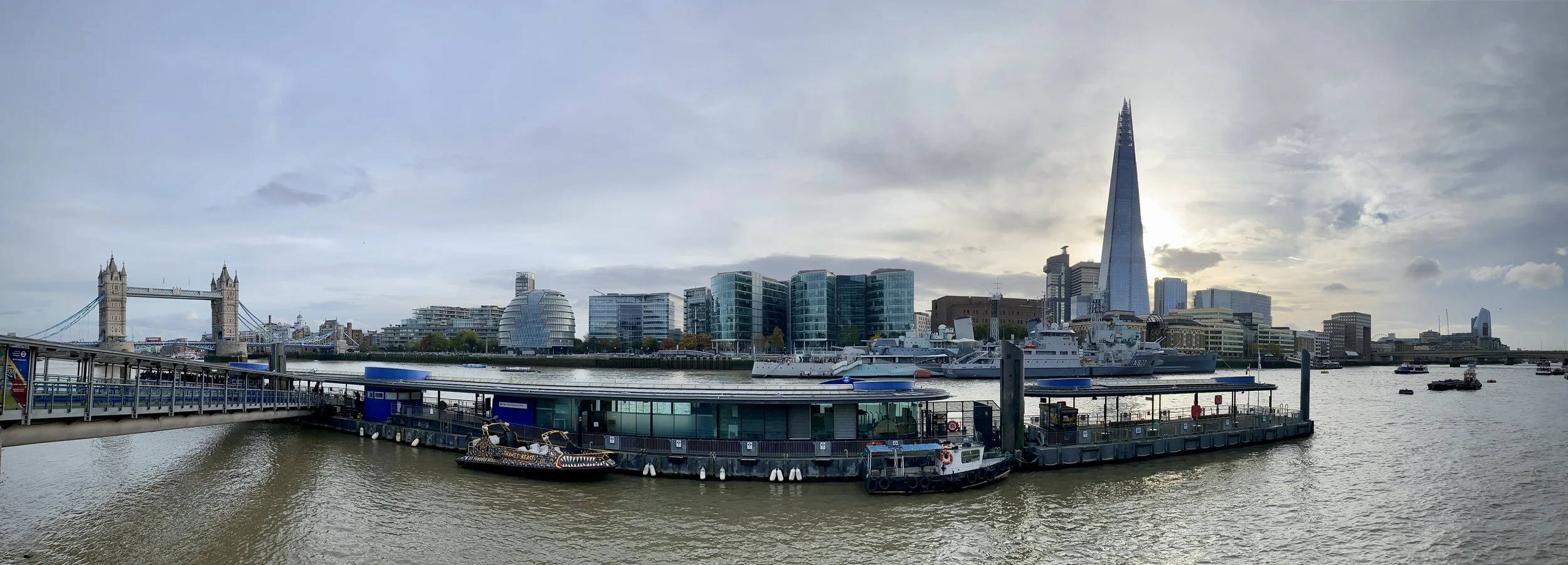
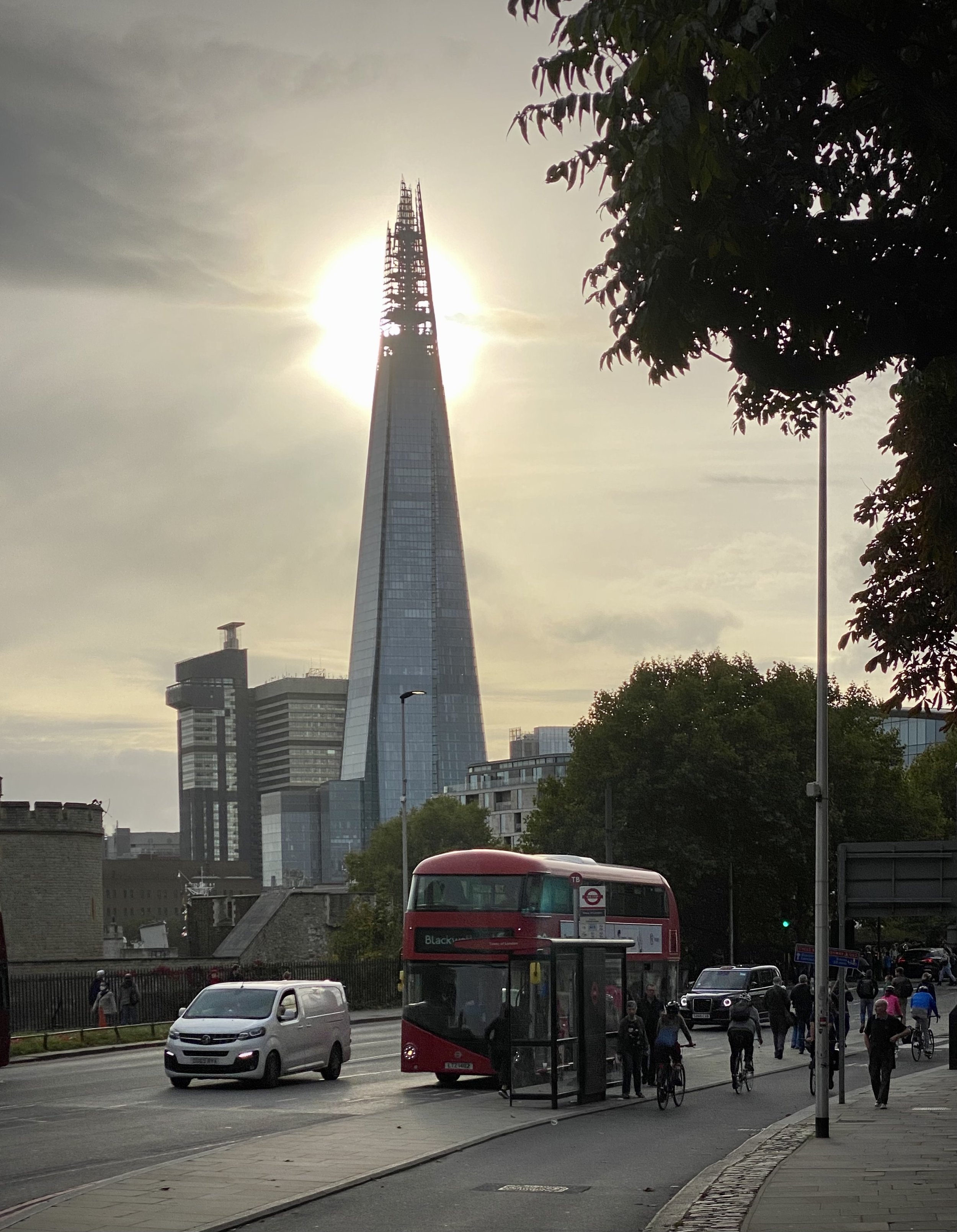
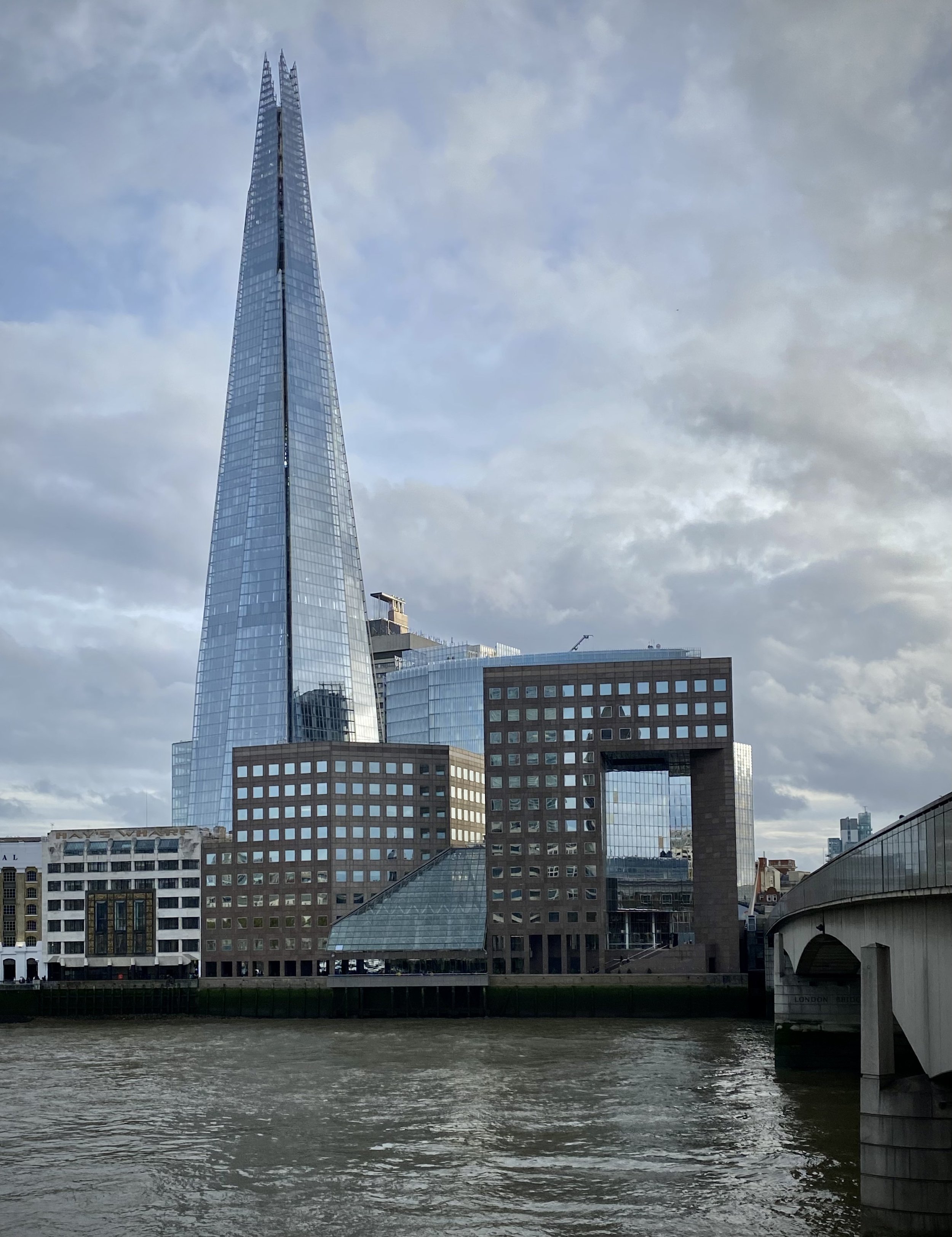
View of the Thames from the southern border of The City at the City/Tower Hamlets/Southwark Tri-point
The City of London is a unique place in the UK’s geography and governance. It’s part of Greater London but not one of the 32 London Boroughs. It’s inside a city but is a city itself. It’s a Ceremonial County and was within the boundaries of the Historic County of Middlesex but was self-governing.
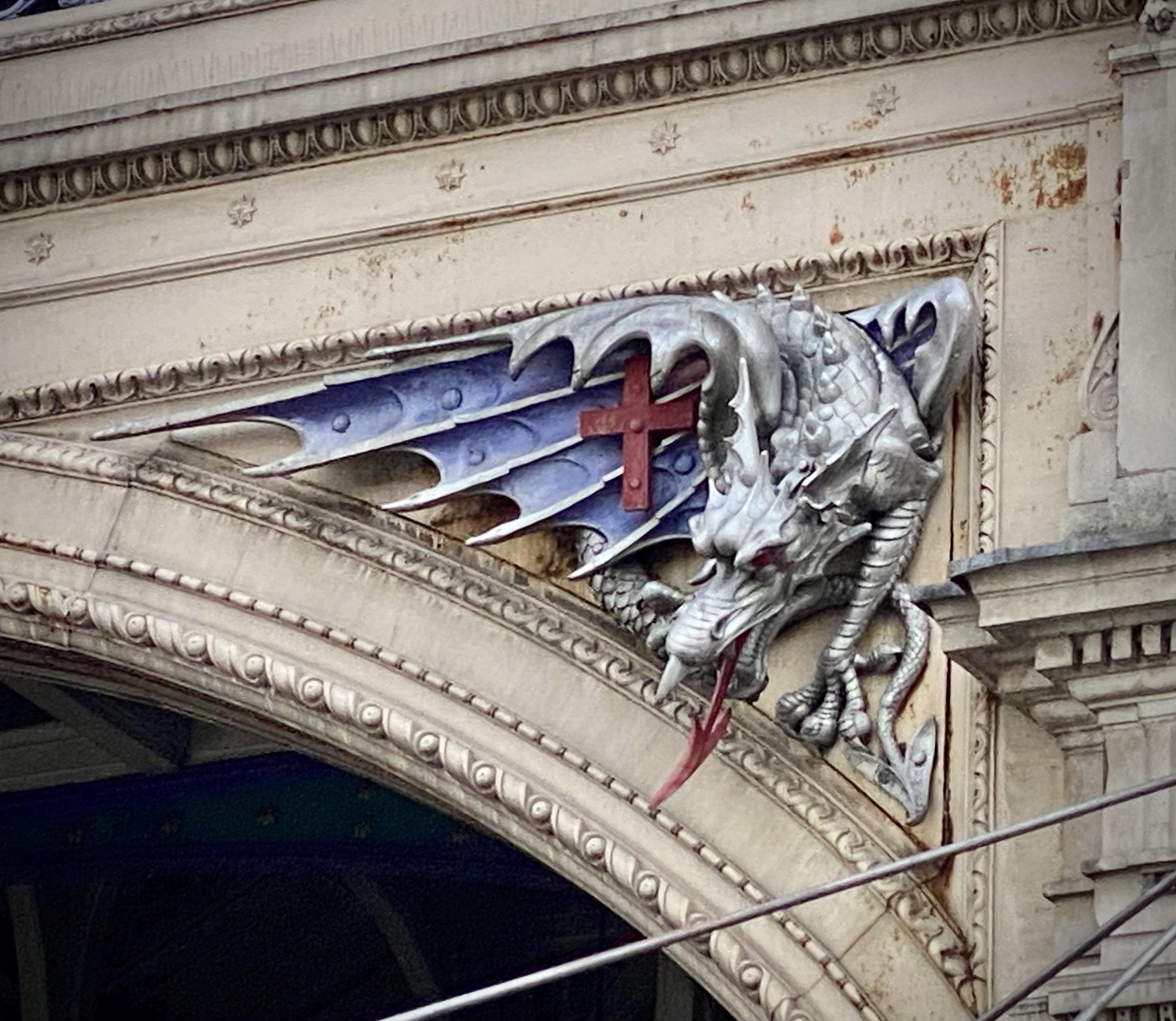
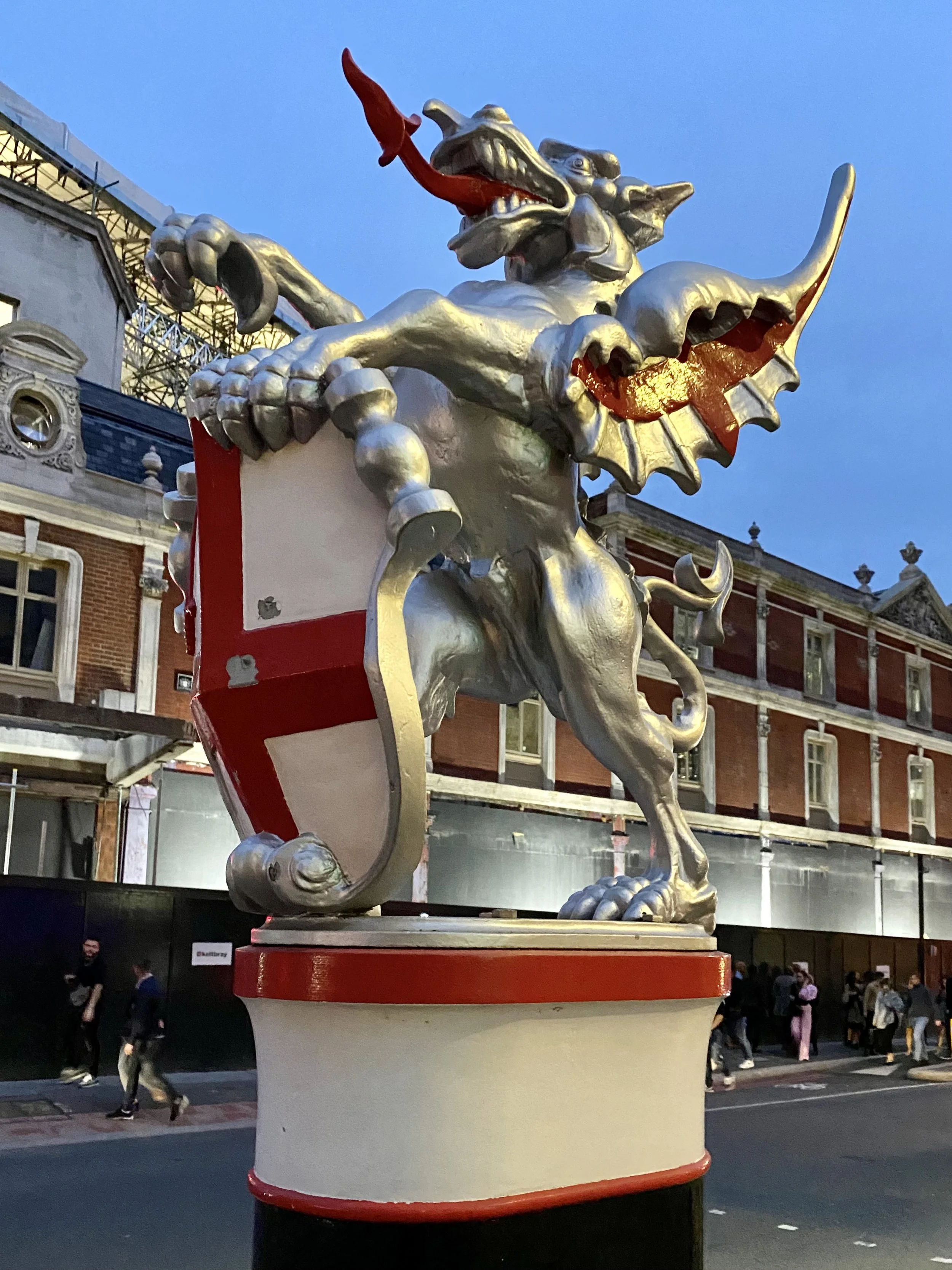
The City is nicknamed the Square Mile as its internal area is 1.12 square miles. The boundary is less than 11 km with negligible elevation change which makes it a very manageable walk of approximately 3 hours. As a as walk it’s also fascinating as you’ll pass the 14 dragons that guard the boundary, 7 tri-points with the London Boroughs and the highest point of the City of London.
The dragons are cast iron statues that guard the main road entrances to the City of London. They were designed and installed in the 1960s. For a more detailed history of the dragons, see the post on IanVisits.
The page below describes the walk that we did in October 2022. Directions start at the Victoria Embankment Dragon, close to Temple Station, but there are several other good starting points close to tube or rail stations. Let me know if you spot an error or have an interesting fact about the boundary to share. I’ll donate £1 to one of my causes for each update to the page.
Start & Finish: At the Embankment Dragons, Victoria Embankment, Temple, London, WC2R 2PN
Distance: 10.6 km (6.6 miles)
Elevation change: +/- 89m
GPX File: get via Buy Me a Coffee
Other routes touched (walk): Thames Path, Jubilee Walkway, Jack The Ripper Walk, Jubilee Greenway
Other routes touched (cycle): CS 3,7, C2,6
Map: London North Map | The City, West End, Enfield, Ealing, Harrow & Watford | Ordnance Survey | OS Explorer Map 173
Links: City of London, Dragon Boundary Mark

Route of the boundary walk showing locations of the Dragons (liliac icon), Tri-points (brown icon) and high point (red icon)


The City / Borough Tri-Points
Our boundary walk was partly inspired by David Natzler’s project to visit the Borough Tri-Points of Greater London. David’s project, documented in this blog post, visits 32 points where three London Boroughs connect. The City of London isn’t a borough so the 7 Tri-Points of the City with 2 boroughs were out of scope for that project. Given that all 7 of these are on the City of London boundary I wanted to find them all.
David had the great idea of using an oak sprig in photos of each Tri-Point. I wanted to do something slightly different and used a fridge magnet of a London postbox to show the Tri-Point location. Scroll down to see details and the photo of each Tri-Point at the relevant part of the walk.

Dragons 1 & 2: Embankment
Type: Twins, either side of Victoria Embankment, mounted on stone pedestals.
Distance into walk: 0 km
Address: Victoria Embankment, Temple, London, WC2R 2PN.
Nearest Station: Temple (Circle, District)
Coordinates: 51°30'40.0"N 0°06'41.5"W
Links: Victoria Embankment, Inner Temple Gardens

Dragon 3: Temple Bar
Type: Large single dragon on top of a memorial obelisk.
Distance into walk: 0.4 km
Address: The Strand, Temple, London, EC4A 2LT
Nearest Stations: Temple (Circle, District) or City Thameslink
Coordinates: 51°30'49.4"N 0°06'42.9"W
Directions from previous point: Right onto Temple Place, up the Milford Lane steps, along Essex Street, right onto The Strand. Note that the boundary runs through the buildings east of Essex Street. Essex Street itself is actually in the City of Westminster.
Links: Temple Bar, Temple Bar Memorial, Royal Courts of Justice

City of London High Point
Distance into walk: 1 km
Address: Junction of Chancery Lane and High Holborn.
Nearest Station: Chancery Lane (Central)
Coordinates: 51°31'05.3"N 0°06'49.5"W
Directions from previous point: Left onto Chancery Lane, continue to the junction with High Holborn.
See this related post for more details and photos of the City of London High Point

Dragons 4 & 5: High Holborn
Type: Twin dragons on stone plinths either side of the road.
Distance into walk: 1.2 km
Address: Either side of High Holborn near exit to Chancery Lane Underground. Staple Inn 5, London, WC1V 7QH.
Nearest Station: Chancery Lane (Central)
Coordinates: 51°31'05.1"N 0°06'40.7"W
Directions from previous point: Turn right out of Chancery Lane onto High Holborn, continue east.
Links: Chancery Lane, High Holborn
This one is often referred to as the Chancery Lane Dragon, however High Holborn is a more accurate name for its location.

Tri-Point: City of London / Westminster / Camden
Distance into walk: 1.3 km
Address: Between the two carriageways of High Holborn at the corner of High Holborn and Furnival Street, WC1V 7QU.
Nearest Station: Chancery Lane (Central)
Coordinates: 51°31'05.0"N 0°06'37.6"W
Directions from previous point: Continue east along High Holborn.
Links: City of Westminster, Camden
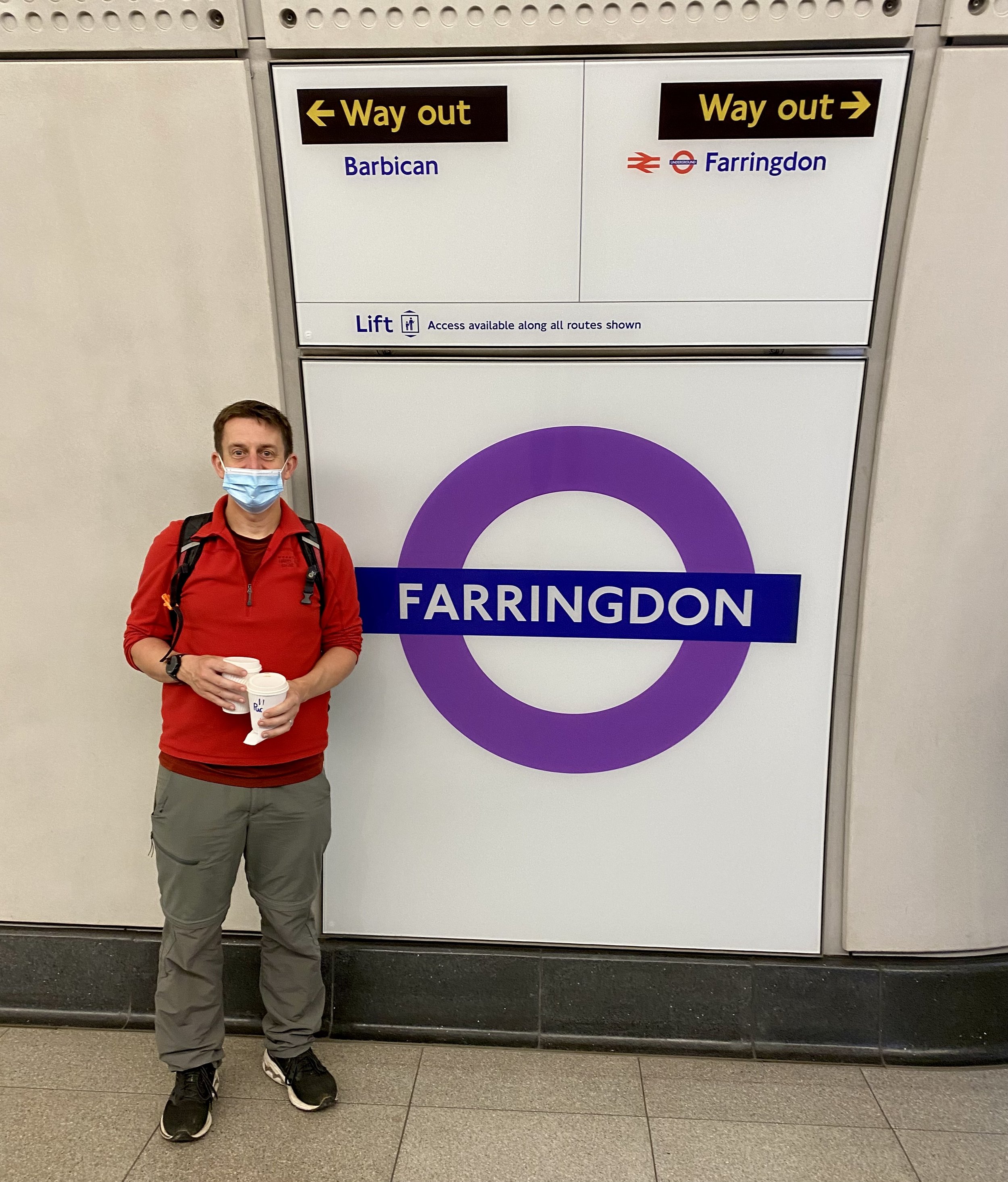
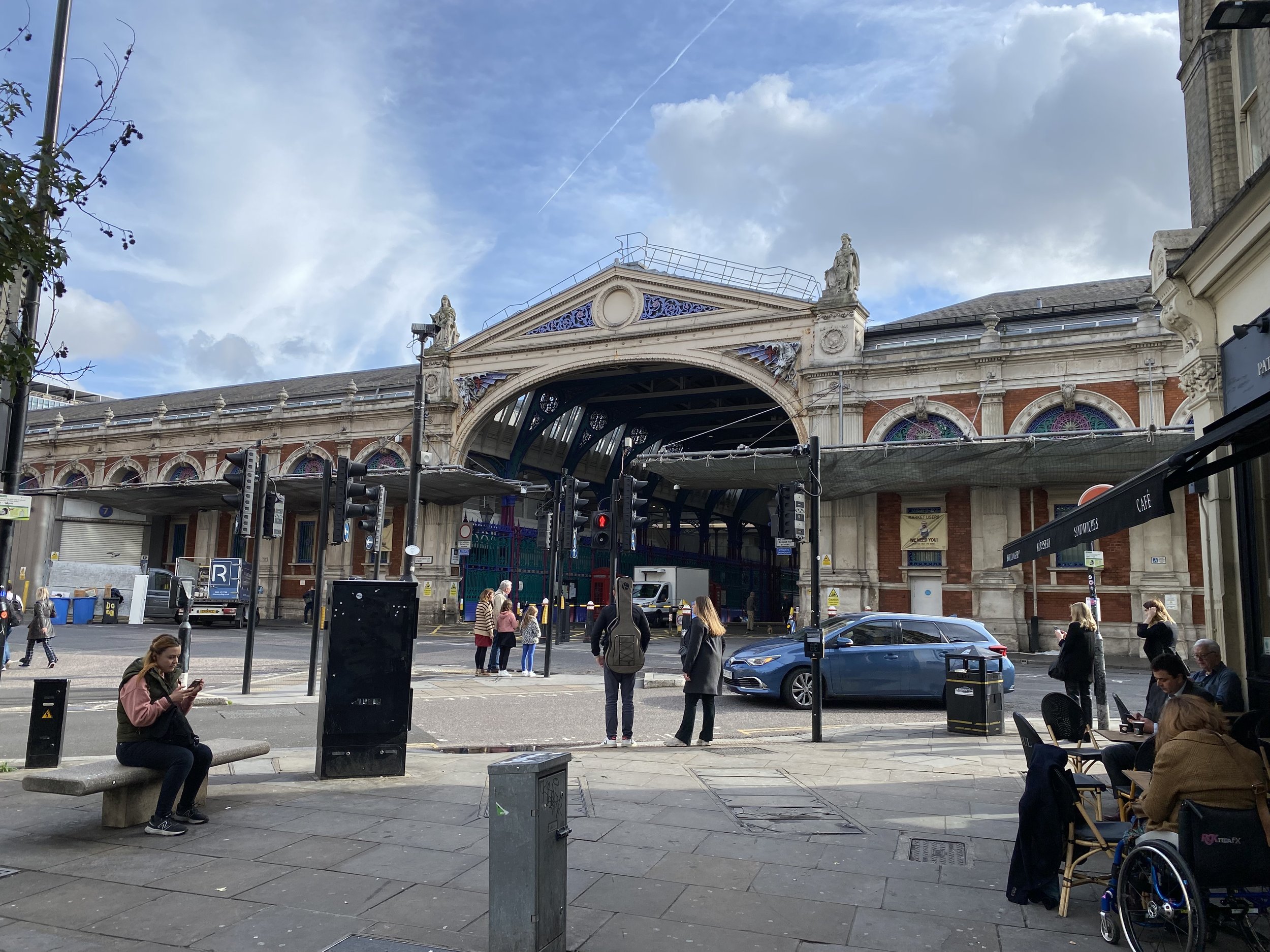
Dragon 6: Farringdon
Type: Single dragon on a pedestal.
Distance into walk: 1.7 km
Address: South side of junction of Charterhouse Street and Farringdon Street, EC4A 4LL.
Nearest Station: Farringdon (Circle, Hammersmith & City, Metropolitan, Elizabeth Line, Thameslink)
Coordinates: 51°31'06.6"N 0°06'19.1"W
Directions from previous point: Turn left onto Charterhouse Street at Junction of High Holborn/Hatton Garden/Charterhouse/New Fetter Lane.
Links: Farringdon, Smithfield, Smithfield Market
Look out for the 2 “bonus” dragons either side of the arch at the entrance to Smithfield Market on Charterhouse Street.

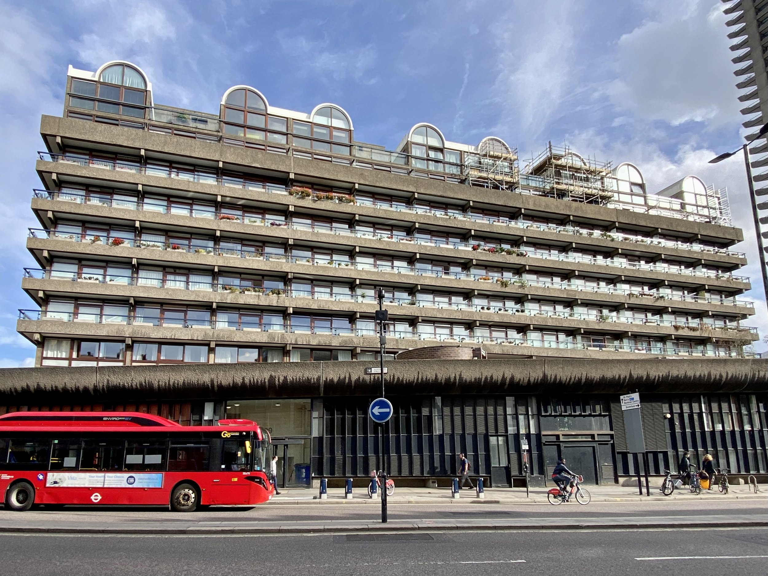
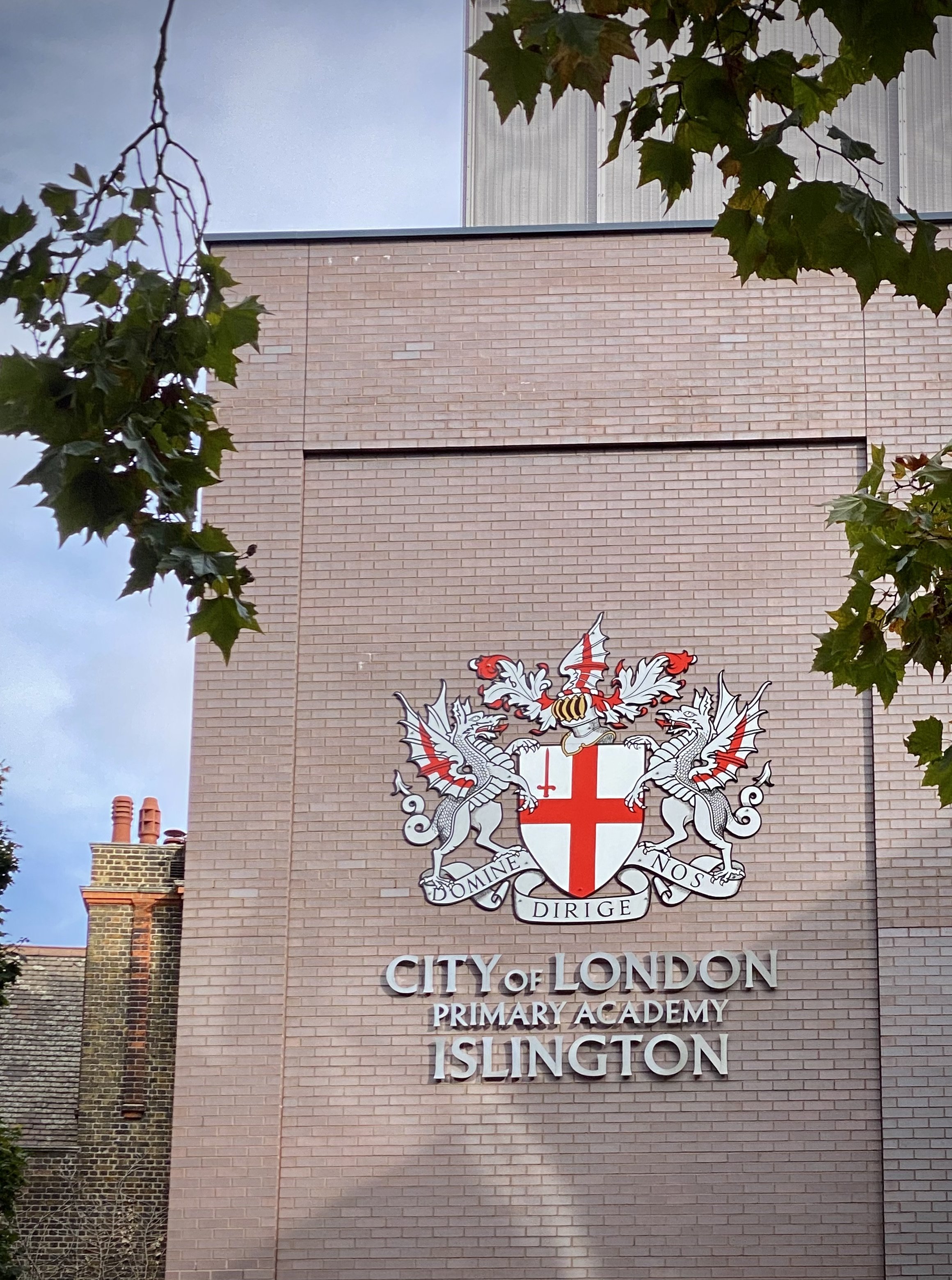
Tri-Point: City of London / Camden / Islington
Distance into walk: 1.7 km
Address: South side of junction of Charterhouse Street and Farringdon Street, EC4A 4LL.
Nearest Station: Farringdon (Circle, Hammersmith & City, Metropolitan, Elizabeth Line, Thameslink)
Coordinates: 51°31'06.6"N 0°06'19.1"W
Directions from previous point: N/A - at Farringdon Dragon.
Links: Camden, Islington

Dragon 7: Barbican
Type: Single dragon on a pedestal.
Distance into walk: 2.5 km
Address: Junction of A1 Goswell Road and Baltic Street West. 38 Goswell Road, Golden Lane Estate, London, EC1M 7AA.
Nearest Station: Barbican (Circle, Hammersmith & City, Metropolitan)
Coordinates: 51°31'22.4"N 0°05'52.1"W
Directions from previous point: Continue along Charterhouse Street until end, turn left onto A1 Goswell Road, continue north.
Links: Barbican, Barbican Estate, Golden Lane Estate

Dragon 8: Moorgate
Type: Single dragon on a pedestal.
Distance into walk: 3.6 km
Address: South-east side of junction of Ropemaker Street/A501 Moorgate/South Place, EC2M 2RB.
Nearest Station: Moorgate (National Rail)
Coordinates: 51°31'08.5"N 0°05'15.9"W
Directions from previous point: Turn right into Baltic Street West, onto Baltic Street East, right onto Golden Lane, Left onto B100 Beech Street, onto B100 Chiswell Street, right onto Moor Lane, left onto Ropemaker Street.
Links: Moorgate
At the time that we visited in October 2022 the Moorgate Dragon was looking shiny and new having been recently replaced. The original had been removed to allow room for lorries accessing the construction site for Crossrail / The Elizabeth Line.

Tri-Point: City of London / Islington / Hackney
Distance into walk: 3.9 km
Address: South-East Corner of Finsbury Square / Sun Street and Wilson Street, EC2M 2PA.
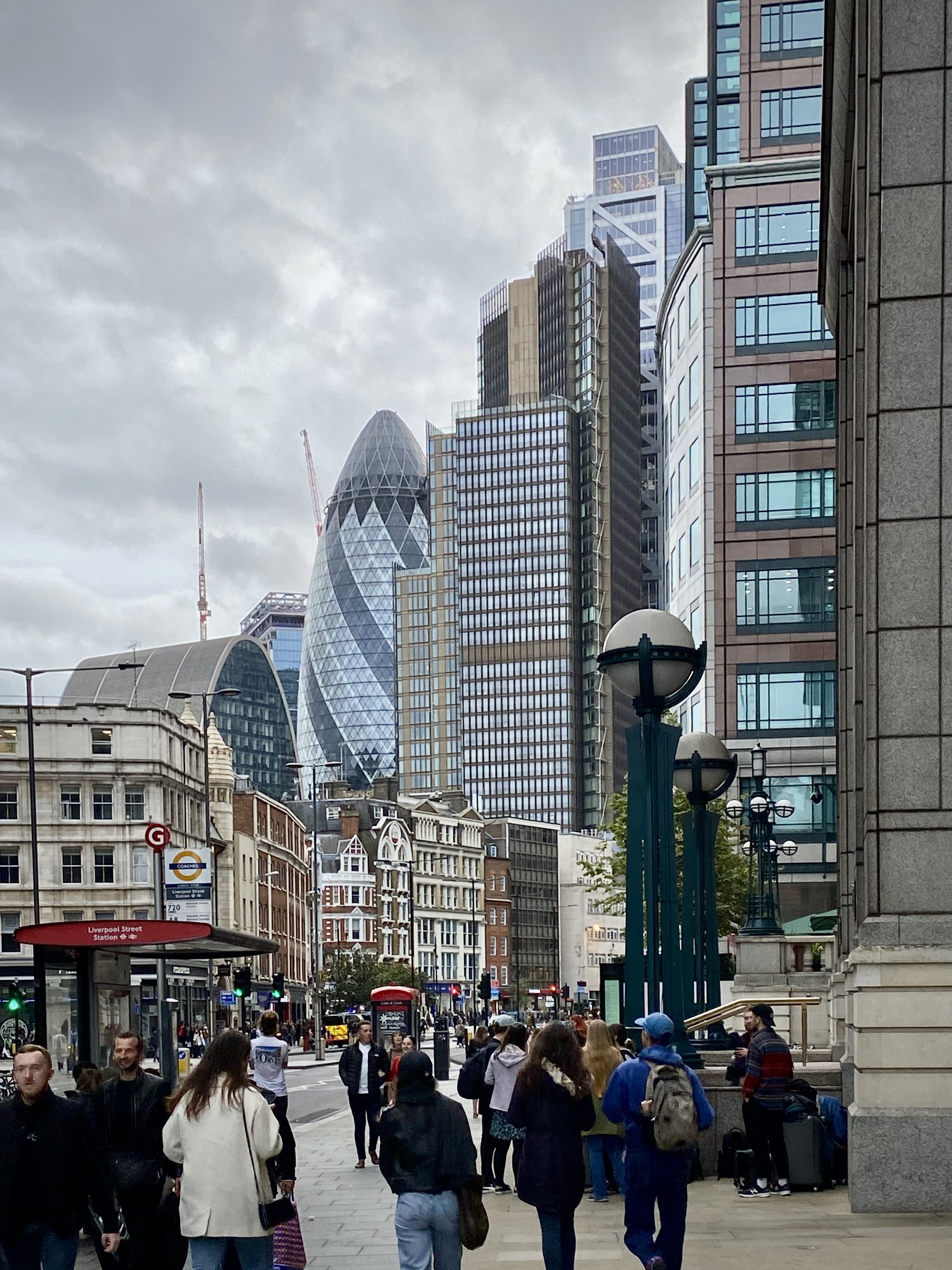
Nearest Station: Liverpool Street (Circle, Hammersmith & City, Metropolitan, Central, Elizabeth Line, Overground, National Rail)
Coordinates: 51°31'13.2"N 0°05'06.9"W
Directions from previous point: Continue east along South Place, left onto Wilson Street, continue to junction with Sun Street.
Links: Islington, Hackney

Dragon 9: Bishopsgate
Type: Single dragon on a pedestal.
Distance into walk: 4.5 km
Address: Corner of Worship Street and A10 Norton Foldgate.
Nearest Station: Liverpool Street (Circle, Hammersmith & City, Metropolitan, Central, Elizabeth Line, Overground, National Rail)
Coordinates: 51°31'17.3"N 0°04'43.1"W
Directions from previous point: Turn right onto Sun Street, curve to the left onto Appold Street, right onto Worship Street.
Links: Bishopsgate
This one is often referred to as the Liverpool Street Dragon, however Bishopsgate is a more accurate name for its location.

Tri-Point: City of London / Hackney / Tower Hamlets
Distance into walk: 4.5 km
Address: East side of A10 Shoreditch High Street opposite junction with Worship Street.
Nearest Station: Liverpool Street (Circle, Hammersmith & City, Metropolitan, Central, Elizabeth Line, Overground, National Rail)
Coordinates: 51°31'17.4"N 0°04'42.5"W
Directions from previous point: Opposite side of A10 North Foldgate to the Liverpool Street Dragon.
Links: Hackney, Tower Hamlets

Dragon 10: Aldgate
Type: Single dragon on a pedestal.
Distance into walk: 5.5 km
Address: South-west corner of Middlesex Street and Aldgate High Street, E1 8AX.
Nearest Stations: Aldgate (Circle, Metropolitan) and Aldgate East (District, Hammersmith & City)
Coordinates: 51°30'51.7"N 0°04'26.6"W
Directions from previous point: Turn right out of Worship Street onto A10 North Foldgate, left onto Brushfield Street, right onto Fort Street, (briefly) right onto Artillery Lane, left onto Sandy’s Row, left onto Middlesex Street, left onto St Botolph Street.
Links: Aldgate

Dragon 11: Tower Hill
Type: Single dragon on a pedestal.
Distance into walk: 6.6 km
Address: South side of Byward Street/Tower Hill, at 1 Tower Hill Terrace, London, EC3N 4EE.
Nearest Station: Tower Hill (Circle, District)
Coordinates: 51°30'34.1"N 0°04'43.1"W
Directions from previous point: Cross over Aldgate High Street onto A1210 Mansell Street, right onto Shorter Street, cross over The Minories and follow the north side of Trinity Square Gardens to Tower Hill (road). Cross over to South Side of Tower Hill (road).
Links: Tower Hill, Tower of London

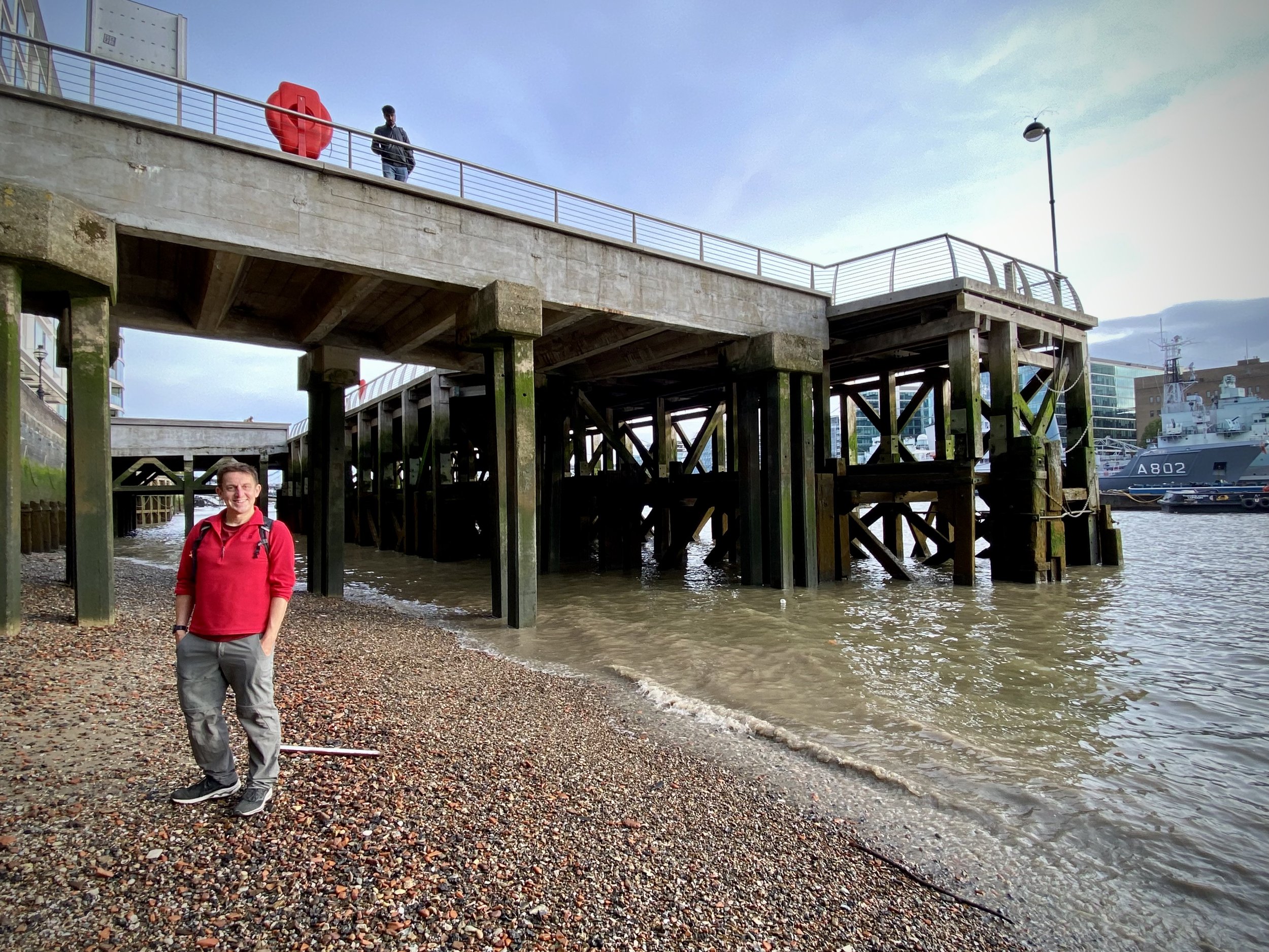
Tri-Point: City of London / Tower Hamlets / Southwark
Distance into walk: 6.8 km
Address: In River Thames between west end of Millennium Pier (north-side) and east end of HMS Belfast (south-side).
Nearest Station: Tower Hill (Circle, District)
Coordinates: 51°30'24.7"N 0°04'48.7"W
Directions from previous point: Turn right onto Tower Hill Terrace, continue onto Petty Wales then to the Thames Path.
Links: Tower Hamlets, Southwark

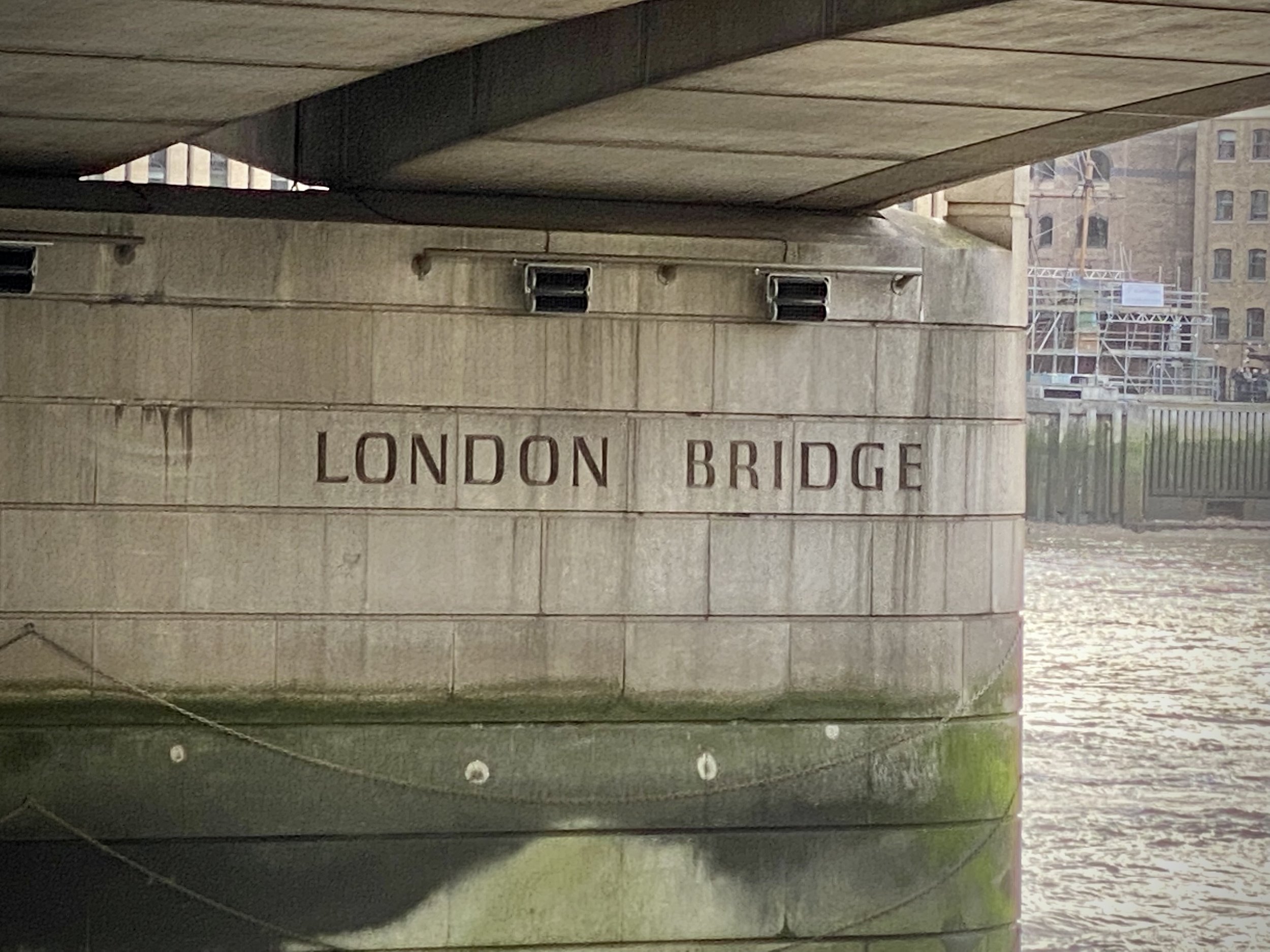
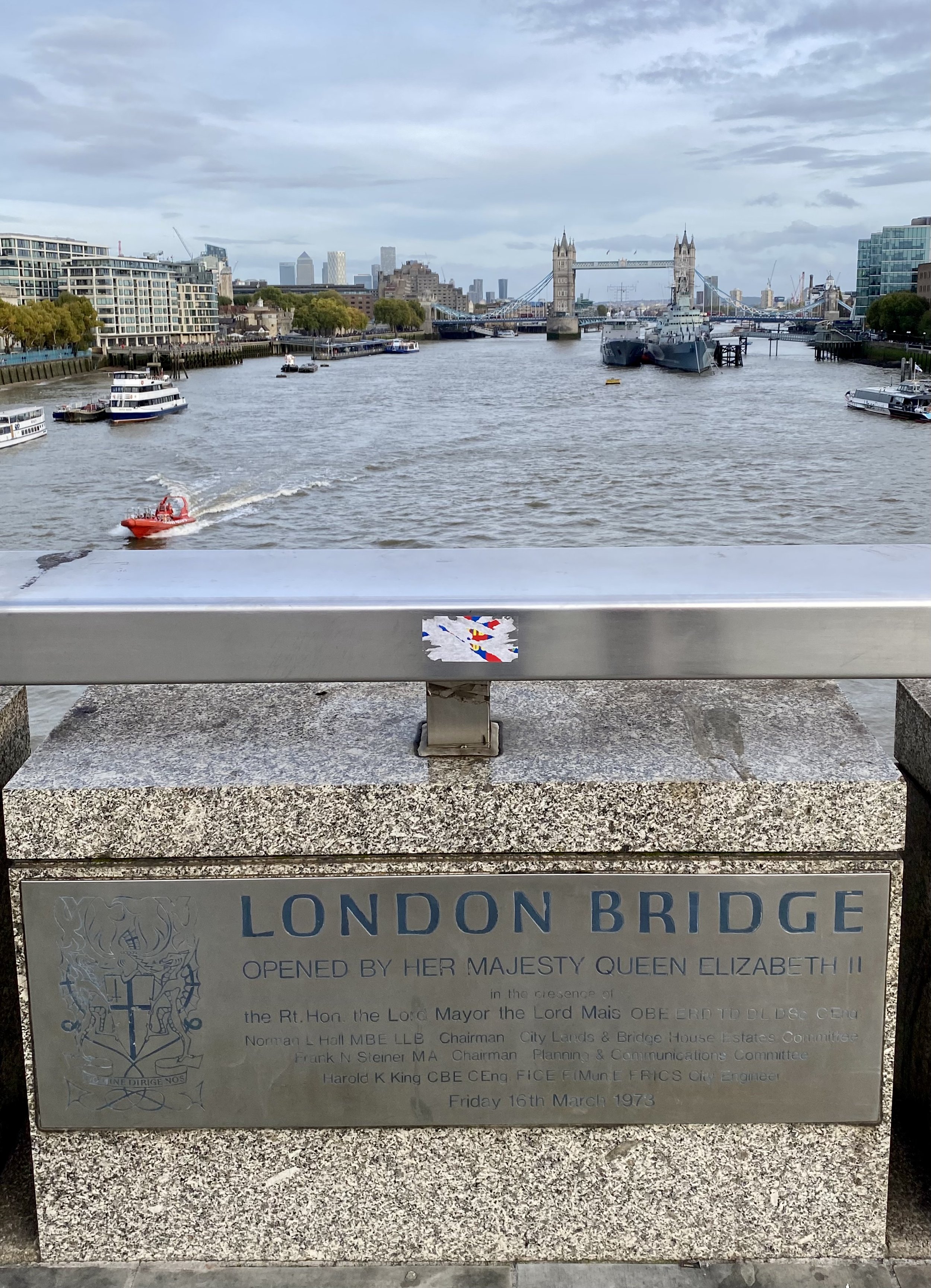
Dragon 12 and 13: London Bridge
Type: Twin dragons on stone plinths either side of southern entrance to bridge.
Distance into walk: 7.7 km
Address: On A3 London Bridge (road) at south end of #1 London Bridge (plus twin on opposite side of road), SE1 9AJ.
Nearest Station: London Bridge (Jubilee, Northern)
Coordinates: 51°30'23.6"N 0°05'16.5"W
Directions from previous point: Follow Thames Path in a westerly direction to London Bridge. Cross bridge to south side.
Links: London Bridge. Other bridges between London and Blackfriars: Southwark Bridge, Millennium Bridge.
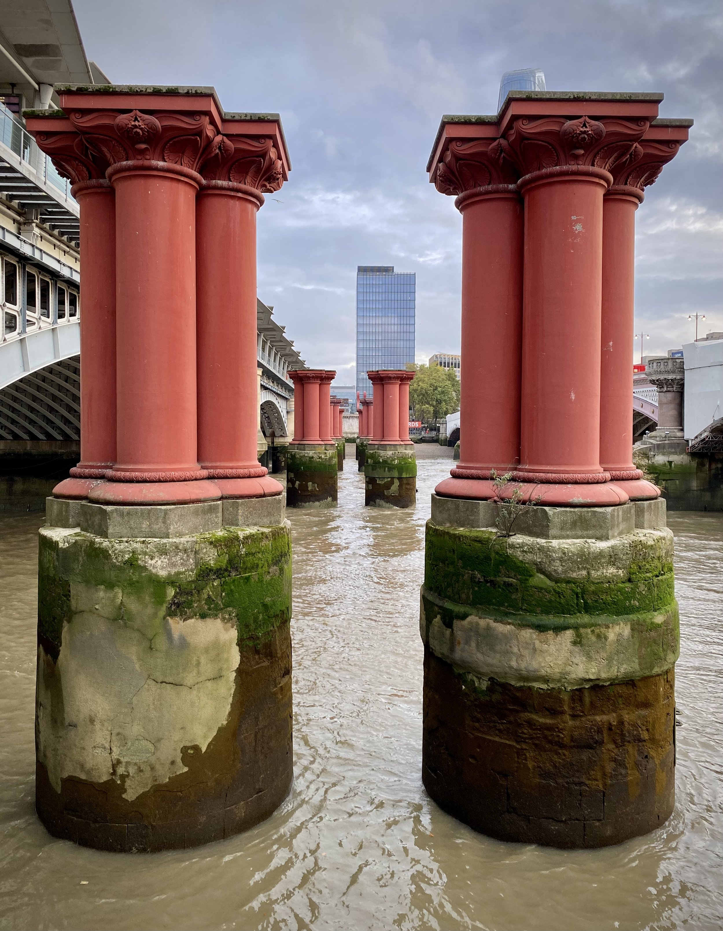
The actual boundary of the City of London runs through the middle of the Thames between the City/Tower Hamlets/Southwark Tri-Point in the east and the City/Southwark/Lambeth Tri-Point in the west. Both London Bridge and Blackfriars Bridge are wholly within the City boundary and are overseen by the City of London Corporation (through Bridge House Estates). Two other bridges, between these: Southwark Bridge and Millennium Bridge are not part of the City of London, however the northern half of each is within the river boundary.

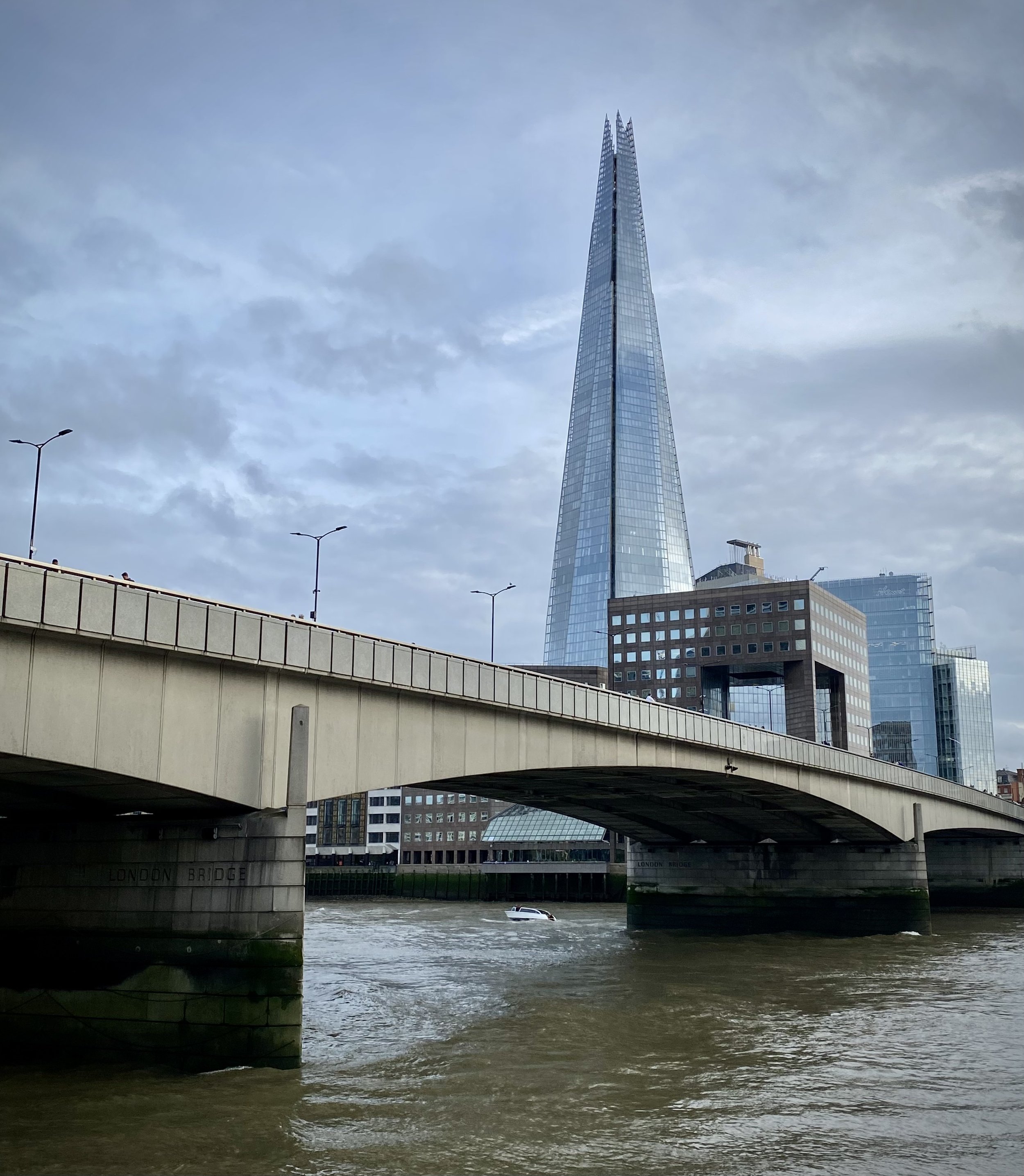
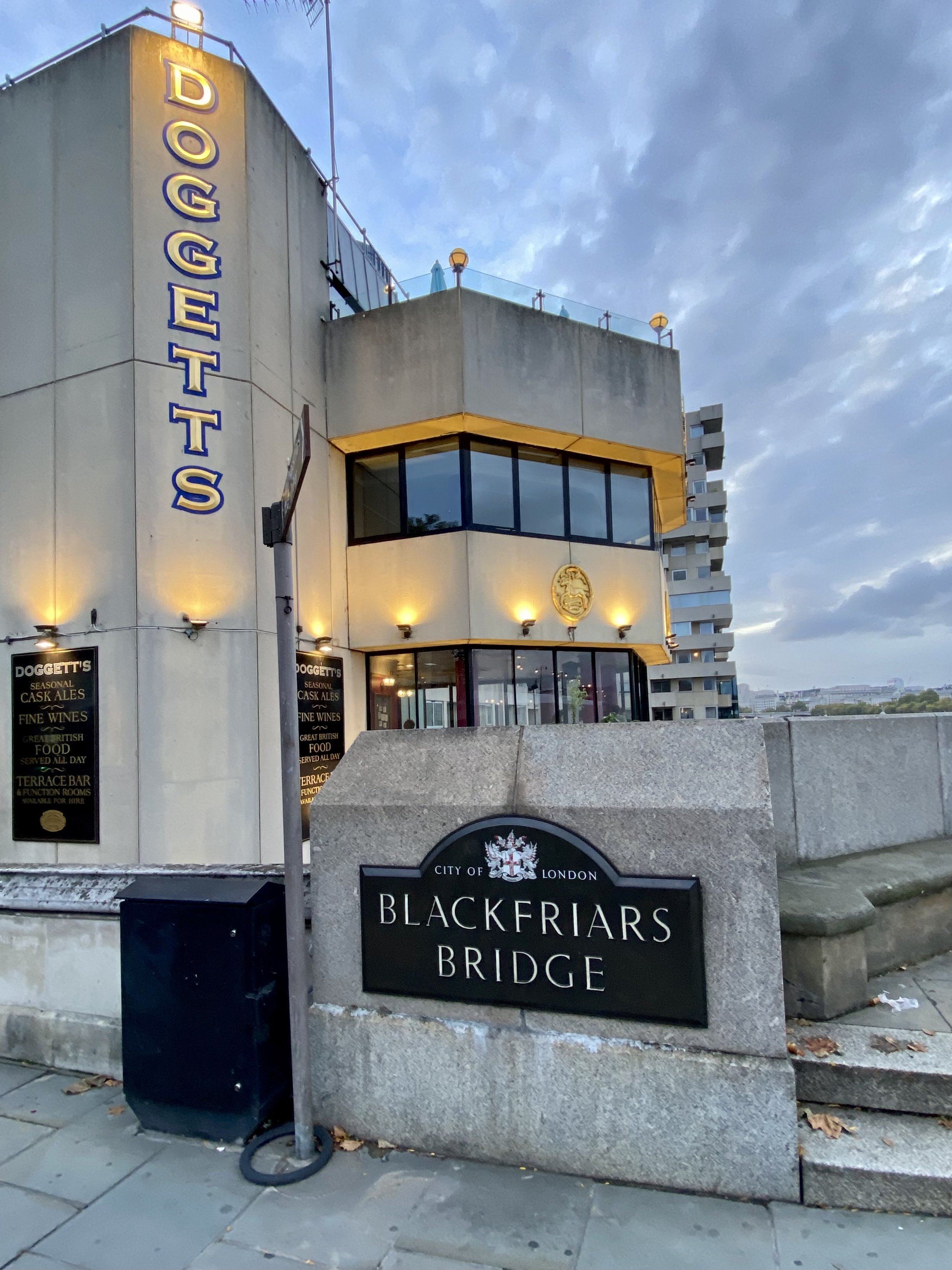
Dragon 14: Blackfriars Bridge
Type: Single dragon on a pedestal.
Distance into walk: 9.7 km
Address: Middle of carriageway at southern end of A2021 Blackfriars Bridge (road), SE1 9UD.
Nearest Station: Blackfriars (Circle, District, Thameslink, National Rail)
Coordinates: 51°30'30.7"N 0°06'15.8"W
Directions from previous point: Cross back over London Bridge to north side of the Thames, continue along Thames Path in a westerly direction to Blackfriars Bridge. Cross bridge to south side.
Links: Blackfriars Bridge

Tri-Point: City of London / Southwark / Lambeth
Distance into walk: 10.5 km
Address: In River Thames between Inner Temple Gardens (north-side) and west end of the Oxo Building (south-side).
Nearest Stations: Temple (Circle, District) or Blackfriars (Circle, District, Thameslink, National Rail)
Coordinates: 51°30'35.2"N 0°06'41.3"W
Directions from previous point: Cross back over Blackfriars Bridge to north side of the Thames, continue along Thames Path in a westerly direction.
Links: Southwark, Lambeth

Tri-Point: City of London / Lambeth / Westminster
Distance into walk: 10.6 km
Address: In River Thames between east end of HMS Wellington (north-side) and The London Studios (south-side).
Nearest Station: Temple (Circle, District)
Coordinates: 51°30'35.5"N 0°06'33.1"W
Directions from previous point: Continue along Thames Path in a westerly direction.
Links: Lambeth, City of Westminster
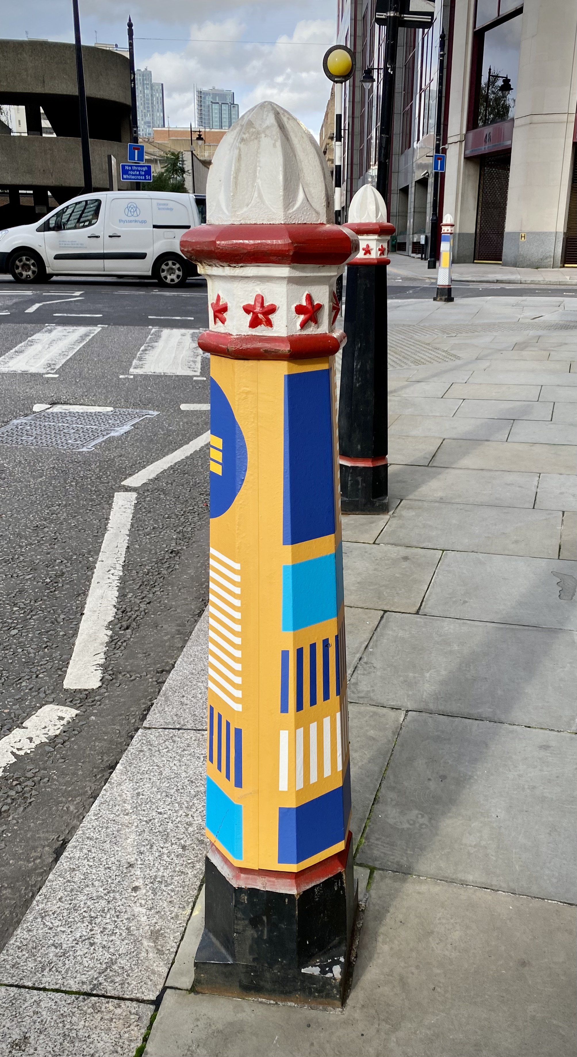
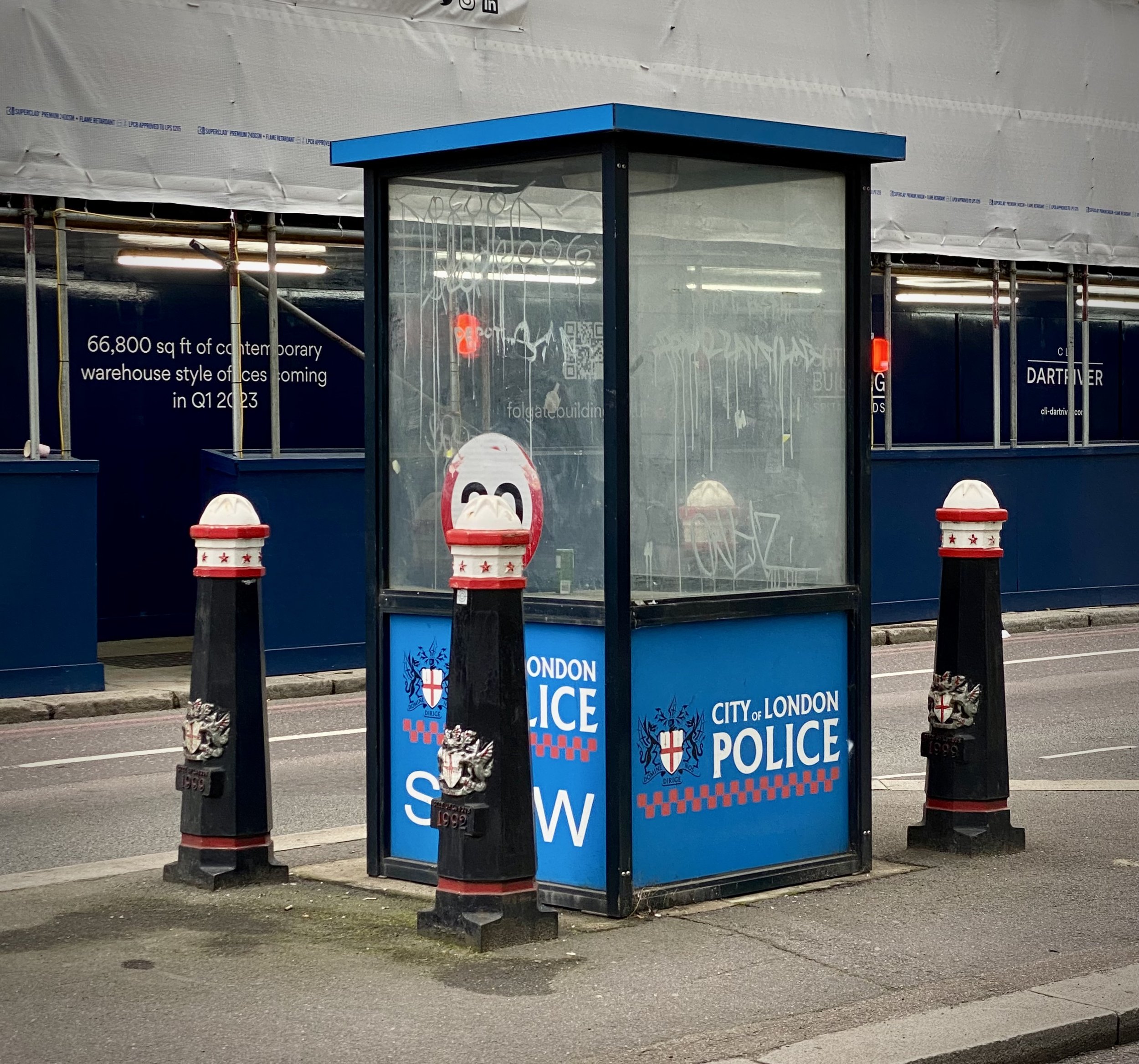
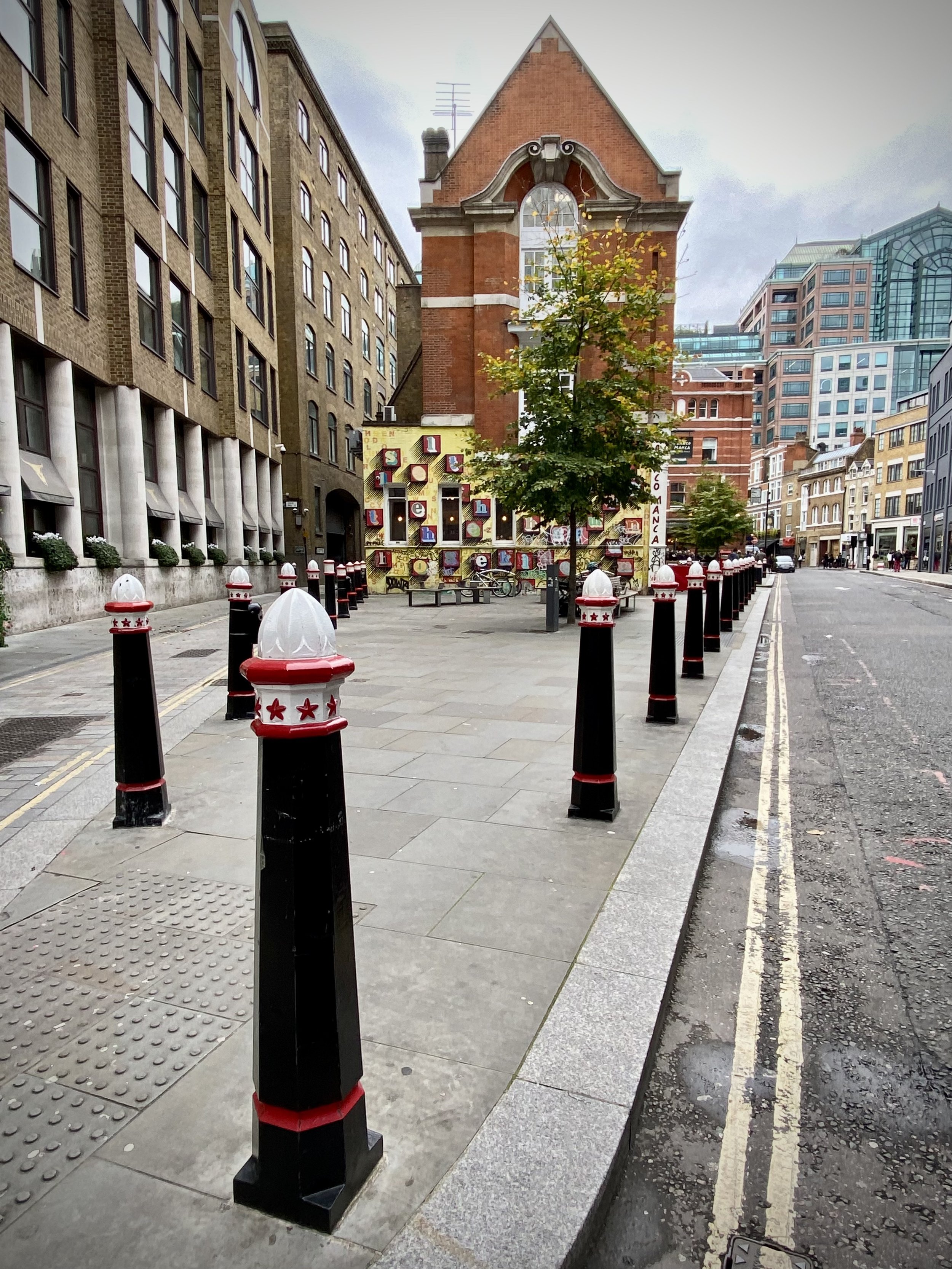
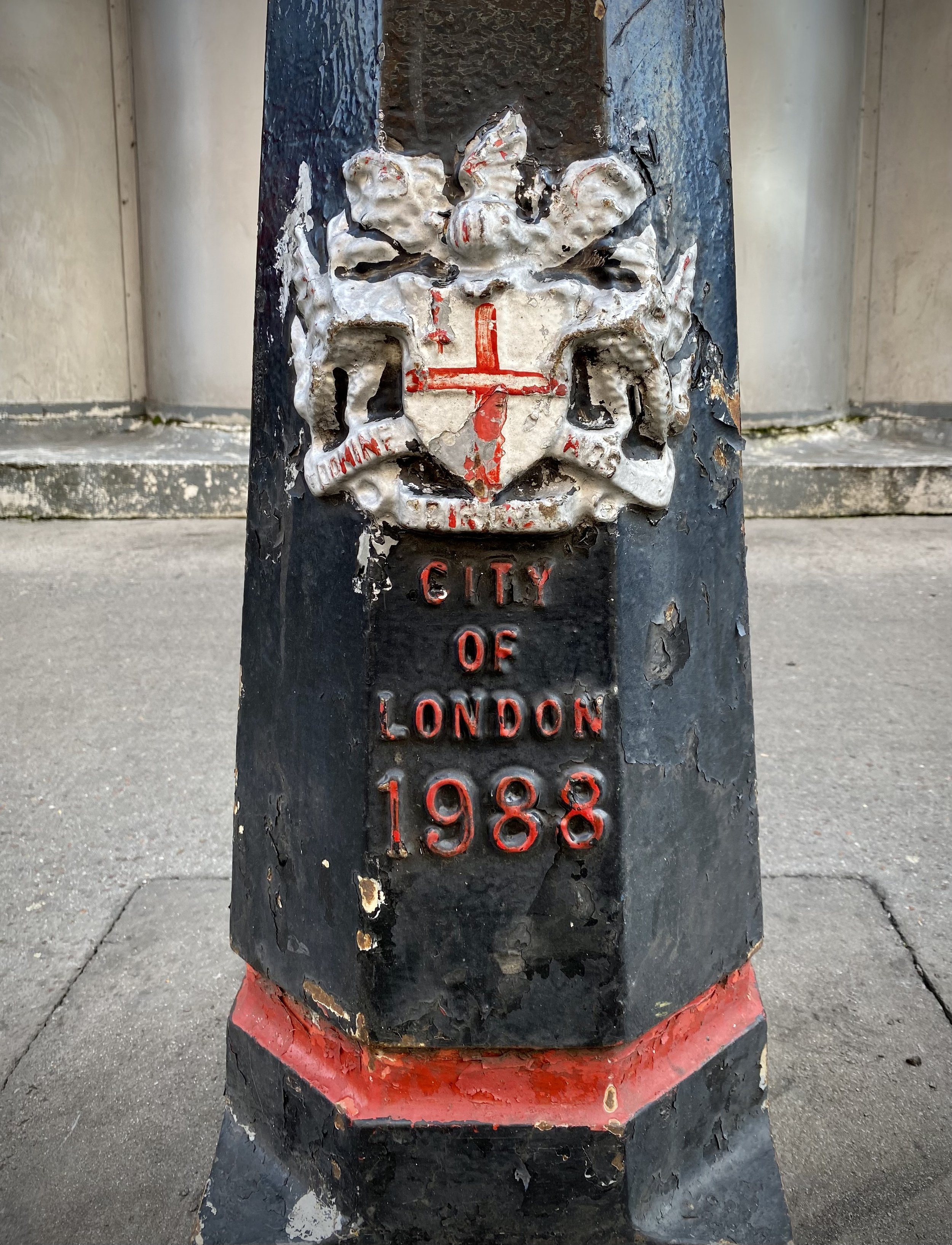
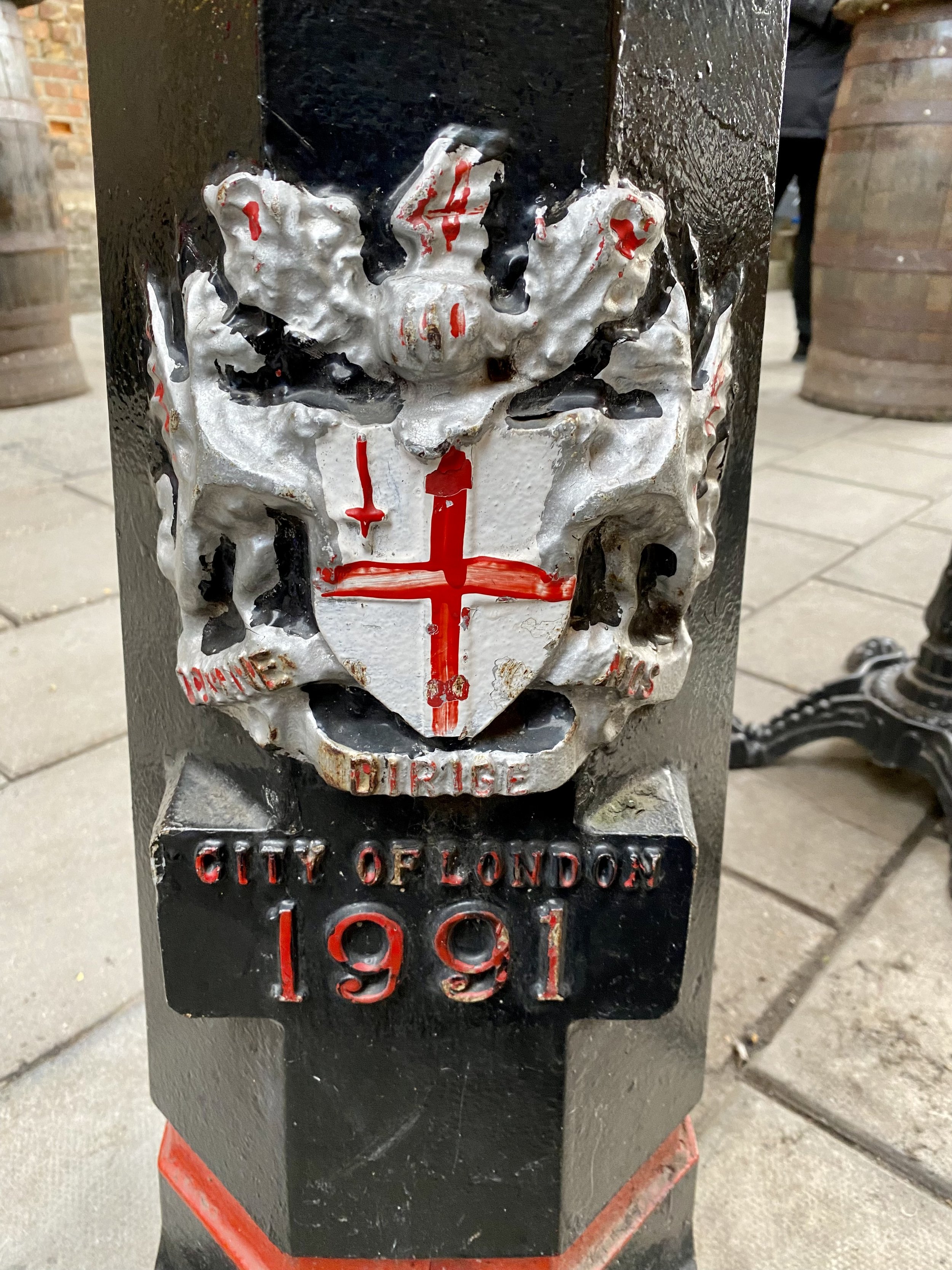
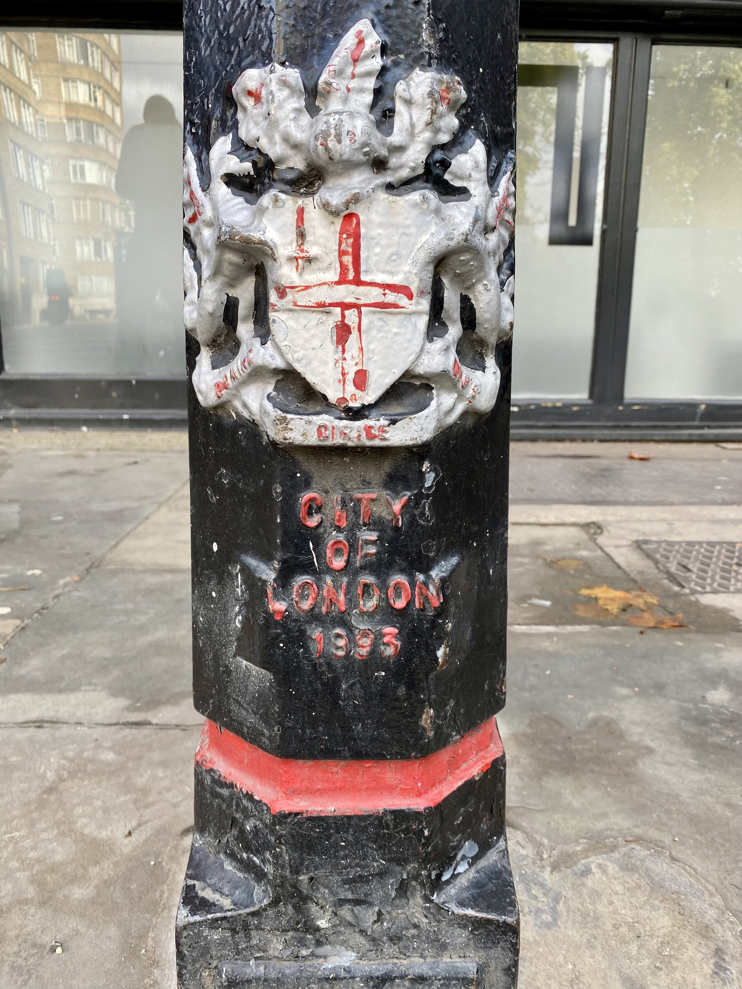
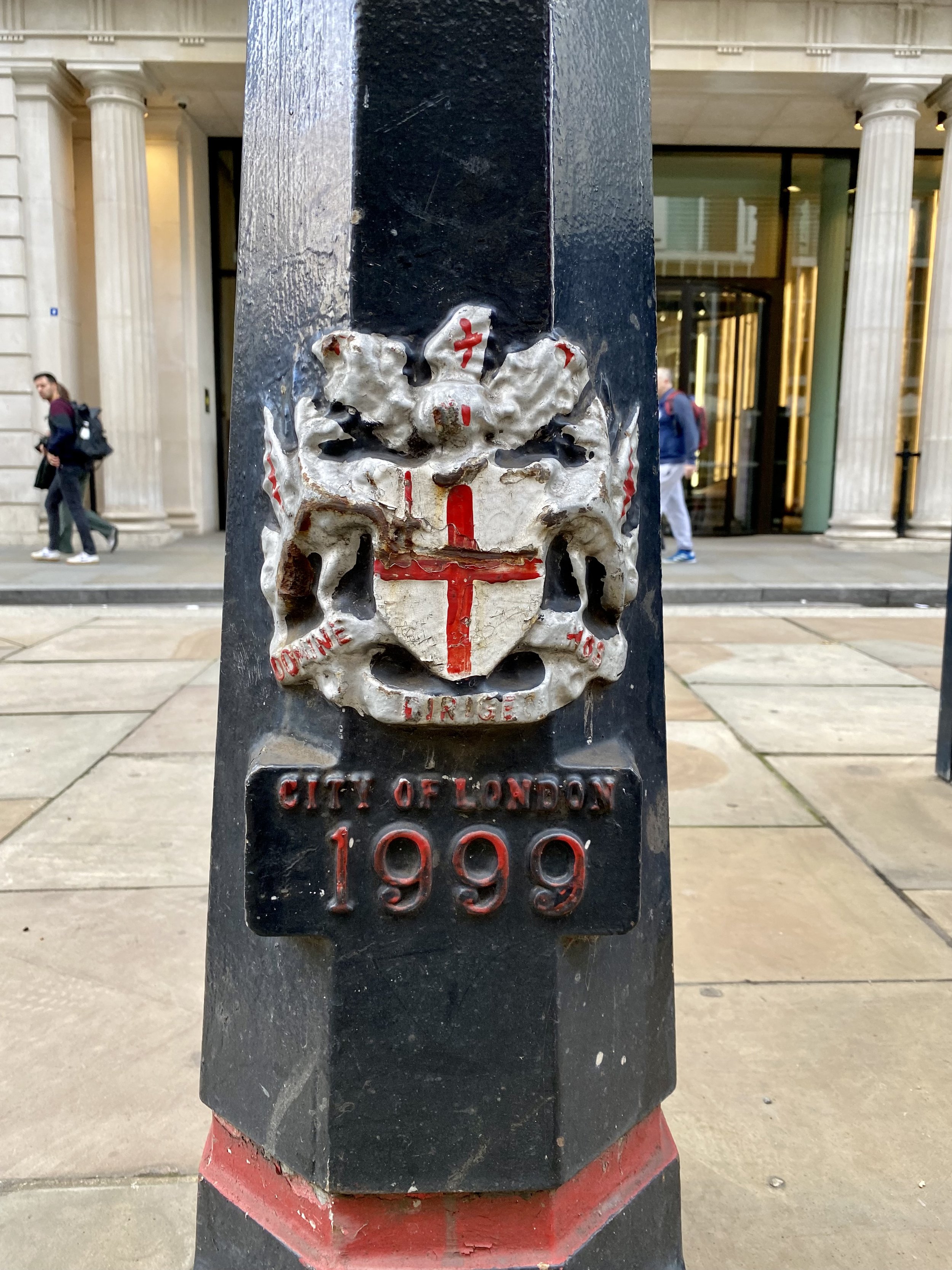
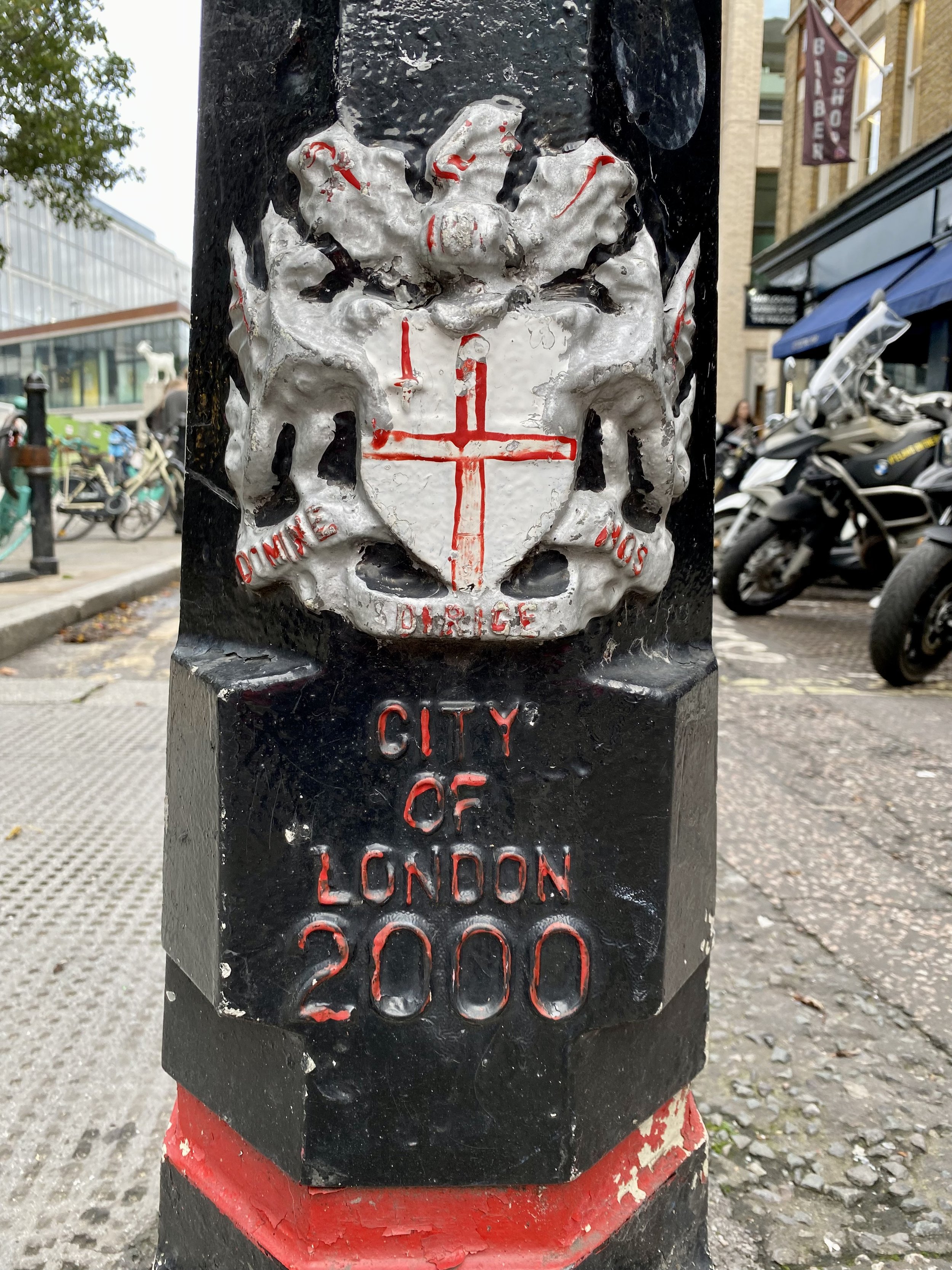
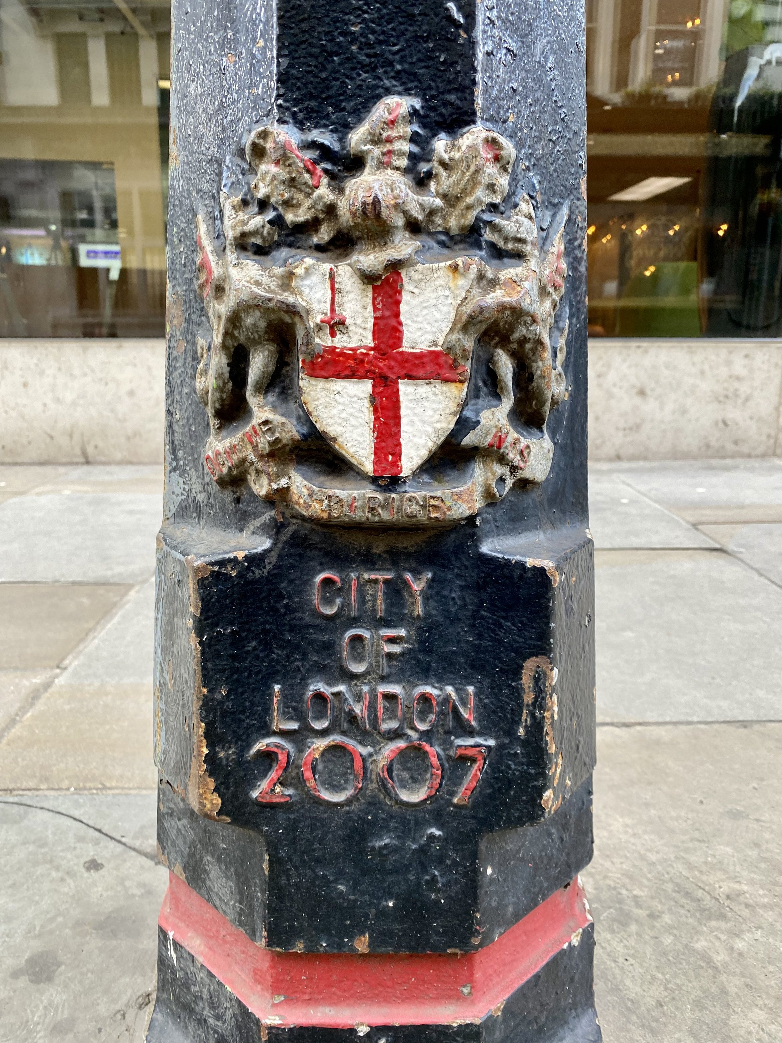
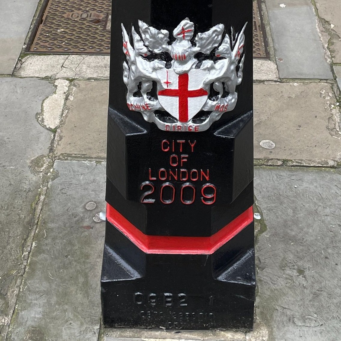
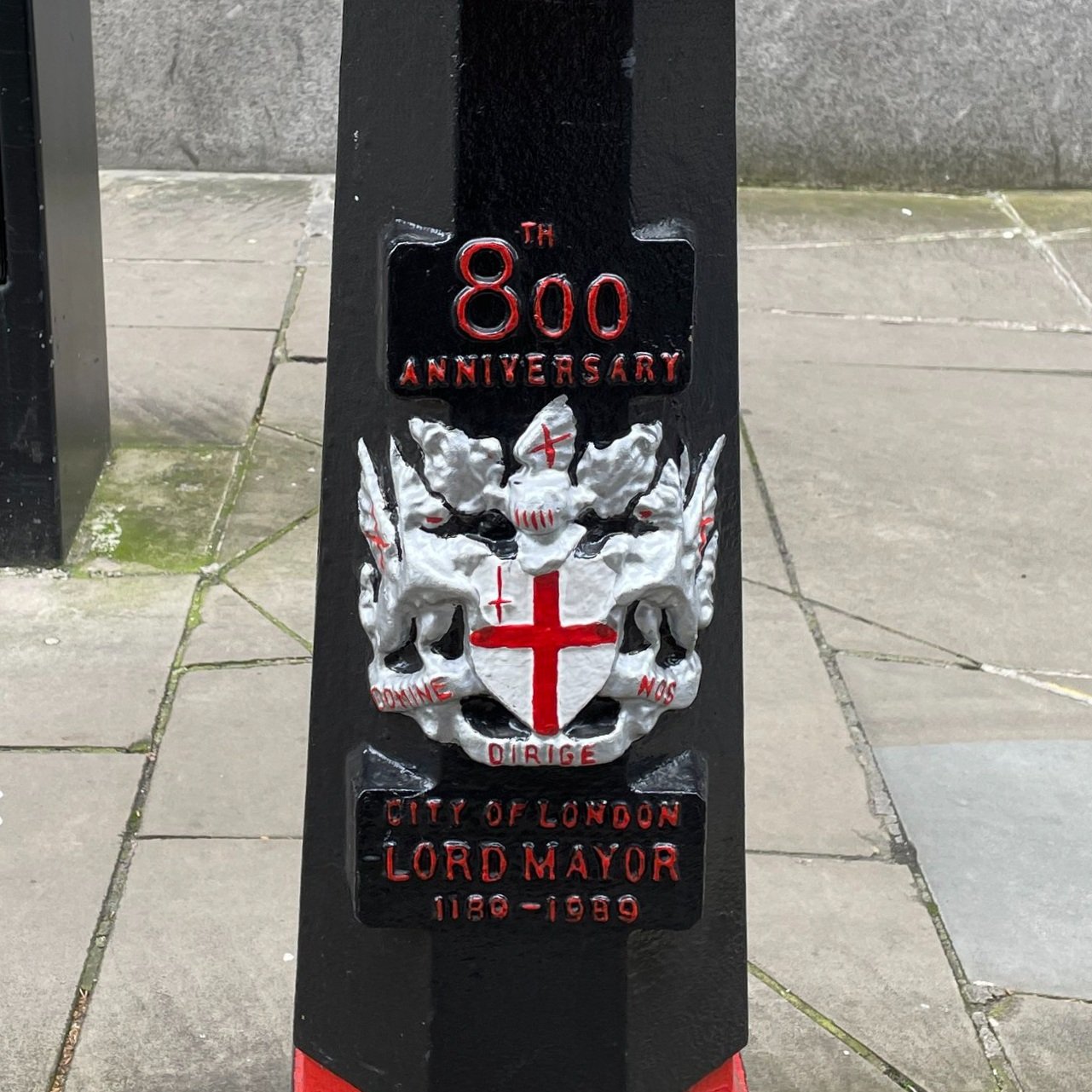
A Load of Bollards
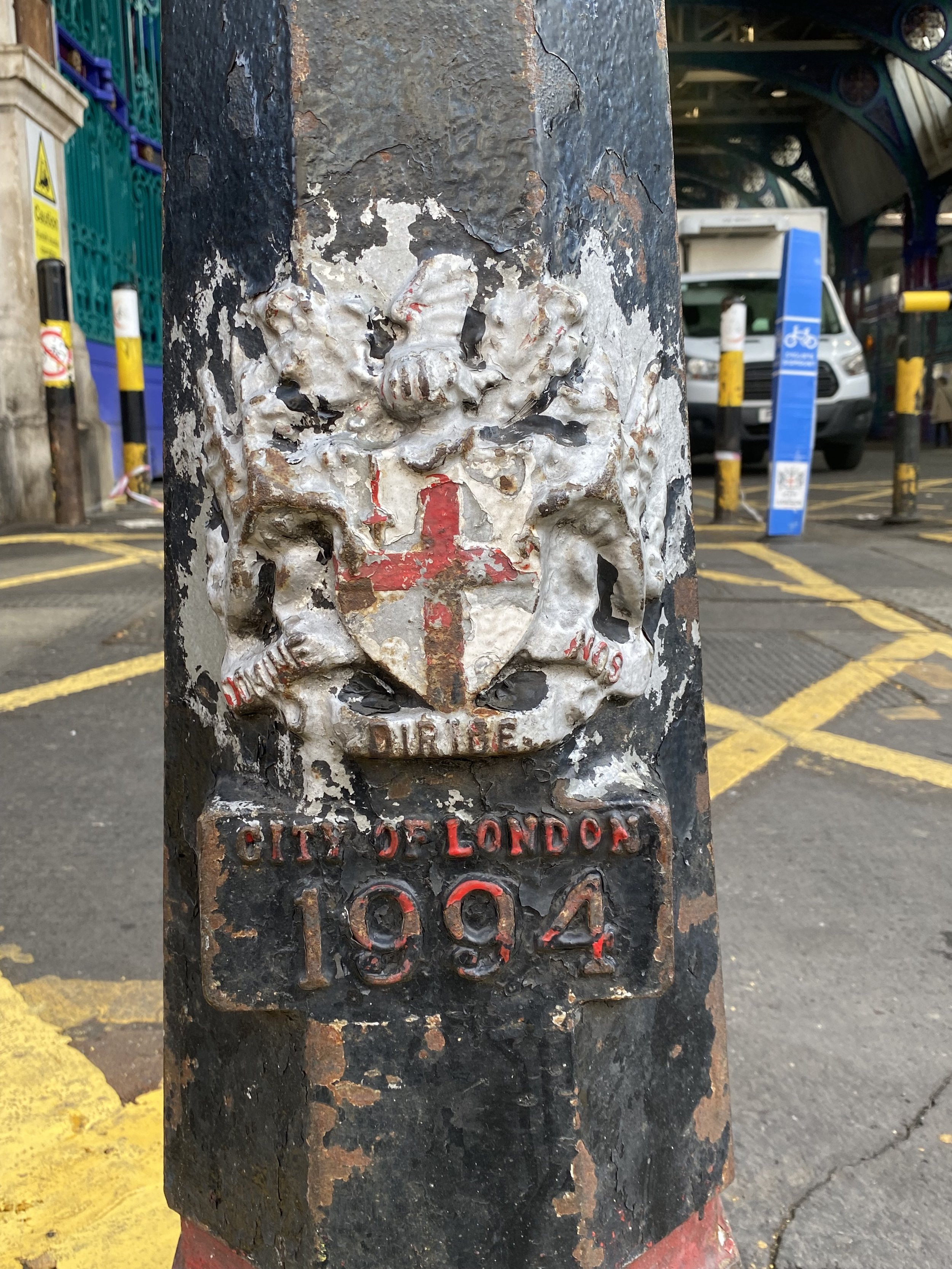
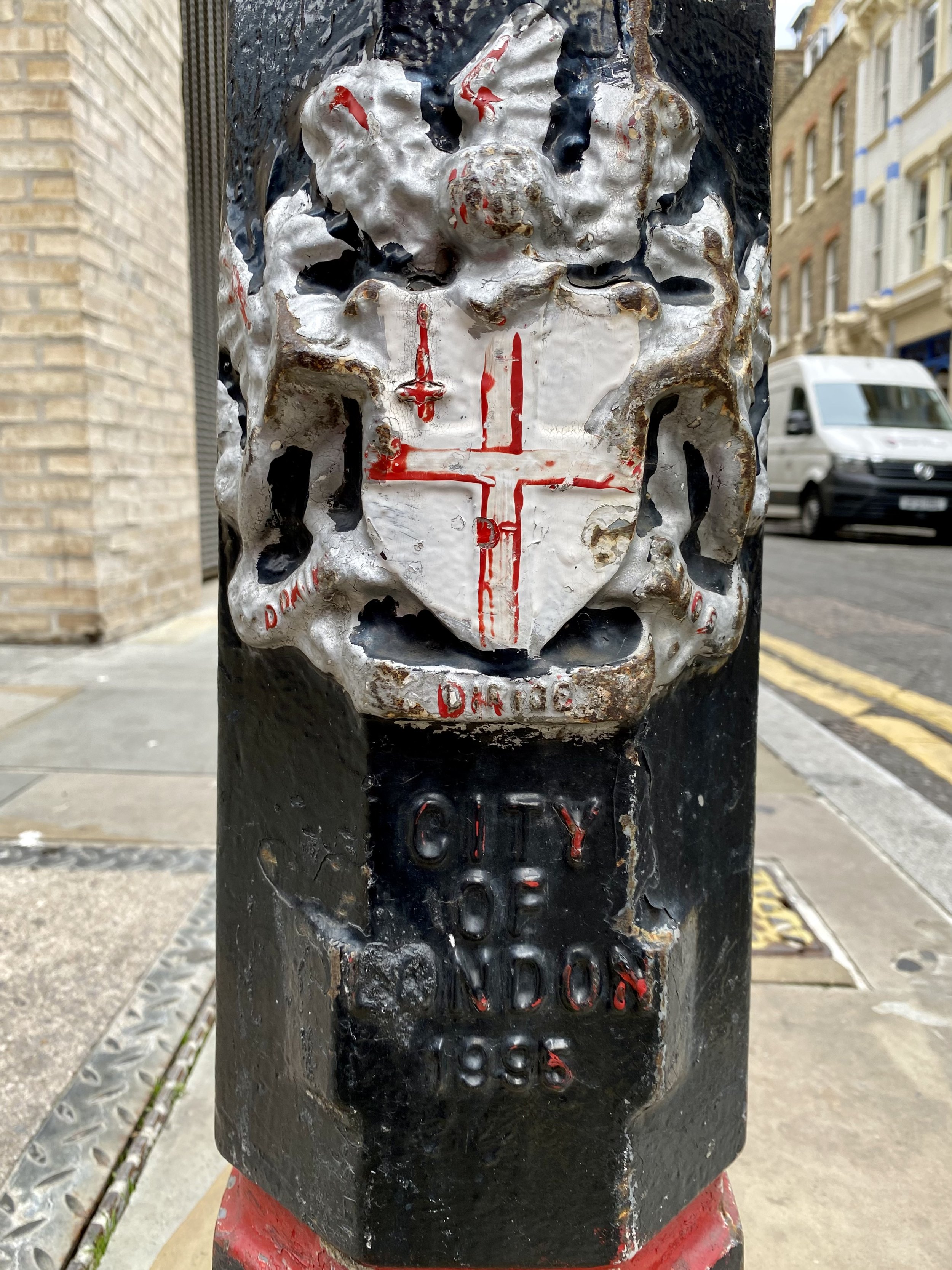
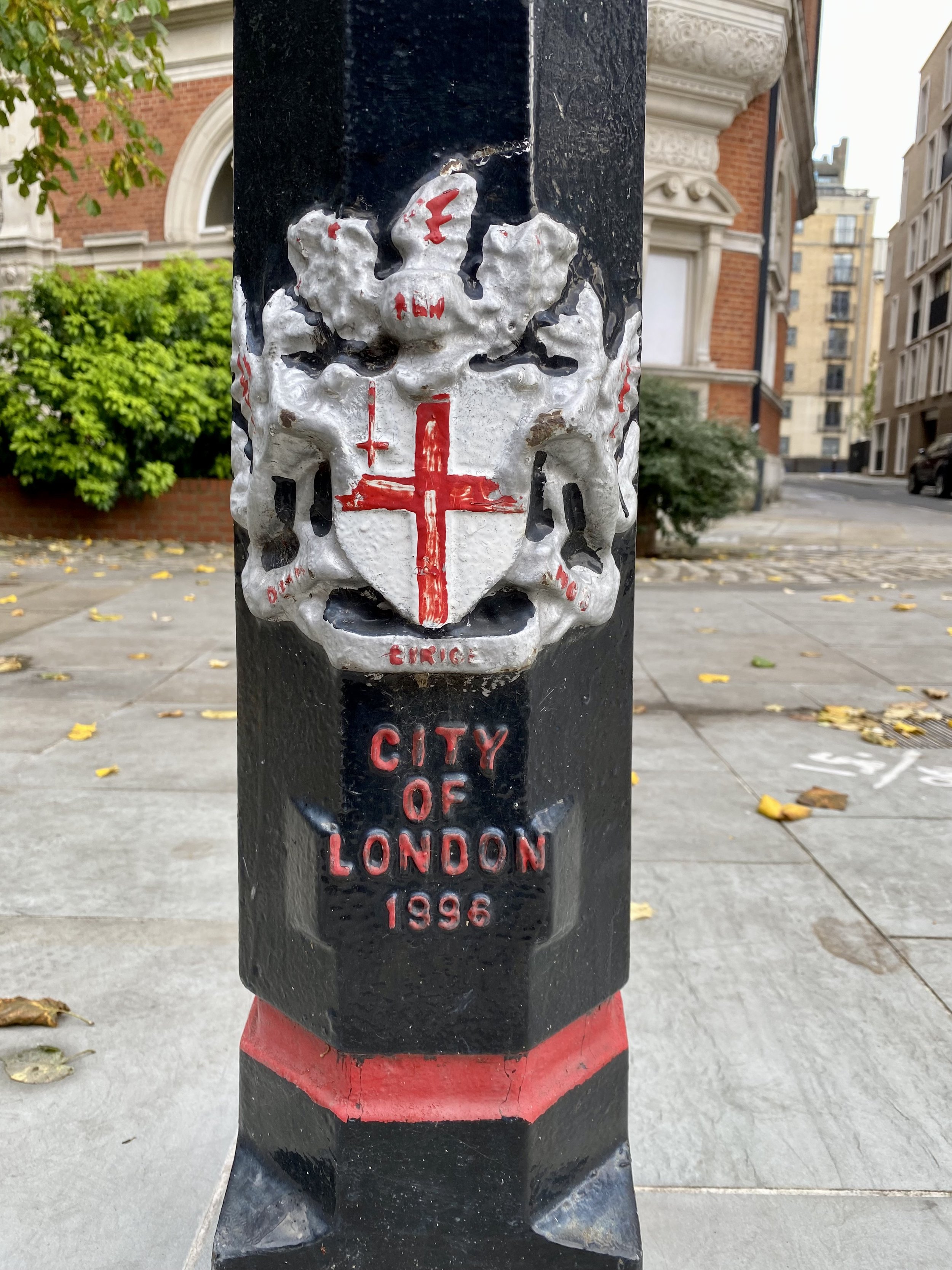
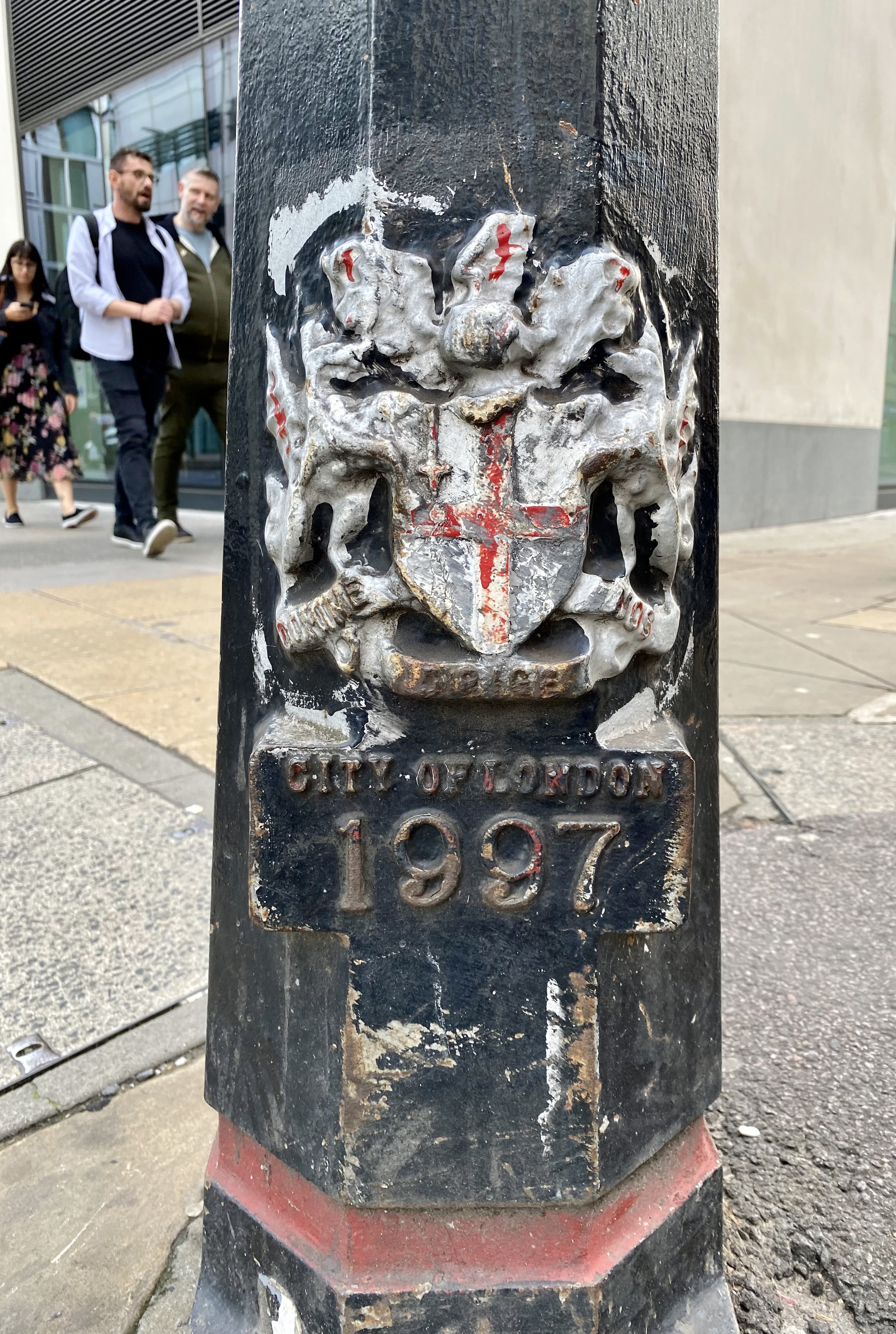
If collecting the dragons, the tri-points and the high point isn’t geeky enough for you, there’s also the bollards. We noticed that most of the bollards have a date at the bottom and decided to see if we could get the full set. We completed 1991 through to 2000 plus 1988 and 2007.


Other articles and blog posts on the City of London Boundary
More London Posts
If you enjoyed reading this post, there is plenty more to explore across the capital. I have put together a dedicated London Outdoors page where I keep track of all my other adventures around the city. It is a handy index where I group my posts by the different types of places I have visited: including historic boundary lines, canal towpaths, and some surprising urban high points.
The collection covers a bit of everything: from long-distance cycling routes to tracing the underground network on foot, and ticking off another Saturday morning parkrun. If you are looking for some inspiration for your own weekend outings, head back over to the London Outdoors page to see what else I have been up to.