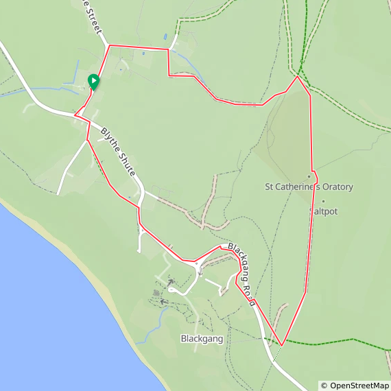
Trig Pillar Walks: St. Catherine's Hill, Isle of Wight
St Catherine’s Hill IoW Trig Pillar
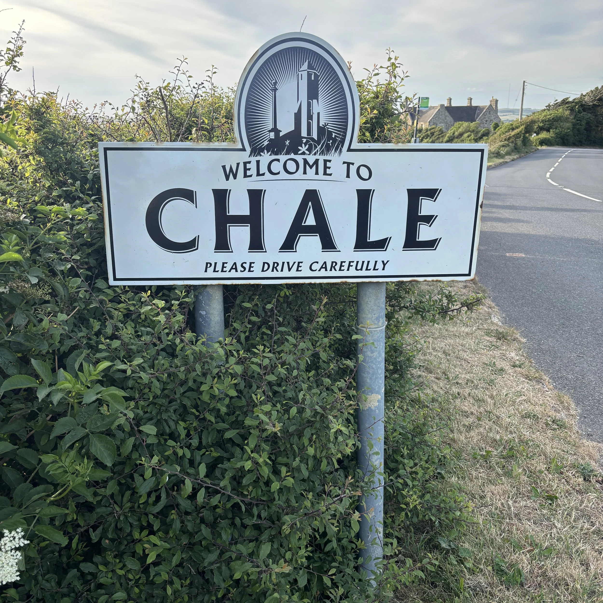
Start & Finish: Wight Mouse Inn, Church Place, Chale, Ventnor, PO38 2HA
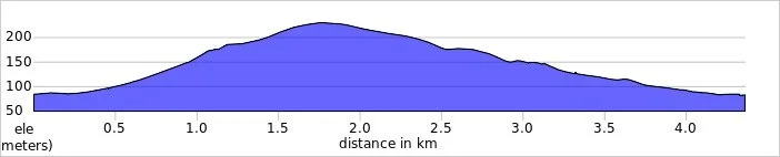
Distance: 4.4 km (2.7 miles)
Elevation change: +/- 144m
GPX File: get via Buy Me a Coffee
Other routes touched (walk): Isle of Wight Coastal Path
Other routes touched (cycle): Isle of Wight Round-The-Island Cycle Route (Route 67)
Pubs / Cafes on route: Wight Mouse Inn at the start and end
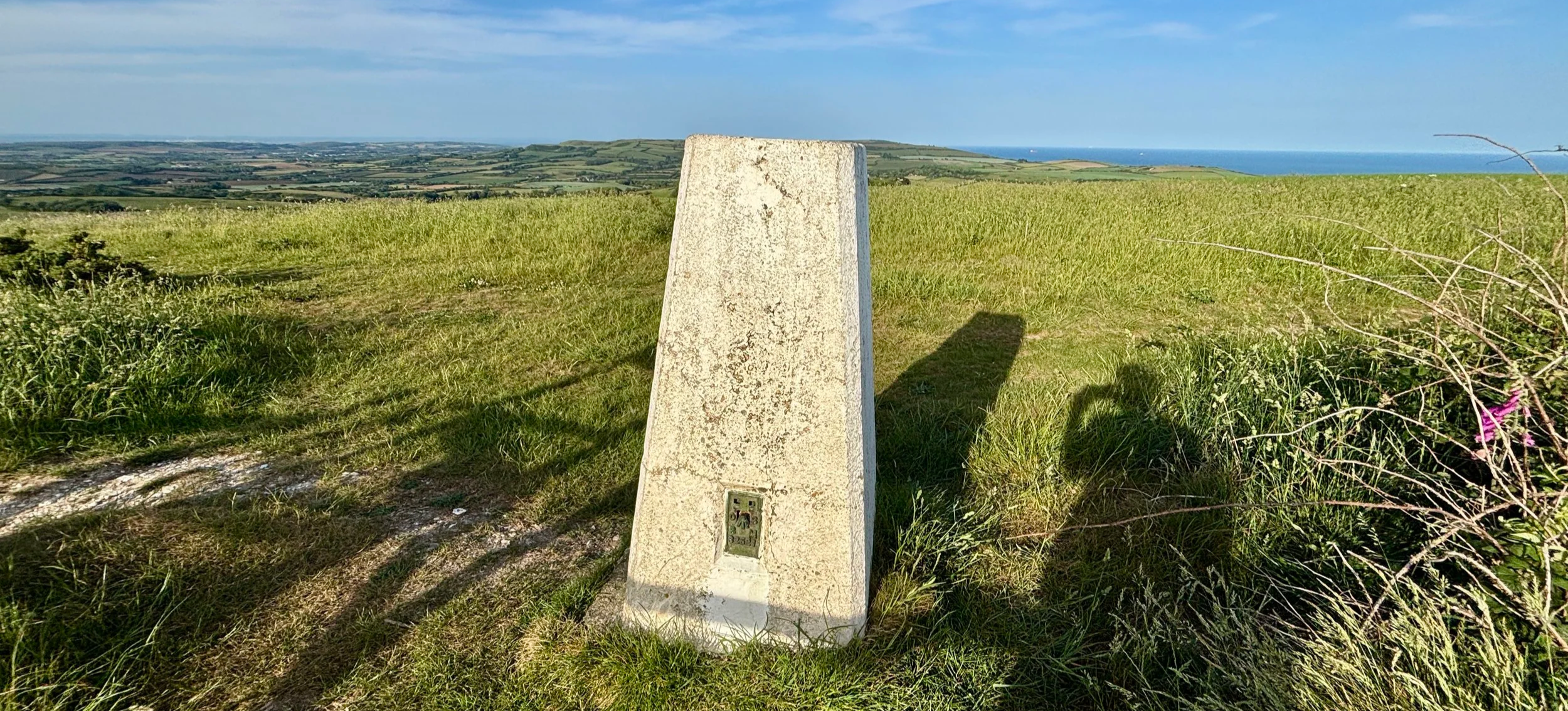
OS Trig Pillar: TP6127 - St Catherines Hill Isle Of Wight
Map: Isle of Wight Map | Cowes, Newport, Ryde, Sandown, Shanklin, Yarmouth & Ventnor | Ordnance Survey | OS Explorer Map OL29
Links: Chale, St. Catherine's Down, St Catherine's Oratory, Blackgang
Our Isle of Wight coastal cycle weekend late in May brought a brilliant unexpected bonus walk. Brian and I were on a two-day trip, and our first day involved cycling from Newport down to Chale on the south coast. We stayed overnight at a lovely pub called the Wight Mouse.
We arrived and checked in around 5:00 in the afternoon. We were both pretty tired, and Brian was particularly exhausted. We decided to grab an early dinner, after which I planned to head out for a short walk up nearby St. Catherine's Hill to bag the trig pillar. Brian had absolutely no interest in joining me: partly because of the fatigue, but mostly because he only had his clip-in cycle shoes with him, which are completely useless for walking. I do not use clip-ins, so I had my trusty trainers for the weekend, which were perfectly fine for a hike. Plus, we could actually see the top of the hill from our bedroom window at the pub: it was just too tempting to pass up!
Walking Directions
The guidance below will help you navigate but don’t use it as a fully accurate turn-by-turn guide. Always take a map and/or a GPX route and prepare well for the weather and terrain.
Just after dinner, I set out. I took a left out of the pub onto Church Place, and then the first right onto Upper House Lane. Taking a right onto a footpath, I headed out into the fields. From there, you can navigate through the fields and up a steep bank to the ridge line, which leads straight to St. Catherine's Hill.
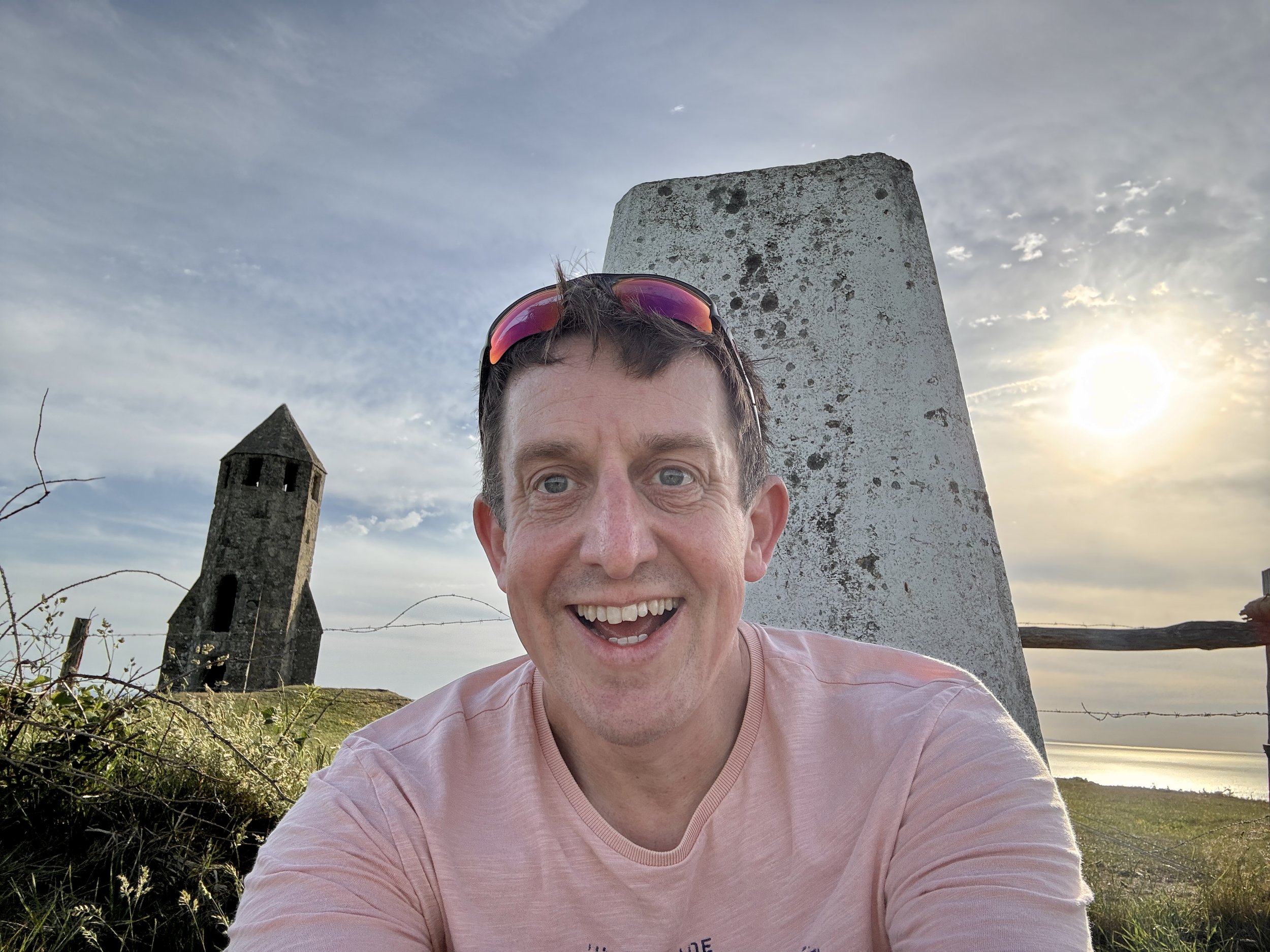
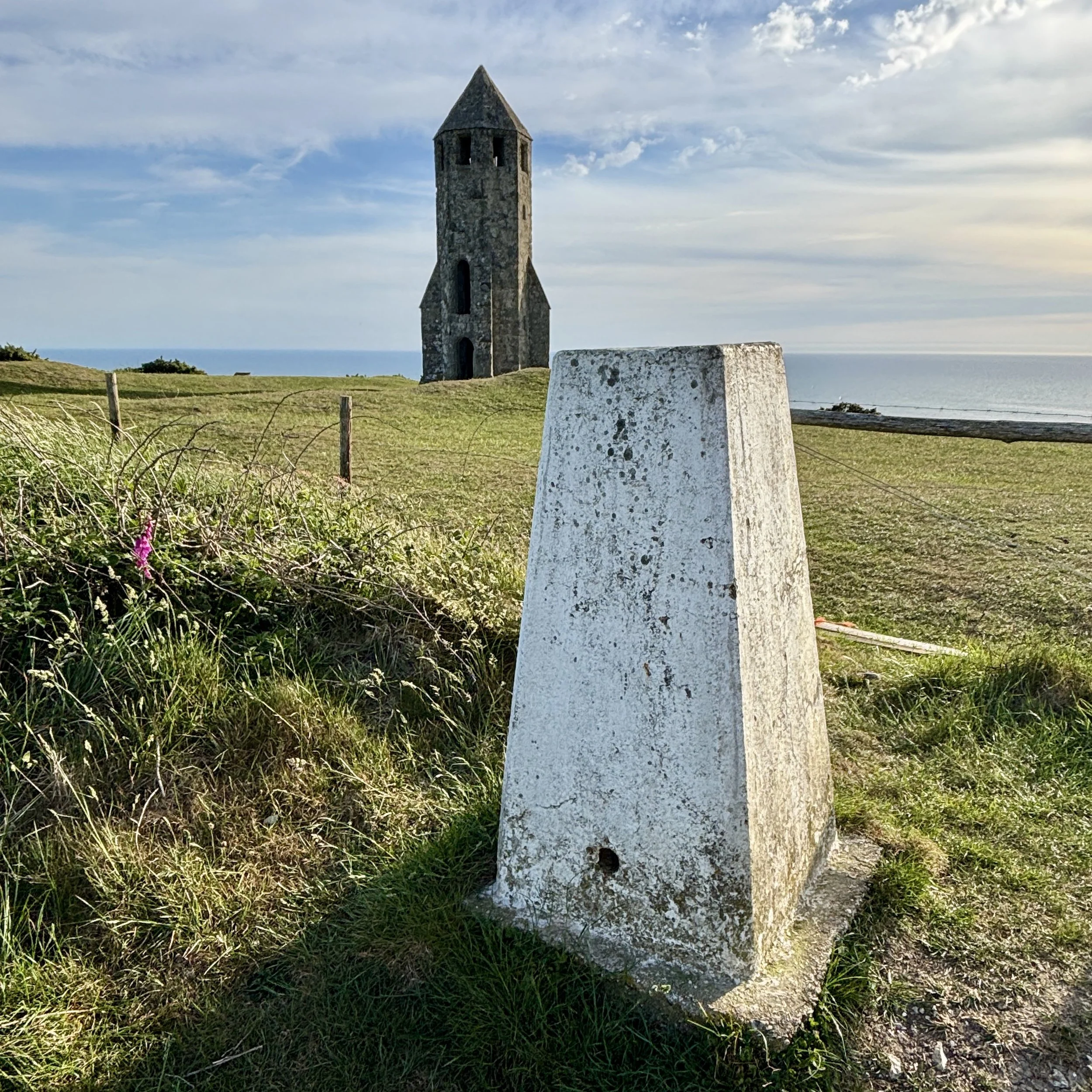
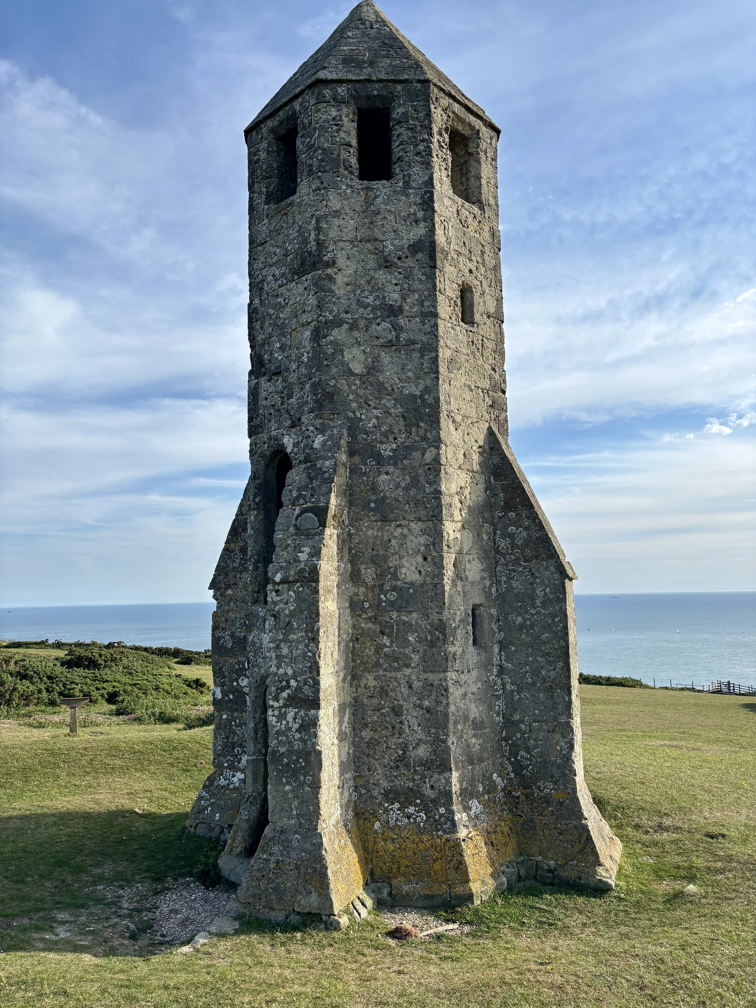
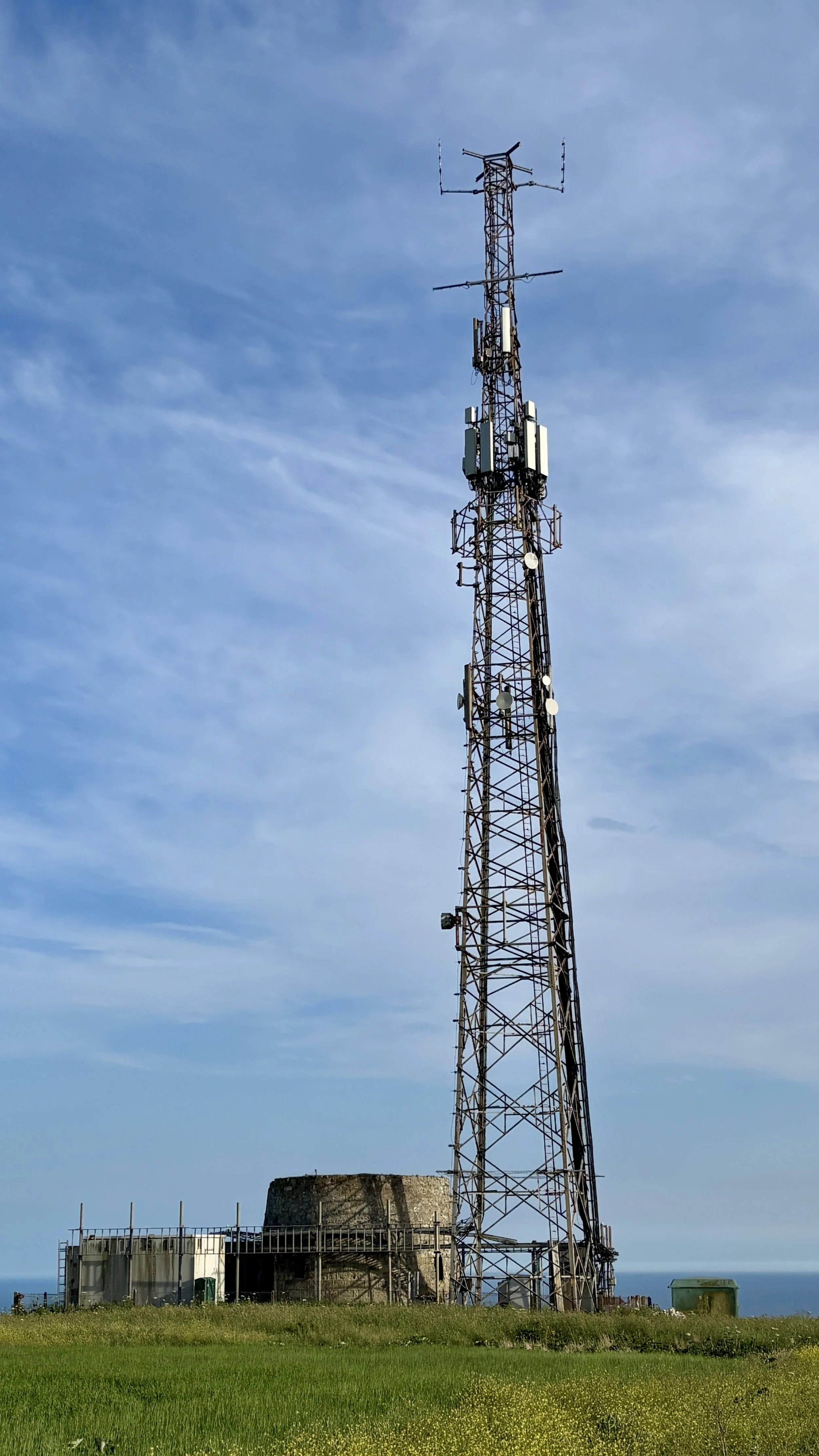
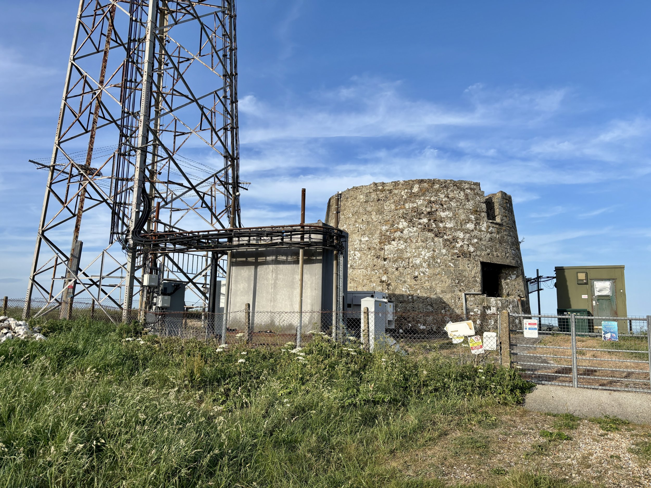
There are some genuinely fascinating things to see at the top. Naturally, my first stop was the trig pillar itself, which I successfully bagged. Moving on, the landscape reveals St. Catherine's Oratory, affectionately known locally as the "Pepperpot". This 35-foot structure is the only surviving medieval lighthouse in England. It was completed in 1328 by Walter de Godeton, the Lord of Chale. He was ordered by the Church to build the lighthouse and an adjoining oratory as an act of penance after he illegally plundered casks of white wine from a shipwrecked vessel called the St Marie of Bayonne in Chale Bay. Interestingly, historical sources conflict slightly on the exact date of the wreck: English Heritage and some historical texts note it as occurring in 1314, whilst other local historical records state it happened on 20 April 1313. A bit further south from the trig pillar, there is another striking piece of history: a modern telecommunications tower built right next to an old World War II pillbox.
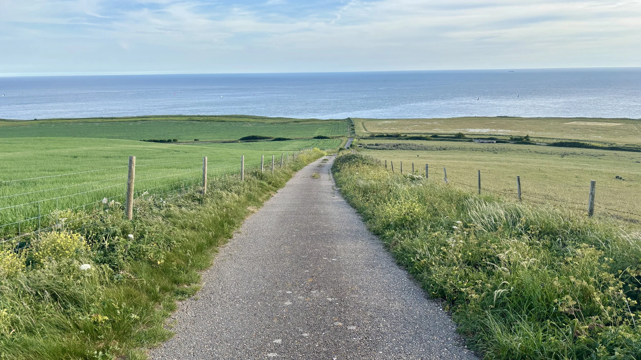
After spending a good amount of time at the top investigating the sights, I continued south along the footpath until I reached Blackgang Road: the exact road we had cycled down just a couple of hours prior.
I crossed over the road at a safe point into the Blackgang Viewpoint car park. From there, I picked up the Isle of Wight Coastal Path. This walking route takes a much safer path running parallel to Blackgang Road. I followed it all the way back to Chale, returning to Church Place and finally arriving back at the Wight Mouse. I found Brian relaxing in the pub garden, and we enjoyed a final drink together before getting a big sleep ahead of our second day of cycling.
Points of Interest along or near to the Route
St Catherine's Hill (Trig Pillar & Tumuli) At 239 metres above sea level, St Catherine's Hill is one of the highest points on the Isle of Wight. The summit area, including St. Catherine's Down, not only houses the trig pillar but also features ancient burial mounds (tumuli) dating back to the Bronze Age. The elevation provides commanding, uninterrupted views across the English Channel and the rolling downland of the island.
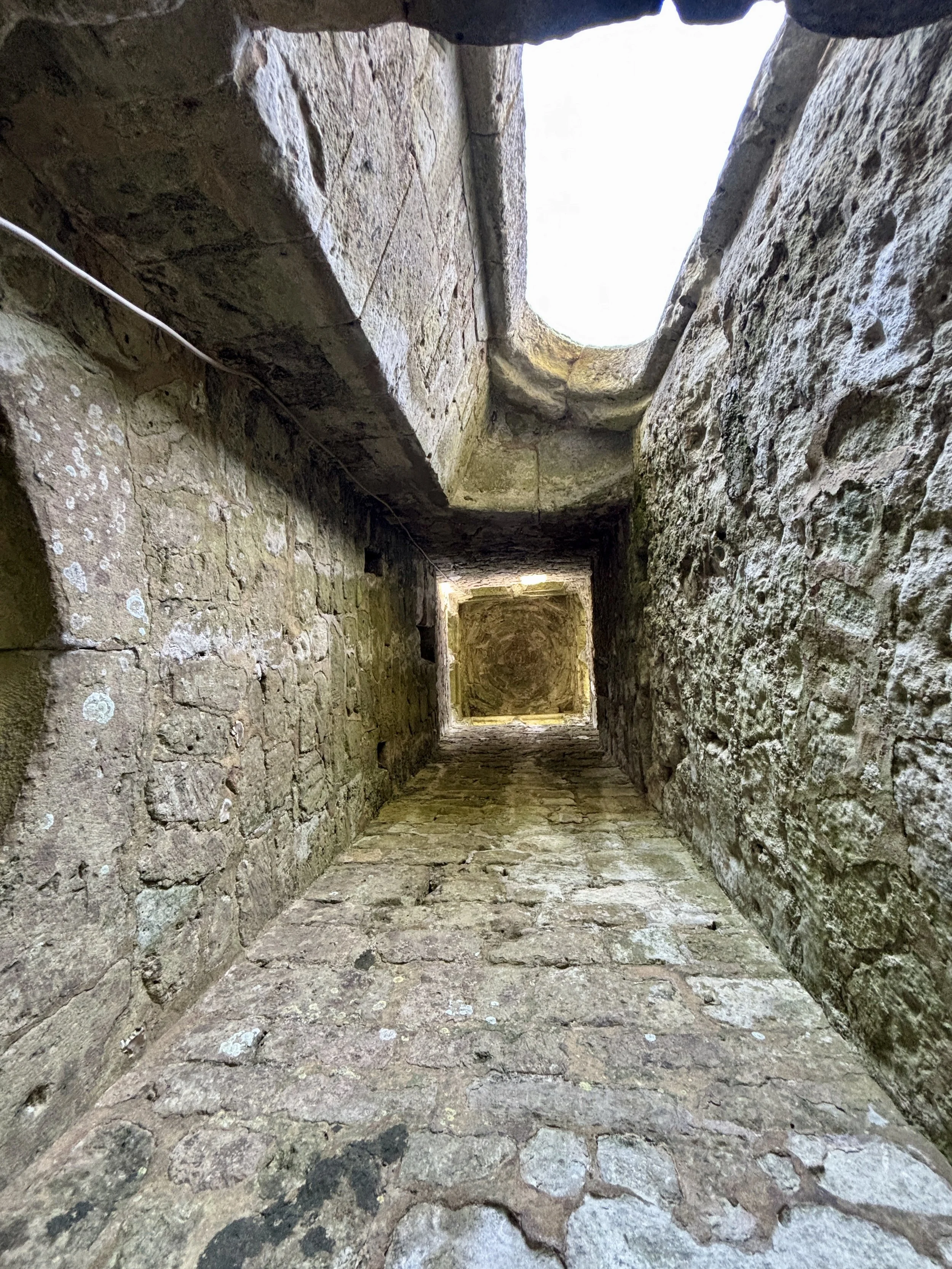
St Catherine's Oratory (The Pepperpot) Standing 35 feet tall, this striking octagonal stone tower is Britain's only surviving medieval lighthouse. It was built in 1328 by Walter de Godeton as penance for plundering a shipwrecked vessel laden with wine destined for a monastery. Originally, a priest would have tended the light to warn sailors of the treacherous Chale Bay below while offering prayers for the souls of those lost at sea.
Wight Mouse Inn (Chale) Located in the village of Chale, this historic 17th-century pub serves as a welcome starting and finishing point for the route. The building has deep roots in the local community, serving weary travellers for generations. Chale is positioned near the rugged southwestern coast, an area historically notorious for shipwrecks, giving the pub a rich maritime and smuggling heritage.
Blackgang Viewpoint Overlooking the dramatic southern coastline, this viewpoint offers spectacular vistas along the Undercliff and out over the sea. The area around Blackgang is constantly shaped by coastal erosion and landslides, which gives the cliffs their rugged, sheer appearance. In the past, this stretch of coastline was heavily patrolled by coastguards due to frequent shipwrecks and active smuggling operations.