Walking The England Coast Path: Shoreham to Rottingdean

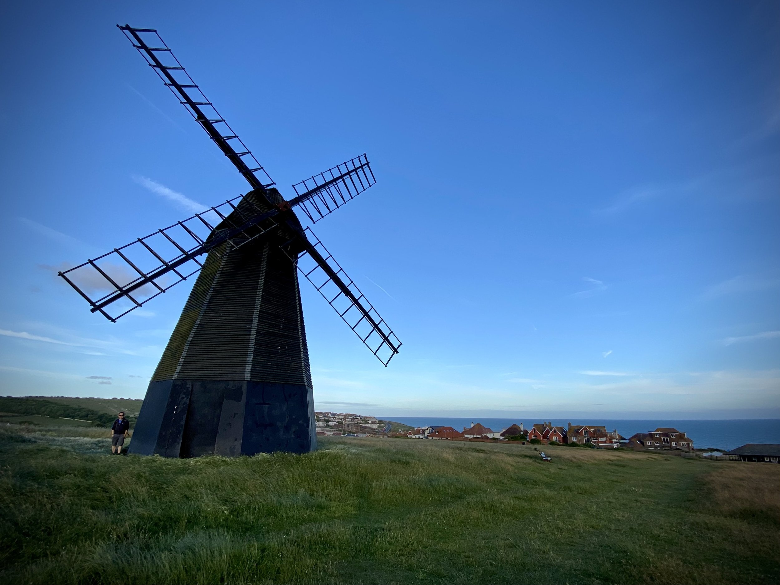
View from Brighton Marina to the undercliff path with Rottingdean Windmill in the distance.
Start: Shoreham-by-Sea Railway Station, BN43 5WX, Sussex
Finish: The Windmill Bus Stop, Marine Drive, Rottingdean, BN2 7GZ
Distance: 19.3 km (12 miles)
Elevation change: +132m /-117m. Net -15m
GPX File: get via Buy Me a Coffee
Other routes touched (walk): England Coast Path, Monarch’s Way, Mid Sussex Link, Undercliff Walk, Newhaven Brighton Clifftop Path
Other routes touched (cycle): Downs Link, NCN 2, 223
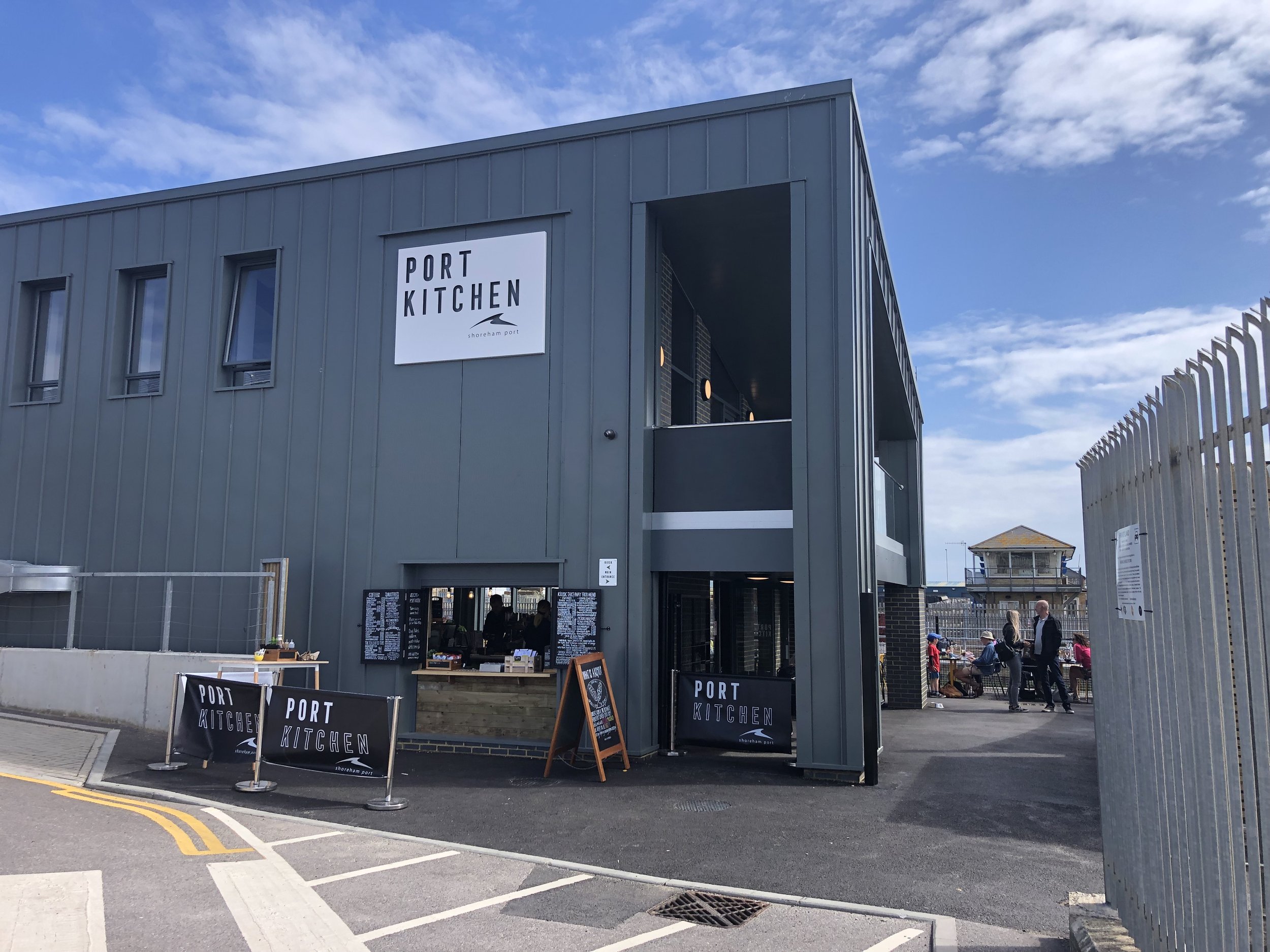
Pubs / Cafes on route: Many along the route. Notable ones that we used are Port Kitchen at Shoreham Port (4.2k in), White Cloud Coffee Company (13k in), The White Horse Hotel Rottingdean (18k in)
Map: Brighton & Hove Map | Lewes & Burgess Hill | Ordnance Survey | OS Explorer Map OL11
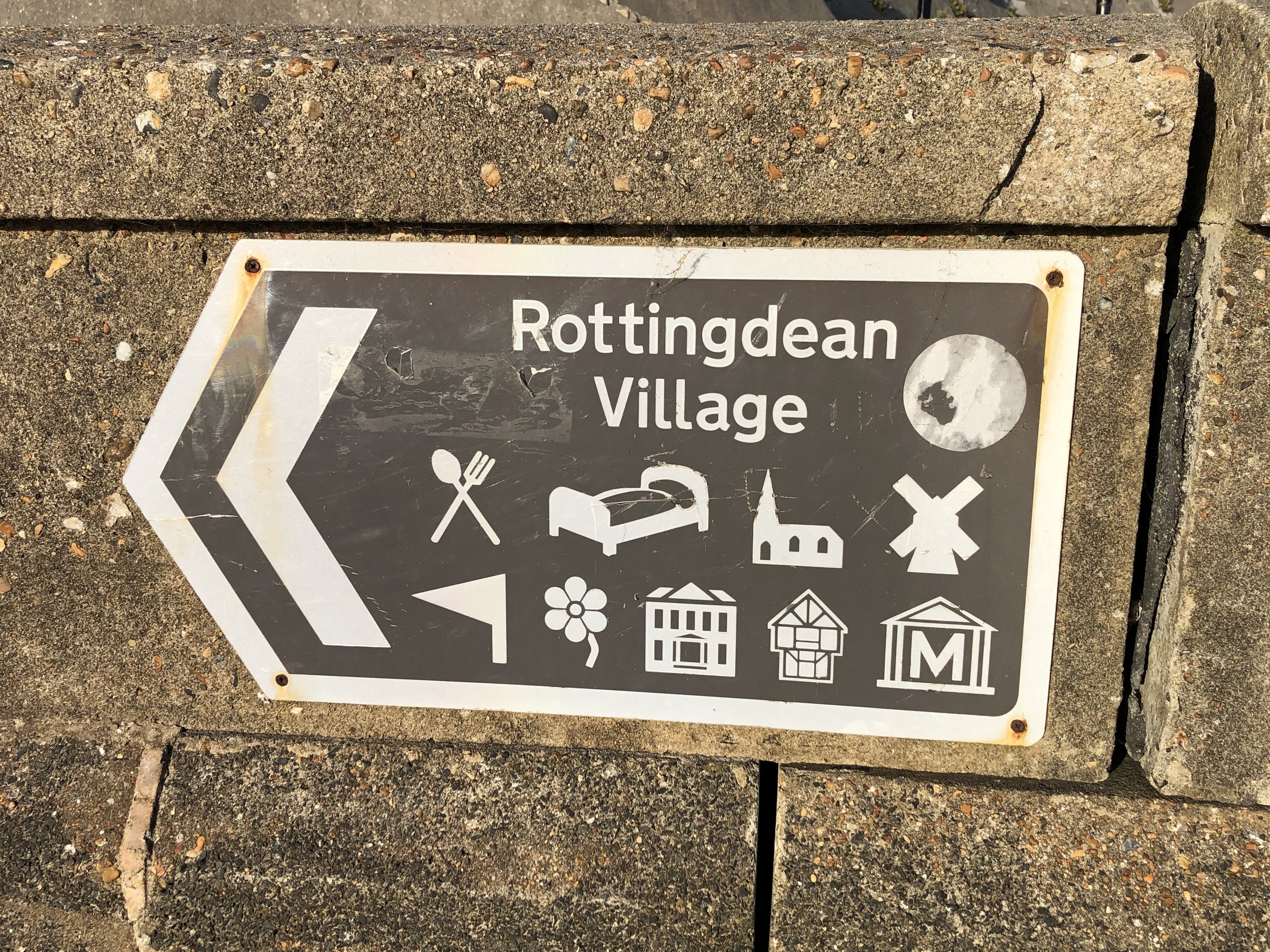
Links: Shoreham-by-Sea, Hove, Brighton, Brighton Marina, Rottingdean, Rottingdean Windmill
In our latest short section of the England Coast Path we chose the 19km stretch between Shoreham-by-Sea and Rottingdean. My main interest was to connect 2 previous trips: the end of the Downs Link that I had previously completed by bike and as an Ultra, and the Rottingdean to Peacehaven section that I had done ahead of the Prime Meridian cycle trip.
We were staying in Brighton for the week and actually split this into 2 days. The Coaster bus service runs parallel to the whole route so it’s easy to divide into smaller combinations. You can also take the train from Brighton to Shoreham. I planned the start of this trip from Shoreham train station so it’s a little shorter if you start from either the Downs Link end-point next to the River Adur or the bus stop on Shoreham High Street.
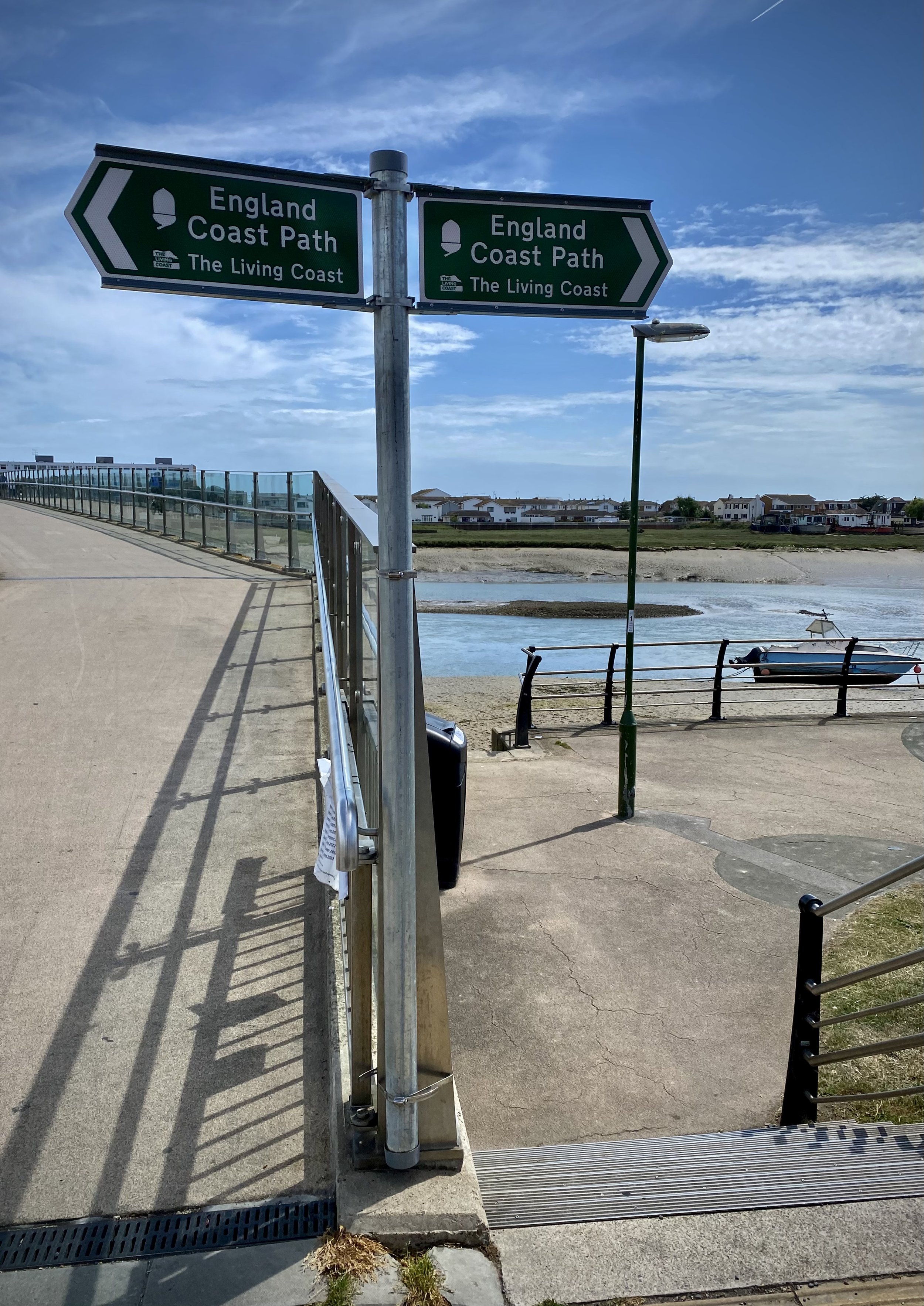
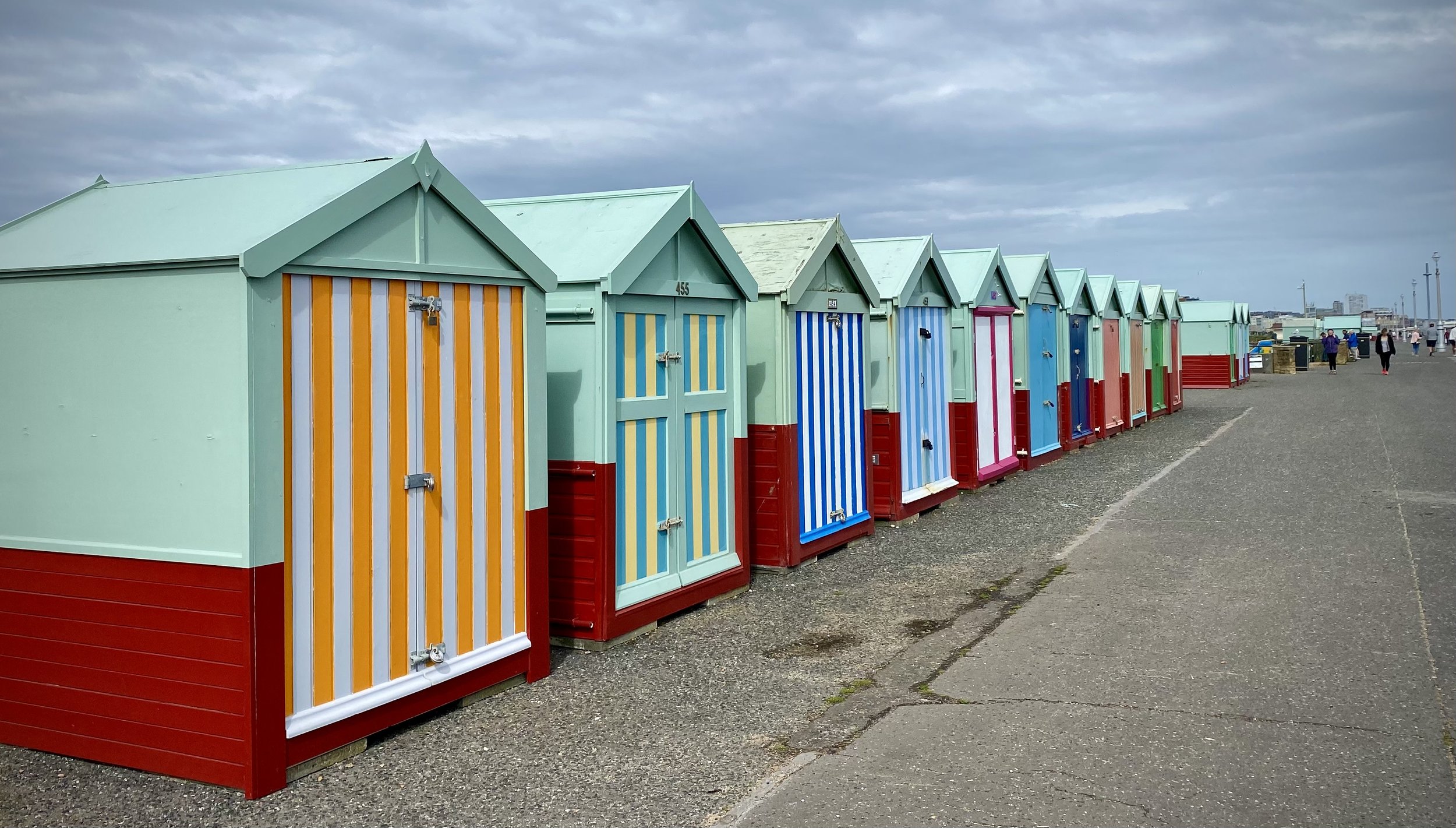
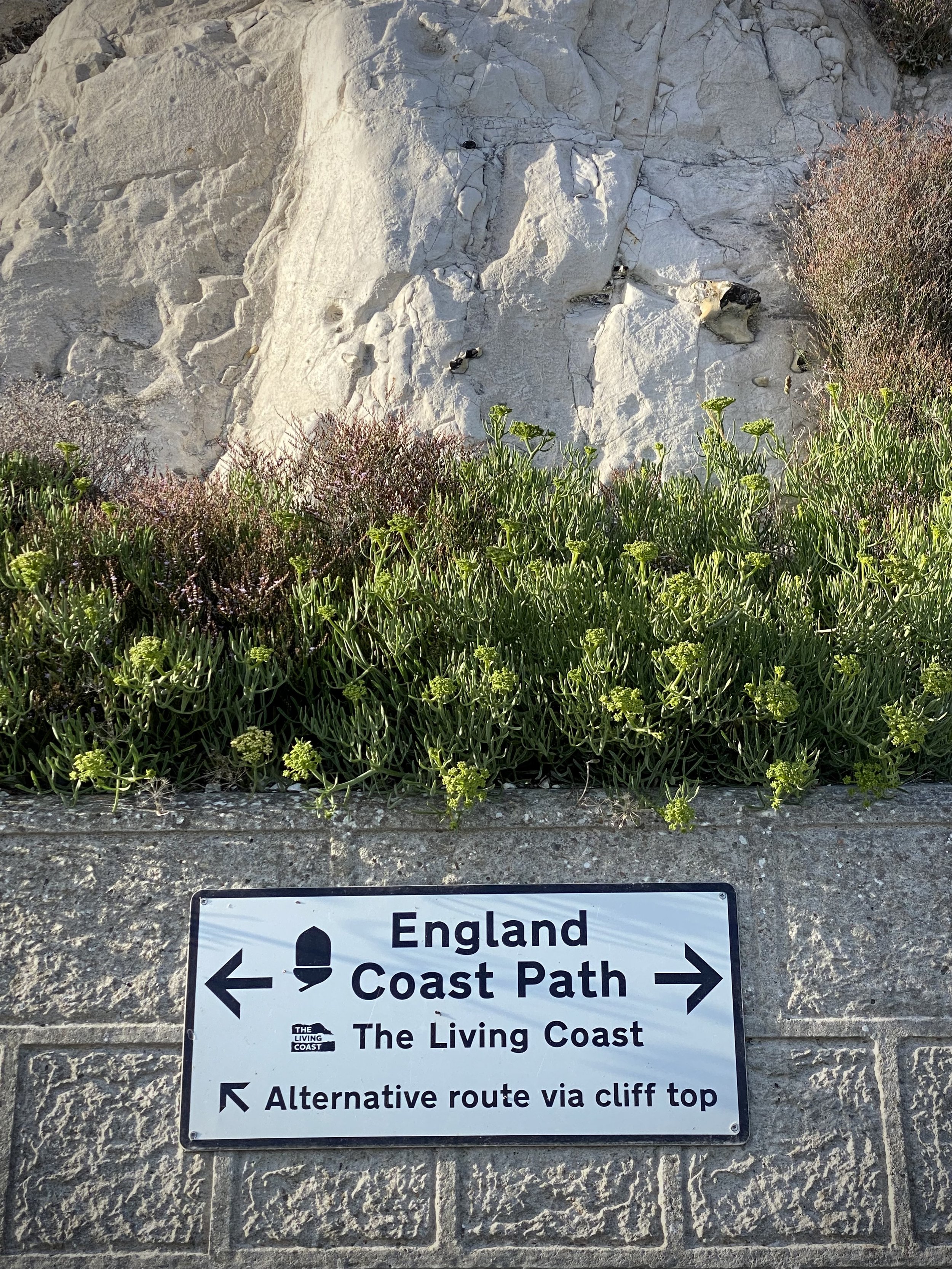
Navigation is very easy as you’ll be following the closest path to the sea. Much of it is signposted with either England Coast Path or (to Brighton) Monarch’s Way signs. After Brighton Pier the cliffs start to rise which gives you the option of either following the cliff-top path or the undercliff path. We always chose the undercliff path or whatever path was closest to the sea to give us a quieter, more interesting walk.
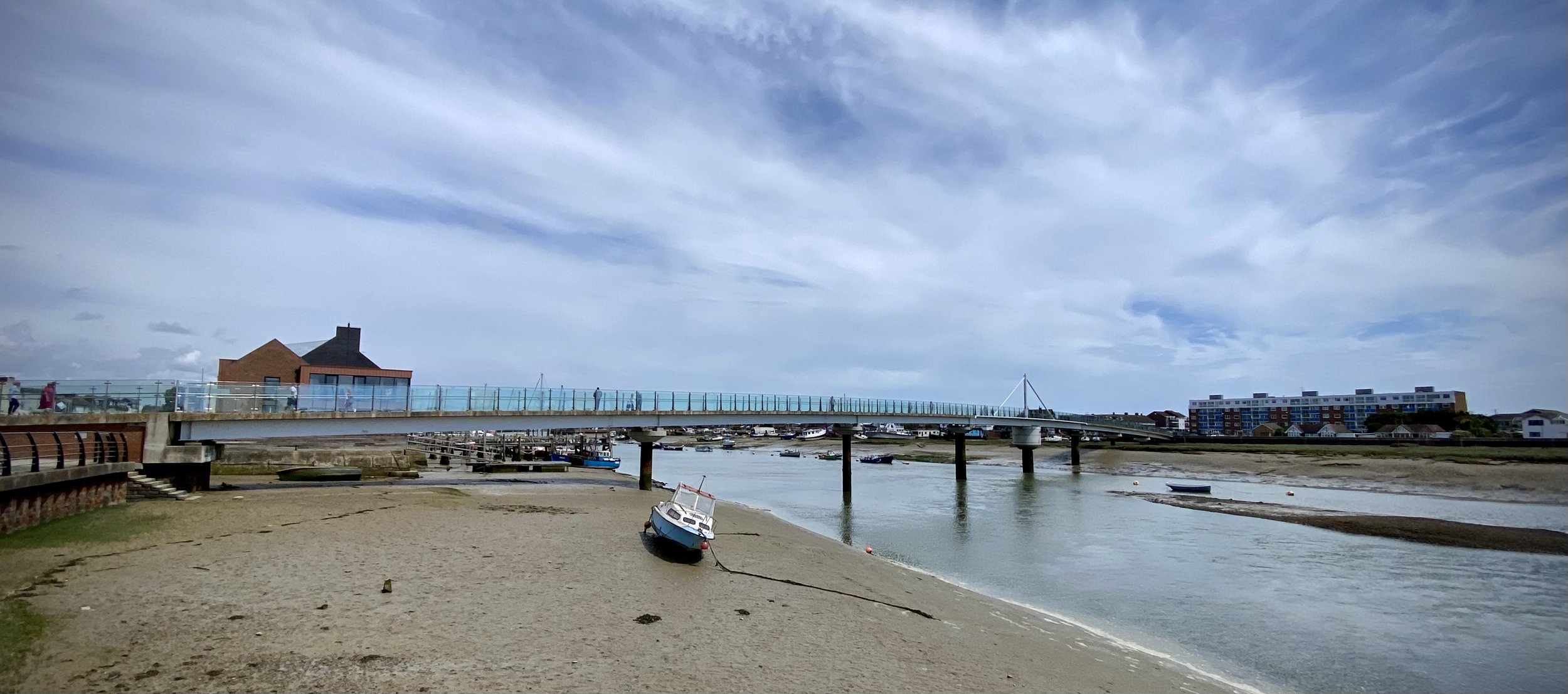
The scenery gets more pleasant the further east you travel. After Shoreham High Street you follow the busy A259 past industrial units and out-of-town stores for 2km until Shoreham Port. At the port, the path leaves the road, crosses the Adur and joins the Basin Road South. This is a good place to stop for a coffee and cake at either the Port Kitchen or Carats Café Bar to celebrate passing the grim part. Although Basin Road is still industrial, you’re now off the busy main road and next to the sea.
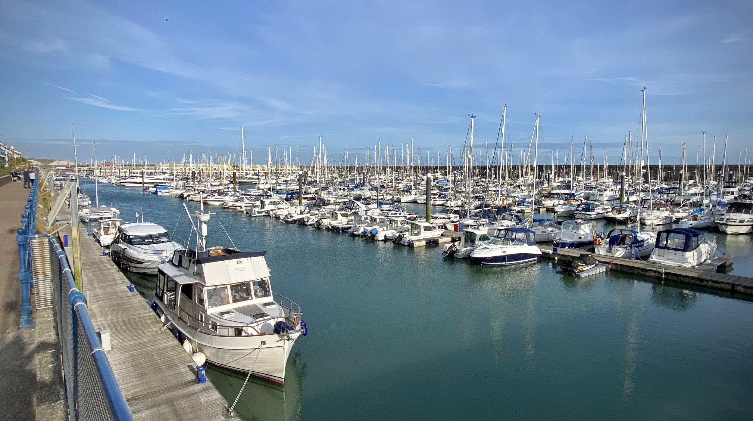
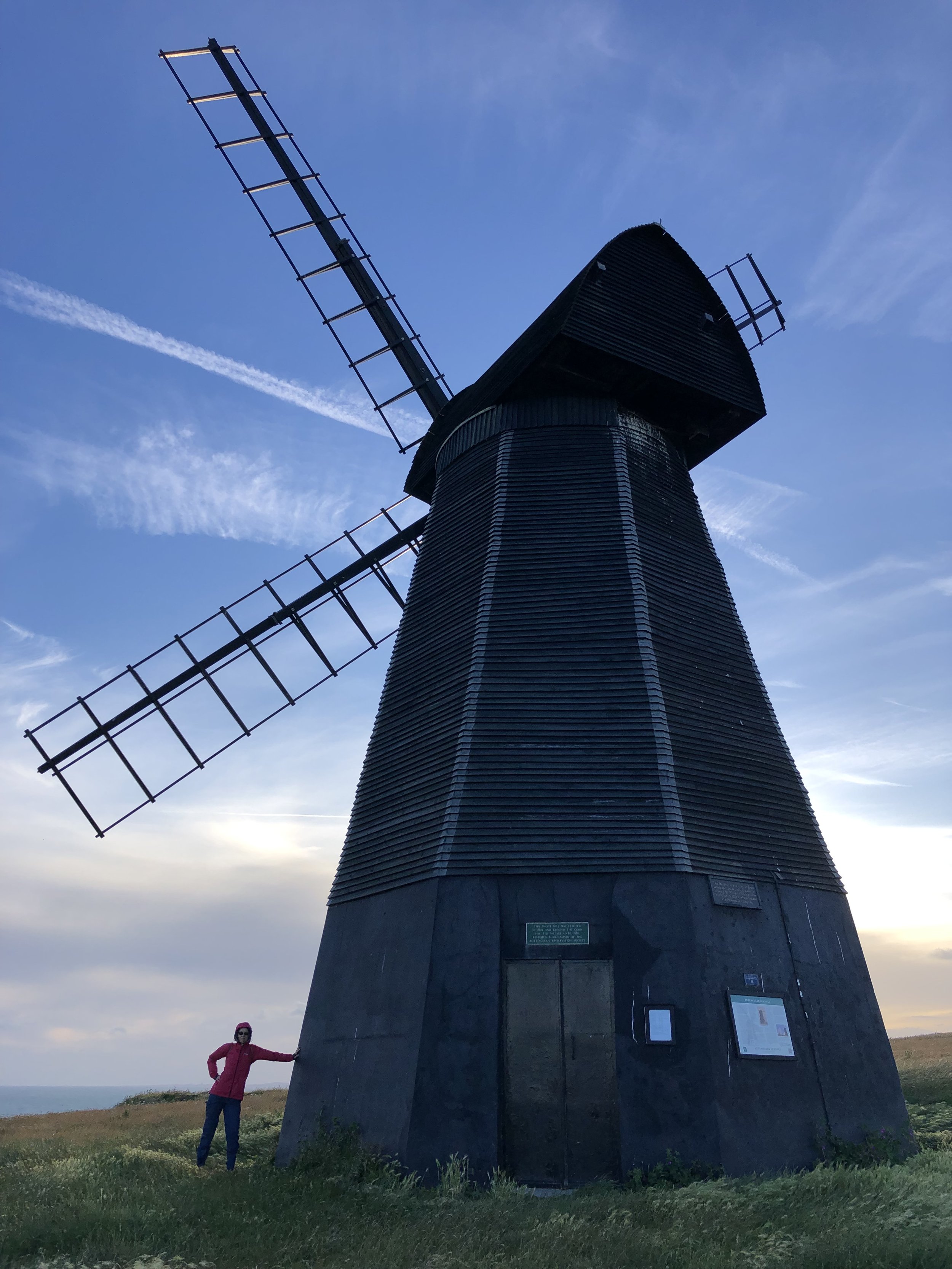
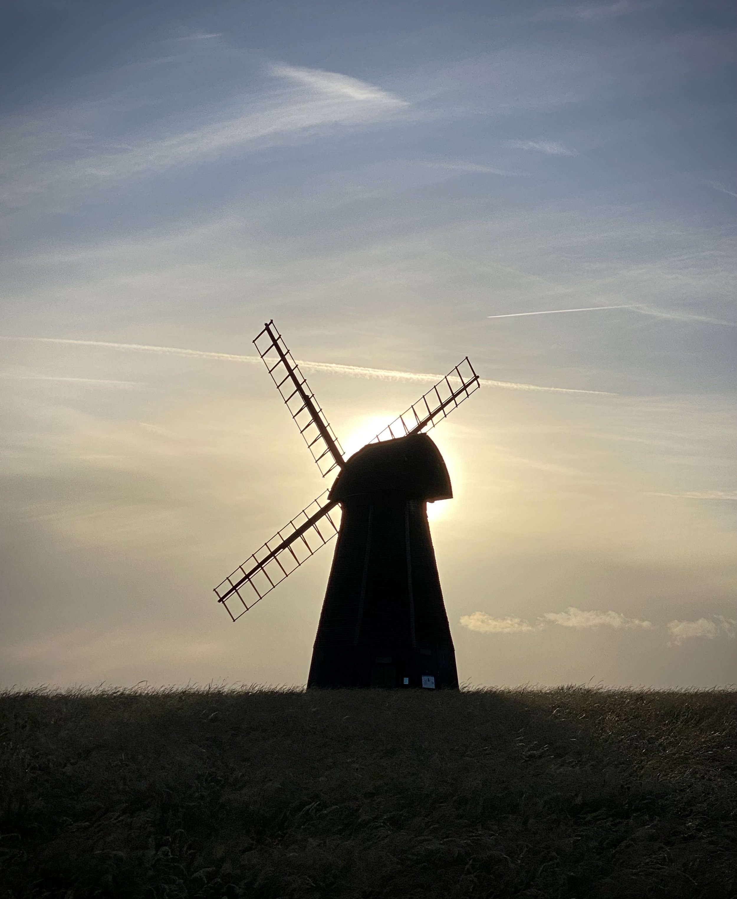
At the far eastern end of Basin Road you’ll arrive at Hove joining the promenade and a proper sea-side feel. Here you’ll have a lot of options for food and drink or to divert into Brighton town. After Brighton Pier keep to Madeira Drive, the lower / undercliff road and cut through Brighton Marina. After the Marina you’ll get to the undercliff path, a very quiet 2.5km stretch to Rottingdean. This is a good place to stop for a rest at the White Horse Hotel and get the bus back. Alternatively, as we did you could walk up to the Windmill on top of Beacon Hill for a great view. The view is especially good in the evening with the sun setting behind the windmill. From here, walk back down the hill to the A259 to the bus stop.