Walking The Ebury Way Disused Railway

The River Chess at the end of the Ebury Way at Rickmansworth. The hotel in the centre is the site of the old Rickmansworth Church Street Station.
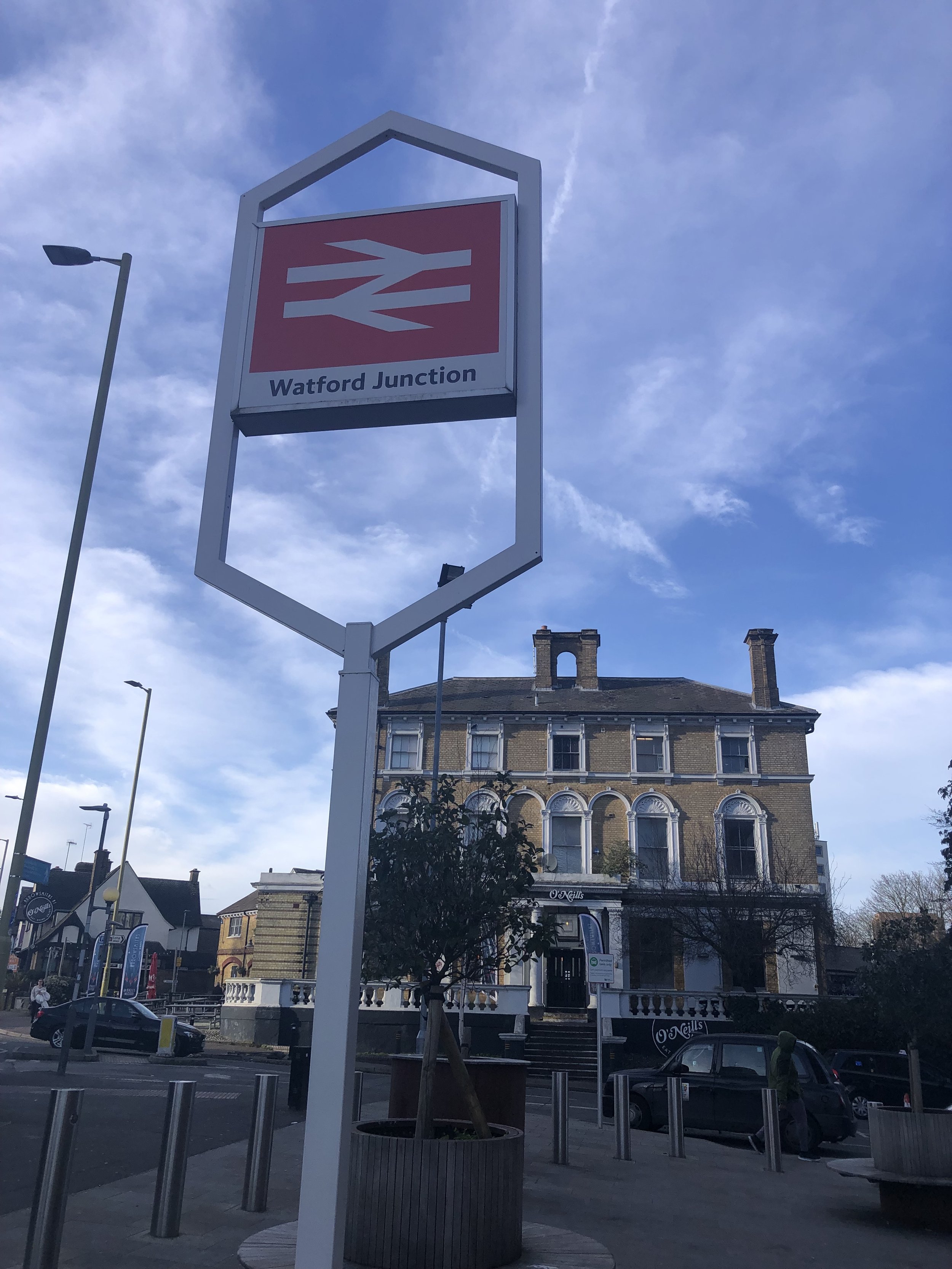
Start: Watford Junction Station, Station Rd, Watford WD17 1EU
Finish: Premier Inn Rickmansworth Hotel, Batchworth Lock House, Rickmansworth, WD3 1JB
Return to Start: via #322 bus. Check timetables for details.
Distance: 8.8 km (5.5 miles)
Elevation change: +39m / -61m. Net -22m
GPX File: get via Buy Me a Coffee
Other routes touched (walk): Abbey Line Trail, Croxley Green Boundary Walk, Grand Union Canal Towpath
Other routes touched (cycle): Colne Valley Cycle Route, Abbey Way, NCN 6, 61
London Coal Duty Posts: 45, 46
Pubs / Cafes on route: Many in Watford and Rickmansworth. On route: café in the Oxhey Activity Park at 3 km in.
Maps:
- London North Map | The City, West End, Enfield, Ealing, Harrow & Watford | Ordnance Survey | OS Explorer Map 173
- Chiltern Hills East Map | High Wycombe, Maidenshead & Rickmansworth | Ordnance Survey | OS Explorer Map 172
Links: Watford, Watford Junction Station, London Orphan Asylum, River Colne, Ebury Way, Croxley Common Moor, Rickmansworth
The Ebury Way is a walking and cycle path that runs along the course of the old Watford to Rickmansworth branch line. I have cycled it many times as a part of longer trips but it’s a short trail and it always went by too quickly to fully appreciate it. Having recently completed the Abbey Line Trail from St Albans to Watford Junction, it felt right to continue the rail-themed walk to Rickmansworth via the route of the old line.

Source; Wikipedia - creator Cnbrb
The original rail line followed the current route of the Overground service to Watford High Street Station but then continued to the south-west and split into 2 branches, one to the old Croxley Green Station and the other to Rickmansworth. The route branched again with a short section diverting north to Croxley Mills goods station. There’s an image on the Wikipedia page for the Watford & Rickmansworth Railway that shows the different routes.
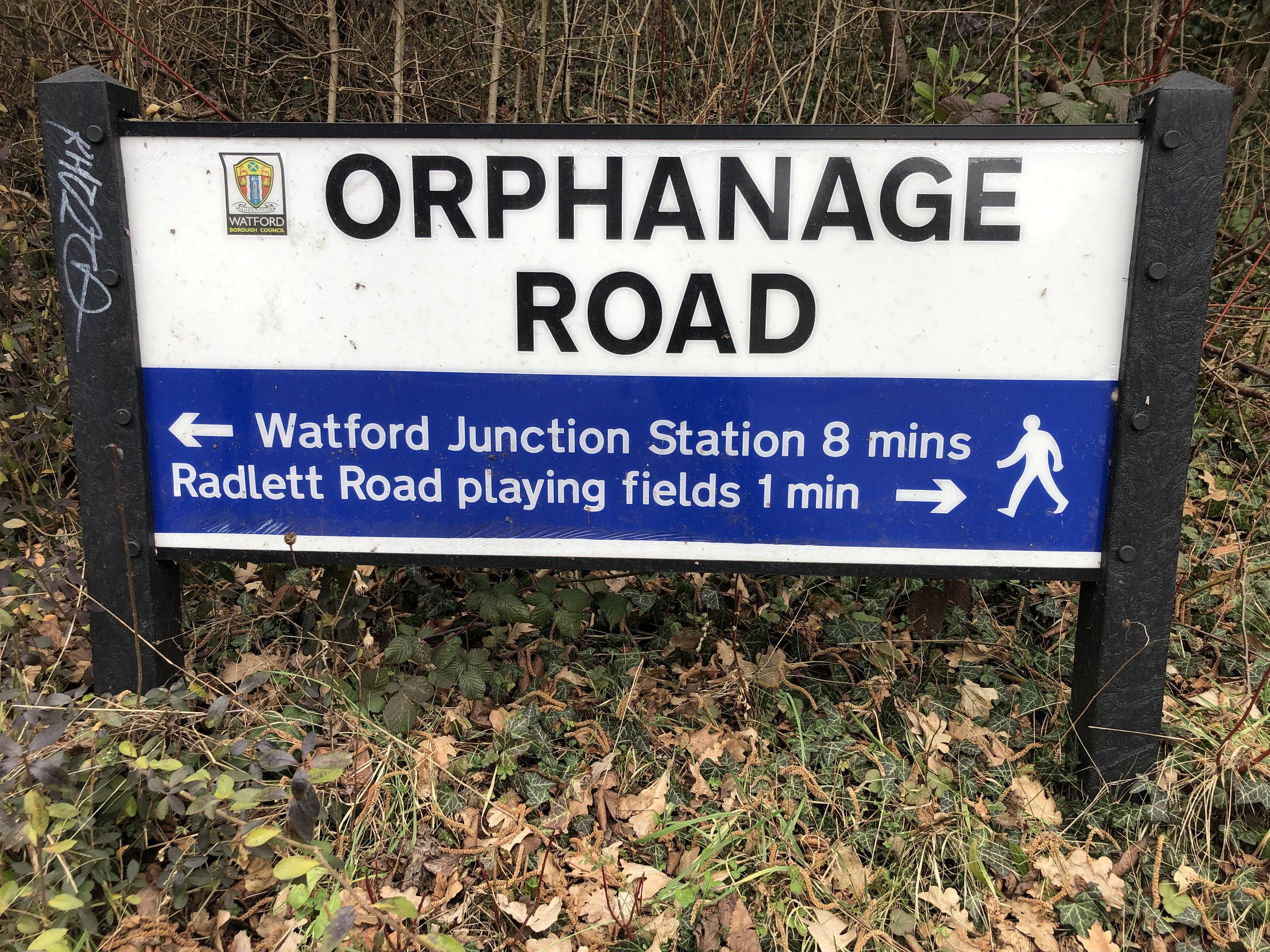
The start of the Ebury Way is in Riverside Park just south of the old split to Croxley Green Station. It’s impractical, and not a scenic walk, to follow the old rail route to here from either Watford Junction or Watford High Street stations. A better walk is to follow the route of the Abbey Way / NCN 6,61 cycle route that follows the River Colne. From Watford Junction station you can get to this route by retracing the last 1 km of the Abbey Line Trail down Orphanage Road, Radlett Road and Link Road to Radlett Road Playing Fields. From here you can follow the cycle route to the south.
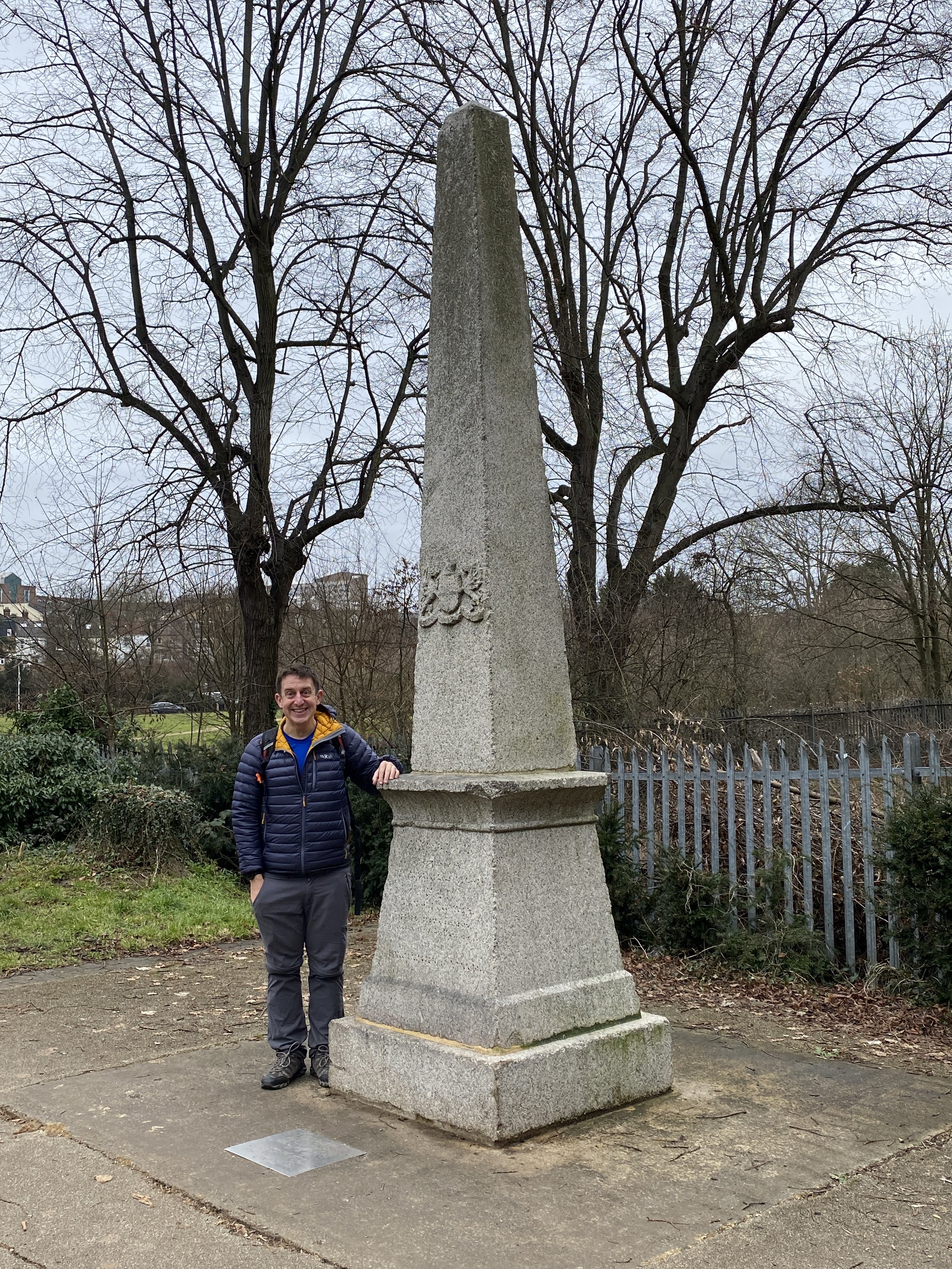
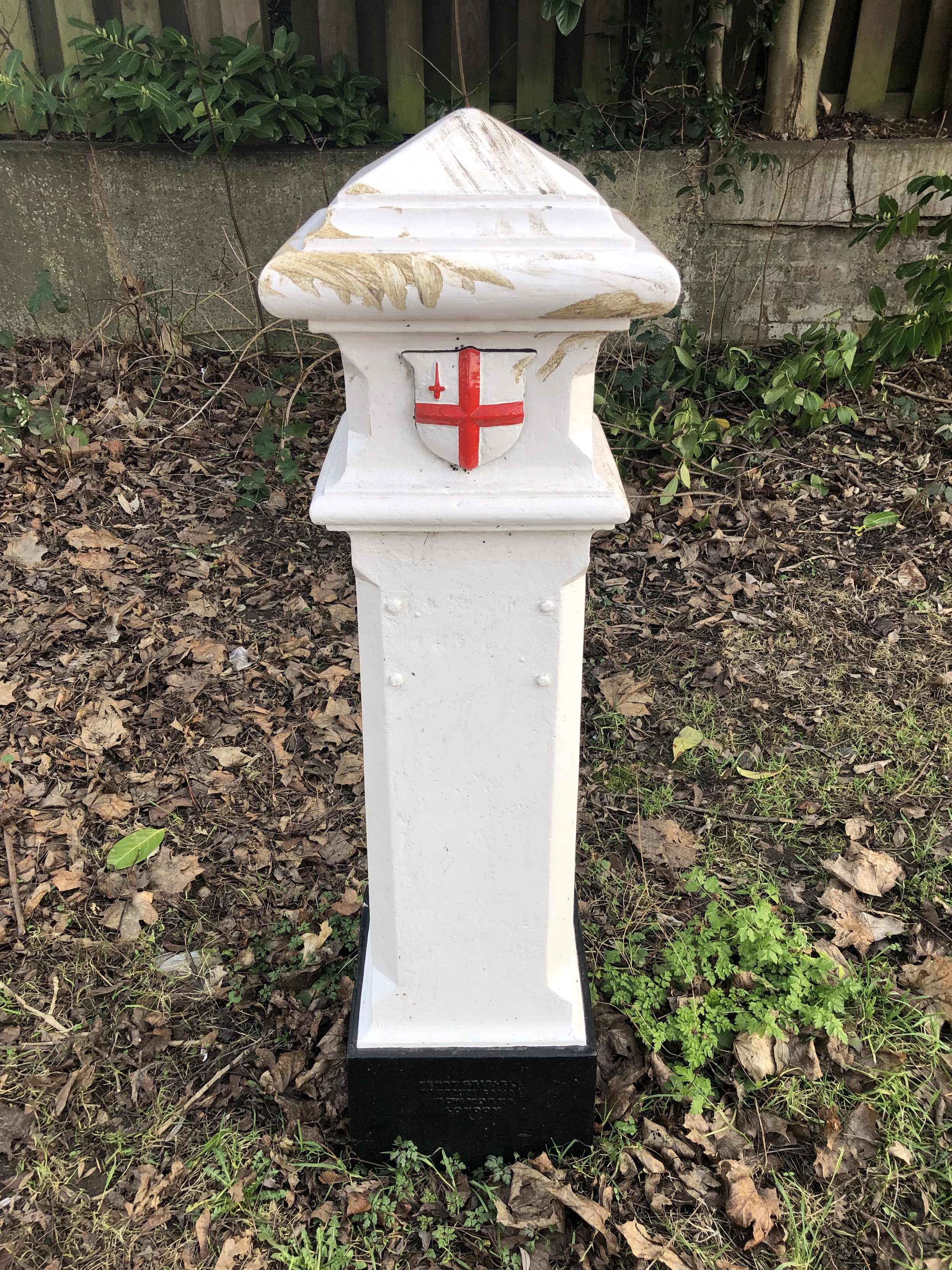
There’s a few things to look out for on this first section of the walk through Watford. At 1.6 km (1 mile) in, just after the huge brick rail bridge crossing the River Colne you can find a great example of one of the old London Coal Duty Posts. This one is a large stone obelisk, originally positioned on the opposite side of the river but repaired and moved to its current position in 1984.
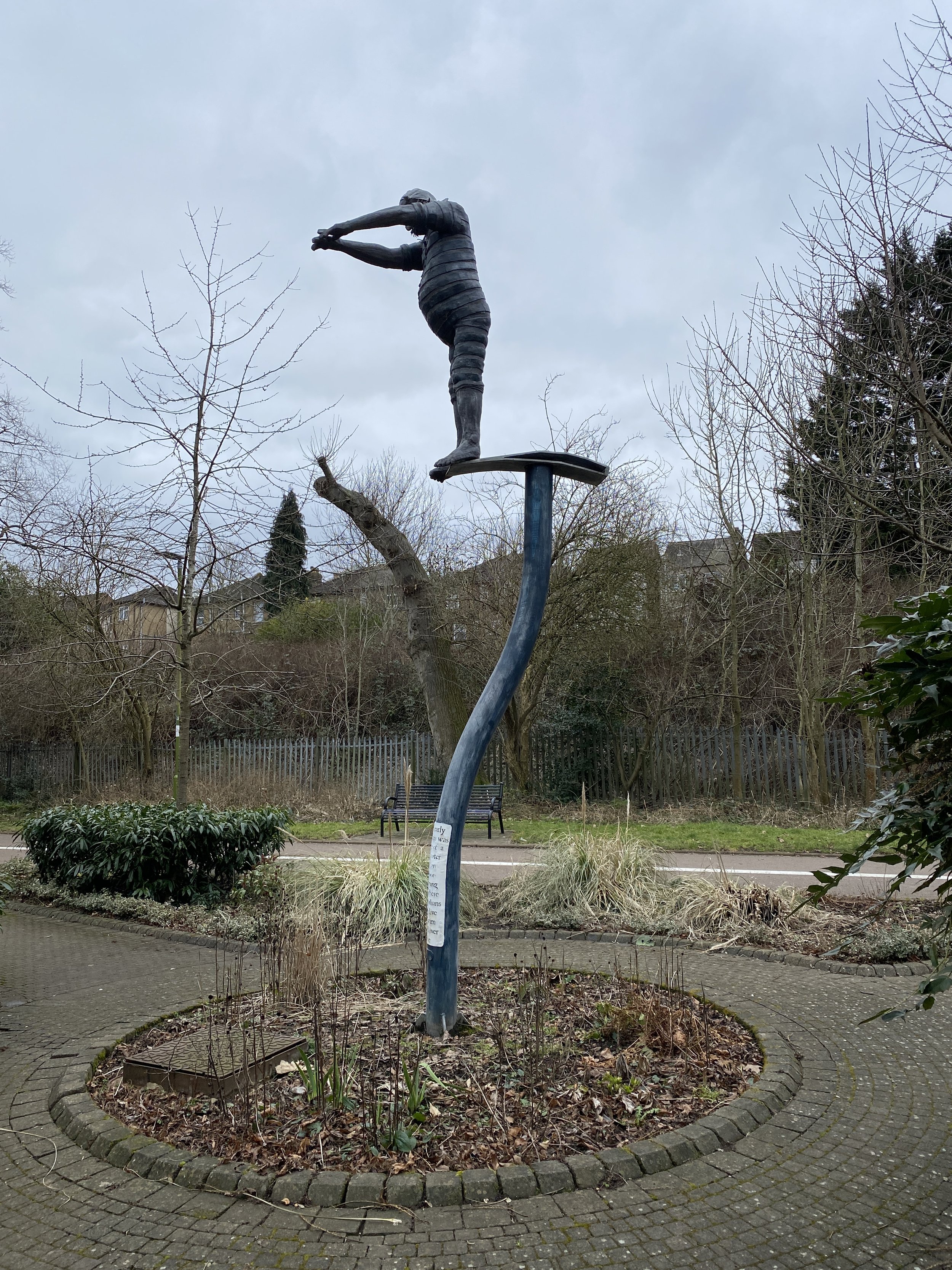
After the Coal Duty Post Obelisk you’ll be in Waterfields Recreation Ground. At the point where the Colne takes a curve to the left you’ll see a metal sculpture of a man about to dive into a pool. The inscription reads: “In the early 1900’s this was the site of a fresh water Lido, an outdoor swimming pool where Watfordonians could dive and swim in the River Colne”. I hope that the river was a lot cleaner then as I wouldn’t want to get into it now.
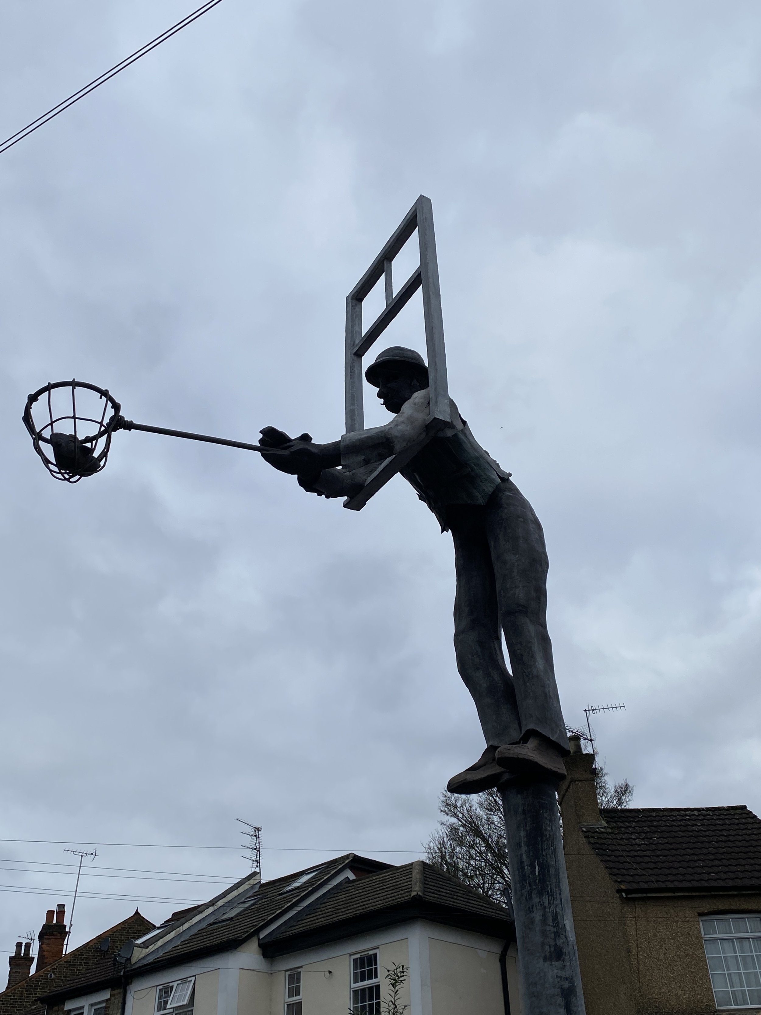
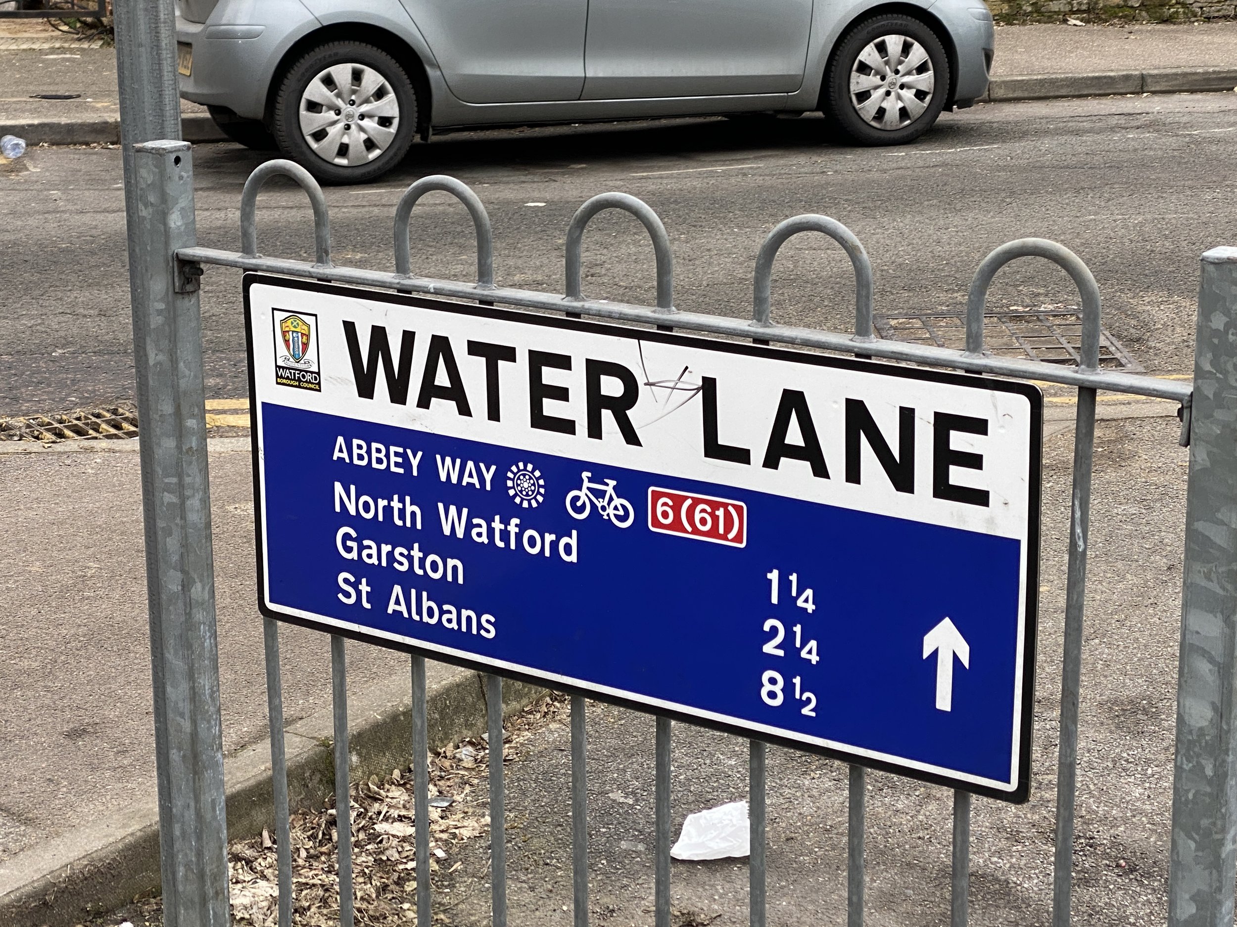
After another 200m and after crossing under the A411 you’ll cross over Water’s Lane where there’s a similar sculpture, this time of a man leaning out of a window holding a net. The inscription on this one reads: “In the 1900’s houses on this lane were continuously flooded with stories of locals climbing in through their upstairs window from boats. This is how Water Lane got its name”.
As you cross over Water Lane look to the left across the bridge over the River Colne to see another Coal Duty Post, this one is a good example of the distinctive and more common white Type 2 cast iron posts.
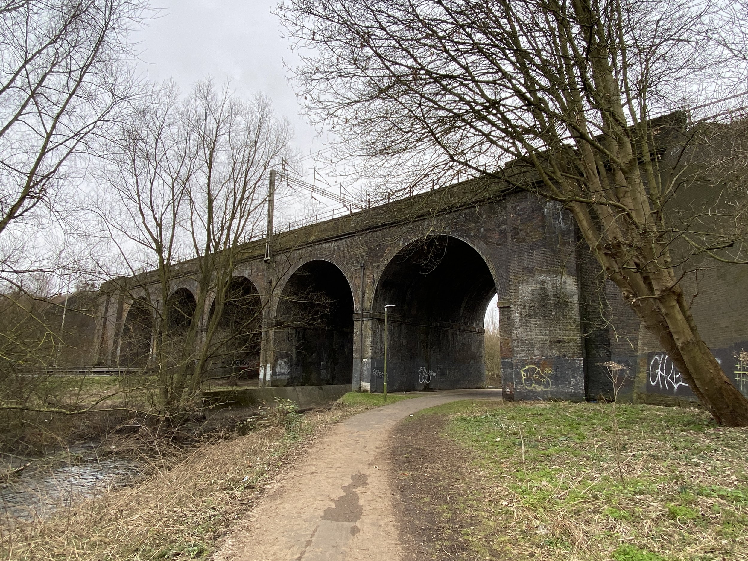
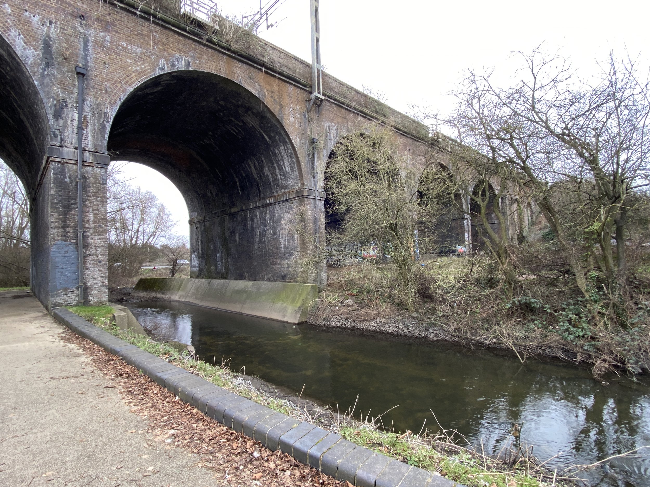
For the next kilometer you’ll pass through the retails parks of the east side of Watford. There’s not much to see here until you cross under the large curved viaduct that carries the Overground from Watford High Street to Bushey. After the viaduct you’ll cross over Thomas Sawyer Way, into Oxhey Activity Park and back to the River Colne.
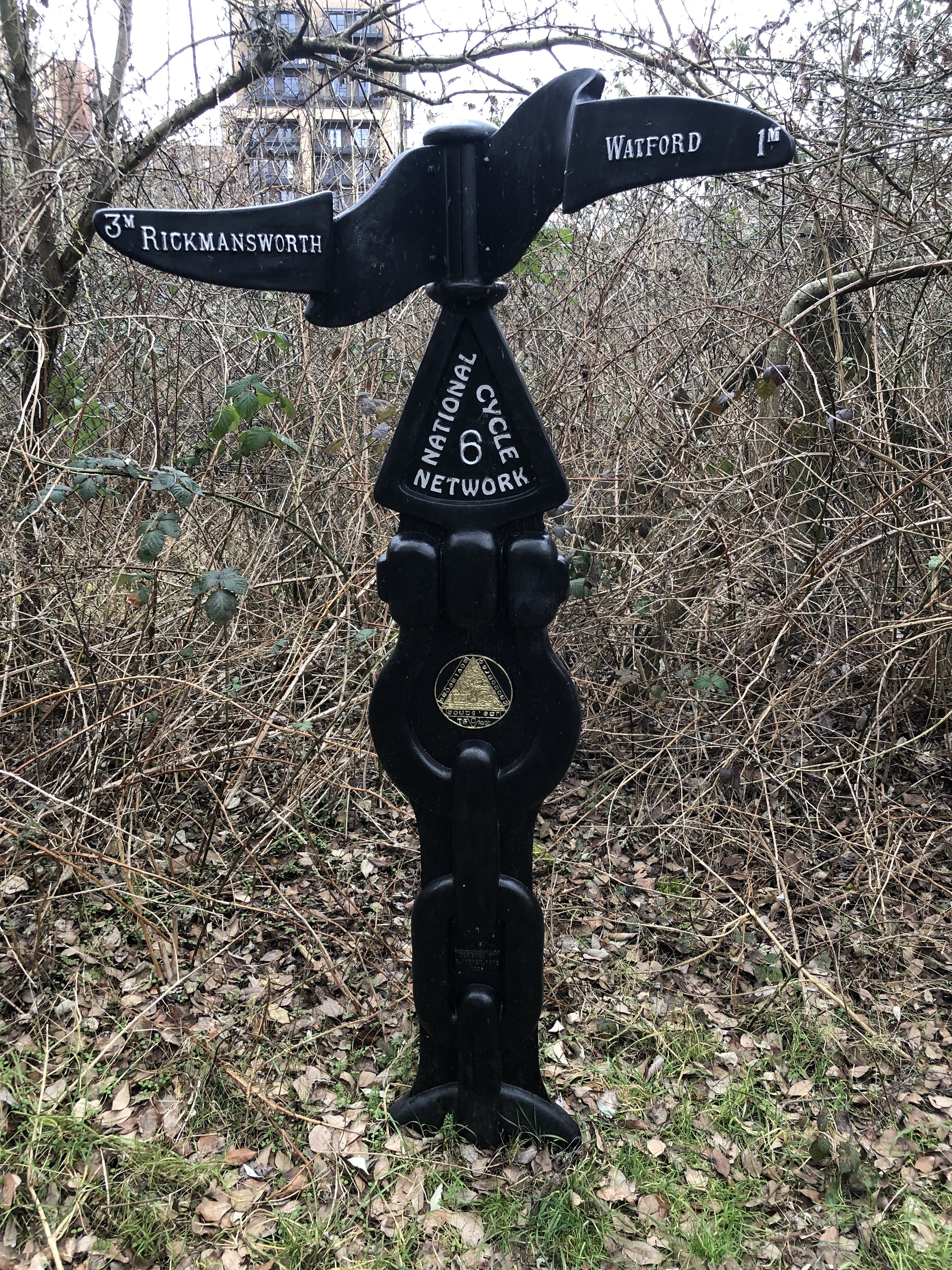
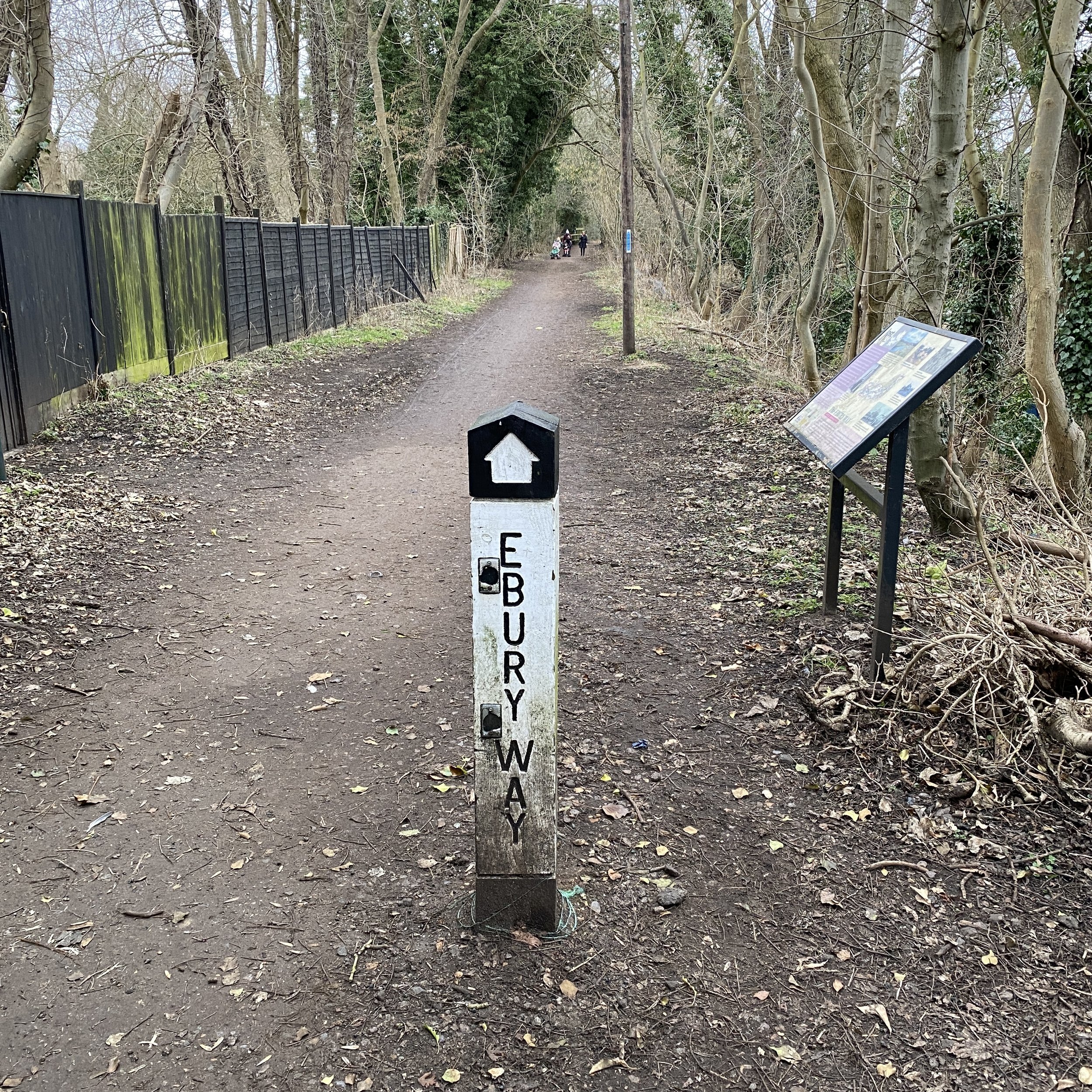
Follow the National Cycle Route 6/61 in an westerly direction next to the River Colne through Oxhey Activity Park, over the A4178 into Riverside Recreation Ground and then into Riverside Park. The route curves through Riverside Park before connecting with the route of the old railway. An Ebury Way Information Board and a Millennium National Cycle Network sign mark the official start of the Ebury Way. You’ll now be 4 km into the walk from Watford Junction station.
Navigation along the Ebury Way is as simple as you would expect from a disused railway and there’s regular signposts along the way. We noticed a lot of litter on the route which spoilt an otherwise pleasant trail.
After 2 km on the rail route (6 km from Watford Junction) you’ll reach the western edge of Croxley Common Moor, a Site of Special Scientific Interest (SSSI) and a Local Nature Reserve (LNR). This is also the point where the branch line to Croxley Mills split off from the Watford to Rickmansworth line. If you pass through the kissing gate into the common you can see the a footpath along the western side of the common that follows the route of the old track.
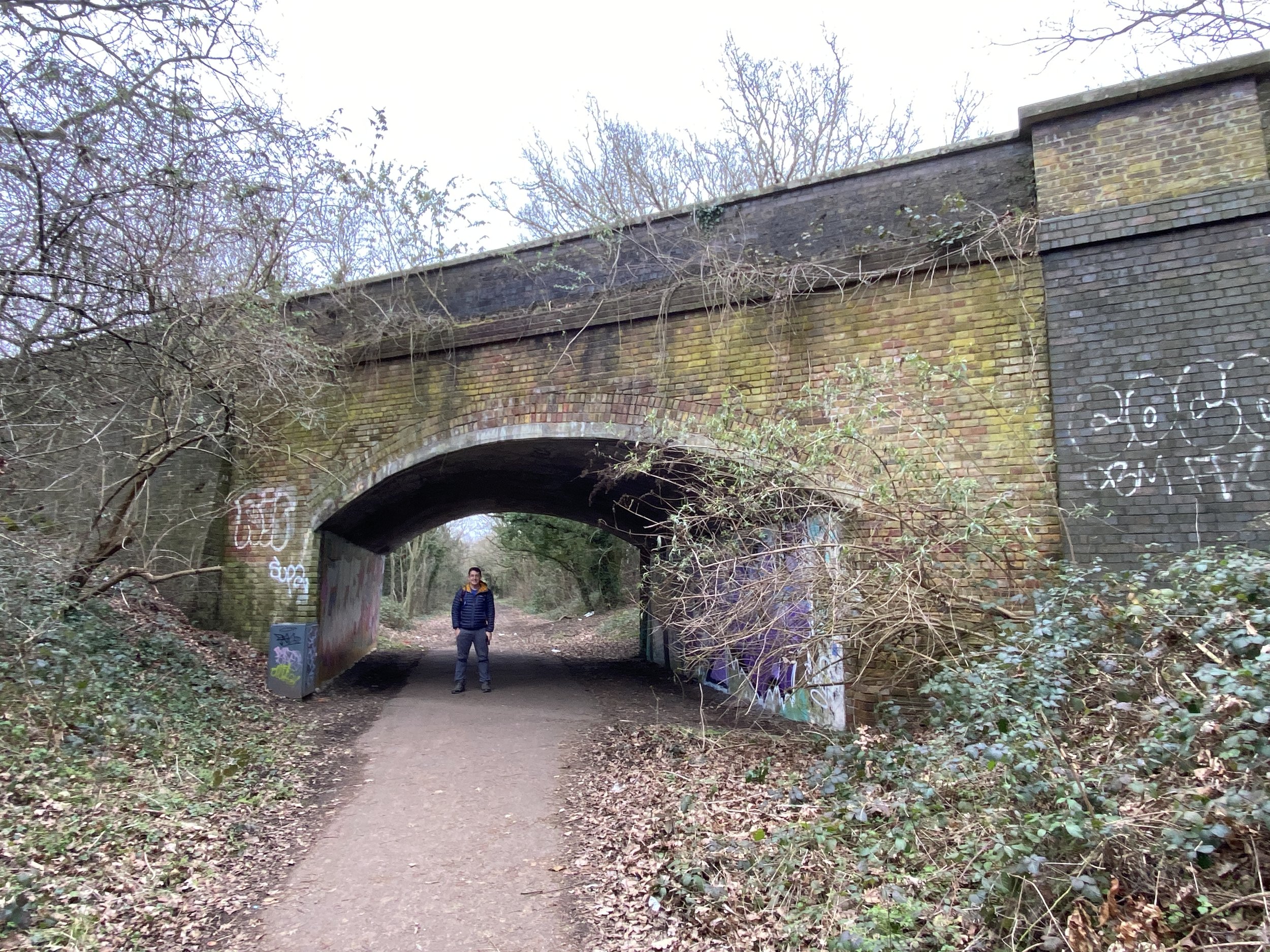
Continuing along the Ebury Way you’ll have uninspiring light-industrial buildings on your left and Croxley Common Moor on your right. At the eastern end of the moor you’ll pass under the railway bridge that carries the Metropolitan Line between Moor Park and Rickmansworth.
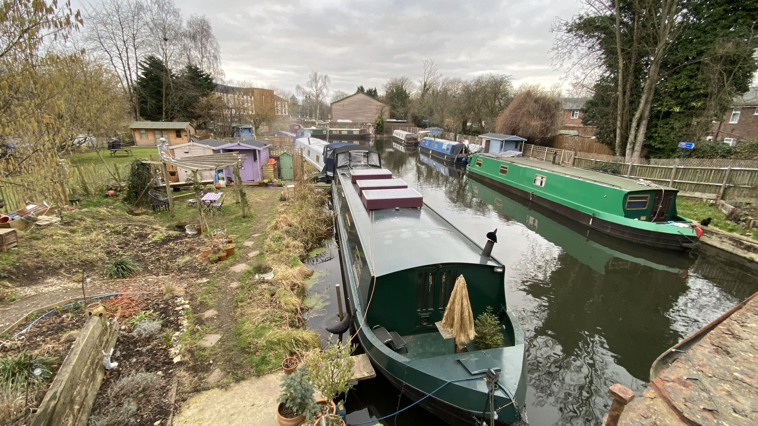
The final 1.5 km, after the railway bridge passes through a series of fishing lakes, and over the Grand Union Canal. The Ebury Way ends with another information board before crossing a bridge over the River Chess. This is a nice spot with barges and quirky moorings. Beyond the barges you’ll see the Premier Inn which is built on the site of the old Rickmansworth Church Street Station.