Cathkin Braes: Glasgow City County Top
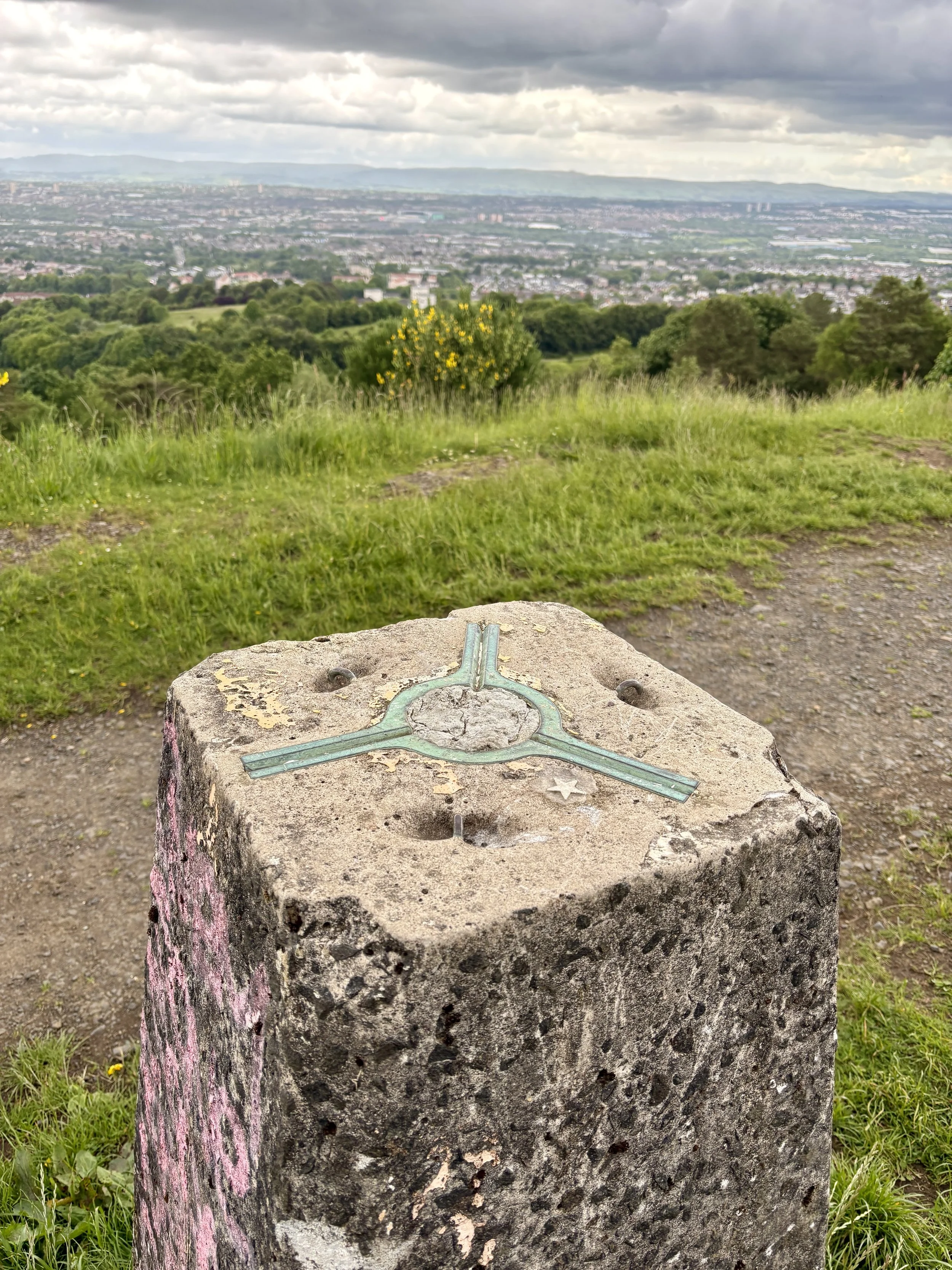
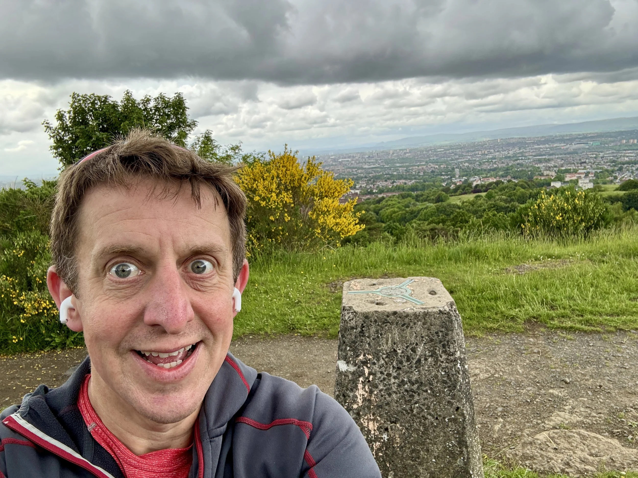
View over Glasgow from the OS Trig Pillar
Significance: Present-day County Top for Glasgow City
Historic County: Lanarkshire, of which Culter Fell is the Historic County Top
Member of: N/A
Nearest Higher Neighbour: Corse Hill
Elevation: 200m
Date climbed: June 5th 2026
Coordinates: 55° 47' 56'' N, 4° 12' 41'' W
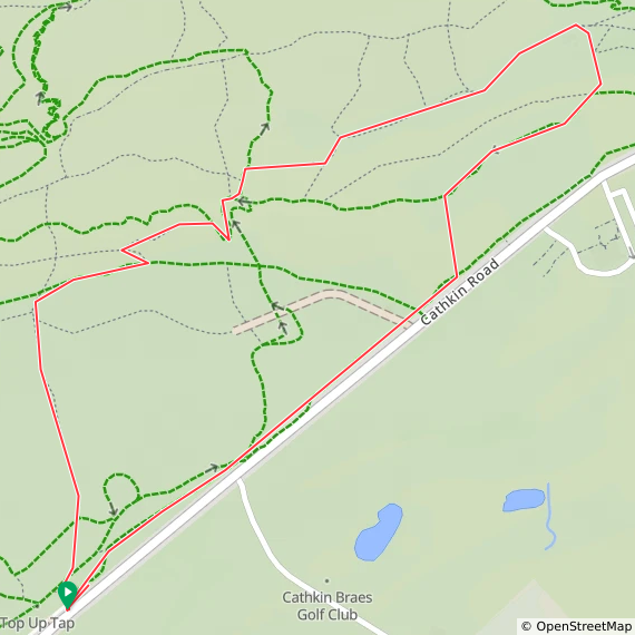
Route Start & Finish: Cathkin Brae Bike Park Top Car Park, B759, Glasgow, G76 9EY
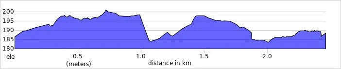
Route Distance: 2.3 km (1.42 miles)
Route Elevation change: +/- 31m
Subsidiary tops on route: xx
GPX File: get via Buy Me a Coffee
Other routes touched (walk): None
OS Trig Pillar: None
Pubs / Cafes on route: None
Map: Glasgow Map | Paisley, Rutherglen & Kirkintilloch | Ordnance Survey | OS Explorer Map 342
Links: Wikipedia: (Glasgow / Cathkin Braes), Peakbagger, Hillbagging
Cathkin Braes is the Present-Day County Top for Glasgow City. I bagged it in 2026 on our annual County Top weekend trip, along with the present-day County Tops of East and West Dunbartonshire and the Historic County Tops of Argyll and Ross and Cromarty.
It had already been a successful hiking day, having conquered both Earl's Seat and Duncolm to successfully claim the high points of East and West Dunbartonshire. This was part of our broader weekend plan and a parallel adventure: while I was out ticking off these local summits, Mark, Matt, and Joel were over on the Isle of Arran to tackle Goat Fell.
With a couple of hours to spare before I needed to drop my hire car back at Glasgow Airport and reunite with the boys, I realised I had the perfect window for a quick detour. I have been saving Cathkin Braes for a few years, waiting for an opportunity to comfortably squeeze it into an itinerary. As the county top for Glasgow City, it is highly accessible and makes for a very straightforward, short walk.
Walking Directions
The guidance below will help you navigate but don’t use it as a fully accurate turn-by-turn guide. Always take a map and/or a GPX route and prepare well for the weather and terrain.
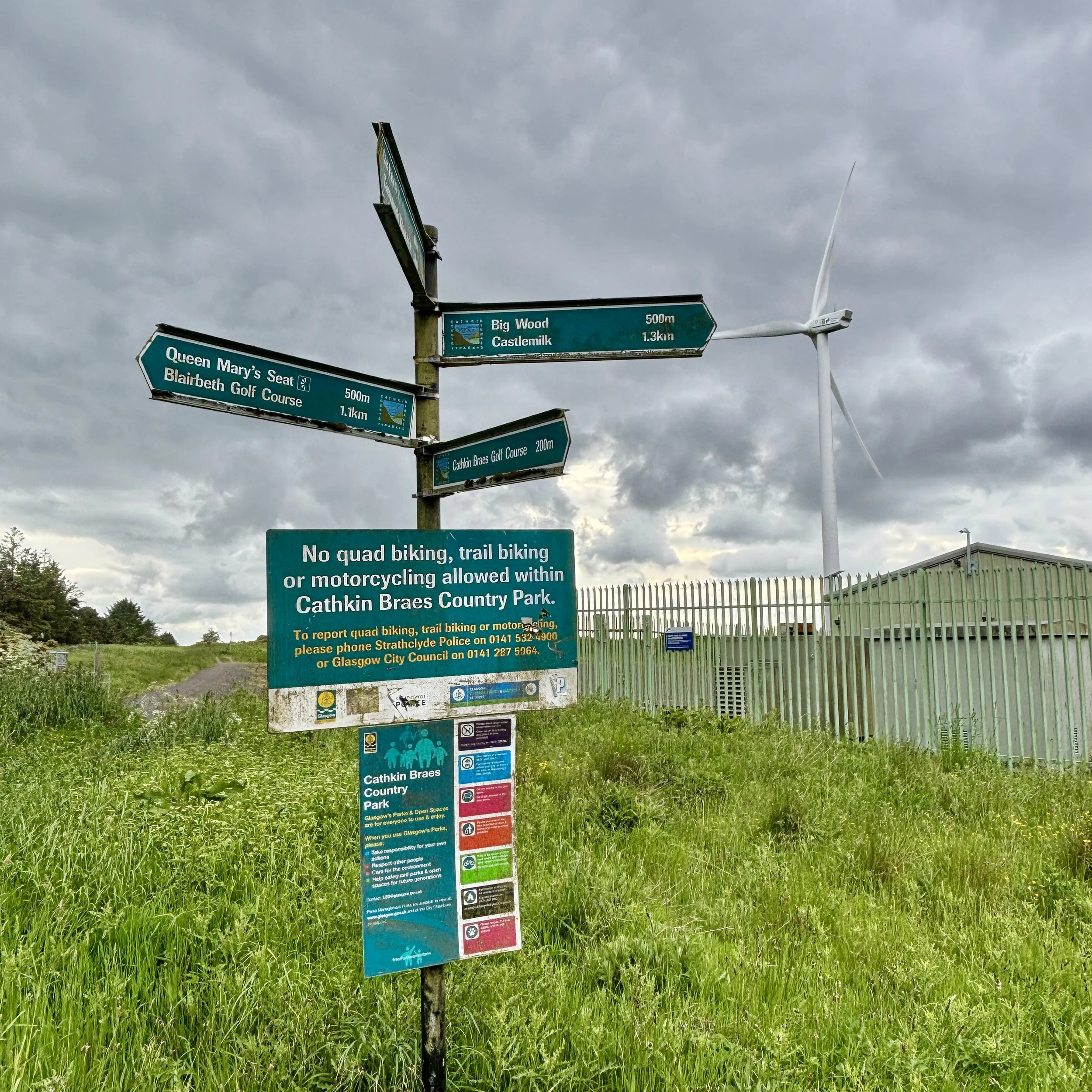
The drive over from Kilpatrick Braes was quick and easy. I pulled into the main Cathkin Braes car park located just off the B759 road. It is a good size, and being late on a Friday afternoon, it was full of people out enjoying a walk with their dogs.
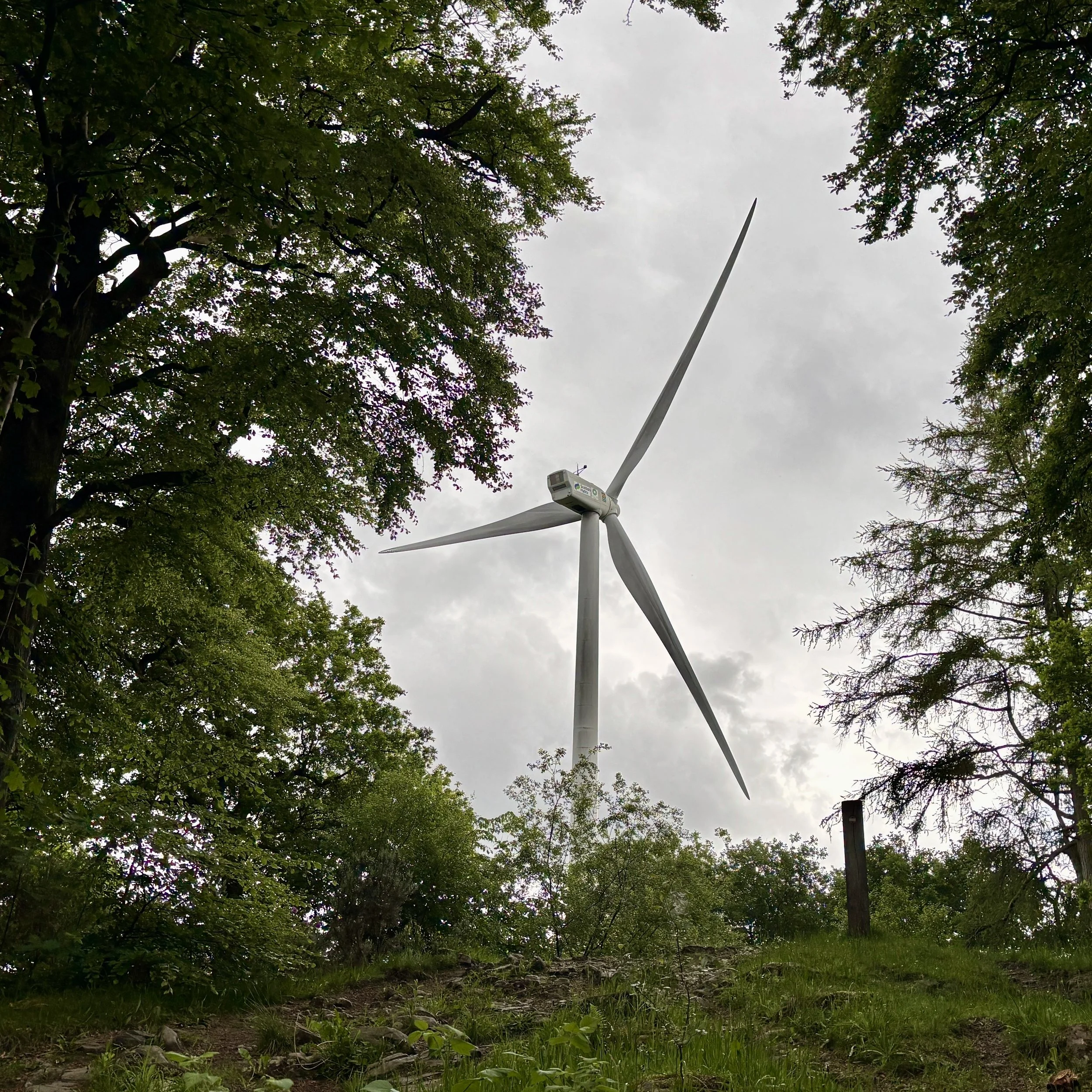
From the car park, you pick up a path that runs close to and parallel with the B759 in a north-easterly direction. The route takes you through some vegetation, pointing you towards a very clear visual target: the large wind turbine. You simply keep heading towards it, eventually passing right through the turbine's car park and out the other side.
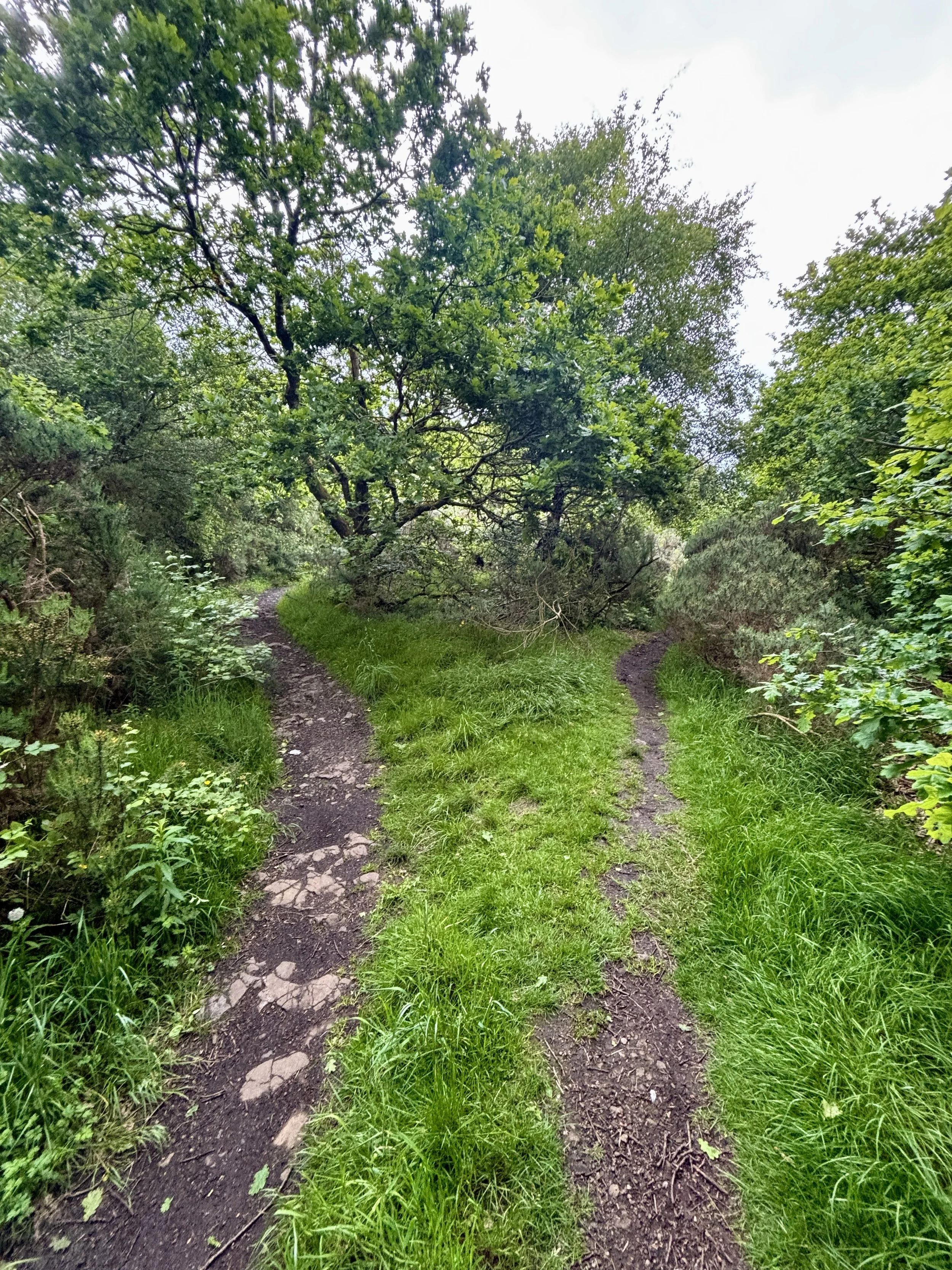
From the turbine, you follow a path heading in a slightly northerly direction to hunt down the exact coordinates of the high point. Unlike some of the more dramatic peaks, the true highest elevation here is beautifully unassuming. It is located on a path deep in the woods, with nothing marking the spot other than a distinct fork in the trail. I snapped a quick picture of the fork to officially document the achievement and pressed on.
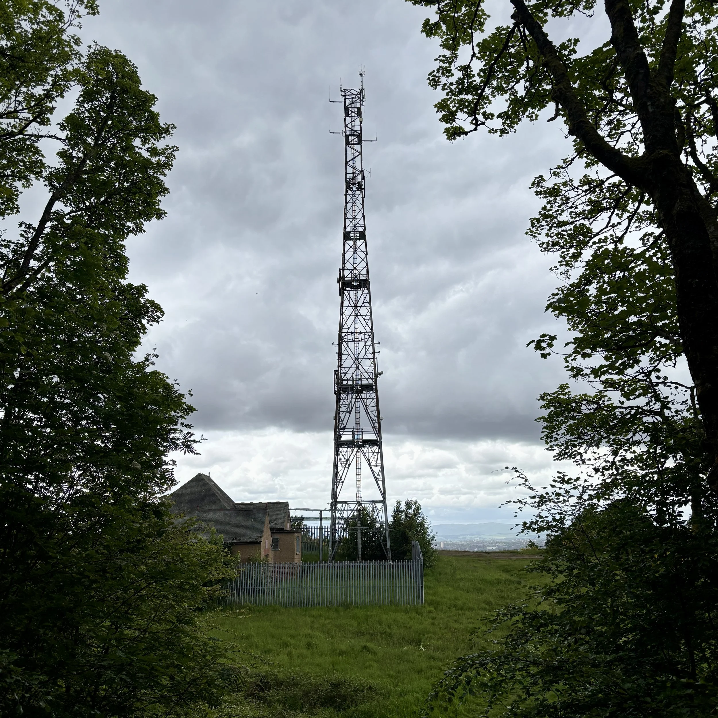
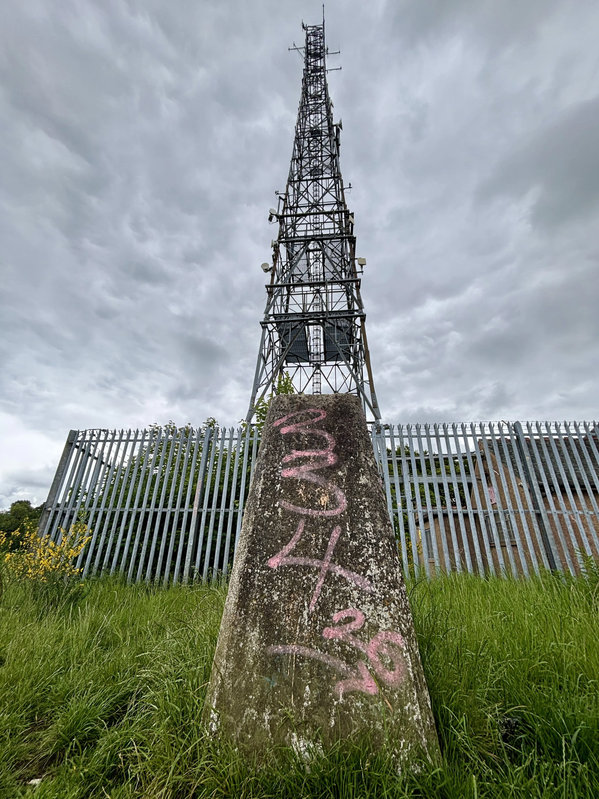
Taking the north-easterly path from the fork, I headed out towards a clearing. This is where the walk really rewards you: it opens up onto the ridge line, offering a fantastic view stretching right over the city of Glasgow. Sitting just in front of a very large telegraph pole, you will find the trig pillar. It is sporting a little bit of graffiti these days, but it is otherwise in good condition and well looked after.
After taking in the city views, the return leg is incredibly simple. You just follow the path along the ridge in a south-westerly direction, re-enter the woods shortly afterwards, and follow the trail all the way back to where you started at the B759 car park. It was an excellent, short walk to cap off the day before heading to the airport.
Points of Interest along or near to the Route
Cathkin Braes Country Park: Sitting among the highest points in Glasgow at around 200 metres, Cathkin Braes offers sweeping views across the city towards the Campsie Fells and, on clear days, the distant Southern Highlands. The Braes are also tied to the story of Mary, Queen of Scots: tradition holds that she watched the 1568 Battle of Langside from a vantage point here, witnessing the defeat of her supporters and the effective end of her reign in Scotland.
Geological Significance: The Braes form part of Glasgow’s Carboniferous volcanic landscape, shaped over millions of years as lava flows and volcanic rocks were gradually eroded into the distinctive ridge line seen today. This varied terrain supports a rich mosaic of habitats, from acid grassland and heath to woodland edges and wetlands. It is an important refuge for wildlife, including kestrels, owls, and seasonal migratory birds, making it one of the city’s most ecologically valuable upland areas.