Posts tagged Snowdonia
Western Wales County Tops

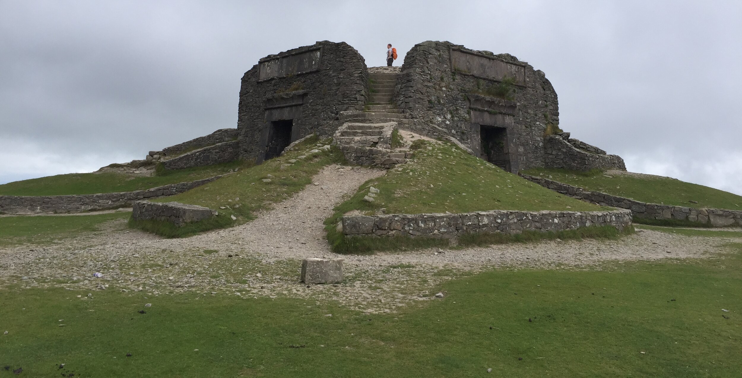
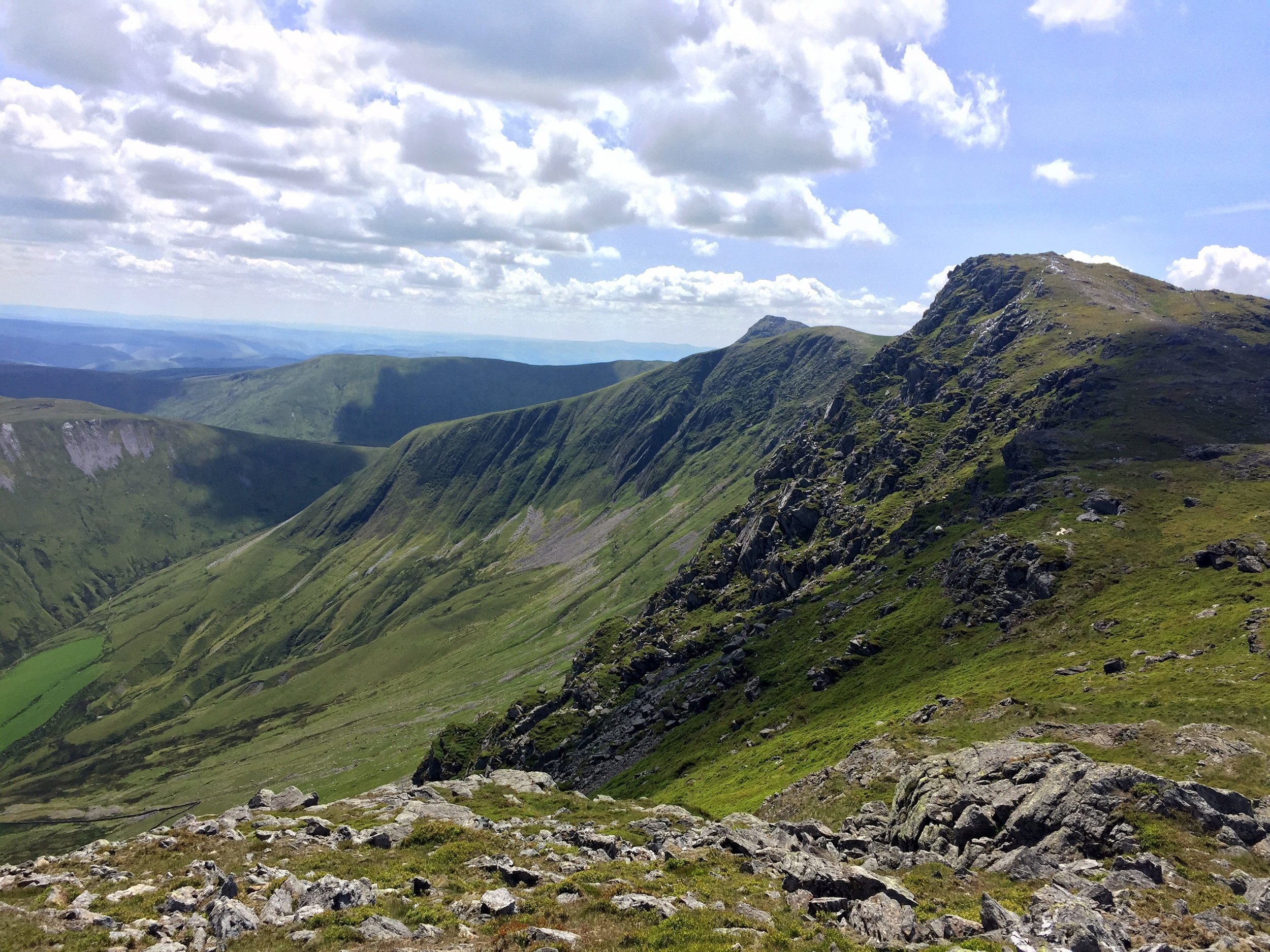
View from Aran Fawddwy


“Remote” and “obscure” are relative terms. If you live in Aberystwyth then Arran Fawddwy, Plynlimon and Foel Cwmcerwyn are all local and accessible peaks. If, like the rest of the us, you don’t then they’re a bugger to get to.

Over my 7 years of County Topping I’d managed to pick off the rest of Wales. Snowdon came first and I’d repeated it several times. The rest of the North was ticked in one trip in 2016, the South in 2014 and all between came on weekend adventures over the years. The final 3 are pretty well spaced out so they could only be done on a road trip rather than a single location adventure. If I’d known earlier that this trip would be such fun I’d have tackled these much earlier.

As is mandatory for all weekend trips now, travel happens on a Friday after work. Saturday starts with the nearest parkrun not yet done. This time is was Dolgellau, a beautiful course along the Afon Mawddach river and Madwddach Trail. The Sustrans signs along the route reminded me that I’d passed through here before on my NCN8 end to end Wales trip in 2010.
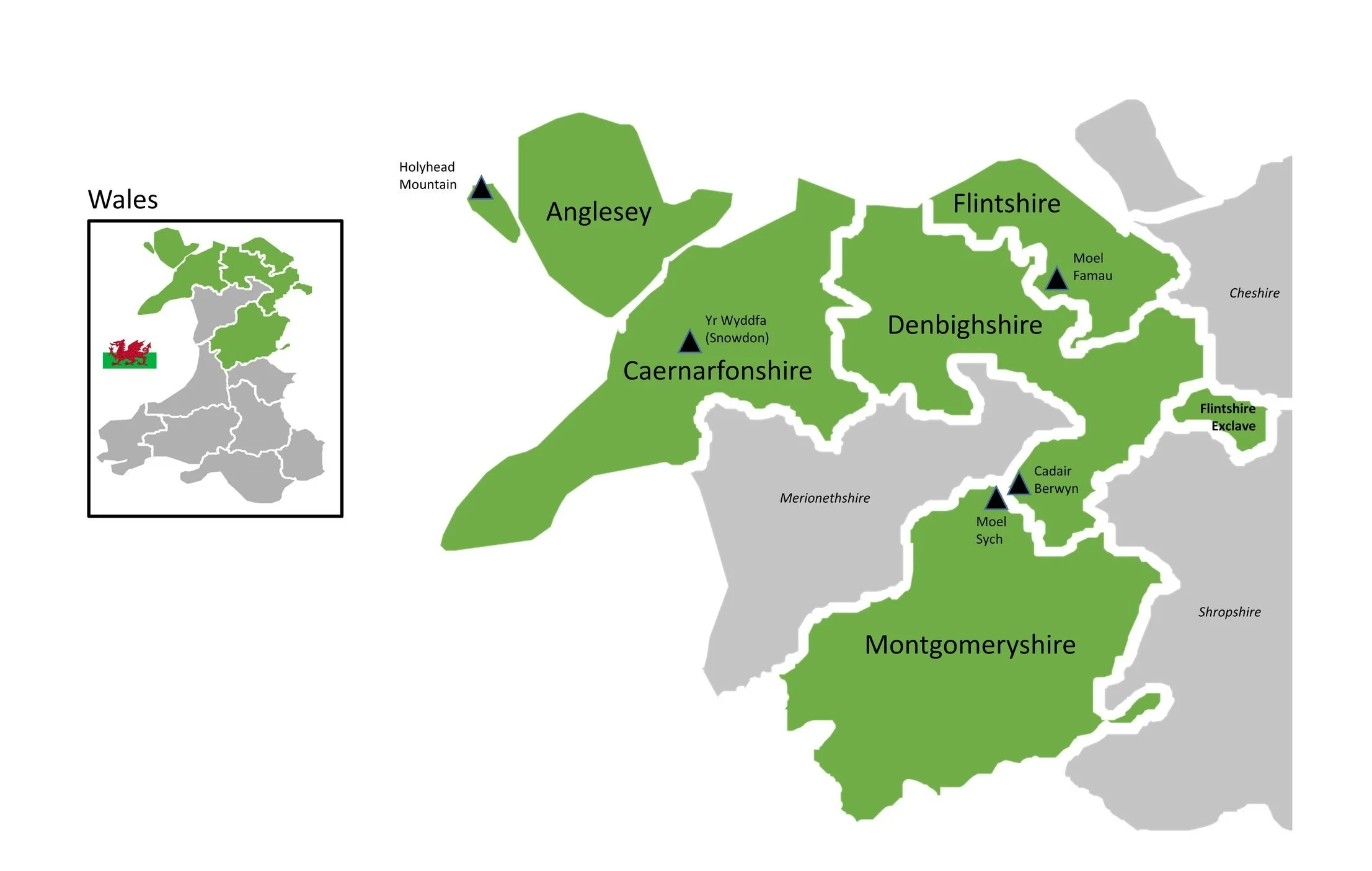
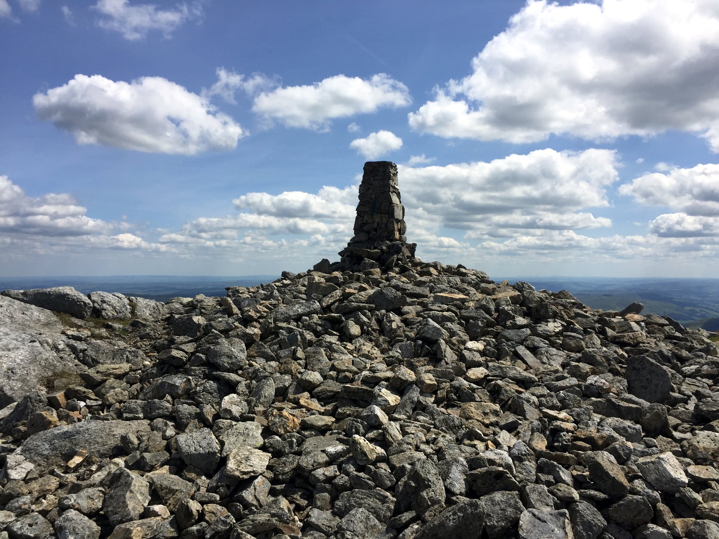
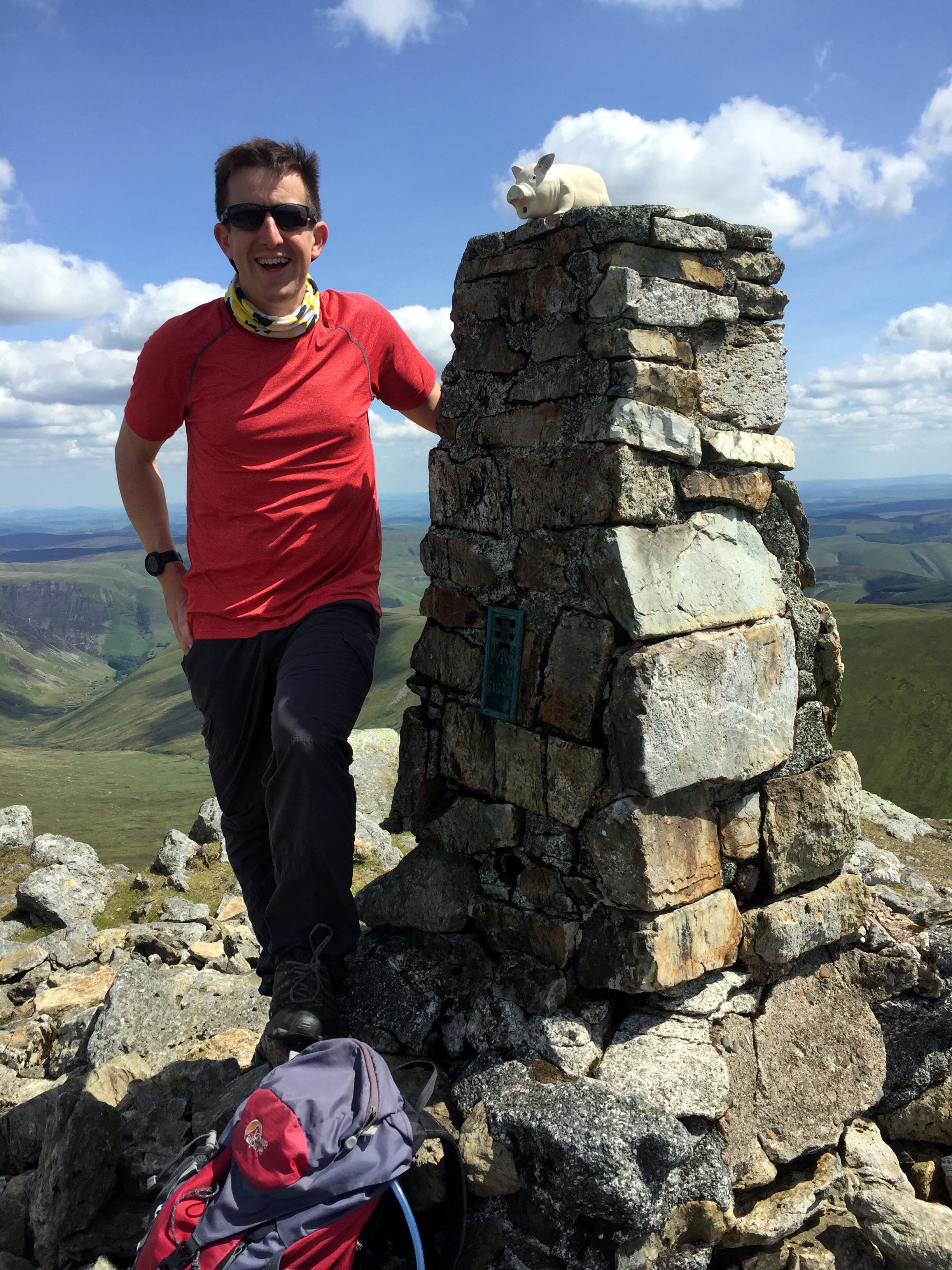
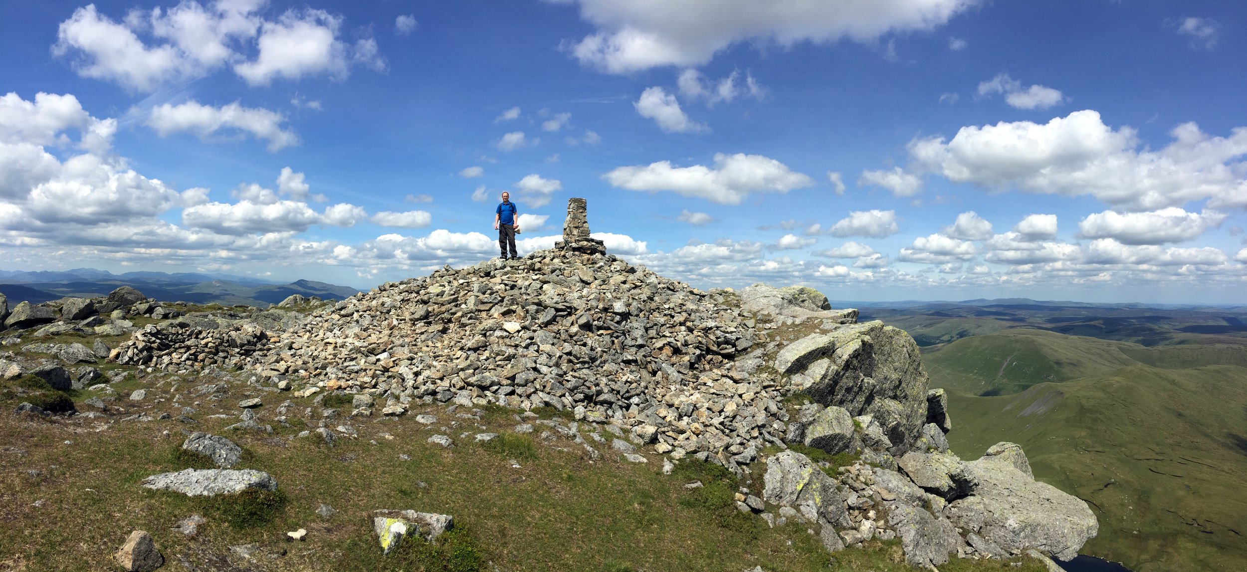

Arran Fawddwy

Significance: Highest peak in Merionethshire (Historic CT)
Member of: Hewitt, Marilyn, Nuttall
Parent Peak: Snowdon. NHN = Peak 931
Elevation: 907m
Date climbed: June 22nd 2019
Coordinates: 52.7880° N, 3.6881° W
Route Start / End: Out and back from Llanuwchllyn, LL23 7TR
Route Distance: 18.2k / (11.3 miles)
Route Elevation Change: +/- 898m
Subsidiary tops on route: Arran Benllyn (885m), Erw y Ddafad-ddu (872m)
GPX File: get via Buy Me a Coffee
Other routes touched: None
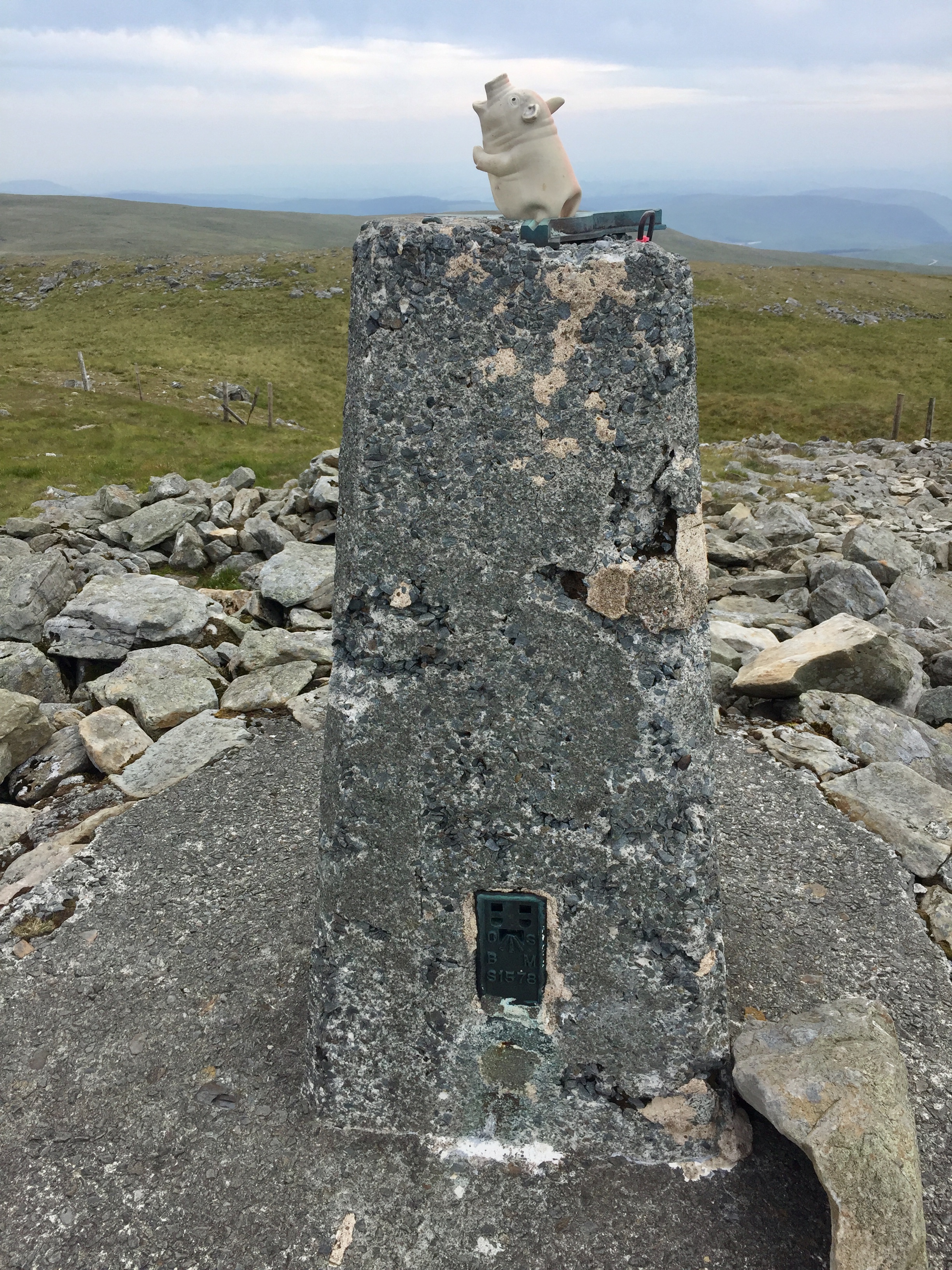
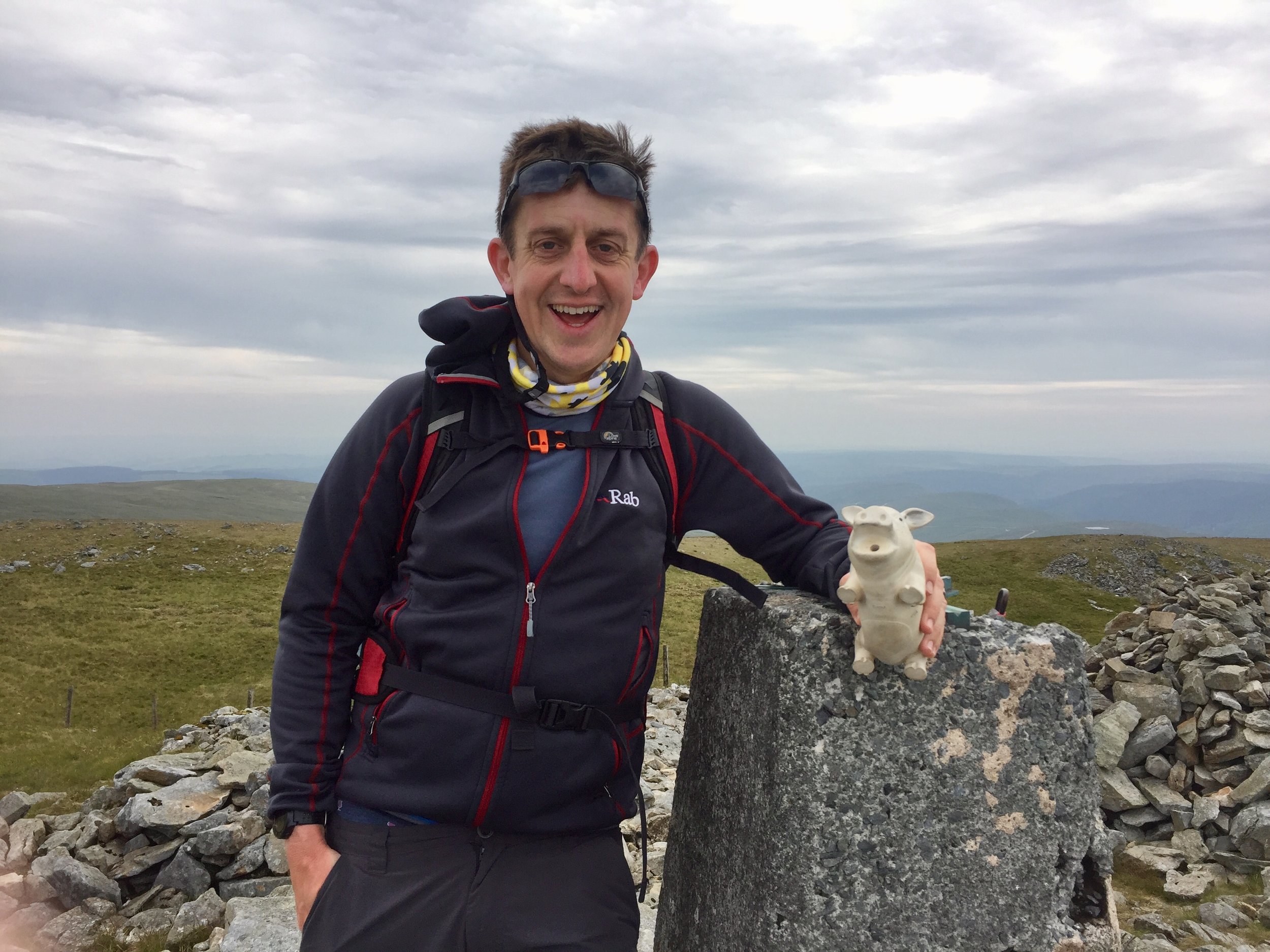
OS Trig Pillar: TP0865 - Aran Fawddwy
Map: OS Explorer Map OL23 Cadair Idris & Llyn Tegid
Guidebook: The UK's County Tops (Jonny Muir)
Links: Wikipedia (Merionethshire), Wikipedia (Aran Fawddwy), Peakbagger, Hillbagging

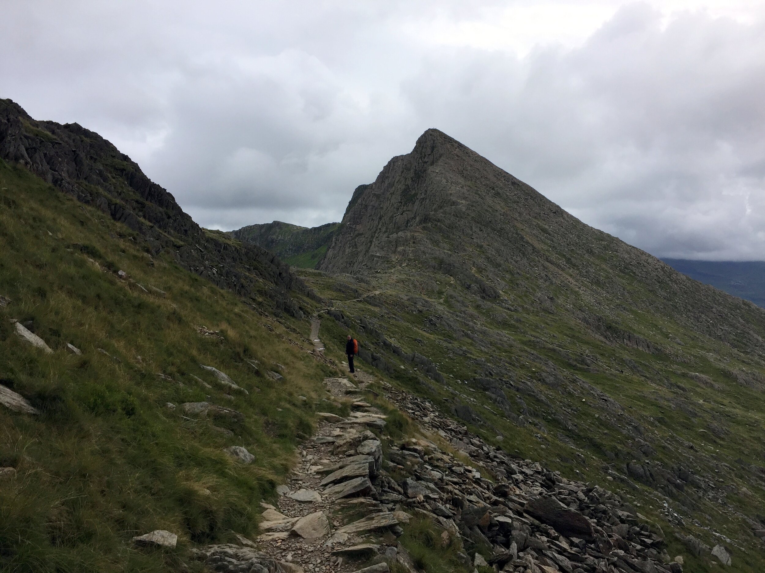
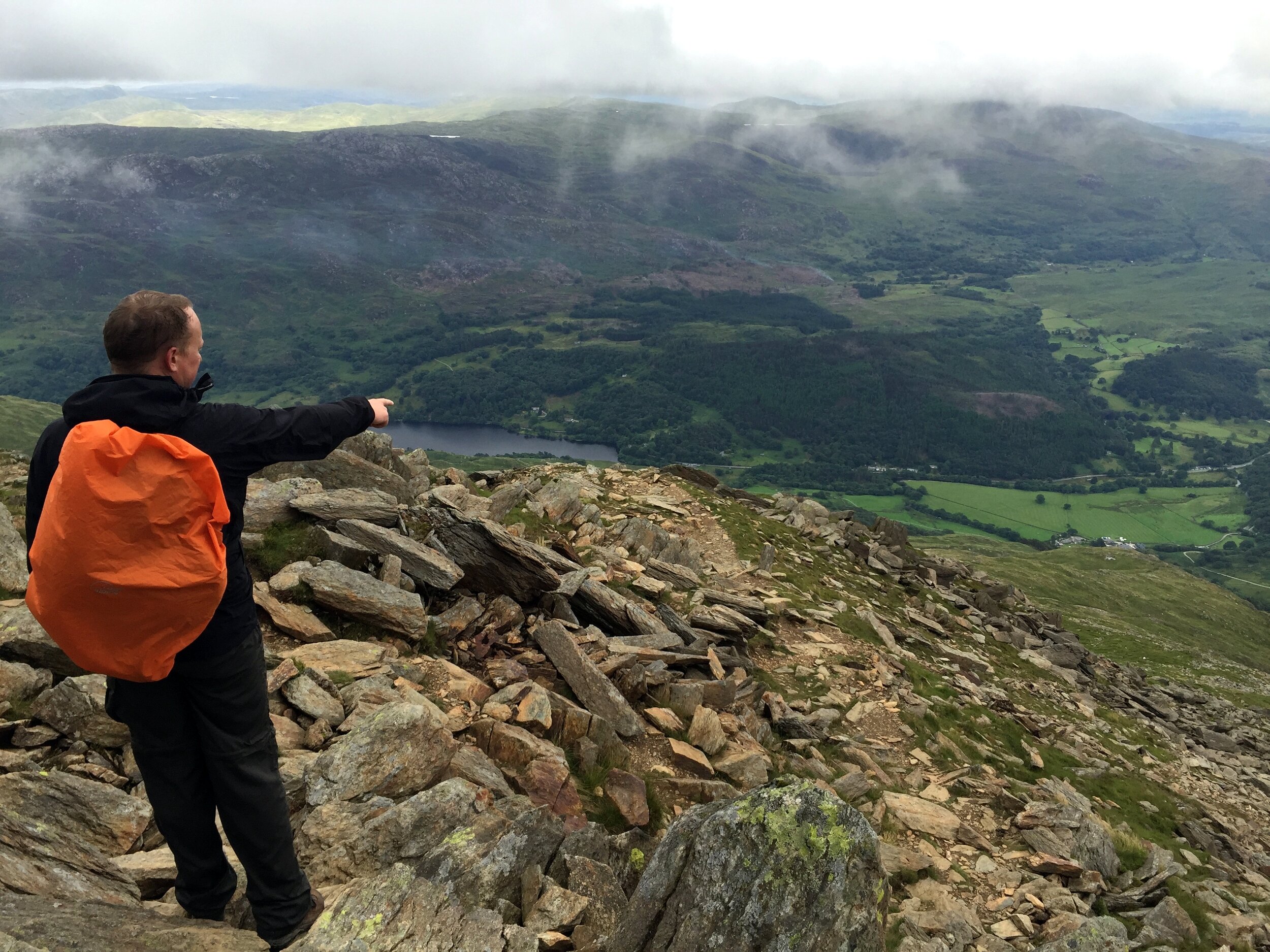
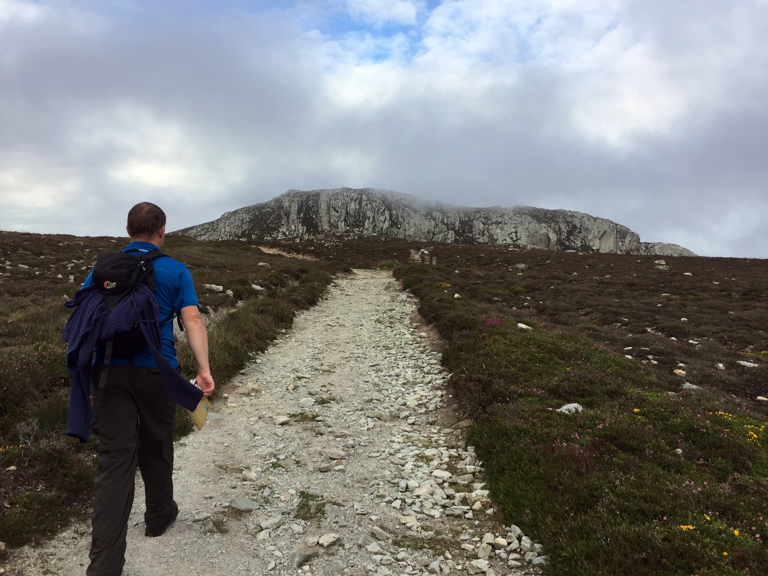
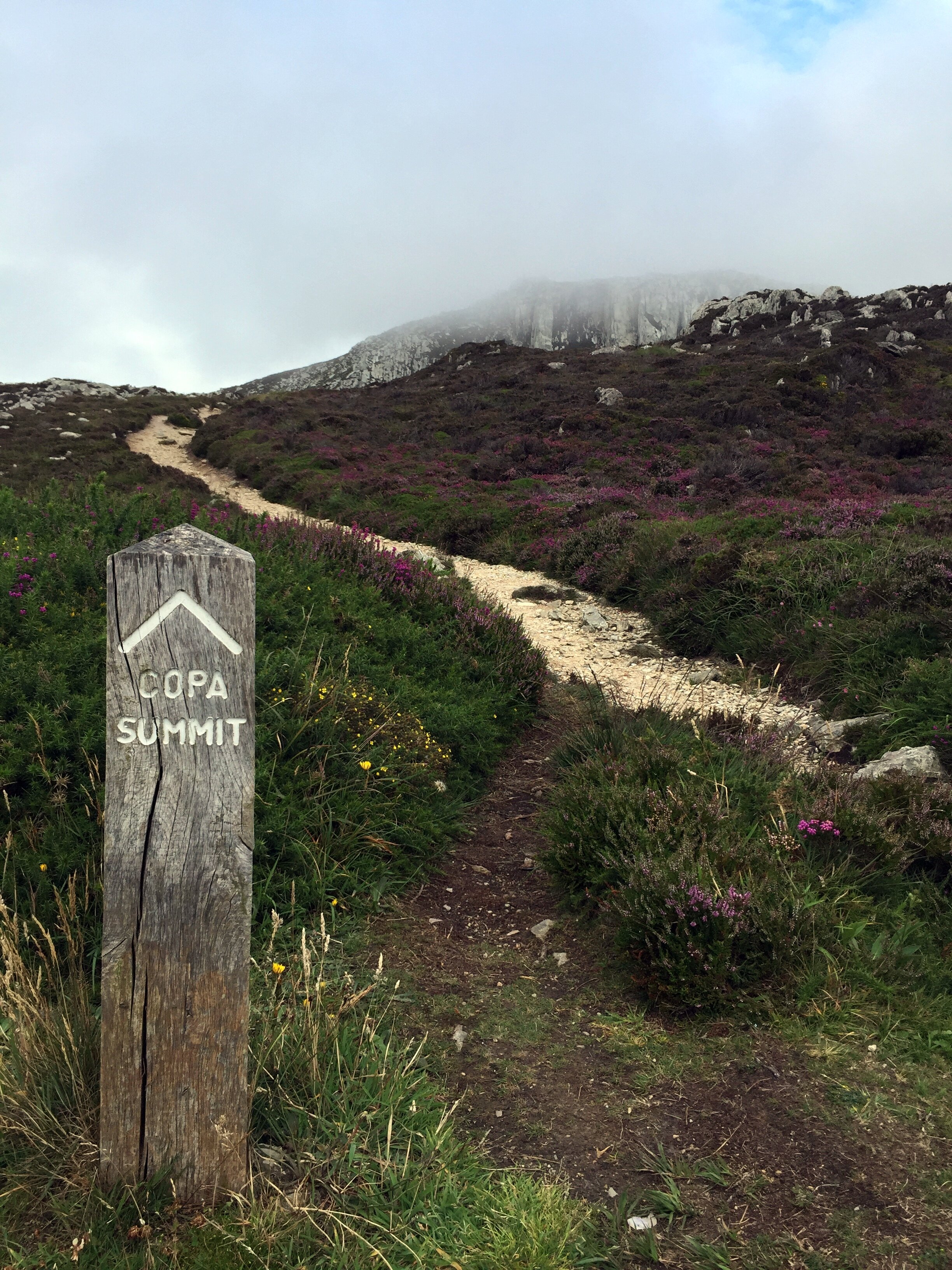
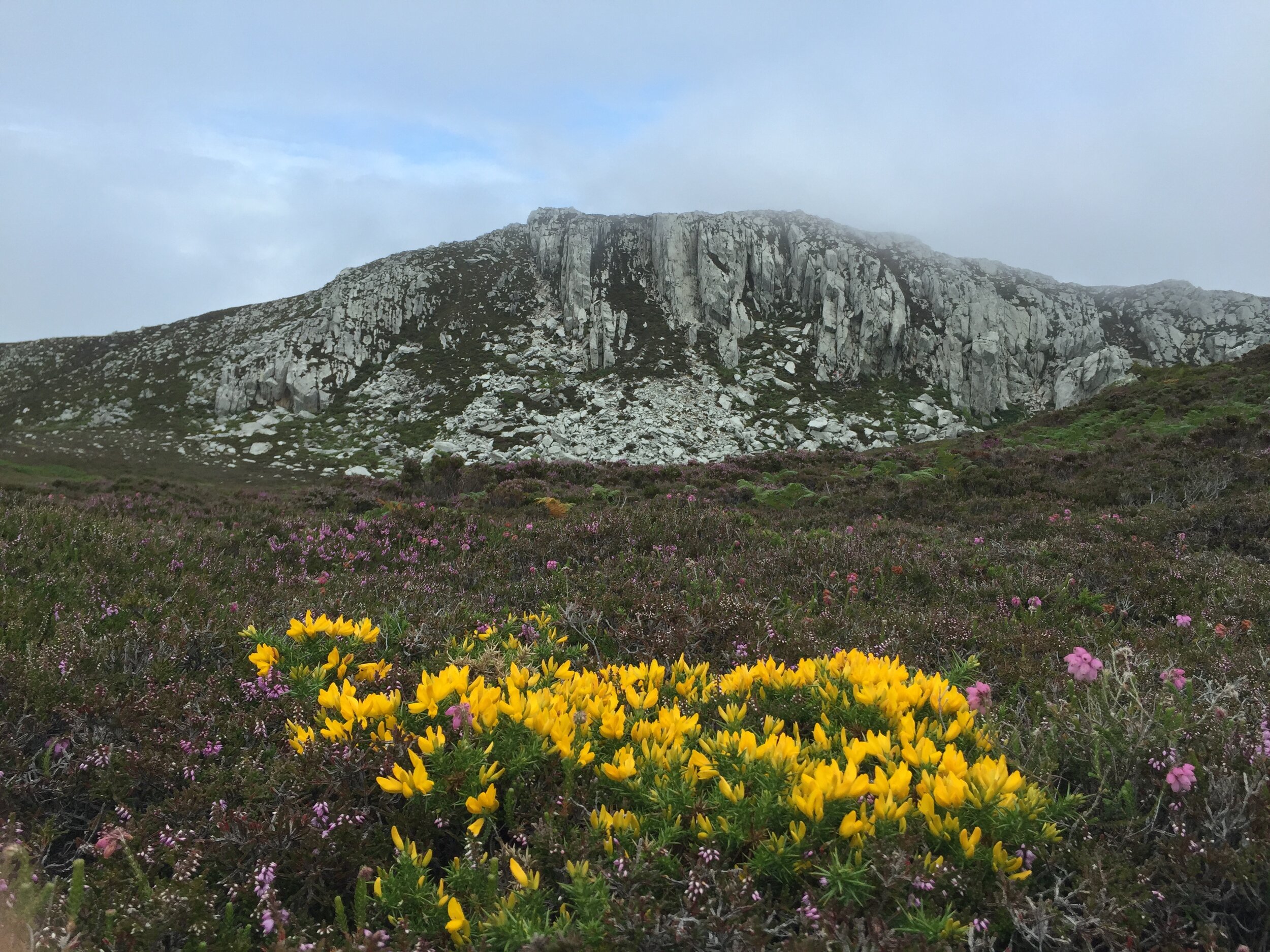
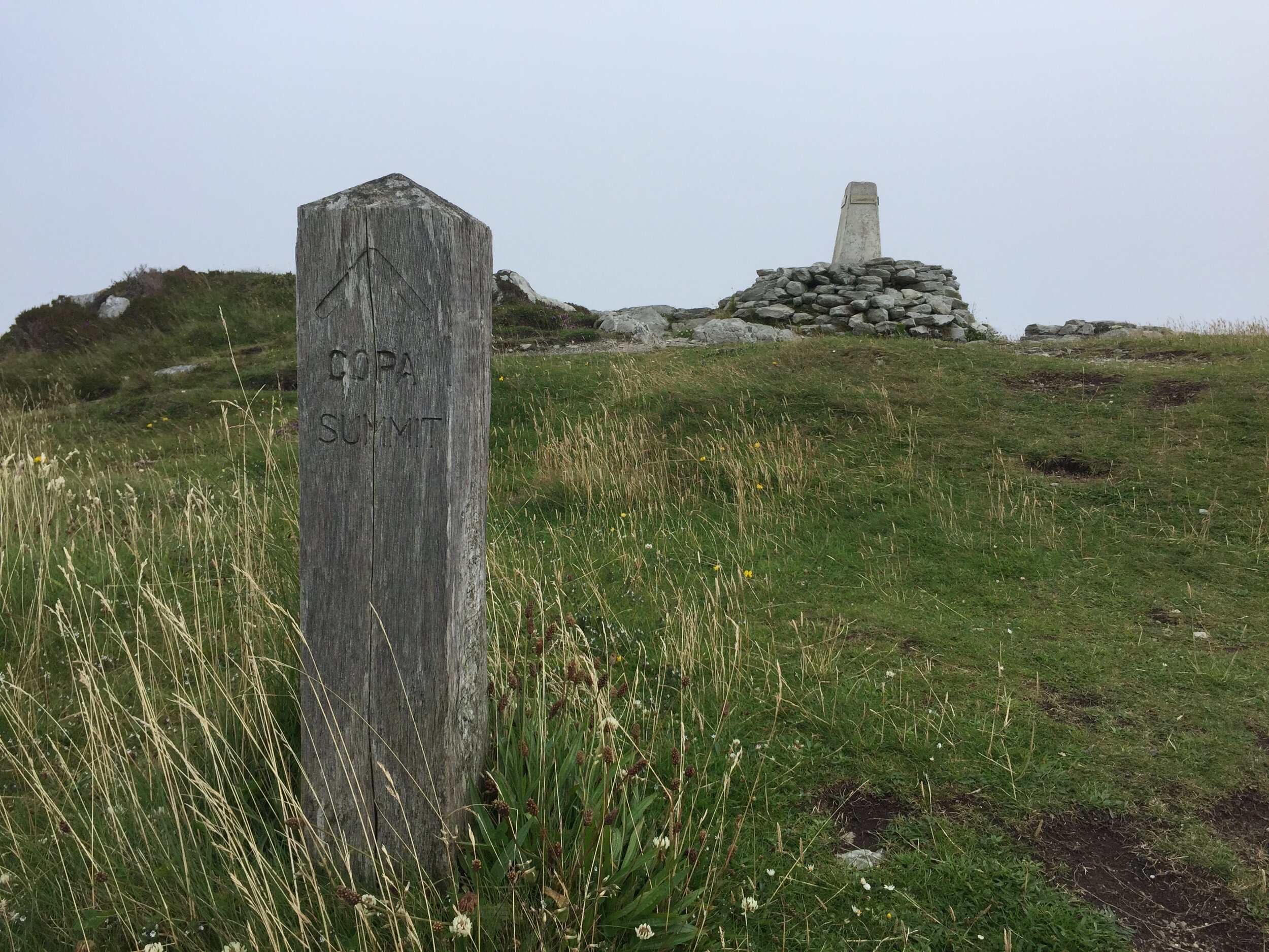
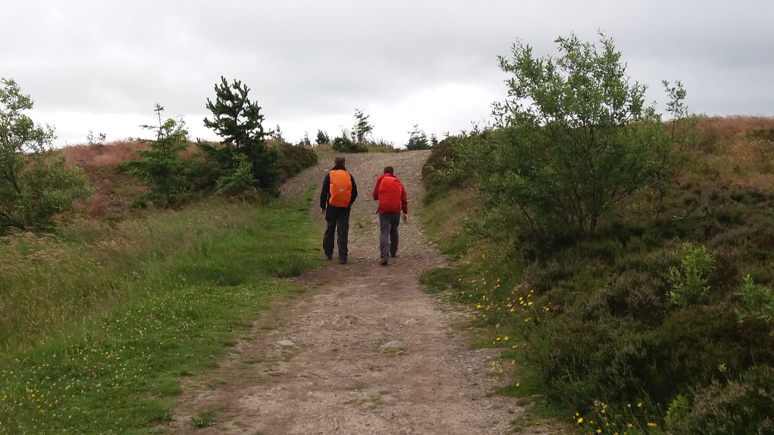
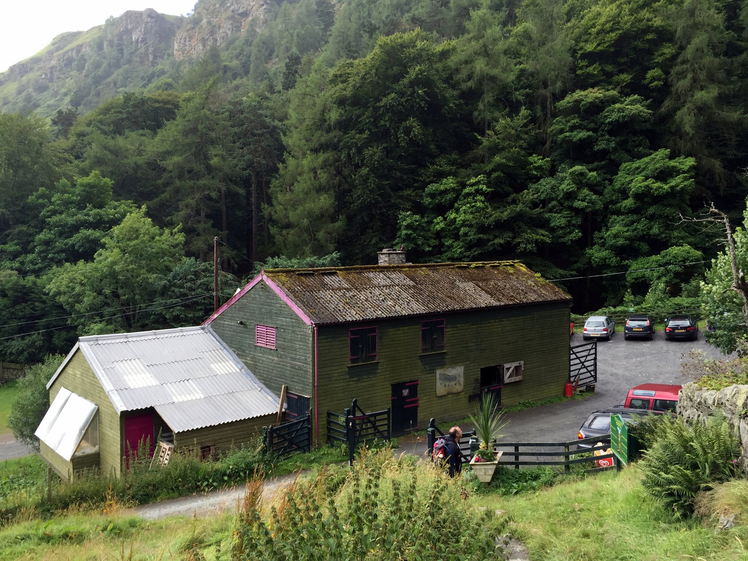
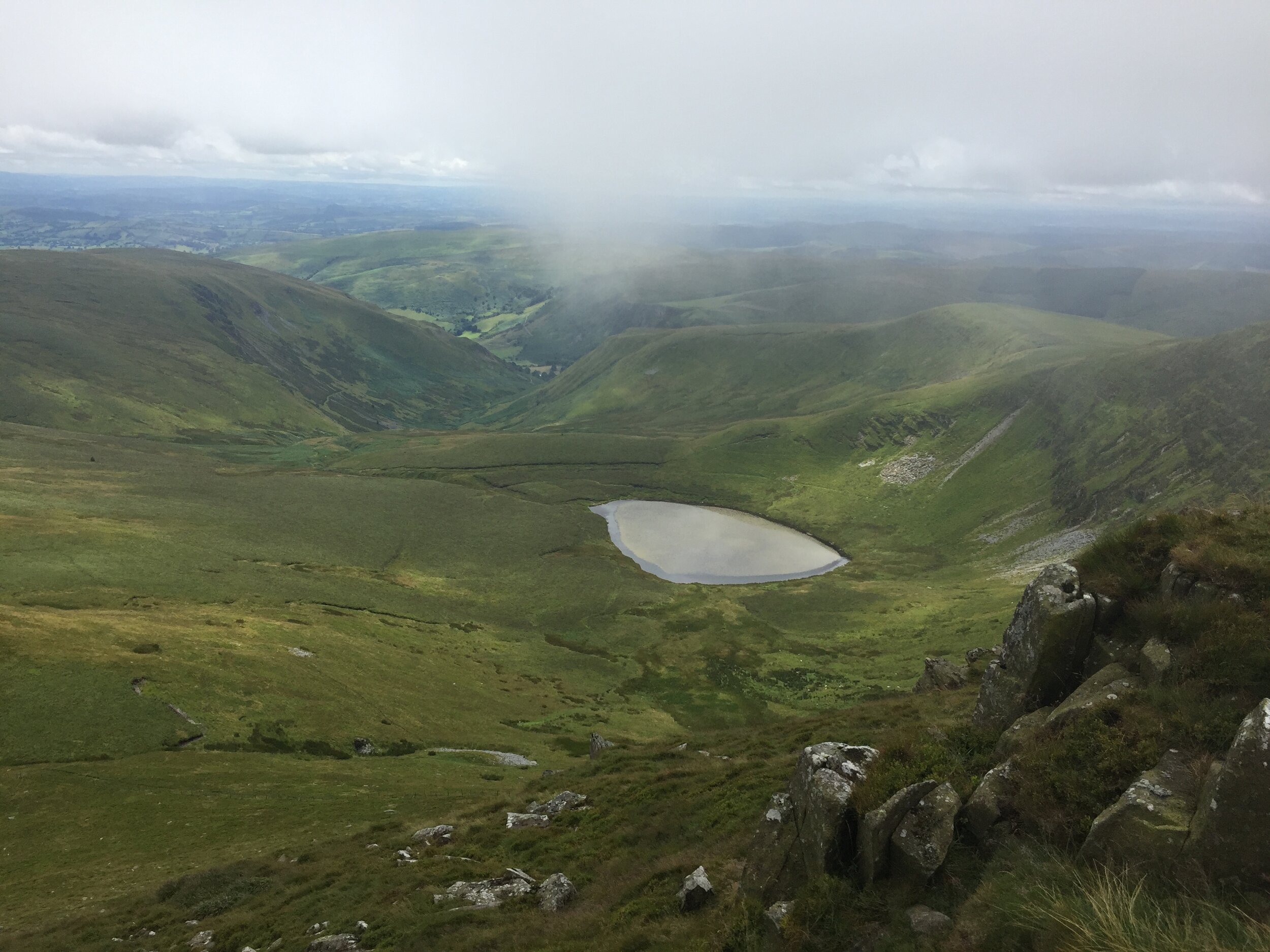
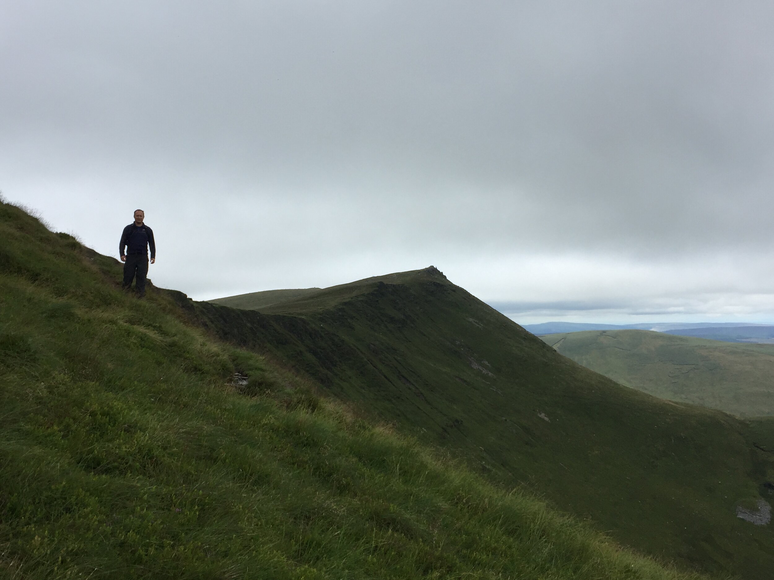
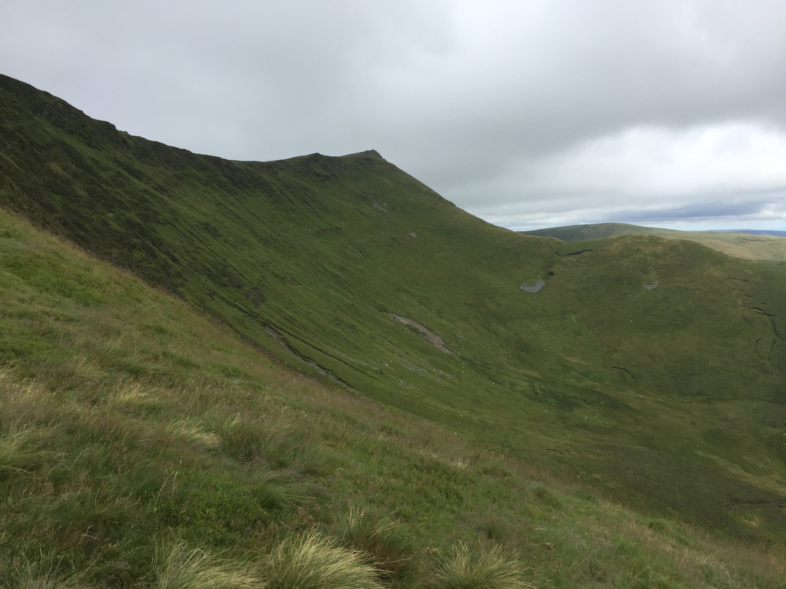
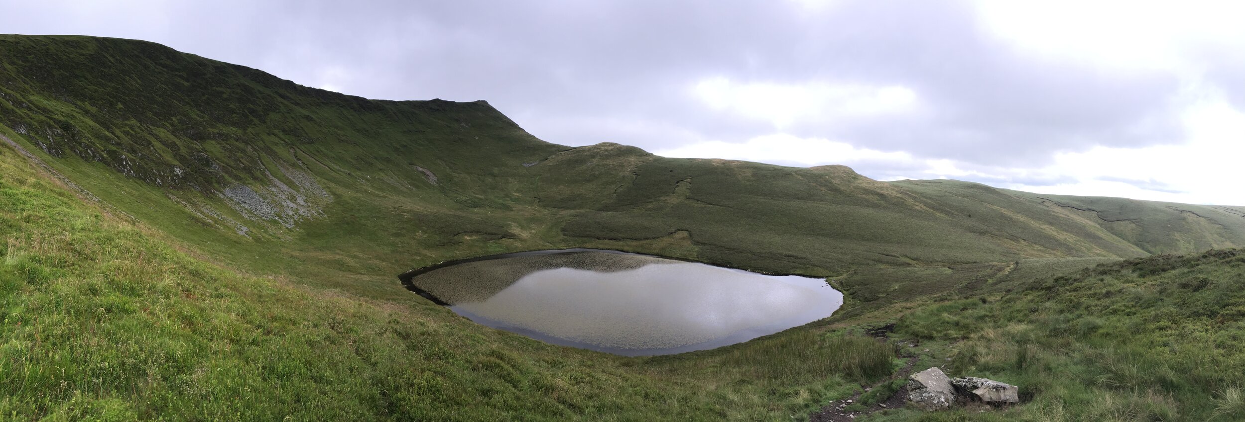
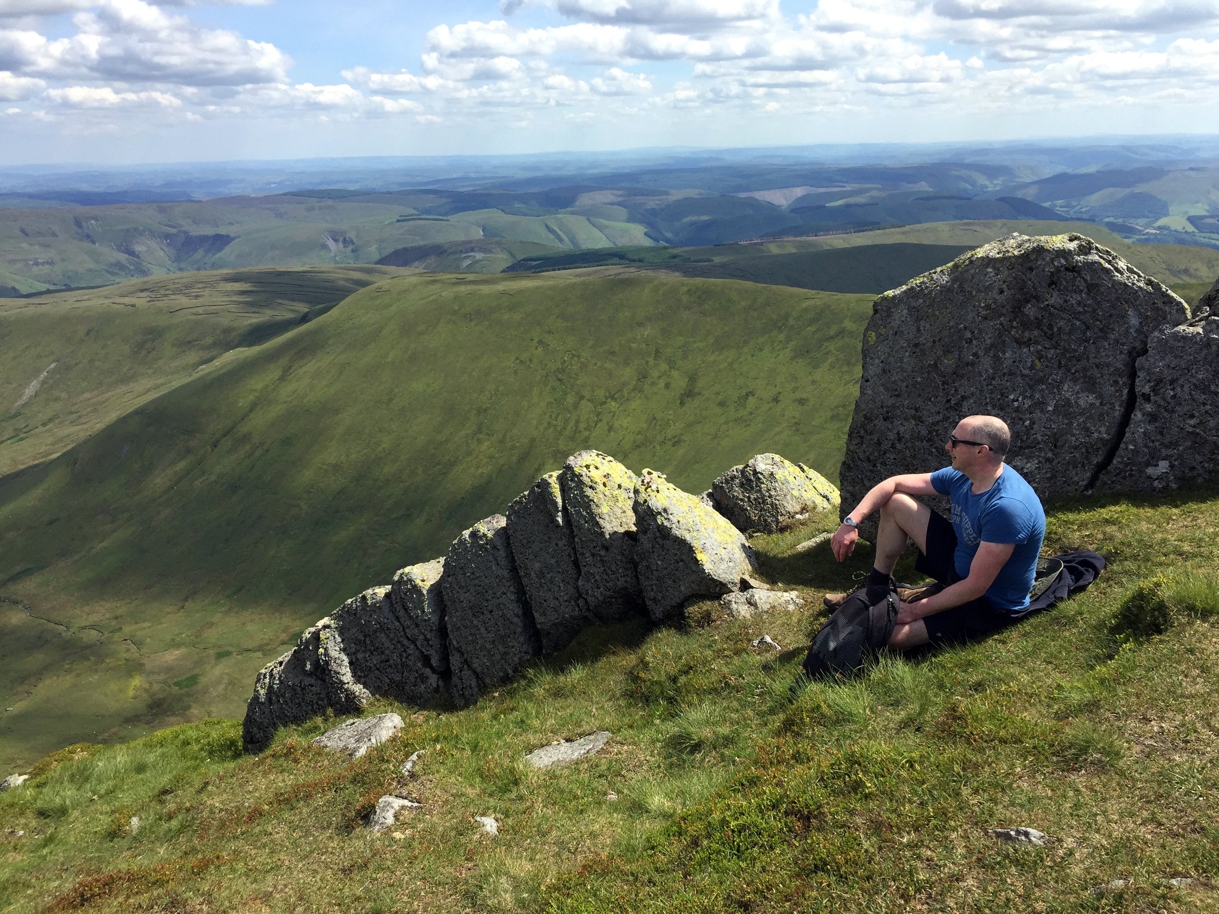
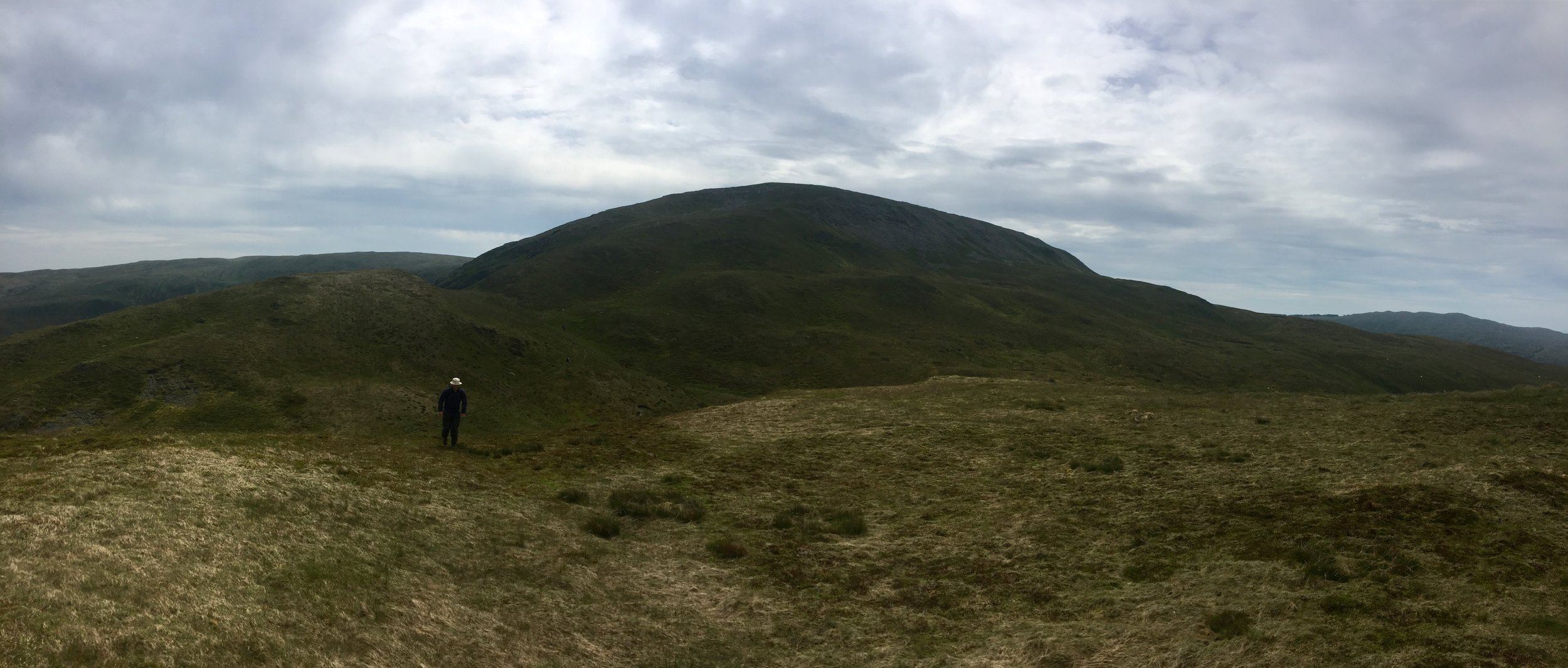
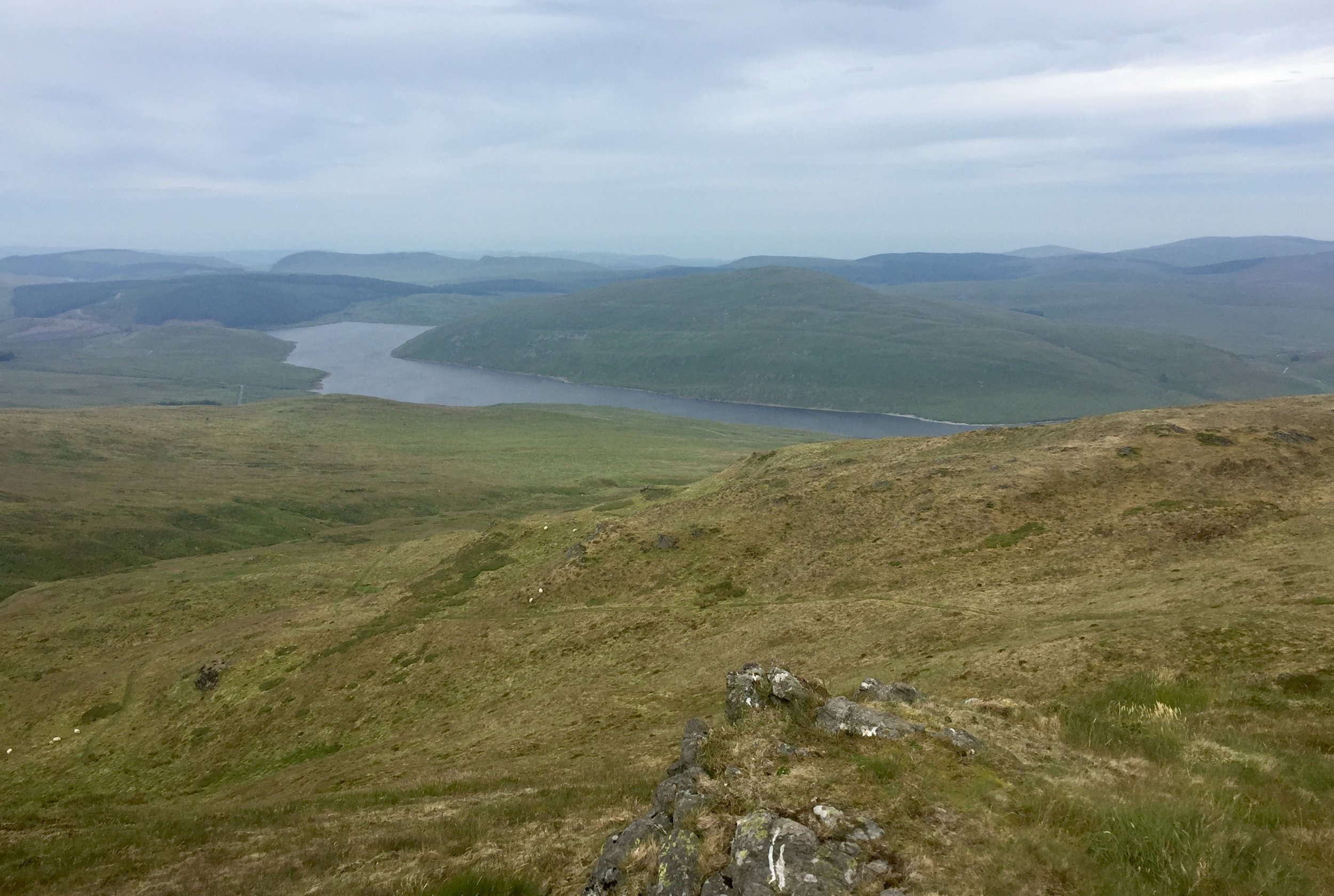
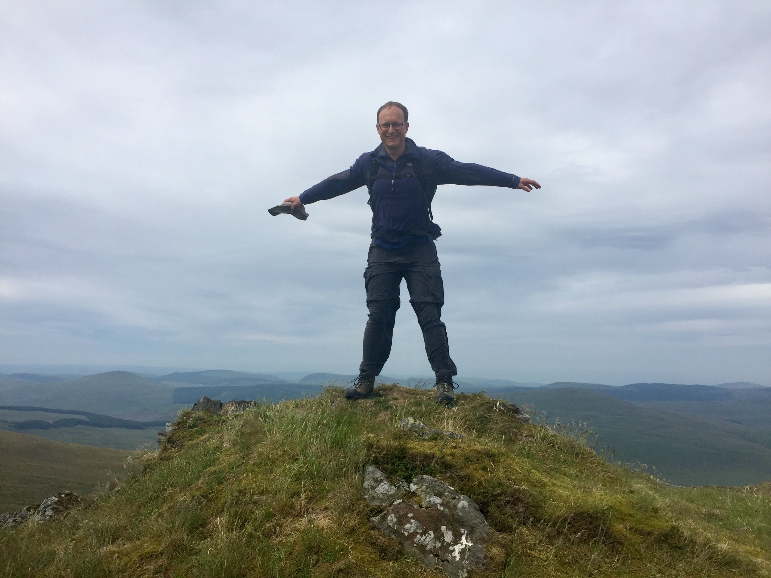
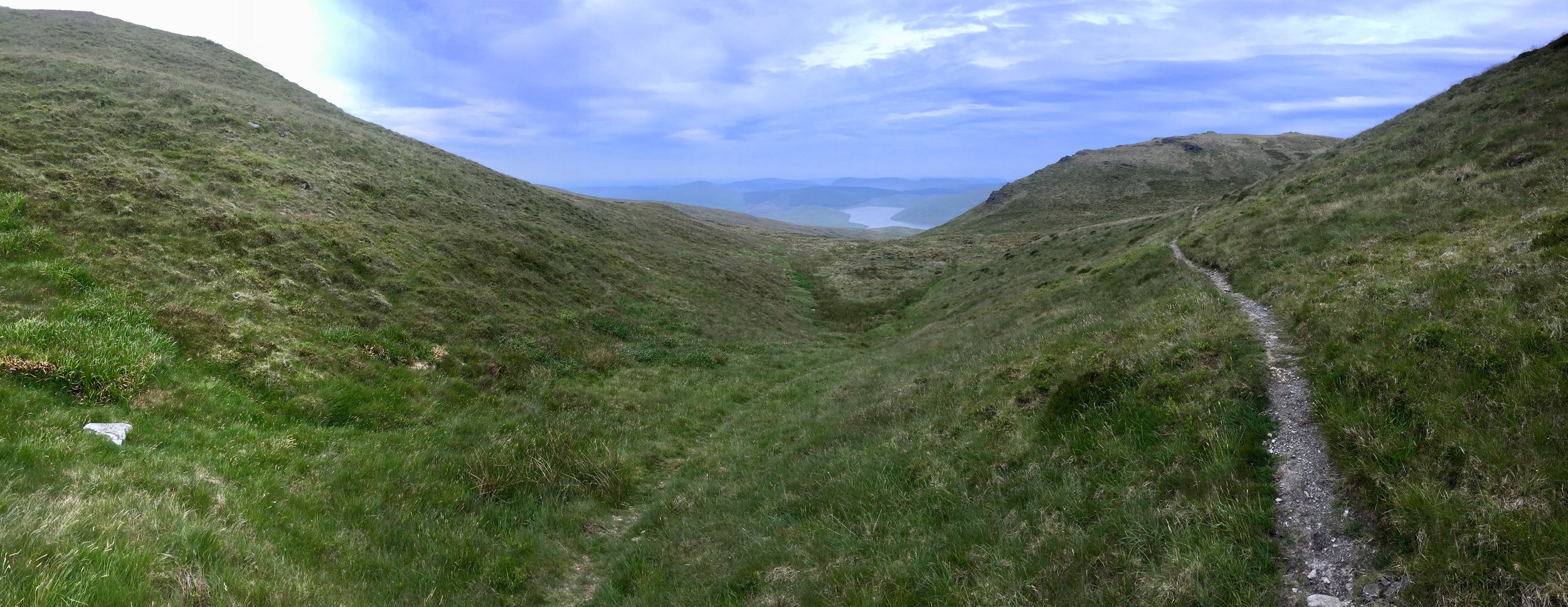
Llanuwchllyn, our start point for the Arran Fawddwy, walk was only 20 minutes from Dolgellau so we were on the trail by 11:00. We were lucky with the weather and had a the most amazing sunny day with clear skies and view for miles. The 360° view from the summit was a rare prize amongst so many cloudy summit days in my Welsh trekking experience.

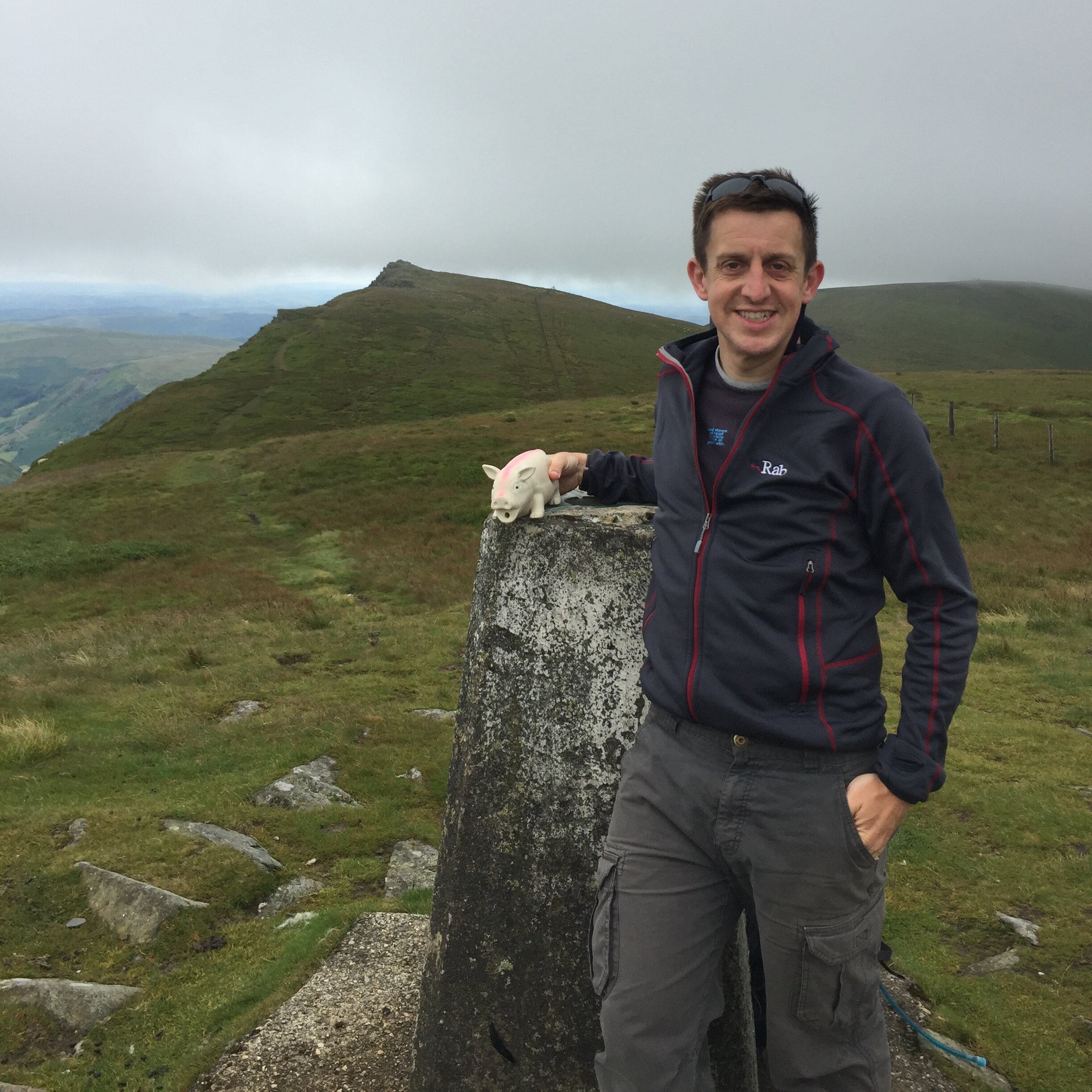
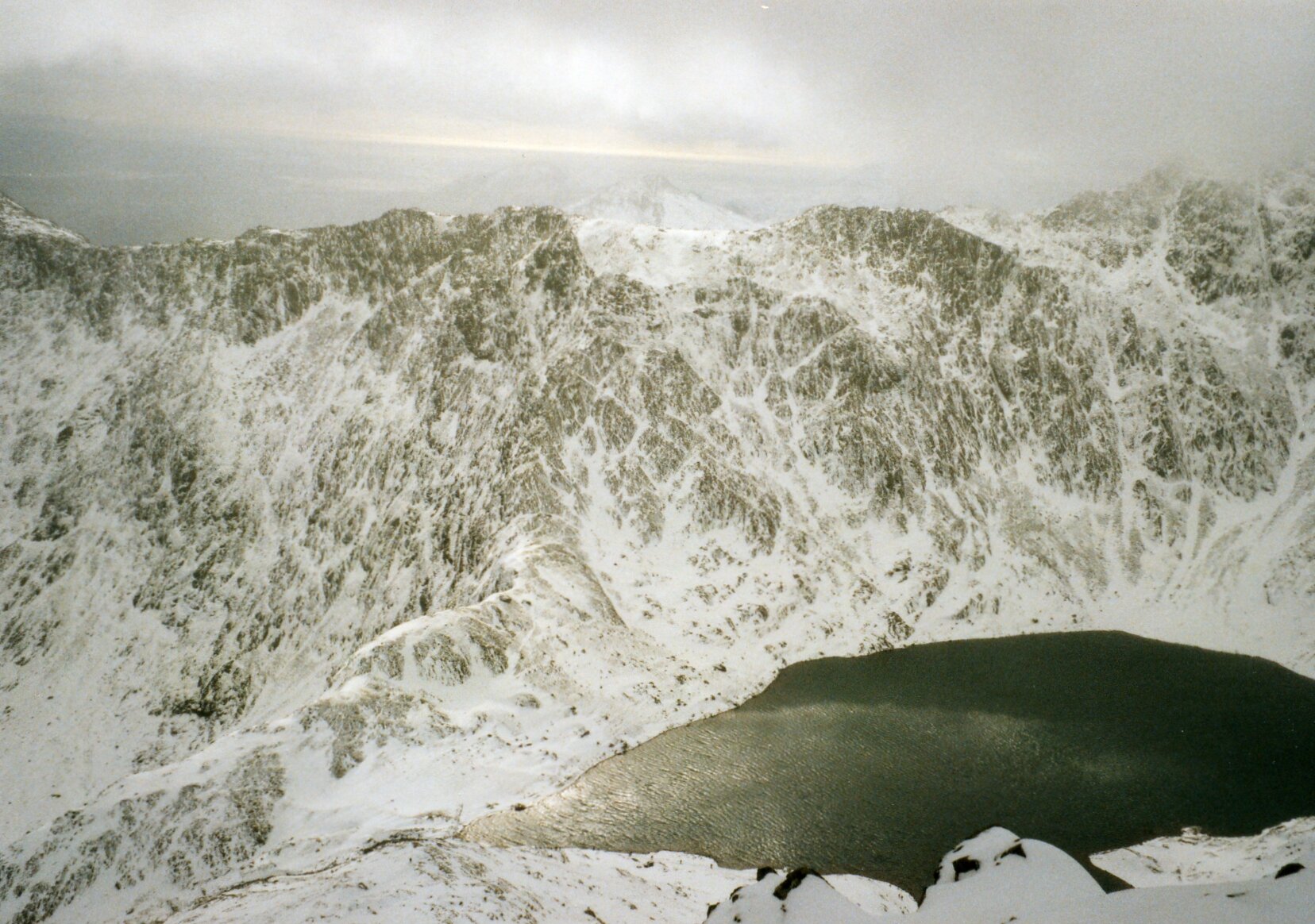
Arran Fawddwy is a long but easy trek with only a small bit of scrambling in the last 20 minutes. It’s quiet up there too. At 2976 feet it narrowly misses out on being in the Welsh 3000s and the nearby Cadair Idris gets much more attention. If it wasn’t for it being a County Top I’d likely never have gone there either. That would have been a shame as this was one of my most enjoyable UK hikes in several years.

Once off the mountain we drove an hour South to the YHA at Borth. I didn’t know what to expect when I booked this one. My friend who was in charge of accommodation booking had made such an arse of it, I had to take over with only a month to go. This one was booked on the only criteria that it was near Plynlimon and still available.

As it turned out, Borth was a hidden gem. It’s an old Seaside resort that missed the memo about the need to become cheap and tacky. Our room in the YHA was spacious and had a sea view. Dinner in the seafront Victoria Inn and a beach walk back topped off a perfect adventure day in Wales.


Plynlimon

Also known as: Pumlumon Fawr
Significance: Highest peak in Cardiganshire (Historic CT), High Point of the Preserved County of Dyfed and the Principal area of Ceredigion
Member of: Hewitt, Marilyn, Nuttall
Parent Peak: Pen Y Fan. NHN = Craig Cwm Amarch
Elevation: 752m
Date climbed: June 23rd 2019
Coordinates: 52.4675°N 3.7828°W
Route Start / End: Out and back from parking place on Nant-y-Moch eastern road plus a loop of Pumlumon Fach
Route Distance: 7.7 km (4.8 miles)
Route Elevation Change: +/- 400m
Subsidiary tops on route: Pumlumon Fach (664m)
GPX File: get via Buy Me a Coffee
Other routes touched: none
OS Trig Pillar: TP5480 - Plynlimon
Map: OS Explorer Map (213) Aberystwyth and Cwm Rheidol for Plynlimon
Guidebook: The UK's County Tops (Jonny Muir)
Links: Wikipedia (Cardiganshire), Wikipedia (Plynlimon), Peakbagger, Hillbagging

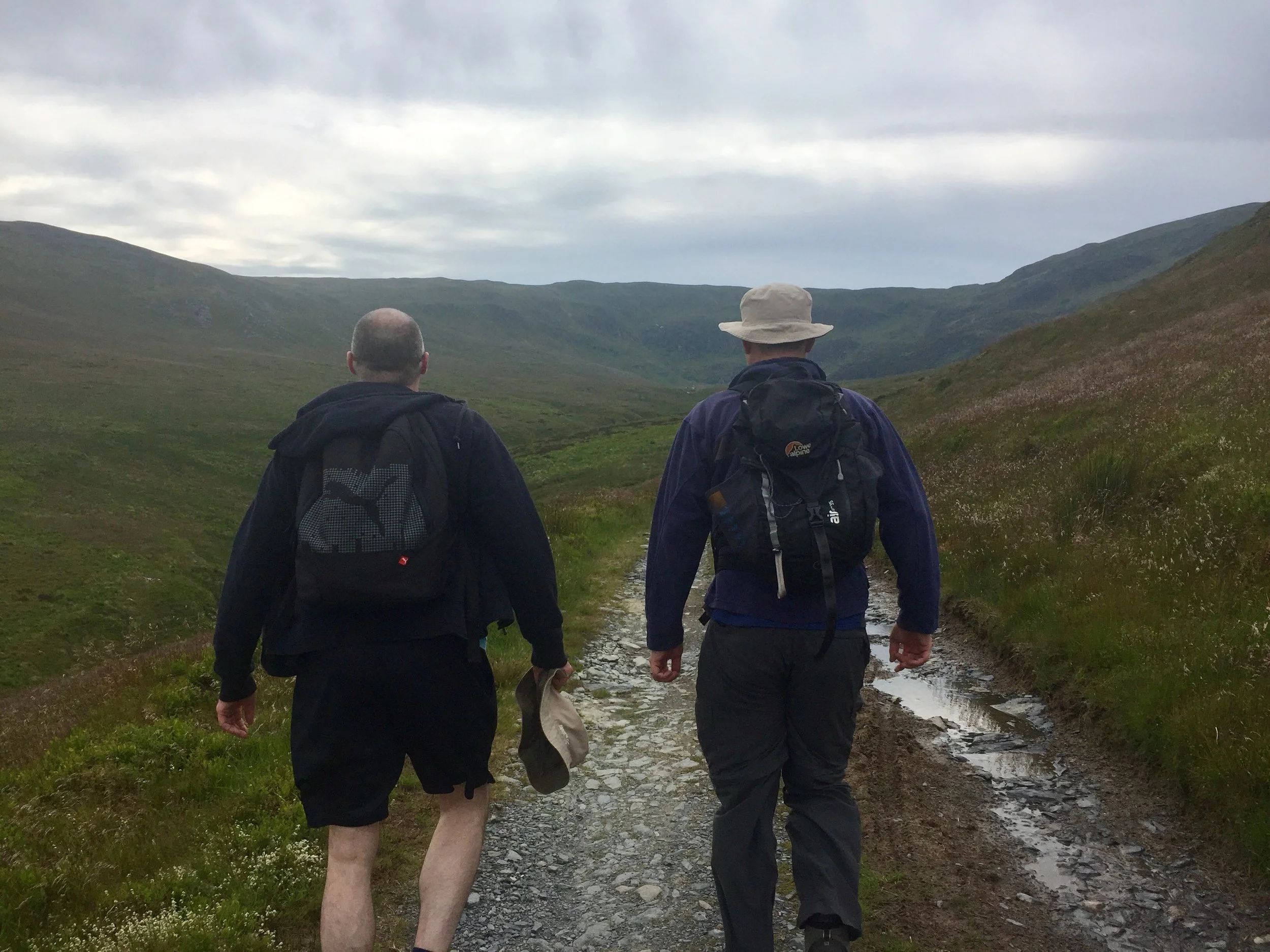
Plynlimon is just a few miles as the crow flies from Borth. We were driving though so it took a winding 45 minute trip so many hairpin bends and a route around the Nant-y-Moch reservoir.

The start of the trail is a small parking spot on the Maesnant road where it meets a farm track. There's 2 options from here: an out and back following the Maesnant stream or a circuit of the Pumlumon Fach. As we were following Jonny Muir's guide an wanted a more interesting route. We opted for the circular plus a couple of detours to bag the summits of Pumlumon Fach and an unnamed peak nearby.

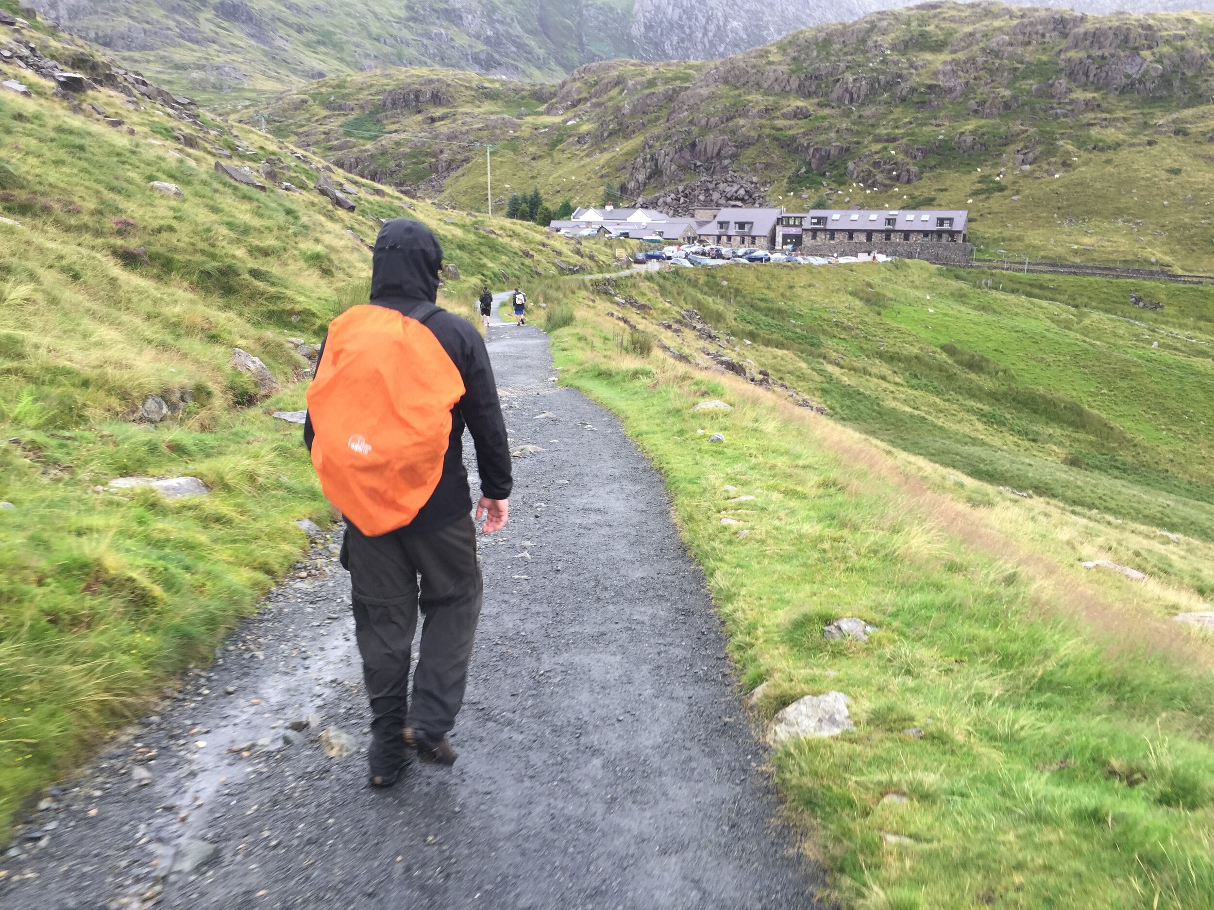
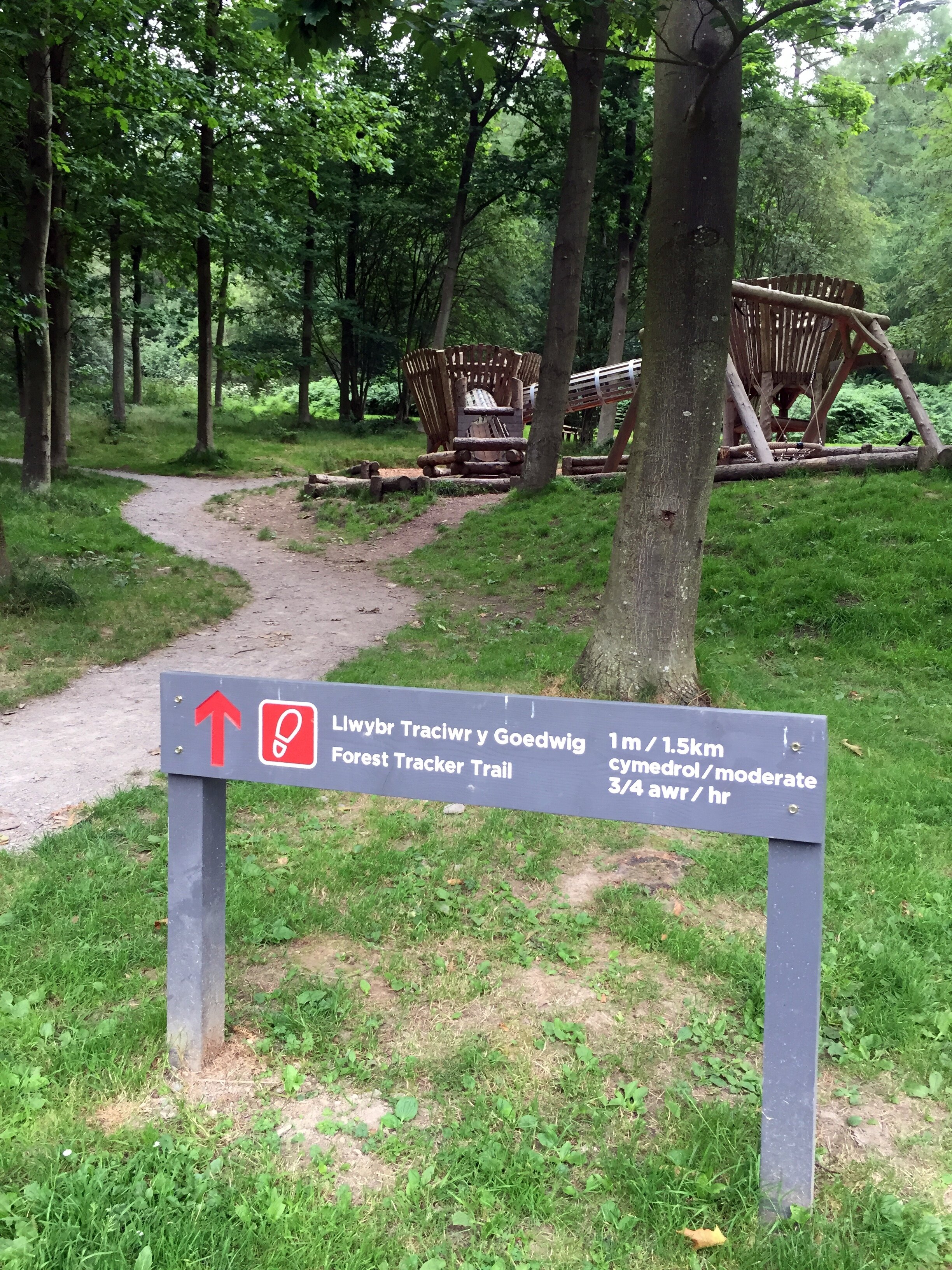
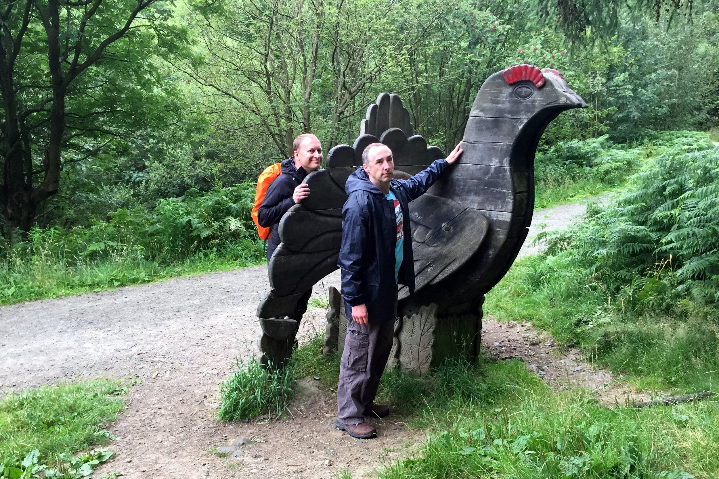
Plynlimon was a much shorter trek than yesterday's Arran Fawddwy trip so we were back down by lunchtime and quickly on the road towards Newport YHA. Even with a short stop to bag a bonus Trig Pillar near Cardigan we arrived at the YHA by 15:00. I'd not read the check-in instructions so didn't realise that we were 2 hours too early. We could get a whole other mountain bagged in that time.


Foel Cwmcerwyn

Significance: Highest peak in Pembrokeshire (Historic CT and Principal Area)
Member of: Marilyn
Parent Peak: Plynlimon. NHN = Garreg Lwyd
Elevation: 536m
Date climbed: June 23rd 2019
Coordinates: 51°56′44″N 4°46′29″W
Route Start / End: Out and back from parking place on B4329
Route Distance: 6 km (3.7 miles)
Route Elevation Change: +/- 135m
Subsidiary tops on route: None
GPX File: get via Buy Me a Coffee
Other routes touched: None
OS Trig Pillar: TP5522 - Prescelly
Map: Ordnance Survey Explorer OL35 North Pembrokeshire
Guidebook: The UK's County Tops (Jonny Muir)
Links: Wikipedia (Pembrokeshire), Wikipedia (Foel Cwmcerwyn), Peakbagger, Hillbagging

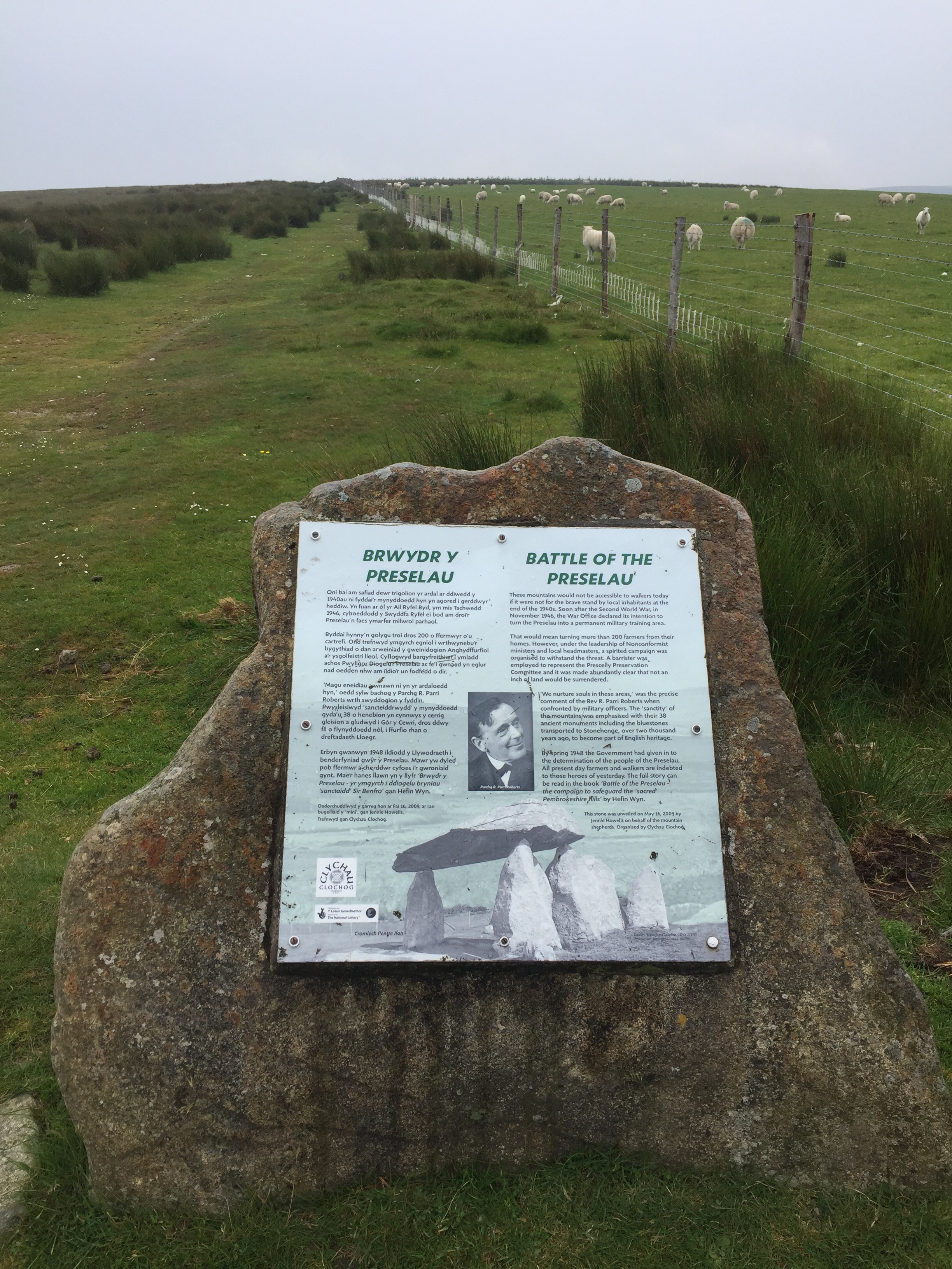
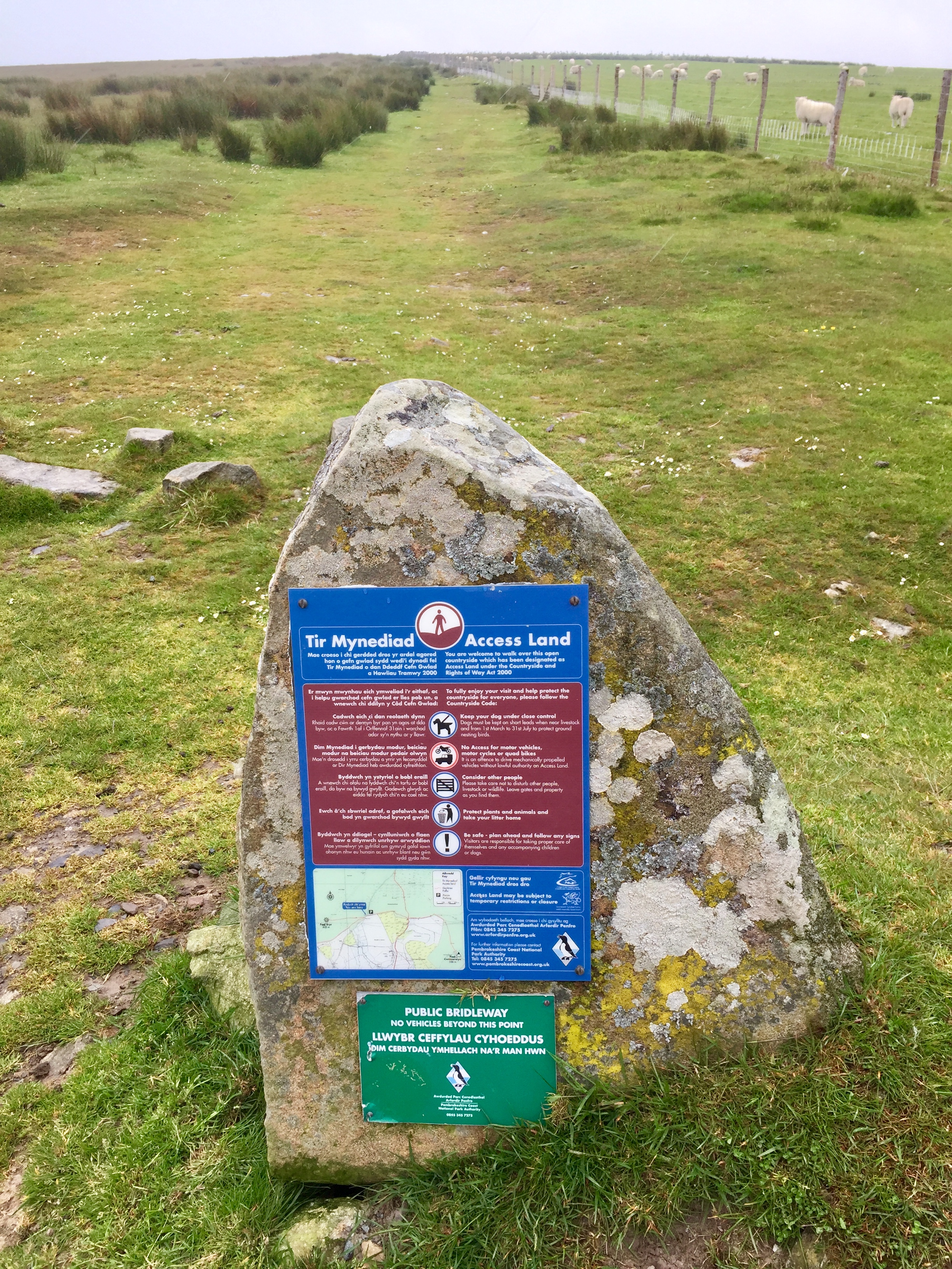
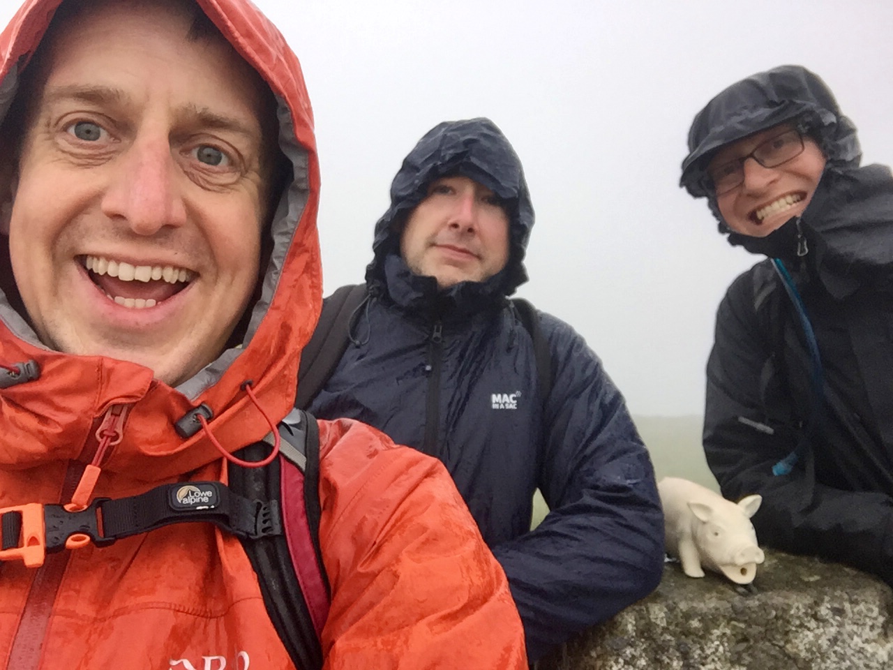
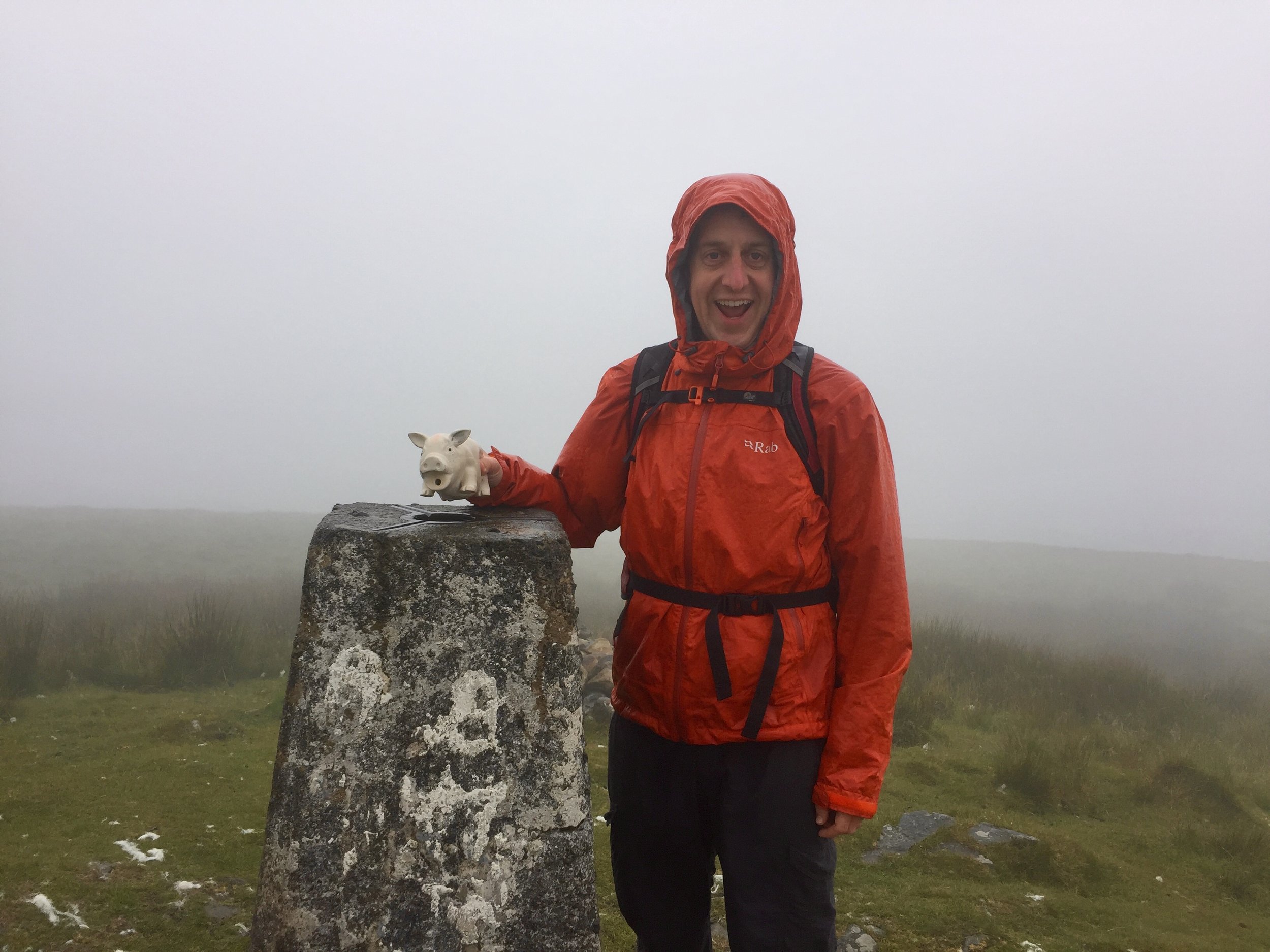
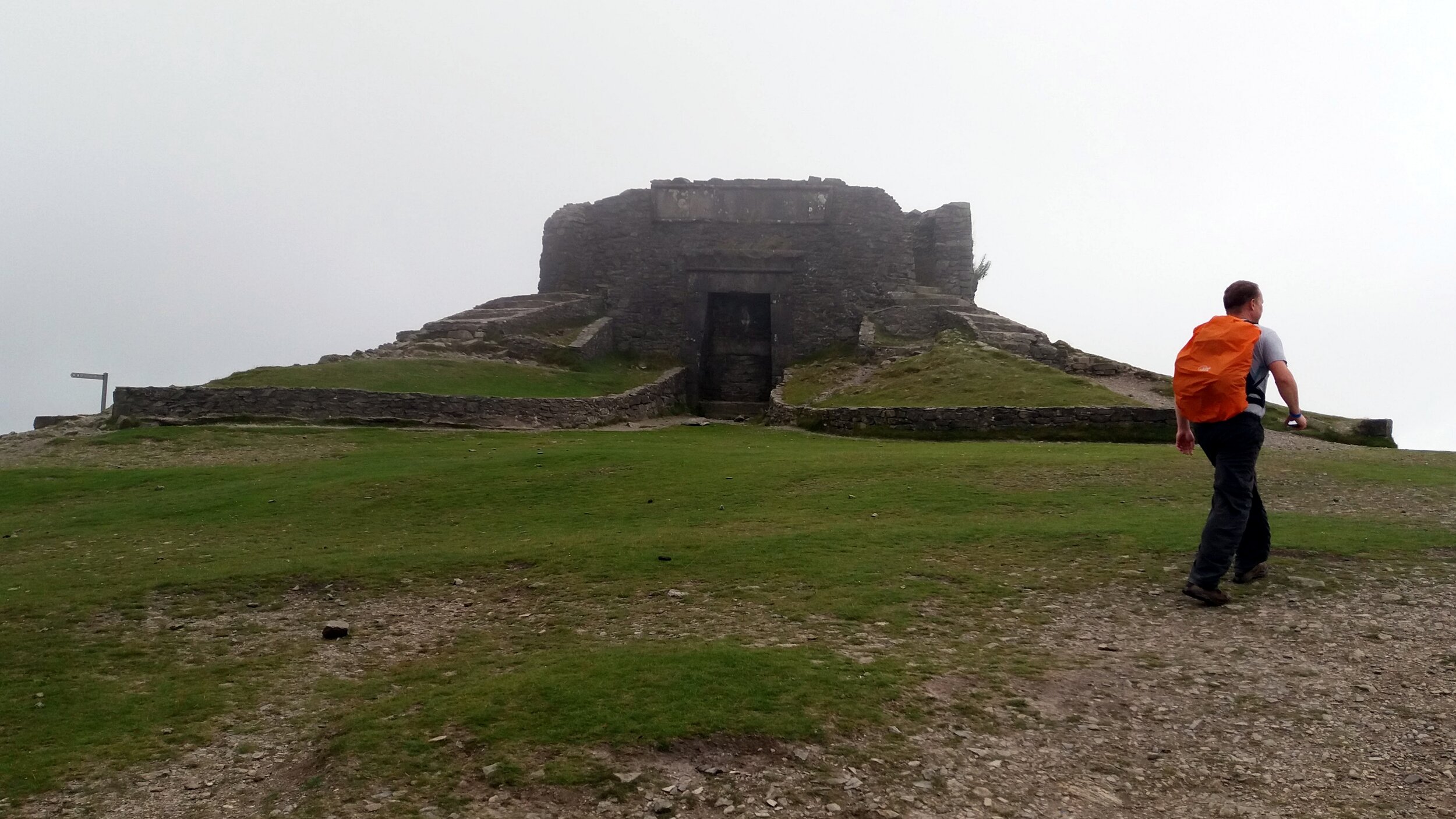
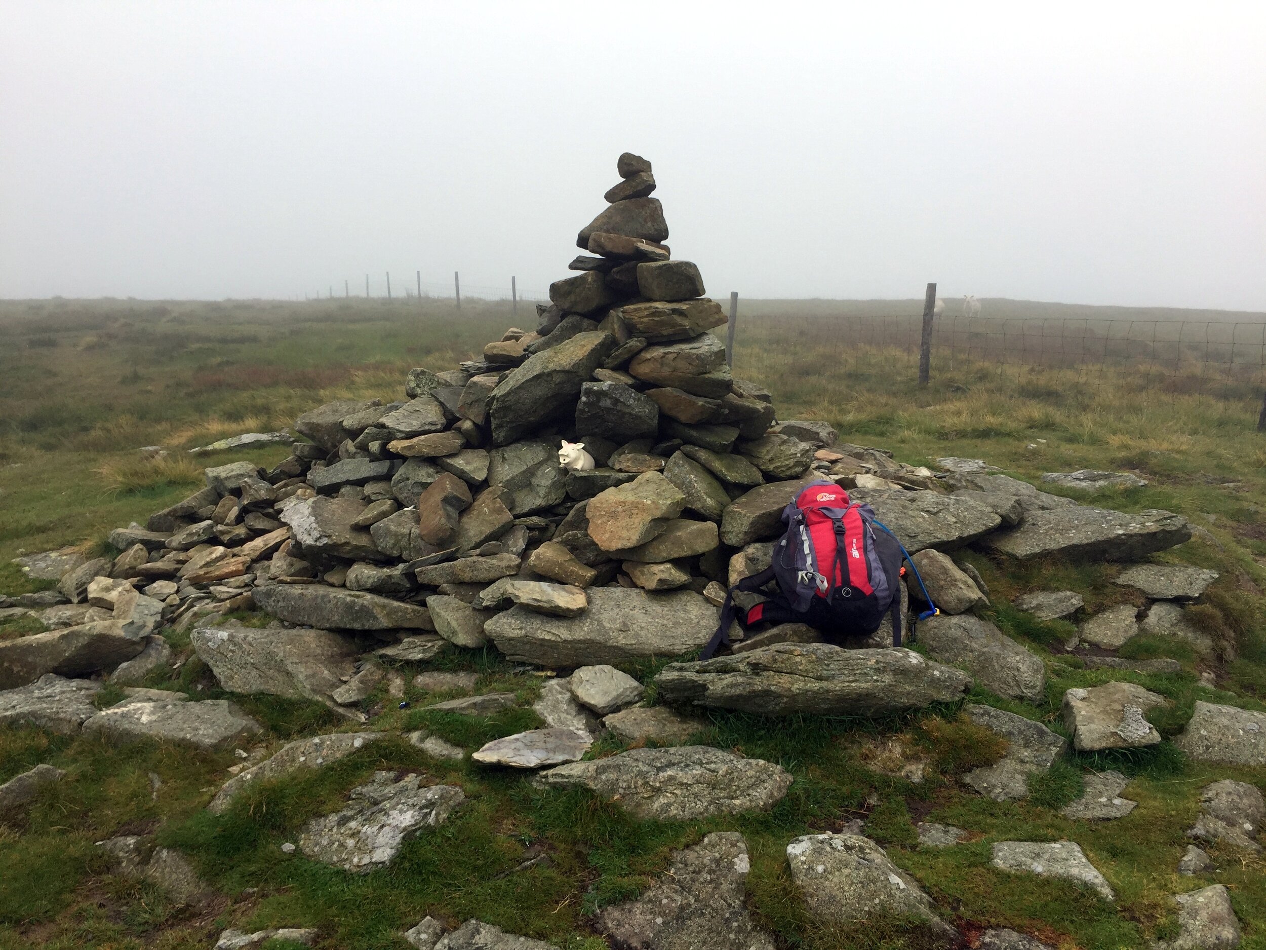
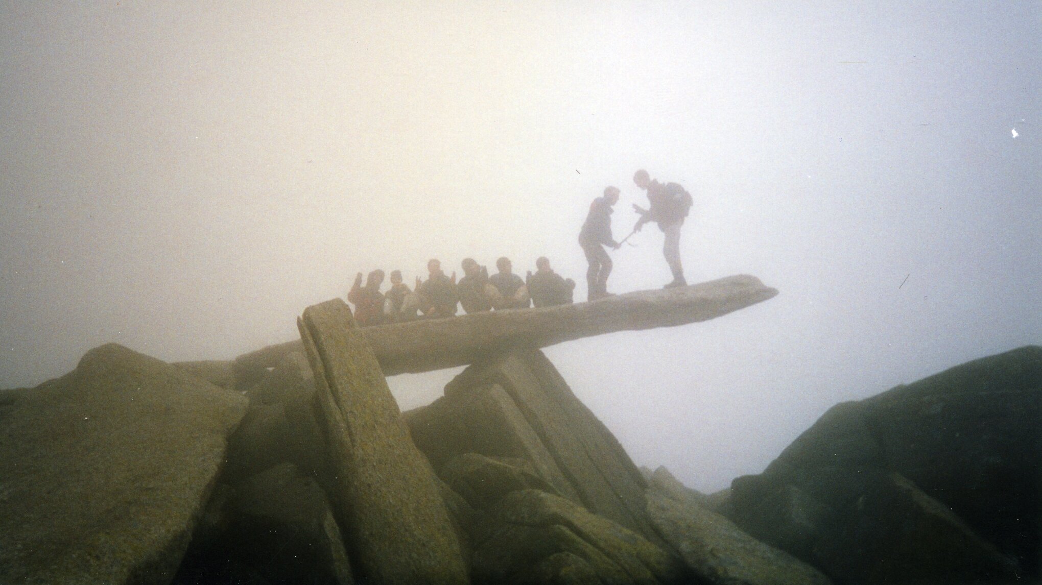
By the time wed reached the parking spot for Foel Cwmcerwyn it was proper rainy. The summit was apparently not far away but we couldn't see anything. Sticking to the GPS route and a straightforward path we arrived at the Trig Point in under and hour. The completion of the Welsh County Tops was a bit of an anticlimax in a damp field with views stretching across the nearest 15 metres.


North Wales County Tops

Snowdon

Now that I've done most of the Southern County Tops, the rest are getting higher and further away from home. Expeditions have changed from day-trips to a few days away, bagging multiple tops in one region. The plan for this trip was North West Wales, bagging Snowdon, Holyhead Mountain, Moel Famau and Cadair Berwyn. Ideally we would have also squeezed in Aran Fawddwy but we only had 3 days off work and we wanted to get in some zip-lining action too.


Snowdon

Also known as: Yr Wyddfa
Significance: 
Highest peak in Caernarfonshire (Historic CT), Gwynedd (Preserved County and Principal Area), Wales Country Top
Member of: Marilyn, Furth, Hewitt, Nuttall, Welsh 3000s
Parent Peak: Ben Nevis. NHN = Stob Binnein
Elevation: 1,085m
Date climbed: 25th July 2016 (and several times before) 
Coordinates: 53°4′6.59″N 4°4′34.43″W
Route Start / End: Pen Y Pass car park
Route Distance: 12.4 km (7.7 miles)
Route Elevation Change: +/- 874m
Subsidiary tops on route: Y Lliwedd
GPX File: get via Buy Me a Coffee
Other routes touched (walk): Pyg Track, Llanberis Path, Snowdon Ranger Path, Watkin Path, Miners Track
Other routes touched (cycle): None
OS Trig Pillar: TP6043 - Snowdon Summit
Map: OS Explorer OL17 Snowdon & Conwy Valley
Guidebook: The UK's County Tops (Jonny Muir)
Links: Wikipedia (Caernarfonshire), Wikipedia (Snowdon), Peakbagger, Hillbagging
 

Before the trip I wasn't hugely excited about doing Snowdon again. I'd been up there at least 4 times before and would have rather spent the time on a new peak. Mark, my fellow County Topper, hadn't done it before so we needed to include it. Chris, the third of our group had literally no idea where he was so had no opinion on the matter.

Our plan was to do the Snowdon Horseshoe including the knife-edge Crib Goch. This excited me as I hadn't done any of that route before, normally sticking to the Watkin or Llanberis paths. I was a bit nervous about Crib Goch so I did a bit of Internet research on it the night before. I'm fine with heights but get nervous of slipping so I wanted to find out more about it. It turned out that this kind of research is much the same as looking up the cause of an itchy rash in the Web (You are definitely going to die). Our breakfast time meeting about the route was a good decider to not do it. We were discussing kit and Chris was talking about how proud he was of his new £9.99 waterproofs. He was also not sure about whether he would need to take a backpack or any water. That was it ... Pyg Track to the summit, no Crib Goch.

Despite leaving the B&B early, we soon became an hour and a half behind schedule. The Pen Y Pass Car park gets full really early so we had to go to the next lay-by a couple of miles along the road to Llanberis. The good news was that there’s a regular bus service connecting the stops on the road. The bad news is that non-one, including us, could work out what the bus timetable was telling us. Convinced that the bus would be imminent, we waited an hour before getting into a taxi exactly 30 seconds before the bus came round the corner.

Heading away from Pen Y Pass on the Pyg Track, the sky was overcast and the rain came within 10 minutes. This was further confirmation that our plan to avoid Crib Goch was the best idea ever. I also got the opportunity to stoke my amusement of people on mountains who are unprepared for the the conditions. £9.99 waterproofs were the height of preparedness compared the the walkers in jeans and t shirts and some carrying babies up the highest mountain in Wales.

Just beyond the cloud line we joined the familiar Llanberis Path and reached the summit. Apparently the view is amazing, but in the 5 times I've been there, it's only been dirty fog. After a quick stop at the summit cafe we started the descent along the Watkin Path. I done the Watkin a couple of times in reverse and remember the steep part near the top to be a bit of a wobbly scramble. We must have gone off track on those previous attempts as the path down was significantly more straightforward than I remembered.

At Bwlch Ciliau we left the Watkin and ascended again to Y Lliwedd. This was a new summit for me and, at 898m, it was taller than the majority of County Tops. With some amazing views, my previous disinterest in climbing Snowdon again was long gone.

At the bottom of Lliwedd Bach, the final peak of the Horseshoe,  we joined the Miners Track on relatively flat ground. Mark, who was just ahead of Chris and I, had got talking to a lone walker by the reservoir. The guy had done Crib Goch that morning and still looked petrified by the experience. He'd got to the knife edge relatively easily only to have got caught in a strong downpour right at the top. After our breakfast decision Mark and I were worried about whether missing it would take some of the enjoyment out of the day. As it happened, the day was awesome and the had the added bonus of not shitting ourselves and/or falling off.

Snowdon done ... Next stop: Holyhead Mountain.


Holyhead Mountain

Significance: Highest peak in Anglesey / Isle of Anglesey (Historic CT, Preserved County and Principal Area)
Member of: Marilyn
Parent Peak: N/A. NHN = Moel Tryfan
Elevation: 220m
Date climbed: 25th July 2016
Coordinates: 53°18′47″N 4°40′35″W
Route Start / End: Car park opposite Ty Mawr Hut Circles on South Stack Road
Route Distance: 4 km (2.5 miles)
Route Elevation Change: +/- 141m
Subsidiary tops on route: none
GPX File: get via Buy Me a Coffee
Other routes touched (walk): Isle of Anglesey Coastal Path
Other routes touched (cycle): None
OS Trig Pillar: TP3989 - Holyhead
Map: OS Explorer 262 Anglesey West
Guidebook: The UK's County Tops (Jonny Muir)
Links: Wikipedia (Anglesey), Wikipedia (Holyhead Mountain), Peakbagger, Hillbagging

The problem with Holyhead Mountain in that it's a massive pain in the arse to get to. Holyhead an island off an island in the far North West corner of Wales and takes a long time to get there from anywhere other than Snowdonia. At only 220m high and an hour and a half up and down, it not worth the trip unless you’re in the area anyway. Having just completed Snowdon and with several hours of daylight left, we decided to squeeze in Holyhead Mountain before evening beers.

The last time I’d been to Holyhead was in 2010 for the start of the 4-day NCN Route 8 Wales End-To-End cycle trip. Holyhead was once a thriving town supporting the ferry to Dublin, but had long since fallen on hard times. With a fast road and rail connection straight through to the port, there’s now no need to stop in the town. We were staying there overnight before setting off on the ride and really struggled to find anywhere to eat. Only 1 out of 3 shops in the high street were open with the rest either shut or housing a weird local charity. The Anglesey Feral Cat Action Trust was my favourite. If only I’d got the County Top obsession back then I could have bagged Holyhead Mountain then and avoided a return trip.

The walk, like so many of those I’m not expecting much from, turned out to be surprisingly pleasant. From the RSPB car park, its a gentle incline for about 20 minutes towards the big chalky cliff. A relatively straightforward and well sign-posted path leads through beautifully coloured heather to the trig point at the top. We had a warm but cloudy day so couldn’t see all the way to Dublin, just bits of Holyhead harbour and the ferries coming in and out.

elevation_profile - Holyhead Mountain.jpg

Moel Famau

Significance: Highest peak in Flintshire (Historic CT and Principal Area), High Point of Preserved County of Clwyd
Member of: Marilyn
Parent Peak: Moel y Gamelin. NHN = Cyrn-y-Brain
Elevation: 555m
Date climbed: 26th July 2016
Coordinates: 53°09′16″N 3°15′21″W
Route Start / End: Car park opposite Pen Barras Lodge on Bwlch Pen Barras Road
Route Distance: 4.4 km (2.7 miles)
Route Elevation Change: +/- 271m
Subsidiary tops on route: none
GPX File: get via Buy Me a Coffee
Other routes touched (walk): Offa’s Dyke Path
Other routes touched (cycle): None
OS Trig Pillar: TP0005 - Moel Fammau
Map: OS Explorer 265 Clwydian Range, Prestatyn, Mold & Ruthin
Guidebook: The UK's County Tops (Jonny Muir)
Links: Wikipedia (Flintshire), Wikipedia (Moel Famau), Peakbagger, Hillbagging

 Just like Holyhead Mountain, Moel Famau isn’t a County Top that you’d make a big effort to get to just for itself. The summit itself is surrounded by a Country Park with various routes to the top and nice views. We picked the main route from the car-park at the bottom making the round trip in an hour and a half.

The main highlight of Moel Famau is the ruins of the Jubilee Tower, an Egyptian-style monument built in 1810 to commemorate the Golden Jubilee of George III. It was never completed and the actual tower was destroyed in a storm 1862 leaving the base that you can see today.


Moel Sych

Significance: Highest peak in Montgomeryshire (Historic CT)
Member of: Marilyn, Nuttall
Parent Peak: Cadair Berwyn
Elevation: 827m
Coordinates: 52°52′34″N 3°23′19″W
Links: Wikipedia (Montgomeryshire), Wikipedia (Moel Sych), Peakbagger, Hillbagging

Cadair Berwyn

Significance: Highest peak in Denbighshire (Historic CT), Wrexham (Council Top)
Member of: Marilyn, Hewitt, Nuttall
Parent Peak: Aran Benllyn
Elevation: 832m
Coordinates: 52°53′02″N 3°22′49″W
OS Trig Pillar: TP1837 - Cader Berwyn
Links: Wikipedia (Denbighshire), Wikipedia (Cadair Berwyn), Peakbagger, Hillbagging

For both peaks:
Date climbed: 27th July 2016
Route Start / End: Car park at Pistyll Rhaeadr Waterfall
Route Distance: 10.5 km (6.5 miles)
Route Elevation Change: +/- 597m
Subsidiary tops on route: Cadair Berwyn North Top
GPX File: get via Buy Me a Coffee
Other routes touched (walk): None
Other routes touched (cycle): None
Map: OS Explorer 255 Llangollen & Berwyn
Guidebook: The UK's County Tops (Jonny Muir)

Two tops in one trip: this was the highlight of the 5-County Top adventure as it was one that I’d not done before and a long, interesting trek. We’d saved this one for last as it was on our way back down South from our base on Betws-y-Coed.

The obvious starting point is a car park at the base of Tan-y-Pistyll Falls, the longest single-drop waterfall in the UK. Jonny Muir’s book recommends a there-and-back route to Cadiar Berwyn via Moel Sych. We followed this route up, but descended via a parallel path on the East side of the valley, ending up a mile further South from the car park. I definitely recommend this as is a far more interesting walk.

Navigation is easy for most of the route except, we found, for a small section near the top of the waterfall leading up to Moel Sych. It took a couple of attempts to find the small path however once on it, its an obvious route to the summit.

We read that Moel Sych was once considered the County Top of both Montgomeryshire and Denbighshire until someone noticed that Cadair Berwyn was higher and both counties got their own summit. When you’re at the top its obvious which one is the higher and hard to imagine how it too so long to discover it.

The route down follows a path curving down the side of a steep drop. Safe enough on a clear day like we had, however I’d seriously consider returning via the Moel Sych route on a low-visibility winter’s day.  

route-28201389-map-full Moel Sych & Cadair Berwyn.png

For Merionethshire (Aran Fawddwy), see the Western Wales post, linked below


OTHER HIGH POINTS IN North Wales


Tryfan & The Glyderau: a night to remember

I often brought up "Best Day / Worst Day" as a conversation starter on nights out. With a bit of alcohol it could often be quite revealing about newly found friends. Prior to my wedding day my own Best Day would vary. My Worst Day was always the same: the night we called out Mountain Rescue on the Glyderau.

Although I'd recounted the story many times I've not written about it until now, nearly 30 years later. It was the evening that drilled into me a respect of both the mountains and the need to prepare for any eventuality.

It was March 1993 and I was part of a group of Venture Scouts and leaders on a mountain leadership course. It was a mix of learning about mountain skills, practical experience and an end of winter social event.

While spring is emerging in a lot for the country, March is still very much winter in Snowdonia. Even in the best of weather this is a place where treks need careful consideration. In winter you really need your wits about you. Detailed planning, appropriate clothing, backup food and escape routes are all essential precautions.

As with the previous 2 years that I'd joined the trip, our main walk was Tryfan and the Glyderau. It's a challenging 10k circular walk taking in 3 summits between 918 and 1001 metres. Each year the weather had closed in and we descended early using our escape routes.

This particular year I was leading a group of 6. As usual we parked at Idwall Cottage Youth Hostel at the western end of Llyn Ogwen. Unlike previous attempts we took a clockwise route taking in Tryfan first.

Tryfan is a beast. From a distance it looks like Godzilla and is scary enough to put off many inexperienced hikers. Assuming you're a good scrambler with head for heights, it's relatively straightforward. By contrast we found that climbing Glyder Fawr via the Devil's Kitchen on previous trips much trickier.

We got up an over Tryan without problems and started heading south toward Glyder Fach. Here we met another group from the same course who had approached from the east on a different route. From here were were on the same route up and over the Glyderau. The other group were friends of ours and we came together as a larger group. This was the main mistake as it led to one large group travelling more slowly than two smaller ones. One girl in the other group was also having knee issues, adding more time to the ascent.

After submitting Glyder Fach the clouds came in. It was cold and we were clearly behind schedule. I made the decision to take the emergency route descending to the north from the next summit, Castell y Gwynt. The route was clear, but had several steep sections. The group stuck together, helping each other down. It was safe but slow.

By 16:00 we were not far from the bottom of the mountain. What lay in the middle was a stream and a waterfall over a short but steep cliffs. It would have been doable earlier in the day, but light was quickly fading and it was clear that we were not going to get 14 of us down safely.

The plan was for two of us to make our way down the waterfall to the car park and call for help. The others would stay where they were with two of the oldest in the group in charge to keep them together. They had enough food and clothing so would have been fine as long as they didn't leave that spot.

Chris and I slowly made our way down the waterfall. The rocks were sharp and my trousers got snagged on a few, ripping a large hole in the back. Not far from the base of the falls we found the path that followed the east side of Llyn Idwal to the car park.

By now it was clear to the leaders at the base that we were long past our planned finish time. We met one of those leaders half way back along the lake path as he had come to find us. We took him back to the base of the waterfall to show him where we had come down. The group was not far up and we could clearly see their torch lights.

Chris and I were taken back to the bunkhouse to wait there until the others could be brought down. Meanwhile 17 members of Ogwen Mountain Rescue stopped whatever they were doing that evening and and headed to Llyn Idwal.

The 5 hours between us getting to the bunkhouse and the first of the others returning were nerve-racking. We were safe, but what about the others? They seemed safe enough where we left them but what if they moved and fell? What if something went wrong when they were being helped down? My mind played out the aftermath of a worst case scenario. This was what makes it easy for me to pick this as my Worst Day.

The others slowly came down and arrived at the bunkhouse from 02:00 in the morning. One girl had been screaming and was freaking out the others. They got her down and back first. The others came back by 03:30. Everyone was safe and relieved to be back in the warm.

Everyone went through their own process of closure. There was the inevitable inquest run the local Scout region. Some of us did some fund raising for Ogwen Mountain Rescue, this time on the significantly flatter Thames Path. Four of us had a need to complete the route, although doing it in winter wasn't a criteria. We returned in the summer on a clear dry day and finished the full 10k circuit without a hitch.

The main legacy for me is in my approach to the mountains. I've done a walking leadership course at Plas-y-Brenin, got better equipment, maps and GPS devices. I only go in smaller groups and in summer conditions. I save the more challenging routes for times when I'm part of a group that's being lead by a qualified guide. Maybe it was my Worst Day, but for the lessons that lead to all the safe treks that I've enjoyed since then, it could be one of the best.


Tryfan

Member of: Marilyn Hewitt, Welsh 3000, Nuttall, Furth
Parent Peak: Glyder Fawr
Elevation: 917m
Coordinates: 53° 6' 54'' N, 3° 59' 51'' W
Links: Wikipedia / Peakbagger / Hillbagging / National Trust


Glyder Fawr

Member of: Marilyn, Hewitt, Welsh 3000s, Nuttall, Furth
Parent Peak: Snowdon
Elevation: 1001m
Coordinates: 53° 6' 5'' N, 4° 1' 45'' W
Links: Wikipedia / Peakbagger / Hillbagging

Glyder Fach

Member of: Hewitt, Welsh 3000s, Nuttall, Furth
Parent Peak: Glyder Fawr
Elevation: 994m
Coordinates: 53° 6' 17'' N, 4° 0' 30'' W
Links: Wikipedia / Peakbagger / Hillbagging


The Route - all peaks

Route Start / End: Ogwen Car Park, Bethesda, Bangor, LL57 3LZ
Route Distance: 9.8km (6 miles)
Route Elevation Change: +/- 857m
Subsidiary tops on route: Castell y Gwynt (972m)
GPX File: get via Buy Me a Coffee
Other routes touched: Welsh 3000s, Snowdonia Slate Trail


route-37149331-map-full  - Tryfan Glyderau.png
elevation_profile - Tryfan Glyderau.jpg